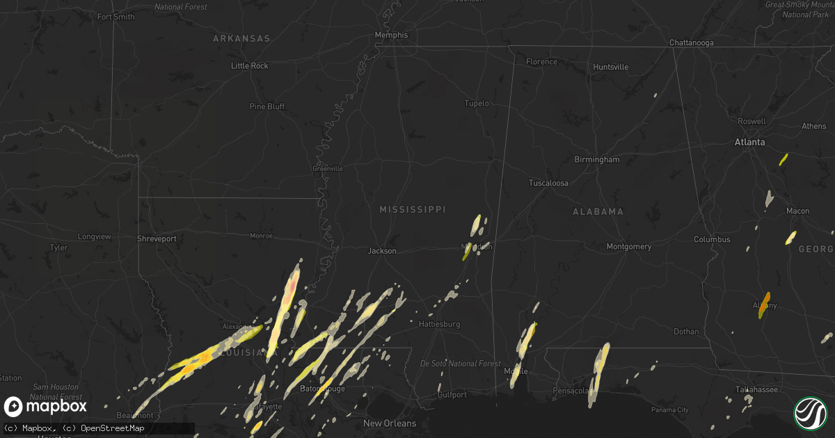
Hail Map in Mississippi on December 23, 2014
Get this storm
December 23 map
$229
one time, instant access
Download today. No call, no setup
Keep the $229
Bought the map and want the full workflow? Apply the entire $229 to a subscription within 7 days. None of it is wasted.
Every map, not just this one
This buys you this map. Subscription and you get every map we run, in the markets you choose from a few cities to whole states to nationwide. Plus real-time alerts the moment a storm fires.
Contact data
Name, contact info, occupancy, even credit band for addresses in the footprint. You go from where it hit to who to call.
Become the source they trust
Unlimited branding weather history reports on demand. You already have the documented answer ready for the property owner, and you are the one who showed up with it.
Property data and RoofTrace estimates
Pull up any address you have got, its value and the exact code rules for that jurisdiction, straight from One Click Code. Then RoofTrace estimates the squares, pitch, and roof value, priced the way you price.
Storm reports in Mississippi
Mississippi
| Date | Description |
|---|---|
| 12/23/20144:30 PM CST | Report of a tree down on county road 420. |
| 12/23/20144:27 PM CST | Tornado rated ef-0. Path length 0.5 miles and path width 100 yards. The tornado started along cr-658 and traveled northeast. It crossed pine ridge road and ended about |
| 12/23/20144:25 PM CST | Tree downed on cr 420 north of ms highway 18 |
| 12/23/20144:19 PM CST | Numerous trees downed and three homes received minor damage in an area from cr 657 to cr 658 to cr 643. Possible tornado. |
| 12/23/20144:13 PM CST | Report of trees down near carmichael community. |
| 12/23/20144:00 PM CST | Power line down |
| 12/23/20143:59 PM CST | Tree downed on cr 230 near the clarke wayne county line |
| 12/23/20143:50 PM CST | Reports of trees down on county road 377. |
| 12/23/20143:45 PM CST | Large tree limbs and branches down. Wind gusts up to 60mph. |
| 12/23/20143:40 PM CST | Reports of trees snapped or uprooted. Possible tornado. |
| 12/23/20143:40 PM CST | Reports of trees snapped and uprooted west of heidelberg. |
| 12/23/20143:40 PM CST | Reports of trees snapped and uprooted west of heidelberg. |
| 12/23/20143:30 PM CST | *** 2 fatal *** report of multiple homes damaged on mullican road with injuries. Some trees blown onto homes with people trapped. |
| 12/23/20143:30 PM CST | Report of power lines snapped near hoss power on highway 15 north. Trees and powerlines down on shady grove road near highway 15 north. Tornado reported on the ground b |
| 12/23/20143:22 PM CST | Report of trees on mobile homes in the calhoun community. Tree through a mobile home on crepe myrtle drive. Hines road is blocked with major structural damage. Trees do |
| 12/23/20143:22 PM CST | *** 2 fatal *** tornado rated ef-2 with estimated max winds of 125 mph had a path length of 5 miles and width of 350 yds and tracked from 5 miles west of laurel to 4 mi |
| 12/23/20143:05 PM CST | Report of trees snapped and uprooted. Possible tornado. |
| 12/23/20142:46 PM CST | This tornado briefly touched down in a subdivision northeast of sumrall. Twelve homes received minor roof damage...several fences were damaged and two trees were downed |
| 12/23/20142:45 PM CST | The tin roofing was torn off a daycare center and several large limbs were knocked down from this brief tornado touchdown. Path length 100 yards and path width 50 yards |
| 12/23/20142:45 PM CST | Report of multi-vortex tornado west of sumrall on highway 589 and highway 42. |
| 12/23/20142:39 PM CST | Highway patrol reports tornado on marion lamar county line |
| 12/23/20142:35 PM CST | Tornado still on the ground in lamar county heading towards sumrall. Debris was falling out of the sky. |
| 12/23/20142:25 PM CST | Rain wrapped tornado on the ground. Trees were blown down and uprooted. Possible structure damage. |
| 12/23/20142:25 PM CST | Multiple vehicles were flipped on highway 98. Also report of roof damage at dialysis center and challenger businesses on highway 98 at columbia-purvis road. |
| 12/23/20142:25 PM CST | *** 2 fatal *** tornado rated ef3 caused extensive tree and structural damage with major damage to area businesses over southern and eastern portions of the city of col |
| 12/23/20142:24 PM CST | Report of people trapped in homes in columbia. |
| 12/23/20142:17 PM CST | *** 2 fatal *** this ef3 with maximum winds of 165 mph significantly damaged numerous homes...business and power poles and lines along its 12 mile path. One well built |
| 12/23/20142:00 PM CST | Sheriffs office reported trees down north side of tylertown. |
| 12/23/201412:50 PM CST | Report of a tree down on a house on ivy lane. |
| 12/23/201412:49 PM CST | High winds also reported at this location |
| 12/23/201412:30 PM CST | A local report indicates 1.25 inch wind near 5 NNW EAST LINCOLN |
| 12/23/201412:22 PM CST | A local report indicates 1.75 inch wind near ENTERPRISE |
| 12/23/201412:10 PM CST | Report of dime to quarter size hail covering the ground from dekalb police. |
| 12/23/201412:10 PM CST | Large tree limbs and branches blown down. Estimated wind gusts over 60 mph. |
| 12/23/201412:00 PM CST | 1 inch sized hail reported along with estimated winds of 65 mph. |
| 12/23/201411:40 AM CST | Report of nickel to quarter size hail in western lauderdale county. |
| 12/23/201411:35 AM CST | A few trees were downed in southern lincoln county. |
| 12/23/201411:08 AM CST | A few trees down along hwy 43 |
| 12/23/201410:52 AM CST | Report of a tree down across enon road. Also dime size hail in yellow creek community east of louisville. |
| 12/23/201410:41 AM CST | A local report indicates 1.00 inch wind near 4 E WOODVILLE |
| 12/23/20147:41 AM CST | Reported along ms highway 550 |
| 12/23/20146:45 AM CST | Public reports of quarter size hail. Time estimated based on radar. |
Cities Impacted by Hail Map on December 23, 2014
- Eglin Afb, FL
- Navarre, FL
- Wing, AL
- Holt, FL
- Baker, FL
- Mobile, AL
- Dry Creek, LA
- Deridder, LA
- Sugartown, LA
- Pitkin, LA
- Crawfordville, FL
- Woodworth, LA
- Ferriday, LA
- Jonesville, LA
- Gilbert, LA
- Clayton, LA
- Sicily Island, LA
- Stockton, AL
- Little River, AL
- Jackson, AL
- Liberty, MS
- Centreville, MS
- Perry, GA
- Fort Valley, GA
- Kathleen, GA
- Singer, LA
- Amite, LA
- Plaucheville, LA
- Baton Rouge, LA
- Vidalia, LA
- Natchez, MS
- Saint Francisville, LA
- Woodville, MS
- Addis, LA
- Rayne, LA
- Kaplan, LA
- Waterproof, LA
- Pineville, LA
- Lecompte, LA
- Alexandria, LA
- Effie, LA
- Oakdale, LA
- Forest Hill, LA
- Elmer, LA
- Center Point, LA
- Glenmora, LA
- Deville, LA
- Bogue Chitto, MS
- Brookhaven, MS
- Greenwell Springs, LA
- Gloster, MS
- Ventress, LA
- Oscar, LA
- Jackson, LA
- Jarreau, LA
- Orange, TX
- Vidor, TX
- Buna, TX
- Marksville, LA
- Moreauville, LA
- Eunice, LA
- Abbeville, LA
- Maurice, LA
- Lafayette, LA
- Duson, LA
- Morgan City, LA
- Paulina, LA
- Sopchoppy, FL
- Morse, LA
- Gueydan, LA
- Meridian, MS
- Monterey, LA
- Acme, LA
- Simmesport, LA
- Monticello, MS
- Ponce De Leon, FL
- Westville, FL
- Starks, LA
- Grant, LA
- Merryville, LA
- Longville, LA
- Washington, LA
- Carencro, LA
- Sunset, LA
- Crowley, LA
- Scott, LA
- Opelousas, LA
- Church Point, LA
- Kentwood, LA
- Clinton, LA
- Greensburg, LA
- Denham Springs, LA
- Pine Grove, LA
- Port Allen, LA
- Mount Hermon, LA
- Shubuta, MS
- Batchelor, LA
- Tallahassee, FL
- Warner Robins, GA
- Silsbee, TX
- Summit, MS
- Jayess, MS
- Mccomb, MS
- Tylertown, MS
- Enterprise, MS
- De Kalb, MS
- Bailey, MS
- Daleville, MS
- Pride, LA
- Port Barre, LA
- Arnaudville, LA
- Norwood, LA
- Wilson, LA
- Defuniak Springs, FL
- Niceville, FL
- Batson, TX
- Plattenville, LA
- Napoleonville, LA
- Belle Rose, LA
- Yatesville, GA
- Barnesville, GA
- Forsyth, GA
- Culloden, GA
- Pinola, MS
- Evergreen, LA
- Cottonport, LA
- Sumrall, MS
- Newhebron, MS
- Magnolia, MS
- Theodore, AL
- Creola, AL
- Axis, AL
- Beaumont, TX
- Elizabeth, LA
- Deweyville, TX
- Sontag, MS
- Lakeland, GA
- Ray City, GA
- Nashville, GA
- Franklinton, LA
- Ethel, LA
- Saint James, LA
- Saint Martinville, LA
- Lakeland, LA
- Zachary, LA
- New Roads, LA
- Livonia, LA
- Lottie, LA
- Maringouin, LA
- Grove Hill, AL
- Erath, LA
- Smithdale, MS
- Wesson, MS
- Silver Creek, MS
- Osyka, MS
- Oak Vale, MS
- Plaquemine, LA
- Call, TX
- Sunshine, LA
- Saint Gabriel, LA
- Butler, GA
- Branch, LA
- Union Church, MS
- McCall Creek, MS
- Saucier, MS
- Perkinston, MS
- Kountze, TX
- Jeanerette, LA
- Hosford, FL
- Palmetto, LA
- Heidelberg, MS
- Meadville, MS
- Breaux Bridge, LA
- Slaughter, LA
- Bude, MS
- Fordoche, LA
- Crosby, MS
- Andalusia, AL
- Milton, FL
- Mary Esther, FL
- Independence, LA
- Albany, LA
- Tickfaw, LA
- Holden, LA
- Eastpoint, FL
- Mendenhall, MS
- Roseland, LA
- Lauderdale, MS
- Prentiss, MS
- Morrow, LA
- Mansura, LA
- Hazlehurst, MS
- Ruth, MS
- Laurel, MS
- Hattiesburg, MS
- Seminary, MS
- Porterville, MS
- New Iberia, LA
- Broussard, LA
- Youngsville, LA
- Dawson, AL
- Collinsville, AL
- Kirbyville, TX
- Buena Vista, GA
- Fluker, LA
- Walker, LA
- Dudley, GA
- Columbia, MS
- Chunchula, AL
- Mount Vernon, AL
- Bon Wier, TX
- McIntosh, AL
- Ponchatoula, LA
- Springfield, LA
- Egan, LA
- White Castle, LA
- Lettsworth, LA
- Angola, LA
- Jennings, LA
- Lake Arthur, LA
- Baker, LA
- Ellisville, MS
- Garyville, LA
- Maurepas, LA
- Newellton, LA
- Colquitt, GA
- Toomsuba, MS
- Port Saint Joe, FL
- Gulfport, MS
- Pass Christian, MS
- Cameron, LA
- Creole, LA
- Wiggins, MS
- Wisner, LA
- Rose Hill, MS
- Covington, GA
- Bonaire, GA
- Albany, GA
- Leesburg, GA
- Newton, GA


