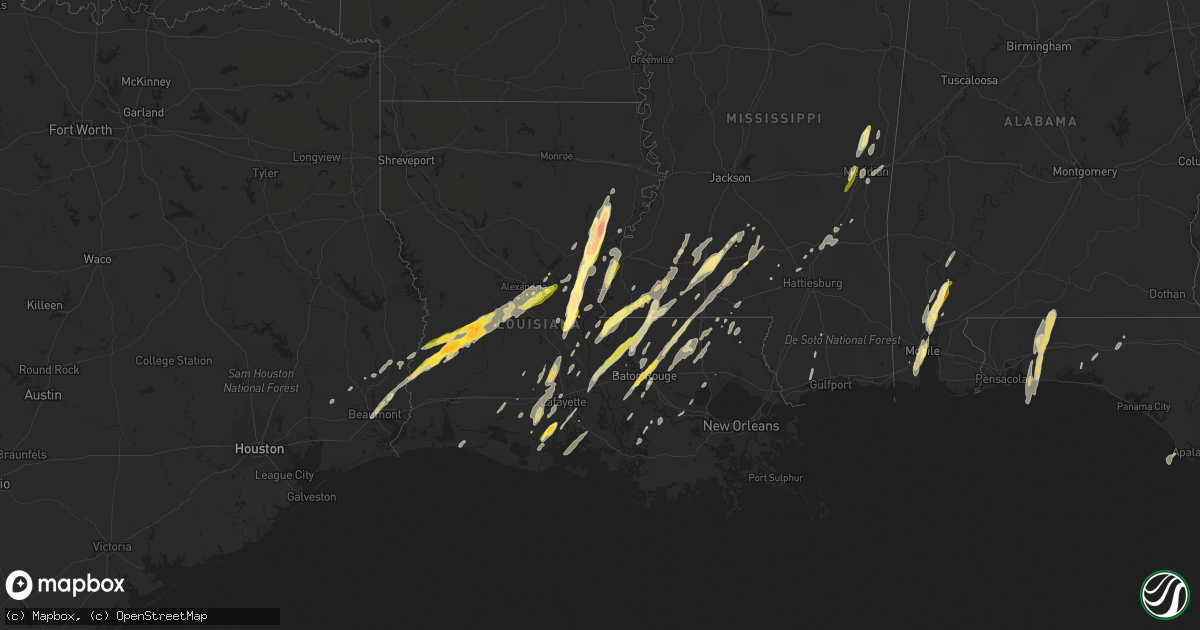
Hail Map in Louisiana on December 23, 2014
Get this storm
December 23 map
$229
one time, instant access
Download today. No call, no setup
Keep the $229
Bought the map and want the full workflow? Apply the entire $229 to a subscription within 7 days. None of it is wasted.
Every map, not just this one
This buys you this map. Subscription and you get every map we run, in the markets you choose from a few cities to whole states to nationwide. Plus real-time alerts the moment a storm fires.
Contact data
Name, contact info, occupancy, even credit band for addresses in the footprint. You go from where it hit to who to call.
Become the source they trust
Unlimited branding weather history reports on demand. You already have the documented answer ready for the property owner, and you are the one who showed up with it.
Property data and RoofTrace estimates
Pull up any address you have got, its value and the exact code rules for that jurisdiction, straight from One Click Code. Then RoofTrace estimates the squares, pitch, and roof value, priced the way you price.
Storm reports in Louisiana
Louisiana
| Date | Description |
|---|---|
| 12/23/20141:59 PM CST | Trees uprooted. Possible tornado. |
| 12/23/20141:24 PM CST | Tornado reported near the intersection of highway 16 and 1054. Trees downed and power lines down. |
| 12/23/20141:19 PM CST | Tornado touched down just south of hwy 16 east of amite and moved northeast lifting just before reaching rolling pine dr. Damage was mostly ef-1...with a few small area |
| 12/23/201411:40 AM CST | Several trees down in the buckhorn wildlife management area. Reported by park service. |
| 12/23/201411:29 AM CST | Reported along la highway 562. Delayed report. |
| 12/23/201411:18 AM CST | Report relayed from nws shreveport |
| 12/23/201411:18 AM CST | Hail damaged roofs and vehicles |
| 12/23/201411:12 AM CST | Occurred west of clayton |
| 12/23/201411:10 AM CST | Occurred around dunbarton |
| 12/23/201411:00 AM CST | Vehicle damaged |
| 12/23/201410:48 AM CST | A local report indicates 1.00 inch wind near VIDALIA |
| 12/23/201410:43 AM CST | Power lines reported down near the community of oscar. |
| 12/23/201410:40 AM CST | A local report indicates 2.00 inch wind near SUGARTOWN |
| 12/23/201410:20 AM CST | A local report indicates 2.50 inch wind near BORDELONVILLE |
| 12/23/201410:20 AM CST | A local report indicates 2.50 inch wind near TULLA |
| 12/23/201410:18 AM CST | Video of hail posted on face book. |
| 12/23/20149:45 AM CST | Around 70 feet of wooden fence blown down. Metal poles anchoring the fence bent to less than 20 degrees off ground. Shingles removed off one home. Large tree branches b |
| 12/23/20149:20 AM CST | A local report indicates 1.50 inch wind near ABBEVILLE |
| 12/23/20149:06 AM CST | Public report relayed via local media. |
Cities Impacted by Hail Map on December 23, 2014
- Eglin Afb, FL
- Navarre, FL
- Wing, AL
- Holt, FL
- Baker, FL
- Mobile, AL
- Dry Creek, LA
- Deridder, LA
- Sugartown, LA
- Pitkin, LA
- Crawfordville, FL
- Woodworth, LA
- Ferriday, LA
- Jonesville, LA
- Gilbert, LA
- Clayton, LA
- Sicily Island, LA
- Stockton, AL
- Little River, AL
- Jackson, AL
- Liberty, MS
- Centreville, MS
- Perry, GA
- Fort Valley, GA
- Kathleen, GA
- Singer, LA
- Amite, LA
- Plaucheville, LA
- Baton Rouge, LA
- Vidalia, LA
- Natchez, MS
- Saint Francisville, LA
- Woodville, MS
- Addis, LA
- Rayne, LA
- Kaplan, LA
- Waterproof, LA
- Pineville, LA
- Lecompte, LA
- Alexandria, LA
- Effie, LA
- Oakdale, LA
- Forest Hill, LA
- Elmer, LA
- Center Point, LA
- Glenmora, LA
- Deville, LA
- Bogue Chitto, MS
- Brookhaven, MS
- Greenwell Springs, LA
- Gloster, MS
- Ventress, LA
- Oscar, LA
- Jackson, LA
- Jarreau, LA
- Orange, TX
- Vidor, TX
- Buna, TX
- Marksville, LA
- Moreauville, LA
- Eunice, LA
- Abbeville, LA
- Maurice, LA
- Lafayette, LA
- Duson, LA
- Morgan City, LA
- Paulina, LA
- Sopchoppy, FL
- Morse, LA
- Gueydan, LA
- Meridian, MS
- Monterey, LA
- Acme, LA
- Simmesport, LA
- Monticello, MS
- Ponce De Leon, FL
- Westville, FL
- Starks, LA
- Grant, LA
- Merryville, LA
- Longville, LA
- Washington, LA
- Carencro, LA
- Sunset, LA
- Crowley, LA
- Scott, LA
- Opelousas, LA
- Church Point, LA
- Kentwood, LA
- Clinton, LA
- Greensburg, LA
- Denham Springs, LA
- Pine Grove, LA
- Port Allen, LA
- Mount Hermon, LA
- Shubuta, MS
- Batchelor, LA
- Tallahassee, FL
- Warner Robins, GA
- Silsbee, TX
- Summit, MS
- Jayess, MS
- Mccomb, MS
- Tylertown, MS
- Enterprise, MS
- De Kalb, MS
- Bailey, MS
- Daleville, MS
- Pride, LA
- Port Barre, LA
- Arnaudville, LA
- Norwood, LA
- Wilson, LA
- Defuniak Springs, FL
- Niceville, FL
- Batson, TX
- Plattenville, LA
- Napoleonville, LA
- Belle Rose, LA
- Yatesville, GA
- Barnesville, GA
- Forsyth, GA
- Culloden, GA
- Pinola, MS
- Evergreen, LA
- Cottonport, LA
- Sumrall, MS
- Newhebron, MS
- Magnolia, MS
- Theodore, AL
- Creola, AL
- Axis, AL
- Beaumont, TX
- Elizabeth, LA
- Deweyville, TX
- Sontag, MS
- Lakeland, GA
- Ray City, GA
- Nashville, GA
- Franklinton, LA
- Ethel, LA
- Saint James, LA
- Saint Martinville, LA
- Lakeland, LA
- Zachary, LA
- New Roads, LA
- Livonia, LA
- Lottie, LA
- Maringouin, LA
- Grove Hill, AL
- Erath, LA
- Smithdale, MS
- Wesson, MS
- Silver Creek, MS
- Osyka, MS
- Oak Vale, MS
- Plaquemine, LA
- Call, TX
- Sunshine, LA
- Saint Gabriel, LA
- Butler, GA
- Branch, LA
- Union Church, MS
- McCall Creek, MS
- Saucier, MS
- Perkinston, MS
- Kountze, TX
- Jeanerette, LA
- Hosford, FL
- Palmetto, LA
- Heidelberg, MS
- Meadville, MS
- Breaux Bridge, LA
- Slaughter, LA
- Bude, MS
- Fordoche, LA
- Crosby, MS
- Andalusia, AL
- Milton, FL
- Mary Esther, FL
- Independence, LA
- Albany, LA
- Tickfaw, LA
- Holden, LA
- Eastpoint, FL
- Mendenhall, MS
- Roseland, LA
- Lauderdale, MS
- Prentiss, MS
- Morrow, LA
- Mansura, LA
- Hazlehurst, MS
- Ruth, MS
- Laurel, MS
- Hattiesburg, MS
- Seminary, MS
- Porterville, MS
- New Iberia, LA
- Broussard, LA
- Youngsville, LA
- Dawson, AL
- Collinsville, AL
- Kirbyville, TX
- Buena Vista, GA
- Fluker, LA
- Walker, LA
- Dudley, GA
- Columbia, MS
- Chunchula, AL
- Mount Vernon, AL
- Bon Wier, TX
- McIntosh, AL
- Ponchatoula, LA
- Springfield, LA
- Egan, LA
- White Castle, LA
- Lettsworth, LA
- Angola, LA
- Jennings, LA
- Lake Arthur, LA
- Baker, LA
- Ellisville, MS
- Garyville, LA
- Maurepas, LA
- Newellton, LA
- Colquitt, GA
- Toomsuba, MS
- Port Saint Joe, FL
- Gulfport, MS
- Pass Christian, MS
- Cameron, LA
- Creole, LA
- Wiggins, MS
- Wisner, LA
- Rose Hill, MS
- Covington, GA
- Bonaire, GA
- Albany, GA
- Leesburg, GA
- Newton, GA


