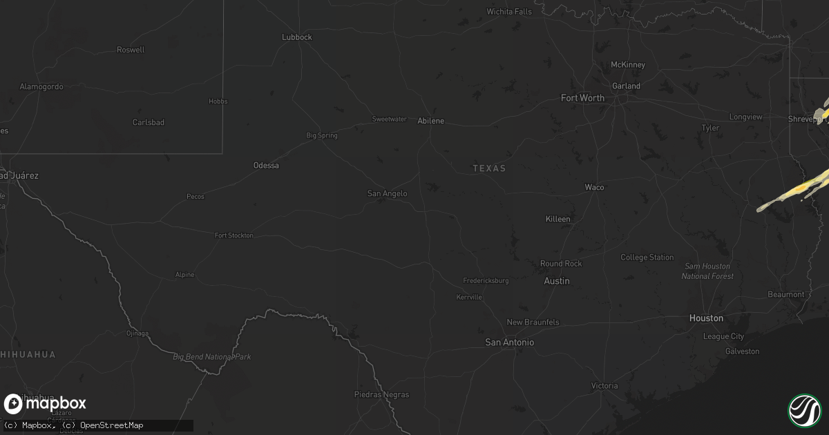
Hail Map in Texas on November 29, 2022
Get this storm
November 29 map
$229
one time, instant access
Download today. No call, no setup
Keep the $229
Bought the map and want the full workflow? Apply the entire $229 to a subscription within 7 days. None of it is wasted.
Every map, not just this one
This buys you this map. Subscription and you get every map we run, in the markets you choose from a few cities to whole states to nationwide. Plus real-time alerts the moment a storm fires.
Contact data
Name, contact info, occupancy, even credit band for addresses in the footprint. You go from where it hit to who to call.
Become the source they trust
Unlimited branding weather history reports on demand. You already have the documented answer ready for the property owner, and you are the one who showed up with it.
Property data and RoofTrace estimates
Pull up any address you have got, its value and the exact code rules for that jurisdiction, straight from One Click Code. Then RoofTrace estimates the squares, pitch, and roof value, priced the way you price.
Storm reports in Texas
Texas
| Date | Description |
|---|---|
| 11/29/20223:20 PM CST | Several snapped and down trees along county line road near the geneva community. |
| 11/29/20223:20 PM CST | Reports of ping pong size hail just north of the milam community. |
| 11/29/20223:17 PM CST | Nws storm survey determined wind damage found in sabine co. To be consistent with straight line winds of about 85 mph. |
| 11/29/20223:00 PM CST | Large tree and telephone pole snapped at a home near the intersection of us highway 96 and fm road 1751. |
| 11/28/20229:26 PM CST | At 326 PM CST, a severe thunderstorm was located 8 miles northwest of Milam, or 24 miles southeast of Center, moving northeast at 45 mph. HAZARD...70 mph wind gusts and ping pong ball size hail. SOURCE...Radar indicated. IMPACT...People and animals outdoors will be injured. Expect hail damage to roofs, siding, windows, and vehicles. Expect considerable tree damage. Wind damage is also likely to mobile homes, roofs, and outbuildings. Locations impacted include... Milam, Zwolle, Converse, Oak Grove, Pleasant Hill, Noble, Robeline, Sexton, Belmont, Pelican, Toledo Bend Reservoir North, Marthaville, Rambin and Ajax. |
| 11/28/20228:42 PM CST | At 241 PM CST, a severe thunderstorm was located near Etoile, or 24 miles north of Ebenezer, moving northeast at 55 mph. HAZARD...Ping pong ball size hail and 60 mph wind gusts. SOURCE...Radar indicated. IMPACT...People and animals outdoors will be injured. Expect hail damage to roofs, siding, windows, and vehicles. Expect wind damage to roofs, siding, and trees. Locations impacted include... Milam, San Augustine, Rosevine, Patroon, Macune, Etoile, Bland Lake, Broaddus, Hurstown, Denning, Sexton, Calgary, Bronson and Chinaquapin. |
| 11/28/20227:53 PM CST | At 153 PM CST, a severe thunderstorm was located 8 miles north of Dayton Lakes, or 14 miles north of Dayton, moving northeast at 30 mph. HAZARD...60 mph wind gusts. SOURCE...Radar indicated. IMPACT...Expect damage to roofs, siding, and trees. Locations impacted include... Rye. |
All States Impacted by Hail Map on November 29, 2022
Cities Impacted by Hail Map on November 29, 2022
- Clarkson, KY
- Elizabethtown, KY
- Boston, KY
- Dickson, TN
- McEwen, TN
- Vanleer, TN
- Palmyra, TN
- Erin, TN
- Cumberland City, TN
- Cumberland Furnace, TN
- Campbellsville, KY
- Summersville, KY
- Meridian, MS
- Stonewall, MS
- Enterprise, MS
- Gattman, MS
- Starkville, MS
- Mississippi State, MS
- Millport, AL
- West Point, MS
- Aberdeen, MS
- Caledonia, MS
- Steens, MS
- Vernon, AL
- Sulligent, AL
- Cedarbluff, MS
- Hamilton, MS
- Columbus, MS
- Rossville, TN
- Ridgeland, MS
- Madison, MS
- Warren, AR
- Kingston Springs, TN
- Burns, TN
- Centerville, TN
- Nunnelly, TN
- White Bluff, TN
- Charlotte, TN
- Ashland City, TN
- Bon Aqua, TN
- Lobelville, TN
- Only, TN
- Farmerville, LA
- Hollandale, MS
- Cub Run, KY
- Leitchfield, KY
- Stamping Ground, KY
- Bardstown, KY
- Mount Eden, KY
- Sadieville, KY
- Mammoth Cave, KY
- Bonnieville, KY
- Waddy, KY
- Coxs Creek, KY
- Fairfield, KY
- New Haven, KY
- Sweeden, KY
- Bowling Green, KY
- Shelbyville, KY
- Taylorsville, KY
- Bloomfield, KY
- Munfordville, KY
- Hodgenville, KY
- Upton, KY
- Brownsville, KY
- Frankfort, KY
- Sonora, KY
- Bee Spring, KY
- Hornsby, TN
- Bethel Springs, TN
- Pocahontas, TN
- Selmer, TN
- Middleton, TN
- Hurricane Mills, TN
- Byhalia, MS
- Florence, AL
- Park City, KY
- Rocky Hill, KY
- Oakland, KY
- Smiths Grove, KY
- Nesbit, MS
- Southaven, MS
- Hernando, MS
- Coldwater, MS
- Falmouth, KY
- Georgetown, OH
- Hamersville, OH
- Felicity, OH
- Foster, KY
- Brooksville, KY
- Jackson, TN
- Townley, AL
- Berry, AL
- Hanceville, AL
- Bankston, AL
- Trafford, AL
- Oakman, AL
- Hayden, AL
- Fayette, AL
- Carbon Hill, AL
- Empire, AL
- Locust Fork, AL
- Jasper, AL
- Parrish, AL
- Dora, AL
- Warrior, AL
- Bremen, AL
- Cordova, AL
- Kennedy, AL
- Cullman, AL
- Crane Hill, AL
- Cleveland, AL
- Hamburg, AR
- Bastrop, LA
- Canmer, KY
- Hardyville, KY
- Horse Cave, KY
- Magnolia, KY
- Poplar Grove, AR
- El Dorado, AR
- Junction City, AR
- Ackerman, MS
- Greenwood, MS
- Coila, MS
- Carrollton, MS
- Falkner, MS
- Gravel Switch, KY
- Springfield, KY
- Lebanon, KY
- Harrodsburg, KY
- Nicholasville, KY
- Wilmore, KY
- Perryville, KY
- Mackville, KY
- Versailles, KY
- Saltillo, MS
- Winnsboro, LA
- Delhi, LA
- Scooba, MS
- West, MS
- Grady, AR
- Gould, AR
- Lexa, AR
- Crossett, AR
- Marion, LA
- Huttig, AR
- Morton, MS
- Forest, MS
- Lena, MS
- McCool, MS
- French Camp, MS
- Ethel, MS
- Weir, MS
- Baldwyn, MS
- Dumas, MS
- Booneville, MS
- Stewart, MS
- Saint Francisville, LA
- Angola, LA
- Woodville, MS
- Batchelor, LA
- Lettsworth, LA
- Monterey, LA
- Durant, MS
- Eutaw, AL
- Knoxville, AL
- Fairview, TN
- Lyles, TN
- Big Sandy, TN
- Stewart, TN
- Waverly, TN
- Tennessee Ridge, TN
- Coffeeville, MS
- Oakland, MS
- Water Valley, MS
- Tillatoba, MS
- Arkansas City, AR
- Lillie, LA
- Hermitage, AR
- Strong, AR
- Homer, LA
- Lake Village, AR
- Rohwer, AR
- Summerfield, LA
- Bernice, LA
- Spearsville, LA
- Haynesville, LA
- McGehee, AR
- Greenville, MS
- Dermott, AR
- Benoit, MS
- Monticello, AR
- Montrose, AR
- Chatham, MS
- Oxford, MS
- Pontotoc, MS
- Marietta, MS
- Belmont, MS
- Fulton, MS
- Golden, MS
- Ecru, MS
- Cherokee, AL
- New Site, MS
- Blue Springs, MS
- Muscle Shoals, AL
- Iuka, MS
- New Albany, MS
- Tuscumbia, AL
- Guntown, MS
- Thaxton, MS
- Tupelo, MS
- Etta, MS
- Red Bay, AL
- Tishomingo, MS
- Sheffield, AL
- Russellville, AL
- Dennis, MS
- Leighton, AL
- Myrtle, MS
- Marianna, AR
- Linden, TN
- Moundville, AL
- Greensboro, AL
- Sardis, TN
- Finger, TN
- Reagan, TN
- Enville, TN
- Adamsville, TN
- Kilmichael, MS
- Tibbie, AL
- Uriah, AL
- Fruitdale, AL
- State Line, MS
- Deer Park, AL
- Jackson, AL
- Wagarville, AL
- Gainestown, AL
- Leroy, AL
- Chatom, AL
- Portland, AR
- Parkdale, AR
- Olive Branch, MS
- Banks, AR
- Yazoo City, MS
- Vicksburg, MS
- Carthage, MS
- Hemphill, TX
- Clarksville, TN
- Dumas, AR
- Marvell, AR
- Decatur, MS
- Union, MS
- Conehatta, MS
- Barksdale Afb, LA
- Minden, LA
- Haughton, LA
- Sibley, LA
- Elm Grove, LA
- Doyline, LA
- Athens, LA
- Princeton, LA
- Bossier City, LA
- Jones, AL
- Plantersville, AL
- Marion, AL
- Billingsley, AL
- Selma, AL
- Shuqualak, MS
- De Kalb, MS
- Preston, MS
- Ripley, MS
- Birmingham, AL
- Maben, MS
- Mathiston, MS
- Prairie, MS
- Quinton, AL
- Fosters, AL
- Gordo, AL
- Boligee, AL
- Macon, MS
- Aliceville, AL
- Ralph, AL
- Emelle, AL
- Belzoni, MS
- Tchula, MS
- Prattville, AL
- Downsville, LA
- Southside, TN
- Cunningham, TN
- Olmstead, KY
- Adairville, KY
- Franklin, KY
- Springfield, TN
- Cedar Hill, TN
- Russellville, KY
- Clinton, MS
- Jackson, MS
- Paris, KY
- Lexington, KY
- Lexington, MS
- Cruger, MS
- Vaiden, MS
- Eupora, MS
- Winona, MS
- Sidon, MS
- Pheba, MS
- Silver City, MS
- De Witt, AR
- Ethel, AR
- Gillett, AR
- Holly Grove, AR
- Clarendon, AR
- Saint Charles, AR
- Stuttgart, AR
- Duncanville, AL
- Centreville, AL
- Orrville, AL
- Safford, AL
- Alberta, AL
- Philipp, MS
- Schlater, MS
- Sunflower, MS
- Charleston, MS
- Holcomb, MS
- Cascilla, MS
- Minter City, MS
- Parsons, TN
- Decaturville, TN
- Fruithurst, AL
- Rockmart, GA
- Muscadine, AL
- Tallapoosa, GA
- Cedartown, GA
- Buchanan, GA
- Stanton, TN
- Robinsonville, MS
- West Helena, AR
- Helena, AR
- Germantown, TN
- Eads, TN
- Memphis, TN
- Tunica, MS
- Collierville, TN
- Cordova, TN
- Oakland, TN
- Dundee, MS
- Mason, TN
- Horn Lake, MS
- Lake Cormorant, MS
- Walls, MS
- Somerville, TN
- Arlington, TN
- Monroe, LA
- Sterlington, LA
- Vardaman, MS
- Calhoun City, MS
- Gore Springs, MS
- Walnut Grove, MS
- Guthrie, KY
- Allensville, KY
- Buhl, AL
- Tuscaloosa, AL
- Bay Springs, MS
- Paulding, MS
- Enid, MS
- Utica, MS
- Edwards, MS
- Seminary, MS
- Richton, MS
- Kelly, LA
- Winnfield, LA
- Goldonna, LA
- Natchitoches, LA
- Atlanta, LA
- Sikes, LA
- Dodson, LA
- Olla, LA
- Grayson, LA
- Columbia, LA
- Tullos, LA
- Robeline, LA
- Provencal, LA
- Nettleton, MS
- Hampton, AR
- Harrell, AR
- Gilbert, LA
- Collins, MS
- Columbia, MS
- Sumrall, MS
- Monticello, MS
- Prentiss, MS
- Bassfield, MS
- Oak Vale, MS
- Carson, MS
- Foxworth, MS
- Jayess, MS
- Almyra, AR
- Gibsland, LA
- Dubberly, LA
- Okolona, MS
- Amory, MS
- Liberty, MS
- Summit, MS
- Smithdale, MS
- Magnolia, MS
- Kosciusko, MS
- Baldwin, LA
- Franklin, LA
- Jeanerette, LA
- Morgan City, LA
- Waynesboro, MS
- Shubuta, MS
- Melvin, AL
- Laurel, MS
- Gilbertown, AL
- Sallis, MS
- Marion Junction, AL
- Thomaston, AL
- Catherine, AL
- Mccomb, MS
- Toxey, AL
- Silas, AL
- Quitman, MS
- Needham, AL
- Star City, AR
- New Edinburg, AR
- Rison, AR
- Many, LA
- Belmont, LA
- Zwolle, LA
- Marthaville, LA
- Centreville, MS
- Bogue Chitto, MS
- Gloster, MS
- Ruth, MS
- Heflin, LA
- Huntington, TX
- Goodman, MS
- Louisville, MS
- Ellisville, MS
- Cotton Valley, LA
- Adamsville, AL
- Graysville, AL
- Mantee, MS
- Woodland, MS
- Houston, MS
- Smithville, MS
- Tremont, MS
- Carriere, MS
- Poplarville, MS
- Bogalusa, LA
- West Monroe, LA
- Benton, MS
- Pickens, MS
- Ruleville, MS
- Courtland, MS
- Pope, MS
- Tutwiler, MS
- Drew, MS
- Louann, AR
- Yorktown, AR
- Greensburg, LA
- Brent, AL
- Altheimer, AR
- Itta Bena, MS
- Petal, MS
- Bolton, MS
- Sweet Water, AL
- Linden, AL
- Milam, TX
- Broaddus, TX
- San Augustine, TX
- Noble, LA
- Bronson, TX
- Indianola, MS
- Pelahatchie, MS
- Wisner, LA
- Franklinton, LA
- Sandy Hook, MS
- Angie, LA
- Tylertown, MS
- Glen Allan, MS
- Wetumpka, AL
- Autaugaville, AL
- Coosada, AL
- Deatsville, AL
- Millbrook, AL
- Elmore, AL
- Hattiesburg, MS
- Pleasant Hill, LA
- Fort Necessity, LA
- Zavalla, TX
- Montgomery, LA
- Georgetown, LA
- Campti, LA
- Newellton, LA
- Etoile, TX
- Dubach, LA
- Perkinston, MS
- Booth, AL
- Lowndesboro, AL
- Montgomery, AL
- Eclectic, AL
- Tallassee, AL
- Wilmot, AR
- Hollywood, AL
- Cave City, KY
- Adams, TN
- Scottsboro, AL
- Fackler, AL
- Joelton, TN
- Calhoun, LA
- Oak Ridge, LA
- Collinston, LA
- Rayville, LA
- Killen, AL
- Blue Mountain, MS
- Town Creek, AL
- Athens, AL
- Rogersville, AL
- Oneonta, AL
- Greensburg, KY
- Salvisa, KY
- Lawrenceburg, KY
- Bagdad, KY
- Oberlin, LA
- Heidelberg, MS
- Stringer, MS
- Akron, AL
- Newhebron, MS
- Magee, MS


