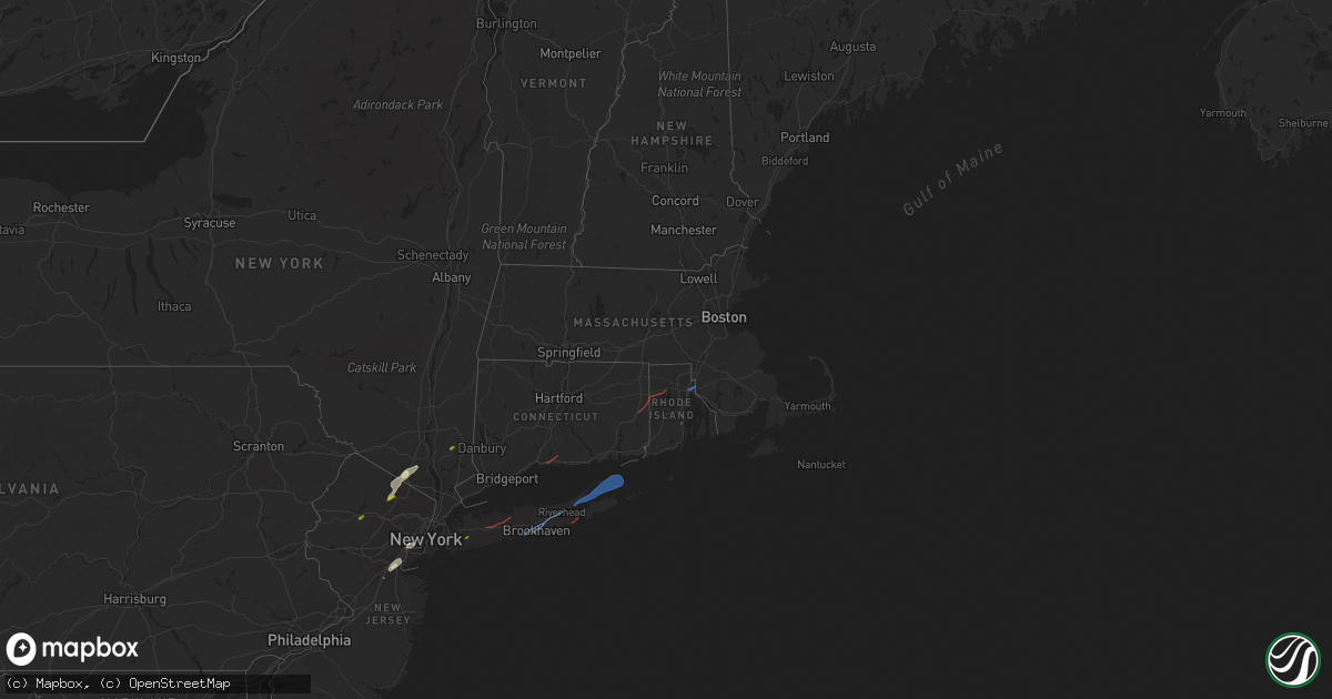
Hail Map in Connecticut on November 13, 2021
Get this storm
November 13 map
$229
one time, instant access
Download today. No call, no setup
Keep the $229
Bought the map and want the full workflow? Apply the entire $229 to a subscription within 7 days. None of it is wasted.
Every map, not just this one
This buys you this map. Subscription and you get every map we run, in the markets you choose from a few cities to whole states to nationwide. Plus real-time alerts the moment a storm fires.
Contact data
Name, contact info, occupancy, even credit band for addresses in the footprint. You go from where it hit to who to call.
Become the source they trust
Unlimited branding weather history reports on demand. You already have the documented answer ready for the property owner, and you are the one who showed up with it.
Property data and RoofTrace estimates
Pull up any address you have got, its value and the exact code rules for that jurisdiction, straight from One Click Code. Then RoofTrace estimates the squares, pitch, and roof value, priced the way you price.
Storm reports in Connecticut
Connecticut
| Date | Description |
|---|---|
| 11/13/20214:05 PM CST | Tree down on house on main street |
| 11/13/20214:00 PM CST | 10-inch diameter tree snapped 10 to 15 feet up. |
| 11/13/20214:00 PM CST | Tree and wires down on sterling hill road. Power lines down on norwich road. |
| 11/13/20213:50 PM CST | Corrects previous tstm wnd dmg report from north stonington location. Multiple trees down in town. Large sticks/branches got blown up to 150 feet away from the nearest |
| 11/13/20213:50 PM CST | Multiple trees down in town. Large sticks/branches got blown up to 150 feet away from the nearest tree. |
| 11/13/20213:50 PM CST | Multiple large branches down on road. |
| 11/13/20213:44 PM CST | Multiple trees and power lines down. Time estimated by radar. |
| 11/13/20213:40 PM CST | Tree and wires down on jim calhoun way. |
| 11/13/20213:30 PM CST | Tree down blocking plains road. |
| 11/13/20213:23 PM CST | Tree and power lines down on walker lane at pentigill road. |
| 11/13/20213:21 PM CST | Tree down on rowland rd... Flat rock hill rd and miles creek rd. |
| 11/13/20213:15 PM CST | Large tree branches snapped and twisted on lebanon ave. |
| 11/13/20212:54 PM CST | Trees snapped and downed in backyard in haddam neck. |
| 11/13/20212:45 PM CST | Police report numerous downed trees... Power lines around pine orchard. Time estimated by radar. |
| 11/13/20212:44 PM CST | Corrects previous tstm wnd dmg report from 2 ene branford. Multiple trees and power lines down. Time estimated by radar. |
| 11/13/20212:34 PM CST | Multiple trees down on route 10 in cheshire. |
| 11/13/20212:34 PM CST | Photo shows trampoline hanging from a power line on country club road in cheshire. Time estimated by radar. |
| 11/13/20212:34 PM CST | Trees down on property off of w main st. In cheshire. |
| 11/13/20212:33 PM CST | Multiple trees down in backyard on warren street in chesire. |
| 11/12/202111:01 PM CST | At 501 PM EST, severe thunderstorms were located along a line extending from Charlton to Thompson to near Killingly, moving northeast at 40 mph. HAZARD...60 mph wind gusts and penny size hail. SOURCE...Radar indicated. IMPACT...Expect damage to trees and power lines. Locations impacted include... Worcester, Providence, Cranston, Shrewsbury, Coventry, North Providence, Johnston, Plainfield, Smithfield, Grafton, Killingly, Webster, Southbridge, Auburn, Burrillville, Northbridge, Oxford, Uxbridge, Millbury and Charlton. |
| 11/12/20218:09 PM CST | At 208 PM EST, a severe thunderstorm was located over Mahopac, moving northeast at 50 mph. HAZARD...60 mph wind gusts and quarter size hail. SOURCE...Radar indicated. IMPACT...Hail damage to vehicles is expected. Expect wind damage to roofs, siding, and trees. Locations impacted include... Torrington, New Milford, Sherman, Pawling, Thomaston, Litchfield, Northwest Harwinton, Oakville, Terryville, Woodbury Center, Gaylordsville, New Preston, Wingdale, Watertown, Plymouth, Woodbury, Harwinton, Bethlehem, Washington and Morris. |
All States Impacted by Hail Map on November 13, 2021
Cities Impacted by Hail Map on November 13, 2021
- Tuxedo Park, NY
- Sloatsburg, NY
- Bayonne, NJ
- Elizabeth, NJ
- Elizabethport, NJ
- Toms River, NJ
- Edison, NJ
- Keasbey, NJ
- Sterling Forest, NY
- Ringwood, NJ
- East Brunswick, NJ
- Perth Amboy, NJ
- Sayreville, NJ
- Fords, NJ
- Woodbridge, NJ
- Staten Island, NY
- Port Reading, NJ
- Sewaren, NJ
- South Amboy, NJ
- Bloomingdale, NJ
- Hewitt, NJ
- West Milford, NJ
- Wanaque, NJ
- Butler, NJ
- Southfields, NY
- Pomona, NY
- Stony Point, NY
- Guilford, CT
- Branford, CT
- Moosup, CT
- Sterling, CT
- Plainfield, CT
- Foster, RI
- North Scituate, RI
- Providence, RI
- Rumford, RI
- Seekonk, MA
- East Providence, RI
- Pawcatuck, CT
- Westerly, RI
- North Kingstown, RI
- Kenvil, NJ
- Ledgewood, NJ
- Succasunna, NJ
- Mine Hill, NJ
- Haskell, NJ
- Mahopac, NY
- Hempstead, NY
- Uniondale, NY
- Huntington Station, NY
- Smithtown, NY
- Melville, NY
- Commack, NY
- Saint James, NY
- Manorville, NY
- Patchogue, NY
- Shirley, NY
- Bellport, NY
- Brookhaven, NY
- Yaphank, NY
- Mastic, NY
- Riverhead, NY
- Sag Harbor, NY
- East Hampton, NY
- Shelter Island, NY
- New Suffolk, NY
- Mattituck, NY
- Southold, NY
- Cutchogue, NY
- Shelter Island Heights, NY
- Hampton Bays, NY


