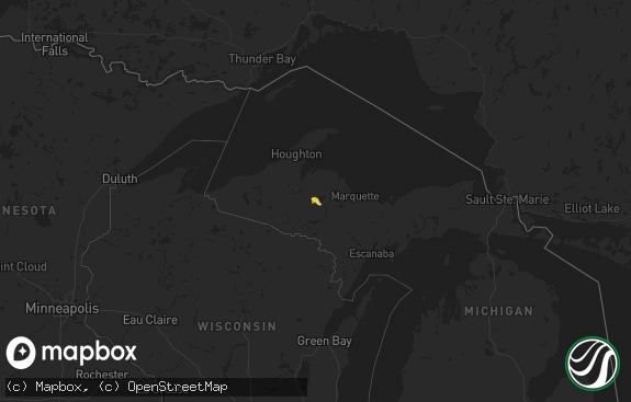
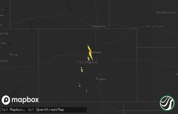
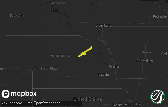
Hail Map in Michigan on September 20, 2018
The weather event in Michigan on September 20, 2018 includes Hail map. 9 states and 198 cities were impacted and suffered possible damage. The total estimated number of properties impacted is 0.

Hail
0
Estimated number of impacted properties by a 1.00" hail or larger0
Estimated number of impacted properties by a 1.75" hail or larger0
Estimated number of impacted properties by a 2.50" hail or largerStorm reports in Michigan
Michigan
| Date | Description |
|---|---|
| 09/20/20185:37 PM CDT | Several trees down in lake diane vicinity near territorial road. Size of trees unknown. Time estimated from radar. |
| 09/20/20186:32 AM CDT | At 1132 PM EDT, a severe thunderstorm was located 8 miles south of Corinne, or 18 miles northwest of Saint James On Beaver Island, moving northeast at 40 mph. HAZARD...60 mph wind gusts and quarter size hail. SOURCE...Radar indicated. IMPACT...Hail damage to vehicles is expected. Expect wind damage to roofs, siding, and trees. Locations impacted include... Brevort, Trout Lake, Hulbert, Corinne, Epoufette, Garnet, Naubinway, Gilchrist, Eckerman, Engadine, Fibre, Rexton, Gould City, East Lake, Batty Doe Lake, Garfield Township and Loon Lake. |
| 09/20/20184:59 AM CDT | Report received of multiple large trees down between byron rd and riley st south of jamestown. |
| 09/20/20182:40 AM CDT | Trees down in north and west portions of antrim county around central lake... Bellaire... Torch lake and echo township... As line of storms moved through early in the m |
| 09/20/20182:35 AM CDT | Awos station mcd... Mackinac island. |
| 09/20/20182:30 AM CDT | Received report of several trees down and some home damage. |
| 09/20/20182:05 AM CDT | At 705 PM EDT, a severe thunderstorm was located over Fayette, or near Morenci, moving east at 40 mph. HAZARD...60 mph wind gusts. SOURCE...Radar indicated. IMPACT...Expect damage to roofs, siding, and trees. Locations impacted include... Swanton, Fayette, Metamora, Lyons, Oakshade, Tedrow, Zone, Seward, Denson, Winameg, Ottokee and Assumption.This includes Interstate 80 in Ohio between mile markers 40 and 48. |
| 09/20/20181:59 AM CDT | At 658 PM EDT, a severe thunderstorm was located near Fayette, or 7 miles south of Hudson, moving east at 40 mph. HAZARD...60 mph wind gusts and quarter size hail. SOURCE...Radar indicated. IMPACT...Hail damage to vehicles is expected. Expect wind damage to roofs, siding, and trees. This severe thunderstorm will be near, Morenci around 710 PM EDT. Clayton around 715 PM EDT. Adrian around 730 PM EDT. Blissfield around 740 PM EDT. Deerfield and Britton around 745 PM EDT.Other locations impacted by this severe thunderstorm include Seneca,Lime Creek, Munson, Ogden Center, Canandaigua, Ridgeway, Palmyra,Sand Creek, Jasper and Medina. |
| 09/20/201812:18 AM CDT | At 518 PM EDT, a severe thunderstorm was located over Dunlap, moving east at 40 mph. Between 500 and 515 PM EDT, there have been several reports of trees and branches down in the greater South Bend area. HAZARD...60 mph wind gusts. SOURCE...Public. IMPACT...Expect damage to roofs, siding, and trees. Locations impacted include... Elkhart, Goshen, Dunlap, Simonton Lake, Middlebury, Bristol, White Pigeon, Millersburg, Union, Mottville, Adamsville, Jimtown and Waterford Mills.This includes Interstate 80 in Indiana between mile markers 88 and108. |
| 09/20/201812:03 AM CDT | At 502 PM EDT, a severe thunderstorm was located over Mishawaka, moving east at 30 mph. At 454 PM, a wind gust of 60 mph was reported at the South Bend Airport. HAZARD...60 mph wind gusts. SOURCE...Radar indicated. IMPACT...Expect damage to roofs, siding, and trees. Locations impacted include... South Bend, Elkhart, Mishawaka, Georgetown, Granger, Gulivoire Park, Simonton Lake, Dunlap, Osceola, Edwardsburg, Roseland, Indian Village, Adamsville, Juno Lake, Jimtown and Eagle Lake.This includes Interstate 80 in Indiana between mile markers 73 and92. |
All States Impacted by Hail Map on September 20, 2018
Cities Impacted by Hail Map on September 20, 2018
- Ridgeland, WI
- Scribner, NE
- North Bend, NE
- Bartlett, NE
- Ewing, NE
- Saint Paul, MN
- Estherville, IA
- Alpha, MN
- Dunnell, MN
- Grainfield, KS
- Park, KS
- Quinter, KS
- Collyer, KS
- Hoxie, KS
- Morland, KS
- Gove, KS
- Winona, KS
- Lake Crystal, MN
- Red Cloud, NE
- Bladen, NE
- Phillipsburg, KS
- Long Island, KS
- Almena, KS
- Lenora, KS
- Norton, KS
- Prairie View, KS
- Republican City, NE
- Trimont, MN
- Welcome, MN
- Sherburn, MN
- Guide Rock, NE
- Inavale, NE
- Blue Hill, NE
- Kensington, KS
- Smith Center, KS
- Agra, KS
- Athol, KS
- Jackson, MN
- Bogue, KS
- Hill City, KS
- Kirwin, KS
- Gaylord, KS
- Glade, KS
- Cedar, KS
- Stockton, KS
- Naubinway, MI
- Camden, MI
- Waldron, MI
- Hillsdale, MI
- Osseo, MI
- Pittsford, MI
- Sturgis, MI
- West Salem, WI
- Bangor, WI
- Eden Prairie, MN
- Minneapolis, MN
- Shakopee, MN
- Exeter, NE
- York, NE
- Beaver Crossing, NE
- Fairmont, NE
- Rock Valley, IA
- Sioux Center, IA
- Bridgeport, NE
- Bayard, NE
- Dalton, NE
- Leoti, KS
- Ocheyedan, IA
- Belle Plaine, MN
- Hawarden, IA
- Edgar, NE
- Fairfield, NE
- Sutton, NE
- Clay Center, NE
- Oshkosh, NE
- Garden City, MN
- Vernon Center, MN
- Friend, NE
- Elk Point, SD
- Holland, MI
- West Olive, MI
- Burr Oak, KS
- Lebanon, KS
- Burr Oak, MI
- Wheeler, WI
- Somerset, WI
- Saint James, MN
- North Royalton, OH
- Brunswick, OH
- Strongsville, OH
- Hinckley, OH
- Bronson, MI
- Coldwater, MI
- Woodston, KS
- Damar, KS
- Lodgepole, NE
- Waterbury, NE
- Allen, NE
- Wakefield, NE
- Emerson, NE
- Wayne, NE
- Truman, MN
- Chappell, NE
- Brule, NE
- Lewellen, NE
- Big Springs, NE
- Newberry, MI
- Sibley, IA
- Hanley Falls, MN
- Potter, NE
- Hartley, IA
- Scott City, KS
- Hancock, IA
- Avoca, IA
- West Branch, MI
- Redwood Falls, MN
- Broadwater, NE
- New Prague, MN
- Mountain Lake, MN
- Waco, NE
- Cordova, NE
- McCool Junction, NE
- Boyceville, WI
- Carp Lake, MI
- Comfrey, MN
- Henderson, MN
- Le Sueur, MN
- Madison Lake, MN
- Levering, MI
- Byron Center, MI
- Montgomery, MI
- Minden, IA
- Shelby, IA
- Oakland, IA
- Roberts, WI
- River Falls, WI
- Engadine, MI
- Lawrence, NE
- Riverton, NE
- White Pigeon, MI
- Constantine, MI
- Winnebago, MN
- Mankato, MN
- Le Mars, IA
- Merrill, IA
- Jordan, MN
- Janesville, MN
- Eagle Lake, MN
- Fairmont, MN
- Granada, MN
- Dorchester, NE
- Campbell, NE
- Mapleton, MN
- Woodstock, MN
- Ruthton, MN
- Holland, MN
- Sparta, WI
- Ayrshire, IA
- Emmetsburg, IA
- Coral Springs, FL
- Fort Lauderdale, FL
- Gould City, MI
- Sanborn, IA
- Stillwater, MN
- Savage, MN
- Willernie, MN
- Prior Lake, MN
- Burnsville, MN
- Lake Park, IA
- Reading, MI
- Dolliver, IA
- Armstrong, IA
- Edgerton, MN
- Rockland, WI
- Jeffers, MN
- Inwood, IA
- Canton, SD
- Cleveland, MN
- Saint Peter, MN
- Butterfield, MN
- Bingham Lake, MN
- Darfur, MN
- Ogallala, NE
- Melvin, IA
- Graettinger, IA
- Oconomowoc, WI
- Curlew, IA
- Ruthven, IA
- Utica, NE
- Lake City, MN
- Ormsby, MN
- Odin, MN
- Amboy, MN
- Franklin, NE
- Miami, FL
- West Point, NE
- Seward, NE
- Goehner, NE


