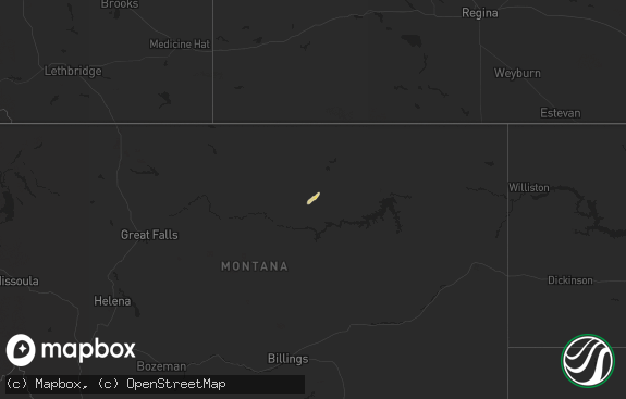
Hail Map in North Dakota on September 2, 2021
The weather event in North Dakota on September 2, 2021 includes Wind and Hail maps. 9 states and 61 cities were impacted and suffered possible damage. The total estimated number of properties impacted is 9.

Wind
Hail
9
Estimated number of impacted properties by a 1.00" hail or larger0
Estimated number of impacted properties by a 1.75" hail or larger0
Estimated number of impacted properties by a 2.50" hail or largerStorm reports in North Dakota
North Dakota
| Date | Description |
|---|---|
| 09/02/202110:08 AM CDT | Much wind-driven hail fell. Most was smaller but some was the size of quarters. A skylight on a home was broken. Time estimated from radar. |
| 09/02/20217:46 AM CDT | Wind gusts of 60 mph with enough pea size hail that drifts of hail remained and leaves were stripped from the trees in the yard. The strong winds and hail lasted about |
| 09/02/20214:04 AM CDT | At 904 AM MDT, a severe thunderstorm was located 16 miles northwest of Amidon, moving east at 15 mph. HAZARD...60 mph wind gusts and half dollar size hail. SOURCE...Radar indicated. IMPACT...Hail damage to vehicles is expected. Expect wind damage to roofs, siding, and trees. This severe thunderstorm will remain over mainly rural areas of southeastern Golden Valley, southwestern Billings and north central Slope Counties. |
| 09/02/20212:40 AM CDT | At 739 AM CDT, a severe thunderstorm was located 6 miles northwest of Minot Air Force Base, or 18 miles north of Minot, moving east at 25 mph. HAZARD...60 mph wind gusts and quarter size hail. SOURCE...Radar indicated. IMPACT...Hail damage to vehicles is expected. Expect wind damage to roofs, siding, and trees. This severe thunderstorm will be near... Minot Air Force Base around 750 AM CDT.Other locations in the path of this severe thunderstorm includeGlenburn. |
| 09/02/202112:45 AM CDT | At 544 AM CDT, a severe thunderstorm was located over Stanley, moving northeast at 30 mph. HAZARD...Quarter size hail. SOURCE...Radar indicated. IMPACT...Damage to vehicles is expected. This severe thunderstorm will be near... Palermo around 600 AM CDT. |
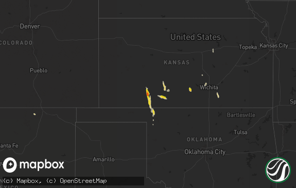
All States Impacted by Hail Map on September 2, 2021
Cities Impacted by Hail Map on September 2, 2021
- Soda Springs, ID
- Houston, TX
- Copeland, KS
- Sublette, KS
- Berthold, ND
- Glenburn, ND
- Glenvil, NE
- Lansford, ND
- Carpio, ND
- White Castle, LA
- Woodbine, KS
- Hope, KS
- Chapman, KS
- Council Grove, KS
- Tescott, KS
- Ellsworth, KS
- Beverly, KS
- Lincoln, KS
- White City, KS
- Rhame, ND
- Americus, KS
- Emporia, KS
- Escalante, UT
- Gove, KS
- Bancroft, ID
- Dwight, KS
- Wilsey, KS
- Boulder, WY
- Centerville, UT
- Woods Cross, UT
- Minneapolis, KS
- Brookville, KS
- Duchesne, UT
- Amidon, ND
- Breaux Bridge, LA
- Mountain Home, UT
- Enterprise, KS
- Abilene, KS
- Holdrege, NE
- Alma, NE
- Belmont, LA
- Zwolle, LA
- Marthaville, LA
- Pleasant Hill, LA
- Converse, LA
- Christmas, FL
- Oviedo, FL
- Pierre Part, LA
- Belle Rose, LA
- Magna, UT
- Florien, LA
- Lake Wales, FL
- Reading, KS
- Admire, KS
- Glenmora, LA
- Forest Hill, LA
- Wilson, KS
- Sylvan Grove, KS
- Dorrance, KS
- Herington, KS
- Brownfield, TX


