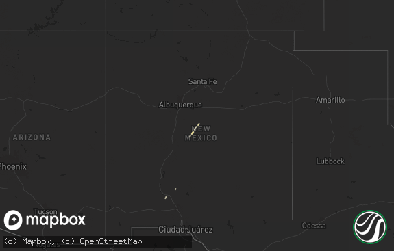
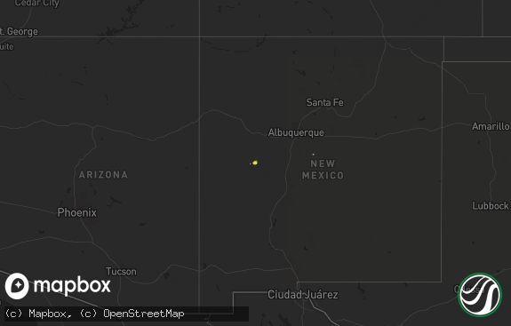
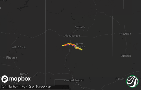
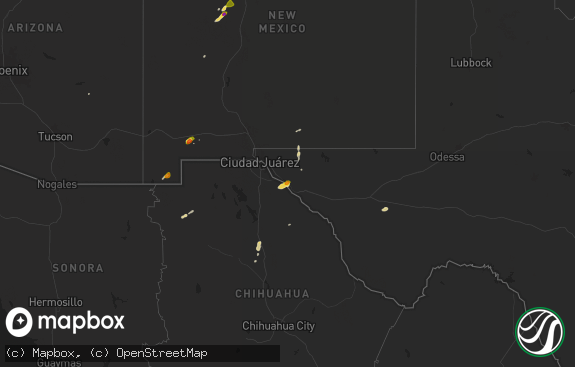
Hail Map in New Mexico on August 28, 2020
The weather event in New Mexico on August 28, 2020 includes Wind and Hail maps. 25 states and 640 cities were impacted and suffered possible damage. The total estimated number of properties impacted is 0.

Wind
Hail
0
Estimated number of impacted properties by a 1.00" hail or larger0
Estimated number of impacted properties by a 1.75" hail or larger0
Estimated number of impacted properties by a 2.50" hail or largerStorm reports in New Mexico
New Mexico
| Date | Description |
|---|---|
| 08/28/20204:37 PM CDT | Krtn asos. |
| 08/28/20201:09 AM CDT | At 608 PM MDT, a severe thunderstorm was located 15 miles west of Northern Meadows, or 17 miles west of Rio Rancho, moving east at 15 mph. HAZARD...60 mph wind gusts. SOURCE...Radar indicated. IMPACT...Expect damage to roofs, siding, and trees. Locations impacted include... Albuquerque, Rio Rancho, Corrales, Bernalillo, Los Ranchos De Albuquerque, Enchanted Hills, Mariposa, Cabezon, Coronado State Monument and Vista Hills.This includes the following highways... Interstate 40 between Mile Markers 136 and 162. Interstate 25 between Mile Markers 224 and 244. Highway 550 between Mile Markers 1 and 7. |
| 08/27/202011:50 PM CDT | At 450 PM MDT, a severe thunderstorm was located near Mosquero, moving northeast at 10 mph. HAZARD...60 mph wind gusts and quarter size hail. SOURCE...Radar indicated. IMPACT...Hail damage to vehicles is expected. Expect wind damage to roofs, siding, and trees. This severe thunderstorm will remain over mainly rural areas of central Harding County. |
| 08/27/202011:44 PM CDT | At 444 PM MDT, a severe thunderstorm was located 13 miles southwest of Grenville, or 17 miles south of Des Moines, moving north at 15 mph. HAZARD...60 mph wind gusts and quarter size hail. SOURCE...Radar indicated. IMPACT...Hail damage to vehicles is expected. Expect wind damage to roofs, siding, and trees. Locations impacted include... Grenville.This includes Highway 64 between Mile Markers 388 and 404. |
All States Impacted by Hail Map on August 28, 2020
Cities Impacted by Hail Map on August 28, 2020
- Howard City, MI
- Pleasant Hill, OH
- Laura, OH
- Morland, KS
- Penokee, KS
- Hill City, KS
- Pritchett, CO
- Kim, CO
- Concordia, KS
- Winthrop, IA
- Ryan, IA
- Masonville, IA
- Coggon, IA
- Manchester, IA
- Sullivan, OH
- Fredericktown, OH
- Mount Vernon, OH
- Syracuse, KS
- Iola, TX
- Dover, DE
- Havre De Grace, MD
- Cecilton, MD
- Warwick, MD
- Smyrna, DE
- Townsend, DE
- Galena, MD
- Middletown, DE
- North East, MD
- Clayton, DE
- Earleville, MD
- Kennett Square, PA
- Chadds Ford, PA
- Traer, IA
- Gladbrook, IA
- Ashland, OH
- Ashley, MI
- Ithaca, MI
- Grinnell, KS
- Spencer, OH
- Litchfield, OH
- Valley City, OH
- Medina, OH
- Grafton, OH
- Wellington, OH
- Columbia Station, OH
- Morgantown, WV
- Hoxie, KS
- Andrews Air Force Base, MD
- Fort Washington, MD
- Temple Hills, MD
- Suitland, MD
- Clinton, MD
- Oxon Hill, MD
- Alexandria, VA
- Cimarron, KS
- Stratford, TX
- Hazleton, IA
- Fairbank, IA
- Immokalee, FL
- Winona, KS
- Olsburg, KS
- Kent City, MI
- Grant, MI
- Cedar Springs, MI
- Bailey, MI
- Sparta, MI
- Ionia, MI
- Muir, MI
- Lucas, KS
- Owings, MD
- Prince Frederick, MD
- Huntingtown, MD
- Brandywine, MD
- Waldorf, MD
- Port Republic, MD
- Aquasco, MD
- Woodbridge, VA
- New Lothrop, MI
- Tribune, KS
- Leoti, KS
- Lakeview, MI
- Morley, MI
- Greenville, PA
- Gore, VA
- Winchester, VA
- Dundee, IA
- Independence, IA
- Brandon, IA
- Hopkinton, IA
- Center Junction, IA
- Rowley, IA
- Delhi, IA
- Anamosa, IA
- Langworthy, IA
- Monticello, IA
- Quasqueton, IA
- West Chester, PA
- Mount Morris, PA
- Akron, OH
- Clinton, OH
- Hockessin, DE
- Avondale, PA
- Wilmington, DE
- Arcanum, OH
- Moline, KS
- Grainfield, KS
- Gove, KS
- Elkton, MD
- Aberdeen, MD
- Dover Afb, DE
- Camden Wyoming, DE
- Magnolia, DE
- Perry Point, MD
- Port Deposit, MD
- Chesapeake City, MD
- Perryville, MD
- Quinter, KS
- Park, KS
- Brooklyn, MI
- Medicine Lodge, KS
- New Bethlehem, PA
- Mayport, PA
- Fairmount City, PA
- Scott City, KS
- Healy, KS
- Newton, IA
- Union, IA
- Saugatuck, MI
- Douglas, MI
- Brookfield, WI
- Pewaukee, WI
- Waukesha, WI
- Elm Grove, WI
- Otsego, MI
- Hopkins, MI
- Menomonee Falls, WI
- South Haven, MI
- Milwaukee, WI
- Hamilton, MI
- Allegan, MI
- Fennville, MI
- Vermillion, KS
- Carmichaels, PA
- Lakin, KS
- Marshalltown, IA
- Dysart, IA
- Garrison, IA
- Garwin, IA
- Toledo, IA
- The Plains, VA
- Middleburg, VA
- Aldie, VA
- Tipton, KS
- Hunter, KS
- High View, WV
- Elyria, OH
- Holton, KS
- Valley Falls, KS
- Denison, KS
- Sedan, KS
- Cuba City, WI
- Oakley, KS
- Caldwell, OH
- Melbourne, IA
- Laurel, IA
- Flint, MI
- Flushing, MI
- Mount Morris, MI
- Martin, MI
- Greenville, MI
- Marienthal, KS
- Aberdeen, MS
- Belle Plaine, KS
- Udall, KS
- Oxford, KS
- Shelby, OH
- Waldo, KS
- Luray, KS
- Osborne, KS
- Kankakee, IL
- Herscher, IL
- Wooster, OH
- Cedar Vale, KS
- Crawford, WV
- Rockwell, NC
- China Grove, NC
- Salisbury, NC
- Kannapolis, NC
- Haymarket, VA
- Felicity, OH
- Bethel, OH
- Hume, VA
- Flint Hill, VA
- Huntly, VA
- Lansdowne, PA
- Clifton Heights, PA
- Springfield, PA
- Havertown, PA
- Upper Darby, PA
- Drexel Hill, PA
- Philadelphia, PA
- Charlestown, MD
- Bannister, MI
- Pompeii, MI
- Perrinton, MI
- Sumner, MI
- Johnson, KS
- Winfield, KS
- Lovelady, TX
- Dubuque, IA
- Potosi, WI
- Sherrill, IA
- Larned, KS
- Jeromesville, OH
- Kutztown, PA
- Lenhartsville, PA
- Fleetwood, PA
- Hamburg, PA
- Swartz Creek, MI
- Pullman, MI
- Colfax, IA
- Prairie City, IA
- Clifton, KS
- Bear, DE
- Sunbury, OH
- North Judson, IN
- Winston Salem, NC
- Farmdale, OH
- Kinsman, OH
- Wynnewood, PA
- Darby, PA
- Morton, PA
- Broomall, PA
- Glenolden, PA
- Ardmore, PA
- Swarthmore, PA
- Lyon Station, PA
- Shoemakersville, PA
- Cheltenham, MD
- Kellogg, IA
- Deforest, WI
- Dane, WI
- Benton, WI
- Shullsburg, WI
- Pierson, MI
- Coral, MI
- Eau Claire, MI
- Sodus, MI
- Hadley, PA
- Stoneboro, PA
- Clarks Mills, PA
- Sharpsville, PA
- Jackson Center, PA
- Fredonia, PA
- Mercer, PA
- Huron, OH
- Berlin Heights, OH
- Marshall, VA
- Longton, KS
- Elk City, KS
- Newcastle, NE
- Gilman, IA
- Frankfort, KS
- Jamestown, SC
- Garden City, KS
- Casnovia, MI
- Catharpin, VA
- Ashburn, VA
- Broad Run, VA
- Gainesville, VA
- Chantilly, VA
- Clearwater, KS
- Elwell, MI
- Saint Louis, MI
- Alma, MI
- Lyons, MI
- Annandale, VA
- McLean, VA
- Arlington, VA
- Fairfax, VA
- Vienna, VA
- Oakton, VA
- Falls Church, VA
- Dunn Loring, VA
- Grinnell, IA
- Bellevue, MI
- Shiloh, OH
- Manter, KS
- Glen Haven, WI
- Cassville, WI
- Muskegon, MI
- Gowen, MI
- Twin Lake, MI
- Fenwick, MI
- Pewamo, MI
- Orleans, MI
- Holton, MI
- Fowler, MI
- Saint Johns, MI
- Westphalia, MI
- Belding, MI
- Sand Lake, MI
- Ravenna, MI
- Rockford, MI
- Woodville, VA
- Washington, VA
- Sperryville, VA
- Castleton, VA
- Owosso, MI
- Merion Station, PA
- Wayne, PA
- Holmes, PA
- Wallingford, PA
- Haverford, PA
- Villanova, PA
- Media, PA
- Newtown Square, PA
- Bryn Mawr, PA
- Folsom, PA
- Westover, MD
- Princess Anne, MD
- Clarksburg, MD
- Barnesville, MD
- Boyds, MD
- Protection, KS
- Denton, MD
- Uniontown, OH
- Watertown, WI
- Wellington, KS
- Burden, KS
- Lenoir, NC
- Mitchellville, IA
- Runnells, IA
- North Star, MI
- Burton, MI
- Davison, MI
- Oakley, MI
- Corunna, MI
- Chesaning, MI
- Montrose, MI
- Bagley, WI
- Chester Heights, PA
- Glen Mills, PA
- Aston, PA
- Fulks Run, VA
- Elk Falls, KS
- Grenola, KS
- Clinton, MI
- Sylvan Grove, KS
- Galion, OH
- Spring, TX
- Weston, WV
- Horner, WV
- Lorton, VA
- Manassas, VA
- Fairfax Station, VA
- Reddick, IL
- Bonfield, IL
- Kittanning, PA
- Adrian, PA
- Templeton, PA
- Waynesburg, PA
- Spraggs, PA
- Hinton, VA
- Dayton, VA
- Jetmore, KS
- Ingalls, KS
- Zanesfield, OH
- West Liberty, OH
- Ellis, KS
- Eureka, KS
- Hockley, TX
- Earlville, IA
- Mazon, IL
- Gardner, IL
- Lancaster, WI
- Zearing, IA
- Monroe, IA
- Rushsylvania, OH
- Belle Center, OH
- Bussey, IA
- Alton, KS
- Holly, CO
- Hartland, WI
- Sussex, WI
- Jamestown, PA
- Decatur, MI
- Kennerdell, PA
- Emlenton, PA
- Wakarusa, IN
- Nappanee, IN
- New Paris, IN
- Goshen, IN
- Grove City, PA
- Dexter, KS
- Shelbyville, MI
- Russell, KS
- Hubbardston, MI
- Niles, MI
- Berrien Springs, MI
- Buchanan, MI
- Ubly, MI
- Bellefontaine, OH
- Guttenberg, IA
- Bloomington, WI
- Clio, MI
- Burghill, OH
- Barberton, OH
- Senecaville, OH
- Kipling, OH
- Cambridge, OH
- Lore City, OH
- Byesville, OH
- Drayden, MD
- Great Mills, MD
- Valley Lee, MD
- Park Hall, MD
- Lexington Park, MD
- Saint Inigoes, MD
- Dameron, MD
- Snow Hill, MD
- Altoona, IA
- Coal Township, PA
- Paxinos, PA
- Shamokin, PA
- Cutler, IN
- Urbana, OH
- Hornick, IA
- Bronson, IA
- Landenberg, PA
- Greenwood, DE
- Harrington, DE
- Ridgely, MD
- Ogallah, KS
- Aurora, IA
- Columbus, OH
- Henderson, MI
- Oelwein, IA
- Lima, OH
- Galena, OH
- Stockton, IL
- Apple River, IL
- Lennon, MI
- Tremont, MS
- Brant, MI
- Elsie, MI
- Middleton, MI
- Crystal, MI
- Wheeler, MI
- Merrill, MI
- Saint Charles, MI
- Demotte, IN
- Wheatfield, IN
- Conway Springs, KS
- Viola, KS
- Milton, KS
- Clemons, IA
- Albion, IA
- McCallsburg, IA
- Hubbard, IA
- Saint Anthony, IA
- New Providence, IA
- Liscomb, IA
- Pocomoke City, MD
- Grenville, NM
- Dunkerton, IA
- Continental, OH
- Chester Gap, VA
- Foster, KY
- Cambridge, MD
- Oconomowoc, WI
- Lexington, NC
- East Brady, PA
- Chicora, PA
- Cedarburg, WI
- Mequon, WI
- Grafton, WI
- Upperville, VA
- Syria, VA
- Stevensville, MI
- Saint Joseph, MI
- Indian Head, MD
- Pomfret, MD
- La Plata, MD
- Bryans Road, MD
- White Plains, MD
- Laurel, DE
- Madison, MD
- Chebanse, IL
- Exton, PA
- Downingtown, PA
- Lewis Center, OH
- Peru, KS
- Dewitt, MI
- Jackson, MI
- Worthington, IA
- Cascade, IA
- Spivey, KS
- La Porte City, IA
- Harper, KS
- Sergeant Bluff, IA
- Salix, IA
- Zenda, KS
- Lodi, WI
- Arlington, WI
- Haverhill, IA
- Clewiston, FL
- Hartly, DE
- Conroe, TX
- New Caney, TX
- Scales Mound, IL
- Odessa, DE
- North Beach, MD
- Tracys Landing, MD
- Chesapeake Beach, MD
- Friendship, MD
- Washington, DC
- Dunkirk, MD
- Fort Belvoir, VA
- Upper Marlboro, MD
- Woodstock, OH
- Cable, OH
- Mechanicsburg, OH
- Tomball, TX
- Cypress, TX
- Waller, TX
- Transfer, PA
- Beaman, IA
- Vinton, IA
- Conrad, IA
- Wilmington, IL
- Marengo, OH
- Kendall, KS
- Prairie Du Chien, WI
- Mount Hope, WI
- Lexington, AL
- Florence, AL
- Tuscumbia, AL
- Sheffield, AL
- Killen, AL
- Rogersville, AL
- Muscle Shoals, AL
- Haleyville, AL
- Moulton, AL
- Addison, AL
- Danville, AL
- Double Springs, AL
- Hartselle, AL
- Houston, AL
- Falkville, AL
- Vinemont, AL
- Broadway, VA
- Kingston Springs, TN
- Nashville, TN
- Ashland City, TN
- Pegram, TN
- Centerville, TN
- Madison, TN
- Whites Creek, TN
- Bon Aqua, TN
- Fairview, TN
- Lyles, TN
- Mcminnville, TN
- Morrison, TN
- Manchester, TN
- Dodge City, KS
- Mullinville, KS
- Bucklin, KS
- Wright, KS
- Holcomb, KS
- Ford, KS
- Spearville, KS
- Greensburg, KS
- Minneola, KS
- Mount Auburn, IA
- Bristol, PA
- Joint Base Mdl, NJ
- Langhorne, PA
- Warminster, PA
- Horsham, PA
- Huntingdon Valley, PA
- Southampton, PA
- Florence, NJ
- Dublin, PA
- Cookstown, NJ
- Lansdale, PA
- Willingboro, NJ
- Warrington, PA
- Doylestown, PA
- Richboro, PA
- Sellersville, PA
- Telford, PA
- Montgomeryville, PA
- Newtown, PA
- Roebling, NJ
- Pemberton, NJ
- Hatfield, PA
- Quakertown, PA
- Mount Holly, NJ
- Ambler, PA
- Bordentown, NJ
- Croydon, PA
- Line Lexington, PA
- Fairless Hills, PA
- Burlington, NJ
- Feasterville Trevose, PA
- Colmar, PA
- Jobstown, NJ
- Wrightstown, NJ
- Columbus, NJ
- Jamison, PA
- Furlong, PA
- Chalfont, PA
- Silverdale, PA
- Beverly, NJ
- Souderton, PA
- Bryn Athyn, PA
- Perkasie, PA
- Hatboro, PA
- Levittown, PA
- Fountainville, PA
- Bensalem, PA
- Hilltown, PA
- Lakehurst, NJ
- Browns Mills, NJ
- Vincentown, NJ
- North Wales, PA
- Belleville, PA
- Petersburg, PA
- Lewistown, PA
- Pennsylvania Furnace, PA
- Huntingdon, PA
- Ashville, PA
- Carrolltown, PA
- Hollidaysburg, PA
- Altoona, PA
- Gallitzin, PA
- Ebensburg, PA
- Loretto, PA
- Patton, PA


