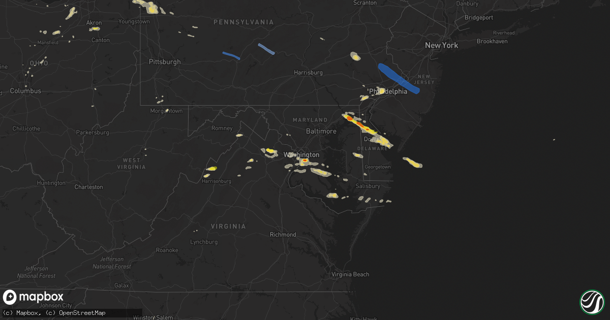
Hail Map on August 28, 2020
Get this storm
August 28 map
$229
one time, instant access
Download today. No call, no setup
Keep the $229
Bought the map and want the full workflow? Apply the entire $229 to a subscription within 7 days. None of it is wasted.
Every map, not just this one
This buys you this map. Subscription and you get every map we run, in the markets you choose from a few cities to whole states to nationwide. Plus real-time alerts the moment a storm fires.
Contact data
Name, contact info, occupancy, even credit band for addresses in the footprint. You go from where it hit to who to call.
Become the source they trust
Unlimited branding weather history reports on demand. You already have the documented answer ready for the property owner, and you are the one who showed up with it.
Property data and RoofTrace estimates
Pull up any address you have got, its value and the exact code rules for that jurisdiction, straight from One Click Code. Then RoofTrace estimates the squares, pitch, and roof value, priced the way you price.
States Impacted by Hail Map on August 28, 2020
Storm reports
Mississippi
| Date | Description |
|---|---|
| 08/28/20203:15 PM CDT | Large tree split in houlka. |
| 08/28/20202:45 PM CDT | Damage to a store front and radio tower. Large tree down on home. |
| 08/28/20202:13 AM CDT | At 713 PM CDT, a severe thunderstorm was located near Blue Mountain, or 7 miles northwest of New Albany, moving east at 40 mph. HAZARD...60 mph wind gusts. SOURCE...Radar indicated. IMPACT...Expect damage to roofs, siding, and trees. Locations impacted include... New Albany, Blue Mountain, Keownville, Blair, Hickory Flat, Myrtle, Dumas, Blue Springs, Shari, Graham, Jericho, Branyan, Ellistown, Old Myrtle, Pumpkin Center, Jug Fork, Baker, Geeville, Locum and Smalco. |
| 08/28/20201:18 AM CDT | At 617 AM CDT, a severe thunderstorm was located near Burgess, or near Holly Springs National Forest, moving northeast at 30 mph. HAZARD...60 mph wind gusts. SOURCE...Radar indicated. IMPACT...Expect damage to roofs, siding, and trees. Locations impacted include... Oxford, Holly Springs National Forest, Springdale, Burgess, Cambridge, Abbeville, Taylor, College Hill Station, Keel, Blackwater, College Hill and Burt. |
| 08/28/202012:29 AM CDT | At 529 PM CDT, a severe thunderstorm was located over Canaan, or 19 miles northwest of Ripley, moving east at 40 mph. HAZARD...60 mph wind gusts. SOURCE...Radar indicated. IMPACT...Expect damage to roofs, siding, and trees. Locations impacted include... Canaan, Lagrange, Michigan City, Theo, Walnut, Middleton, Falkner, Grand Junction, La Grange, Saulsbury, Rogers Springs, Chalybeate, Brody, Collinstown, Crumtown, New Canaan, Essary Springs, Brownfield, Lone Pine and Hamilton. |
| 08/27/202011:32 PM CDT | At 431 PM CDT, a severe thunderstorm was located near Sulligent, moving east at 45 mph. HAZARD...60 mph wind gusts and penny size hail. SOURCE...Radar indicated. IMPACT...Expect damage to roofs, siding, and trees. Locations impacted include... Hamilton, Winfield, Sulligent, Guin, Brilliant, Glen Allen, Detroit, Beaverton, Gu- Win, Lamar County Airport, Crews, Bluff, Twin, Tucker, Henson Springs, Bazemore, Wayside, Pearces Mill, Hubbertville and Texas. |
| 08/27/202011:13 PM CDT | At 413 PM CDT, a severe thunderstorm was located near Aberdeen, moving east at 40 mph. HAZARD...60 mph wind gusts. SOURCE...Radar indicated. IMPACT...Expect damage to roofs, siding, and trees. Locations impacted include... Amory, Aberdeen, Hatley, Gattman, Binford, Sipsey Fork, Becker, Quincy, Splunge, Wise Gap, Athens, East Aberdeen, Greenwood Springs and Parham. |
| 08/27/202010:11 PM CDT | At 310 PM CDT, a severe thunderstorm was located near Houlka, or near Houston, moving east at 50 mph. HAZARD...60 mph wind gusts. SOURCE...Radar indicated. IMPACT...Expect damage to roofs, siding, and trees. Locations impacted include... Houston, Okolona, Vardaman, Houlka, New Houlka, Thorn, Van Vleet, Parkersburg, Reid and Thelma. |
| 08/27/20209:57 PM CDT | At 257 PM CDT, a severe thunderstorm was located near Derma, or 16 miles west of Houston, moving northeast at 45 mph. HAZARD...60 mph wind gusts. SOURCE...Radar indicated. IMPACT...Expect damage to roofs, siding, and trees. Locations impacted include... Houston, Calhoun City, Vardaman, Derma, Pittsboro, Pyland, Houlka, New Houlka, Thorn, Reid, Loyd and Thelma. |
South Dakota
| Date | Description |
|---|---|
| 08/28/20207:27 AM CDT | At 1227 AM CDT, severe thunderstorms were located along a line extending from near Pleasant Valley Country Church to near Gann Valley to 9 miles north of Kimball, moving east at 45 mph. HAZARD...60 mph wind gusts and half dollar size hail. SOURCE...Radar indicated. IMPACT...Hail damage to vehicles is expected. Expect wind damage to roofs, siding, and trees. Severe thunderstorms will be near... Wessington Springs around 1250 AM CDT. Lane and Virgil around 100 AM CDT. Alpena around 105 AM CDT. Woonsocket around 110 AM CDT. Forestburg around 120 AM CDT. |
| 08/27/20208:28 PM CDT | At 128 AM CDT, a severe thunderstorm was located near Fulton, or 11 miles northeast of Mitchell, moving east at 40 mph. HAZARD...70 mph wind gusts and penny size hail. SOURCE...Radar indicated. IMPACT...Expect considerable tree damage. Damage is likely to mobile homes, roofs, and outbuildings. This severe thunderstorm will be near... Farmer around 140 AM CDT. Spencer In McCook County around 150 AM CDT. Salem around 205 AM CDT. Montrose around 220 AM CDT. |
| 08/27/20208:11 PM CDT | At 110 AM CDT, a severe thunderstorm was located near Clark Colony, or 11 miles west of Clark, moving east at 70 mph. HAZARD...60 mph wind gusts. SOURCE...Radar indicated. IMPACT...Expect damage to roofs, siding, and trees. Locations impacted include... Watertown, Redfield, Clark, Lake Norden, Bryant, Hayti, Florence, Henry, Willow Lake, Doland, Frankfort, Conde, Ashton, Hazel, Hitchcock, Wallace, Brentford, Bradley, Athol and Garden City. |
| 08/27/20208:09 PM CDT | At 109 AM CDT, severe thunderstorms were located along a line extending from 7 miles west of Carpenter to 7 miles southeast of Cavour to Forestburg, moving east at 60 mph. These are very dangerous storms. HAZARD...80 mph wind gusts and nickel size hail. SOURCE...Radar indicated. IMPACT...Flying debris will be dangerous to those caught without shelter. Mobile homes will be heavily damaged. Expect considerable damage to roofs, windows, and vehicles. Extensive tree damage and power outages are likely. Severe thunderstorms will be near... Iroquois around 115 AM CDT. Fedora around 125 AM CDT. De Smet, Carthage and Roswell around 130 AM CDT. Lake Thompson State Recreation Area and Vilas around 135 AM CDT. Howard and Lake Preston around 140 AM CDT. Winfred and Hetland around 145 AM CDT. Arlington around 150 AM CDT. Ramona around 155 AM CDT.Other locations impacted by these severe thunderstorms includeBancroft and Erwin. |
| 08/27/20208:05 PM CDT | At 105 AM CDT, severe thunderstorms were located along a line extending from near Wessington Springs to 10 miles northeast of White Lake to near Grass Ranch Colony, moving east at 55 mph. HAZARD...60 mph wind gusts. SOURCE...Radar indicated. IMPACT...Expect damage to roofs, siding, and trees. Severe thunderstorms will be near... Storla around 120 AM CDT. Plankinton around 125 AM CDT. Mitchell, Stickney, Letcher and Loomis around 130 AM CDT. |
| 08/27/20208:02 PM CDT | At 102 AM CDT, severe thunderstorms were located along a line extending from 8 miles southwest of Hillside Colony to near Cavour to 6 miles east of Alpena, moving east at 60 mph. HAZARD...70 mph wind gusts. SOURCE...Radar indicated. IMPACT...Expect considerable tree damage. Damage is likely to mobile homes, roofs, and outbuildings. Severe thunderstorms will be near... Yale around 110 AM CDT.Other locations impacted by these severe thunderstorms includeBroadland. |
Indiana
| Date | Description |
|---|---|
| 08/28/20202:35 AM CDT | Tree limbs of unknown size downed across portions of southwest tippecanoe county. Time estimated from radar. |
| 08/28/202012:46 AM CDT | Tree limb down on power line... Power out. |
Georgia
| Date | Description |
|---|---|
| 08/28/20204:12 AM CDT | At 912 PM EDT, a severe thunderstorm was located 9 miles northeast of Toccoa, or 5 miles west of Westminster, moving northeast at 20 mph. HAZARD...60 mph wind gusts. SOURCE...Radar indicated. IMPACT...Expect damage to trees and power lines. Locations impacted include... Seneca, Walhalla, Westminster, Salem, Clemson and Lake Keowee. |
Texas
| Date | Description |
|---|---|
| 08/28/202012:34 AM CDT | At 533 PM CDT, a severe thunderstorm was located near Bedias, or 14 miles southwest of Madisonville, moving south at 10 mph. HAZARD...60 mph wind gusts and quarter size hail. SOURCE...Radar indicated. IMPACT...Hail damage to vehicles is expected. Expect wind damage to roofs, siding, and trees. Locations impacted include... Bedias and Iola. |
| 08/28/202012:08 AM CDT | At 507 PM CDT, a severe thunderstorm was located near Kingwood, moving east at 10 mph. HAZARD...60 mph wind gusts and quarter size hail. SOURCE...Radar indicated. IMPACT...Hail damage to vehicles is expected. Expect wind damage to roofs, siding, and trees. Locations impacted include... Humble, Kingwood, Spring, Porter Heights, northern Atascocita, northeastern Bush Intercontinental Airport, Lake Houston and Porter. |
| 08/27/20208:30 PM CDT | A local report indicates 58 MPH wind near 11 SSW ROMERO |
North Carolina
| Date | Description |
|---|---|
| 08/28/20205:55 PM CDT | 911 call center reported trees and power lines down in 300 block of newsome rd. |
| 08/28/20205:55 PM CDT | 911 call center reported trees down in 700 block of s. Church st. |
| 08/28/20205:50 PM CDT | 911 call center reported trees and power lines down on faith rd. Additional scattered tree damage from salisbury to faith. |
| 08/28/20205:50 PM CDT | 911 call center reported trees and power lines down on vineyard dr & peach orchard rd. |
| 08/28/20205:50 PM CDT | 911 call center reported trees down in 2000 block of church st. |
| 08/28/20205:45 PM CDT | 911 call center reported trees and power lines down in 2300 block of mt hope church rd. |
| 08/28/20201:39 AM CDT | At 639 PM EDT, a severe thunderstorm was located 7 miles south of Salisbury, or near Faith, moving northeast at 35 mph. HAZARD...60 mph wind gusts. SOURCE...Radar indicated. IMPACT...Expect damage to trees and power lines. Locations impacted include... Salisbury, China Grove, Spencer, Landis, Granite Quarry, Rockwell, Faith, High Rock Lake, High Rock and Gold Hill. |
Delaware
| Date | Description |
|---|---|
| 08/28/20205:52 PM CDT | Downed tree limbs and wires near staytonville road east of farmington. Time estimated from radar. |
| 08/28/20204:35 PM CDT | Several reports of trees and wires down in the vicinity of cheswold. Time estimated from radar and power outage reports. |
| 08/28/20202:25 PM CDT | Downed tree limbs and power lines reported in the woodland beach area. Time estimated from radar. |
| 08/28/20201:17 AM CDT | At 617 PM EDT, a severe thunderstorm was located over Denton, or 16 miles northeast of Easton, moving southeast at 30 mph. HAZARD...60 mph wind gusts and half dollar size hail. SOURCE...Radar indicated. IMPACT...Minor damage to vehicles is possible. Wind damage to roofs, siding, trees, and power lines is possible. Locations impacted include... Seaford, Denton, Harrington, Bridgeville, Greensboro, Ridgely, Ellendale, Smithville, Griffin, Andrewsville, Greenwood and Farmington. |
| 08/27/202010:21 PM CDT | At 320 PM EDT, a severe thunderstorm was located near Smyrna, or 10 miles north of Dover, moving east at 30 mph. HAZARD...Two inch hail and 70 mph wind gusts. SOURCE...Radar indicated. IMPACT...People and animals outdoors will be injured. Expect hail damage to roofs, siding, windows, and vehicles. Expect considerable tree damage. Wind damage is also likely to mobile homes, roofs, and outbuildings. Locations impacted include... Dover, Smyrna, Clayton, Cheswold, Woodland Beach, Little Creek and Leipsic. |
Iowa
| Date | Description |
|---|---|
| 08/28/20204:31 PM CDT | Large tree limb down... At least a foot in diameter. Reported on social media. |
| 08/28/20204:30 PM CDT | Large limb down. At least 12 inches in diameter. |
| 08/28/20204:30 PM CDT | Social media report of large tree limb that fell on a power line. Power lines also said to be down throughout town. Limb was about 8 inches in diameter... Estimated fro |
| 08/28/20204:29 PM CDT | Large tree down. Many large limbs also down. |
| 08/28/20204:10 PM CDT | Machine shed door blown off. |
| 08/28/20204:10 PM CDT | A local report indicates 60 MPH wind near 10 NW GARRISON |
| 08/28/20204:10 PM CDT | Dime to quarter size. |
| 08/28/20204:03 PM CDT | Relayed by woi-tv. Time estimated from radar. |
| 08/28/20203:50 PM CDT | Mostly dime sized but a few stones to quarter sized. Winds to 40 mph. |
| 08/28/20203:39 PM CDT | A local report indicates 1.00 inch wind near GLADBROOK |
| 08/27/202011:31 PM CDT | At 430 PM CDT, a severe thunderstorm was located over Prairie City, or 10 miles southwest of Newton, moving southeast at 35 mph. HAZARD...60 mph wind gusts and quarter size hail. SOURCE...Radar indicated. IMPACT...Hail damage to vehicles is expected. Expect wind damage to roofs, siding, and trees. Locations impacted include... Newton, Pella, Colfax, Monroe, Prairie City, Lake Red Rock, Iowa Speedway, Sully, Lynnville, Harvey, Lambs Grove, Reasnor, Pella Municipal Airport, Prairie City Krohn Airport, Elk Rock State Park and Newton Municipal Airport.This includes Interstate 80 between mile markers 155 and 175. |
| 08/27/202011:27 PM CDT | At 426 PM CDT, severe thunderstorms were located along a line extending from near Worthington to near Prairieburg, moving southeast at 35 mph. HAZARD...60 mph wind gusts and quarter size hail. SOURCE...Radar indicated. IMPACT...Hail damage to vehicles is expected. Expect wind damage to roofs, siding, and trees. Locations impacted include... Monticello, Cascade, Hopkinton, Worthington, Jones County Fairgrounds, South Gary Owen, Fillmore, Garry Owen, Pictured Rocks Wildlife Area, Fillmore Recreation Area, Buck Creek, Camp Courageous, Scotch Grove, Temple Hill and Monticello Municipal Airport. |
| 08/27/202010:59 PM CDT | At 359 PM CDT, a severe thunderstorm was located over Dysart, or 14 miles west of Vinton, moving east at 40 mph. HAZARD...60 mph wind gusts and quarter size hail. SOURCE...Radar indicated. IMPACT...Hail damage to vehicles is expected. Expect wind damage to roofs, siding, and trees. Locations impacted include... Vinton, Atkins, Urbana, Dysart, Shellsburg, Newhall, Van Horne, Keystone, Garrison, Mount Auburn, Vinton Memorial Airport, Rodgers Park, Benton City Park, Hoefle-Dulin Park, Spencers Grove, Benton County Fairgrounds, Minne Estema Park, Wildcat Bluff Park and Cheney.This includes Interstate 380 between mile markers 40 and 48. |
| 08/27/202010:33 PM CDT | At 333 PM CDT, a severe thunderstorm was located 8 miles southeast of Conrad, or 11 miles northeast of Marshalltown, moving east at 30 mph. HAZARD...60 mph wind gusts and quarter size hail. SOURCE...Radar indicated. IMPACT...Hail damage to vehicles is expected. Expect wind damage to roofs, siding, and trees. Locations impacted include... Toledo, Tama, Traer, Dysart, Gladbrook, Garwin, Chelsea, Clutier, Elberon, Green Mountain, Vining, Tf Clark State Park, Toledo Municipal Airport and Union Grove State Park. |
| 08/27/20209:55 PM CDT | At 254 PM CDT, a severe thunderstorm was located 9 miles north of State Center, or 15 miles northeast of Nevada, moving southeast at 30 mph. HAZARD...60 mph wind gusts and quarter size hail. SOURCE...Radar indicated. IMPACT...Hail damage to vehicles is expected. Expect wind damage to roofs, siding, and trees. Locations impacted include... Marshalltown, State Center, Le Grand, Zearing, Albion, Haverhill, Clemons, Ferguson, St. Anthony and Marshalltown Municipal Airport. |
Wisconsin
| Date | Description |
|---|---|
| 08/28/202011:31 AM CDT | Large tree branches down. Time estimated from radar. |
Kansas
| Date | Description |
|---|---|
| 08/28/20206:46 AM CDT | At 1146 PM CDT, a severe thunderstorm was located 8 miles west of Lakin, moving east at 40 mph. HAZARD...60 mph wind gusts and nickel size hail. SOURCE...Radar indicated. IMPACT...Expect damage to roofs, siding, and trees. Locations impacted include... Lakin and Deerfield. |
| 08/28/20206:17 AM CDT | At 1117 PM CDT/1017 PM MDT/, a severe thunderstorm was located 10 miles south of Syracuse, moving east at 20 mph. HAZARD...60 mph wind gusts and nickel size hail. SOURCE...Radar indicated. IMPACT...Expect damage to roofs, siding, and trees. This severe thunderstorm will remain over mainly rural areas of southeastern Hamilton and southwestern Kearny Counties. |
| 08/28/20205:34 AM CDT | At 1034 PM CDT, a severe thunderstorm was located near Manter, moving north at 20 mph. HAZARD...60 mph wind gusts and quarter size hail. SOURCE...Radar indicated. IMPACT...Hail damage to vehicles is expected. Expect wind damage to roofs, siding, and trees. Locations impacted include... Manter and The Saunders Elevator. |
| 08/28/20204:23 AM CDT | Delayed report. Dispatch relayed a public report of a tree down on a power line. Time estimated based off radar. |
| 08/28/20203:56 AM CDT | At 856 PM CDT, a severe thunderstorm was located 9 miles northeast of Luray, or 27 miles northeast of Russell, moving southeast at 25 mph. HAZARD...Ping pong ball size hail and 60 mph wind gusts. SOURCE...Radar indicated. IMPACT...People and animals outdoors will be injured. Expect hail damage to roofs, siding, windows, and vehicles. Expect wind damage to roofs, siding, and trees. Locations impacted include... Lucas, Luray, Ash Grove and Wilson Lake. |
| 08/28/20203:55 AM CDT | At 854 PM CDT, a severe thunderstorm was located 10 miles southwest of Tipton, or 29 miles north of Russell, moving southeast at 20 mph. This warning replaces the previous warning in effect for Osborne County. HAZARD...Golf ball size hail and 60 mph wind gusts. SOURCE...Radar indicated. IMPACT...People and animals outdoors will be injured. Expect hail damage to roofs, siding, windows, and vehicles. Expect wind damage to roofs, siding, and trees. Locations impacted include... Tipton and Hunter. |
| 08/28/20203:50 AM CDT | Delayed report. Peak gust at a dot site on hwy 56 in great bend. |
| 08/28/20203:42 AM CDT | A local report indicates 64 MPH wind near GREAT BEND AIRPORT |
| 08/28/20203:29 AM CDT | At 828 PM CDT, a severe thunderstorm was located near Osborne, or 34 miles west of Beloit, moving south at 10 mph. HAZARD...60 mph wind gusts and quarter size hail. SOURCE...Radar indicated. IMPACT...Hail damage to vehicles is expected. Expect wind damage to roofs, siding, and trees. Locations impacted include... Osborne. |
| 08/28/20202:08 AM CDT | Power poles snapped in bucklin. Time estimated by radar. |
| 08/28/20202:04 AM CDT | Asos station kddc dodge city regional airport. |
| 08/28/20202:00 AM CDT | Mesonet station dw9907 bloom. |
| 08/28/20201:58 AM CDT | Asos station kddc dodge city regional airport. |
| 08/28/20201:13 AM CDT | Barn siding damage and power outage. |
| 08/28/202012:58 AM CDT | Asos station kgck garden city. |
| 08/28/202012:25 AM CDT | A local report indicates 63 MPH wind near 9 W FRIEND |
| 08/27/202010:57 PM CDT | A local report indicates 1.00 inch wind near 3 W JOHNSON CITY |
| 08/27/20209:09 PM CDT | Corrects text from previous hail report from 13 sw tipton. A few hail stones up to ping pong ball size...most smaller. |
| 08/27/20208:55 PM CDT | Quarter size hail slightly east of highway 281. |
| 08/27/20208:50 PM CDT | Hail up to ping pong ball size destroyed rose blooms. |
| 08/27/20208:28 PM CDT | Dispatch reports hail up to around quarter size outside their window. |
Ohio
| Date | Description |
|---|---|
| 08/28/20206:09 PM CDT | Trees down |
| 08/28/20206:06 PM CDT | Trees reported down near the intersection of three locks rd and u.s. 23. Time estimated from radar. |
| 08/28/20206:03 PM CDT | Trees down |
| 08/28/20206:03 PM CDT | Trees reported down near the intersection of liberty hill rd and oh-772. Time estimated from radar. |
| 08/28/20204:39 PM CDT | Several healthy tree limbs down. Time est from radar. |
| 08/28/20204:30 PM CDT | One tree down |
| 08/28/20204:13 PM CDT | Pole down onto a house |
| 08/28/20202:14 PM CDT | One tree down on a house |
| 08/28/20202:10 PM CDT | Delayed report - tree down on power line. |
| 08/28/20202:04 PM CDT | Numerous reports of trees and powerlines down. |
| 08/28/20201:18 PM CDT | 2 trees down. |
| 08/28/202012:50 PM CDT | Delayed report - several large tree limbs up to 8 feet in length down. |
| 08/28/202012:46 PM CDT | A local report indicates 60 MPH wind near CARDINGTON |
| 08/28/202012:25 PM CDT | A few trees and power lines down in the heath and newark areas. Time estimated by radar. |
| 08/28/202012:15 PM CDT | Trees down |
| 08/28/202012:15 PM CDT | Several trees reported down throughout the county between 1 and 130 pm. |
| 08/28/202012:12 PM CDT | A power pole was blown down. Time estimated from radar. |
| 08/28/202012:11 PM CDT | A tree was downed. Time estimated from radar. |
| 08/28/202012:05 PM CDT | Large tree limbs |
| 08/28/202011:59 AM CDT | Several trees down near the intersection of walnut street and orchard lane. Time estimated from radar. |
| 08/28/202011:58 AM CDT | A large section of a 50 foot tree down. |
| 08/28/202011:53 AM CDT | Large tree limbs down |
| 08/28/202010:44 AM CDT | A local report indicates 1.00 inch wind near 2 WSW UNIONTOWN |
| 08/28/20207:52 AM CDT | At 1252 PM EDT, a severe thunderstorm was located over Easton, moving northeast at 45 mph. HAZARD...60 mph wind gusts and penny size hail. SOURCE...Radar indicated. IMPACT...Expect damage to trees and power lines. Locations impacted include... Columbus, Westerville, Gahanna, Pataskala, Johnstown, Utica, Minerva Park, Easton, Whitehall, New Albany, Jersey, Alexandria, Hartford, St. Louisville, Port Columbus Airport, Fredonia, US Route 62 at State Route 661, Purity, State Route 310 at State Route 161 and Huber Ridge.This includes I-71 in Ohio between mile markers 117 and 118. |
| 08/28/20206:57 AM CDT | At 1157 AM EDT, a severe thunderstorm was located 7 miles east of Wakeman, or 9 miles south of Western Vermilion, moving east at 15 mph. HAZARD...60 mph wind gusts. SOURCE...Radar indicated. IMPACT...Expect damage to trees and power lines. Locations impacted include... Elyria, Strongsville, Grafton, Wellington, Eaton, Oberlin, Lagrange, Penfield, South Amherst, Pittsfield, Kipton and Eaton Estates. |
| 08/28/20206:48 AM CDT | At 1148 AM EDT, a severe thunderstorm was located over Wadsworth, or 10 miles southeast of Medina, moving east at 20 mph. HAZARD...60 mph wind gusts and quarter size hail. SOURCE...Radar indicated. IMPACT...Minor damage to vehicles is possible. Expect damage to trees and power lines. Locations impacted include... Akron, Barberton, Green, Wadsworth, Rittman, Doylestown, Creston, Norton, Seville, Clinton, Westfield Center, Gloria Glens Park and Portage Lakes. |
| 08/28/20206:34 AM CDT | At 1134 AM EDT, a severe thunderstorm was located over Green, or 7 miles south of Akron, moving east at 20 mph. HAZARD...60 mph wind gusts and quarter size hail. SOURCE...Radar indicated. IMPACT...Minor damage to vehicles is possible. Expect damage to trees and power lines. Locations impacted include... Akron, Green, Alliance, North Canton, Louisville, Mogadore, Hartville, New Franklin, Randolph, Lakemore, Atwater, Limaville, Greentown, Portage Lakes, Maximo and Uniontown. |
| 08/28/20203:56 AM CDT | At 856 AM EDT, a severe thunderstorm was located near Kinsman, or 11 miles north of Sharpsville, moving east at 50 mph. HAZARD...Wind gusts to 60 mph. SOURCE...Radar. IMPACT...Expect damage to trees and power lines, resulting in some power outages. Locations impacted include... Hermitage... Sharon... Grove City... Franklin... Sharpsville... Greenville... Sugarcreek... Farrell... New Wilmington... Mercer... Pulaski... Stoneboro...This includes the following highways... Interstate 79 in Pennsylvania between mile markers 108 and 136. Interstate 80 in Pennsylvania between mile markers 0 and 37. Interstate 376 in Pennsylvania between mile markers 4 and 8. |
| 08/28/202012:25 AM CDT | At 524 PM EDT, a severe thunderstorm was located over Bethel, moving northeast at 25 mph. HAZARD...60 mph wind gusts. SOURCE...Radar indicated. IMPACT...Expect damage to trees and power lines. Locations impacted include... Georgetown, Mount Orab, Bethel, Williamsburg, Lynchburg, Sardinia, Felicity, New Market, Hamersville, Mowrystown, Fayetteville, St. Martin, Chasetown, Danville in Highland County, Saltair, Nicholsville, State Route 32 at US Route 68, Point Isabel, Feesburg and New Hope. |
| 08/27/202010:44 PM CDT | At 343 PM EDT, a severe thunderstorm was located over West Mansfield, moving northeast at 45 mph. HAZARD...60 mph wind gusts. SOURCE...Radar indicated. IMPACT...Expect damage to trees and power lines. Locations impacted include... West Mansfield, Mount Victory, Ridgeway, Hepburn, Byhalia, Pfeiffer and East Liberty. |
| 08/27/202010:26 PM CDT | At 326 PM EDT, a severe thunderstorm was located near Grafton, or 7 miles northwest of Medina, moving northeast at 35 mph. HAZARD...60 mph wind gusts and quarter size hail. SOURCE...Radar indicated. IMPACT...Minor damage to vehicles is possible. Expect damage to trees and power lines. Locations impacted include... Cleveland, Elyria, Medina, Parma, Lakewood, Euclid, Cleveland Heights, Strongsville, Brunswick, Westlake, North Royalton, North Ridgeville, Solon, Warrensville Heights, Grafton, Highland Hills, North Olmsted, Garfield Heights, Shaker Heights and Maple Heights. |
| 08/27/202010:06 PM CDT | At 305 PM EDT, a severe thunderstorm was located over West Liberty, moving northeast at 20 mph. HAZARD...Wind gusts to 60 mph. SOURCE...Radar. IMPACT...Expect damage to trees and power lines, resulting in some power outages. Locations impacted include... Weirton... Wellsburg... West Liberty... Avella... Valley Grove... Cecil-Bishop... Hooverson Heights... Burgettstown... Bethany... Franklin... Hickory... Beech Bottom...This includes the following highways... Interstate 70 in West Virginia between mile markers 12 and 14. Interstate 70 in Pennsylvania near mile marker 0. |
| 08/27/20209:50 PM CDT | At 250 PM EDT, a severe thunderstorm was located near Sugarcreek, or near Dover, moving northeast at 25 mph. HAZARD...Wind gusts to 60 mph. SOURCE...Radar. IMPACT...Expect damage to trees and power lines, resulting in some power outages. Locations impacted include... New Philadelphia... Dover... Strasburg... Sugarcreek... Bolivar... Mineral City... Parral... Zoar...This includes Interstate 77 in Ohio between mile markers 79 and 94. |
| 08/27/20209:46 PM CDT | At 246 PM EDT, a severe thunderstorm was located over Bethlehem, moving northeast at 25 mph. HAZARD...Wind gusts to 60 mph. SOURCE...Radar. IMPACT...Expect damage to trees and power lines, resulting in some power outages. Locations impacted include... Wheeling... Martins Ferry... Bellaire... Warwood... Bethlehem... West Liberty... Triadelphia... Clearview... Valley Grove... Bridgeport... Bethany... Brookside...This includes the following highways... Interstate 70 in Ohio near mile marker 225. Interstate 70 in West Virginia between mile markers 0 and 7, and between mile markers 9 and 14. Interstate 70 in Pennsylvania between mile markers 0 and 4. |
| 08/27/20209:36 PM CDT | At 235 PM EDT, severe thunderstorms were located along a line extending from near New Washington to near Savannah to 6 miles northeast of Hayesville, moving northeast at 35 mph. HAZARD...60 mph wind gusts and nickel size hail. SOURCE...Radar indicated. IMPACT...Expect damage to trees and power lines. Locations impacted include... Medina, Brunswick, Wadsworth, Grafton, Rittman, Willard, Wellington, Doylestown, Lodi, New London, Creston, Plymouth, West Salem, Wakeman, Chippewa Lake, Broadview Heights, Oberlin, Hinckley, Sullivan and Seville. |
| 08/27/20209:11 PM CDT | At 210 PM EDT, a severe thunderstorm was located 8 miles southeast of Danville, or 15 miles northwest of Coshocton, moving northeast at 30 mph. HAZARD...60 mph wind gusts. SOURCE...Radar indicated. IMPACT...Expect damage to trees and power lines. Locations impacted include... Millersburg, Berlin, Walnut Creek, Sugarcreek, Killbuck, Winesburg, Farmerstown, Baltic and Charm. |
| 08/27/20209:03 PM CDT | At 203 PM EDT, severe thunderstorms were located along a line extending from 7 miles southwest of Bucyrus to near Bellville, moving northeast at 35 mph. HAZARD...60 mph wind gusts. SOURCE...Radar indicated. IMPACT...Expect damage to trees and power lines. Locations impacted include... Mansfield, Ashland, Bucyrus, Galion, Shelby, Ontario, Crestline, New London, Plymouth, Savannah, Polk, Sullivan, Bailey Lakes, Tiro, North Robinson, Nova, Sulpher Springs, Nankin, Shenandoah and Olivesburg. |
| 08/27/20208:54 PM CDT | At 153 PM EDT, a severe thunderstorm was located near Frazeysburg, or 14 miles west of Coshocton, moving northeast at 35 mph. HAZARD...Wind gusts to 60 mph. SOURCE...Radar. IMPACT...Expect damage to trees and power lines, resulting in some power outages. Locations impacted include... Zanesville... Coshocton... Newcomerstown... West Lafayette... Dresden... Frazeysburg... Baltic... Warsaw... Conesville... Plainfield... Nellie... Chili... |
| 08/27/20208:51 PM CDT | At 150 PM EDT, a severe thunderstorm was located near Fredericktown, or 7 miles north of Mount Vernon, moving northeast at 50 mph. HAZARD...60 mph wind gusts. SOURCE...Radar indicated. IMPACT...Expect damage to trees and power lines. Locations impacted include... Mansfield, Wooster, Ashland, Millersburg, Orrville, Lexington, Loudonville, Bellville, Dalton, Shreve, West Salem, Hayesville, Holmesville, Polk, Glenmont, Mount Eaton, Nashville, Smithville, Apple Creek and Butler. |
| 08/27/20208:37 PM CDT | At 137 PM EDT, severe thunderstorms were located along a line extending from Utica to near Hanover, moving northeast at 30 mph. HAZARD...60 mph wind gusts. SOURCE...Radar indicated. IMPACT...Expect damage to trees and power lines. Locations impacted include... Utica, Hanover, Marne, St. Louisville, Toboso, US Route 62 at State Route 661, Fallsburg and Purity. |
| 08/27/20208:25 PM CDT | At 125 PM EDT, severe thunderstorms were located along a line extending from near Richwood to near Centerburg, moving east at 50 mph. HAZARD...60 mph wind gusts. SOURCE...Radar indicated. IMPACT...Expect damage to trees and power lines. Locations impacted include... Sunbury, Ashley, Radnor, Delaware State Park, Leonardsburg, Olive Green and Kilbourne.This includes I-71 in Ohio between mile markers 132 and 138. |
| 08/27/20208:22 PM CDT | At 121 PM EDT, severe thunderstorms were located along a line extending from 6 miles west of Kenton to near Utica, moving northeast at 35 mph. HAZARD...60 mph wind gusts. SOURCE...Radar indicated. IMPACT...Expect damage to trees and power lines. Locations impacted include... Marion, Mount Vernon, Mount Gilead, Fredericktown, Gambier, Utica, Cardington, Centerburg, Ashley, Prospect, Danville, La Rue, Morral, Waldo, Chesterville, Sparta, Waterford, Caledonia, New Bloomington and Edison. |
| 08/27/20208:21 PM CDT | At 120 PM EDT, a severe thunderstorm was located near Grabill, or 8 miles southwest of Hicksville, moving northeast at 15 mph. HAZARD...60 mph wind gusts and quarter size hail. SOURCE...Radar indicated. IMPACT...Hail damage to vehicles is expected. Expect wind damage to roofs, siding, and trees. Locations impacted include... Hicksville, Antwerp, Grabill, St. Joe, Leo-cedarville, Newville, Cuba, Saint Joe, Harlan and Spencerville In Dekalb County. |
| 08/27/20208:11 PM CDT | At 111 PM EDT, severe thunderstorms were located along a line extending from near Belle Center to near West Mansfield, moving northeast at 30 mph. HAZARD...60 mph wind gusts and penny size hail. SOURCE...Radar indicated. IMPACT...Expect damage to trees and power lines. Locations impacted include... Kenton, Richwood, Forest, Russells Point, Belle Center, West Mansfield, Northwood, Blanchard, Mount Victory, Rushsylvania, Huntsville, Ridgeway, Patterson, Raymond, Broadway, Pfeiffer, Big Springs, Essex, Grant and Silver Creek. |
South Carolina
| Date | Description |
|---|---|
| 08/28/20205:13 AM CDT | At 1013 PM EDT, a severe thunderstorm was located near Pickens, or near Liberty, moving northeast at 30 mph. HAZARD...60 mph wind gusts. SOURCE...Radar indicated. IMPACT...Expect damage to trees and power lines. Locations impacted include... Greenville Downtown, Easley, Pickens, Taylors, Berea, Travelers Rest, Liberty, Slater-Marietta, Norris and Paris Mountain State Park. |
Kentucky
| Date | Description |
|---|---|
| 08/28/20201:03 PM CDT | Dispatch reported trees and power lines down within city limits of russellville. Time estimated from radar. |
Nevada
| Date | Description |
|---|---|
| 08/28/20203:55 AM CDT | Boulder city... Nv airport. |
Alabama
| Date | Description |
|---|---|
| 08/28/20205:58 PM CDT | Nws huntsville and morgan county ema storm survey determined damage near eva or near the cullman county and morgan county line was consistent with a small but strong ef |
| 08/28/20205:40 PM CDT | Trees down north of the airport in vinemont. |
| 08/28/20205:27 PM CDT | Nws huntsville storm survey concluded that the damage in northwestern cullman county was consistent with an ef-1 tornado with winds of 87 mph. |
| 08/28/20205:25 PM CDT | Mobile home damage on cr 1059 and trees down as well. |
| 08/28/20205:22 PM CDT | Sardis fire reports damage to a barn and trees down on cr 1069 in cullman co. Possible tornado. |
| 08/28/20205:16 PM CDT | Trees were blown down. Possible tornado. |
| 08/28/20204:54 PM CDT | Building material scattered all over the place at wilkins builders. |
| 08/28/20204:50 PM CDT | A few structures were damaged in the moreland community south of grayson. |
| 08/28/20204:42 PM CDT | A few trees were blown down in the sulligent area. |
| 08/28/20204:39 PM CDT | Lawrence co. Ema reports trees down in the speake community near cr200. |
| 08/28/20204:38 PM CDT | Multiple trees were blown down along highway 2 east of highway 33. Possible tornado. |
| 08/28/20204:36 PM CDT | Nws storm survey determined a brief ef-1 tornado occurred in the double springs area of winston county. Max est winds were 95 mph with max width of 100 yards. Sporadic |
| 08/28/20204:26 PM CDT | A tree was reported down at 302 county line road onto a power line. |
| 08/28/20204:16 PM CDT | Corrects previous tstm wnd dmg report from 1 se moreland. At least 3 structures were damaged in the moreland community south of grayson. Several trees were also blown d |
| 08/28/20204:11 PM CDT | Several trees down along cranal road at the sipsey river bridge. |
| 08/28/20204:11 PM CDT | Trees reported down at 4552 cr 70. |
| 08/28/20204:02 PM CDT | Nws storm survey determined an ef-1 tornado touched down in north central winston county with peak est winds of 105 mph and max width of 325 yards. Most damage was clus |
| 08/28/20204:00 PM CDT | A few trees blown down in the hamilton area. |
| 08/28/20203:57 PM CDT | Trees down across the road on cr 168 at this location. |
| 08/28/20203:55 PM CDT | Trees reported down on w. Montgomery ave in sheffield. |
| 08/28/20203:35 PM CDT | Trees reported down on power poles. |
| 08/28/20203:32 PM CDT | Corrects previous tstm wnd dmg report from sheffield. Trees reported down on w. Montgomery ave in sheffield. Time estimated by radar. |
| 08/28/20201:28 AM CDT | At 628 PM CDT, a severe thunderstorm was located near Guntersville, moving east at 40 mph. HAZARD...60 mph wind gusts. SOURCE...Radar indicated. IMPACT...Expect damage to roofs, siding, and trees. Locations impacted include... Albertville, Guntersville, Rainsville, Fyffe, Powell, Geraldine, Grant, Section, Dutton and Langston. |
| 08/28/20201:20 AM CDT | At 619 PM CDT, a severe thunderstorm was located over southeastern Huntsville, moving northeast at 25 mph. HAZARD...60 mph wind gusts. SOURCE...Radar indicated. IMPACT...Expect damage to roofs, siding, and trees. Locations impacted include... Southern Huntsville, Redstone Arsenal, Owens Cross Roads, Gurley, Paint Rock, Farley, Trenton, Garth, Hampton Cove and Brownsboro. |
| 08/28/202012:49 AM CDT | At 549 PM CDT, a severe thunderstorm was located 8 miles southeast of Falkville, or 10 miles northeast of Cullman, moving east at 45 mph. HAZARD...60 mph wind gusts. SOURCE...Radar indicated. IMPACT...Expect damage to roofs, siding, and trees. Locations impacted include... Albertville, Cullman, Guntersville, Arab, Owens Cross Roads, Falkville, Holly Pond, Morgan City, Vinemont and Baileyton. |
| 08/28/202012:27 AM CDT | At 527 PM CDT, severe thunderstorms were located along a line extending from near Bluff to near Millport, moving east at 40 mph. HAZARD...60 mph wind gusts and penny size hail. SOURCE...Radar indicated. IMPACT...Expect damage to roofs, siding, and trees. Locations impacted include... Jasper, Fayette, Carbon Hill, Millport, Berry, Kennedy, Belk, Ashcraft Corner, Bankston, Cody, Stone Wall, Richard Arthur Field, West Corona, Fayette County Public Lake, Bevill State College Fayette, Hubbertville, Cedrum Area, Fowlers Crossroads, Holly Grove and Gamble. |
| 08/28/202012:21 AM CDT | At 521 PM CDT, a severe thunderstorm was located near Lynn, moving east at 45 mph. HAZARD...60 mph wind gusts and penny size hail. SOURCE...Radar indicated. IMPACT...Expect damage to roofs, siding, and trees. Locations impacted include... Jasper, Carbon Hill, Lynn, Arley, Kansas, Nauvoo, Eldridge, Curry, Camp McDowell, Smith Dam, Ashbank, Smith Lake, Poplar Springs, Helicon, Corinth Rec Area, Falls City, Houston, Mill Branch, Maple Branch and Hullett Branch. |
| 08/28/202012:15 AM CDT | At 515 PM CDT, a severe thunderstorm was located over Sardis, or 12 miles northeast of Arley, moving northeast at 30 mph. HAZARD...60 mph wind gusts. SOURCE...Radar indicated. IMPACT...Expect damage to roofs, siding, and trees. Locations impacted include... Addison, Sardis, Inmanfield, Upshaw, Addison Town Hall and Addison Municipal Airport. |
| 08/28/202012:13 AM CDT | At 513 PM CDT, a severe thunderstorm was located over Sardis, or 12 miles north of Arley, moving east at 25 mph. HAZARD...60 mph wind gusts. SOURCE...Radar indicated. IMPACT...Expect damage to roofs, siding, and trees. Locations impacted include... Cullman, Falkville, Vinemont, West Point, Lacon, Jones Chapel and Battleground. |
| 08/27/202010:40 PM CDT | At 340 PM CDT, a severe thunderstorm was located near Amory, moving northeast at 45 mph. HAZARD...60 mph wind gusts. SOURCE...Radar indicated. IMPACT...Expect damage to roofs, siding, and trees. Locations impacted include... Amory, Smithville, Hatley, Sipsey Fork, Quincy, Turon, Splunge and Parham. |
| 08/27/202010:36 PM CDT | At 336 PM CDT, a severe thunderstorm was located near Tremont, or 12 miles southeast of Fulton, moving east at 30 mph. HAZARD...60 mph wind gusts and quarter size hail. SOURCE...Radar indicated. IMPACT...Hail damage to vehicles is expected. Expect wind damage to roofs, siding, and trees. Locations impacted include... Hamilton, Weston, Byrd, Bexar, Pigeye, Shottsville and Rankin Fite Airport. |
| 08/27/20208:56 PM CDT | Red bay pd reports trees and power lines down on newell road. Several power outages in the area of red bay. |
Colorado
| Date | Description |
|---|---|
| 08/28/20202:22 AM CDT | At 721 PM MDT, a severe thunderstorm was located 14 miles southwest of Pritchett, or 27 miles southwest of Springfield, moving northeast at 35 mph. HAZARD...60 mph wind gusts and quarter size hail. SOURCE...Radar indicated. IMPACT...Hail damage to vehicles is expected. Expect wind damage to roofs, siding, and trees. Locations impacted include... Pritchett. |
| 08/27/20208:58 PM CDT | 3 power poles damaged... 1 blown down. |
| 08/27/20208:48 PM CDT | Asos station kspd 8 s springfield. |
Pennsylvania
| Date | Description |
|---|---|
| 08/28/20203:59 PM CDT | Multiple trees down. Time estimated from radar. |
| 08/28/20203:45 PM CDT | A few reports of downed trees and wires in the chester heights and aston mills areas. Time estimated from radar. |
| 08/28/20203:43 PM CDT | Several reports of downed trees and power lines in the levittown and tullytown area. Time estimated from radar. |
| 08/28/20203:42 PM CDT | Downed power lines near sedgley avenue. Time estimated from radar. |
| 08/28/20203:39 PM CDT | Downed power lines near wedgewood drive in fairville. Time estimated from radar. |
| 08/28/20203:39 PM CDT | A few reports of downed trees and wires near and west of lima. Time estimated from radar. |
| 08/28/20203:36 PM CDT | Several reports of downed tree limbs and power lines in the millbourne area. Time estimated from radar. |
| 08/28/20203:36 PM CDT | A few reports of downed power lines near and south of cheltenham. Time estimated from radar. |
| 08/28/20203:36 PM CDT | Downed tree on city avenue near berwick road in lower merion twp. Time estimated from radar. |
| 08/28/20203:32 PM CDT | Tree limbs and branches downed. |
| 08/28/20203:32 PM CDT | Trees down in the area. Time estimated from radar. |
| 08/28/20203:31 PM CDT | Downed power lines near moredon road. Time estimated from radar. |
| 08/28/20203:30 PM CDT | A few reports of downed power lines near windy bush road. Time estimated from radar. |
| 08/28/20203:29 PM CDT | Several reports of downed trees and power lines in the richboro area. Time estimated from radar. |
| 08/28/20203:29 PM CDT | Downed trees and wires near mcmillan drive in avondale. Time estimated from radar. |
| 08/28/20203:26 PM CDT | Downed tree on cornwallis drive. Time estimated from radar. |
| 08/28/20203:26 PM CDT | Downed tree blocking wollerton alley near darlington street. Time estimated from radar. |
| 08/28/20203:26 PM CDT | Downed trees on deer run road and valley road in abington. Time estimated from radar. |
| 08/28/20203:26 PM CDT | Downed tree limbs blocking militia hill road near joshua road. Time estimated from radar. |
| 08/28/20203:23 PM CDT | Downed tree on jenkintown road near north hills avenue. Time estimated from radar. |
| 08/28/20203:23 PM CDT | Photos of downed trees. |
| 08/28/20203:23 PM CDT | Downed tree on forest lane near chester road. Time estimated from radar. |
| 08/28/20203:21 PM CDT | Trees down. Time estimated from radar. |
| 08/28/20203:21 PM CDT | Downed tree blocking king road near ravine road. Time estimated from radar. |
| 08/28/20203:21 PM CDT | Downed tree on lancaster avenue near lockwood lane. Time estimated from radar. |
| 08/28/20203:21 PM CDT | Downed tree blocking moreland avenue near maple avenue. Time estimated from radar. |
| 08/28/20203:20 PM CDT | Tree and utility wires down on farnum road. |
| 08/28/20203:18 PM CDT | Downed tree blocking westbound route 30 bypass near bailey road. Time estimated from radar. |
| 08/28/20203:18 PM CDT | Downed trees and wires near second avenue in parkesburg. Time estimated from radar. |
| 08/28/20203:16 PM CDT | Downed tree limbs and wires near shamrock hill lane. Time estimated from radar. |
| 08/28/20203:16 PM CDT | A small area of hardwood trees were downed in what appears to have been an rfd surge. A couple trees were snapped 5-10 feet above the ground. Time estimated from radar. |
| 08/28/20203:15 PM CDT | Several trees down. |
| 08/28/20203:14 PM CDT | Trees down. Start of a path or zone of tree damage. |
| 08/28/20203:14 PM CDT | Widespread tree damage. Time estimated from radar. |
| 08/28/20203:13 PM CDT | Downed tree on hadfield road. Time estimated from radar. |
| 08/28/20203:12 PM CDT | Tree in wires. Time estimated from radar. |
| 08/28/20203:11 PM CDT | Downed tree blocking manor road near red oak drive. Time estimated from radar. |
| 08/28/20203:11 PM CDT | Downed tree limbs and power lines near messner road. Time estimated from radar. |
| 08/28/20203:08 PM CDT | Downed tree on towamencin avenue near second street. Time estimated from radar. |
| 08/28/20203:05 PM CDT | Numerous reports of trees and wires down between telford and chalfont... With widespread power outages. Time estimated from radar. |
| 08/28/20203:03 PM CDT | Downed power lines in vicinity of lower road. Time estimated from radar. |
| 08/28/20202:55 PM CDT | Downed power lines reported in the harmonyville area. Time estimated from radar. |
| 08/28/20202:55 PM CDT | A local report indicates 60 MPH wind near AVONDALE |
| 08/28/20202:55 PM CDT | Several reports of trees/wires/poles down in and around martic and providence twps. |
| 08/28/20202:55 PM CDT | Several reports of downed trees and wires south of trumbauersville. Time estimated from radar. |
| 08/28/20202:55 PM CDT | Several reports of downed trees and wires in salford and marlborough townships. Time estimated from radar. |
| 08/28/20202:50 PM CDT | Downed trees and wires on gerryville pike near brinckman road. Time estimated from radar. |
| 08/28/20202:48 PM CDT | Downed power lines in the vicinity of main street east of monocacy. Time estimated from radar. |
| 08/28/20202:48 PM CDT | Downed tree blocking deep creek road near hill road. Time estimated from radar. |
| 08/28/20202:45 PM CDT | Downed power lines in the vicinity of pond road in earl twp. Time estimated from radar. |
| 08/28/20202:45 PM CDT | Downed tree and wires near the intersection of manatawny road and diener drive. Time estimated from radar. |
| 08/28/20202:45 PM CDT | Tree limbs down in tylersport. |
| 08/28/20202:41 PM CDT | Downed trees and wires near vera cruz road south. Time estimated from radar. |
| 08/28/20202:39 PM CDT | Downed power lines in the vicinity of old gibraltar road. Time estimated from radar. |
| 08/28/20202:39 PM CDT | Downed power lines in the vicinity of ruppert school road in pike twp. Time estimated from radar. |
| 08/28/20202:36 PM CDT | Downed trees and wires near basket road. Time estimated from radar. |
| 08/28/20202:36 PM CDT | Downed trees and wires near dautrich road. Time estimated from radar. |
| 08/28/20202:36 PM CDT | Downed tree near the intersection of woodland avenue and carsonia avenue in lower alsace twp. Time estimated from radar. |
| 08/28/20202:36 PM CDT | Downed tree and wires on friedensburg road in alsace twp. Time estimated from radar. |
| 08/28/20202:30 PM CDT | Tree limbs and utility wires down. |
| 08/28/20202:30 PM CDT | Some small branches down in the area west of reading. Time estimated from radar. |
| 08/28/20202:29 PM CDT | Downed trees and wires near walnut lane. Time estimated from radar. |
| 08/28/20202:28 PM CDT | Trees brought down power lines. Time estimated from radar. |
| 08/28/20202:27 PM CDT | Downed tree and wires near the intersection of commons road and baldy road. Time estimated from radar. |
| 08/28/20202:27 PM CDT | Downed tree near the intersection of hilltop road and upper van reed road. Time estimated from radar. |
| 08/28/20202:26 PM CDT | Trees brought down power lines. Time estimated from radar. |
| 08/28/20202:25 PM CDT | Multiple downed power poles on kutztown road. Time estimated from radar. |
| 08/28/20202:25 PM CDT | A local report indicates 58 MPH wind near READING REGIONAL AIRPOR |
| 08/28/20202:12 PM CDT | Trees down on wires. |
| 08/28/20202:11 PM CDT | Downed tree and wires on old route 22 west of lenhartsville. Time estimated from radar. |
| 08/28/20202:09 PM CDT | Downed trees and wires near blue rocks road in lenhartsville. Time estimated from radar. |
| 08/28/20202:06 PM CDT | Trees down on wires on golf course road. |
| 08/28/20202:04 PM CDT | Trees down on wires. |
| 08/28/20202:00 PM CDT | Downed trees and wires near mountain road in albany twp. Time estimated from radar. |
| 08/28/20201:59 PM CDT | Trees down on wires. |
| 08/28/20201:58 PM CDT | Trees down on wires. |
| 08/28/20201:50 PM CDT | Trees down on wires. |
| 08/28/20201:46 PM CDT | Trees down on wires. |
| 08/28/20201:38 PM CDT | Trees down on wires. |
| 08/28/20201:15 PM CDT | Trees down in juniata and saville twps. |
| 08/28/20201:15 PM CDT | Trees down on wires. |
| 08/28/20201:08 PM CDT | Tree limbs on wires along mountain road. |
| 08/28/20201:00 PM CDT | 12+ trees down and some structural damage on property. |
| 08/28/202012:50 PM CDT | Snapped power poles on route 26. |
| 08/28/202012:33 PM CDT | Trees down on wires. |
| 08/28/202012:30 PM CDT | Corrects previous tstm wnd dmg report from 4 ene mcalevys fort. 6 to 8 trees down reported at greenwood furnace. |
| 08/28/202011:55 AM CDT | Several reports of trees down in the johnstown area. |
| 08/28/202010:01 AM CDT | Trees and power lines down along rte 338 in knox. |
| 08/28/20209:57 AM CDT | Trees reported down around the town. |
| 08/28/20209:56 AM CDT | Trees reported down in the vicinity of 44 band hill rd. |
| 08/28/20209:34 AM CDT | Numerous trees down. |
| 08/28/20209:10 AM CDT | Trees and power lines down along rte 338 in knox. |
| 08/28/20208:44 AM CDT | Trees reported down along rte 308 near town. |
| 08/28/20208:07 AM CDT | Trees reported down in the vicinity of 44 band hill rd. |
| 08/28/20208:00 AM CDT | Trees reported down around the town. |
| 08/28/20208:00 AM CDT | Reports of multiple trees down near the mercer and crawford county border. |
| 08/28/20207:46 AM CDT | At 1244 PM EDT, severe thunderstorms were located along a line extending from near Prince Gallitzin State Park to Cresson to near St. Michael to near Westmont, moving east at 15 mph. HAZARD...60 mph wind gusts and penny size hail. SOURCE...Radar indicated. IMPACT...Expect damage to trees, roofs, and siding. Locations impacted include... Altoona, Johnstown, Hollidaysburg, Westmont, Windber, Belmont, Portage, Roaring Spring, Geistown, Southmont, Martinsburg, Lakemont, Cresson, Gallitzin, Claysburg, Loretto, Williamsburg, Dale, Duncansville and East Conemaugh.This includes Interstate 99 from mile markers 9 to 39. |
| 08/28/20206:41 AM CDT | At 1140 AM EDT, severe thunderstorms were located along a line extending from 13 miles southeast of Punxsutawney to 8 miles north of Hastings to 6 miles north of Northern Cambria, moving southeast at 35 mph. HAZARD...60 mph wind gusts and penny size hail. SOURCE...Radar indicated. IMPACT...Expect damage to trees, roofs, and siding. Locations impacted include... Altoona, Hollidaysburg, Tyrone, Northern Cambria, Bald Eagle, Lakemont, Bellwood, Patton, Cresson, Gallitzin, Loretto, Hastings, Williamsburg, Duncansville, Tipton, Carrolltown, Sankertown, Blandburg, Birmingham and Horseshoe Curve.This includes Interstate 99 from mile markers 27 to 53. |
| 08/28/20205:27 AM CDT | At 1027 AM EDT, a severe thunderstorm was located near New Bethlehem, or 8 miles east of Rimersburg, moving east at 35 mph. HAZARD...Wind gusts to 60 mph. SOURCE...Radar. IMPACT...Expect damage to trees and power lines, resulting in some power outages. Locations impacted include... Punxsutawney... New Bethlehem... Dayton... Summerville... Rossiter... Limestone... Hawthorn... Timblin... Worthville... Smicksburg... Anita... Mahoning Creek Lake... |
| 08/28/20204:40 AM CDT | At 940 AM EDT, a severe thunderstorm was located 13 miles south of Franklin, moving east at 40 mph. HAZARD...Wind gusts to 70 mph. SOURCE...Radar. IMPACT...Trees snapped and uprooted. Power outages can be expected. Locations impacted include... Grove City... Franklin... Clarion... Knox... Rimersburg... Sugarcreek... Slippery Rock... Chicora... Seneca... East Brady... Harrisville... Parker...This includes the following highways... Interstate 79 in Pennsylvania between mile markers 108 and 116. Interstate 80 in Pennsylvania between mile markers 20 and 66. |
| 08/27/202011:49 PM CDT | At 449 PM EDT, severe thunderstorms were located along a line extending from near Mercerville-Hamilton Square to near Voorhees, moving southeast at 45 mph. HAZARD...70 mph wind gusts and penny size hail. SOURCE...Radar indicated. IMPACT...Expect considerable tree damage. Damage is likely to mobile homes, roofs, and outbuildings. Locations impacted include... Toms River, Trenton, Long Branch, Asbury Park, Lakewood, Jackson, Howell, Evesham, Mount Laurel, Manalapan, Medford, Barnegat, Tinton Falls, Lumberton, Princeton, Florence, Beachwood, Burlington, Mount Holly and Tabernacle.This includes the following highways... New Jersey Turnpike between exits 5 and 8A. Interstate 195 in New Jersey between mile markers 0 and 34. Interstate 295 in New Jersey between mile markers 40 and 69. Garden State Parkway between mile markers 60 and 105. |
| 08/27/202011:29 PM CDT | At 429 PM EDT, severe thunderstorms were located along a line extending from Newtown to Bryn Mawr in Pennsylvania, moving southeast at 35 mph. HAZARD...60 mph wind gusts and quarter size hail. SOURCE...Radar indicated. IMPACT...Minor damage to vehicles is possible. Wind damage to roofs, siding, trees, and power lines is possible. Locations impacted include... Philadelphia, Trenton, Camden, Gloucester City, Cherry Hill, Evesham, Mount Laurel, Ewing, Willingboro, Deptford, Voorhees, Medford, West Deptford, Glassboro, Lindenwold, Lumberton, Florence, Bellmawr, Woodbury and Burlington.This includes the following highways... New Jersey Turnpike between exits 3 and 8. Pennsylvania Turnpike near mile marker 359. Interstate 76 in New Jersey between mile markers 0 and 3. Interstate 195 in New Jersey between mile markers 0 and 8. Interstate 295 in New Jersey between mile markers 18 and 65, andbetween mile markers 72 and 76. Interstate 676 in New Jersey between mile markers 0 and 4. Atlantic City Expressway between mile markers 42 and 44. |
| 08/27/202010:56 PM CDT | At 355 PM EDT, severe thunderstorms were located along a line extending from near Perkasie to Pottstown, moving southeast at 45 mph. HAZARD...60 mph wind gusts and quarter size hail. SOURCE...Radar indicated. IMPACT...Minor damage to vehicles is possible. Wind damage to roofs, siding, trees, and power lines is possible. Locations impacted include... Philadelphia, Camden, West Chester, Bensalem, Ewing, Norristown, Pottstown, Phoenixville, Lansdale, West Norriton, East Norriton, Yeadon, Westtown, Burlington, Bristol, Perkasie, Doylestown, Byram, Conshohocken and Palmyra.This includes the following highways... Pennsylvania Turnpike between mile markers 321 and 358. Northeast Extension between mile markers 21 and 40. Interstate 95 in Pennsylvania between mile markers 10 and 40. Interstate 76 in Pennsylvania between mile markers 327 and 351. Interstate 676 in Pennsylvania between mile markers 0 and 1. Interstate 476 in Pennsylvania between mile markers 4 and 19. |
| 08/27/202010:36 PM CDT | At 336 PM EDT, a severe thunderstorm was located near Reading, moving southeast at 25 mph. HAZARD...60 mph wind gusts and quarter size hail. SOURCE...Radar indicated. IMPACT...Minor damage to vehicles is possible. Wind damage to roofs, siding, trees, and power lines is possible. Locations impacted include... Reading, West Chester, Phoenixville, Coatesville, Wyomissing, Downingtown, Birdsboro, Laureldale, Honey Brook, Elverson, New Morgan, Pughtown, Marshallton, Lionville-Marchwood, Glenmoore, Chester Springs, Lionville, Cedarville, West Goshen and Stowe.This includes the following highways... Pennsylvania Turnpike between mile markers 296 and 322. Interstate 176 in Pennsylvania between mile markers 1 and 11. |
| 08/27/202010:22 PM CDT | At 322 PM EDT, a severe thunderstorm was located near Fleetwood, or 12 miles north of Reading, moving southeast at 30 mph. HAZARD...60 mph wind gusts and quarter size hail. SOURCE...Radar indicated. IMPACT...Minor damage to vehicles is possible. Wind damage to roofs, siding, trees, and power lines is possible. Locations impacted include... Pottstown, Quakertown, Kutztown, Royersford, Fleetwood, Laureldale, East Greenville, Topton, Schwenksville, Bally, Bechtelsville, Green Lane, Lyons, Zionsville, Spring Mount, Geryville, Gilbertsville, Cedarville, Ancient Oaks and Stowe.This includes the following highways... Northeast Extension between mile markers 37 and 47. Interstate 78 in Pennsylvania between mile markers 42 and 45. |
| 08/27/202010:19 PM CDT | At 319 PM EDT, severe thunderstorms were located along a line extending from near West York to Codorus to near Pennville to near Taneytown, moving east at 35 mph. HAZARD...60 mph wind gusts. SOURCE...Radar indicated. IMPACT...Damaging winds will cause some trees and large branches to fall. This could injure those outdoors, as well as damage homes and vehicles. Roadways may become blocked by downed trees. Localized power outages are possible. Unsecured light objects may become projectiles. Locations impacted include... Westminster, Taneytown, Hampstead, Manchester, New Windsor, Union Bridge, Carrollton, Freeland, Upperco, Lineboro, Norrisville, Boring, Bentley Springs, Patapsco, Reese, Uniontown, Parkton, Wagners Mill, Millers and Greenmount. |
| 08/27/20209:53 PM CDT | At 253 PM EDT, a severe thunderstorm was located over Avon, moving east at 20 mph. HAZARD...60 mph wind gusts and quarter size hail. SOURCE...Radar indicated. IMPACT...Hail damage to vehicles is expected. Expect wind damage to trees, roofs, and siding. Locations impacted include... Lebanon, Ephrata, Annville, Cornwall, Myerstown, Denver, Reamstown, Pleasant Hill, Sand Hill, Newmanstown, Lebanon South, Cleona, Avon, Richland, Fredericksburg, Brickerville, Schaefferstown, Quentin, Harper Tavern and Lickdale.This includes the following Interstates... The Pennsylvania Turnpike from mile markers 274 to 284. Interstate 78 from mile markers 0 to 8. Interstate 81 from mile markers 85 to 94. |
| 08/27/20209:16 PM CDT | At 215 PM EDT, severe thunderstorms were located along a line extending from near Big Spring State Park to near Roxbury to near Upper Strasburg to McConnellsburg, moving southeast at 40 mph. HAZARD...60 mph wind gusts and penny size hail. SOURCE...Radar indicated. IMPACT...Expect damage to trees, roofs, and siding. Locations impacted include... Chambersburg, Hanover, Waynesboro, Gettysburg, Parkville, Shippensburg, Greencastle, Hampton, Guilford, St. Thomas, Littlestown, Carroll Valley, Codorus, Fayetteville, McSherrystown, Lake Meade, Wayne Heights, Spring Grove, Pennville and Bonneauville.This includes the following Interstates... The Pennsylvania Turnpike from mile markers 200 to 208. Interstate 81 from mile markers 3 to 37. |
| 08/27/20208:48 PM CDT | At 148 PM EDT, a severe thunderstorm was located near Stonington, moving east at 25 mph. HAZARD...60 mph wind gusts and quarter size hail. SOURCE...Radar indicated. IMPACT...Hail damage to vehicles is expected. Expect wind damage to trees, roofs, and siding. Locations impacted include... Shamokin, Mount Carmel, Shenandoah, Frackville, Kulpmont, Ashland, Elysburg, Fairview-Ferndale, Trevorton, Tremont, Girardville, Marshallton, Lavelle, Altamont, Englewood, Forrestville, Branchdale, Donaldson, Aristes and Fountain Springs.This includes Interstate 81 from mile markers 110 to 123. |
| 08/27/20208:35 PM CDT | At 134 PM EDT, a severe thunderstorm was located over Belleville, moving southeast at 30 mph. HAZARD...60 mph wind gusts. SOURCE...Radar indicated. IMPACT...Expect damage to trees, roofs, and siding. Locations impacted include... Lewistown, Burnham, Belleville, Highland Park, Honey Grove, Yeagertown, Spruce Hill, Strodes Mills, Juniata Terrace, Allensville, Mexico, East Waterford, Loysville, Ickesburg, Walnut, Blacklog, Colonel Denning State Park, Mifflintown, Port Royal and Mifflin. |
| 08/27/20208:29 PM CDT | At 127 PM EDT, severe thunderstorms were located along a line extending from near Huntingdon to Dudley to near Ogletown, moving east at 45 mph. HAZARD...60 mph wind gusts and penny size hail. SOURCE...Radar indicated. IMPACT...Expect damage to trees, roofs, and siding. Locations impacted include... Chambersburg, Shippensburg, Breezewood, Guilford, St. Thomas, Fayetteville, Mount Union, New Enterprise, Martinsburg, Everett, Claysburg, Mercersburg, Scotland, McConnellsburg, Osterburg, Harrisonville, Fort Loudon, Crystal Springs, Waterfall and Rockhill Furnace.This includes the following Interstates... Interstate 70 from mile markers 147 to 152. The Pennsylvania Turnpike between mile markers 145 and 146...andfrom mile markers 152 to 201. Interstate 81 from mile markers 12 to 25. Interstate 99 from mile markers 0 to 16. |
| 08/27/20208:09 PM CDT | At 108 PM EDT, a severe thunderstorm was located over Rock Springs, moving southeast at 35 mph. HAZARD...60 mph wind gusts and penny size hail. SOURCE...Radar indicated. IMPACT...Expect damage to trees, roofs, and siding. Locations impacted include... Lewistown, Belleville, Highland Park, Strodes Mills, Juniata Terrace, Allensville, Whipple Dam State Park, Mcalevys Fort, McVeytown, Longfellow and Barrville. |
New Jersey
| Date | Description |
|---|---|
| 08/28/20204:43 PM CDT | Several reports of downed power lines near central avenue in berkeley. Time estimated from radar. |
| 08/28/20204:40 PM CDT | Several reports of trees and power lines down in the island heights area. Time estimated from radar. |
| 08/28/20204:38 PM CDT | Several trees downed as the bow echo moved across the county. Time estimated from radar. |
| 08/28/20204:38 PM CDT | Downed trees and wires near sinclair avenue and clairmore avenue in lanoka harbor. Time estimated from radar. |
| 08/28/20204:35 PM CDT | Downed trees and power lines in several locations in forked river. Time estimated from radar. |
| 08/28/20204:30 PM CDT | Several reports of downed trees and power lines with numerous power outages in the toms river area. Time estimated from radar. |
| 08/28/20204:06 PM CDT | Large tree downed on acton station road. Time estimated from radar. |
| 08/28/20204:06 PM CDT | Downed trees and wires near the ellisdale-crosswicks road and province line road intersection. Time estimated from radar. |
| 08/28/20204:06 PM CDT | Downed power lines near circle drive in allentown. Time estimated from radar. |
| 08/28/20204:05 PM CDT | Njwxnet measured 60 mph wind gust at lower alloways creek. |
| 08/28/20203:57 PM CDT | Trees caused power outage at us 206 and mansfield rd. East. Time estimated from radar. |
| 08/28/20203:55 PM CDT | Downed power lines near groveville road. Time estimated from radar. |
| 08/28/20203:55 PM CDT | Downed trees and wires near amboy road and u.s. Highway 206. Time estimated from radar. |
| 08/28/20203:53 PM CDT | Downed tree limbs and wires near bunting avenue. Time estimated from radar. |
| 08/28/20203:47 PM CDT | Downed power lines near evergreen drive. Time estimated from radar. |
| 08/28/202012:28 AM CDT | At 528 PM EDT, severe thunderstorms were located along a line extending from Chesilhurst to near Millville to near Greenwich, moving east at 45 mph. HAZARD...60 mph wind gusts and quarter size hail. SOURCE...Radar indicated. IMPACT...Minor damage to vehicles is possible. Wind damage to roofs, siding, trees, and power lines is possible. Locations impacted include... Vineland, Atlantic City, Millville, Bridgeton, Ocean City, Cape May, Cumberland, Barnegat, Pleasantville, Hammonton, Somers Point, Ventnor City, Brigantine, Northfield, Absecon, Clayton, Berlin, Shamong, Margate City and Buena.This includes the following highways... Garden State Parkway between mile markers 0 and 69. Atlantic City Expressway between mile markers 0 and 39. |
| 08/27/202011:17 PM CDT | At 416 PM EDT, a severe thunderstorm was located 9 miles south of Fortesque, or 16 miles northwest of Cape May, moving east at 40 mph. HAZARD...70 mph wind gusts and ping pong ball size hail. SOURCE...Radar indicated. IMPACT...People and animals outdoors will be injured. Expect hail damage to roofs, siding, windows, and vehicles. Expect considerable tree damage. Wind damage is also likely to mobile homes, roofs, and outbuildings. Locations impacted include... Cape May, North Wildwood, Wildwood Crest, Sea Isle City, Avalon, West Cape May, Stone Harbor, Cape May Court House, Scotch Bonnet, Diamond Beach, Green Creek, Goshen, Rio Grande, North Cape May, Villas, West Wildwood, Erma and Whitesboro-Burleigh.This includes Garden State Parkway between mile markers 0 and 15. |
| 08/27/202010:52 PM CDT | At 352 PM EDT, severe thunderstorms were located along a line extending from Kennett Square to near Bear to Hope Creek, moving east at 30 mph. HAZARD...60 mph wind gusts and quarter size hail. SOURCE...Radar indicated. IMPACT...Minor damage to vehicles is possible. Wind damage to roofs, siding, trees, and power lines is possible. Locations impacted include... Wilmington, Newark, Chester, Pennsville, Carneys Point, Folcroft, Swarthmore, Elsmere, Paulsboro, Kennett Square, New Castle, Penns Grove, Salem, Woodstown, Alloway, Quinton, Swedesboro, Delaware City, Elmer and Newport.This includes the following highways... New Jersey Turnpike between exits 1 and 2. Interstate 95 in Pennsylvania between mile markers 0 and 10. Interstate 95 in Delaware between mile markers 2 and 23. Interstate 295 in New Jersey between mile markers 0 and 18. Interstate 476 in Pennsylvania between mile markers 0 and 4. |
New Mexico
| Date | Description |
|---|---|
| 08/28/20204:37 PM CDT | Krtn asos. |
| 08/28/20201:09 AM CDT | At 608 PM MDT, a severe thunderstorm was located 15 miles west of Northern Meadows, or 17 miles west of Rio Rancho, moving east at 15 mph. HAZARD...60 mph wind gusts. SOURCE...Radar indicated. IMPACT...Expect damage to roofs, siding, and trees. Locations impacted include... Albuquerque, Rio Rancho, Corrales, Bernalillo, Los Ranchos De Albuquerque, Enchanted Hills, Mariposa, Cabezon, Coronado State Monument and Vista Hills.This includes the following highways... Interstate 40 between Mile Markers 136 and 162. Interstate 25 between Mile Markers 224 and 244. Highway 550 between Mile Markers 1 and 7. |
| 08/27/202011:50 PM CDT | At 450 PM MDT, a severe thunderstorm was located near Mosquero, moving northeast at 10 mph. HAZARD...60 mph wind gusts and quarter size hail. SOURCE...Radar indicated. IMPACT...Hail damage to vehicles is expected. Expect wind damage to roofs, siding, and trees. This severe thunderstorm will remain over mainly rural areas of central Harding County. |
| 08/27/202011:44 PM CDT | At 444 PM MDT, a severe thunderstorm was located 13 miles southwest of Grenville, or 17 miles south of Des Moines, moving north at 15 mph. HAZARD...60 mph wind gusts and quarter size hail. SOURCE...Radar indicated. IMPACT...Hail damage to vehicles is expected. Expect wind damage to roofs, siding, and trees. Locations impacted include... Grenville.This includes Highway 64 between Mile Markers 388 and 404. |
Maryland
| Date | Description |
|---|---|
| 08/28/20206:54 PM CDT | Multiple reports of trees down around the huntington area. |
| 08/28/20205:55 PM CDT | Multiple reports of trees down around the huntington area. |
| 08/28/20205:29 PM CDT | A local report indicates 1.75 inch wind near 1 W CAMP SPRINGS |
| 08/28/20204:10 PM CDT | Outflow winds downed trees and destroyed a transformer. Time estimated from radar. |
| 08/28/20203:46 PM CDT | Large branch snapped and downed power lines and power pole. |
| 08/28/20203:42 PM CDT | Downed powerlines near 15 fulks corner in gaithersburg. |
| 08/28/20203:40 PM CDT | Trees and wires down. |
| 08/28/20203:40 PM CDT | Tree down on md-22 west at us-40. |
| 08/28/20203:20 PM CDT | Several downed trees and power lines. |
| 08/28/20203:18 PM CDT | Tree down at the intersection of md-623 north/south at glen cove rd. |
| 08/28/20203:13 PM CDT | Tree down on md-136 at trappe church road. |
| 08/28/20202:47 PM CDT | Tree down on klees mill rd. |
| 08/28/20202:42 PM CDT | Tree down near the intersection of klees mill rd and terrapin dr. |
| 08/28/20202:33 PM CDT | Tree down near 2916 warehime rd. |
| 08/28/20201:45 PM CDT | Several reports of downed trees and wires in the warwick area. Time estimated from radar. |
| 08/28/20201:43 PM CDT | Several reports of downed trees and wires in the cecilton area. Time estimated from radar. |
| 08/28/20201:30 PM CDT | Trained spotter reports winds in excess of 60 mph at hacks point on route 213. Time estimated from radar. |
| 08/28/202012:57 PM CDT | A pole and wires were down near the intersection of md-155 level road and graceview drive. |
| 08/28/20203:19 AM CDT | At 819 PM EDT, a severe thunderstorm was located over Saint Marys City, moving northeast at 20 mph. HAZARD...60 mph wind gusts and quarter size hail. SOURCE...Radar indicated. IMPACT...Damaging winds will cause some trees and large branches to fall. This could injure those outdoors, as well as damage homes and vehicles. Roadways may become blocked by downed trees. Localized power outages are possible. Unsecured light objects may become projectiles. Locations impacted include... Lexington Park, Saint Marys City, Saint Inigoes, Dameron and Park Hall. |
| 08/28/20202:41 AM CDT | At 741 PM EDT, a severe thunderstorm was located 7 miles south of Dunkirk, or 7 miles north of Hallowing Point, moving east at 25 mph. HAZARD...60 mph wind gusts and quarter size hail. SOURCE...Radar indicated. IMPACT...Damaging winds will cause some trees and large branches to fall. This could injure those outdoors, as well as damage homes and vehicles. Roadways may become blocked by downed trees. Localized power outages are possible. Unsecured light objects may become projectiles. Locations impacted include... Chesapeake Beach, Prince Frederick, Calvert Cliffs, Hallowing Point, Breezy Point, Flag Harbor, Golden Beach, Dunkirk, Saint Leonard, Huntingtown, Hughesville, Owings, Baden, Long Beach, Aquasco, Calvert Beach, Bryantown, Friendship, Benedict and Eagle Harbor. |
| 08/28/20201:55 AM CDT | At 655 PM EDT, a severe thunderstorm was located over Dunkirk, or near Upper Marlboro, moving east at 25 mph. HAZARD...60 mph wind gusts and quarter size hail. SOURCE...Radar indicated. IMPACT...Damaging winds will cause some trees and large branches to fall. This could injure those outdoors, as well as damage homes and vehicles. Roadways may become blocked by downed trees. Localized power outages are possible. Unsecured light objects may become projectiles. Locations impacted include... Shady Side, Chesapeake Beach, Deale, Breezy Point, Dunkirk, Huntingtown, Owings, Baden, Galesville, Friendship, Lower Marlboro, West River, Tracys Landing, Lothian, Sunderland and Mount Harmony. |
| 08/28/202012:50 AM CDT | Trees downed on public landing road. Time is radar estimated. |
| 08/27/202011:39 PM CDT | At 437 PM EDT, severe thunderstorms were located along a line extending from Broomall to near Ashland to Newark to near Hollywood Beach, moving southeast at 35 mph. HAZARD...60 mph wind gusts and penny size hail. SOURCE...Radar indicated. IMPACT...Damage to roofs, siding, trees, and power lines is possible. Locations impacted include... Philadelphia, Camden, Wilmington, Vineland, Dover, Newark, Bridgeton, Middletown, Elkton, Gloucester City, Chester, Deptford, Voorhees, West Deptford, Glassboro, Lindenwold, Pennsville, Bellmawr, Yeadon and Woodbury.This includes the following highways... New Jersey Turnpike between exits 1 and 3. Interstate 95 in Pennsylvania between mile markers 0 and 24, andbetween mile markers 26 and 28, and near mile marker 32. Interstate 95 in Delaware between mile markers 0 and 23. Interstate 95 in Maryland between mile markers 97 and 109. Interstate 76 in Pennsylvania between mile markers 330 and 351. Interstate 76 in New Jersey between mile markers 0 and 3. Interstate 295 in New Jersey between mile markers 0 and 33. Interstate 676 in Pennsylvania between mile markers 0 and 1. Interstate 676 in New Jersey between mile markers 0 and 4. Interstate 476 in Pennsylvania between mile markers 0 and 16. Atlantic City Expressway between mile markers 32 and 44. |
| 08/27/202011:33 PM CDT | At 433 PM EDT, a severe thunderstorm was located over Boyds, or near Germantown, moving east at 35 mph. HAZARD...60 mph wind gusts and quarter size hail. SOURCE...Radar indicated. IMPACT...Damaging winds will cause some trees and large branches to fall. This could injure those outdoors, as well as damage homes and vehicles. Roadways may become blocked by downed trees. Localized power outages are possible. Unsecured light objects may become projectiles. Locations impacted include... Columbia, Germantown, Gaithersburg, Olney, Beltsville, Damascus, Historic Ellicott City, Ellicott City, Aspen Hill, Catonsville, Montgomery Village, Laurel, Fairland, White Oak, Redland, Colesville, Boyds, Rossmoor, Savage-guilford and Wheaton-Glenmont. |
| 08/27/202011:02 PM CDT | At 402 PM EDT, severe thunderstorms were located along a line extending from near Quarryville to near Jarrettsville to near Cockeysville, moving east at 35 mph. HAZARD...60 mph wind gusts. SOURCE...Radar indicated. IMPACT...Damaging winds will cause some trees and large branches to fall. This could injure those outdoors, as well as damage homes and vehicles. Roadways may become blocked by downed trees. Localized power outages are possible. Unsecured light objects may become projectiles. Locations impacted include... Cockeysville, Aberdeen, Havre De Grace, Aberdeen Proving Ground, Bel Air South, Bel Air North, Carney, Perry Hall, Timonium, White Marsh, Fallston, Riverside, Hampton, Kingsville, Pleasant Hills, Jarrettsville, Perryman, Lutherville-Timonium, Edgewood and Joppatowne. |
| 08/27/202011:01 PM CDT | At 401 PM EDT, severe thunderstorms were located along a line extending from New Holland to Quarryville to near Jarrettsville, moving east at 40 mph. HAZARD...60 mph wind gusts and quarter size hail. SOURCE...Radar indicated. IMPACT...Minor damage to vehicles is possible. Wind damage to roofs, siding, trees, and power lines is possible. Locations impacted include... Newark, West Chester, Elkton, Calvert, Coatesville, Westtown, Downingtown, Kennett Square, Oxford, Parkesburg, North East, West Grove, Rising Sun, Honey Brook, Charlestown, Glen Roy, Blake, West Nottingham, Mount Vernon and Marshallton.This includes the following highways... Pennsylvania Turnpike between mile markers 307 and 321. Interstate 95 in Delaware between mile markers 0 and 4. Interstate 95 in Maryland between mile markers 91 and 109. |
| 08/27/202010:45 PM CDT | At 345 PM EDT, a severe thunderstorm was located over Eldersburg, or 10 miles south of Westminster, moving east at 25 mph. HAZARD...60 mph wind gusts and quarter size hail. SOURCE...Radar indicated. IMPACT...Damaging winds will cause some trees and large branches to fall. This could injure those outdoors, as well as damage homes and vehicles. Roadways may become blocked by downed trees. Localized power outages are possible. Unsecured light objects may become projectiles. Locations impacted include... Pikesville, Woodlawn, Randallstown, Owings Mills, Eldersburg, Milford Mill, Reisterstown, Lochearn, Sykesville, Oakland, Gamber, Garrison, Finksburg, Louisville, Glyndon, Mcdonogh, Stevenson and Carrolltowne. |
| 08/27/202010:35 PM CDT | At 333 PM EDT, severe thunderstorms were located along a line extending from near Adamstown to near Manheim to near Windsor to near Manchester, moving east at 35 mph. HAZARD...60 mph wind gusts and nickel size hail. SOURCE...Radar indicated. IMPACT...Expect damage to trees, roofs, and siding. Locations impacted include... Lancaster, Ephrata, Columbia, Lititz, Millersville, Willow Street, Mount Joy, Red Lion, New Holland, Manheim, East Petersburg, Dallastown, Akron, Leola, Paradise, Salunga-Landisville, Denver, Shrewsbury, Reamstown and Rothsville.This includes the following Interstates... The Pennsylvania Turnpike from mile markers 268 to 295. Interstate 83 from mile markers 0 to 9. |
| 08/27/202010:07 PM CDT | At 307 PM EDT, a severe thunderstorm was located over Mount Airy, or 7 miles north of Damascus, moving east at 35 mph. HAZARD...60 mph wind gusts and quarter size hail. SOURCE...Radar indicated. IMPACT...Damaging winds will cause some trees and large branches to fall. This could injure those outdoors, as well as damage homes and vehicles. Roadways may become blocked by downed trees. Localized power outages are possible. Unsecured light objects may become projectiles. Locations impacted include... Columbia, Damascus, Historic Ellicott City, Ellicott City, Catonsville, Woodlawn, Randallstown, Owings Mills, Eldersburg, Milford Mill, Reisterstown, Mount Airy, Sykesville, Oakland, New Market, Gamber, Green Valley, Linganore-Bartonsville, Ilchester and Garrison. |
| 08/27/202010:02 PM CDT | At 301 PM EDT, a severe thunderstorm was located near Berkeley Springs, or 7 miles north of Greenwood, moving southeast at 30 mph. HAZARD...60 mph wind gusts and quarter size hail. SOURCE...Radar indicated. IMPACT...Damaging winds will cause some trees and large branches to fall. This could injure those outdoors, as well as damage homes and vehicles. Roadways may become blocked by downed trees. Localized power outages are possible. Unsecured light objects may become projectiles. Locations impacted include... Martinsburg, Inwood, Berkeley Springs, Berkeley, Middleway, Great Cacapon, Hedgesville, Johnsons Mill, Tomahawk, Johnsontown, Valley View, Bunker Hill, Oakland, Rock Gap, Arden, Smith Crossroads, Jones Springs, New Hope, Omps and Shanghai. |
| 08/27/202010:00 PM CDT | At 258 PM EDT, a few severe thunderstorms were located along a line extending from near Dillsburg to Lake Meade to near New Oxford to near Rouzerville to near Waynesboro, moving east at 45 mph. HAZARD...60 mph wind gusts and penny size hail. SOURCE...Radar indicated. IMPACT...Expect damage to trees, roofs, and siding. Locations impacted include... York, Hanover, Weigelstown, Waynesboro, Gettysburg, Parkville, Red Lion, Spry, Dallastown, Hampton, Shiloh, East York, Stonybrook-Wilshire, West York, Littlestown, Carroll Valley, Shrewsbury, Codorus, Grantley and Valley Green.This includes Interstate 83 from mile markers 0 to 35. |
| 08/27/20209:40 PM CDT | At 240 PM EDT, a severe thunderstorm was located over Warwick, or near Middletown, moving east at 25 mph. HAZARD...Ping pong ball size hail and 60 mph wind gusts. SOURCE...Radar indicated. IMPACT...People and animals outdoors will be injured. Expect hail damage to roofs, siding, windows, and vehicles. Wind damage to roofs, siding, trees, and power lines is possible. Locations impacted include... Middletown, Smyrna, Clayton, Cheswold, Cecilton, Warwick, Sassafras, Green Spring, Bohemias Mills, Delaney Corner, Cayots, Townsend, Odessa and Chambersville. |
| 08/27/20208:53 PM CDT | At 153 PM EDT, a severe thunderstorm was located over Havre De Grace, moving east at 25 mph. HAZARD...60 mph wind gusts and penny size hail. SOURCE...Radar indicated. IMPACT...Damage to roofs, siding, trees, and power lines is possible. Locations impacted include... Middletown, Elkton, North East, Charlestown, Cecilton, Warwick, Sassafras, Mount Pleasant, Glasgow, Bohemias Mills, Woodlawn, Brantwood, Cayots, Hollywood Beach, Saint Georges, Bear, Perryville and Chesapeake City.This includes Interstate 95 in Maryland between mile markers 91 and99. |
| 08/27/20208:51 PM CDT | At 151 PM EDT, a severe thunderstorm was located over Havre De Grace, moving east at 25 mph. HAZARD...60 mph wind gusts. SOURCE...Radar indicated. IMPACT...Damaging winds will cause some trees and large branches to fall. This could injure those outdoors, as well as damage homes and vehicles. Roadways may become blocked by downed trees. Localized power outages are possible. Unsecured light objects may become projectiles. Locations impacted include... Aberdeen and Havre De Grace. |
West Virginia
| Date | Description |
|---|---|
| 08/28/20202:17 PM CDT | Tree down near the 5500 block of hedgesville rd. |
| 08/28/20202:09 PM CDT | Trees down along washington pike near painters run |
| 08/28/20202:09 PM CDT | Several large trees down along mcadoo ridge road |
| 08/28/20202:04 PM CDT | A local report indicates 1.25 inch wind near 1 SW CANYON |
| 08/28/20202:04 PM CDT | Numerous trees reported down. |
| 08/28/20201:56 PM CDT | Numerous trees reported down. |
| 08/28/20201:55 PM CDT | Report of trees down in warwood. Time estimated based on radar. |
| 08/27/202010:03 PM CDT | At 303 PM EDT, a severe thunderstorm was located near Brookhaven, or near Morgantown, moving northeast at 20 mph. HAZARD...Wind gusts to 60 mph and quarter-size hail. SOURCE...Radar. IMPACT...Minor hail damage to vehicles is possible. Expect wind damage to trees and power lines, resulting in some power outages. Locations impacted include... Morgantown... Point Marion... Brookhaven... Fairchance... Smithfield... Clifton Mills... Cheat Lake... This includes Interstate 68 in West Virginia between mile markers 5and 17. |
Virginia
| Date | Description |
|---|---|
| 08/28/20206:10 PM CDT | Trees reported down along green springs rd. |
| 08/28/20205:49 PM CDT | Tree down near the intersection of camden st and stratford ln. |
| 08/28/20205:44 PM CDT | Tree down near the 8000 block of fulks gap rd. |
| 08/28/20205:20 PM CDT | Tilton valley dr closed due to a tree down near va-608 west ox rd. |
| 08/28/20205:15 PM CDT | Downed tree on bennett rd |
| 08/28/20205:13 PM CDT | Downed tree on old lee rd |
| 08/28/20205:01 PM CDT | Downed wires near the intersection of kirby rd and chesterbrook rd. |
| 08/28/20205:00 PM CDT | Downed power lines at 2042 burrland ln. |
| 08/28/20204:54 PM CDT | Downed trees on lenah rd and lenah farm ln |
| 08/28/20204:53 PM CDT | Tree down on george washington parkway southbound before va-123. |
| 08/28/20204:51 PM CDT | Tree down on mclean park rd near va-695 idylwood rd. |
| 08/28/20204:49 PM CDT | Downed tree at new rd near linwood farm ln |
| 08/28/20204:47 PM CDT | Multiple reports of trees down along us-15 between braddock rd and logmill rd. |
| 08/28/20203:46 PM CDT | A local report indicates 1.00 inch wind near 2 SSE GORE |
| 08/28/20204:04 AM CDT | At 904 PM EDT, a severe thunderstorm was located near Bealeton, or 7 miles south of Warrenton, moving east at 25 mph. HAZARD...60 mph wind gusts and quarter size hail. SOURCE...Radar indicated. IMPACT...Damaging winds will cause some trees and large branches to fall. This could injure those outdoors, as well as damage homes and vehicles. Roadways may become blocked by downed trees. Localized power outages are possible. Unsecured light objects may become projectiles. Locations impacted include... Warrenton, Bealeton, Nokesville, Opal, Remington, Catlett, Calverton, Midland, Auburn, Lois, Casanova, Turnbull, Aden, Heflin, Morrisville, Somerville, Bristersburg and Ruby. |
| 08/28/20204:02 AM CDT | At 901 PM EDT, a severe thunderstorm was located 9 miles south of Sperryville, or 9 miles north of Madison, moving east at 25 mph. HAZARD...60 mph wind gusts and quarter size hail. SOURCE...Radar indicated. IMPACT...Damaging winds will cause some trees and large branches to fall. This could injure those outdoors, as well as damage homes and vehicles. Roadways may become blocked by downed trees. Localized power outages are possible. Unsecured light objects may become projectiles. Locations impacted include... Culpeper, Brightwood, Catalpa, Slate Mills, Etlan, Nethers, Woodville, Syria, Winston, Cardova, Reva, Rixeyville, Leon, Alanthus, Boston, Castleton and Haywood. |
| 08/28/20202:24 AM CDT | At 724 PM EDT, a severe thunderstorm was located 8 miles northwest of Dale Enterprise, or 11 miles northwest of Harrisonburg, moving east at 15 mph. HAZARD...60 mph wind gusts and quarter size hail. SOURCE...Radar indicated. IMPACT...Damaging winds will cause some trees and large branches to fall. This could injure those outdoors, as well as damage homes and vehicles. Roadways may become blocked by downed trees. Localized power outages are possible. Unsecured light objects may become projectiles. Locations impacted include... Broadway, Timberville, Tunis, Cherry Grove, Lacey Spring, Fulks Run, Singers Glen, Rawley Springs, Linville and Sparkling Springs. |
| 08/28/20202:20 AM CDT | At 720 PM EDT, a severe thunderstorm was located near Abingdon, moving northeast at 20 mph. HAZARD...60 mph wind gusts and quarter size hail. SOURCE...Radar indicated. IMPACT...Hail damage to vehicles is expected. Expect wind damage to roofs, siding, and trees. Locations impacted include... Abingdon, Lindell, Emory-Meadow View, Rosedale and Holston. This includes Interstate 81 in Virginia between mile markers 16 and25. |
| 08/28/20201:30 AM CDT | At 630 PM EDT, a severe thunderstorm was located 10 miles west of Broadway, or 16 miles north of Harrisonburg, moving east at 25 mph. HAZARD...60 mph wind gusts and quarter size hail. SOURCE...Radar indicated. IMPACT...Damaging winds will cause some trees and large branches to fall. This could injure those outdoors, as well as damage homes and vehicles. Roadways may become blocked by downed trees. Localized power outages are possible. Unsecured light objects may become projectiles. Locations impacted include... Broadway, Timberville, Mount Jackson, New Market, Tunis, Shenandoah Caverns, Yankeetown, Cherry Grove, Lacey Spring, Fulks Run, Quicksburg, Hawkinstown, Forestville and Mount Clifton. |
| 08/28/202012:52 AM CDT | At 552 PM EDT, a severe thunderstorm was located near Arcola, or near Brambleton, moving east at 25 mph. HAZARD...Ping pong ball size hail and 60 mph wind gusts. SOURCE...Radar indicated. IMPACT...Damaging winds will cause some trees and large branches to fall. This could injure those outdoors, as well as damage homes and vehicles. Roadways may become blocked by downed trees. Localized power outages are possible. Unsecured light objects may become projectiles. Locations impacted include... Centreville, Reston, South Riding, Herndon, Fairfax, Vienna, Broadlands, Lowes Island, Brambleton, Dulles International Airport, Potomac, Ashburn, Oakton, Sterling, Chantilly, Wolf Trap, Great Falls, Countryside, Arcola and Fairfax Station. |
| 08/28/202012:29 AM CDT | At 528 PM EDT, a severe thunderstorm was located near Middleburg, or 15 miles west of Brambleton, moving east at 10 mph. HAZARD...60 mph wind gusts and quarter size hail. SOURCE...Radar indicated. IMPACT...Damaging winds will cause some trees and large branches to fall. This could injure those outdoors, as well as damage homes and vehicles. Roadways may become blocked by downed trees. Localized power outages are possible. Unsecured light objects may become projectiles. Locations impacted include... Broadlands, Brambleton, Middleburg, Arcola, Oatlands, Saint Louis, Gleedsville, Woolsey, Rectortown, Aldie, Halfway, Upperville and Philomont. |
| 08/28/202012:21 AM CDT | At 521 PM EDT, a severe thunderstorm was located 8 miles southwest of Hume, or 10 miles south of Front Royal, moving east at 20 mph. HAZARD...60 mph wind gusts and quarter size hail. SOURCE...Radar indicated. IMPACT...Damaging winds will cause some trees and large branches to fall. This could injure those outdoors, as well as damage homes and vehicles. Roadways may become blocked by downed trees. Localized power outages are possible. Unsecured light objects may become projectiles. Locations impacted include... Hume, Marshall, Chester Gap, Flint Hill, Huntly, Hackleys Crossroads, Ashville, Cresthill, Orlean and Ada. |
| 08/27/202011:34 PM CDT | At 434 PM EDT, a severe thunderstorm was located 10 miles north of Star Tannery, or 12 miles west of Winchester, moving east at 20 mph. HAZARD...60 mph wind gusts and quarter size hail. SOURCE...Radar indicated. IMPACT...Damaging winds will cause some trees and large branches to fall. This could injure those outdoors, as well as damage homes and vehicles. Roadways may become blocked by downed trees. Localized power outages are possible. Unsecured light objects may become projectiles. Locations impacted include... Winchester, Millwood Pike, Stephens City, Brucetown, High View, Greenwood, High View Manor, Cedar Grove, Clear Brook, Stephenson, Cedar Hill, Rock Enon Springs, Albin, Gore and Lehew. |
| 08/27/20209:58 PM CDT | Tree down near the intersection of austin drive and gordon drive. |
| 08/27/20208:15 PM CDT | Tree down on va-643 meetze rd near va-674 green rd/lunsford rd. |
| 08/27/20208:05 PM CDT | Tree downed on routts hill road. |
District of Columbia
| Date | Description |
|---|---|
| 08/28/20201:17 AM CDT | At 617 PM EDT, a severe thunderstorm was located over National Harbor, moving east at 25 mph. HAZARD...60 mph wind gusts and half dollar size hail. SOURCE...Radar indicated. IMPACT...Damaging winds will cause some trees and large branches to fall. This could injure those outdoors, as well as damage homes and vehicles. Roadways may become blocked by downed trees. Localized power outages are possible. Unsecured light objects may become projectiles. Locations impacted include... Clinton, Fort Washington, Fort Hunt, Forestville, National Harbor, Upper Marlboro, Andrews Air Force Base, Camp Springs, Oxon Hill, Rosaryville, Friendly, Marlton, Temple Hills, Marlow Heights, Brandywine, Forest Heights, Baden, Morningside, Suitland-Silver Hill and Cheltenham. |
| 08/28/202012:45 AM CDT | At 545 PM EDT, a severe thunderstorm was located over Vienna, moving east at 20 mph. HAZARD...Quarter size hail. SOURCE...Radar indicated. IMPACT...Some hail damage to agriculture is expected. Locations impacted include... Arlington, Alexandria, Bethesda, Annandale, Springfield, Fort Washington, Fairfax, Fort Hunt, Vienna, Groveton, Falls Church, Huntington, Bladensburg, Mantua, Pimmit Hills, National Harbor, Mclean, Nationals Park, Howard University and Gallaudet University. |
Minnesota
| Date | Description |
|---|---|
| 08/28/20201:07 AM CDT | At 606 AM CDT, a severe thunderstorm was located over West Concord, or 8 miles northwest of Dodge Center, moving east at 50 mph. HAZARD...Quarter size hail. SOURCE...Radar indicated. IMPACT...Damage to vehicles is expected. This severe thunderstorm will be near... Dodge Center around 610 AM CDT. Mantorville and Kasson around 615 AM CDT.Other locations impacted by this severe thunderstorm include CountyRoads 20 And 5, Concord, Eden, Highway 57 And 570th Street, CountyRoads 6 And 15, County Roads 5 And 6 and Wasioja. |
| 08/28/202012:35 AM CDT | At 535 AM CDT, a severe thunderstorm was located over Waseca, or 17 miles west of Owatonna, moving east at 30 mph. HAZARD...60 mph wind gusts and quarter size hail. SOURCE...Radar indicated. IMPACT...Hail damage to vehicles is expected. Expect wind damage to roofs, siding, and trees. This severe thunderstorm will be near... Waseca around 540 AM CDT. Owatonna and Medford around 610 AM CDT.Other locations impacted by this severe thunderstorm include ClintonFalls, Waseca Airport, Merton, Ruskin, Deerfield, Owatonna Airportand Moland. |
| 08/27/202010:44 PM CDT | At 343 AM CDT, severe thunderstorms were located along a line extending from 7 miles north of Olivia to Morton to near Walnut Grove, moving east at 50 mph. HAZARD...60 mph wind gusts and quarter size hail. SOURCE...Radar indicated. IMPACT...Hail damage to vehicles is expected. Expect wind damage to roofs, siding, and trees. Severe thunderstorms will be near... Franklin and Morton around 350 AM CDT. Fairfax around 400 AM CDT. Springfield and Gibbon around 410 AM CDT. Winthrop around 420 AM CDT. Hutchinson and Sleepy Eye around 425 AM CDT. Gaylord and Arlington around 430 AM CDT.Other locations impacted by these severe thunderstorms includeBechyn, Klossner, Essig, Clements, Revere, Redwood Falls Airport, NewUlm Airport, Cobden, Hutchinson Airport and Sanborn.This includes Jackpot Junction Casino. |
| 08/27/20209:58 PM CDT | At 258 AM CDT, severe thunderstorms were located along a line extending from near Madison to near Clarkfield to Ghent to near Balaton, moving east at 65 mph. HAZARD...60 mph wind gusts. SOURCE...Radar indicated. IMPACT...Expect damage to roofs, siding, and trees. Severe thunderstorms will be near... Clarkfield around 305 AM CDT. Dawson and Hanley Falls around 310 AM CDT. Granite Falls, Wood Lake and Milan around 315 AM CDT. Walnut Grove, Maynard, Echo and Watson around 320 AM CDT. Sacred Heart around 325 AM CDT. Redwood Falls, Renville and Wabasso around 330 AM CDT. Prinsburg around 335 AM CDT. Olivia, Morton and Murdock around 340 AM CDT.Other locations impacted by these severe thunderstorms includeBechyn, Seaforth, Asbury, Delhi, Clements, Willmar Airport, Revere,Blomkest, Lake Lillian and Belview.This includes Prairies Edge Casino Resort and Jackpot JunctionCasino. |
| 08/27/20209:37 PM CDT | At 237 AM CDT, severe thunderstorms were located along a line extending from Porter to near Arco to near Lake Benton, moving east at 60 mph. HAZARD...70 mph wind gusts. SOURCE...Radar indicated. IMPACT...Expect considerable tree damage. Damage is likely to mobile homes, roofs, and outbuildings. Severe thunderstorms will be near... Taunton around 245 AM CDT. Minneota, Florence and Camden State Park around 250 AM CDT. Marshall, Ghent and Russell around 255 AM CDT. Balaton around 300 AM CDT. Cottonwood around 305 AM CDT. Tracy around 315 AM CDT.Other locations impacted by these severe thunderstorms include Lyndand Garvin. |
| 08/27/20209:14 PM CDT | At 213 AM CDT, severe thunderstorms were located along a line extending from near Castlewood to near Poinsett Colony to near Estelline, moving east at 45 mph. HAZARD...60 mph wind gusts. SOURCE...Radar indicated. IMPACT...Expect damage to roofs, siding, and trees. Severe thunderstorms will be near... Canby around 250 AM CDT. Porter around 300 AM CDT. Dawson and Clarkfield around 315 AM CDT.Other locations impacted by these severe thunderstorms include SpringCreek, Providence, Burr, Spellman Lake, St. Leo and Florida CreekWildlife Management Area. |
| 08/27/20209:01 PM CDT | At 200 AM CDT, severe thunderstorms were located along a line extending from near Lake Poinsett to near Volga to near Orland, moving east at 50 mph. These are very dangerous storms. HAZARD...80 mph wind gusts. SOURCE...Radar indicated. IMPACT...Flying debris will be dangerous to those caught without shelter. Mobile homes will be heavily damaged. Expect considerable damage to roofs, windows, and vehicles. Extensive tree damage and power outages are likely. Severe thunderstorms will be near... Brookings around 205 AM CDT. Aurora and White around 215 AM CDT. Chester around 220 AM CDT. Hendricks, Lake Benton and Trent around 235 AM CDT. Tyler, Ivanhoe and Arco around 245 AM CDT. Jasper around 250 AM CDT. Pipestone National Monument around 255 AM CDT. Edgerton and Trosky around 300 AM CDT.Other locations impacted by these severe thunderstorms includeHatfield, Bushnell and Ihlen. |
| 08/27/20208:49 PM CDT | At 148 AM CDT, a severe thunderstorm was located over Hayti, or 16 miles west of Estelline, moving east at 40 mph. HAZARD...60 mph wind gusts. SOURCE...Radar indicated. IMPACT...Expect damage to roofs, siding, and trees. Locations impacted include... Clear Lake, Estelline, Castlewood, Lake Norden, Bryant, Hayti, Gary, Toronto, Goodwin, Astoria, Brandt, Hazel, Altamont, Kellerton Church, Moritz, Stone Bridge, Claremont Colony, Hamlin Education Center, Lake Poinsett and Dempster. |
Michigan
| Date | Description |
|---|---|
| 08/28/20204:10 PM CDT | A local report indicates 2.00 inch wind near 2 ESE FLUSHING |
| 08/28/20204:08 PM CDT | A local report indicates 1.00 inch wind near 4 NW FLINT |
| 08/28/20204:07 PM CDT | A local report indicates 1.75 inch wind near 1 ESE FLUSHING |
| 08/28/20204:05 PM CDT | A local report indicates 1.25 inch wind near 1 E FLUSHING |
| 08/28/20204:02 PM CDT | Media passed along a photo of snapped tree |
| 08/28/20203:30 PM CDT | Ashley fire department reported hail the size of golf balls to central dispatch. Time estimated from radar. |
| 08/28/20202:20 PM CDT | Report of large 10 inch branch down partially covering westbound willis rd near whittaker rd. |
| 08/28/20201:10 PM CDT | Several trees and wires down within city limits. Time is estimated. |
| 08/28/20201:05 PM CDT | Corrects previous non-tstm wnd gst report from 3 ene sandstone. Asos station kjxn jackson county-reynolds field airport. |
| 08/28/20206:47 AM CDT | At 1147 PM EDT, severe thunderstorms were located along a line extending from 9 miles southwest of Eaton Rapids to near Marshall to near Burlington, moving east at 40 mph. HAZARD...60 mph wind gusts and penny size hail. SOURCE...Radar indicated. IMPACT...Expect damage to roofs, siding, and trees. Locations impacted include... Jackson... Brooklyn... Grass Lake... Vandercook Lake... Leoni... Spring Arbor... Napoleon... Sandstone... Norvell... Pulaski... Concord... Horton... Springport... Parma... Hanover... Oak Point... Tompkins... Rives Junction... Sunset Beach... Michigan Center... |
| 08/28/20206:25 AM CDT | At 1125 PM EDT, severe thunderstorms were located along a line extending from near Brownlee Park to near Battle Creek to near Kalamazoo, moving southeast at 40 mph. HAZARD...60 mph wind gusts and penny size hail. SOURCE...Radar indicated. IMPACT...Expect damage to roofs, siding, and trees. Locations impacted include... Kalamazoo... Portage... Albion... Marshall... Battle Creek... Galesburg... Homer... Union City... Climax... Richland... Burlington... Brownlee Park... Comstock Northwest... Level Park-Oak Park... Gull Lake... Fulton... Marengo... Athens... Augusta... Tekonsha... |
| 08/28/20206:24 AM CDT | At 1124 PM EDT, severe thunderstorms were located along a line extending from 7 miles north of St. Johns to near Elsie to Dewitt, moving east at 35 mph. HAZARD...60 mph wind gusts. SOURCE...Radar indicated. IMPACT...Expect damage to roofs, siding, and trees. Severe thunderstorms will be near... Laingsburg around 1145 PM EDT. Owosso around 1150 PM EDT. Perry, Corunna, Oakley and Henderson around 1155 PM EDT. Morrice around 1200 AM EDT. Durand and Bancroft around 1210 AM EDT. New Lothrop and Lennon around 1215 AM EDT. Byron around 1220 AM EDT.Other locations impacted by these severe thunderstorms includeJuddville, Fenmore, Layton Corners, Bennington, Shaftsburg, Carlandand Vernon. |
| 08/28/20205:56 AM CDT | At 1055 PM EDT, severe thunderstorms were located along a line extending from near Hastings to 8 miles north of Level Park-Oak Park to near Gull Lake, moving east at 40 mph. HAZARD...60 mph wind gusts and penny size hail. SOURCE...Radar indicated. IMPACT...Expect damage to roofs, siding, and trees. Locations impacted include... Charlotte... Hastings... Potterville... Nashville... Bellevue... Assyria... Kalamo... Olivet... Brookfield... Vermontville... Banfield... Hickory Corners... Gresham... Dowling... Lacey... |
| 08/28/20205:56 AM CDT | At 1056 PM EDT, a severe thunderstorm was located near Ubly, moving east at 25 mph. HAZARD...60 mph wind gusts and quarter size hail. SOURCE...Radar indicated. IMPACT...Hail damage to vehicles is expected. Expect wind damage to roofs, siding, and trees. This severe thunderstorm will be near... Argyle around 1100 PM EDT. Deckerville around 1125 PM EDT. Forestville around 1140 PM EDT.Other locations impacted by this severe thunderstorm include Tyre,Ruth, Palms, Parisville, McGregor, White Rock, Ivanhoe, Forester,Minden and Richmondville. |
| 08/28/20205:46 AM CDT | At 1046 PM EDT, severe thunderstorms were located along a line extending from near Carson City to 12 miles west of St. Johns to near Portland, moving east at 40 mph. HAZARD...60 mph wind gusts and penny size hail. SOURCE...Radar indicated. IMPACT...Expect damage to roofs, siding, and trees. Locations impacted include... St. Johns... Elsie... Eureka... Ovid... Fowler... Westphalia... Maple Rapids... Ashley... Perrinton... Hubbardston... Bannister... Pompeii... Middleton... |
| 08/28/20205:26 AM CDT | At 1026 PM EDT, a severe thunderstorm was located near Belding, moving east at 25 mph. HAZARD...60 mph wind gusts and quarter size hail. SOURCE...Radar indicated. IMPACT...Hail damage to vehicles is expected. Expect wind damage to roofs, siding, and trees. Locations impacted include... Ionia... Greenville... Belding... Carson City... Orleans... Crystal... Sidney... Lyons... Sheridan... Muir... Pewamo... Hubbardston... Palo... Butternut... Fenwick... Smyrna... Kings Corner... |
| 08/28/20205:13 AM CDT | At 1013 PM EDT, a severe thunderstorm was located near Belding, moving east at 25 mph. HAZARD...60 mph wind gusts and quarter size hail. SOURCE...Radar indicated. IMPACT...Hail damage to vehicles is expected. Expect wind damage to roofs, siding, and trees. Locations impacted include... Ionia... Belding... Orleans... Smyrna... |
| 08/28/20204:44 AM CDT | At 944 PM EDT, a severe thunderstorm was located near Saugatuck, or 13 miles southwest of Holland, moving east at 25 mph. HAZARD...60 mph wind gusts and quarter size hail. SOURCE...Radar indicated. IMPACT...Hail damage to vehicles is expected. Expect wind damage to roofs, siding, and trees. Locations impacted include... Holland... Allegan... Fennville... Saugatuck... Dorr... Ganges... Hamilton... Douglas... Hopkins... Burnips... Castle Park... Pullman... Saugatuck Dunes SP... Overisel... |
| 08/28/20204:42 AM CDT | At 942 PM EDT, a severe thunderstorm was located near Sparta, or 13 miles north of Grand Rapids, moving southeast at 35 mph. HAZARD...60 mph wind gusts and quarter size hail. SOURCE...Radar indicated. IMPACT...Hail damage to vehicles is expected. Expect wind damage to roofs, siding, and trees. Locations impacted include... Grand Rapids... Walker... East Grand Rapids... Rockford... Sparta... Ada... Grattan... Cedar Springs... Belmont... Comstock Park... Northview... Murray Lake... Cannonsburg... |
| 08/28/20204:24 AM CDT | At 923 PM EDT, a severe thunderstorm was located near Grant, or 11 miles south of Newaygo, moving east at 40 mph. HAZARD...60 mph wind gusts and penny size hail. SOURCE...Radar indicated. IMPACT...Expect damage to roofs, siding, and trees. Locations impacted include... Greenville... Stanton... Sparta... Howard City... Ravenna... Lakeview... Grant... Cedar Springs... Sidney... Kent City... Sheridan... Sand Lake... Casnovia... Pierson... Westville... Gowen... Entrican... Turk Lake... Bailey... Langston... |
| 08/28/20203:49 AM CDT | At 849 PM EDT, severe thunderstorms were located along a line extending from 27 miles west of Grand Haven to 18 miles west of Holland SP to 27 miles west of Saugatuck, moving east at 50 mph. HAZARD...60 mph wind gusts and quarter size hail. SOURCE...Radar indicated. IMPACT...Hail damage to vehicles is expected. Expect wind damage to roofs, siding, and trees. Locations impacted include... Holland... Grand Haven... Allegan... Hudsonville... Zeeland... Coopersville... Ferrysburg... Spring Lake... Fennville... Saugatuck... Beechwood... Jenison... Allendale... Ganges... Conklin... Hamilton... Wright... Douglas... Port Sheldon... Lamont... |
| 08/27/202011:52 PM CDT | County dispatch reports a tree down along pier rd. |
| 08/27/202011:50 PM CDT | A few sporadic trees downed across the county from cassopolis to jones. |
| 08/27/202011:50 PM CDT | County dispatch reports trees down near mcgregor rd south of m36 |
| 08/27/202011:43 PM CDT | At 443 PM EDT, a severe thunderstorm was located over New Lothrop, moving east at 25 mph. HAZARD...60 mph wind gusts and quarter size hail. SOURCE...Radar indicated. IMPACT...Hail damage to vehicles is expected. Expect wind damage to roofs, siding, and trees. This severe thunderstorm will be near... Flushing and Clio around 500 PM EDT. Mount Morris and Beecher around 510 PM EDT. Flint and Crossroads Village around 515 PM EDT. Burton around 525 PM EDT. Davison around 535 PM EDT.Other locations impacted by this severe thunderstorm include Atlas,Genesee and Thetford Township. |
| 08/27/202011:39 PM CDT | County dispatch reports trees down near monks and kelly rds |
| 08/27/202011:29 PM CDT | At 427 PM EDT, a severe thunderstorm was located 8 miles southwest of Marion Springs, or 9 miles southeast of Ithaca, moving east at 30 mph. HAZARD...60 mph wind gusts and penny size hail. SOURCE...Radar indicated. IMPACT...Expect damage to roofs, siding, and trees. This severe thunderstorm will be near... Marion Springs around 440 PM EDT. Oakley and Henderson around 455 PM EDT. Chesaning around 500 PM EDT. Corunna around 510 PM EDT. New Lothrop around 515 PM EDT. Lennon around 525 PM EDT.Other locations impacted by this severe thunderstorm include Brant,Juddville, Fenmore, Layton Corners, Carland, Vernon and Burt.Another strong thunderstorm to the east may also produce large hail and gusty winds as it shift east of Chesaning. |
| 08/27/202011:20 PM CDT | Report of several trees downed near indian lake. Delayed report. Time estimated by radar. |
| 08/27/202010:54 PM CDT | At 354 PM EDT, a severe thunderstorm was located 7 miles north of Carson City, or 9 miles west of Ithaca, moving east at 35 mph. HAZARD...60 mph wind gusts. SOURCE...Radar indicated. IMPACT...Expect damage to roofs, siding, and trees. Locations impacted include... Alma... Ithaca... St. Louis... Breckenridge... Wheeler... Sumner... North Star... Ashley... Perrinton... Elm Hall... Bannister... Forest Hill... Pompeii... Riverdale... Middleton... |
| 08/27/202010:35 PM CDT | Trees down. |
| 08/27/202010:27 PM CDT | At 327 PM EDT, a severe thunderstorm was located 7 miles southwest of Big Rapids, moving east at 50 mph. HAZARD...60 mph wind gusts. SOURCE...Radar indicated. IMPACT...Expect damage to roofs, siding, and trees. Locations impacted include... Big Rapids... Morley... Mecosta... Canadian Lakes... Remus... Millbrook... Barryton... Stanwood... Rodney... Sylvester... Altona... Chippewa Lake... |
| 08/27/202010:16 PM CDT | At 315 PM EDT, a severe thunderstorm was located near White Cloud, moving east at 45 mph. HAZARD...60 mph wind gusts. SOURCE...Radar indicated. IMPACT...Expect damage to roofs, siding, and trees. Locations impacted include... Newaygo... White Cloud... Fremont... Croton... Woodville... Croton Heights... Wooster... |
| 08/27/20209:37 PM CDT | At 236 PM EDT, severe thunderstorms were located along a line extending from Chelsea to near Clinton to near Onsted, moving east at 30 mph. HAZARD...60 mph wind gusts. SOURCE...Radar indicated. IMPACT...Expect damage to roofs, siding, and trees. Severe thunderstorms will be near... Chelsea around 240 PM EDT. Tecumseh and Dexter around 255 PM EDT. Ann Arbor and Saline around 300 PM EDT. Ypsilanti, Whitmore Lake, Willis and Dixboro around 315 PM EDT. Milan and Salem around 325 PM EDT.Other locations impacted by these severe thunderstorms includeManitou Beach-Devils Lake, Pittsfield Township, Whittaker, Macon,Hudson Mills Metropark, Bridgewater, Delhi Mills, Pleasant Lake,Tipton and Barton Hills. |
| 08/27/20209:30 PM CDT | Multiple trees down on the south side of long lake. |
| 08/27/20209:30 PM CDT | Multiple trees and limbs down... Some on camper trailers at tri-ponds family campground. Relayed via social media. Time estimated by radar. |
| 08/27/20209:26 PM CDT | At 225 PM EDT, a severe thunderstorm was located 16 miles southwest of Montague, or 21 miles west of Muskegon, moving east at 55 mph. HAZARD...60 mph wind gusts. SOURCE...Radar indicated. IMPACT...Expect damage to roofs, siding, and trees. Locations impacted include... Muskegon... Muskegon Heights... Roosevelt Park... North Muskegon... Whitehall... Montague... Lakewood Club... Ravenna... Fruitport... Norton Shores... Dalton... Holton... Sullivan... Casnovia... Brunswick... Muskegon SP... Big Blue Lake... Wolf Lake... Duck Lake SP... Twin Lake... |
| 08/27/20209:25 PM CDT | At least 4 healthy trees with large |
| 08/27/20209:20 PM CDT | A couple of business signs... Limbs... And trees down in and around belding. |
| 08/27/20209:09 PM CDT | At 209 PM EDT, a severe thunderstorm was located near Vandercook Lake, or near Jackson, moving east at 25 mph. HAZARD...60 mph wind gusts. SOURCE...Radar indicated. IMPACT...Expect damage to roofs, siding, and trees. Locations impacted include... Jackson... Brooklyn... Grass Lake... Vandercook Lake... Leoni... Napoleon... Norvell... Oak Point... Sunset Beach... Michigan Center... Munith... |
| 08/27/20208:49 PM CDT | Multiple trees and wires down. Reported by multiple member of the public. |
| 08/27/20208:48 PM CDT | Half dollar sized hail reported via social media. Tie estimated via radar. |
| 08/27/20208:46 PM CDT | Several large trees pushed down. |
| 08/27/20208:46 PM CDT | About two dozen trees down near the intersection of 18 mile and algoma. Winds estimated to be 70-75 mph. Time estimated via radar. |
| 08/27/20208:43 PM CDT | 6 pine trees pushed over. Winds estimated to be 70 mph. |
Tennessee
| Date | Description |
|---|---|
| 08/28/20206:54 PM CDT | Large tree limbs down on old railroad grade road |
| 08/28/20206:10 PM CDT | Large tree down blocking road at 1621 copenhaver road. Time estimated. |
| 08/28/20205:28 PM CDT | Updated info...a damage survey by warren county emergency management along with video by nearby residents indicate a brief weak ef-0 tornado intermittently touched down |
| 08/28/20205:27 PM CDT | Report of barn destroyed on cecil laxson rd. |
| 08/28/20205:27 PM CDT | A damage survey by warren county ema along with video by nearby residents indicate a very brief weak ef-0 tornado touched down in extreme southwest warren county betwee |
| 08/28/20201:14 PM CDT | Two power poles and one large tree damaged |
| 08/28/20201:10 PM CDT | Trees down |
| 08/28/202012:42 PM CDT | Report of trees down on powerlines. Time estimated via radar. |
| 08/28/202012:35 PM CDT | Two trees down on dry creek road |
| 08/28/202012:30 PM CDT | Report of trees down on powerlines. Time estimated via radar. |
| 08/28/202012:19 PM CDT | Trees down on old franklin road |
| 08/28/202012:12 PM CDT | Picture of tree down. Time estimated via radar. |
| 08/28/202012:11 PM CDT | Trees down and a few power outages in the primm springs area |
| 08/28/202012:05 PM CDT | Pictures of trees down... Reported in east hickman county. |
| 08/28/20207:54 AM CDT | At 1254 PM CDT, severe thunderstorms were located along a line extending from Bellevue to near Spring Hill, moving northeast at 45 mph. HAZARD...60 mph wind gusts. SOURCE...Radar indicated. IMPACT...Expect damage to roofs, siding, and trees. Locations impacted include... Franklin, Columbia, Brentwood, Spring Hill, Nolensville, Forest Hills, Oak Hill, Belle Meade, Lakewood, Thompson's Station, Antioch, Berry Hill, Natchez Trace At Highway 96 and Leipers Fork.This includes the following highways... Interstate 40 between mile markers 210 and 218. Interstate 65 between mile markers 51 and 82. Interstate 24 between mile markers 52 and 61. Interstate 840 between mile markers 20 and 40. |
| 08/28/20207:40 AM CDT | At 1239 PM CDT, a severe thunderstorm was located over Pegram, or 10 miles south of Ashland City, moving northeast at 45 mph. HAZARD...60 mph wind gusts. SOURCE...Radar indicated. IMPACT...Expect damage to roofs, siding, and trees. Locations impacted include... Ashland City, Nashville, Madison, Goodlettsville, Greenbrier, Belle Meade, Lakewood, Pegram, Bellevue, Joelton, Old Hickory, Bells Bend, Whites Creek and Beaman Park.This includes the following highways... Interstate 40 between mile markers 191 and 209. Interstate 65 between mile markers 85 and 95. Interstate 24 between mile markers 30 and 49. |
| 08/28/20207:33 AM CDT | At 1232 PM CDT, a severe thunderstorm was located near Mount Pleasant, or 9 miles west of Columbia, moving northeast at 40 mph. HAZARD...60 mph wind gusts. SOURCE...Radar indicated. IMPACT...Expect damage to roofs, siding, and trees. Locations impacted include... Columbia, Spring Hill, Mount Pleasant and Santa Fe. This includes Interstate 65 between mile markers 50 and 52. |
| 08/28/20207:13 AM CDT | At 1212 PM CDT, severe thunderstorms were located along a line extending from near Burns to 10 miles southeast of Centerville, moving northeast at 45 mph. HAZARD...60 mph wind gusts. SOURCE...Radar indicated. IMPACT...Expect damage to roofs, siding, and trees. Locations impacted include... Dickson, Ashland City, White Bluff, Kingston Springs, Pegram, Burns, Fairview, Bon Aqua, Primm Springs, Leipers Fork and Natchez Trace At Highway 96.This includes the following highways... Interstate 40 between mile markers 172 and 196. Interstate 840 between mile markers 1 and 18. |
| 08/28/20206:45 AM CDT | At 1145 AM CDT, severe thunderstorms were located along a line extending from 7 miles northwest of Centerville to Hohenwald, moving northeast at 50 mph. HAZARD...60 mph wind gusts. SOURCE...Radar indicated. IMPACT...Expect damage to roofs, siding, and trees. Locations impacted include... Columbia, Hohenwald, Centerville, Fairview, Gordonsburg, Bon Aqua, Kimmins, Primm Springs, Lyles, Santa Fe, Pinewood, Hampshire, Williamsport and Nunnelly.This includes the following highways... Interstate 40 near mile marker 154, and between mile markers 177 and184. Interstate 840 between mile markers 1 and 18. |
| 08/28/20206:37 AM CDT | At 1137 AM CDT, severe thunderstorms were located along a line extending from 7 miles east of Erin to 8 miles southwest of Dickson, moving northeast at 40 mph. HAZARD...60 mph wind gusts. SOURCE...Radar indicated. IMPACT...Expect damage to roofs, siding, and trees. Locations impacted include... Dickson, Clarksville, White Bluff, Kingston Springs, Pegram, Burns, Charlotte, Vanleer, Slayden, Cheatham Dam and Cunningham.This includes the following highways... Interstate 40 near mile marker 160, between mile markers 164 and176, and between mile markers 185 and 191. Interstate 24 between mile markers 7 and 17. |
| 08/28/20206:21 AM CDT | At 1120 AM CDT, a severe thunderstorm was located near Linden, moving northeast at 50 mph. HAZARD...60 mph wind gusts. SOURCE...Radar indicated. IMPACT...Expect damage to roofs, siding, and trees. Locations impacted include... Hohenwald, Centerville, Linden, Kimmins and Pleasantville. |
| 08/28/20202:45 AM CDT | At 745 AM CDT, a severe thunderstorm was located near Cayce, or near Hickman, moving north at 30 mph. HAZARD...60 mph wind gusts. SOURCE...Radar indicated. IMPACT...Expect damage to roofs, siding, and trees. Locations impacted include... Hickman, Clinton, Cayce and Columbus. |
| 08/27/202010:46 PM CDT | At 345 PM CDT, a severe thunderstorm was located near Killen, or 8 miles east of Florence, moving northeast at 45 mph. HAZARD...60 mph wind gusts. SOURCE...Radar indicated. IMPACT...Expect damage to roofs, siding, and trees. Locations impacted include... Florence, Athens, Muscle Shoals, Sheffield, Tuscumbia, Rogersville, Killen, Lexington, Leighton and St. Florian. |
| 08/27/20208:22 PM CDT | At 122 PM CDT, severe thunderstorms were located along a line extending from near Madison to near Nolensville, moving northeast at 40 mph. HAZARD...60 mph wind gusts. SOURCE...Radar indicated. IMPACT...Expect damage to roofs, siding, and trees. Locations impacted include... Gallatin, Lebanon, Hendersonville, Smyrna, Brentwood, La Vergne, Mount Juliet, Nolensville, Lakewood, Hermitage, Rural Hill, Antioch, Belinda City, Old Hickory, Berry Hill, Green Hill, Bledsoe Creek State Park, Triune, Percy Priest Lake and Gladeville.This includes the following highways... Interstate 40 between mile markers 211 and 237. Interstate 24 between mile markers 49 and 70. Interstate 840 between mile markers 37 and 40, and between milemarkers 60 and 76. |
| 08/27/20207:25 PM CDT | Roof damage to a home at 6207 cheyenne trail |
| 08/27/20207:24 PM CDT | A damage survey by putnam county ema along with radar data indicate a brief ef-0 tornado touched down south of baxter. One home on palmer ln suffered garage door damage |
Cities Impacted by Hail Map on August 28, 2020
- Howard City, MI
- Pleasant Hill, OH
- Laura, OH
- Morland, KS
- Penokee, KS
- Hill City, KS
- Pritchett, CO
- Kim, CO
- Concordia, KS
- Winthrop, IA
- Ryan, IA
- Masonville, IA
- Coggon, IA
- Manchester, IA
- Sullivan, OH
- Fredericktown, OH
- Mount Vernon, OH
- Syracuse, KS
- Iola, TX
- Dover, DE
- Havre De Grace, MD
- Cecilton, MD
- Warwick, MD
- Smyrna, DE
- Townsend, DE
- Galena, MD
- Middletown, DE
- North East, MD
- Clayton, DE
- Earleville, MD
- Kennett Square, PA
- Chadds Ford, PA
- Traer, IA
- Gladbrook, IA
- Ashland, OH
- Ashley, MI
- Ithaca, MI
- Grinnell, KS
- Spencer, OH
- Litchfield, OH
- Valley City, OH
- Medina, OH
- Grafton, OH
- Wellington, OH
- Columbia Station, OH
- Morgantown, WV
- Hoxie, KS
- Andrews Air Force Base, MD
- Fort Washington, MD
- Temple Hills, MD
- Suitland, MD
- Clinton, MD
- Oxon Hill, MD
- Alexandria, VA
- Cimarron, KS
- Stratford, TX
- Hazleton, IA
- Fairbank, IA
- Immokalee, FL
- Winona, KS
- Olsburg, KS
- Kent City, MI
- Grant, MI
- Cedar Springs, MI
- Bailey, MI
- Sparta, MI
- Ionia, MI
- Muir, MI
- Lucas, KS
- Owings, MD
- Prince Frederick, MD
- Huntingtown, MD
- Brandywine, MD
- Waldorf, MD
- Port Republic, MD
- Aquasco, MD
- Woodbridge, VA
- New Lothrop, MI
- Tribune, KS
- Leoti, KS
- Lakeview, MI
- Morley, MI
- Greenville, PA
- Gore, VA
- Winchester, VA
- Dundee, IA
- Independence, IA
- Brandon, IA
- Hopkinton, IA
- Center Junction, IA
- Rowley, IA
- Delhi, IA
- Anamosa, IA
- Langworthy, IA
- Monticello, IA
- Quasqueton, IA
- West Chester, PA
- Mount Morris, PA
- Akron, OH
- Clinton, OH
- Hockessin, DE
- Avondale, PA
- Wilmington, DE
- Arcanum, OH
- Moline, KS
- Grainfield, KS
- Gove, KS
- Elkton, MD
- Aberdeen, MD
- Dover Afb, DE
- Camden Wyoming, DE
- Magnolia, DE
- Perry Point, MD
- Port Deposit, MD
- Chesapeake City, MD
- Perryville, MD
- Quinter, KS
- Park, KS
- Brooklyn, MI
- Medicine Lodge, KS
- New Bethlehem, PA
- Mayport, PA
- Fairmount City, PA
- Scott City, KS
- Healy, KS
- Newton, IA
- Union, IA
- Saugatuck, MI
- Douglas, MI
- Brookfield, WI
- Pewaukee, WI
- Waukesha, WI
- Elm Grove, WI
- Otsego, MI
- Hopkins, MI
- Menomonee Falls, WI
- South Haven, MI
- Milwaukee, WI
- Hamilton, MI
- Allegan, MI
- Fennville, MI
- Vermillion, KS
- Carmichaels, PA
- Lakin, KS
- Marshalltown, IA
- Dysart, IA
- Garrison, IA
- Garwin, IA
- Toledo, IA
- The Plains, VA
- Middleburg, VA
- Aldie, VA
- Tipton, KS
- Hunter, KS
- High View, WV
- Elyria, OH
- Holton, KS
- Valley Falls, KS
- Denison, KS
- Sedan, KS
- Cuba City, WI
- Oakley, KS
- Caldwell, OH
- Melbourne, IA
- Laurel, IA
- Flint, MI
- Flushing, MI
- Mount Morris, MI
- Martin, MI
- Greenville, MI
- Marienthal, KS
- Aberdeen, MS
- Belle Plaine, KS
- Udall, KS
- Oxford, KS
- Shelby, OH
- Waldo, KS
- Luray, KS
- Osborne, KS
- Kankakee, IL
- Herscher, IL
- Wooster, OH
- Cedar Vale, KS
- Crawford, WV
- Rockwell, NC
- China Grove, NC
- Salisbury, NC
- Kannapolis, NC
- Haymarket, VA
- Felicity, OH
- Bethel, OH
- Hume, VA
- Flint Hill, VA
- Huntly, VA
- Lansdowne, PA
- Clifton Heights, PA
- Springfield, PA
- Havertown, PA
- Upper Darby, PA
- Drexel Hill, PA
- Philadelphia, PA
- Charlestown, MD
- Bannister, MI
- Pompeii, MI
- Perrinton, MI
- Sumner, MI
- Johnson, KS
- Winfield, KS
- Lovelady, TX
- Dubuque, IA
- Potosi, WI
- Sherrill, IA
- Larned, KS
- Jeromesville, OH
- Kutztown, PA
- Lenhartsville, PA
- Fleetwood, PA
- Hamburg, PA
- Swartz Creek, MI
- Pullman, MI
- Colfax, IA
- Prairie City, IA
- Clifton, KS
- Bear, DE
- Sunbury, OH
- North Judson, IN
- Winston Salem, NC
- Farmdale, OH
- Kinsman, OH
- Wynnewood, PA
- Darby, PA
- Morton, PA
- Broomall, PA
- Glenolden, PA
- Ardmore, PA
- Swarthmore, PA
- Lyon Station, PA
- Shoemakersville, PA
- Cheltenham, MD
- Kellogg, IA
- Deforest, WI
- Dane, WI
- Benton, WI
- Shullsburg, WI
- Pierson, MI
- Coral, MI
- Eau Claire, MI
- Sodus, MI
- Hadley, PA
- Stoneboro, PA
- Clarks Mills, PA
- Sharpsville, PA
- Jackson Center, PA
- Fredonia, PA
- Mercer, PA
- Huron, OH
- Berlin Heights, OH
- Marshall, VA
- Longton, KS
- Elk City, KS
- Newcastle, NE
- Gilman, IA
- Frankfort, KS
- Jamestown, SC
- Garden City, KS
- Casnovia, MI
- Catharpin, VA
- Ashburn, VA
- Broad Run, VA
- Gainesville, VA
- Chantilly, VA
- Clearwater, KS
- Elwell, MI
- Saint Louis, MI
- Alma, MI
- Lyons, MI
- Annandale, VA
- McLean, VA
- Arlington, VA
- Fairfax, VA
- Vienna, VA
- Oakton, VA
- Falls Church, VA
- Dunn Loring, VA
- Grinnell, IA
- Bellevue, MI
- Shiloh, OH
- Manter, KS
- Glen Haven, WI
- Cassville, WI
- Muskegon, MI
- Gowen, MI
- Twin Lake, MI
- Fenwick, MI
- Pewamo, MI
- Orleans, MI
- Holton, MI
- Fowler, MI
- Saint Johns, MI
- Westphalia, MI
- Belding, MI
- Sand Lake, MI
- Ravenna, MI
- Rockford, MI
- Woodville, VA
- Washington, VA
- Sperryville, VA
- Castleton, VA
- Owosso, MI
- Merion Station, PA
- Wayne, PA
- Holmes, PA
- Wallingford, PA
- Haverford, PA
- Villanova, PA
- Media, PA
- Newtown Square, PA
- Bryn Mawr, PA
- Folsom, PA
- Westover, MD
- Princess Anne, MD
- Clarksburg, MD
- Barnesville, MD
- Boyds, MD
- Protection, KS
- Denton, MD
- Uniontown, OH
- Watertown, WI
- Wellington, KS
- Burden, KS
- Lenoir, NC
- Mitchellville, IA
- Runnells, IA
- North Star, MI
- Burton, MI
- Davison, MI
- Oakley, MI
- Corunna, MI
- Chesaning, MI
- Montrose, MI
- Bagley, WI
- Chester Heights, PA
- Glen Mills, PA
- Aston, PA
- Fulks Run, VA
- Elk Falls, KS
- Grenola, KS
- Clinton, MI
- Sylvan Grove, KS
- Galion, OH
- Spring, TX
- Weston, WV
- Horner, WV
- Lorton, VA
- Manassas, VA
- Fairfax Station, VA
- Reddick, IL
- Bonfield, IL
- Kittanning, PA
- Adrian, PA
- Templeton, PA
- Waynesburg, PA
- Spraggs, PA
- Hinton, VA
- Dayton, VA
- Jetmore, KS
- Ingalls, KS
- Zanesfield, OH
- West Liberty, OH
- Ellis, KS
- Eureka, KS
- Hockley, TX
- Earlville, IA
- Mazon, IL
- Gardner, IL
- Lancaster, WI
- Zearing, IA
- Monroe, IA
- Rushsylvania, OH
- Belle Center, OH
- Bussey, IA
- Alton, KS
- Holly, CO
- Hartland, WI
- Sussex, WI
- Jamestown, PA
- Decatur, MI
- Kennerdell, PA
- Emlenton, PA
- Wakarusa, IN
- Nappanee, IN
- New Paris, IN
- Goshen, IN
- Grove City, PA
- Dexter, KS
- Shelbyville, MI
- Russell, KS
- Hubbardston, MI
- Niles, MI
- Berrien Springs, MI
- Buchanan, MI
- Ubly, MI
- Bellefontaine, OH
- Guttenberg, IA
- Bloomington, WI
- Clio, MI
- Burghill, OH
- Barberton, OH
- Senecaville, OH
- Kipling, OH
- Cambridge, OH
- Lore City, OH
- Byesville, OH
- Drayden, MD
- Great Mills, MD
- Valley Lee, MD
- Park Hall, MD
- Lexington Park, MD
- Saint Inigoes, MD
- Dameron, MD
- Snow Hill, MD
- Altoona, IA
- Coal Township, PA
- Paxinos, PA
- Shamokin, PA
- Cutler, IN
- Urbana, OH
- Hornick, IA
- Bronson, IA
- Landenberg, PA
- Greenwood, DE
- Harrington, DE
- Ridgely, MD
- Ogallah, KS
- Aurora, IA
- Columbus, OH
- Henderson, MI
- Oelwein, IA
- Lima, OH
- Galena, OH
- Stockton, IL
- Apple River, IL
- Lennon, MI
- Tremont, MS
- Brant, MI
- Elsie, MI
- Middleton, MI
- Crystal, MI
- Wheeler, MI
- Merrill, MI
- Saint Charles, MI
- Demotte, IN
- Wheatfield, IN
- Conway Springs, KS
- Viola, KS
- Milton, KS
- Clemons, IA
- Albion, IA
- McCallsburg, IA
- Hubbard, IA
- Saint Anthony, IA
- New Providence, IA
- Liscomb, IA
- Pocomoke City, MD
- Grenville, NM
- Dunkerton, IA
- Continental, OH
- Chester Gap, VA
- Foster, KY
- Cambridge, MD
- Oconomowoc, WI
- Lexington, NC
- East Brady, PA
- Chicora, PA
- Cedarburg, WI
- Mequon, WI
- Grafton, WI
- Upperville, VA
- Syria, VA
- Stevensville, MI
- Saint Joseph, MI
- Indian Head, MD
- Pomfret, MD
- La Plata, MD
- Bryans Road, MD
- White Plains, MD
- Laurel, DE
- Madison, MD
- Chebanse, IL
- Exton, PA
- Downingtown, PA
- Lewis Center, OH
- Peru, KS
- Dewitt, MI
- Jackson, MI
- Worthington, IA
- Cascade, IA
- Spivey, KS
- La Porte City, IA
- Harper, KS
- Sergeant Bluff, IA
- Salix, IA
- Zenda, KS
- Lodi, WI
- Arlington, WI
- Haverhill, IA
- Clewiston, FL
- Hartly, DE
- Conroe, TX
- New Caney, TX
- Scales Mound, IL
- Odessa, DE
- North Beach, MD
- Tracys Landing, MD
- Chesapeake Beach, MD
- Friendship, MD
- Washington, DC
- Dunkirk, MD
- Fort Belvoir, VA
- Upper Marlboro, MD
- Woodstock, OH
- Cable, OH
- Mechanicsburg, OH
- Tomball, TX
- Cypress, TX
- Waller, TX
- Transfer, PA
- Beaman, IA
- Vinton, IA
- Conrad, IA
- Wilmington, IL
- Marengo, OH
- Kendall, KS
- Prairie Du Chien, WI
- Mount Hope, WI
- Lexington, AL
- Florence, AL
- Tuscumbia, AL
- Sheffield, AL
- Killen, AL
- Rogersville, AL
- Muscle Shoals, AL
- Haleyville, AL
- Moulton, AL
- Addison, AL
- Danville, AL
- Double Springs, AL
- Hartselle, AL
- Houston, AL
- Falkville, AL
- Vinemont, AL
- Broadway, VA
- Kingston Springs, TN
- Nashville, TN
- Ashland City, TN
- Pegram, TN
- Centerville, TN
- Madison, TN
- Whites Creek, TN
- Bon Aqua, TN
- Fairview, TN
- Lyles, TN
- Mcminnville, TN
- Morrison, TN
- Manchester, TN
- Dodge City, KS
- Mullinville, KS
- Bucklin, KS
- Wright, KS
- Holcomb, KS
- Ford, KS
- Spearville, KS
- Greensburg, KS
- Minneola, KS
- Mount Auburn, IA
- Bristol, PA
- Joint Base Mdl, NJ
- Langhorne, PA
- Warminster, PA
- Horsham, PA
- Huntingdon Valley, PA
- Southampton, PA
- Florence, NJ
- Dublin, PA
- Cookstown, NJ
- Lansdale, PA
- Willingboro, NJ
- Warrington, PA
- Doylestown, PA
- Richboro, PA
- Sellersville, PA
- Telford, PA
- Montgomeryville, PA
- Newtown, PA
- Roebling, NJ
- Pemberton, NJ
- Hatfield, PA
- Quakertown, PA
- Mount Holly, NJ
- Ambler, PA
- Bordentown, NJ
- Croydon, PA
- Line Lexington, PA
- Fairless Hills, PA
- Burlington, NJ
- Feasterville Trevose, PA
- Colmar, PA
- Jobstown, NJ
- Wrightstown, NJ
- Columbus, NJ
- Jamison, PA
- Furlong, PA
- Chalfont, PA
- Silverdale, PA
- Beverly, NJ
- Souderton, PA
- Bryn Athyn, PA
- Perkasie, PA
- Hatboro, PA
- Levittown, PA
- Fountainville, PA
- Bensalem, PA
- Hilltown, PA
- Lakehurst, NJ
- Browns Mills, NJ
- Vincentown, NJ
- North Wales, PA
- Belleville, PA
- Petersburg, PA
- Lewistown, PA
- Pennsylvania Furnace, PA
- Huntingdon, PA
- Ashville, PA
- Carrolltown, PA
- Hollidaysburg, PA
- Altoona, PA
- Gallitzin, PA
- Ebensburg, PA
- Loretto, PA
- Patton, PA