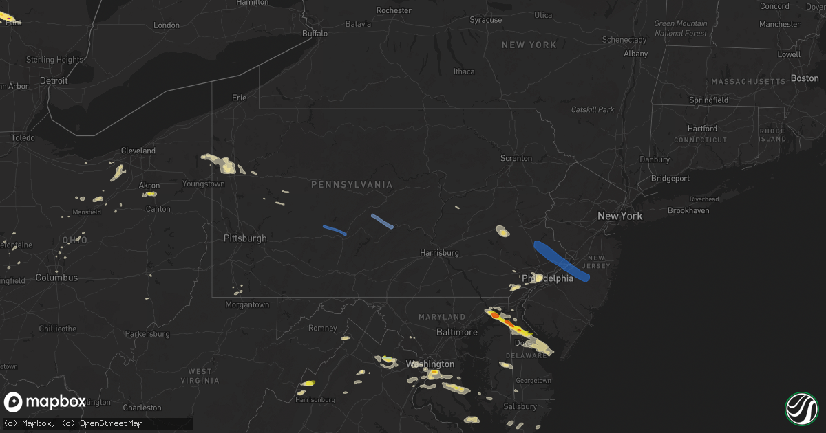
Hail Map in Pennsylvania on August 28, 2020
Get this storm
August 28 map
$229
one time, instant access
Download today. No call, no setup
Keep the $229
Bought the map and want the full workflow? Apply the entire $229 to a subscription within 7 days. None of it is wasted.
Every map, not just this one
This buys you this map. Subscription and you get every map we run, in the markets you choose from a few cities to whole states to nationwide. Plus real-time alerts the moment a storm fires.
Contact data
Name, contact info, occupancy, even credit band for addresses in the footprint. You go from where it hit to who to call.
Become the source they trust
Unlimited branding weather history reports on demand. You already have the documented answer ready for the property owner, and you are the one who showed up with it.
Property data and RoofTrace estimates
Pull up any address you have got, its value and the exact code rules for that jurisdiction, straight from One Click Code. Then RoofTrace estimates the squares, pitch, and roof value, priced the way you price.
Storm reports in Pennsylvania
Pennsylvania
| Date | Description |
|---|---|
| 08/28/20203:59 PM CDT | Multiple trees down. Time estimated from radar. |
| 08/28/20203:45 PM CDT | A few reports of downed trees and wires in the chester heights and aston mills areas. Time estimated from radar. |
| 08/28/20203:43 PM CDT | Several reports of downed trees and power lines in the levittown and tullytown area. Time estimated from radar. |
| 08/28/20203:42 PM CDT | Downed power lines near sedgley avenue. Time estimated from radar. |
| 08/28/20203:39 PM CDT | A few reports of downed trees and wires near and west of lima. Time estimated from radar. |
| 08/28/20203:39 PM CDT | Downed power lines near wedgewood drive in fairville. Time estimated from radar. |
| 08/28/20203:36 PM CDT | A few reports of downed power lines near and south of cheltenham. Time estimated from radar. |
| 08/28/20203:36 PM CDT | Several reports of downed tree limbs and power lines in the millbourne area. Time estimated from radar. |
| 08/28/20203:36 PM CDT | Downed tree on city avenue near berwick road in lower merion twp. Time estimated from radar. |
| 08/28/20203:32 PM CDT | Tree limbs and branches downed. |
| 08/28/20203:32 PM CDT | Trees down in the area. Time estimated from radar. |
| 08/28/20203:31 PM CDT | Downed power lines near moredon road. Time estimated from radar. |
| 08/28/20203:30 PM CDT | A few reports of downed power lines near windy bush road. Time estimated from radar. |
| 08/28/20203:29 PM CDT | Downed trees and wires near mcmillan drive in avondale. Time estimated from radar. |
| 08/28/20203:29 PM CDT | Several reports of downed trees and power lines in the richboro area. Time estimated from radar. |
| 08/28/20203:26 PM CDT | Downed tree blocking wollerton alley near darlington street. Time estimated from radar. |
| 08/28/20203:26 PM CDT | Downed tree on cornwallis drive. Time estimated from radar. |
| 08/28/20203:26 PM CDT | Downed trees on deer run road and valley road in abington. Time estimated from radar. |
| 08/28/20203:26 PM CDT | Downed tree limbs blocking militia hill road near joshua road. Time estimated from radar. |
| 08/28/20203:23 PM CDT | Downed tree on jenkintown road near north hills avenue. Time estimated from radar. |
| 08/28/20203:23 PM CDT | Photos of downed trees. |
| 08/28/20203:23 PM CDT | Downed tree on forest lane near chester road. Time estimated from radar. |
| 08/28/20203:21 PM CDT | Downed tree on lancaster avenue near lockwood lane. Time estimated from radar. |
| 08/28/20203:21 PM CDT | Trees down. Time estimated from radar. |
| 08/28/20203:21 PM CDT | Downed tree blocking king road near ravine road. Time estimated from radar. |
| 08/28/20203:21 PM CDT | Downed tree blocking moreland avenue near maple avenue. Time estimated from radar. |
| 08/28/20203:20 PM CDT | Tree and utility wires down on farnum road. |
| 08/28/20203:18 PM CDT | Downed trees and wires near second avenue in parkesburg. Time estimated from radar. |
| 08/28/20203:18 PM CDT | Downed tree blocking westbound route 30 bypass near bailey road. Time estimated from radar. |
| 08/28/20203:16 PM CDT | Downed tree limbs and wires near shamrock hill lane. Time estimated from radar. |
| 08/28/20203:16 PM CDT | A small area of hardwood trees were downed in what appears to have been an rfd surge. A couple trees were snapped 5-10 feet above the ground. Time estimated from radar. |
| 08/28/20203:15 PM CDT | Several trees down. |
| 08/28/20203:14 PM CDT | Trees down. Start of a path or zone of tree damage. |
| 08/28/20203:14 PM CDT | Widespread tree damage. Time estimated from radar. |
| 08/28/20203:13 PM CDT | Downed tree on hadfield road. Time estimated from radar. |
| 08/28/20203:12 PM CDT | Tree in wires. Time estimated from radar. |
| 08/28/20203:11 PM CDT | Downed tree blocking manor road near red oak drive. Time estimated from radar. |
| 08/28/20203:11 PM CDT | Downed tree limbs and power lines near messner road. Time estimated from radar. |
| 08/28/20203:08 PM CDT | Downed tree on towamencin avenue near second street. Time estimated from radar. |
| 08/28/20203:05 PM CDT | Numerous reports of trees and wires down between telford and chalfont... With widespread power outages. Time estimated from radar. |
| 08/28/20203:03 PM CDT | Downed power lines in vicinity of lower road. Time estimated from radar. |
| 08/28/20202:55 PM CDT | Several reports of downed trees and wires south of trumbauersville. Time estimated from radar. |
| 08/28/20202:55 PM CDT | Several reports of downed trees and wires in salford and marlborough townships. Time estimated from radar. |
| 08/28/20202:55 PM CDT | Downed power lines reported in the harmonyville area. Time estimated from radar. |
| 08/28/20202:55 PM CDT | Several reports of trees/wires/poles down in and around martic and providence twps. |
| 08/28/20202:55 PM CDT | A local report indicates 60 MPH wind near AVONDALE |
| 08/28/20202:50 PM CDT | Downed trees and wires on gerryville pike near brinckman road. Time estimated from radar. |
| 08/28/20202:48 PM CDT | Downed power lines in the vicinity of main street east of monocacy. Time estimated from radar. |
| 08/28/20202:48 PM CDT | Downed tree blocking deep creek road near hill road. Time estimated from radar. |
| 08/28/20202:45 PM CDT | Downed power lines in the vicinity of pond road in earl twp. Time estimated from radar. |
| 08/28/20202:45 PM CDT | Tree limbs down in tylersport. |
| 08/28/20202:45 PM CDT | Downed tree and wires near the intersection of manatawny road and diener drive. Time estimated from radar. |
| 08/28/20202:41 PM CDT | Downed trees and wires near vera cruz road south. Time estimated from radar. |
| 08/28/20202:39 PM CDT | Downed power lines in the vicinity of ruppert school road in pike twp. Time estimated from radar. |
| 08/28/20202:39 PM CDT | Downed power lines in the vicinity of old gibraltar road. Time estimated from radar. |
| 08/28/20202:36 PM CDT | Downed trees and wires near dautrich road. Time estimated from radar. |
| 08/28/20202:36 PM CDT | Downed trees and wires near basket road. Time estimated from radar. |
| 08/28/20202:36 PM CDT | Downed tree and wires on friedensburg road in alsace twp. Time estimated from radar. |
| 08/28/20202:36 PM CDT | Downed tree near the intersection of woodland avenue and carsonia avenue in lower alsace twp. Time estimated from radar. |
| 08/28/20202:30 PM CDT | Tree limbs and utility wires down. |
| 08/28/20202:30 PM CDT | Some small branches down in the area west of reading. Time estimated from radar. |
| 08/28/20202:29 PM CDT | Downed trees and wires near walnut lane. Time estimated from radar. |
| 08/28/20202:28 PM CDT | Trees brought down power lines. Time estimated from radar. |
| 08/28/20202:27 PM CDT | Downed tree near the intersection of hilltop road and upper van reed road. Time estimated from radar. |
| 08/28/20202:27 PM CDT | Downed tree and wires near the intersection of commons road and baldy road. Time estimated from radar. |
| 08/28/20202:26 PM CDT | Trees brought down power lines. Time estimated from radar. |
| 08/28/20202:25 PM CDT | Multiple downed power poles on kutztown road. Time estimated from radar. |
| 08/28/20202:25 PM CDT | A local report indicates 58 MPH wind near READING REGIONAL AIRPOR |
| 08/28/20202:12 PM CDT | Trees down on wires. |
| 08/28/20202:11 PM CDT | Downed tree and wires on old route 22 west of lenhartsville. Time estimated from radar. |
| 08/28/20202:09 PM CDT | Downed trees and wires near blue rocks road in lenhartsville. Time estimated from radar. |
| 08/28/20202:06 PM CDT | Trees down on wires on golf course road. |
| 08/28/20202:04 PM CDT | Trees down on wires. |
| 08/28/20202:00 PM CDT | Downed trees and wires near mountain road in albany twp. Time estimated from radar. |
| 08/28/20201:59 PM CDT | Trees down on wires. |
| 08/28/20201:58 PM CDT | Trees down on wires. |
| 08/28/20201:50 PM CDT | Trees down on wires. |
| 08/28/20201:46 PM CDT | Trees down on wires. |
| 08/28/20201:38 PM CDT | Trees down on wires. |
| 08/28/20201:15 PM CDT | Trees down on wires. |
| 08/28/20201:15 PM CDT | Trees down in juniata and saville twps. |
| 08/28/20201:08 PM CDT | Tree limbs on wires along mountain road. |
| 08/28/20201:00 PM CDT | 12+ trees down and some structural damage on property. |
| 08/28/202012:50 PM CDT | Snapped power poles on route 26. |
| 08/28/202012:33 PM CDT | Trees down on wires. |
| 08/28/202012:30 PM CDT | Corrects previous tstm wnd dmg report from 4 ene mcalevys fort. 6 to 8 trees down reported at greenwood furnace. |
| 08/28/202011:55 AM CDT | Several reports of trees down in the johnstown area. |
| 08/28/202010:01 AM CDT | Trees and power lines down along rte 338 in knox. |
| 08/28/20209:57 AM CDT | Trees reported down around the town. |
| 08/28/20209:56 AM CDT | Trees reported down in the vicinity of 44 band hill rd. |
| 08/28/20209:34 AM CDT | Numerous trees down. |
| 08/28/20209:10 AM CDT | Trees and power lines down along rte 338 in knox. |
| 08/28/20208:44 AM CDT | Trees reported down along rte 308 near town. |
| 08/28/20208:07 AM CDT | Trees reported down in the vicinity of 44 band hill rd. |
| 08/28/20208:00 AM CDT | Reports of multiple trees down near the mercer and crawford county border. |
| 08/28/20208:00 AM CDT | Trees reported down around the town. |
| 08/28/20207:46 AM CDT | At 1244 PM EDT, severe thunderstorms were located along a line extending from near Prince Gallitzin State Park to Cresson to near St. Michael to near Westmont, moving east at 15 mph. HAZARD...60 mph wind gusts and penny size hail. SOURCE...Radar indicated. IMPACT...Expect damage to trees, roofs, and siding. Locations impacted include... Altoona, Johnstown, Hollidaysburg, Westmont, Windber, Belmont, Portage, Roaring Spring, Geistown, Southmont, Martinsburg, Lakemont, Cresson, Gallitzin, Claysburg, Loretto, Williamsburg, Dale, Duncansville and East Conemaugh.This includes Interstate 99 from mile markers 9 to 39. |
| 08/28/20206:41 AM CDT | At 1140 AM EDT, severe thunderstorms were located along a line extending from 13 miles southeast of Punxsutawney to 8 miles north of Hastings to 6 miles north of Northern Cambria, moving southeast at 35 mph. HAZARD...60 mph wind gusts and penny size hail. SOURCE...Radar indicated. IMPACT...Expect damage to trees, roofs, and siding. Locations impacted include... Altoona, Hollidaysburg, Tyrone, Northern Cambria, Bald Eagle, Lakemont, Bellwood, Patton, Cresson, Gallitzin, Loretto, Hastings, Williamsburg, Duncansville, Tipton, Carrolltown, Sankertown, Blandburg, Birmingham and Horseshoe Curve.This includes Interstate 99 from mile markers 27 to 53. |
| 08/28/20205:27 AM CDT | At 1027 AM EDT, a severe thunderstorm was located near New Bethlehem, or 8 miles east of Rimersburg, moving east at 35 mph. HAZARD...Wind gusts to 60 mph. SOURCE...Radar. IMPACT...Expect damage to trees and power lines, resulting in some power outages. Locations impacted include... Punxsutawney... New Bethlehem... Dayton... Summerville... Rossiter... Limestone... Hawthorn... Timblin... Worthville... Smicksburg... Anita... Mahoning Creek Lake... |
| 08/28/20204:40 AM CDT | At 940 AM EDT, a severe thunderstorm was located 13 miles south of Franklin, moving east at 40 mph. HAZARD...Wind gusts to 70 mph. SOURCE...Radar. IMPACT...Trees snapped and uprooted. Power outages can be expected. Locations impacted include... Grove City... Franklin... Clarion... Knox... Rimersburg... Sugarcreek... Slippery Rock... Chicora... Seneca... East Brady... Harrisville... Parker...This includes the following highways... Interstate 79 in Pennsylvania between mile markers 108 and 116. Interstate 80 in Pennsylvania between mile markers 20 and 66. |
| 08/27/202011:49 PM CDT | At 449 PM EDT, severe thunderstorms were located along a line extending from near Mercerville-Hamilton Square to near Voorhees, moving southeast at 45 mph. HAZARD...70 mph wind gusts and penny size hail. SOURCE...Radar indicated. IMPACT...Expect considerable tree damage. Damage is likely to mobile homes, roofs, and outbuildings. Locations impacted include... Toms River, Trenton, Long Branch, Asbury Park, Lakewood, Jackson, Howell, Evesham, Mount Laurel, Manalapan, Medford, Barnegat, Tinton Falls, Lumberton, Princeton, Florence, Beachwood, Burlington, Mount Holly and Tabernacle.This includes the following highways... New Jersey Turnpike between exits 5 and 8A. Interstate 195 in New Jersey between mile markers 0 and 34. Interstate 295 in New Jersey between mile markers 40 and 69. Garden State Parkway between mile markers 60 and 105. |
| 08/27/202011:29 PM CDT | At 429 PM EDT, severe thunderstorms were located along a line extending from Newtown to Bryn Mawr in Pennsylvania, moving southeast at 35 mph. HAZARD...60 mph wind gusts and quarter size hail. SOURCE...Radar indicated. IMPACT...Minor damage to vehicles is possible. Wind damage to roofs, siding, trees, and power lines is possible. Locations impacted include... Philadelphia, Trenton, Camden, Gloucester City, Cherry Hill, Evesham, Mount Laurel, Ewing, Willingboro, Deptford, Voorhees, Medford, West Deptford, Glassboro, Lindenwold, Lumberton, Florence, Bellmawr, Woodbury and Burlington.This includes the following highways... New Jersey Turnpike between exits 3 and 8. Pennsylvania Turnpike near mile marker 359. Interstate 76 in New Jersey between mile markers 0 and 3. Interstate 195 in New Jersey between mile markers 0 and 8. Interstate 295 in New Jersey between mile markers 18 and 65, andbetween mile markers 72 and 76. Interstate 676 in New Jersey between mile markers 0 and 4. Atlantic City Expressway between mile markers 42 and 44. |
| 08/27/202010:56 PM CDT | At 355 PM EDT, severe thunderstorms were located along a line extending from near Perkasie to Pottstown, moving southeast at 45 mph. HAZARD...60 mph wind gusts and quarter size hail. SOURCE...Radar indicated. IMPACT...Minor damage to vehicles is possible. Wind damage to roofs, siding, trees, and power lines is possible. Locations impacted include... Philadelphia, Camden, West Chester, Bensalem, Ewing, Norristown, Pottstown, Phoenixville, Lansdale, West Norriton, East Norriton, Yeadon, Westtown, Burlington, Bristol, Perkasie, Doylestown, Byram, Conshohocken and Palmyra.This includes the following highways... Pennsylvania Turnpike between mile markers 321 and 358. Northeast Extension between mile markers 21 and 40. Interstate 95 in Pennsylvania between mile markers 10 and 40. Interstate 76 in Pennsylvania between mile markers 327 and 351. Interstate 676 in Pennsylvania between mile markers 0 and 1. Interstate 476 in Pennsylvania between mile markers 4 and 19. |
| 08/27/202010:36 PM CDT | At 336 PM EDT, a severe thunderstorm was located near Reading, moving southeast at 25 mph. HAZARD...60 mph wind gusts and quarter size hail. SOURCE...Radar indicated. IMPACT...Minor damage to vehicles is possible. Wind damage to roofs, siding, trees, and power lines is possible. Locations impacted include... Reading, West Chester, Phoenixville, Coatesville, Wyomissing, Downingtown, Birdsboro, Laureldale, Honey Brook, Elverson, New Morgan, Pughtown, Marshallton, Lionville-Marchwood, Glenmoore, Chester Springs, Lionville, Cedarville, West Goshen and Stowe.This includes the following highways... Pennsylvania Turnpike between mile markers 296 and 322. Interstate 176 in Pennsylvania between mile markers 1 and 11. |
| 08/27/202010:22 PM CDT | At 322 PM EDT, a severe thunderstorm was located near Fleetwood, or 12 miles north of Reading, moving southeast at 30 mph. HAZARD...60 mph wind gusts and quarter size hail. SOURCE...Radar indicated. IMPACT...Minor damage to vehicles is possible. Wind damage to roofs, siding, trees, and power lines is possible. Locations impacted include... Pottstown, Quakertown, Kutztown, Royersford, Fleetwood, Laureldale, East Greenville, Topton, Schwenksville, Bally, Bechtelsville, Green Lane, Lyons, Zionsville, Spring Mount, Geryville, Gilbertsville, Cedarville, Ancient Oaks and Stowe.This includes the following highways... Northeast Extension between mile markers 37 and 47. Interstate 78 in Pennsylvania between mile markers 42 and 45. |
| 08/27/202010:19 PM CDT | At 319 PM EDT, severe thunderstorms were located along a line extending from near West York to Codorus to near Pennville to near Taneytown, moving east at 35 mph. HAZARD...60 mph wind gusts. SOURCE...Radar indicated. IMPACT...Damaging winds will cause some trees and large branches to fall. This could injure those outdoors, as well as damage homes and vehicles. Roadways may become blocked by downed trees. Localized power outages are possible. Unsecured light objects may become projectiles. Locations impacted include... Westminster, Taneytown, Hampstead, Manchester, New Windsor, Union Bridge, Carrollton, Freeland, Upperco, Lineboro, Norrisville, Boring, Bentley Springs, Patapsco, Reese, Uniontown, Parkton, Wagners Mill, Millers and Greenmount. |
| 08/27/20209:53 PM CDT | At 253 PM EDT, a severe thunderstorm was located over Avon, moving east at 20 mph. HAZARD...60 mph wind gusts and quarter size hail. SOURCE...Radar indicated. IMPACT...Hail damage to vehicles is expected. Expect wind damage to trees, roofs, and siding. Locations impacted include... Lebanon, Ephrata, Annville, Cornwall, Myerstown, Denver, Reamstown, Pleasant Hill, Sand Hill, Newmanstown, Lebanon South, Cleona, Avon, Richland, Fredericksburg, Brickerville, Schaefferstown, Quentin, Harper Tavern and Lickdale.This includes the following Interstates... The Pennsylvania Turnpike from mile markers 274 to 284. Interstate 78 from mile markers 0 to 8. Interstate 81 from mile markers 85 to 94. |
| 08/27/20209:16 PM CDT | At 215 PM EDT, severe thunderstorms were located along a line extending from near Big Spring State Park to near Roxbury to near Upper Strasburg to McConnellsburg, moving southeast at 40 mph. HAZARD...60 mph wind gusts and penny size hail. SOURCE...Radar indicated. IMPACT...Expect damage to trees, roofs, and siding. Locations impacted include... Chambersburg, Hanover, Waynesboro, Gettysburg, Parkville, Shippensburg, Greencastle, Hampton, Guilford, St. Thomas, Littlestown, Carroll Valley, Codorus, Fayetteville, McSherrystown, Lake Meade, Wayne Heights, Spring Grove, Pennville and Bonneauville.This includes the following Interstates... The Pennsylvania Turnpike from mile markers 200 to 208. Interstate 81 from mile markers 3 to 37. |
| 08/27/20208:48 PM CDT | At 148 PM EDT, a severe thunderstorm was located near Stonington, moving east at 25 mph. HAZARD...60 mph wind gusts and quarter size hail. SOURCE...Radar indicated. IMPACT...Hail damage to vehicles is expected. Expect wind damage to trees, roofs, and siding. Locations impacted include... Shamokin, Mount Carmel, Shenandoah, Frackville, Kulpmont, Ashland, Elysburg, Fairview-Ferndale, Trevorton, Tremont, Girardville, Marshallton, Lavelle, Altamont, Englewood, Forrestville, Branchdale, Donaldson, Aristes and Fountain Springs.This includes Interstate 81 from mile markers 110 to 123. |
| 08/27/20208:35 PM CDT | At 134 PM EDT, a severe thunderstorm was located over Belleville, moving southeast at 30 mph. HAZARD...60 mph wind gusts. SOURCE...Radar indicated. IMPACT...Expect damage to trees, roofs, and siding. Locations impacted include... Lewistown, Burnham, Belleville, Highland Park, Honey Grove, Yeagertown, Spruce Hill, Strodes Mills, Juniata Terrace, Allensville, Mexico, East Waterford, Loysville, Ickesburg, Walnut, Blacklog, Colonel Denning State Park, Mifflintown, Port Royal and Mifflin. |
| 08/27/20208:29 PM CDT | At 127 PM EDT, severe thunderstorms were located along a line extending from near Huntingdon to Dudley to near Ogletown, moving east at 45 mph. HAZARD...60 mph wind gusts and penny size hail. SOURCE...Radar indicated. IMPACT...Expect damage to trees, roofs, and siding. Locations impacted include... Chambersburg, Shippensburg, Breezewood, Guilford, St. Thomas, Fayetteville, Mount Union, New Enterprise, Martinsburg, Everett, Claysburg, Mercersburg, Scotland, McConnellsburg, Osterburg, Harrisonville, Fort Loudon, Crystal Springs, Waterfall and Rockhill Furnace.This includes the following Interstates... Interstate 70 from mile markers 147 to 152. The Pennsylvania Turnpike between mile markers 145 and 146...andfrom mile markers 152 to 201. Interstate 81 from mile markers 12 to 25. Interstate 99 from mile markers 0 to 16. |
| 08/27/20208:09 PM CDT | At 108 PM EDT, a severe thunderstorm was located over Rock Springs, moving southeast at 35 mph. HAZARD...60 mph wind gusts and penny size hail. SOURCE...Radar indicated. IMPACT...Expect damage to trees, roofs, and siding. Locations impacted include... Lewistown, Belleville, Highland Park, Strodes Mills, Juniata Terrace, Allensville, Whipple Dam State Park, Mcalevys Fort, McVeytown, Longfellow and Barrville. |
All States Impacted by Hail Map on August 28, 2020
Cities Impacted by Hail Map on August 28, 2020
- Howard City, MI
- Pleasant Hill, OH
- Laura, OH
- Morland, KS
- Penokee, KS
- Hill City, KS
- Pritchett, CO
- Kim, CO
- Concordia, KS
- Winthrop, IA
- Ryan, IA
- Masonville, IA
- Coggon, IA
- Manchester, IA
- Sullivan, OH
- Fredericktown, OH
- Mount Vernon, OH
- Syracuse, KS
- Iola, TX
- Dover, DE
- Havre De Grace, MD
- Cecilton, MD
- Warwick, MD
- Smyrna, DE
- Townsend, DE
- Galena, MD
- Middletown, DE
- North East, MD
- Clayton, DE
- Earleville, MD
- Kennett Square, PA
- Chadds Ford, PA
- Traer, IA
- Gladbrook, IA
- Ashland, OH
- Ashley, MI
- Ithaca, MI
- Grinnell, KS
- Spencer, OH
- Litchfield, OH
- Valley City, OH
- Medina, OH
- Grafton, OH
- Wellington, OH
- Columbia Station, OH
- Morgantown, WV
- Hoxie, KS
- Andrews Air Force Base, MD
- Fort Washington, MD
- Temple Hills, MD
- Suitland, MD
- Clinton, MD
- Oxon Hill, MD
- Alexandria, VA
- Cimarron, KS
- Stratford, TX
- Hazleton, IA
- Fairbank, IA
- Immokalee, FL
- Winona, KS
- Olsburg, KS
- Kent City, MI
- Grant, MI
- Cedar Springs, MI
- Bailey, MI
- Sparta, MI
- Ionia, MI
- Muir, MI
- Lucas, KS
- Owings, MD
- Prince Frederick, MD
- Huntingtown, MD
- Brandywine, MD
- Waldorf, MD
- Port Republic, MD
- Aquasco, MD
- Woodbridge, VA
- New Lothrop, MI
- Tribune, KS
- Leoti, KS
- Lakeview, MI
- Morley, MI
- Greenville, PA
- Gore, VA
- Winchester, VA
- Dundee, IA
- Independence, IA
- Brandon, IA
- Hopkinton, IA
- Center Junction, IA
- Rowley, IA
- Delhi, IA
- Anamosa, IA
- Langworthy, IA
- Monticello, IA
- Quasqueton, IA
- West Chester, PA
- Mount Morris, PA
- Akron, OH
- Clinton, OH
- Hockessin, DE
- Avondale, PA
- Wilmington, DE
- Arcanum, OH
- Moline, KS
- Grainfield, KS
- Gove, KS
- Elkton, MD
- Aberdeen, MD
- Dover Afb, DE
- Camden Wyoming, DE
- Magnolia, DE
- Perry Point, MD
- Port Deposit, MD
- Chesapeake City, MD
- Perryville, MD
- Quinter, KS
- Park, KS
- Brooklyn, MI
- Medicine Lodge, KS
- New Bethlehem, PA
- Mayport, PA
- Fairmount City, PA
- Scott City, KS
- Healy, KS
- Newton, IA
- Union, IA
- Saugatuck, MI
- Douglas, MI
- Brookfield, WI
- Pewaukee, WI
- Waukesha, WI
- Elm Grove, WI
- Otsego, MI
- Hopkins, MI
- Menomonee Falls, WI
- South Haven, MI
- Milwaukee, WI
- Hamilton, MI
- Allegan, MI
- Fennville, MI
- Vermillion, KS
- Carmichaels, PA
- Lakin, KS
- Marshalltown, IA
- Dysart, IA
- Garrison, IA
- Garwin, IA
- Toledo, IA
- The Plains, VA
- Middleburg, VA
- Aldie, VA
- Tipton, KS
- Hunter, KS
- High View, WV
- Elyria, OH
- Holton, KS
- Valley Falls, KS
- Denison, KS
- Sedan, KS
- Cuba City, WI
- Oakley, KS
- Caldwell, OH
- Melbourne, IA
- Laurel, IA
- Flint, MI
- Flushing, MI
- Mount Morris, MI
- Martin, MI
- Greenville, MI
- Marienthal, KS
- Aberdeen, MS
- Belle Plaine, KS
- Udall, KS
- Oxford, KS
- Shelby, OH
- Waldo, KS
- Luray, KS
- Osborne, KS
- Kankakee, IL
- Herscher, IL
- Wooster, OH
- Cedar Vale, KS
- Crawford, WV
- Rockwell, NC
- China Grove, NC
- Salisbury, NC
- Kannapolis, NC
- Haymarket, VA
- Felicity, OH
- Bethel, OH
- Hume, VA
- Flint Hill, VA
- Huntly, VA
- Lansdowne, PA
- Clifton Heights, PA
- Springfield, PA
- Havertown, PA
- Upper Darby, PA
- Drexel Hill, PA
- Philadelphia, PA
- Charlestown, MD
- Bannister, MI
- Pompeii, MI
- Perrinton, MI
- Sumner, MI
- Johnson, KS
- Winfield, KS
- Lovelady, TX
- Dubuque, IA
- Potosi, WI
- Sherrill, IA
- Larned, KS
- Jeromesville, OH
- Kutztown, PA
- Lenhartsville, PA
- Fleetwood, PA
- Hamburg, PA
- Swartz Creek, MI
- Pullman, MI
- Colfax, IA
- Prairie City, IA
- Clifton, KS
- Bear, DE
- Sunbury, OH
- North Judson, IN
- Winston Salem, NC
- Farmdale, OH
- Kinsman, OH
- Wynnewood, PA
- Darby, PA
- Morton, PA
- Broomall, PA
- Glenolden, PA
- Ardmore, PA
- Swarthmore, PA
- Lyon Station, PA
- Shoemakersville, PA
- Cheltenham, MD
- Kellogg, IA
- Deforest, WI
- Dane, WI
- Benton, WI
- Shullsburg, WI
- Pierson, MI
- Coral, MI
- Eau Claire, MI
- Sodus, MI
- Hadley, PA
- Stoneboro, PA
- Clarks Mills, PA
- Sharpsville, PA
- Jackson Center, PA
- Fredonia, PA
- Mercer, PA
- Huron, OH
- Berlin Heights, OH
- Marshall, VA
- Longton, KS
- Elk City, KS
- Newcastle, NE
- Gilman, IA
- Frankfort, KS
- Jamestown, SC
- Garden City, KS
- Casnovia, MI
- Catharpin, VA
- Ashburn, VA
- Broad Run, VA
- Gainesville, VA
- Chantilly, VA
- Clearwater, KS
- Elwell, MI
- Saint Louis, MI
- Alma, MI
- Lyons, MI
- Annandale, VA
- McLean, VA
- Arlington, VA
- Fairfax, VA
- Vienna, VA
- Oakton, VA
- Falls Church, VA
- Dunn Loring, VA
- Grinnell, IA
- Bellevue, MI
- Shiloh, OH
- Manter, KS
- Glen Haven, WI
- Cassville, WI
- Muskegon, MI
- Gowen, MI
- Twin Lake, MI
- Fenwick, MI
- Pewamo, MI
- Orleans, MI
- Holton, MI
- Fowler, MI
- Saint Johns, MI
- Westphalia, MI
- Belding, MI
- Sand Lake, MI
- Ravenna, MI
- Rockford, MI
- Woodville, VA
- Washington, VA
- Sperryville, VA
- Castleton, VA
- Owosso, MI
- Merion Station, PA
- Wayne, PA
- Holmes, PA
- Wallingford, PA
- Haverford, PA
- Villanova, PA
- Media, PA
- Newtown Square, PA
- Bryn Mawr, PA
- Folsom, PA
- Westover, MD
- Princess Anne, MD
- Clarksburg, MD
- Barnesville, MD
- Boyds, MD
- Protection, KS
- Denton, MD
- Uniontown, OH
- Watertown, WI
- Wellington, KS
- Burden, KS
- Lenoir, NC
- Mitchellville, IA
- Runnells, IA
- North Star, MI
- Burton, MI
- Davison, MI
- Oakley, MI
- Corunna, MI
- Chesaning, MI
- Montrose, MI
- Bagley, WI
- Chester Heights, PA
- Glen Mills, PA
- Aston, PA
- Fulks Run, VA
- Elk Falls, KS
- Grenola, KS
- Clinton, MI
- Sylvan Grove, KS
- Galion, OH
- Spring, TX
- Weston, WV
- Horner, WV
- Lorton, VA
- Manassas, VA
- Fairfax Station, VA
- Reddick, IL
- Bonfield, IL
- Kittanning, PA
- Adrian, PA
- Templeton, PA
- Waynesburg, PA
- Spraggs, PA
- Hinton, VA
- Dayton, VA
- Jetmore, KS
- Ingalls, KS
- Zanesfield, OH
- West Liberty, OH
- Ellis, KS
- Eureka, KS
- Hockley, TX
- Earlville, IA
- Mazon, IL
- Gardner, IL
- Lancaster, WI
- Zearing, IA
- Monroe, IA
- Rushsylvania, OH
- Belle Center, OH
- Bussey, IA
- Alton, KS
- Holly, CO
- Hartland, WI
- Sussex, WI
- Jamestown, PA
- Decatur, MI
- Kennerdell, PA
- Emlenton, PA
- Wakarusa, IN
- Nappanee, IN
- New Paris, IN
- Goshen, IN
- Grove City, PA
- Dexter, KS
- Shelbyville, MI
- Russell, KS
- Hubbardston, MI
- Niles, MI
- Berrien Springs, MI
- Buchanan, MI
- Ubly, MI
- Bellefontaine, OH
- Guttenberg, IA
- Bloomington, WI
- Clio, MI
- Burghill, OH
- Barberton, OH
- Senecaville, OH
- Kipling, OH
- Cambridge, OH
- Lore City, OH
- Byesville, OH
- Drayden, MD
- Great Mills, MD
- Valley Lee, MD
- Park Hall, MD
- Lexington Park, MD
- Saint Inigoes, MD
- Dameron, MD
- Snow Hill, MD
- Altoona, IA
- Coal Township, PA
- Paxinos, PA
- Shamokin, PA
- Cutler, IN
- Urbana, OH
- Hornick, IA
- Bronson, IA
- Landenberg, PA
- Greenwood, DE
- Harrington, DE
- Ridgely, MD
- Ogallah, KS
- Aurora, IA
- Columbus, OH
- Henderson, MI
- Oelwein, IA
- Lima, OH
- Galena, OH
- Stockton, IL
- Apple River, IL
- Lennon, MI
- Tremont, MS
- Brant, MI
- Elsie, MI
- Middleton, MI
- Crystal, MI
- Wheeler, MI
- Merrill, MI
- Saint Charles, MI
- Demotte, IN
- Wheatfield, IN
- Conway Springs, KS
- Viola, KS
- Milton, KS
- Clemons, IA
- Albion, IA
- McCallsburg, IA
- Hubbard, IA
- Saint Anthony, IA
- New Providence, IA
- Liscomb, IA
- Pocomoke City, MD
- Grenville, NM
- Dunkerton, IA
- Continental, OH
- Chester Gap, VA
- Foster, KY
- Cambridge, MD
- Oconomowoc, WI
- Lexington, NC
- East Brady, PA
- Chicora, PA
- Cedarburg, WI
- Mequon, WI
- Grafton, WI
- Upperville, VA
- Syria, VA
- Stevensville, MI
- Saint Joseph, MI
- Indian Head, MD
- Pomfret, MD
- La Plata, MD
- Bryans Road, MD
- White Plains, MD
- Laurel, DE
- Madison, MD
- Chebanse, IL
- Exton, PA
- Downingtown, PA
- Lewis Center, OH
- Peru, KS
- Dewitt, MI
- Jackson, MI
- Worthington, IA
- Cascade, IA
- Spivey, KS
- La Porte City, IA
- Harper, KS
- Sergeant Bluff, IA
- Salix, IA
- Zenda, KS
- Lodi, WI
- Arlington, WI
- Haverhill, IA
- Clewiston, FL
- Hartly, DE
- Conroe, TX
- New Caney, TX
- Scales Mound, IL
- Odessa, DE
- North Beach, MD
- Tracys Landing, MD
- Chesapeake Beach, MD
- Friendship, MD
- Washington, DC
- Dunkirk, MD
- Fort Belvoir, VA
- Upper Marlboro, MD
- Woodstock, OH
- Cable, OH
- Mechanicsburg, OH
- Tomball, TX
- Cypress, TX
- Waller, TX
- Transfer, PA
- Beaman, IA
- Vinton, IA
- Conrad, IA
- Wilmington, IL
- Marengo, OH
- Kendall, KS
- Prairie Du Chien, WI
- Mount Hope, WI
- Lexington, AL
- Florence, AL
- Tuscumbia, AL
- Sheffield, AL
- Killen, AL
- Rogersville, AL
- Muscle Shoals, AL
- Haleyville, AL
- Moulton, AL
- Addison, AL
- Danville, AL
- Double Springs, AL
- Hartselle, AL
- Houston, AL
- Falkville, AL
- Vinemont, AL
- Broadway, VA
- Kingston Springs, TN
- Nashville, TN
- Ashland City, TN
- Pegram, TN
- Centerville, TN
- Madison, TN
- Whites Creek, TN
- Bon Aqua, TN
- Fairview, TN
- Lyles, TN
- Mcminnville, TN
- Morrison, TN
- Manchester, TN
- Dodge City, KS
- Mullinville, KS
- Bucklin, KS
- Wright, KS
- Holcomb, KS
- Ford, KS
- Spearville, KS
- Greensburg, KS
- Minneola, KS
- Mount Auburn, IA
- Bristol, PA
- Joint Base Mdl, NJ
- Langhorne, PA
- Warminster, PA
- Horsham, PA
- Huntingdon Valley, PA
- Southampton, PA
- Florence, NJ
- Dublin, PA
- Cookstown, NJ
- Lansdale, PA
- Willingboro, NJ
- Warrington, PA
- Doylestown, PA
- Richboro, PA
- Sellersville, PA
- Telford, PA
- Montgomeryville, PA
- Newtown, PA
- Roebling, NJ
- Pemberton, NJ
- Hatfield, PA
- Quakertown, PA
- Mount Holly, NJ
- Ambler, PA
- Bordentown, NJ
- Croydon, PA
- Line Lexington, PA
- Fairless Hills, PA
- Burlington, NJ
- Feasterville Trevose, PA
- Colmar, PA
- Jobstown, NJ
- Wrightstown, NJ
- Columbus, NJ
- Jamison, PA
- Furlong, PA
- Chalfont, PA
- Silverdale, PA
- Beverly, NJ
- Souderton, PA
- Bryn Athyn, PA
- Perkasie, PA
- Hatboro, PA
- Levittown, PA
- Fountainville, PA
- Bensalem, PA
- Hilltown, PA
- Lakehurst, NJ
- Browns Mills, NJ
- Vincentown, NJ
- North Wales, PA
- Belleville, PA
- Petersburg, PA
- Lewistown, PA
- Pennsylvania Furnace, PA
- Huntingdon, PA
- Ashville, PA
- Carrolltown, PA
- Hollidaysburg, PA
- Altoona, PA
- Gallitzin, PA
- Ebensburg, PA
- Loretto, PA
- Patton, PA


