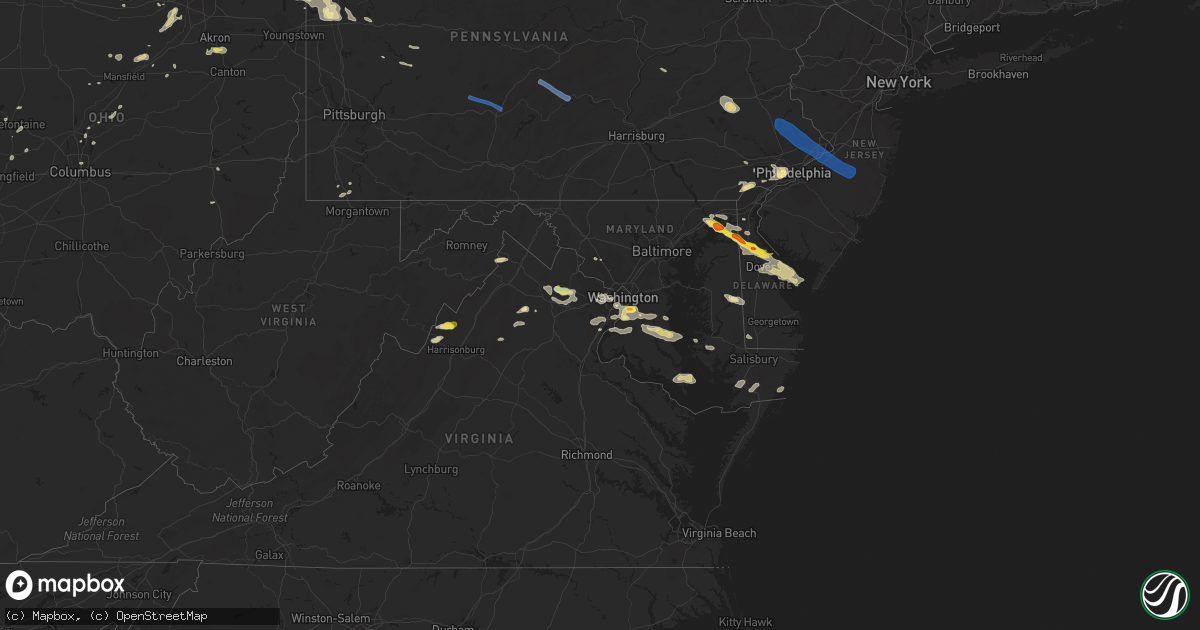
Hail Map in Maryland on August 28, 2020
Get this storm
August 28 map
$229
one time, instant access
Download today. No call, no setup
Keep the $229
Bought the map and want the full workflow? Apply the entire $229 to a subscription within 7 days. None of it is wasted.
Every map, not just this one
This buys you this map. Subscription and you get every map we run, in the markets you choose from a few cities to whole states to nationwide. Plus real-time alerts the moment a storm fires.
Contact data
Name, contact info, occupancy, even credit band for addresses in the footprint. You go from where it hit to who to call.
Become the source they trust
Unlimited branding weather history reports on demand. You already have the documented answer ready for the property owner, and you are the one who showed up with it.
Property data and RoofTrace estimates
Pull up any address you have got, its value and the exact code rules for that jurisdiction, straight from One Click Code. Then RoofTrace estimates the squares, pitch, and roof value, priced the way you price.
Storm reports in Maryland
Maryland
| Date | Description |
|---|---|
| 08/28/20206:54 PM CDT | Multiple reports of trees down around the huntington area. |
| 08/28/20205:55 PM CDT | Multiple reports of trees down around the huntington area. |
| 08/28/20205:29 PM CDT | A local report indicates 1.75 inch wind near 1 W CAMP SPRINGS |
| 08/28/20204:10 PM CDT | Outflow winds downed trees and destroyed a transformer. Time estimated from radar. |
| 08/28/20203:46 PM CDT | Large branch snapped and downed power lines and power pole. |
| 08/28/20203:42 PM CDT | Downed powerlines near 15 fulks corner in gaithersburg. |
| 08/28/20203:40 PM CDT | Tree down on md-22 west at us-40. |
| 08/28/20203:40 PM CDT | Trees and wires down. |
| 08/28/20203:20 PM CDT | Several downed trees and power lines. |
| 08/28/20203:18 PM CDT | Tree down at the intersection of md-623 north/south at glen cove rd. |
| 08/28/20203:13 PM CDT | Tree down on md-136 at trappe church road. |
| 08/28/20202:47 PM CDT | Tree down on klees mill rd. |
| 08/28/20202:42 PM CDT | Tree down near the intersection of klees mill rd and terrapin dr. |
| 08/28/20202:33 PM CDT | Tree down near 2916 warehime rd. |
| 08/28/20201:45 PM CDT | Several reports of downed trees and wires in the warwick area. Time estimated from radar. |
| 08/28/20201:43 PM CDT | Several reports of downed trees and wires in the cecilton area. Time estimated from radar. |
| 08/28/20201:30 PM CDT | Trained spotter reports winds in excess of 60 mph at hacks point on route 213. Time estimated from radar. |
| 08/28/202012:57 PM CDT | A pole and wires were down near the intersection of md-155 level road and graceview drive. |
| 08/28/20203:19 AM CDT | At 819 PM EDT, a severe thunderstorm was located over Saint Marys City, moving northeast at 20 mph. HAZARD...60 mph wind gusts and quarter size hail. SOURCE...Radar indicated. IMPACT...Damaging winds will cause some trees and large branches to fall. This could injure those outdoors, as well as damage homes and vehicles. Roadways may become blocked by downed trees. Localized power outages are possible. Unsecured light objects may become projectiles. Locations impacted include... Lexington Park, Saint Marys City, Saint Inigoes, Dameron and Park Hall. |
| 08/28/20202:41 AM CDT | At 741 PM EDT, a severe thunderstorm was located 7 miles south of Dunkirk, or 7 miles north of Hallowing Point, moving east at 25 mph. HAZARD...60 mph wind gusts and quarter size hail. SOURCE...Radar indicated. IMPACT...Damaging winds will cause some trees and large branches to fall. This could injure those outdoors, as well as damage homes and vehicles. Roadways may become blocked by downed trees. Localized power outages are possible. Unsecured light objects may become projectiles. Locations impacted include... Chesapeake Beach, Prince Frederick, Calvert Cliffs, Hallowing Point, Breezy Point, Flag Harbor, Golden Beach, Dunkirk, Saint Leonard, Huntingtown, Hughesville, Owings, Baden, Long Beach, Aquasco, Calvert Beach, Bryantown, Friendship, Benedict and Eagle Harbor. |
| 08/28/20201:55 AM CDT | At 655 PM EDT, a severe thunderstorm was located over Dunkirk, or near Upper Marlboro, moving east at 25 mph. HAZARD...60 mph wind gusts and quarter size hail. SOURCE...Radar indicated. IMPACT...Damaging winds will cause some trees and large branches to fall. This could injure those outdoors, as well as damage homes and vehicles. Roadways may become blocked by downed trees. Localized power outages are possible. Unsecured light objects may become projectiles. Locations impacted include... Shady Side, Chesapeake Beach, Deale, Breezy Point, Dunkirk, Huntingtown, Owings, Baden, Galesville, Friendship, Lower Marlboro, West River, Tracys Landing, Lothian, Sunderland and Mount Harmony. |
| 08/28/202012:50 AM CDT | Trees downed on public landing road. Time is radar estimated. |
| 08/27/202011:39 PM CDT | At 437 PM EDT, severe thunderstorms were located along a line extending from Broomall to near Ashland to Newark to near Hollywood Beach, moving southeast at 35 mph. HAZARD...60 mph wind gusts and penny size hail. SOURCE...Radar indicated. IMPACT...Damage to roofs, siding, trees, and power lines is possible. Locations impacted include... Philadelphia, Camden, Wilmington, Vineland, Dover, Newark, Bridgeton, Middletown, Elkton, Gloucester City, Chester, Deptford, Voorhees, West Deptford, Glassboro, Lindenwold, Pennsville, Bellmawr, Yeadon and Woodbury.This includes the following highways... New Jersey Turnpike between exits 1 and 3. Interstate 95 in Pennsylvania between mile markers 0 and 24, andbetween mile markers 26 and 28, and near mile marker 32. Interstate 95 in Delaware between mile markers 0 and 23. Interstate 95 in Maryland between mile markers 97 and 109. Interstate 76 in Pennsylvania between mile markers 330 and 351. Interstate 76 in New Jersey between mile markers 0 and 3. Interstate 295 in New Jersey between mile markers 0 and 33. Interstate 676 in Pennsylvania between mile markers 0 and 1. Interstate 676 in New Jersey between mile markers 0 and 4. Interstate 476 in Pennsylvania between mile markers 0 and 16. Atlantic City Expressway between mile markers 32 and 44. |
| 08/27/202011:33 PM CDT | At 433 PM EDT, a severe thunderstorm was located over Boyds, or near Germantown, moving east at 35 mph. HAZARD...60 mph wind gusts and quarter size hail. SOURCE...Radar indicated. IMPACT...Damaging winds will cause some trees and large branches to fall. This could injure those outdoors, as well as damage homes and vehicles. Roadways may become blocked by downed trees. Localized power outages are possible. Unsecured light objects may become projectiles. Locations impacted include... Columbia, Germantown, Gaithersburg, Olney, Beltsville, Damascus, Historic Ellicott City, Ellicott City, Aspen Hill, Catonsville, Montgomery Village, Laurel, Fairland, White Oak, Redland, Colesville, Boyds, Rossmoor, Savage-guilford and Wheaton-Glenmont. |
| 08/27/202011:02 PM CDT | At 402 PM EDT, severe thunderstorms were located along a line extending from near Quarryville to near Jarrettsville to near Cockeysville, moving east at 35 mph. HAZARD...60 mph wind gusts. SOURCE...Radar indicated. IMPACT...Damaging winds will cause some trees and large branches to fall. This could injure those outdoors, as well as damage homes and vehicles. Roadways may become blocked by downed trees. Localized power outages are possible. Unsecured light objects may become projectiles. Locations impacted include... Cockeysville, Aberdeen, Havre De Grace, Aberdeen Proving Ground, Bel Air South, Bel Air North, Carney, Perry Hall, Timonium, White Marsh, Fallston, Riverside, Hampton, Kingsville, Pleasant Hills, Jarrettsville, Perryman, Lutherville-Timonium, Edgewood and Joppatowne. |
| 08/27/202011:01 PM CDT | At 401 PM EDT, severe thunderstorms were located along a line extending from New Holland to Quarryville to near Jarrettsville, moving east at 40 mph. HAZARD...60 mph wind gusts and quarter size hail. SOURCE...Radar indicated. IMPACT...Minor damage to vehicles is possible. Wind damage to roofs, siding, trees, and power lines is possible. Locations impacted include... Newark, West Chester, Elkton, Calvert, Coatesville, Westtown, Downingtown, Kennett Square, Oxford, Parkesburg, North East, West Grove, Rising Sun, Honey Brook, Charlestown, Glen Roy, Blake, West Nottingham, Mount Vernon and Marshallton.This includes the following highways... Pennsylvania Turnpike between mile markers 307 and 321. Interstate 95 in Delaware between mile markers 0 and 4. Interstate 95 in Maryland between mile markers 91 and 109. |
| 08/27/202010:45 PM CDT | At 345 PM EDT, a severe thunderstorm was located over Eldersburg, or 10 miles south of Westminster, moving east at 25 mph. HAZARD...60 mph wind gusts and quarter size hail. SOURCE...Radar indicated. IMPACT...Damaging winds will cause some trees and large branches to fall. This could injure those outdoors, as well as damage homes and vehicles. Roadways may become blocked by downed trees. Localized power outages are possible. Unsecured light objects may become projectiles. Locations impacted include... Pikesville, Woodlawn, Randallstown, Owings Mills, Eldersburg, Milford Mill, Reisterstown, Lochearn, Sykesville, Oakland, Gamber, Garrison, Finksburg, Louisville, Glyndon, Mcdonogh, Stevenson and Carrolltowne. |
| 08/27/202010:35 PM CDT | At 333 PM EDT, severe thunderstorms were located along a line extending from near Adamstown to near Manheim to near Windsor to near Manchester, moving east at 35 mph. HAZARD...60 mph wind gusts and nickel size hail. SOURCE...Radar indicated. IMPACT...Expect damage to trees, roofs, and siding. Locations impacted include... Lancaster, Ephrata, Columbia, Lititz, Millersville, Willow Street, Mount Joy, Red Lion, New Holland, Manheim, East Petersburg, Dallastown, Akron, Leola, Paradise, Salunga-Landisville, Denver, Shrewsbury, Reamstown and Rothsville.This includes the following Interstates... The Pennsylvania Turnpike from mile markers 268 to 295. Interstate 83 from mile markers 0 to 9. |
| 08/27/202010:07 PM CDT | At 307 PM EDT, a severe thunderstorm was located over Mount Airy, or 7 miles north of Damascus, moving east at 35 mph. HAZARD...60 mph wind gusts and quarter size hail. SOURCE...Radar indicated. IMPACT...Damaging winds will cause some trees and large branches to fall. This could injure those outdoors, as well as damage homes and vehicles. Roadways may become blocked by downed trees. Localized power outages are possible. Unsecured light objects may become projectiles. Locations impacted include... Columbia, Damascus, Historic Ellicott City, Ellicott City, Catonsville, Woodlawn, Randallstown, Owings Mills, Eldersburg, Milford Mill, Reisterstown, Mount Airy, Sykesville, Oakland, New Market, Gamber, Green Valley, Linganore-Bartonsville, Ilchester and Garrison. |
| 08/27/202010:02 PM CDT | At 301 PM EDT, a severe thunderstorm was located near Berkeley Springs, or 7 miles north of Greenwood, moving southeast at 30 mph. HAZARD...60 mph wind gusts and quarter size hail. SOURCE...Radar indicated. IMPACT...Damaging winds will cause some trees and large branches to fall. This could injure those outdoors, as well as damage homes and vehicles. Roadways may become blocked by downed trees. Localized power outages are possible. Unsecured light objects may become projectiles. Locations impacted include... Martinsburg, Inwood, Berkeley Springs, Berkeley, Middleway, Great Cacapon, Hedgesville, Johnsons Mill, Tomahawk, Johnsontown, Valley View, Bunker Hill, Oakland, Rock Gap, Arden, Smith Crossroads, Jones Springs, New Hope, Omps and Shanghai. |
| 08/27/202010:00 PM CDT | At 258 PM EDT, a few severe thunderstorms were located along a line extending from near Dillsburg to Lake Meade to near New Oxford to near Rouzerville to near Waynesboro, moving east at 45 mph. HAZARD...60 mph wind gusts and penny size hail. SOURCE...Radar indicated. IMPACT...Expect damage to trees, roofs, and siding. Locations impacted include... York, Hanover, Weigelstown, Waynesboro, Gettysburg, Parkville, Red Lion, Spry, Dallastown, Hampton, Shiloh, East York, Stonybrook-Wilshire, West York, Littlestown, Carroll Valley, Shrewsbury, Codorus, Grantley and Valley Green.This includes Interstate 83 from mile markers 0 to 35. |
| 08/27/20209:40 PM CDT | At 240 PM EDT, a severe thunderstorm was located over Warwick, or near Middletown, moving east at 25 mph. HAZARD...Ping pong ball size hail and 60 mph wind gusts. SOURCE...Radar indicated. IMPACT...People and animals outdoors will be injured. Expect hail damage to roofs, siding, windows, and vehicles. Wind damage to roofs, siding, trees, and power lines is possible. Locations impacted include... Middletown, Smyrna, Clayton, Cheswold, Cecilton, Warwick, Sassafras, Green Spring, Bohemias Mills, Delaney Corner, Cayots, Townsend, Odessa and Chambersville. |
| 08/27/20208:53 PM CDT | At 153 PM EDT, a severe thunderstorm was located over Havre De Grace, moving east at 25 mph. HAZARD...60 mph wind gusts and penny size hail. SOURCE...Radar indicated. IMPACT...Damage to roofs, siding, trees, and power lines is possible. Locations impacted include... Middletown, Elkton, North East, Charlestown, Cecilton, Warwick, Sassafras, Mount Pleasant, Glasgow, Bohemias Mills, Woodlawn, Brantwood, Cayots, Hollywood Beach, Saint Georges, Bear, Perryville and Chesapeake City.This includes Interstate 95 in Maryland between mile markers 91 and99. |
| 08/27/20208:51 PM CDT | At 151 PM EDT, a severe thunderstorm was located over Havre De Grace, moving east at 25 mph. HAZARD...60 mph wind gusts. SOURCE...Radar indicated. IMPACT...Damaging winds will cause some trees and large branches to fall. This could injure those outdoors, as well as damage homes and vehicles. Roadways may become blocked by downed trees. Localized power outages are possible. Unsecured light objects may become projectiles. Locations impacted include... Aberdeen and Havre De Grace. |
All States Impacted by Hail Map on August 28, 2020
Cities Impacted by Hail Map on August 28, 2020
- Howard City, MI
- Pleasant Hill, OH
- Laura, OH
- Morland, KS
- Penokee, KS
- Hill City, KS
- Pritchett, CO
- Kim, CO
- Concordia, KS
- Winthrop, IA
- Ryan, IA
- Masonville, IA
- Coggon, IA
- Manchester, IA
- Sullivan, OH
- Fredericktown, OH
- Mount Vernon, OH
- Syracuse, KS
- Iola, TX
- Dover, DE
- Havre De Grace, MD
- Cecilton, MD
- Warwick, MD
- Smyrna, DE
- Townsend, DE
- Galena, MD
- Middletown, DE
- North East, MD
- Clayton, DE
- Earleville, MD
- Kennett Square, PA
- Chadds Ford, PA
- Traer, IA
- Gladbrook, IA
- Ashland, OH
- Ashley, MI
- Ithaca, MI
- Grinnell, KS
- Spencer, OH
- Litchfield, OH
- Valley City, OH
- Medina, OH
- Grafton, OH
- Wellington, OH
- Columbia Station, OH
- Morgantown, WV
- Hoxie, KS
- Andrews Air Force Base, MD
- Fort Washington, MD
- Temple Hills, MD
- Suitland, MD
- Clinton, MD
- Oxon Hill, MD
- Alexandria, VA
- Cimarron, KS
- Stratford, TX
- Hazleton, IA
- Fairbank, IA
- Immokalee, FL
- Winona, KS
- Olsburg, KS
- Kent City, MI
- Grant, MI
- Cedar Springs, MI
- Bailey, MI
- Sparta, MI
- Ionia, MI
- Muir, MI
- Lucas, KS
- Owings, MD
- Prince Frederick, MD
- Huntingtown, MD
- Brandywine, MD
- Waldorf, MD
- Port Republic, MD
- Aquasco, MD
- Woodbridge, VA
- New Lothrop, MI
- Tribune, KS
- Leoti, KS
- Lakeview, MI
- Morley, MI
- Greenville, PA
- Gore, VA
- Winchester, VA
- Dundee, IA
- Independence, IA
- Brandon, IA
- Hopkinton, IA
- Center Junction, IA
- Rowley, IA
- Delhi, IA
- Anamosa, IA
- Langworthy, IA
- Monticello, IA
- Quasqueton, IA
- West Chester, PA
- Mount Morris, PA
- Akron, OH
- Clinton, OH
- Hockessin, DE
- Avondale, PA
- Wilmington, DE
- Arcanum, OH
- Moline, KS
- Grainfield, KS
- Gove, KS
- Elkton, MD
- Aberdeen, MD
- Dover Afb, DE
- Camden Wyoming, DE
- Magnolia, DE
- Perry Point, MD
- Port Deposit, MD
- Chesapeake City, MD
- Perryville, MD
- Quinter, KS
- Park, KS
- Brooklyn, MI
- Medicine Lodge, KS
- New Bethlehem, PA
- Mayport, PA
- Fairmount City, PA
- Scott City, KS
- Healy, KS
- Newton, IA
- Union, IA
- Saugatuck, MI
- Douglas, MI
- Brookfield, WI
- Pewaukee, WI
- Waukesha, WI
- Elm Grove, WI
- Otsego, MI
- Hopkins, MI
- Menomonee Falls, WI
- South Haven, MI
- Milwaukee, WI
- Hamilton, MI
- Allegan, MI
- Fennville, MI
- Vermillion, KS
- Carmichaels, PA
- Lakin, KS
- Marshalltown, IA
- Dysart, IA
- Garrison, IA
- Garwin, IA
- Toledo, IA
- The Plains, VA
- Middleburg, VA
- Aldie, VA
- Tipton, KS
- Hunter, KS
- High View, WV
- Elyria, OH
- Holton, KS
- Valley Falls, KS
- Denison, KS
- Sedan, KS
- Cuba City, WI
- Oakley, KS
- Caldwell, OH
- Melbourne, IA
- Laurel, IA
- Flint, MI
- Flushing, MI
- Mount Morris, MI
- Martin, MI
- Greenville, MI
- Marienthal, KS
- Aberdeen, MS
- Belle Plaine, KS
- Udall, KS
- Oxford, KS
- Shelby, OH
- Waldo, KS
- Luray, KS
- Osborne, KS
- Kankakee, IL
- Herscher, IL
- Wooster, OH
- Cedar Vale, KS
- Crawford, WV
- Rockwell, NC
- China Grove, NC
- Salisbury, NC
- Kannapolis, NC
- Haymarket, VA
- Felicity, OH
- Bethel, OH
- Hume, VA
- Flint Hill, VA
- Huntly, VA
- Lansdowne, PA
- Clifton Heights, PA
- Springfield, PA
- Havertown, PA
- Upper Darby, PA
- Drexel Hill, PA
- Philadelphia, PA
- Charlestown, MD
- Bannister, MI
- Pompeii, MI
- Perrinton, MI
- Sumner, MI
- Johnson, KS
- Winfield, KS
- Lovelady, TX
- Dubuque, IA
- Potosi, WI
- Sherrill, IA
- Larned, KS
- Jeromesville, OH
- Kutztown, PA
- Lenhartsville, PA
- Fleetwood, PA
- Hamburg, PA
- Swartz Creek, MI
- Pullman, MI
- Colfax, IA
- Prairie City, IA
- Clifton, KS
- Bear, DE
- Sunbury, OH
- North Judson, IN
- Winston Salem, NC
- Farmdale, OH
- Kinsman, OH
- Wynnewood, PA
- Darby, PA
- Morton, PA
- Broomall, PA
- Glenolden, PA
- Ardmore, PA
- Swarthmore, PA
- Lyon Station, PA
- Shoemakersville, PA
- Cheltenham, MD
- Kellogg, IA
- Deforest, WI
- Dane, WI
- Benton, WI
- Shullsburg, WI
- Pierson, MI
- Coral, MI
- Eau Claire, MI
- Sodus, MI
- Hadley, PA
- Stoneboro, PA
- Clarks Mills, PA
- Sharpsville, PA
- Jackson Center, PA
- Fredonia, PA
- Mercer, PA
- Huron, OH
- Berlin Heights, OH
- Marshall, VA
- Longton, KS
- Elk City, KS
- Newcastle, NE
- Gilman, IA
- Frankfort, KS
- Jamestown, SC
- Garden City, KS
- Casnovia, MI
- Catharpin, VA
- Ashburn, VA
- Broad Run, VA
- Gainesville, VA
- Chantilly, VA
- Clearwater, KS
- Elwell, MI
- Saint Louis, MI
- Alma, MI
- Lyons, MI
- Annandale, VA
- McLean, VA
- Arlington, VA
- Fairfax, VA
- Vienna, VA
- Oakton, VA
- Falls Church, VA
- Dunn Loring, VA
- Grinnell, IA
- Bellevue, MI
- Shiloh, OH
- Manter, KS
- Glen Haven, WI
- Cassville, WI
- Muskegon, MI
- Gowen, MI
- Twin Lake, MI
- Fenwick, MI
- Pewamo, MI
- Orleans, MI
- Holton, MI
- Fowler, MI
- Saint Johns, MI
- Westphalia, MI
- Belding, MI
- Sand Lake, MI
- Ravenna, MI
- Rockford, MI
- Woodville, VA
- Washington, VA
- Sperryville, VA
- Castleton, VA
- Owosso, MI
- Merion Station, PA
- Wayne, PA
- Holmes, PA
- Wallingford, PA
- Haverford, PA
- Villanova, PA
- Media, PA
- Newtown Square, PA
- Bryn Mawr, PA
- Folsom, PA
- Westover, MD
- Princess Anne, MD
- Clarksburg, MD
- Barnesville, MD
- Boyds, MD
- Protection, KS
- Denton, MD
- Uniontown, OH
- Watertown, WI
- Wellington, KS
- Burden, KS
- Lenoir, NC
- Mitchellville, IA
- Runnells, IA
- North Star, MI
- Burton, MI
- Davison, MI
- Oakley, MI
- Corunna, MI
- Chesaning, MI
- Montrose, MI
- Bagley, WI
- Chester Heights, PA
- Glen Mills, PA
- Aston, PA
- Fulks Run, VA
- Elk Falls, KS
- Grenola, KS
- Clinton, MI
- Sylvan Grove, KS
- Galion, OH
- Spring, TX
- Weston, WV
- Horner, WV
- Lorton, VA
- Manassas, VA
- Fairfax Station, VA
- Reddick, IL
- Bonfield, IL
- Kittanning, PA
- Adrian, PA
- Templeton, PA
- Waynesburg, PA
- Spraggs, PA
- Hinton, VA
- Dayton, VA
- Jetmore, KS
- Ingalls, KS
- Zanesfield, OH
- West Liberty, OH
- Ellis, KS
- Eureka, KS
- Hockley, TX
- Earlville, IA
- Mazon, IL
- Gardner, IL
- Lancaster, WI
- Zearing, IA
- Monroe, IA
- Rushsylvania, OH
- Belle Center, OH
- Bussey, IA
- Alton, KS
- Holly, CO
- Hartland, WI
- Sussex, WI
- Jamestown, PA
- Decatur, MI
- Kennerdell, PA
- Emlenton, PA
- Wakarusa, IN
- Nappanee, IN
- New Paris, IN
- Goshen, IN
- Grove City, PA
- Dexter, KS
- Shelbyville, MI
- Russell, KS
- Hubbardston, MI
- Niles, MI
- Berrien Springs, MI
- Buchanan, MI
- Ubly, MI
- Bellefontaine, OH
- Guttenberg, IA
- Bloomington, WI
- Clio, MI
- Burghill, OH
- Barberton, OH
- Senecaville, OH
- Kipling, OH
- Cambridge, OH
- Lore City, OH
- Byesville, OH
- Drayden, MD
- Great Mills, MD
- Valley Lee, MD
- Park Hall, MD
- Lexington Park, MD
- Saint Inigoes, MD
- Dameron, MD
- Snow Hill, MD
- Altoona, IA
- Coal Township, PA
- Paxinos, PA
- Shamokin, PA
- Cutler, IN
- Urbana, OH
- Hornick, IA
- Bronson, IA
- Landenberg, PA
- Greenwood, DE
- Harrington, DE
- Ridgely, MD
- Ogallah, KS
- Aurora, IA
- Columbus, OH
- Henderson, MI
- Oelwein, IA
- Lima, OH
- Galena, OH
- Stockton, IL
- Apple River, IL
- Lennon, MI
- Tremont, MS
- Brant, MI
- Elsie, MI
- Middleton, MI
- Crystal, MI
- Wheeler, MI
- Merrill, MI
- Saint Charles, MI
- Demotte, IN
- Wheatfield, IN
- Conway Springs, KS
- Viola, KS
- Milton, KS
- Clemons, IA
- Albion, IA
- McCallsburg, IA
- Hubbard, IA
- Saint Anthony, IA
- New Providence, IA
- Liscomb, IA
- Pocomoke City, MD
- Grenville, NM
- Dunkerton, IA
- Continental, OH
- Chester Gap, VA
- Foster, KY
- Cambridge, MD
- Oconomowoc, WI
- Lexington, NC
- East Brady, PA
- Chicora, PA
- Cedarburg, WI
- Mequon, WI
- Grafton, WI
- Upperville, VA
- Syria, VA
- Stevensville, MI
- Saint Joseph, MI
- Indian Head, MD
- Pomfret, MD
- La Plata, MD
- Bryans Road, MD
- White Plains, MD
- Laurel, DE
- Madison, MD
- Chebanse, IL
- Exton, PA
- Downingtown, PA
- Lewis Center, OH
- Peru, KS
- Dewitt, MI
- Jackson, MI
- Worthington, IA
- Cascade, IA
- Spivey, KS
- La Porte City, IA
- Harper, KS
- Sergeant Bluff, IA
- Salix, IA
- Zenda, KS
- Lodi, WI
- Arlington, WI
- Haverhill, IA
- Clewiston, FL
- Hartly, DE
- Conroe, TX
- New Caney, TX
- Scales Mound, IL
- Odessa, DE
- North Beach, MD
- Tracys Landing, MD
- Chesapeake Beach, MD
- Friendship, MD
- Washington, DC
- Dunkirk, MD
- Fort Belvoir, VA
- Upper Marlboro, MD
- Woodstock, OH
- Cable, OH
- Mechanicsburg, OH
- Tomball, TX
- Cypress, TX
- Waller, TX
- Transfer, PA
- Beaman, IA
- Vinton, IA
- Conrad, IA
- Wilmington, IL
- Marengo, OH
- Kendall, KS
- Prairie Du Chien, WI
- Mount Hope, WI
- Lexington, AL
- Florence, AL
- Tuscumbia, AL
- Sheffield, AL
- Killen, AL
- Rogersville, AL
- Muscle Shoals, AL
- Haleyville, AL
- Moulton, AL
- Addison, AL
- Danville, AL
- Double Springs, AL
- Hartselle, AL
- Houston, AL
- Falkville, AL
- Vinemont, AL
- Broadway, VA
- Kingston Springs, TN
- Nashville, TN
- Ashland City, TN
- Pegram, TN
- Centerville, TN
- Madison, TN
- Whites Creek, TN
- Bon Aqua, TN
- Fairview, TN
- Lyles, TN
- Mcminnville, TN
- Morrison, TN
- Manchester, TN
- Dodge City, KS
- Mullinville, KS
- Bucklin, KS
- Wright, KS
- Holcomb, KS
- Ford, KS
- Spearville, KS
- Greensburg, KS
- Minneola, KS
- Mount Auburn, IA
- Bristol, PA
- Joint Base Mdl, NJ
- Langhorne, PA
- Warminster, PA
- Horsham, PA
- Huntingdon Valley, PA
- Southampton, PA
- Florence, NJ
- Dublin, PA
- Cookstown, NJ
- Lansdale, PA
- Willingboro, NJ
- Warrington, PA
- Doylestown, PA
- Richboro, PA
- Sellersville, PA
- Telford, PA
- Montgomeryville, PA
- Newtown, PA
- Roebling, NJ
- Pemberton, NJ
- Hatfield, PA
- Quakertown, PA
- Mount Holly, NJ
- Ambler, PA
- Bordentown, NJ
- Croydon, PA
- Line Lexington, PA
- Fairless Hills, PA
- Burlington, NJ
- Feasterville Trevose, PA
- Colmar, PA
- Jobstown, NJ
- Wrightstown, NJ
- Columbus, NJ
- Jamison, PA
- Furlong, PA
- Chalfont, PA
- Silverdale, PA
- Beverly, NJ
- Souderton, PA
- Bryn Athyn, PA
- Perkasie, PA
- Hatboro, PA
- Levittown, PA
- Fountainville, PA
- Bensalem, PA
- Hilltown, PA
- Lakehurst, NJ
- Browns Mills, NJ
- Vincentown, NJ
- North Wales, PA
- Belleville, PA
- Petersburg, PA
- Lewistown, PA
- Pennsylvania Furnace, PA
- Huntingdon, PA
- Ashville, PA
- Carrolltown, PA
- Hollidaysburg, PA
- Altoona, PA
- Gallitzin, PA
- Ebensburg, PA
- Loretto, PA
- Patton, PA


