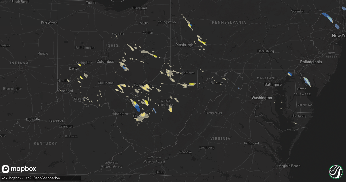
Hail Map in West Virginia on August 25, 2020
Get this storm
August 25 map
$229
one time, instant access
Download today. No call, no setup
Keep the $229
Bought the map and want the full workflow? Apply the entire $229 to a subscription within 7 days. None of it is wasted.
Every map, not just this one
This buys you this map. Subscription and you get every map we run, in the markets you choose from a few cities to whole states to nationwide. Plus real-time alerts the moment a storm fires.
Contact data
Name, contact info, occupancy, even credit band for addresses in the footprint. You go from where it hit to who to call.
Become the source they trust
Unlimited branding weather history reports on demand. You already have the documented answer ready for the property owner, and you are the one who showed up with it.
Property data and RoofTrace estimates
Pull up any address you have got, its value and the exact code rules for that jurisdiction, straight from One Click Code. Then RoofTrace estimates the squares, pitch, and roof value, priced the way you price.
Storm reports in West Virginia
West Virginia
| Date | Description |
|---|---|
| 08/25/20206:50 PM CDT | Several trees down. One tree fell onto a building and cracked the brick and another onto a carport. |
| 08/25/20206:50 PM CDT | Tree fell on apartment building and trees down blocking toneys branch road. |
| 08/25/20206:38 PM CDT | Tree and power-line down in the vicinity of us 219 at spring creek station road. |
| 08/25/20206:34 PM CDT | Tree down at the intersection of kieffer rd. And deitz rd. |
| 08/25/20206:33 PM CDT | Tree down across simms mountain road near rt. 20 heading toward lilly park. |
| 08/25/20206:26 PM CDT | A couple trees down along scarbro rd. |
| 08/25/20206:25 PM CDT | Tree down. |
| 08/25/20206:25 PM CDT | Tree down. Time estimated from radar. |
| 08/25/20206:23 PM CDT | Large tree down with numerous small ones completely blocking off the road. |
| 08/25/20206:16 PM CDT | Tree down. |
| 08/25/20205:45 PM CDT | Several reports of a single tree down in various locations in and around clay... Including a tree with power lines down at 819 dog run road and and a tree down between |
| 08/25/20205:41 PM CDT | A few trees and large tree limbs down |
| 08/25/20205:37 PM CDT | Multiple trees damaged by wind on eastwood drive... Some 12 inches or more in diameter. |
| 08/25/20205:36 PM CDT | Two trees down on elk river road. Time corroborated via radar. |
| 08/25/20205:35 PM CDT | Tree down blocking ivydale road and another down blocking ivydale ridge road. Time estimated from caller information and radar. |
| 08/25/20205:35 PM CDT | Tree down blocking ivydale road and another down blocking ivydale ridge road. Time estimated from caller information and radar. |
| 08/25/20205:35 PM CDT | Several trees down and power out in the beverly hills neighborhood. Time estimated from caller and radar. |
| 08/25/20205:30 PM CDT | Several trees down and an outbuilding damged/lost. Time estimated from caller and radar. |
| 08/25/20205:30 PM CDT | Backside of video board at marshall joan c edwards stadium damaged. Report courtesy of wowk. |
| 08/25/20205:30 PM CDT | Emergency services director from wallback called in a strong storm producing 60kt gusts which immediately dropped down to 20kt. |
| 08/25/20205:18 PM CDT | Large limb of locust tree down across driveway. Spouse of employee saw limb snap and fall. |
| 08/25/20205:16 PM CDT | Several trees down over tucker ridge rd. Buffalo wv |
| 08/25/20205:10 PM CDT | Trees down |
| 08/25/20204:55 PM CDT | Trees down. Report from wowk. |
| 08/25/20204:55 PM CDT | Multiple reports of trees and wires down across southeastern hampshire county |
| 08/25/20204:48 PM CDT | Tree down and wires down on the 1500 block of river road |
| 08/25/20204:47 PM CDT | Video submitted on social media of half dollar size hail falling near leon. |
| 08/25/20204:43 PM CDT | A tree was blown down onto us-50 northwestern pike near trojan way. |
| 08/25/20204:40 PM CDT | Trees down around the town of lucile. |
| 08/25/20204:36 PM CDT | Multiple reports of trees and wires down in romney. |
| 08/25/20204:36 PM CDT | Pictures submitted of large trees down on property approx 5 miles east of sandyville. General public stated they estimated winds of 60 to 65 mph and continuous lightnin |
| 08/25/20204:32 PM CDT | Tree down on henry dobbin highway near east portal road |
| 08/25/20204:31 PM CDT | Powerline pole down on the 7000 block of sonnybrook lane |
| 08/25/20204:28 PM CDT | At least 2 trees down along roadway in the town of meadowbrook. |
| 08/25/20204:28 PM CDT | Tree down on the 13000 block of fort asby road |
| 08/25/20204:26 PM CDT | *** 1 inj *** numerous trees down across the county with power outages. A women had a head injury from a downed tree and several roads were blocked due to trees. |
| 08/25/20204:16 PM CDT | A local report indicates 1.00 inch wind near ERWIN |
| 08/25/20204:15 PM CDT | Numerous trees down in nestorville and elsewhere in barbour county. Time for nestorville estimated from radar. |
| 08/25/20204:11 PM CDT | Numerous trees and power lines down. |
| 08/25/20204:08 PM CDT | Tree down and wires down on the 2000 block of young blood road |
| 08/25/20204:00 PM CDT | Few trees down... Blocking roads. Time estiamted from radar. |
| 08/25/20203:56 PM CDT | Tree down near the intersection of powerhouse road and cacapon road |
| 08/25/20203:55 PM CDT | Tree down on country club road. Report from wdtv. |
| 08/25/20203:50 PM CDT | Large tree down blocking dawson drive. Report from wdtv. |
| 08/25/20203:44 PM CDT | Shinnston fd reports multiple areas of trees and power lines down across shinnston including vine st... Owings rd... Clarks st... Landing way... Laurel run rd... Saltwe |
| 08/25/20203:40 PM CDT | Tree down near the intersection of canal parkway and industrial blvd |
| 08/25/20203:29 PM CDT | Marion 911 reports several large trees down and trees down on power lines through the county... Including the town of rivesville. |
| 08/25/20203:25 PM CDT | Marion 911 reports several large trees down and trees down on power lines through the county... Including the town of grant town. |
| 08/25/20203:22 PM CDT | Marion 911 reports several large trees down and trees down on power lines through the county... Including the town of fairview. |
| 08/25/20203:15 PM CDT | Trees down. Report from wboy. |
| 08/25/20203:07 PM CDT | Trees and powerlines reported down |
| 08/25/20203:01 PM CDT | Multiple trees and power lines reported down across the county. |
| 08/25/20202:35 PM CDT | Several trees reported down in moundsville wv... Along with non-specific roof damage |
| 08/25/20203:51 AM CDT | At 851 PM EDT, a severe thunderstorm was located near Sophia, or 9 miles southwest of Beckley, moving southeast at 30 mph. HAZARD...60 mph wind gusts. SOURCE...Radar indicated. IMPACT...Expect damage to roofs, siding, and trees. Locations impacted include... Pineville, Mullens, Oceana, Sophia, Twin Falls State Park, Crab Orchard, Coal City, Lester, Kopperston, Glen Daniel, Bolt and Maben. |
| 08/25/20203:09 AM CDT | At 808 PM EDT, a severe thunderstorm was located near Burnwell, or 16 miles east of Madison, moving southeast at 30 mph. HAZARD...60 mph wind gusts. SOURCE...Radar indicated. IMPACT...Expect damage to roofs, siding, and trees. Locations impacted include... Pineville, Mullens, Oceana, Sophia, Van, Bald Knob, Twin Falls State Park, Wharton, Crab Orchard, Coal City, Whitesville, Lester, Sylvester, Prenter, Eskdale, Dorothy, Stickney, Artie, Leewood and Naoma. |
| 08/25/20202:00 AM CDT | At 700 PM EDT, a severe thunderstorm was located over Cedar Grove, or 12 miles southeast of Charleston, moving southeast at 35 mph. HAZARD...60 mph wind gusts. SOURCE...Radar indicated. IMPACT...Expect damage to roofs, siding, and trees. Locations impacted include... Charleston, Fayetteville, South Charleston, Dunbar, Oak Hill, Montgomery, Chesapeake, Marmet, Ansted, Belle, Cedar Grove, East Bank, Glasgow, Smithers, Gauley Bridge, Pratt, Powellton, Hawks Nest State Park, Coal Fork and Burnwell.This includes the following highways... Interstate 77 in West Virginia between mile markers 96 and 102. Interstate 64 in West Virginia between mile markers 54 and 57. West Virginia Turnpike near mile marker 61, and between mile markers65 and 95. Route 119 between mile markers 76 and 80. Route 19 between mile markers 9 and 21. |
| 08/25/20201:15 AM CDT | At 614 PM EDT, a severe thunderstorm was located 9 miles northwest of Clendenin, or 14 miles south of Spencer, moving southeast at 35 mph. HAZARD...60 mph wind gusts. SOURCE...Radar indicated. IMPACT...Expect damage to roofs, siding, and trees. Locations impacted include... Charleston, Clay, South Charleston, Sissonville, Clendenin, Pinch, Glen, Big Otter, Coal Fork, Elkview, Wallback, Amma, Cross Lanes, Harrison, Nebo, Bickmore, Procious, Indore, Left Hand and Ivydale.This includes the following highways... Interstate 79 between mile markers 1 and 44. Interstate 77 in West Virginia between mile markers 96 and 116. Interstate 64 in West Virginia between mile markers 55 and 57. West Virginia Turnpike near mile marker 95. Route 119 between mile markers 78 and 80. |
| 08/25/202012:44 AM CDT | At 544 PM EDT, a severe thunderstorm was located over Point Pleasant, moving southeast at 35 mph. HAZARD...60 mph wind gusts. SOURCE...Radar indicated. IMPACT...Expect damage to roofs, siding, and trees. Locations impacted include... Point Pleasant, Gallipolis, Buffalo, Kenna, Henderson, Leon, Cheshire, Mount Alto, Lakin, Given, Southside, Liberty, Cottageville, Grimms Landing, Evans, Letart and Kyger.This includes Interstate 77 in West Virginia between mile markers 119and 124. |
| 08/25/202012:26 AM CDT | At 526 PM EDT, a severe thunderstorm was located 7 miles southeast of Rowlesburg, moving southeast at 25 mph. HAZARD...70 mph wind gusts and quarter size hail. SOURCE...Radar indicated. IMPACT...Damaging winds will cause some trees and large branches to fall. This could injure those outdoors, as well as damage homes and vehicles. Roadways may become blocked by downed trees. Localized power outages are possible. Unsecured light objects may become projectiles. Locations impacted include... Bayard, Gorman, Maysville, Beechwood, Wilson, Martin, Scherr, Lahmansville, Streby, Cabins, Gormania, Medley, Kline Gap, Wilsonia, Bismarck, Mount Storm and Williamsport. |
| 08/24/202011:57 PM CDT | At 457 PM EDT, a severe thunderstorm was located near Tuppers Plains, or 8 miles west of Coolville, moving southeast at 35 mph. HAZARD...60 mph wind gusts. SOURCE...Radar indicated. IMPACT...Expect damage to roofs, siding, and trees. Locations impacted include... Racine, Coolville, Forked Run State Park, Tuppers Plains, Chester, Portland, Belleville and Reedsville.This includes Interstate 77 in West Virginia between mile markers 162and 165. |
| 08/24/202011:54 PM CDT | At 454 PM EDT, a severe thunderstorm was located over Lumberport, or near Clarksburg, moving southeast at 15 mph. HAZARD...60 mph wind gusts and penny size hail. SOURCE...Radar indicated. IMPACT...Expect damage to roofs, siding, and trees. Locations impacted include... Clarksburg, Grafton, Philippi, Bridgeport, Shinnston, Lumberport, Anmoore, Enterprise, Flemington, Montrose, Moatsville, Rosemont, Knottsville, Nestorville, Meadland, Tygart Lake State Park, Thornton, McGee, Galloway and Meadowbrook.This includes the following highways... Interstate 79 between mile markers 119 and 128. Route 50 in West Virginia between mile markers 81 and 82. |
| 08/24/202011:51 PM CDT | At 451 PM EDT, a severe thunderstorm was located 9 miles northeast of Elizabeth, moving southeast at 15 mph. HAZARD...60 mph wind gusts and penny size hail. SOURCE...Radar indicated. IMPACT...Expect damage to roofs, siding, and trees. Locations impacted include... Cairo, Brohard, Macfarlan, Petroleum and Smithville. |
| 08/24/202011:48 PM CDT | At 448 PM EDT, a severe thunderstorm was located over Bittinger, moving southeast at 40 mph. HAZARD...Wind gusts to 60 mph. SOURCE...Radar. IMPACT...Expect damage to trees and power lines, resulting in some power outages. Locations impacted include... Bittinger... Grantsville... Friendsville... Accident... Merrill... Big Run State Park... New Germany... Keysers Ridge... Piney Grove... Jennings... Mineral Spring... Selbysport...This includes Interstate 68 in Maryland between mile markers 5 and30. |
| 08/24/202011:45 PM CDT | At 445 PM EDT, a severe thunderstorm was located near Albany, moving southeast at 30 mph. HAZARD...60 mph wind gusts. SOURCE...Radar indicated. IMPACT...Expect damage to roofs, siding, and trees. Locations impacted include... Pomeroy, Mcarthur, Albany, Rutland, New Haven, Mason, Middleport, Syracuse, Hartford City, Zaleski, Wilkesville, Radcliffe, Dyesville, Darwin, Salem Center, Harrisonville, Dexter and Carpenter. |
| 08/24/20207:57 PM CDT | Trees down in kopperston. |
| 08/24/20207:35 PM CDT | Trees down in glen rogers road. |
| 08/24/20207:05 PM CDT | Tree down on both lanes of prenter rd. |
| 08/24/20207:00 PM CDT | Trees down onto powerlines knocking out the power. |
All States Impacted by Hail Map on August 25, 2020
Cities Impacted by Hail Map on August 25, 2020
- Dexter, ME
- Saint Clairsville, OH
- Middletown, OH
- Mass City, MI
- Fresno, OH
- Coshocton, OH
- Ford City, PA
- Bradley, ME
- Newark, OH
- Heath, OH
- Blairsville, PA
- Apollo, PA
- Procious, WV
- Clendenin, WV
- West Union, OH
- Winchester, OH
- Newport, NJ
- Bloomery, WV
- Paw Paw, WV
- Slanesville, WV
- Ripley, OH
- Mesick, MI
- Keyser, WV
- Pelkie, MI
- Onekama, MI
- Bear Lake, MI
- Tracys Landing, MD
- Wautoma, WI
- Neshkoro, WI
- Redgranite, WI
- Berlin, WI
- Markesan, WI
- Brandon, WI
- Princeton, WI
- Green Lake, WI
- Ripon, WI
- Elkview, WV
- Charleston, WV
- Accident, MD
- Parkersburg, WV
- Davisville, WV
- Walker, WV
- Waverly, WV
- Gandeeville, WV
- Spencer, WV
- Athens, OH
- Albany, OH
- New Marshfield, OH
- Hope, ME
- Thomaston, ME
- Metamora, IN
- Connersville, IN
- Laurel, IN
- Brookville, IN
- Portland, OH
- Racine, OH
- South Charleston, WV
- Old Town, ME
- Bangor, ME
- Orono, ME
- Elizabeth, WV
- Mineral Wells, WV
- Waynesburg, PA
- Mount Morris, PA
- Honor, MI
- Beulah, MI
- Frankfort, MI
- Benzonia, MI
- Wellston, OH
- Webster Springs, WV
- Westover, MD
- Princess Anne, MD
- Hamden, OH
- McArthur, OH
- Ellsworth, ME
- Orland, ME
- Clarksburg, PA
- Avonmore, PA
- Saltsburg, PA
- Randolph, WI
- Fall River, WI
- Hart, MI
- Hesperia, MI
- Walkerville, MI
- Harrisville, WV
- Berea, WV
- Josephine, PA
- Black Lick, PA
- Wilmington, OH
- Wilkesville, OH
- Waupun, WI
- Fairwater, WI
- Pine River, WI
- Mount Desert, ME
- Bar Harbor, ME
- Highland Lakes, NJ
- Glenwood, NJ
- Vernon, NJ
- Hewitt, NJ
- West Milford, NJ
- Greenwich, NJ
- Bridgeton, NJ
- Cedarville, NJ
- Newaygo, MI
- Shelocta, PA
- Spring Church, PA
- Nisula, MI
- Ontonagon, MI
- Belmont, OH
- Flushing, OH
- Bethesda, OH
- Piedmont, OH
- Freeport, OH
- Millersburg, OH
- Gowen, MI
- Cedar Springs, MI
- Greenville, MI
- Hawley, MN
- Leon, WV
- Sand Lake, MI
- Wisconsin Dells, WI
- Oxford, WI
- Sardinia, OH
- Russellville, OH
- Georgetown, OH
- Rio, WI
- Portage, WI
- Cambria, WI
- Pardeeville, WI
- Montello, WI
- Ludington, MI
- Pentwater, MI
- Blount, WV
- Hernshaw, WV
- Alum Creek, WV
- Ridgeview, WV
- Tad, WV
- Nellis, WV
- Tornado, WV
- Sod, WV
- Belle, WV
- Ashford, WV
- Cambridge, MD
- Belleville, WV
- Lumberport, WV
- New Freeport, PA
- Holbrook, PA
- Kaleva, MI
- Manistee, MI
- Arcadia, MI
- Cincinnati, OH
- Hebron, KY
- Washington, WV
- Petroleum, WV
- Duck, WV
- Frametown, WV
- Somerset, OH
- New Lexington, OH
- Rivesville, WV
- Maidsville, WV
- Morgantown, WV
- Guysville, OH
- Lake George, MN
- Park Rapids, MN
- Clarksville, OH
- Grand Marsh, WI
- West Union, WV
- Littleton, WV
- Warsaw, OH
- Chicora, PA
- Petrolia, PA
- Karns City, PA
- Colfax, ND
- Walcott, ND
- Champion, MI
- Otway, OH
- Lucasville, OH
- Aberdeen, OH
- Lyndon Station, WI
- Eddington, ME
- New Martinsville, WV
- Enon, OH
- Medway, OH
- Yellow Springs, OH
- Fairborn, OH
- Port Deposit, MD
- Charlestown, MD
- North East, MD
- Saint Michaels, MD
- Bozman, MD
- Wittman, MD
- Parsons, WV
- Aurora, WV
- Rowlesburg, WV
- Terra Alta, WV
- Stoneboro, PA
- Jackson Center, PA
- Le Roy, WV
- Reedy, WV
- Palestine, WV
- Wahpeton, ND
- Garnett, SC
- Moatsville, WV
- Philippi, WV
- Grafton, WV
- Thornton, WV
- Milford, ME
- Jamestown, OH
- Port William, OH
- Sabina, OH
- Bancroft, WI
- Dalton, WI
- Endeavor, WI
- Genoa, NY
- Groton, NY
- Locke, NY
- Lansing, NY
- King Ferry, NY
- Ripley, WV
- Mauston, WI
- Copemish, MI
- Thompsonville, MI
- Export, PA
- Oregonia, OH
- Fremont, MI
- Deeth, NV
- Rogerson, ID
- Jackpot, NV
- Peebles, OH
- Piketon, OH
- Wisconsin Rapids, WI
- Mansfield, OH
- Rockland, ME
- Owls Head, ME
- Brownsville, IN
- Liberty, IN
- Frazeysburg, OH
- Blanchester, OH
- Fayetteville, OH
- White Pine, MI
- New Alexandria, PA
- North Haven, ME
- West Chester, OH
- Hamilton, OH
- French Creek, WV
- Michigamme, MI
- Erbacon, WV
- Cowen, WV
- Diana, WV
- Paris, MI
- Rodney, MI
- Big Rapids, MI
- Plainfield, WI
- Ligonier, PA
- Bolivar, PA
- Proctor, WV
- Clarksburg, WV
- Mannington, WV
- Smithfield, WV
- Folsom, WV
- Wallace, WV
- Shinnston, WV
- Peytona, WV
- Sussex, NJ
- Ringwood, NJ
- Bloomingdale, NJ
- Wanaque, NJ
- Lanse, MI
- Mount Orab, OH
- Creston, WV
- Hilliards, PA
- Harrisville, PA
- West Sunbury, PA
- Parker, PA
- Boyers, PA
- Cairo, WV
- Ravenswood, WV
- Long Bottom, OH
- New Lisbon, WI
- Lebanon, OH
- Mason, OH
- Lafayette, IN
- Zanesville, OH
- Lidgerwood, ND
- Wyndmere, ND
- Bridgeport, WV
- Flemington, WV
- Orr, MN
- Burton, WV
- Fairview, WV
- Hundred, WV
- Metz, WV
- Cameron, WV
- Wana, WV
- Pine Grove, WV
- Jacksonburg, WV
- Zaleski, OH
- Vinton, OH
- Langsville, OH
- Thornville, OH
- Glenford, OH
- New Carlisle, OH
- Pennsboro, WV
- Rockport, WV
- Moundsville, WV
- Callaway, MN
- Kenduskeag, ME
- Hudson, ME
- Chase, MI
- Reed City, MI
- Walton, WV
- Gay, WV
- Huger, SC
- Fox Lake, WI
- Rarden, OH
- Boyce, VA
- Homer City, PA
- Mount Perry, OH
- Wind Ridge, PA
- Aleppo, PA
- Romney, WV
- Tippecanoe, OH
- Pickett, WI
- Laporte, MN
- Galion, OH
- East Brady, PA
- Worthington, PA
- New Florence, PA
- Hibbing, MN
- Rushville, IN
- Newcomerstown, OH
- Stone Creek, OH
- Reedsville, OH
- Clarks Hill, IN
- Surry, ME
- Oakland, MD
- Rock Cave, WV
- Crawford, WV
- Tallmansville, WV
- Port Washington, OH
- Kimbolton, OH
- Auburn, WV
- Perryville, MD
- Morrow, OH
- Brinkhaven, OH
- Augusta, WV
- Stout, OH
- Bucksport, ME
- Foster, WV
- Burlington, WV
- Senecaville, OH
- Byesville, OH
- New Concord, OH
- Cambridge, OH
- Julian, WV
- Given, WV
- Kenna, WV
- Point Pleasant, WV
- Buffalo, WV
- Southside, WV
- Liberty, WV
- Letart, WV
- Bellville, OH
- Orma, WV
- Lancaster, OH
- Pineland, SC
- Mecosta, MI
- Kindred, ND
- Port Edwards, WI
- Clay, WV
- Bomont, WV
- Brooksville, KY
- Lake Park, MN
- Briggsville, WI
- Friesland, WI
- Middleburg, VA
- Dallas, WV
- Crooksville, OH
- Junction City, OH
- Hebron, OH
- Rushville, OH
- Fortescue, NJ
- Salem, NJ
- Camden, OH
- Newfoundland, NJ
- Latrobe, PA
- Stahlstown, PA
- Addison, PA
- Reader, WV
- Smithville, WV
- Pullman, WV
- Hankinson, ND
- Derry, PA
- Grove City, PA
- Lincolnville, ME
- Monroe, OH
- Nashport, OH
- Warren, ME
- Hannibal, OH
- Sardis, OH
- Paden City, WV
- Clarington, OH
- Gardiner, ME
- Rockport, ME
- Walkersville, WV
- Exeter, RI
- Bidwell, OH
- Norwich, OH
- Indiana, PA
- Cheshire, OH
- Blissfield, OH
- Killbuck, OH
- Berryville, VA
- Summit Point, WV
- Elkton, MD
- Rising Sun, MD
- Springfield, OH
- Warwick, NY
- Shiloh, NJ
- Freeville, NY
- Dryden, NY
- Wappingers Falls, NY
- Putnam Valley, NY
- Fishkill, NY
- Beacon, NY
- Cold Spring, NY
- Hopewell Junction, NY
- Laurens, NY
- Otego, NY
- Oneonta, NY
- West Oneonta, NY
- Coral, PA
- Evans, WV
- Tunnelton, WV
- Coventry, CT
- North Windham, CT
- Hampton, CT
- Moosup, CT
- Chaplin, CT
- Brooklyn, CT
- Mansfield Center, CT
- Storrs Mansfield, CT
- Windham, CT
- Plainfield, CT
- Canterbury, CT
- Waldwick, NJ
- Oakland, NJ
- Haledon, NJ
- Midland Park, NJ
- Ho Ho Kus, NJ
- Glen Rock, NJ
- Paterson, NJ
- Allendale, NJ
- Wyckoff, NJ
- Ridgewood, NJ
- Fair Lawn, NJ
- Franklin Lakes, NJ
- Hawthorne, NJ
- Mahwah, NJ
- Saddle Brook, NJ
- Wayne, NJ
- Paramus, NJ
- Elmwood Park, NJ
- Port Jervis, NY
- Pine Island, NY
- Unionville, NY
- Westtown, NY
- Montague, NJ
- Matamoras, PA
- Baraga, MI
- Poland, ME
- Mechanic Falls, ME
- Clinton, ME
- Newton, WV
- Wallback, WV
- Maysel, WV
- Red House, WV
- Poca, WV


