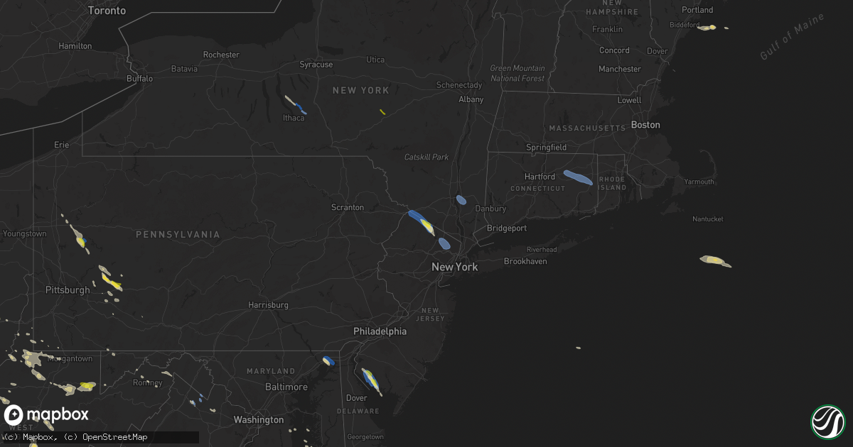
Hail Map on August 25, 2020
Get this storm
August 25 map
$229
one time, instant access
Download today. No call, no setup
Keep the $229
Bought the map and want the full workflow? Apply the entire $229 to a subscription within 7 days. None of it is wasted.
Every map, not just this one
This buys you this map. Subscription and you get every map we run, in the markets you choose from a few cities to whole states to nationwide. Plus real-time alerts the moment a storm fires.
Contact data
Name, contact info, occupancy, even credit band for addresses in the footprint. You go from where it hit to who to call.
Become the source they trust
Unlimited branding weather history reports on demand. You already have the documented answer ready for the property owner, and you are the one who showed up with it.
Property data and RoofTrace estimates
Pull up any address you have got, its value and the exact code rules for that jurisdiction, straight from One Click Code. Then RoofTrace estimates the squares, pitch, and roof value, priced the way you price.
States Impacted by Hail Map on August 25, 2020
Storm reports
Indiana
| Date | Description |
|---|---|
| 08/25/20204:08 PM CDT | Large tree down over road. Time estimated from radar data. |
| 08/25/20203:49 PM CDT | Tree down on old sr-101 near franklin-union county line. Time estimated from radar data. |
| 08/25/20203:02 PM CDT | Multiple reports of trees down across county. Most reports were from the logan area. |
| 08/25/202012:26 AM CDT | At 526 PM EDT, a severe thunderstorm was located near Brookville, moving south at 15 mph. HAZARD...60 mph wind gusts and quarter size hail. SOURCE...Radar indicated. IMPACT...Minor hail damage to vehicles is possible. Expect wind damage to trees and power lines. Locations impacted include... Batesville, Brookville, Oldenburg, Metamora, Peppertown and Saint Peter. |
| 08/24/202011:33 PM CDT | At 433 PM EDT, a severe thunderstorm was located near Liberty, moving southeast at 15 mph. HAZARD...60 mph wind gusts and quarter size hail. SOURCE...Radar indicated. IMPACT...Minor hail damage to vehicles is possible. Expect wind damage to trees and power lines. Locations impacted include... Dunlapsville, Alquina, Whitewater State Park, Charlottesville, Mounds State Recreation Area and Billingsville. |
District of Columbia
| Date | Description |
|---|---|
| 08/25/20206:32 PM CDT | Tree down near the intersection of 27th street northeast and vista street northeast. |
| 08/25/20202:11 AM CDT | At 711 PM EDT, severe thunderstorms were located along a line extending from American Legion Bridge to Fairfax, moving east at 35 mph. HAZARD...60 mph wind gusts. SOURCE...Radar indicated. IMPACT...Damaging winds will cause some trees and large branches to fall. This could injure those outdoors, as well as damage homes and vehicles. Roadways may become blocked by downed trees. Localized power outages are possible. Unsecured light objects may become projectiles. Locations impacted include... Arlington, Alexandria, Bowie, Clinton, Fort Washington, Fort Hunt, Forestville, Largo, Coral Hills, Bladensburg, National Harbor, Nationals Park, Fedex Field, Howard University, Gallaudet University, RFK Stadium, Andrews Air Force Base, Landover, Camp Springs and Oxon Hill. |
| 08/25/20201:57 AM CDT | At 657 PM EDT, a severe thunderstorm was located near Reston, moving southeast at 30 mph. HAZARD...60 mph wind gusts. SOURCE...Radar indicated. IMPACT...Damaging winds will cause some trees and large branches to fall. This could injure those outdoors, as well as damage homes and vehicles. Roadways may become blocked by downed trees. Localized power outages are possible. Unsecured light objects may become projectiles. Locations impacted include... Arlington, Alexandria, Reston, Annandale, Springfield, Fort Washington, Herndon, Fairfax, Fort Hunt, Vienna, Groveton, Falls Church, Huntington, Mantua, Fort Belvoir, Pimmit Hills, Woodbridge, Mclean, Reagan National Airport and Rosslyn. |
Arizona
| Date | Description |
|---|---|
| 08/24/202011:02 PM CDT | At 402 PM MST, a severe thunderstorm was located 9 miles northwest of Horseshoe Reservoir, or 21 miles northeast of New River, moving northeast at 15 mph. HAZARD...60 mph wind gusts and quarter size hail. SOURCE...Radar indicated. IMPACT...Hail damage to vehicles is expected. Expect wind damage to roofs, siding, and trees. This severe thunderstorm will remain over mainly rural areas of Yavapai County. |
Utah
| Date | Description |
|---|---|
| 08/24/202010:20 PM CDT | At 319 PM MDT, severe thunderstorms were located along a line extending from near Albion to 11 miles west of Juniper, moving east at 50 mph. HAZARD...60 mph wind gusts and nickel size hail. SOURCE...Radar indicated. IMPACT...Expect damage to roofs, siding, and trees. Locations impacted include... Malta, Lake Walcott, Declo, Rockland, Albion, Cold Water Rest Area, Elba, Juniper, Yale Rest Area, Massacre Rocks, Mt Harrison, Sweetzer Summit, Idahome, Sublett Reservoir, Interstate 84 And 86 Junction, Roy and Bridge. |
New York
| Date | Description |
|---|---|
| 08/25/20205:30 PM CDT | Tree on house at 82-36 beverly road. |
| 08/25/20205:22 PM CDT | Downed tree reported by utility company resulting in power outage near crane neck road with time estimated by radar |
| 08/25/20205:12 PM CDT | Large tree branch down on hoe ave in the longwood section of the bronx. |
| 08/25/20203:55 PM CDT | Wires down on fishkill rd. |
| 08/25/20203:50 PM CDT | Tree down on wires in chelsea. |
| 08/25/20202:15 PM CDT | Tree and wires down along park ave. |
| 08/25/20201:59 PM CDT | Trees and wires reported down on route 6 in bovina |
| 08/25/20201:16 PM CDT | Tree down across road at caldwell hills road and treiber riad |
| 08/25/20201:13 PM CDT | Tree on the powerlines across dunham hill road |
| 08/25/20201:10 PM CDT | A local report indicates 1.00 inch wind near 2 NW ONEONTA |
| 08/25/202012:39 PM CDT | Wires down at ferguson and south streets. |
| 08/25/202012:23 PM CDT | Trees and wires down along cobb street. |
| 08/25/20201:26 AM CDT | At 625 PM EDT, a severe thunderstorm was located over Clearview Expressway, or over Jamaica, moving southeast at 30 mph. HAZARD...60 mph wind gusts and penny size hail. SOURCE...Radar indicated. IMPACT...Expect damage to trees and power lines. This severe thunderstorm will be near... Garden City and Kennedy Airport around 635 PM EDT. Valley Stream and Woodmere around 640 PM EDT. Lynbrook and Cedarhurst around 645 PM EDT. Freeport and Long Beach around 650 PM EDT. Lido Beach around 655 PM EDT. |
| 08/25/20201:22 AM CDT | At 622 PM EDT, severe thunderstorms were located along a line extending from near Rocky Point to near Centerport, moving southeast at 35 mph. HAZARD...60 mph wind gusts and quarter size hail. SOURCE...Radar indicated. IMPACT...Minor hail damage to vehicles is possible. Expect wind damage to trees and power lines. Locations impacted include... Islip, Huntington, Patchogue, Port Jefferson, Northport, Commack, Manorville, Stony Brook, Deer Park, Shirley, Brentwood, Medford, Huntington Station, Hauppauge and Wading River. |
| 08/24/202011:49 PM CDT | At 449 PM EDT, a severe thunderstorm was located over Marlboro, or near Beacon, moving southeast at 35 mph. HAZARD...60 mph wind gusts and quarter size hail. SOURCE...Radar indicated. IMPACT...Hail damage to vehicles is expected. Expect wind damage to roofs, siding, and trees. Locations impacted include... Beacon, Wappingers Falls, Fishkill, Hopewell Junction, Myers Corner, East Fishkill, Stormville, Knapps Corner, Swartoutville, Brockway, New Hamburg, Glenham, Crown Heights, Beacon Hills, Lomala, Pecksville, Stoneco, Chelsea, Castle Point and Wiccopee. |
| 08/24/202011:49 PM CDT | At 448 PM EDT, a severe thunderstorm was located over Matamoras, moving southeast at 45 mph. HAZARD...60 mph wind gusts. SOURCE...Radar indicated. IMPACT...Damage to roofs, siding, trees, and power lines is possible. Locations impacted include... Hamburg, Sussex, Highland Lake, Vernon Valley and High Point. |
| 08/24/202010:45 PM CDT | At 344 AM EDT, a severe thunderstorm was located over Westfield, or 15 miles southwest of Fredonia, moving southeast at 35 mph. HAZARD...60 mph wind gusts and quarter size hail. SOURCE...Radar indicated. IMPACT...Minor damage to vehicles is possible. Expect wind damage to roofs, siding, and trees. Locations impacted include... Jamestown, Salamanca, Allegany State Park, Westfield, Lakewood, Falconer, Mayville, Long Point State Park, Jamestown West and Chautauqua Institution. This includes the following highways... Interstate 90 between exits 61 and 60. Interstate 86 between exits 6 and 19. |
| 08/24/20209:57 PM CDT | At 257 PM EDT, a severe thunderstorm was located near Bovina Center, or 12 miles east of Delhi, moving southeast at 45 mph. HAZARD...60 mph wind gusts and quarter size hail. SOURCE...Radar indicated. IMPACT...Hail damage to vehicles is expected. Expect wind damage to roofs, siding, and trees. Locations impacted include... Roxbury, Andes, Margaretville, Hobart, Fleischmanns, Arkville, Bovina Center, Dunraven, Wolf Hollow and Halcottsville. |
| 08/24/20209:29 PM CDT | At 229 PM EDT, a severe thunderstorm was located over Sanitaria Springs, or 7 miles northeast of Binghamton, moving southeast at 40 mph. HAZARD...60 mph wind gusts and quarter size hail. SOURCE...Radar indicated. IMPACT...Hail damage to vehicles is expected. Expect wind damage to roofs, siding, and trees. Locations impacted include... Binghamton, Kirkwood, Conklin, Sanford, Susquehanna, Deposit, Susquehanna Depot, Port Dickinson, Hancock and Windsor. |
| 08/24/20209:27 PM CDT | At 225 AM EDT, a severe thunderstorm was located near Medina, moving east at 35 mph. HAZARD...60 mph wind gusts. SOURCE...Radar indicated. IMPACT...Expect damage to roofs, siding, and trees. Locations impacted include... Brockport, Medina, Albion, Hilton, Hamlin Beach State Park, Spencerport, Churchville, Middleport, Holley and Waterport. |
| 08/24/20209:15 PM CDT | At 215 PM EDT, a severe thunderstorm was located over Emmons, or over Oneonta, moving southeast at 55 mph. HAZARD...60 mph wind gusts and quarter size hail. SOURCE...Radar indicated. IMPACT...Hail damage to vehicles is expected. Expect wind damage to roofs, siding, and trees. Locations impacted include... Oneonta, Delhi, Davenport, Roxbury, Kortright, Meredith, Andes, Stamford, Margaretville and Hobart. |
| 08/24/20208:59 PM CDT | At 158 AM EDT, a severe thunderstorm was located near Niagara Falls, moving east at 35 mph. HAZARD...60 mph wind gusts. SOURCE...Radar indicated. IMPACT...Expect damage to roofs, siding, and trees. Locations impacted include... Buffalo, Cheektowaga, Niagara Falls, West Seneca, North Tonawanda, Clarence, Lockport, Lackawanna, Kenmore and Depew. This includes Interstate 90 between exits 56 and 49. |
| 08/24/20208:49 PM CDT | At 147 PM EDT, a severe thunderstorm was located over Harford, or 8 miles west of Marathon, moving southeast at 40 mph. HAZARD...60 mph wind gusts and quarter size hail. SOURCE...Radar indicated. IMPACT...Hail damage to vehicles is expected. Expect wind damage to roofs, siding, and trees. Locations impacted include... Caroline, Virgil, Dryden, Nanticoke, Coventry, Port Dickinson, Greene, Berkshire, Richford and Willet. |
| 08/24/20208:08 PM CDT | At 107 PM EDT, a severe thunderstorm was located over Ledyard, or 14 miles southeast of Seneca Falls, moving southeast at 30 mph. HAZARD...60 mph wind gusts and quarter size hail. SOURCE...Radar indicated. IMPACT...Hail damage to vehicles is expected. Expect wind damage to roofs, siding, and trees. Locations impacted include... Ithaca, Cortland, Cayuga Heights, Lansing, Homer, Virgil, Groton, Covert, Locke and Genoa. |
Michigan
| Date | Description |
|---|---|
| 08/25/20205:38 AM CDT | At 1035 AM EDT, a severe thunderstorm was located near Montague, or 14 miles south of Hart, moving southeast at 45 mph. HAZARD...60 mph wind gusts and quarter size hail. SOURCE...Radar indicated. IMPACT...Hail damage to vehicles is expected. Expect wind damage to roofs, siding, and trees. Locations impacted include... Whitehall... Montague... Lakewood Club... Holton... Bridgeton... Rothbury... Stony Lake... Big Blue Lake... Twin Lake... Slocum... |
Rhode Island
| Date | Description |
|---|---|
| 08/25/20206:12 PM CDT | Wires down on beaver tail road and north road. |
| 08/25/20206:00 PM CDT | Trees down on dry bridge road |
| 08/25/20205:57 PM CDT | Tree and wires down on yawgoo valley road road |
| 08/25/20205:45 PM CDT | Tree down on south road |
| 08/25/20201:23 AM CDT | At 623 PM EDT, a severe thunderstorm was located over Plainfield, moving southeast at 40 mph. This storm has downed trees and wires in Coventry and Mansfield. HAZARD...60 mph wind gusts and penny size hail. SOURCE...Radar indicated. IMPACT...Expect damage to trees and power lines. Locations impacted include... Coventry, South Kingstown, North Kingstown, Plainfield, Narragansett, East Greenwich, Hopkinton, Richmond, Exeter, West Greenwich, Jamestown and Sterling. |
Montana
| Date | Description |
|---|---|
| 08/25/20206:31 PM CDT | A local report indicates 58 MPH wind near 5 NE DILLON |
| 08/25/20205:00 AM CDT | At 1000 PM MDT, a line of severe winds were located along a line extending from 9 miles southeast of The Pines Rec Area to 15 miles southwest of Cohagen, moving east at 30 mph. HAZARD...70 mph wind gusts. SOURCE...Radar indicated. IMPACT...Expect considerable tree damage. Damage is likely to mobile homes, roofs, and outbuildings. Locations impacted include... Flowing Wells Rest Area, Cohagen, Nelson Creek Rec Area, Brockway, Hillside, Rock Creek Rec Area, Weldon, Crow Rock, Watkins and Van Norman. |
| 08/24/202010:32 PM CDT | Asos station kjdn jordan. |
| 08/24/20209:45 PM CDT | A local report indicates 58 MPH wind near 3 NW BILLINGS |
| 08/24/20208:15 PM CDT | A local report indicates 77 MPH wind near 5 E SHAWMUT |
New Hampshire
| Date | Description |
|---|---|
| 08/25/20203:40 PM CDT | Multiple trees on wires in the area. Delayed report. Time estimated from radar. |
| 08/25/20203:20 PM CDT | Trees down on chemical ln. Delayed report. Time estimated from radar. |
| 08/25/20202:15 PM CDT | Multiple reports of trees on wires. Also reported via facebook. Time estimated from radar. |
| 08/25/20202:10 PM CDT | Tree down on mayhew turnpike. Wires down on hemlock brook rd. Also reports of multiple trees on wires in the bridgewater area from facebook. Time estimated from radar. |
| 08/24/202010:55 PM CDT | At 355 PM EDT, a cluster of severe thunderstorms was located near Ossipee, New Hampshire moving east at 50 mph. HAZARD...60 mph wind gusts and penny size hail. SOURCE...Radar indicated. IMPACT...Expect damage to roofs, siding, and trees. Locations impacted include... Biddeford, Alfred, Sanford, Ossipee, Saco, Kennebunk, Buxton, Lebanon, Hollis, Effingham, Cornish, Waterboro, Wolfeboro, Lyman, Arundel, Limington, Limerick, Acton, Brookfield and Wakefield.This includes Interstate 95 between mile markers 24 and 30. |
Wyoming
| Date | Description |
|---|---|
| 08/24/20208:18 PM CDT | Awos station kjac jackson hole airport. |
| 08/24/20207:52 PM CDT | Mesonet station krec atlantic city 10 ne |
Virginia
| Date | Description |
|---|---|
| 08/25/20206:51 PM CDT | Downed tree on i-95 near mm 141 |
| 08/25/20206:45 PM CDT | Downed tree near neabsco rd and macedonia dr. |
| 08/25/20206:45 PM CDT | Downed tree on i-95 near mm 150 |
| 08/25/20206:45 PM CDT | Downed tree on i-95 near mm 150 |
| 08/25/20206:41 PM CDT | Downed tree near mt olive rd and poplar rd |
| 08/25/20206:24 PM CDT | Multiple reports of trees and wires down near bealeton. |
| 08/25/20206:20 PM CDT | Trees down near the intersection of blair road and pinetree terrace. |
| 08/25/20206:20 PM CDT | Multiple reports of trees and wires down throughout culpeper county. |
| 08/25/20206:12 PM CDT | Multiple reports of trees and wires down in woodville. |
| 08/25/20206:11 PM CDT | Multiple reports of trees and wires down in amissville. |
| 08/25/20206:05 PM CDT | Multiple reports of trees and wires down near warrenton. |
| 08/25/20206:04 PM CDT | Multiple reports of trees and wires down in washington. |
| 08/25/20205:54 PM CDT | Multiple reports of trees and wires down across southern portions of warren county. |
| 08/25/20205:52 PM CDT | Tree down on leeds manor road. |
| 08/25/20205:44 PM CDT | Downed tree on mountain rd |
| 08/25/20205:37 PM CDT | Trees down on us-50 lee jackson memorial highway just west of us-15 james monroe highway. |
| 08/25/20205:35 PM CDT | Numerous trees down across the southern portion of clarke county including the cities of berryville and white post |
| 08/25/20205:34 PM CDT | Tree down near the intersection of va-734 snickersville turnpike and va-650 oatlands road. |
| 08/25/20205:28 PM CDT | Tree down near the intersection of va-733 mountville road and va-734 snickersville turnpike. Tree down near the intersection of va-731 hobbs bridge road and va-767 leit |
| 08/25/20205:25 PM CDT | Tree down near intersection of chapel road and hites road. Tree down on veterans road |
| 08/25/20205:20 PM CDT | Ten mature trees uprooted or snapped near kennel rd and burch lane |
| 08/25/20205:14 PM CDT | Tree damage |
| 08/25/20204:36 PM CDT | Tree down in 1400 block of north sleepy creek road. |
| 08/25/202011:22 AM CDT | Tree down on airmont road near yatton road. |
| 08/25/202010:47 AM CDT | Powerlines down near the intersection of route 50 and mount carmel road |
| 08/25/202010:30 AM CDT | Tree reported down on river road near saw mill hill road. |
| 08/25/202010:30 AM CDT | Tree reported down on the 9400 block of lord fairfax highway. |
| 08/25/202010:16 AM CDT | Tree reported down on the 4000 block of shepherds mill road. |
| 08/25/20206:27 AM CDT | At 1127 AM EDT, a severe thunderstorm was located near Berryville, or 8 miles east of Millwood Pike, moving southeast at 45 mph. HAZARD...60 mph wind gusts and quarter size hail. SOURCE...Radar indicated. IMPACT...Damaging winds will cause some trees and large branches to fall. This could injure those outdoors, as well as damage homes and vehicles. Roadways may become blocked by downed trees. Localized power outages are possible. Unsecured light objects may become projectiles. Locations impacted include... Berryville, Middleburg, The Plains, Oatlands, Bluemont, Boyce, Saint Louis, White Post, Briggs, Rectortown, Aldie, Millwood, Halfway, Upperville, Philomont, Bethel, Stringtown and Paris. |
| 08/25/20204:47 AM CDT | At 946 PM EDT, a severe thunderstorm was located near Westover, or 8 miles southwest of Princess Anne, moving southeast at 40 mph. HAZARD...60 mph wind gusts. SOURCE...Radar indicated. IMPACT...Expect damage to trees and powerlines. This severe thunderstorm will be near, Princess Anne around 950 PM EDT. Westover around 955 PM EDT. Marion Station around 1000 PM EDT. Pocomoke City and West Pocomoke around 1005 PM EDT.Other locations impacted by this severe thunderstorm include Oriole,Byrdtown, Cokesbury, Goodwill, Fairmount, Upper Hill, Hopewell,Rehobeth, Kingston and Dames Quarter. |
| 08/25/20202:02 AM CDT | At 701 PM EDT, severe thunderstorms were located along a line extending from 6 miles northwest of Snowshoe to 6 miles north of Ansted, moving south at 25 mph. HAZARD...60 mph wind gusts and quarter size hail. SOURCE...Radar indicated. IMPACT...Hail damage to vehicles is expected. Expect wind damage to roofs, siding, and trees. Locations impacted include... Lewisburg... Rainelle... Rupert... Quinwood... Renick... Neola... and Falling Spring. |
| 08/25/20201:42 AM CDT | At 642 PM EDT, severe thunderstorms were located along a line extending from near Delaplane to 7 miles south of Strasburg, moving southeast at 25 mph. HAZARD...60 mph wind gusts. SOURCE...Radar indicated. IMPACT...Damaging winds will cause some trees and large branches to fall. This could injure those outdoors, as well as damage homes and vehicles. Roadways may become blocked by downed trees. Localized power outages are possible. Unsecured light objects may become projectiles. Locations impacted include... Front Royal, Middleburg, Sperryville, Delaplane, Linden, Hume, Marshall, Chester Gap, Flint Hill, Washington, Castleton, Huntly, Riverton, Hackleys Crossroads, Amissville, Cresthill, Karo, Glen Echo, Bentonville and Blue Mountain. |
| 08/25/20201:27 AM CDT | At 626 PM EDT, severe thunderstorms with a history of producing wind damage were located along a line extending from near Oatlands to 6 miles north of Linden, moving southeast at 40 mph. HAZARD...60 mph wind gusts. SOURCE...Radar indicated. IMPACT...Damaging winds will cause some trees and large branches to fall. This could injure those outdoors, as well as damage homes and vehicles. Roadways may become blocked by downed trees. Localized power outages are possible. Unsecured light objects may become projectiles. Locations impacted include... Centreville, South Riding, Brambleton, Warrenton, Linton Hall, Chantilly, Bull Run, Haymarket, Arcola, The Plains, Oatlands, Manassas, Sudley, Manassas Park, Fairfax Station, Gainesville, New Baltimore, Marshall, Nokesville and Clifton. |
| 08/25/20201:06 AM CDT | At 606 PM EDT, a severe thunderstorm was located near Millwood Pike, moving southeast at 25 mph. HAZARD...60 mph wind gusts and quarter size hail. SOURCE...Radar indicated. IMPACT...Damaging winds will cause some trees and large branches to fall. This could injure those outdoors, as well as damage homes and vehicles. Roadways may become blocked by downed trees. Localized power outages are possible. Unsecured light objects may become projectiles. Locations impacted include... Winchester, Millwood Pike, Berryville, Stephens City, Middleburg, Delaplane, Linden, Hume, Bluemont, Marshall, Boyce, White Post, Clear Brook, Stephenson, Blue Mountain, Nineveh, Bethel, Stringtown, Saint Louis and Brucetown. |
| 08/25/202012:41 AM CDT | At 541 PM EDT, severe thunderstorms were located along a line extending from 6 miles southwest of Greenwood to 10 miles southeast of Romney to 12 miles northwest of Wardensville, moving southeast at 35 mph. HAZARD...60 mph wind gusts. SOURCE...Radar indicated. IMPACT...Damaging winds will cause some trees and large branches to fall. This could injure those outdoors, as well as damage homes and vehicles. Roadways may become blocked by downed trees. Localized power outages are possible. Unsecured light objects may become projectiles. Locations impacted include... Winchester, Millwood Pike, Stephens City, Star Tannery, Capon Bridge, Gravel Springs, Yellow Spring, High View, Greenwood, High View Manor, Gainesboro, Wilde Acres, Cedar Grove, Bloomery, Delray, Cross Junction, Rock Enon Springs, Albin, Gore and Whitacre. |
| 08/24/20207:18 PM CDT | Tree down on power-line along midland trail near the marathon gas station in callaghan. |
| 08/24/20207:03 PM CDT | Downed tree on white oak rd |
Connecticut
| Date | Description |
|---|---|
| 08/25/20205:15 PM CDT | Tree down on a house on franklin street |
| 08/25/20205:08 PM CDT | Trees down and transformer fire on brooklyn turnpike |
| 08/25/20205:01 PM CDT | Tree and wires down on basetts bridge road |
| 08/25/20204:59 PM CDT | Wires down on prospect street |
| 08/25/20204:51 PM CDT | Large tree down near a home in westport... Ct. Time estimated by radar. |
| 08/25/202012:14 AM CDT | At 514 PM EDT, a severe thunderstorm was located over Carmel, or near Mahopac, moving southeast at 40 mph. HAZARD...60 mph wind gusts and penny size hail. SOURCE...Radar indicated. IMPACT...Expect damage to trees and power lines. This severe thunderstorm will be near... Danbury around 530 PM EDT. Ridgefield around 535 PM EDT. New Canaan and Redding around 540 PM EDT. Wilton around 545 PM EDT. Norwalk and Fairfield around 550 PM EDT. Bridgeport around 555 PM EDT. |
Ohio
| Date | Description |
|---|---|
| 08/25/20205:07 PM CDT | Numerous trees downed. |
| 08/25/20204:35 PM CDT | Spotter relayed report from a judge of several trees down. Time and location vectored from spotter information and radar. |
| 08/25/20204:35 PM CDT | Multiple trees and power poles down including on addison pike... Poplar ridge rd... Little kyger rd and rousch hollow. Hwy department reports damage so bad that it may |
| 08/25/20204:30 PM CDT | Trees down in vinton and bidwell communities. Report courtesy of wchs. |
| 08/25/20204:24 PM CDT | One 20 inch diameter tree snapped. Another 8 inch diameter tree limb downed. Time estimated from radar. |
| 08/25/20204:15 PM CDT | Multiple trees down. |
| 08/25/20204:07 PM CDT | Trees down. |
| 08/25/20204:07 PM CDT | A couple trees and several large limbs downed. |
| 08/25/20203:50 PM CDT | Measured on home weather station. |
| 08/25/20203:45 PM CDT | Numerous trees down around town. |
| 08/25/20203:41 PM CDT | Several trees down... Some blocking roads. Time estiamted from call center time and radar. |
| 08/25/20203:37 PM CDT | Several trees down in far southwest portion of athens township... Some blocking roads. Time esitmated from caller information and radar. |
| 08/25/20203:34 PM CDT | Two trees... Several large limbs blown down. Time estimated from radar data. |
| 08/25/20203:30 PM CDT | Multiple large trees downed with several uprooted onto houses. |
| 08/25/20203:30 PM CDT | Numerous trees down. |
| 08/25/20203:28 PM CDT | Three trees and many branches down. Time estimated from radar data. |
| 08/25/20203:06 PM CDT | Several large branches down... Blocking road. Time estimated from radar. |
| 08/25/20203:02 PM CDT | Tree down on car. Time estimated from radar data. |
| 08/25/20203:02 PM CDT | Tree down in road. Time estimated from radar data. |
| 08/25/20203:02 PM CDT | Three mature trees downed near county line and hempstead road. |
| 08/25/20203:02 PM CDT | Multiple reports of trees down across county. Most reports were from the logan area. |
| 08/25/20203:01 PM CDT | Large limb blown down. Time estimated from radar data. |
| 08/25/20203:00 PM CDT | A local report indicates 1.25 inch wind near 5 NW WILMINGTON |
| 08/25/20203:00 PM CDT | Tree down on house and lines. Time estimated from radar data. |
| 08/25/20202:52 PM CDT | One 10-12 inch tree limb downed. Time estimated from radar. |
| 08/25/20202:45 PM CDT | Numerous trees down in the town of somerset. |
| 08/25/20202:30 PM CDT | Muskingum ema reports damage across much of the county including trees and powerlines down around intersection of norfield rd and state route 93. |
| 08/25/20202:17 PM CDT | Pole down at ohio 72 and black road. Time estimated from radar data. |
| 08/25/20202:17 PM CDT | Semi trailer blown over on us-22 near reed road. Time estimated from radar. |
| 08/25/20202:07 PM CDT | Several trees down in and around warsaw village with power lines also down from trees laying on them. |
| 08/25/20201:53 PM CDT | Roof blown off barn on zimmerman road. Time estimated from radar data. |
| 08/25/20201:50 PM CDT | A local report indicates 1.00 inch wind near 1 S FLUSHING |
| 08/25/20201:28 PM CDT | Trees and power lines down in west lafeytte |
| 08/25/202012:55 PM CDT | A local report indicates 1.00 inch wind near ENON |
| 08/25/20207:42 AM CDT | At 1242 PM EDT, a severe thunderstorm was located over Mansfield, moving southeast at 15 mph. HAZARD...60 mph wind gusts and quarter size hail. SOURCE...Radar indicated. IMPACT...Minor damage to vehicles is possible. Expect damage to trees and power lines. Locations impacted include... Mansfield, Ontario, Loudonville, Hayesville, Perrysville, Lucas, Mifflin and Mohicanville. |
| 08/25/20201:19 AM CDT | At 619 PM EDT, a severe thunderstorm was located near Delhi Hills, moving south at 25 mph. HAZARD...60 mph wind gusts. SOURCE...Radar indicated. IMPACT...Expect damage to trees and power lines. Locations impacted include... Florence, Independence, Erlanger, Elsmere, Villa Hills, Walton, Oakbrook, Burlington, Union, Richwood, Bank Lick, Ricedale, Hueys Corners, Constance, Hebron, Beaverlick, Piner, Cvg Airport, Verona and Francisville.This includes the following Interstates... I-71 in Kentucky between mile markers 71 and 77. I-75 in Kentucky between mile markers 169 and 184. |
| 08/25/202012:24 AM CDT | At 524 PM EDT, a severe thunderstorm was located over Ravenswood, or 8 miles south of Forked Run State Park, moving southeast at 40 mph. HAZARD...60 mph wind gusts. SOURCE...Radar indicated. IMPACT...Expect damage to roofs, siding, and trees. Locations impacted include... Ripley, Spencer, Elizabeth, Grantsville, Ravenswood, Sandyville, Arnoldsburg, Reedy, Statts Mills, Cherry, Mount Zion, Kentuck, Left Hand, Lucille, Big Springs, Brohard, Annamoriah, Fairplain, Peewee and Harmony.This includes the following highways... Interstate 79 between mile markers 29 and 30. Interstate 77 in West Virginia between mile markers 125 and 157. |
| 08/24/202011:34 PM CDT | At 434 PM EDT, a severe thunderstorm was located near Pickerington, moving southeast at 35 mph. HAZARD...60 mph wind gusts and quarter size hail. SOURCE...Radar indicated. IMPACT...Minor hail damage to vehicles is possible. Expect wind damage to trees and power lines. Locations impacted include... Lancaster, Reynoldsburg, Pickerington, Pataskala, Canal Winchester, Baltimore, Bremen, Millersport, Pleasantville, Hide-A-Way Hills, Etna, Thurston, Kirkersville, Carroll, Sugar Grove, Rushville, West Rushville, Fairfield County Airport, Hideaway Hills and State Route 158 at State Route 204.This includes I-70 in Ohio between mile markers 112 and 122. |
| 08/24/202011:27 PM CDT | At 427 PM EDT, a severe thunderstorm was located near Nelsonville, moving southeast at 25 mph. HAZARD...60 mph wind gusts and penny size hail. SOURCE...Radar indicated. IMPACT...Expect damage to roofs, siding, and trees. Locations impacted include... Athens, Nelsonville, Chauncey, Buchtel, Amesville, Stroud Run State Park and The Plains. |
| 08/24/202011:26 PM CDT | At 425 PM EDT, a severe thunderstorm was located near Morrow, moving southeast at 35 mph. HAZARD...60 mph wind gusts and quarter size hail. SOURCE...Radar indicated. IMPACT...Minor hail damage to vehicles is possible. Expect wind damage to trees and power lines. Locations impacted include... Hillsboro, Blanchester, Lynchburg, Russell, New Market, Clarksville, Martinsville, Midland, Fort Ancient, Danville in Highland County, Middleboro, Westboro, Cuba, State Route 350 at US Route 22 and Cowan Lake State Park.This includes I-71 in Ohio between mile markers 35 and 40. |
| 08/24/202011:23 PM CDT | At 423 PM EDT, a severe thunderstorm was located near Camden, moving southeast at 20 mph. HAZARD...60 mph wind gusts and quarter size hail. SOURCE...Radar indicated. IMPACT...Minor hail damage to vehicles is possible. Expect wind damage to trees and power lines. Locations impacted include... Middletown, Mason, Monroe, Trenton, South Middletown, Seven Mile, Williamsdale, Olde West Chester, Four Bridges, Wetherington, Darrtown, New Miami, Somerville, West Elkton, Jacksonburg, Hughes, Maud, Collinsville, Maustown and Pisgah.This includes I-75 in Ohio between mile markers 21 and 28. |
| 08/24/202010:57 PM CDT | At 356 PM EDT, a severe thunderstorm was located 8 miles south of New Concord, or 13 miles east of Zanesville, moving southeast at 30 mph. HAZARD...Wind gusts to 60 mph. SOURCE...Radar. IMPACT...Expect damage to trees and power lines, resulting in some power outages. Locations impacted include... Zanesville... Caldwell... New Concord... Byesville... South Zanesville... Dudley... Philo... Pleasant Grove... Senecaville... Pleasant City... Cumberland... Summerfield...This includes the following highways... Interstate 70 in Ohio between mile markers 159 and 174. Interstate 77 in Ohio between mile markers 18 and 41. |
| 08/24/202010:55 PM CDT | At 355 PM EDT, a severe thunderstorm was located over Perry State Forest, moving southeast at 20 mph. HAZARD...60 mph wind gusts and penny size hail. SOURCE...Radar indicated. IMPACT...Expect damage to roofs, siding, and trees. Locations impacted include... New Lexington, Glouster, McConnelsville, Shawnee, Chesterhill, Perry State Forest, Crooksville, Junction City, Malta, Corning, Stockport, Jacksonville, Trimble, Bristol, Hemlock, Rendville, Burr Oak State Park, Hackney and Eagleport. |
| 08/24/202010:49 PM CDT | At 349 PM EDT, a severe thunderstorm was located near Hide-A-Way Hills, moving southeast at 25 mph. HAZARD...60 mph wind gusts and quarter size hail. SOURCE...Radar indicated. IMPACT...Minor hail damage to vehicles is possible. Expect wind damage to trees and power lines. Locations impacted include... Logan, Nelsonville, Hide-A-Way Hills, Starr, Murray City, Sugar Grove, Enterprise, Union Furnace, Rockbridge, Haydenville, Lake Logan State Park and Carbon Hill. |
| 08/24/202010:47 PM CDT | At 347 PM EDT, a severe thunderstorm was located 7 miles northwest of Wilmington, moving southeast at 25 mph. HAZARD...60 mph wind gusts and quarter size hail. SOURCE...Radar indicated. IMPACT...Minor hail damage to vehicles is possible. Expect wind damage to trees and power lines. Locations impacted include... Wilmington, New Vienna, Martinsville, New Antioch, Morrisville, Ogden, Oakland, Kingman, Burtonville and Interstate 71 at US Route 68.This includes I-71 in Ohio between mile markers 44 and 50. |
| 08/24/202010:39 PM CDT | At 338 PM EDT, a severe thunderstorm was located near Powhatan Point, or near Moundsville, moving southeast at 25 mph. HAZARD...Wind gusts to 60 mph and quarter-size hail. SOURCE...Radar. IMPACT...Minor hail damage to vehicles is possible. Expect wind damage to trees and power lines, resulting in some power outages. Locations impacted include... Wheeling... Moundsville... Martins Ferry... New Martinsville... St. Clairsville... Bellaire... Waynesburg... Bethlehem... Woodsfield... Mannington... Triadelphia... Shadyside...This includes the following highways... Interstate 70 in Ohio between mile markers 217 and 225. Interstate 70 in West Virginia between mile markers 0 and 10. Interstate 79 in Pennsylvania between mile markers 3 and 18. |
| 08/24/202010:26 PM CDT | At 325 PM EDT, a severe thunderstorm was located near Coshocton, moving southeast at 25 mph. HAZARD...Wind gusts to 60 mph and quarter-size hail. SOURCE...Radar. IMPACT...Minor hail damage to vehicles is possible. Expect wind damage to trees and power lines, resulting in some power outages. Locations impacted include... Coshocton... Cambridge... Freeport... Newcomerstown... Byesville... West Lafayette... Dresden... Antrim... Warsaw... Senecaville... Conesville... Holloway...This includes the following highways... Interstate 70 in Ohio between mile markers 174 and 196. Interstate 77 in Ohio between mile markers 41 and 68. |
| 08/24/202010:14 PM CDT | At 314 PM EDT, a severe thunderstorm was located near Somerset, moving southeast at 30 mph. HAZARD...60 mph wind gusts and penny size hail. SOURCE...Radar indicated. IMPACT...Expect damage to roofs, siding, and trees. Locations impacted include... New Lexington, Glouster, McConnelsville, Somerset, Shawnee, Perry State Forest, Crooksville, Junction City, Malta, Corning, Glenford, Hemlock, Rendville and Eagleport. |
| 08/24/202010:11 PM CDT | At 311 PM EDT, a severe thunderstorm was located near Frazeysburg, or 8 miles north of Zanesville, moving southeast at 30 mph. HAZARD...Wind gusts to 60 mph and quarter-size hail. SOURCE...Radar. IMPACT...Minor hail damage to vehicles is possible. Expect wind damage to trees and power lines, resulting in some power outages. Locations impacted include... Zanesville... Cambridge... New Concord... Byesville... South Zanesville... North Zanesville... Dresden... Frazeysburg... Philo... Pleasant Grove... Senecaville... Pleasant City...This includes the following highways... Interstate 70 in Ohio near mile marker 143, and between mile markers 145 and 184. Interstate 77 in Ohio between mile markers 32 and 47. |
| 08/24/202010:07 PM CDT | At 306 PM EDT, a severe thunderstorm was located near St. Clairsville, moving east at 25 mph. HAZARD...Wind gusts to 60 mph and quarter-size hail. SOURCE...Radar. IMPACT...Minor hail damage to vehicles is possible. Expect wind damage to trees and power lines, resulting in some power outages. Locations impacted include... Wheeling... Moundsville... Martins Ferry... St. Clairsville... Bellaire... Barnesville... Warwood... Bethlehem... West Liberty... Triadelphia... Clearview... Valley Grove...This includes the following highways... Interstate 70 in Ohio between mile markers 191 and 225. Interstate 70 in West Virginia between mile markers 0 and 14. Interstate 70 in Pennsylvania between mile markers 0 and 9. Interstate 79 in Pennsylvania between mile markers 28 and 29. |
| 08/24/20209:47 PM CDT | At 246 PM EDT, a severe thunderstorm was located 8 miles south of Killbuck, or 11 miles northwest of Coshocton, moving southeast at 25 mph. HAZARD...Wind gusts to 60 mph and quarter-size hail. SOURCE...Radar. IMPACT...Minor hail damage to vehicles is possible. Expect wind damage to trees and power lines, resulting in some power outages. Locations impacted include... Coshocton... West Lafayette... Warsaw... Conesville... Nellie... Chili... Walhonding... Layland... Bakersville... Blissfield... New Guilford... |
| 08/24/20209:23 PM CDT | At 222 PM EDT, a severe thunderstorm was located near Freeport, moving southeast at 25 mph. HAZARD...Wind gusts to 60 mph. SOURCE...Radar. IMPACT...Expect damage to trees and power lines, resulting in some power outages. Locations impacted include... Cambridge... St. Clairsville... Barnesville... Cadiz... Freeport... Bethesda... Antrim... Flushing... Adena... Dillonvale... Quaker City... Mount Pleasant...This includes the following highways... Interstate 70 in Ohio between mile markers 184 and 216. Interstate 77 in Ohio between mile markers 47 and 52. |
| 08/24/20208:57 PM CDT | At 157 PM EDT, a severe thunderstorm was located near Farmerstown, or 11 miles southwest of Dover, moving southeast at 25 mph. HAZARD...Wind gusts to 60 mph. SOURCE...Radar. IMPACT...Expect damage to trees and power lines, resulting in some power outages. Locations impacted include... New Philadelphia... Coshocton... Uhrichsville... Freeport... Newcomerstown... Dennison... West Lafayette... Sugarcreek... Gnadenhutten... Tuscarawas... Baltic... Midvale...This includes Interstate 77 in Ohio between mile markers 52 and 79. |
| 08/24/20208:53 PM CDT | At 153 PM EDT, a severe thunderstorm was located over Killbuck, or 7 miles southwest of Millersburg, moving southeast at 25 mph. HAZARD...Wind gusts to 60 mph. SOURCE...Radar. IMPACT...Expect damage to trees and power lines, resulting in some power outages. Locations impacted include... Coshocton... West Lafayette... Warsaw... Chili... Layland... Bakersville... Blissfield... This includes Interstate 77 in Ohio near mile marker 68. |
| 08/24/20208:45 PM CDT | At 144 PM EDT, a severe thunderstorm was located over Enon, moving southeast at 20 mph. HAZARD...60 mph wind gusts. SOURCE...Radar indicated. IMPACT...Expect damage to trees and power lines. Locations impacted include... Fairborn, Yellow Springs, Cedarville, Enon, Wilberforce, Donnelsville, Clifton, Green Meadows, Springfield Municipal Airport, Hustead, Holiday Valley, John Bryan State Park, Snyderville, Selma, Crystal Lakes, Pitchin, Gladstone, Medway and Park Layne.This includes I-70 in Ohio between mile markers 43 and 52. |
| 08/24/20208:43 PM CDT | At 143 PM EDT, a severe thunderstorm was located near Uhrichsville, moving southeast at 25 mph. HAZARD...Wind gusts to 60 mph. SOURCE...Radar. IMPACT...Expect damage to trees and power lines, resulting in some power outages. Locations impacted include... Uhrichsville... Cadiz... Freeport... Dennison... Gnadenhutten... Antrim... Tuscarawas... Port Washington... Stone Creek... Gilmore... Tippecanoe... Piedmont...This includes Interstate 77 in Ohio between mile markers 70 and 78. |
Idaho
| Date | Description |
|---|---|
| 08/25/20206:45 PM CDT | Itd - telegraph hill. |
| 08/25/20206:45 PM CDT | A local report indicates 61 MPH wind near 14 NE ATOMIC CITY |
| 08/25/20206:45 PM CDT | Inl arl frd - spec manufacturing lof. |
| 08/25/20206:40 PM CDT | Inl arl frd - sand dunes. |
| 08/25/20206:30 PM CDT | Itd inl puzzle - central facilities. |
| 08/25/20206:25 PM CDT | Inl arl frd observation. |
| 08/25/20206:23 PM CDT | Numerous power outages including pocatello... Chubbuck... Mccammon... Lava hot springs... Virginia... Springfield. |
| 08/25/20206:10 PM CDT | Inl arl frd - dean man canyon. |
| 08/25/20206:00 PM CDT | Itd topaz observation. |
| 08/25/20206:00 PM CDT | Inl arl frd - coxs well. |
| 08/25/20206:00 PM CDT | Butte county emergency manager reports numerous tree limbs down across the moore and arco areas... Along with reports of power outages in rural portions of butte county |
| 08/25/20206:00 PM CDT | 4 large stadium light poles snapped off at their bases and down damaging a chain link fence at butte county high school. Wires also down. Report from county em confirme |
| 08/25/20205:54 PM CDT | Raws potter butte. |
| 08/25/20205:50 PM CDT | Portion of tree down at washington elementary. Photo via facebook. Time estimated based on radar and nearby observations. |
| 08/25/20205:48 PM CDT | Pocatello toc reports large tree blown down across s grant ave. Time estimated based on radar and surrounding reports. |
| 08/25/20205:48 PM CDT | Pocatello toc reports large tree blown down across golf dr and numerous tree limbs down at riverside golf course. Time estimated based on radar and surrounding reports. |
| 08/25/20205:48 PM CDT | Tree down. Time estimated based on radar and nearby wind gust reports. |
| 08/25/20205:30 PM CDT | Itd tomcat observation system. |
| 08/25/20204:45 PM CDT | Itd yale observation system. |
| 08/25/20204:22 PM CDT | Power outage from passing thunderstorm. |
| 08/25/20204:09 PM CDT | Usfs raws system - cotton ridge. |
| 08/25/20207:48 AM CDT | At 1248 PM PDT, a severe thunderstorm was located 31 miles north of Midas, moving northeast at 30 mph. HAZARD...60 mph wind gusts and quarter size hail. SOURCE...Radar indicated. IMPACT...Hail damage to vehicles is expected. Expect wind damage to roofs, siding, and trees. Locations impacted include... Wilson Rservoir. |
| 08/25/20203:50 AM CDT | At 850 PM MDT, severe thunderstorms were located along a line extending from 8 miles northwest of Aberdeen to American Falls Reservoir, moving northeast at 40 mph. HAZARD...60 mph wind gusts and penny size hail. SOURCE...Radar indicated. IMPACT...Expect damage to roofs, siding, and trees. Locations impacted include... American Falls Reservoir, Chubbuck, Aberdeen, Fort Hall Buffalo Lodge, Fort Hall Townsite, Springfield, Pingree, Pocatello Airport and Sterling. |
| 08/25/202012:54 AM CDT | At 552 PM MDT, severe thunderstorms were located along a line extending from 7 miles west of Hamer to 12 miles northwest of Shelley to near Rose, moving east at 50 mph. HAZARD...60 to 70 mph wind gusts. SOURCE...Mesonet Observations and Radar indicated. These storms have a history of producing wind gusts up to 70 mph! IMPACT...Expect considerable tree damage. Damage is likely to mobile homes, roofs, and outbuildings. Locations impacted include... Idaho Falls, Rexburg, Rigby, Ririe Reservoir, Terreton, Lorenzo, Goshen, Ammon, Shelley, Iona, Sugar City, Ucon, Menan, Teton, Ririe, Roberts, Firth, Lewisville, and Parker. |
| 08/25/202012:09 AM CDT | At 508 PM MDT, severe thunderstorms were located along a line extending from 10 miles west of Northwest Inl to near Atomic City to 14 miles northwest of Aberdeen, moving east at 45 mph. HAZARD...60 mph wind gusts. SOURCE...Radar indicated. IMPACT...Expect damage to roofs, siding, and trees. Locations impacted include... Idaho Falls, Blackfoot, Arco, Terreton, Goshen, American Falls Reservoir, Shelley, Roberts, Firth, Mud Lake, Hamer, Atomic City, Rose, INL Complex, Pingree, Fort Hall Putnam Lodge, Fort Hall Buffalo Lodge, Fort Hall Eagle Lodge and Fort Hall Lincoln Creek Lodge. |
| 08/24/202011:37 PM CDT | At 437 PM MDT, severe thunderstorms were located along a line extending from 9 miles northwest of Aberdeen to near American Falls Reservoir, moving northeast at 45 mph. HAZARD...60 mph wind gusts. SOURCE...Radar indicated. IMPACT...Expect damage to roofs, siding, and trees. Locations impacted include... Blackfoot, American Falls Reservoir, Aberdeen, Fort Hall Buffalo Lodge, Fort Hall Eagle Lodge, Taber, Springfield, Rockford, Moreland, Pingree, Fort Hall Townsite, Groveland and Sterling. |
| 08/24/202010:55 PM CDT | At 354 PM MDT, severe thunderstorms were located along a line extending from 7 miles southwest of Cold Water Rest Area to 10 miles north of Juniper, moving east at 50 mph. HAZARD...60 mph wind gusts and penny size hail. SOURCE...Radar indicated. IMPACT...Expect damage to roofs, siding, and trees. Locations impacted include... American Falls, Malad, Neeley, Rockland, Cold Water Rest Area, Fort Hall Bannock Peak, Holbrook Summit, Fort Hall Bannock Creek Lodge, Pocatello Airport, Juniper, Pauline, Massacre Rocks, Mink Creek Pass, Daniels Reservoir, Holbrook, Arbon, Sublett Reservoir, Malad Pass, Roy and Hawkins Reservoir. |
| 08/24/20208:44 PM CDT | At 143 PM PDT, a severe thunderstorm was located 9 miles southwest of Owyhee, moving northeast at 30 mph. HAZARD...60 mph wind gusts and nickel size hail. SOURCE...Radar indicated. IMPACT...Expect damage to roofs, siding, and trees. Locations impacted include... Owyhee and Sheep Creek Reservoir. |
Oregon
| Date | Description |
|---|---|
| 08/25/20201:53 AM CDT | At 653 PM MDT, a severe thunderstorm was located near Little Valley, or 27 miles west of Parma, moving northeast at 25 mph. HAZARD...Quarter size hail. SOURCE...Radar indicated. IMPACT...Damage to vehicles is expected. This severe thunderstorm will be near... Little Valley around 700 PM MDT. Bully Creek Reservoir around 730 PM MDT. Vale around 740 PM MDT. |
West Virginia
| Date | Description |
|---|---|
| 08/25/20206:50 PM CDT | Several trees down. One tree fell onto a building and cracked the brick and another onto a carport. |
| 08/25/20206:50 PM CDT | Tree fell on apartment building and trees down blocking toneys branch road. |
| 08/25/20206:38 PM CDT | Tree and power-line down in the vicinity of us 219 at spring creek station road. |
| 08/25/20206:34 PM CDT | Tree down at the intersection of kieffer rd. And deitz rd. |
| 08/25/20206:33 PM CDT | Tree down across simms mountain road near rt. 20 heading toward lilly park. |
| 08/25/20206:26 PM CDT | A couple trees down along scarbro rd. |
| 08/25/20206:25 PM CDT | Tree down. |
| 08/25/20206:25 PM CDT | Tree down. Time estimated from radar. |
| 08/25/20206:23 PM CDT | Large tree down with numerous small ones completely blocking off the road. |
| 08/25/20206:16 PM CDT | Tree down. |
| 08/25/20205:45 PM CDT | Several reports of a single tree down in various locations in and around clay... Including a tree with power lines down at 819 dog run road and and a tree down between |
| 08/25/20205:41 PM CDT | A few trees and large tree limbs down |
| 08/25/20205:37 PM CDT | Multiple trees damaged by wind on eastwood drive... Some 12 inches or more in diameter. |
| 08/25/20205:36 PM CDT | Two trees down on elk river road. Time corroborated via radar. |
| 08/25/20205:35 PM CDT | Tree down blocking ivydale road and another down blocking ivydale ridge road. Time estimated from caller information and radar. |
| 08/25/20205:35 PM CDT | Tree down blocking ivydale road and another down blocking ivydale ridge road. Time estimated from caller information and radar. |
| 08/25/20205:35 PM CDT | Several trees down and power out in the beverly hills neighborhood. Time estimated from caller and radar. |
| 08/25/20205:30 PM CDT | Emergency services director from wallback called in a strong storm producing 60kt gusts which immediately dropped down to 20kt. |
| 08/25/20205:30 PM CDT | Backside of video board at marshall joan c edwards stadium damaged. Report courtesy of wowk. |
| 08/25/20205:30 PM CDT | Several trees down and an outbuilding damged/lost. Time estimated from caller and radar. |
| 08/25/20205:18 PM CDT | Large limb of locust tree down across driveway. Spouse of employee saw limb snap and fall. |
| 08/25/20205:16 PM CDT | Several trees down over tucker ridge rd. Buffalo wv |
| 08/25/20205:10 PM CDT | Trees down |
| 08/25/20204:55 PM CDT | Multiple reports of trees and wires down across southeastern hampshire county |
| 08/25/20204:55 PM CDT | Trees down. Report from wowk. |
| 08/25/20204:48 PM CDT | Tree down and wires down on the 1500 block of river road |
| 08/25/20204:47 PM CDT | Video submitted on social media of half dollar size hail falling near leon. |
| 08/25/20204:43 PM CDT | A tree was blown down onto us-50 northwestern pike near trojan way. |
| 08/25/20204:40 PM CDT | Trees down around the town of lucile. |
| 08/25/20204:36 PM CDT | Multiple reports of trees and wires down in romney. |
| 08/25/20204:36 PM CDT | Pictures submitted of large trees down on property approx 5 miles east of sandyville. General public stated they estimated winds of 60 to 65 mph and continuous lightnin |
| 08/25/20204:32 PM CDT | Tree down on henry dobbin highway near east portal road |
| 08/25/20204:31 PM CDT | Powerline pole down on the 7000 block of sonnybrook lane |
| 08/25/20204:28 PM CDT | At least 2 trees down along roadway in the town of meadowbrook. |
| 08/25/20204:28 PM CDT | Tree down on the 13000 block of fort asby road |
| 08/25/20204:26 PM CDT | *** 1 inj *** numerous trees down across the county with power outages. A women had a head injury from a downed tree and several roads were blocked due to trees. |
| 08/25/20204:16 PM CDT | A local report indicates 1.00 inch wind near ERWIN |
| 08/25/20204:15 PM CDT | Numerous trees down in nestorville and elsewhere in barbour county. Time for nestorville estimated from radar. |
| 08/25/20204:11 PM CDT | Numerous trees and power lines down. |
| 08/25/20204:08 PM CDT | Tree down and wires down on the 2000 block of young blood road |
| 08/25/20204:00 PM CDT | Few trees down... Blocking roads. Time estiamted from radar. |
| 08/25/20203:56 PM CDT | Tree down near the intersection of powerhouse road and cacapon road |
| 08/25/20203:55 PM CDT | Tree down on country club road. Report from wdtv. |
| 08/25/20203:50 PM CDT | Large tree down blocking dawson drive. Report from wdtv. |
| 08/25/20203:44 PM CDT | Shinnston fd reports multiple areas of trees and power lines down across shinnston including vine st... Owings rd... Clarks st... Landing way... Laurel run rd... Saltwe |
| 08/25/20203:40 PM CDT | Tree down near the intersection of canal parkway and industrial blvd |
| 08/25/20203:29 PM CDT | Marion 911 reports several large trees down and trees down on power lines through the county... Including the town of rivesville. |
| 08/25/20203:25 PM CDT | Marion 911 reports several large trees down and trees down on power lines through the county... Including the town of grant town. |
| 08/25/20203:22 PM CDT | Marion 911 reports several large trees down and trees down on power lines through the county... Including the town of fairview. |
| 08/25/20203:15 PM CDT | Trees down. Report from wboy. |
| 08/25/20203:07 PM CDT | Trees and powerlines reported down |
| 08/25/20203:01 PM CDT | Multiple trees and power lines reported down across the county. |
| 08/25/20202:35 PM CDT | Several trees reported down in moundsville wv... Along with non-specific roof damage |
| 08/25/20203:51 AM CDT | At 851 PM EDT, a severe thunderstorm was located near Sophia, or 9 miles southwest of Beckley, moving southeast at 30 mph. HAZARD...60 mph wind gusts. SOURCE...Radar indicated. IMPACT...Expect damage to roofs, siding, and trees. Locations impacted include... Pineville, Mullens, Oceana, Sophia, Twin Falls State Park, Crab Orchard, Coal City, Lester, Kopperston, Glen Daniel, Bolt and Maben. |
| 08/25/20203:09 AM CDT | At 808 PM EDT, a severe thunderstorm was located near Burnwell, or 16 miles east of Madison, moving southeast at 30 mph. HAZARD...60 mph wind gusts. SOURCE...Radar indicated. IMPACT...Expect damage to roofs, siding, and trees. Locations impacted include... Pineville, Mullens, Oceana, Sophia, Van, Bald Knob, Twin Falls State Park, Wharton, Crab Orchard, Coal City, Whitesville, Lester, Sylvester, Prenter, Eskdale, Dorothy, Stickney, Artie, Leewood and Naoma. |
| 08/25/20202:00 AM CDT | At 700 PM EDT, a severe thunderstorm was located over Cedar Grove, or 12 miles southeast of Charleston, moving southeast at 35 mph. HAZARD...60 mph wind gusts. SOURCE...Radar indicated. IMPACT...Expect damage to roofs, siding, and trees. Locations impacted include... Charleston, Fayetteville, South Charleston, Dunbar, Oak Hill, Montgomery, Chesapeake, Marmet, Ansted, Belle, Cedar Grove, East Bank, Glasgow, Smithers, Gauley Bridge, Pratt, Powellton, Hawks Nest State Park, Coal Fork and Burnwell.This includes the following highways... Interstate 77 in West Virginia between mile markers 96 and 102. Interstate 64 in West Virginia between mile markers 54 and 57. West Virginia Turnpike near mile marker 61, and between mile markers65 and 95. Route 119 between mile markers 76 and 80. Route 19 between mile markers 9 and 21. |
| 08/25/20201:15 AM CDT | At 614 PM EDT, a severe thunderstorm was located 9 miles northwest of Clendenin, or 14 miles south of Spencer, moving southeast at 35 mph. HAZARD...60 mph wind gusts. SOURCE...Radar indicated. IMPACT...Expect damage to roofs, siding, and trees. Locations impacted include... Charleston, Clay, South Charleston, Sissonville, Clendenin, Pinch, Glen, Big Otter, Coal Fork, Elkview, Wallback, Amma, Cross Lanes, Harrison, Nebo, Bickmore, Procious, Indore, Left Hand and Ivydale.This includes the following highways... Interstate 79 between mile markers 1 and 44. Interstate 77 in West Virginia between mile markers 96 and 116. Interstate 64 in West Virginia between mile markers 55 and 57. West Virginia Turnpike near mile marker 95. Route 119 between mile markers 78 and 80. |
| 08/25/202012:44 AM CDT | At 544 PM EDT, a severe thunderstorm was located over Point Pleasant, moving southeast at 35 mph. HAZARD...60 mph wind gusts. SOURCE...Radar indicated. IMPACT...Expect damage to roofs, siding, and trees. Locations impacted include... Point Pleasant, Gallipolis, Buffalo, Kenna, Henderson, Leon, Cheshire, Mount Alto, Lakin, Given, Southside, Liberty, Cottageville, Grimms Landing, Evans, Letart and Kyger.This includes Interstate 77 in West Virginia between mile markers 119and 124. |
| 08/25/202012:26 AM CDT | At 526 PM EDT, a severe thunderstorm was located 7 miles southeast of Rowlesburg, moving southeast at 25 mph. HAZARD...70 mph wind gusts and quarter size hail. SOURCE...Radar indicated. IMPACT...Damaging winds will cause some trees and large branches to fall. This could injure those outdoors, as well as damage homes and vehicles. Roadways may become blocked by downed trees. Localized power outages are possible. Unsecured light objects may become projectiles. Locations impacted include... Bayard, Gorman, Maysville, Beechwood, Wilson, Martin, Scherr, Lahmansville, Streby, Cabins, Gormania, Medley, Kline Gap, Wilsonia, Bismarck, Mount Storm and Williamsport. |
| 08/24/202011:57 PM CDT | At 457 PM EDT, a severe thunderstorm was located near Tuppers Plains, or 8 miles west of Coolville, moving southeast at 35 mph. HAZARD...60 mph wind gusts. SOURCE...Radar indicated. IMPACT...Expect damage to roofs, siding, and trees. Locations impacted include... Racine, Coolville, Forked Run State Park, Tuppers Plains, Chester, Portland, Belleville and Reedsville.This includes Interstate 77 in West Virginia between mile markers 162and 165. |
| 08/24/202011:54 PM CDT | At 454 PM EDT, a severe thunderstorm was located over Lumberport, or near Clarksburg, moving southeast at 15 mph. HAZARD...60 mph wind gusts and penny size hail. SOURCE...Radar indicated. IMPACT...Expect damage to roofs, siding, and trees. Locations impacted include... Clarksburg, Grafton, Philippi, Bridgeport, Shinnston, Lumberport, Anmoore, Enterprise, Flemington, Montrose, Moatsville, Rosemont, Knottsville, Nestorville, Meadland, Tygart Lake State Park, Thornton, McGee, Galloway and Meadowbrook.This includes the following highways... Interstate 79 between mile markers 119 and 128. Route 50 in West Virginia between mile markers 81 and 82. |
| 08/24/202011:51 PM CDT | At 451 PM EDT, a severe thunderstorm was located 9 miles northeast of Elizabeth, moving southeast at 15 mph. HAZARD...60 mph wind gusts and penny size hail. SOURCE...Radar indicated. IMPACT...Expect damage to roofs, siding, and trees. Locations impacted include... Cairo, Brohard, Macfarlan, Petroleum and Smithville. |
| 08/24/202011:48 PM CDT | At 448 PM EDT, a severe thunderstorm was located over Bittinger, moving southeast at 40 mph. HAZARD...Wind gusts to 60 mph. SOURCE...Radar. IMPACT...Expect damage to trees and power lines, resulting in some power outages. Locations impacted include... Bittinger... Grantsville... Friendsville... Accident... Merrill... Big Run State Park... New Germany... Keysers Ridge... Piney Grove... Jennings... Mineral Spring... Selbysport...This includes Interstate 68 in Maryland between mile markers 5 and30. |
| 08/24/202011:45 PM CDT | At 445 PM EDT, a severe thunderstorm was located near Albany, moving southeast at 30 mph. HAZARD...60 mph wind gusts. SOURCE...Radar indicated. IMPACT...Expect damage to roofs, siding, and trees. Locations impacted include... Pomeroy, Mcarthur, Albany, Rutland, New Haven, Mason, Middleport, Syracuse, Hartford City, Zaleski, Wilkesville, Radcliffe, Dyesville, Darwin, Salem Center, Harrisonville, Dexter and Carpenter. |
| 08/24/20207:57 PM CDT | Trees down in kopperston. |
| 08/24/20207:35 PM CDT | Trees down in glen rogers road. |
| 08/24/20207:05 PM CDT | Tree down on both lanes of prenter rd. |
| 08/24/20207:00 PM CDT | Trees down onto powerlines knocking out the power. |
New Jersey
| Date | Description |
|---|---|
| 08/25/20206:00 PM CDT | Nj mesonet gust. |
| 08/25/20205:54 PM CDT | Dime to quarter size hail stones. |
| 08/25/20205:25 PM CDT | Branches and wires down. Time estimated from radar. |
| 08/25/20205:15 PM CDT | Live power lines down on ground on west englewood road |
| 08/25/20205:15 PM CDT | Tree on house along knollwood road. |
| 08/25/20205:09 PM CDT | Highview drive and sicomac ave trees and power lines down. Sicomac ave is closed |
| 08/25/20204:45 PM CDT | Large |
| 08/25/20204:17 PM CDT | Multiple trees down in the upper greenwood lake area near lake shore dr. And riverside rd. Time estimated by radar. |
| 08/25/20204:13 PM CDT | Downed trees and wires near pond eddy road in vernon. Time estimated from radar. |
| 08/25/20204:05 PM CDT | Several reports of downed trees and wires near glenwood mount road. Time estimated from radar. |
| 08/25/20203:59 PM CDT | Several reports of downed trees and wires near mount salem road and moore road. Time estimated from radar. |
| 08/25/20203:55 PM CDT | High point monument. |
| 08/25/20203:33 AM CDT | At 833 PM EDT, a severe thunderstorm was located over Plainsboro Center, or 8 miles northeast of Trenton, moving southeast at 50 mph. HAZARD...60 mph wind gusts. SOURCE...Radar indicated. IMPACT...Damage to roofs, siding, trees, and power lines is possible. Locations impacted include... Trenton, Howell, Manalapan, Ewing, Princeton, Hightstown, Cranbury, Allentown, Farmingdale, Roosevelt, Rocky Hill, Princeton Meadows, Windsor, Kingston, Six Flags Theme Park, Plainsboro Center, Jacksons Mills, West Freehold, Clearbrook Park and Cassville.This includes the following highways... New Jersey Turnpike between exits 8 and 9. Interstate 195 in New Jersey between mile markers 3 and 33. Interstate 295 in New Jersey between mile markers 63 and 71. Garden State Parkway between mile markers 99 and 100. |
| 08/25/20201:56 AM CDT | At 655 PM EDT, a severe thunderstorm was located over Newport, or 9 miles southwest of Millville, moving southeast at 35 mph. HAZARD...70 mph wind gusts and quarter size hail. SOURCE...Trained weather spotters. Quarter size hail has been reported with this storm, and radar continues to indicate a high likelihood of damaging winds. IMPACT...Minor damage to vehicles is possible. Expect considerable tree damage. Wind damage is also likely to mobile homes, roofs, and outbuildings. Locations impacted include... Millville, Cape May, North Wildwood, Laurel Lake, Wildwood Crest, Woodbine, Sea Isle City, Avalon, West Cape May, Stone Harbor, Newport, Cape May Court House, Leesburg, Scotch Bonnet, Dennisville, Bricksboro, Fortesque, Eldora, North Cape May and Mauricetown.This includes Garden State Parkway between mile markers 0 and 18. |
| 08/25/20201:00 AM CDT | At 559 PM EDT, severe thunderstorms were located along a line extending from Bronxville to Caldwell, moving south at 20 mph. HAZARD...60 mph wind gusts and penny size hail. SOURCE...Radar indicated. IMPACT...Expect damage to trees and power lines. Severe thunderstorms will be near... New Rochelle and Riverdale around 605 PM EDT. Bloomfield and Cardinal Spellman Hs around 610 PM EDT. Millburn and Orange around 615 PM EDT. Summit and Mott Haven around 620 PM EDT. Newark and Harrison around 625 PM EDT. Great Neck and Flushing around 630 PM EDT. Elizabeth and Little Neck around 635 PM EDT. Bayonne and Clark around 640 PM EDT. |
| 08/25/202012:25 AM CDT | At 524 PM EDT, a severe thunderstorm was located over Ringwood, moving southeast at 40 mph. HAZARD...60 mph wind gusts and quarter size hail. SOURCE...Radar indicated. IMPACT...Minor hail damage to vehicles is possible. Expect wind damage to trees and power lines. This severe thunderstorm will be near... Suffern around 530 PM EDT. Ramsey around 535 PM EDT. Ridgewood and Hawthorne around 540 PM EDT. Paterson and Paramus around 545 PM EDT. Hackensack and Tappan around 550 PM EDT. Bergenfield and Englewood around 555 PM EDT. Yonkers and Ridgefield around 600 PM EDT. |
Maryland
| Date | Description |
|---|---|
| 08/25/20206:43 PM CDT | Tree fell on a house located on pritchard ln |
| 08/25/20205:13 PM CDT | 80 ft walnut tree uprooted in elkmore. Also had pea-sized hail. Time estimated from radar. |
| 08/25/20205:10 PM CDT | A local report indicates 66 MPH wind near 2 E NORTH EAST |
| 08/25/20205:05 PM CDT | Multiple reports of wires and trees down around north east. Time estimated from radar. |
| 08/25/20205:04 PM CDT | Tree and wires down at north east rd. And nazarene camp rd. Time estimated from radar. |
| 08/25/20203:56 PM CDT | Tree down on the 10000 block of mount savage road |
| 08/25/20205:18 AM CDT | At 1017 AM EDT, a severe thunderstorm was located near Paw Paw, moving southeast at 30 mph. HAZARD...60 mph wind gusts and quarter size hail. SOURCE...Radar indicated. IMPACT...Damaging winds will cause some trees and large branches to fall. This could injure those outdoors, as well as damage homes and vehicles. Roadways may become blocked by downed trees. Localized power outages are possible. Unsecured light objects may become projectiles. Locations impacted include... Capon Bridge, Points, Cross Junction, Levels, Higginsville, Gore, Whitacre, Slanesville, Timber Ridge and Bloomery. |
| 08/25/20203:29 AM CDT | At 829 PM EDT, a severe thunderstorm was located 8 miles east of Breezy Point, moving southeast at 30 mph. HAZARD...60 mph wind gusts. SOURCE...Radar indicated. IMPACT...Expect damage to trees and powerlines. This severe thunderstorm will be near, University Of Maryland Center For Environmental Studies around 855 PM EDT. Cambridge around 900 PM EDT.Other locations impacted by this severe thunderstorm include Madison,Brookview, Eldorado, Andrews, Hudson, Church Creek, Lloyds, TaylorsIsland, Woolford and Elliott. |
| 08/25/20203:28 AM CDT | At 828 PM EDT, a severe thunderstorm was located near Tilghman Island, or near Deale, moving southeast at 35 mph. HAZARD...60 mph wind gusts and penny size hail. SOURCE...Radar indicated. IMPACT...Damage to roofs, siding, trees, and power lines is possible. Locations impacted include... Easton, Talbot, Trappe, St. Michaels, Preston, Oxford, Choptank, Tanyard, Tilghman Island, Hambleton and Windyhill. |
| 08/25/20202:51 AM CDT | At 751 PM EDT, severe thunderstorms were located along a line extending from Kettering to Rosaryville to near Fort Washington, moving east at 40 mph. HAZARD...Isolated damaging wind gusts of up to 60 mph. SOURCE...Radar indicated. IMPACT...Damaging winds will cause some trees and large branches to fall. This could injure those outdoors, as well as damage homes and vehicles. Roadways may become blocked by downed trees. Localized power outages are possible. Unsecured light objects may become projectiles. Locations impacted include... Waldorf, Bowie, Clinton, Largo, Mayo, Shady Side, Chesapeake Beach, Deale, Prince Frederick, Upper Marlboro, South River, Breezy Point, Rhode River, Andrews Air Force Base, Kettering, Mitchellville, Rosaryville, Lake Arbor, Marlton and Woodmore. |
| 08/25/20202:36 AM CDT | At 735 PM EDT, severe thunderstorms were located along a line extending from near Lake Ridge to near Dumfries to 8 miles west of Stafford, moving east at 45 mph. HAZARD...60 mph wind gusts. SOURCE...Radar indicated. IMPACT...Damaging winds will cause some trees and large branches to fall. This could injure those outdoors, as well as damage homes and vehicles. Roadways may become blocked by downed trees. Localized power outages are possible. Unsecured light objects may become projectiles. Locations impacted include... Stafford, Waldorf, Dale City, Fredericksburg, La Plata, King George, Woodbridge, Dahlgren, Quantico, Fairview Beach, Nanjemoy Creek, Popes Creek, Aquia Creek, Potomac Creek, Port Tobacco River, Lake Ridge, Montclair, Triangle, Dumfries and Wicomico. |
| 08/25/20202:08 AM CDT | At 708 PM EDT, severe thunderstorms were located along a line extending from Centreville to near Warrenton to near Sperryville, moving southeast at 25 mph. HAZARD...60 mph wind gusts. SOURCE...Radar indicated. IMPACT...Damaging winds will cause some trees and large branches to fall. This could injure those outdoors, as well as damage homes and vehicles. Roadways may become blocked by downed trees. Localized power outages are possible. Unsecured light objects may become projectiles. Locations impacted include... Dale City, Culpeper, Warrenton, Woodbridge, Lake Ridge, Linton Hall, Montclair, Bull Run, Dumfries, Bealeton, Manassas, Sudley, Cherry Hill, Manassas Park, Gainesville, New Baltimore, Independent Hill, Mason Neck, Nokesville and Occoquan. |
| 08/25/20201:31 AM CDT | At 631 PM EDT, a severe thunderstorm was located over Sassafras, or near Middletown, moving southeast at 45 mph. HAZARD...60 mph wind gusts and quarter size hail. SOURCE...Radar indicated. IMPACT...Minor damage to vehicles is possible. Wind damage to roofs, siding, trees, and power lines is possible. Locations impacted include... Dover, Middletown, Smyrna, Clayton, Cheswold, Cecilton, Warwick, Sassafras, Green Spring, Bohemias Mills, Delaney Corner, Dover Speedway, Dover Base Housing, Townsend, Galena, Kenton, Little Creek, Leipsic, Chambersville and Kent Acres. |
| 08/25/202012:50 AM CDT | At 550 PM EDT, a severe thunderstorm was located over Bay View, or 8 miles northeast of Havre De Grace, moving southeast at 30 mph. HAZARD...60 mph wind gusts and quarter size hail. SOURCE...Radar indicated. IMPACT...Minor damage to vehicles is possible. Wind damage to roofs, siding, trees, and power lines is possible. Locations impacted include... Middletown, Elkton, Calvert, North East, Rising Sun, Charlestown, Warwick, Zion, Mount Pleasant, Bohemias Mills, Woodlawn, West Nottingham, Octoraro, Brantwood, Pleasant Hill, Cayots, Bay View, Farmington, Hollywood Beach and Glasgow.This includes Interstate 95 in Maryland between mile markers 92 and106. |
| 08/25/202012:35 AM CDT | At 535 PM EDT, a severe thunderstorm was located over Stanton, or near Newark, moving southeast at 40 mph. HAZARD...60 mph wind gusts and quarter size hail. SOURCE...Radar indicated. IMPACT...Minor damage to vehicles is possible. Wind damage to roofs, siding, trees, and power lines is possible. Locations impacted include... Wilmington, Newark, Pennsville, Carneys Point, Elsmere, New Castle, Salem, Woodstown, Alloway, Quinton, Delaware City, Elmer, Newport, Shiloh, Stanton, North Star, Delaware Memorial Bridge, Hancocks Bridge, Wilmington Manor and Pike Creek.This includes the following highways... New Jersey Turnpike near exit 1. Interstate 95 in Delaware between mile markers 4 and 13. Interstate 295 in New Jersey between mile markers 0 and 4. |
| 08/25/202012:27 AM CDT | At 527 PM EDT, a severe thunderstorm was located 7 miles southeast of Keyser, moving southeast at 30 mph. HAZARD...60 mph wind gusts. SOURCE...Radar indicated. IMPACT...Damaging winds will cause some trees and large branches to fall. This could injure those outdoors, as well as damage homes and vehicles. Roadways may become blocked by downed trees. Localized power outages are possible. Unsecured light objects may become projectiles. Locations impacted include... Keyser, Fort Ashby, Piedmont, Burlington, Luke, Russelldale, Headsville, Short Gap, New Creek, Wagoner, Antioch, Reeses Mill, Ridgeville and Mccoole. |
| 08/25/202012:24 AM CDT | At 524 PM EDT, severe thunderstorms were located along a line extending from 7 miles west of Martinsburg to near Greenwood, moving southeast at 35 mph. HAZARD...60 mph wind gusts and quarter size hail. SOURCE...Radar indicated. IMPACT...Damaging winds will cause some trees and large branches to fall. This could injure those outdoors, as well as damage homes and vehicles. Roadways may become blocked by downed trees. Localized power outages are possible. Unsecured light objects may become projectiles. Locations impacted include... Martinsburg, Charles Town, Greenwood, Ranson, Inwood, Harpers Ferry, Kearneysville, Corporation Of Ranson, Bolivar, Shenandoah Junction, Middleway, Winebrenners Cross, Cedar Grove, Clear Brook, Ridgeway, Bunker Hill, Stephenson, Arden, Cedar Hill and Jones Springs. |
| 08/25/202012:19 AM CDT | At 518 PM EDT, severe thunderstorms were located along a line extending from near Paw Paw to 7 miles east of Westernport to near Keyser, moving southeast at 25 mph. HAZARD...60 mph wind gusts. SOURCE...Radar indicated. IMPACT...Damaging winds will cause some trees and large branches to fall. This could injure those outdoors, as well as damage homes and vehicles. Roadways may become blocked by downed trees. Localized power outages are possible. Unsecured light objects may become projectiles. Locations impacted include... Romney, Springfield, Green Spring, Augusta, Shanks, Purgitsville, Three Churches, Frenchburg, Higginsville, Slanesville, Bloomery, Points, Largent, Levels, Junction and Wapocomo. |
| 08/25/202012:03 AM CDT | At 502 PM EDT, a severe thunderstorm was located 8 miles northwest of Parsons, moving southeast at 25 mph. HAZARD...Wind gusts to 60 mph. SOURCE...Radar. IMPACT...Expect damage to trees and power lines, resulting in some power outages. Locations impacted include... Parsons... Davis... Thomas... Hendricks... Hambleton... Hannahsville... Benbush... Elk... Lead Mine... Pifer Moutain... Canaan Valley State Park... Pheasant Run... |
| 08/24/202011:52 PM CDT | At 451 PM EDT, a severe thunderstorm was located near Bittinger, moving southeast at 30 mph. HAZARD...60 mph wind gusts. SOURCE...Radar indicated. IMPACT...Damaging winds will cause some trees and large branches to fall. This could injure those outdoors, as well as damage homes and vehicles. Roadways may become blocked by downed trees. Localized power outages are possible. Unsecured light objects may become projectiles. Locations impacted include... Cumberland, Frostburg, Keyser, Westernport, Bel Air, La Vale, Fort Ashby, Lonaconing, Piedmont, Cresaptown, Potomac Park, Wiley Ford, Eckhart Mines, Rawlings, Barton, Midland, Midlothian, Franklin, Burlington and Woodland. |
| 08/24/202011:50 PM CDT | At 450 PM EDT, severe thunderstorms were located along a line extending from near Berkeley Springs to 7 miles east of Cumberland, moving southeast at 60 mph. HAZARD...60 mph wind gusts and quarter size hail. SOURCE...Radar indicated. IMPACT...Damaging winds will cause some trees and large branches to fall. This could injure those outdoors, as well as damage homes and vehicles. Roadways may become blocked by downed trees. Localized power outages are possible. Unsecured light objects may become projectiles. Locations impacted include... Martinsburg, Charles Town, Shepherdstown, Paw Paw, Greenwood, Ranson, Inwood, Berkeley Springs, Corporation Of Ranson, Kearneysville, Berkeley, Shenandoah Junction, Middleway, Great Cacapon, Hedgesville, Little Orleans, Winebrenners Cross, Johnsontown, Valley View and Ridgeway. |
| 08/24/202011:21 PM CDT | At 421 PM EDT, severe thunderstorms were located along a line extending from near New Stanton to near Acosta, moving east at 25 mph. HAZARD...60 mph wind gusts and quarter size hail. SOURCE...Radar indicated. IMPACT...Hail damage to vehicles is expected. Expect wind damage to trees, roofs, and siding. Locations impacted include... Somerset, Meyersdale, Berlin, Friedens, Acosta, Ursina, New Centerville, Mount Davis, Rockwood, Confluence, Salisbury, Garrett, Indian Lake, Shanksville, Addison, Wellersburg, New Baltimore, Casselman, Callimont and Seven Springs.This includes The Pennsylvania Turnpike from mile markers 100 to 129. |
| 08/24/202011:20 PM CDT | At 420 PM EDT, a severe thunderstorm was located near Cassville, or 10 miles north of Fairmont, moving southeast at 40 mph. HAZARD...Wind gusts to 60 mph and quarter-size hail. SOURCE...Radar. IMPACT...Minor hail damage to vehicles is possible. Expect wind damage to trees and power lines, resulting in some power outages. Locations impacted include... Morgantown... Fairmont... Westover... Kingwood... Mannington... Star City... Terra Alta... Rowlesburg... Pleasant Valley... Winfield... Barrackville... Point Marion...This includes the following highways... Interstate 68 in West Virginia between mile markers 1 and 31. Interstate 79 in Pennsylvania between mile markers 0 and 6. Interstate 79 in West Virginia between mile markers 130 and 160. |
| 08/24/202011:12 PM CDT | At 411 PM EDT, a severe thunderstorm was located near Lake Gordon, or 13 miles north of Cumberland, moving southeast at 30 mph. HAZARD...60 mph wind gusts and quarter size hail. SOURCE...Radar indicated. IMPACT...Damaging winds will cause some trees and large branches to fall. This could injure those outdoors, as well as damage homes and vehicles. Roadways may become blocked by downed trees. Localized power outages are possible. Unsecured light objects may become projectiles. Locations impacted include... Cumberland, Hancock, Paw Paw, Berkeley Springs, Ellerslie, Corriganville, Great Cacapon, Flintstone, Pecktonville, Little Orleans, Johnsons Mill, Valley View, Spohrs Crossroads, Fishers Bridge, Pumpkin Center, Oakland, Rock Gap, Wolfe Mill, Smith Crossroads and New Hope. |
| 08/24/202010:49 PM CDT | At 348 PM EDT, a severe thunderstorm was located near Central City, moving southeast at 50 mph. HAZARD...60 mph wind gusts and quarter size hail. SOURCE...Radar indicated. IMPACT...Hail damage to vehicles is expected. Expect wind damage to trees, roofs, and siding. Locations impacted include... Bedford, Clearville, Everett, Buffalo Mills, Cessna, Inglesmith, Schellsburg, Manns Choice, New Paris and Rainsburg.This includes the following Interstates... The Pennsylvania Turnpike from mile markers 130 to 157. Interstate 99 from mile markers 0 to 3. |
| 08/24/20209:26 PM CDT | At 226 PM EDT, a severe thunderstorm was located 8 miles east of Point Marion, or 11 miles east of Morgantown, moving east at 25 mph. HAZARD...Wind gusts to 60 mph. SOURCE...Radar. IMPACT...Expect damage to trees and power lines, resulting in some power outages. Locations impacted include... Friendsville... Accident... Markleysburg... Brandonville... Bruceton Mills... Laurel Run... Hazelton... Clifton Mills... Mineral Spring... McHenry... Selbysport... Cranesville...This includes the following highways... Interstate 68 in Maryland between mile markers 1 and 10. Interstate 68 in West Virginia between mile markers 12 and 32. |
| 08/24/20208:55 PM CDT | Tree down near the intersection of route 13 and stewart neck road. Time estimated from radar data. |
| 08/24/20208:30 PM CDT | Tree down. Time estimated from radar data. |
| 08/24/20208:14 PM CDT | Report of a tree blown down in denton. Time estimated from radar. |
| 08/24/20207:25 PM CDT | A local report indicates 72 MPH wind near 3 S GRASONVILLE |
Vermont
| Date | Description |
|---|---|
| 08/25/20203:25 PM CDT | Tree down on interstate 91 northbound. |
| 08/25/202012:52 AM CDT | At 552 PM EDT, a severe thunderstorm was located over Gill, or over Greenfield, moving southeast at 40 mph. HAZARD...60 mph wind gusts and nickel size hail. SOURCE...Radar indicated. IMPACT...Expect damage to trees and power lines. Locations impacted include... Worcester, Shrewsbury, Greenfield, Orange, Deerfield, Holden, Auburn, Oxford, Charlton, Spencer, Athol, Leicester, Montague, Templeton, Rutland, West Boylston, Barre, Paxton, North Brookfield and Hubbardston. |
| 08/24/202010:14 PM CDT | At 314 PM EDT, a severe thunderstorm was located near Dorset, or 7 miles northeast of Salem, moving east at 45 mph. HAZARD...60 mph wind gusts and quarter size hail. SOURCE...Radar indicated. IMPACT...Hail damage to vehicles is expected. Expect wind damage to roofs, siding, and trees. Locations impacted include... Arlington, Londonderry, Manchester, Stratton, Dorset, Manchester Center, West Wardsboro, Jamaica, Sunderland, Wardsboro, Rupert, Sandgate, Peru, Wardsboro Center, Stratton Valley, Beartown, Bondville, Peru Town Center, Stratton Acres and Rawsonville. |
Nevada
| Date | Description |
|---|---|
| 08/25/20202:41 PM CDT | Mesonet station rscn2 rock spring creek raws... Elevation 5427 feet. |
Pennsylvania
| Date | Description |
|---|---|
| 08/25/20204:08 PM CDT | Tree down on 200 block of porter ave in rostraver township |
| 08/25/20203:29 PM CDT | Several trees reported down in mount pleasant township |
| 08/25/20203:15 PM CDT | Trees and power lines down in cook township off linn run rd. |
| 08/25/20203:07 PM CDT | Tree down on 4400 block milligan cove rd. |
| 08/25/20203:00 PM CDT | Tree down at allegheny rd and geller rd. |
| 08/25/20202:45 PM CDT | Tree down across roadway. |
| 08/25/20202:38 PM CDT | Tree reported down near intersection of wilpen rd and ramsey rd |
| 08/25/20202:35 PM CDT | Tree on wires near intersection of view ave and forest lane. |
| 08/25/20202:35 PM CDT | Tree down blocking both lanes of roadway. |
| 08/25/20202:30 PM CDT | Tree down on wires. |
| 08/25/20202:30 PM CDT | Wires down. |
| 08/25/20202:18 PM CDT | Several trees and power lines reported down in and around hopewell township |
| 08/25/20202:16 PM CDT | Trees down on power lines in derry township by route 981 and shortcut rd |
| 08/25/20202:15 PM CDT | Multiple trees down in fairfield township |
| 08/25/20202:05 PM CDT | Power line down on the 800 block of pittsburgh st |
| 08/25/20202:05 PM CDT | Tree down on 200 block of garrigan hill rd |
| 08/25/20202:03 PM CDT | Tree reported down off deep hollow rd |
| 08/25/20201:52 PM CDT | Estimated near 10 trees down at residence with additional trees down in the neighborhood. Metal also ripped off shed roofing. |
| 08/25/20201:47 PM CDT | A local report indicates 1.25 inch wind near ISELIN |
| 08/25/20201:47 PM CDT | Several snapped trees and damage to a barn along route 217 between blairsville and aultman. Time estimated based on radar. |
| 08/25/20201:01 PM CDT | Trees and power lines reported down in worthington pa |
| 08/25/202012:55 PM CDT | Large trees down and split in half... And laying on power lines in cowansville pa |
| 08/25/202012:50 PM CDT | Armstrong 911 reports trees down all across northern armstrong county. |
| 08/25/202012:47 PM CDT | A local report indicates 1.00 inch wind near CHICORA |
| 08/25/202012:40 PM CDT | Trees and wires down; power out near fairview area. |
| 08/25/202012:33 PM CDT | Trees and wires down in washington township |
| 08/25/20208:15 AM CDT | Trees down at 125 ashbaugh rd. |
| 08/25/20207:40 AM CDT | Multiple trees down at maggie rd and keysertown rd. |
| 08/25/20207:40 AM CDT | Power lines reported down. |
| 08/25/20207:29 AM CDT | At 1228 PM EDT, severe thunderstorms were located along a line extending from 6 miles west of Tionesta to 6 miles southeast of Greenville, moving southeast at 45 mph. HAZARD...Wind gusts to 60 mph and quarter-size hail. SOURCE...Radar. IMPACT...Minor hail damage to vehicles is possible. Expect wind damage to trees and power lines, resulting in some power outages. Locations impacted include... Oil City... Grove City... Franklin... Knox... Sugarcreek... Mercer... Hasson Heights... Stoneboro... Seneca... Harrisville... Polk... Sandy Lake...This includes the following highways... Interstate 79 in Pennsylvania between mile markers 113 and 132. Interstate 80 in Pennsylvania between mile markers 14 and 49. |
| 08/25/20207:25 AM CDT | Tree reported down along route 119 near country farms garden center. |
| 08/25/20207:17 AM CDT | Trees down at 125 ashbaugh rd. |
| 08/25/20206:58 AM CDT | At 1158 AM EDT, severe thunderstorms were located along a line extending from near Titusville to near Kinsman, moving southeast at 50 mph. HAZARD...Wind gusts to 60 mph and quarter-size hail. SOURCE...Radar. IMPACT...Minor hail damage to vehicles is possible. Expect wind damage to trees and power lines, resulting in some power outages. Locations impacted include... Hermitage... Oil City... Franklin... Greenville... Sugarcreek... Mercer... Hasson Heights... Stoneboro... Seneca... Polk... Sandy Lake... Clark...This includes the following highways... Interstate 79 in Pennsylvania between mile markers 120 and 138. Interstate 80 in Pennsylvania between mile markers 6 and 8. |
| 08/25/20206:55 AM CDT | At 1154 AM EDT, a severe thunderstorm was located over Meadville, moving east at 30 mph. HAZARD...60 mph wind gusts and quarter size hail. SOURCE...Radar indicated. IMPACT...Minor damage to vehicles is possible. Expect damage to trees and power lines. Locations impacted include... Meadville, Adamsville, Atlantic, Pymatuning Central, Cochranton, Conneaut Lake, Conneaut Lakeshore, Geneva and Hartstown. |
| 08/25/20204:05 AM CDT | At 905 AM EDT, a severe thunderstorm was located near South Connellsville, or near Connellsville, moving southeast at 30 mph. HAZARD...Wind gusts to 60 mph and quarter-size hail. SOURCE...Radar. IMPACT...Minor hail damage to vehicles is possible. Expect wind damage to trees and power lines, resulting in some power outages. Locations impacted include... Connellsville... South Connellsville... Seven Springs... Dunbar... Ohiopyle... Mill Run... Indian Head... Normalville... |
| 08/25/20203:23 AM CDT | At 822 AM EDT, severe thunderstorms were located along a line extending from near Southmont to 8 miles south of Lawson Heights, moving southeast at 30 mph. HAZARD...60 mph wind gusts and quarter size hail. SOURCE...Radar indicated. IMPACT...Hail damage to vehicles is expected. Expect wind damage to trees, roofs, and siding. Locations impacted include... Somerset, Windber, Meyersdale, Berlin, Friedens, Boswell, Davidsville, Central City, Jerome, Acosta, New Centerville, Ogletown, Tire Hill, Rockwood, Jennerstown, Hooversville, Garrett, Indian Lake, Stoystown and Shanksville.This includes The Pennsylvania Turnpike from mile markers 100 to 129. |
| 08/25/20203:18 AM CDT | At 818 AM EDT, a severe thunderstorm was located near Ligonier, or 7 miles southeast of Latrobe, moving south at 30 mph. HAZARD...Wind gusts to 60 mph and quarter-size hail. SOURCE...Radar. IMPACT...Minor hail damage to vehicles is possible. Expect wind damage to trees and power lines, resulting in some power outages. Locations impacted include... Latrobe... McChesneytown-Loyalhanna... Derry... Lawson Heights... Ligonier... Seven Springs... Calumet-Norvelt... Youngstown... Laurel Mountain... Donegal... Champion... Indian Head...This includes Pennsylvania Turnpike between mile markers 81 and 99. |
| 08/25/20202:55 AM CDT | At 754 AM EDT, a severe thunderstorm was located over Delmont, or 8 miles northeast of Jeannette, moving southeast at 25 mph. HAZARD...Wind gusts to 60 mph and quarter-size hail. SOURCE...Radar. IMPACT...Minor hail damage to vehicles is possible. Expect wind damage to trees and power lines, resulting in some power outages. Locations impacted include... Monroeville... Greensburg... Jeannette... Latrobe... Vandergrift... Homer City... Apollo... Murrysville... New Kensington... Lower Burrell... Irwin... McChesneytown-Loyalhanna...This includes the following highways... Interstate 70 in Pennsylvania between mile markers 55 and 57. Pennsylvania Turnpike between mile markers 59 and 81. |
| 08/25/20201:41 AM CDT | At 641 AM EDT, a severe thunderstorm was located near Sarver, or 8 miles south of Butler, moving east at 25 mph. HAZARD...Wind gusts to 60 mph and quarter-size hail. SOURCE...Radar. IMPACT...Minor hail damage to vehicles is possible. Expect wind damage to trees and power lines, resulting in some power outages. Locations impacted include... Vandergrift... Lower Burrell... Harrison Township... Tarentum... Natrona Heights... Brackenridge... Leechburg... Sarver... Freeport... Saxonburg... West Leechburg... Curtisville... |
| 08/25/202012:57 AM CDT | At 557 PM EDT, a severe thunderstorm was located over Reeders, or near Mount Pocono, moving southeast at 35 mph. HAZARD...60 mph wind gusts. SOURCE...Radar indicated. IMPACT...Damage to roofs, siding, trees, and power lines is possible. Locations impacted include... Mount Pocono, East Stroudsburg, Hackettstown, Washington, Blairstown, Bangor, Pen Argyl, Wind Gap, Belvidere, Harmony, Oxford, Hope, East Bangor, Brass Castle, Stormville, Brodheadsville, Delaware Water Gap, Tannersville, Sun Valley and Great Meadows-Vienna.This includes the following highways... Interstate 80 in Pennsylvania between mile markers 296 and 314. Interstate 80 in New Jersey between mile markers 0 and 22. Interstate 380 in Pennsylvania between mile markers 0 and 1. |
| 08/25/202012:05 AM CDT | At 505 PM EDT, a severe thunderstorm was located near Connellsville, moving southeast at 25 mph. HAZARD...Wind gusts to 60 mph. SOURCE...Radar. IMPACT...Expect damage to trees and power lines, resulting in some power outages. Locations impacted include... Connellsville... South Connellsville... Seven Springs... Champion... Mill Run... Indian Head... Normalville... |
| 08/25/202012:01 AM CDT | At 500 PM EDT, a severe thunderstorm was located over Gastonville, moving southeast at 25 mph. HAZARD...Wind gusts to 60 mph. SOURCE...Radar. IMPACT...Expect damage to trees and power lines, resulting in some power outages. Locations impacted include... Bethel Park... Gastonville... South Park Township... Jefferson Hills... Monessen... California... Donora... Monongahela... Charleroi... West Newton... Bentleyville... Perryopolis...This includes Interstate 70 in Pennsylvania between mile markers 30and 50. |
| 08/24/202011:52 PM CDT | At 451 PM EDT, a severe thunderstorm was located over High Point, or near Port Jervis, moving southeast at 40 mph. HAZARD...60 mph wind gusts and penny size hail. SOURCE...Radar indicated. IMPACT...Expect damage to trees and power lines. This severe thunderstorm will be near... Unionville around 500 PM EDT. Warwick around 515 PM EDT. West Milford and Greenwood Lake around 520 PM EDT. Ringwood and Sloatsburg around 530 PM EDT. |
| 08/24/202011:13 PM CDT | At 413 PM EDT, a severe thunderstorm was located near Ligonier, or 11 miles southeast of Latrobe, moving southeast at 25 mph. HAZARD...Wind gusts to 60 mph. SOURCE...Radar. IMPACT...Expect damage to trees and power lines, resulting in some power outages. Locations impacted include... Ligonier... Laurel Mountain... Laurel Mountain State Park... This includes Pennsylvania Turnpike between mile markers 92 and 99. |
| 08/24/202010:15 PM CDT | At 314 PM EDT, severe thunderstorms were located along a line extending from near Belsano to near New Kensington, moving southeast at 50 mph. HAZARD...Wind gusts to 60 mph and quarter-size hail. SOURCE...Radar. IMPACT...Minor hail damage to vehicles is possible. Expect wind damage to trees and power lines, resulting in some power outages. Locations impacted include... Greensburg... Jeannette... Latrobe... Homer City... Murrysville... McChesneytown-Loyalhanna... Blairsville... Youngwood... Derry... Delmont... Lawson Heights... New Stanton...This includes Pennsylvania Turnpike between mile markers 77 and 99. |
| 08/24/202010:00 PM CDT | At 259 PM EDT, a severe thunderstorm was located near Black Lick, moving southeast at 40 mph. HAZARD...60 mph wind gusts and quarter size hail. SOURCE...Radar indicated. IMPACT...Hail damage to vehicles is expected. Expect wind damage to trees, roofs, and siding. Locations impacted include... Johnstown, Westmont, Windber, Belmont, Portage, Geistown, Southmont, Friedens, Vinco, Boswell, Dale, East Conemaugh, Salix-Beauty Line Park, Davidsville, Central City, Beaverdale-Lloydell, Paint, Jerome, South Fork and Scalp Level.This includes The Pennsylvania Turnpike from mile markers 126 to 129. |
| 08/24/20209:34 PM CDT | At 233 PM EDT, severe thunderstorms were located along a line extending from near Northern Cambria to near Trafford, moving south at 40 mph. HAZARD...Wind gusts to 60 mph and quarter-size hail. SOURCE...Radar. IMPACT...Minor hail damage to vehicles is possible. Expect wind damage to trees and power lines, resulting in some power outages. Locations impacted include... Monroeville... Greensburg... Indiana... Jeannette... Latrobe... Homer City... Plum... Murrysville... Irwin... McChesneytown-Loyalhanna... Blairsville... Manor...This includes Pennsylvania Turnpike between mile markers 57 and 72,and near mile marker 96. |
| 08/24/20209:09 PM CDT | At 209 PM EDT, severe thunderstorms were located along a line extending from 8 miles north of Indiana to Mars, moving southeast at 40 mph. HAZARD...Wind gusts to 60 mph and quarter-size hail. SOURCE...Radar. IMPACT...Minor hail damage to vehicles is possible. Expect wind damage to trees and power lines, resulting in some power outages. Locations impacted include... Penn Hills... Indiana... Vandergrift... Kittanning... Apollo... Shaler Township... Plum... Murrysville... Hampton Township... New Kensington... Lower Burrell... Harrison Township...This includes Pennsylvania Turnpike between mile markers 40 and 52. |
| 08/24/20209:07 PM CDT | At 207 PM EDT, a severe thunderstorm was located near Slippery Rock, or 9 miles southeast of Grove City, moving southeast at 45 mph. HAZARD...Wind gusts to 60 mph and quarter-size hail. SOURCE...Radar. IMPACT...Minor hail damage to vehicles is possible. Expect wind damage to trees and power lines, resulting in some power outages. Locations impacted include... Grove City... Shanor-Northvue... Slippery Rock... Prospect... Chicora... East Brady... Harrisville... Parker... Plain Grove Township... Emlenton... Bruin... Clintonville...This includes the following highways... Interstate 79 in Pennsylvania between mile markers 103 and 106, and between mile markers 118 and 124. Interstate 80 in Pennsylvania between mile markers 20 and 45. |
| 08/24/20208:36 PM CDT | At 136 PM EDT, severe thunderstorms were located along a line extending from near Meridian to near Kittanning, moving south at 50 mph. HAZARD...Wind gusts to 60 mph and quarter-size hail. SOURCE...Radar. IMPACT...Minor hail damage to vehicles is possible. Expect wind damage to trees and power lines, resulting in some power outages. Locations impacted include... Butler... Kittanning... Rimersburg... Homeacre-Lyndora... Shanor-Northvue... Meridian... Ford City... Meadowood... Oak Hills... Sarver... Freeport... Mars... |
| 08/24/20208:12 PM CDT | At 112 PM EDT, severe thunderstorms were located along a line extending from near Rimersburg to 6 miles west of Slippery Rock, moving southeast at 35 mph. HAZARD...Wind gusts to 60 mph and quarter-size hail. SOURCE...Radar. IMPACT...Minor hail damage to vehicles is possible. Expect wind damage to trees and power lines, resulting in some power outages. Locations impacted include... Grove City... Knox... Shanor-Northvue... Slippery Rock... Chicora... Seneca... Harrisville... Parker... Plain Grove Township... Sligo... Emlenton... Bruin...This includes the following highways... Interstate 79 in Pennsylvania between mile markers 105 and 106, and between mile markers 111 and 122. Interstate 80 in Pennsylvania between mile markers 18 and 57. |
Illinois
| Date | Description |
|---|---|
| 08/25/20207:29 AM CDT | At 1229 AM CDT, a severe thunderstorm was located over Lake Koshkonong, or near Edgerton, moving southeast at 30 mph. HAZARD...60 mph wind gusts and quarter size hail. SOURCE...Radar indicated. IMPACT...Hail damage to vehicles is expected. Expect wind damage to roofs, siding, and trees. Locations impacted include... Janesville, Elkhorn, Delavan, Milton, Edgerton, Clinton, Darien, Lake Koshkonong, Richmond, Tiffany, Busseyville, Allens Grove, Avalon, Shopiere, Emerald Grove, Johnstown Center, Indianford, Delavan Lake and Lima Center. |
| 08/24/202010:53 PM CDT | At 352 AM CDT, a severe thunderstorm was located over Cary, or near Lake in the Hills, moving southeast at 35 mph. HAZARD...60 mph wind gusts and quarter size hail. SOURCE...Radar indicated. IMPACT...Hail damage to vehicles is expected. Expect wind damage to roofs, siding, and trees. Locations impacted include... Elgin, Waukegan, Arlington Heights, Evanston, Schaumburg, Palatine, Skokie, Des Plaines, Mount Prospect, Hoffman Estates, Glenview, Elmhurst, Lombard, Buffalo Grove, Bartlett, Crystal Lake, Ohare Airport, Streamwood, Carol Stream and Hanover Park.Including the following interstates... I-88 between mile markers 139 and 140. I-90 between mile markers 48 and 78. I-94 between mile markers 13 and 37. I-290 between mile markers 1 and 16. I-294 between mile markers 13 and 37. I-355 between mile markers 27 and 30.This includes... Oakton Community College, Schaumburg BoomersBaseball, Elgin Community College, Great Lakes Naval Training Center,Harper College, Lake County IL Fairgrounds, Lake Forest College,Moraine Hills State Park, and Ravinia Music Festival. |
| 08/24/202010:09 PM CDT | At 309 AM CDT, severe thunderstorms were located along a line extending from near Powers Lake to near Fontana-On-Geneva Lake to near Sharon, moving southeast at 50 mph. HAZARD...60 mph wind gusts and quarter size hail. SOURCE...Radar indicated. IMPACT...Hail damage to vehicles is expected. Expect wind damage to roofs, siding, and trees. Locations impacted include... Crystal Lake, Algonquin, Lake in the Hills, McHenry, Woodstock, Huntley, Fox Lake, Harvard, Island Lake, Marengo, Cary, Johnsburg, Lakemoor, Spring Grove, Fox River Grove, Barrington Hills, Wonder Lake, Lakewood, Pistakee Highlands and Oakwood Hills.Including the following interstate... I-90 between mile markers 30 and 40. This includes... Mchenry County College, Mchenry County Fairgrounds,and Moraine Hills State Park. |
| 08/24/20209:54 PM CDT | At 254 AM CDT, a severe thunderstorm was located near Delavan, moving south at 30 mph. HAZARD...60 mph wind gusts and quarter size hail. SOURCE...Radar indicated. IMPACT...Hail damage to vehicles is expected. Expect wind damage to roofs, siding, and trees. Locations impacted include... Elkhorn, Delavan, Lake Geneva, Williams Bay, Walworth, Fontana-On-Geneva Lake, Sharon, Darien, Como, Richmond, Abells Corners, Tibbets, Allens Grove, Millard and Delavan Lake. |
| 08/24/20208:16 PM CDT | At 116 AM CDT, a severe thunderstorm was located near Darien, or 8 miles west of Delavan, moving southeast at 30 mph. HAZARD...60 mph wind gusts and quarter size hail. SOURCE...Radar indicated. IMPACT...Hail damage to vehicles is expected. Expect wind damage to roofs, siding, and trees. Locations impacted include... Delavan, Williams Bay, Walworth, Clinton, Fontana-On-Geneva Lake, Sharon, Darien, Richmond, Allens Grove, Delavan Lake, Avalon and Emerald Grove. |
Wisconsin
| Date | Description |
|---|---|
| 08/25/20201:49 PM CDT | Near county road v and state road 49. |
| 08/25/20207:59 AM CDT | At 1258 AM CDT, a severe thunderstorm was located near Humbird, or 10 miles west of Neillsville, moving east at 25 mph. HAZARD...Quarter size hail. SOURCE...Radar indicated. IMPACT...Damage to vehicles is expected. This severe thunderstorm will be near... Neillsville around 120 AM CDT. Shortville around 130 AM CDT.Other locations impacted by this severe thunderstorm include WildcatMound, Highway 10 And 12, Highway 95 And 73, Highway 10 And Bald PeakRoad, Granton, The Neillsville Municipal Airport and Snyder Lake. |
| 08/25/20207:47 AM CDT | At 1246 AM CDT, a severe thunderstorm was located near New Rome, or 8 miles south of Wisconsin Rapids, moving southeast at 40 mph. HAZARD...60 mph wind gusts and quarter size hail. SOURCE...Radar indicated. IMPACT...Hail damage to vehicles is expected. Expect wind damage to roofs, siding, and trees. Locations impacted include... Wisconsin Rapids, Wautoma, Redgranite, Plainfield, Napowan Scout Camp, Lake Wazeecha, Nekoosa, Silver Lake, Port Edwards and Dakota. |
| 08/25/20207:32 AM CDT | At 1231 AM CDT, a severe thunderstorm was located over Colfax, or 10 miles northeast of Menomonie, moving east at 25 mph. HAZARD...Ping pong ball size hail. SOURCE...Radar indicated. IMPACT...People and animals outdoors will be injured. Expect damage to roofs, siding, windows, and vehicles. This severe thunderstorm will be near... Colfax around 1235 AM CDT. Bloomer around 100 AM CDT. Chippewa Falls around 110 AM CDT. Lake Wissota around 120 AM CDT.Other locations impacted by this severe thunderstorm include HoffmanHills Rec Area, Jim Falls, Eagleton, Tainter Lake and Tilden. |
| 08/25/20207:27 AM CDT | At 1227 AM CDT, a severe thunderstorm was located near Montello, or 12 miles north of Portage, moving southeast at 30 mph. HAZARD...60 mph wind gusts and quarter size hail. SOURCE...Radar indicated. IMPACT...Hail damage to vehicles is expected. Expect wind damage to roofs, siding, and trees. Locations impacted include... Pardeeville, Randolph, Montello, Cambria, Packwaukee, Endeavor, Friesland, Kingston, Dalton and Glen Oak.This includes the following Location French Creek Wildlife Area. |
| 08/25/20207:25 AM CDT | Reported from meteorologist 5 miles west of oxford wi. |
| 08/25/20205:58 AM CDT | At 1058 AM CDT, a severe thunderstorm was located 7 miles southeast of Lake Wazeecha, or 10 miles southeast of Wisconsin Rapids, moving southeast at 40 mph. HAZARD...Quarter size hail. SOURCE...Radar indicated. IMPACT...Damage to vehicles is expected. Locations impacted include... Plainfield, Lake Wazeecha, Wild Rose, Coloma, Almond, Hancock, Kellner and Bancroft. |
| 08/25/20203:44 AM CDT | At 844 AM CDT, a severe thunderstorm was located near Pardeeville, or 8 miles east of Portage, moving southeast at 30 mph. HAZARD...60 mph wind gusts and quarter size hail. SOURCE...Radar indicated. IMPACT...Hail damage to vehicles is expected. Expect wind damage to roofs, siding, and trees. Locations impacted include... Portage, Columbus, Pardeeville, Randolph, Fall River, Rio, Cambria, Wyocena, Otsego, Friesland and Doylestown.This includes the following Location Historic Indian Agency House. |
| 08/25/20202:08 AM CDT | At 707 AM CDT, severe thunderstorms were located along a line extending from New Lisbon to 10 miles south of Westfield, moving southeast at 20 mph. HAZARD...Quarter size hail. SOURCE...Radar indicated. IMPACT...Damage to vehicles is expected. These severe thunderstorms will remain over mainly rural areas of central Juneau, southern Adams and northeastern Monroe Counties, including the following locations... The Town Of Quincy, Oakdale, Cutler, Valley Junction, Mill Bluff State Park, Highway 13 And County E and Shennington. |
| 08/24/20209:50 PM CDT | At 250 AM CDT, a severe thunderstorm was located 7 miles north of Marshfield, or 26 miles northeast of Neillsville, moving east at 45 mph. HAZARD...60 mph wind gusts and quarter size hail. SOURCE...Radar indicated. IMPACT...Hail damage to vehicles is expected. Expect wind damage to roofs, siding, and trees. This severe thunderstorm will be near... Mosinee around 320 AM CDT.Other locations impacted by this severe thunderstorm includeRozellville, Big Eau Pleine County Park, Moon, Stratford, MarchRapids, Dancy, Peplin, Rocky Corners, Halder and Knowlton. |
| 08/24/20209:47 PM CDT | At 247 AM CDT, a severe thunderstorm was located over Babcock, or 15 miles southwest of Wisconsin Rapids, moving southeast at 40 mph. HAZARD...60 mph wind gusts and quarter size hail. SOURCE...Radar indicated. IMPACT...Hail damage to vehicles is expected. Expect wind damage to roofs, siding, and trees. This severe thunderstorm will be near... New Rome around 305 AM CDT.Other locations impacted by this severe thunderstorm include NewMiner, Lake Arrowhead, Colburn, Highways 13 And 21, County Roads GAnd O, County Roads G And M and The Colburn Wildlife Area. |
| 08/24/20209:14 PM CDT | At 213 AM CDT, a severe thunderstorm was located over Shortville, or near Neillsville, moving southeast at 40 mph. HAZARD...60 mph wind gusts and half dollar size hail. SOURCE...Radar indicated. IMPACT...Hail damage to vehicles is expected. Expect wind damage to roofs, siding, and trees. This severe thunderstorm will be near... Pittsville around 240 AM CDT. Babcock around 245 AM CDT. Lake Wazeecha around 305 AM CDT.Other locations impacted by this severe thunderstorm include SandhillWildlife Area, North Wood County Park, Sherry, Auburndale, Walker,Dexterville, Hewitt, Blenker, Rudolph and Arpin. |
| 08/24/20209:08 PM CDT | At 208 AM CDT, a severe thunderstorm was located near Neillsville, moving east at 35 mph. HAZARD...60 mph wind gusts and quarter size hail. SOURCE...Radar indicated. IMPACT...Hail damage to vehicles is expected. Expect wind damage to roofs, siding, and trees. This severe thunderstorm will remain over mainly rural areas of southeastern Clark and east central Jackson Counties, including the following locations... Chili, Ballard Road And Pray Avenue, Chili Corners, Christie, Lynn, The Cunningham Airfield and Sidney. |
| 08/24/20208:52 PM CDT | At 151 PM CDT, a severe thunderstorm was located near Green Lake, or near Berlin, moving southeast at 25 mph. HAZARD...Ping pong ball size hail and 60 mph wind gusts. SOURCE...Emergency management. At 150 PM, 1 1/4 inch hail was reported along county road B and state road 49 just south of Berlin. IMPACT...People and animals outdoors will be injured. Expect hail damage to roofs, siding, windows, and vehicles. Expect wind damage to roofs, siding, and trees. Locations impacted include... Ripon, Rosendale, Green Lake, Brandon, Lamartine, Alto, Fairwater, West Rosendale and Lagoda. |
| 08/24/20208:45 PM CDT | At 144 AM CDT, a severe thunderstorm was located near Watertown, moving southeast at 25 mph. HAZARD...60 mph wind gusts and quarter size hail. SOURCE...Radar indicated. IMPACT...Hail damage to vehicles is expected. Expect wind damage to roofs, siding, and trees. Locations impacted include... Watertown, Hartland, Jefferson, Delafield, Juneau, Wales, Okauchee Lake, Oconomowoc, Ottawa, Johnson Creek, Dousman, Lac La Belle, Ixonia, Rome, Ashippun, Lebanon, Nashotah, Milford, Hebron and Waterville. |
| 08/24/20208:20 PM CDT | At 119 AM CDT, a severe thunderstorm was located over Clinton, or 9 miles east of Beloit, moving southeast at 25 mph. HAZARD...60 mph wind gusts and quarter size hail. SOURCE...Radar indicated. IMPACT...Hail damage to vehicles is expected. Expect wind damage to roofs, siding, and trees. Locations impacted include... Belvidere, Woodstock, Harvard, Marengo, Poplar Grove, Candlewick Lake, Sharon, Capron, Timberlane, Garden Prairie, Chemung and Caledonia.This includes... Boone County Fairgrounds and Mchenry CountyFairgrounds. |
| 08/24/20208:07 PM CDT | At 106 AM CDT, a severe thunderstorm was located over Cambria, or 14 miles north of Columbus, moving southeast at 30 mph. HAZARD...60 mph wind gusts and quarter size hail. SOURCE...Radar indicated. IMPACT...Hail damage to vehicles is expected. Expect wind damage to roofs, siding, and trees. Locations impacted include... Beaver Dam, Columbus, Juneau, Randolph, Fall River, Hustisford, Cambria, Reeseville, Clyman, Friesland, Lowell, Doylestown, Danville, South Beaver Dam and Leipsig. |
| 08/24/20208:05 PM CDT | At 105 AM CDT, a severe thunderstorm was located near Lake Hallie, or near Eau Claire, moving southeast at 30 mph. HAZARD...Golf ball size hail and 60 mph wind gusts. SOURCE...Radar indicated. IMPACT...People and animals outdoors will be injured. Expect hail damage to roofs, siding, windows, and vehicles. Expect wind damage to roofs, siding, and trees. This severe thunderstorm will be near... Chippewa Falls and Lake Hallie around 115 AM CDT. Altoona around 120 AM CDT. Eau Claire and Lake Wissota around 125 AM CDT. Fall Creek around 145 AM CDT.Other locations impacted by this severe thunderstorm include Seymour. |
Delaware
| Date | Description |
|---|---|
| 08/25/20204:12 AM CDT | At 912 PM EDT, severe thunderstorms were located along a line extending from near Greensboro to Secretary, moving east at 35 mph. HAZARD...60 mph wind gusts. SOURCE...Radar indicated. IMPACT...Damage to roofs, siding, trees, and power lines is possible. Locations impacted include... Georgetown, Milford, Seaford, Denton, Laurel, Harrington, Federalsburg, Milton, Bridgeville, Ridgely, Delmar, Preston, Ellendale, Harmony, Smithville, Agner, Choptank, Sycamore, Andrewsville and Blades. |
| 08/25/20204:08 AM CDT | At 907 PM EDT, a severe thunderstorm was located near Vienna, or 12 miles southeast of Cambridge, moving east at 45 mph. HAZARD...60 mph wind gusts. SOURCE...Radar indicated. IMPACT...Expect damage to trees and powerlines. This severe thunderstorm will be near, Hebron around 925 PM EDT. Salisbury, Fruitland, Salisbury University and Delmar around 930 PM EDT.Other locations impacted by this severe thunderstorm includeWetipquin, Brookview, Trinity, Eldorado, Church Creek, Mount Vernon,Linkwood, Galestown, Green Hill and Catchpenny. |
| 08/25/20201:10 AM CDT | At 610 PM EDT, a severe thunderstorm was located near Newport Meadows, or 8 miles northwest of Bridgeton, moving southeast at 40 mph. HAZARD...60 mph wind gusts and quarter size hail. SOURCE...Radar indicated. IMPACT...Minor damage to vehicles is possible. Wind damage to roofs, siding, trees, and power lines is possible. Locations impacted include... Vineland, Millville, Bridgeton, Cumberland, Laurel Lake, Alloway, Quinton, Greenwich, Shiloh, Newport, Mauricetown, Port Norris, Dividing Creek, Hancocks Bridge, Newport Meadows, Fairton, Bricksboro, Cedarville, Port Elizabeth and Bivalve. |
Maine
| Date | Description |
|---|---|
| 08/25/20205:08 PM CDT | Telephone poll snapped on seagrass lane. |
| 08/25/20203:55 PM CDT | Trees down in seal harbor. |
| 08/25/20203:40 PM CDT | Corrects time of previous report. Telephone poll snapped on seagrass lane. |
| 08/25/20203:33 PM CDT | Trees down on dutch elm golf course. Reported via twitter. Time estimated from radar. |
| 08/25/20203:30 PM CDT | Trees and branches down all over town. Power out. |
| 08/25/20203:20 PM CDT | Corrects source of previous tstm wnd dmg report from 1 ene thomaston. Tree down and blocking roadway on old county rd. Time estimated from radar. |
| 08/25/20203:16 PM CDT | Several trees & power lines down in ellsworth. Power it out in many locations. |
| 08/25/20203:12 PM CDT | Tree down and blocking roadway. Reported at 396 beach hill rd... Jefferson... Me. |
| 08/25/20203:10 PM CDT | Corrects time of previous tstm wnd dmg report from waterboro. Reports of downed trees blocking roadways in the waterboro area. Time estimated from radar. |
| 08/25/20203:00 PM CDT | Corrects source of previous tstm wnd dmg report from nobleboro. Tree down and blocking roadway on center st. Time estimated from radar. |
| 08/25/20202:59 PM CDT | Several trees & power lines down in town. |
| 08/25/20202:45 PM CDT | Tree down on wires on west appleton rd. Time estimated from radar. |
| 08/25/20202:25 PM CDT | Report of a tree down in monroe. Time estimated from radar. |
| 08/25/20202:25 PM CDT | Tree down on vehicle reported on brunswick ave. Delayed report. Time estimated from radar. |
| 08/25/20202:23 PM CDT | Tree down not blocking roadway. |
| 08/25/20202:20 PM CDT | Photo via social media of large tree down. |
| 08/25/20202:20 PM CDT | Umo pd reports 2 trees down on campus blocking roads. Numerous power outages in the area. |
| 08/25/20202:20 PM CDT | Tree on power line on main road. |
| 08/25/20202:15 PM CDT | Corrects source of previous tstm wnd dmg report from jackson. Report of a tree down in jackson. Time estimated from radar. |
| 08/25/20202:05 PM CDT | Tree and wires down reported on prescott rd. |
| 08/25/20202:05 PM CDT | Trees down on rt 11 blocking one lane. |
| 08/25/20202:00 PM CDT | Multiple trees down along rt 135. |
| 08/25/20201:50 PM CDT | Trees down in backyard off of route 17. Time estimated from radar. |
| 08/25/20201:48 PM CDT | Trees across power lines on old kents hill rd and thunder castle rd. Time estimated by radar. |
| 08/25/20201:45 PM CDT | Delayed report: public reported 2 downed trees with pictures of damage. One large pine tree crashed into the home causing structural damage. |
| 08/25/20201:40 PM CDT | Trees and wires down hinckley rd clinton. |
| 08/25/20201:30 PM CDT | Trees and wires down in norway and waterford. Time estimated from radar. |
| 08/24/202011:42 PM CDT | At 442 PM EDT, a severe thunderstorm was located 9 miles southeast of Smyrna Mills, or 12 miles southwest of Houlton, moving east at 30 mph. HAZARD...60 mph wind gusts and penny size hail. SOURCE...Radar indicated. IMPACT...Expect damage to trees and power lines. Locations impacted include... Houlton, Hodgdon, Island Falls, Smyrna, Amity, Cary Plantation, Linneus, Oakfield, New Limerick, Ludlow, Cary, North Amity and Forkstown. |
| 08/24/202011:30 PM CDT | At 428 PM EDT, a severe thunderstorm was located 8 miles southeast of Blue Hill, moving east at 50 mph. HAZARD...60 mph wind gusts and quarter size hail. SOURCE...Radar indicated. IMPACT...Minor hail damage to vehicles is possible. Expect wind damage to trees and power lines. Locations impacted include... Bar Harbor, Blue Hill, Lamoine, Tremont, Trenton, Surry, Brooklin, Winter Harbor, Cranberry Isles and Somesville. |
| 08/24/202011:29 PM CDT | At 429 PM EDT, a severe thunderstorm was located near Biddeford, moving east at 35 mph. HAZARD...60 mph wind gusts and penny size hail. SOURCE...Radar indicated. IMPACT...Expect damage to roofs, siding, and trees. Locations impacted include... Biddeford, Saco, Kennebunk, Cape Elizabeth, Buxton, Kennebunkport, Old Orchard Beach, Scarborough, Lyman, Arundel and Dayton.This includes Interstate 95 between mile markers 24 and 40. This also includes... Fortunes Rock Beach, Higgins Beach, Crescent Beach State Park, andScarborough Beach State Park. |
| 08/24/202011:27 PM CDT | At 427 PM EDT, a severe thunderstorm was located over Rockland, moving east at 35 mph. HAZARD...60 mph wind gusts and penny size hail. SOURCE...Radar indicated. IMPACT...Expect damage to roofs, siding, and trees. Locations impacted include... Rockland, Camden, Lincolnville, Rockport, Thomaston, Islesboro, Isle Au Haut, North Haven, South Thomaston, Owls Head, Vinalhaven and Saint George.This also includes... Birch Point Beach State Park. |
| 08/24/202011:14 PM CDT | At 414 PM EDT, a severe thunderstorm was located over Bristol, or 7 miles southeast of Damariscotta, moving east at 40 mph. HAZARD...60 mph wind gusts and penny size hail. SOURCE...Radar indicated. IMPACT...Expect damage to roofs, siding, and trees. Locations impacted include... Damariscotta, Bristol, Bremen, Cushing, Friendship, South Bristol, Saint George and Newcastle.This also includes... Pemaquid Beach. Burnt Island, Friendship Long Island, Cranberry Island, OtterIsland, and Thompson Island. |
| 08/24/202011:14 PM CDT | At 412 PM EDT, a severe thunderstorm was located 15 miles north of Deblois, or 24 miles north of Cherryfield, moving east at 50 mph. HAZARD...70 mph wind gusts and quarter size hail. SOURCE...Radar indicated. IMPACT...Minor hail damage to vehicles is possible. Expect considerable tree damage. Wind damage is also likely to mobile homes, roofs, and outbuildings. Locations impacted include... Calais, Machias, Lubec, Eastport, Cherryfield, Jonesport, Steuben, Harrington, Perry, Pembroke, Princeton, Jonesboro, Columbia Falls, Cutler, Columbia, Meddybemps, Grand Lake Stream, Deblois, Centerville and Millbridge. |
| 08/24/202011:05 PM CDT | At 405 PM EDT, a severe thunderstorm was located near Waldoboro, or 10 miles west of Rockland, moving east at 30 mph. HAZARD...60 mph wind gusts and penny size hail. SOURCE...Radar indicated. IMPACT...Expect damage to roofs, siding, and trees. Locations impacted include... Rockland, Camden, Bremen, Thomaston, Rockport, Hope, Cushing, Friendship, South Thomaston, Union, Waldoboro, Owls Head, Saint George and Washington.This also includes... Birch Point Beach State Park. |
| 08/24/202010:58 PM CDT | At 356 PM EDT, a severe thunderstorm was located 7 miles south of Dedham, or 9 miles east of Bucksport, moving east at 50 mph. HAZARD...60 mph wind gusts and quarter size hail. SOURCE...Radar indicated. IMPACT...Minor hail damage to vehicles is possible. Expect wind damage to trees and power lines. Locations impacted include... Ellsworth, Bucksport, Blue Hill, Cherryfield, Dedham, Castine, Steuben, Harrington, Jonesboro, Columbia Falls, Columbia, Deblois, Penobscot Township, Centerville, Millbridge, Hancock, Franklin, Orland, Gouldsboro and Lamoine. |
| 08/24/202010:40 PM CDT | At 340 PM EDT, severe thunderstorms were located along a line extending from Liberty to 7 miles southeast of Gardiner, moving east at 35 mph. HAZARD...60 mph wind gusts and penny size hail. SOURCE...Radar indicated. IMPACT...Expect damage to roofs, siding, and trees. Locations impacted include... Belfast, Camden, Damariscotta, Lincolnville, Liberty, Bremen, Islesboro, Rockport, Palermo, Jefferson, Dresden, Hope, Appleton, Alna, Nobleboro, Northport, Belmont, Whitefield, Searsmont and Washington. |
| 08/24/202010:28 PM CDT | At 327 PM EDT, a severe thunderstorm was located near Old Town, moving east at 50 mph. HAZARD...70 mph wind gusts and quarter size hail. SOURCE...Radar indicated. IMPACT...Minor hail damage to vehicles is possible. Expect considerable tree damage. Wind damage is also likely to mobile homes, roofs, and outbuildings. Locations impacted include... Bangor, Old Town, Bucksport, Orono, Brewer, Veazie, Dedham, Columbia Falls, Columbia, Grand Lake Stream, Deblois, Indian Island, Grand Falls, Orrington, Holden, Milford, Eddington, Bradley, Greenbush and Clifton. |
| 08/24/202010:21 PM CDT | At 321 PM EDT, a severe thunderstorm was located near Litchfield, or 10 miles northeast of Lewiston, moving east at 35 mph. HAZARD...60 mph wind gusts and quarter size hail. SOURCE...Radar indicated. IMPACT...Hail damage to vehicles is expected. Expect wind damage to roofs, siding, and trees. Locations impacted include... Gardiner, Litchfield, Farmingdale, Bowdoin, Bowdoinham, Chelsea, Dresden, West Gardiner, Pittston, Richmond, Monmouth and Wales.This includes the following highways... Interstate 295 between mile markers 41 and 51. Interstate 95 between mile markers 91 and 104. |
| 08/24/202010:15 PM CDT | At 315 PM EDT, a severe thunderstorm was located near Thorndike, moving east at 40 mph. HAZARD...60 mph wind gusts and penny size hail. SOURCE...Radar indicated. IMPACT...Expect damage to roofs, siding, and trees. Locations impacted include... Belfast, Searsport, Thorndike, Winterport, Stockton Springs, Prospect, Unity, Knox, Frankfort, Brooks, Jackson, Monroe, Troy, Waldo and Swanville. |
| 08/24/20209:55 PM CDT | At 254 PM EDT, a severe thunderstorm was located over Mechanic Falls, moving east at 50 mph. HAZARD...60 mph wind gusts and quarter size hail. SOURCE...Radar indicated. IMPACT...Hail damage to vehicles is expected. Expect wind damage to roofs, siding, and trees. Locations impacted include... Lewiston, Mechanic Falls, Turner, Topsham, Lisbon, Greene, Durham, Bowdoin, Hebron, Wales, Sabattus, Poland, Minot, Oxford, Paris and Otisfield.This includes Interstate 95 between mile markers 74 and 90. |
| 08/24/20209:48 PM CDT | At 247 PM EDT, a severe thunderstorm was located near Belgrade, or 10 miles northwest of Augusta, moving east at 40 mph. HAZARD...60 mph wind gusts and quarter size hail. SOURCE...Radar indicated. IMPACT...Hail damage to vehicles is expected. Expect wind damage to roofs, siding, and trees. Locations impacted include... Augusta, Waterville, China, Belgrade, Manchester, Hallowell, Winthrop, Chelsea, Albion, Fayette, Windsor, Sidney, Wayne, Vassalboro, Readfield, Mount Vernon and Winslow.This includes Interstate 95 between mile markers 108 and 124. |
| 08/24/20209:46 PM CDT | At 245 PM EDT, a severe thunderstorm was located near Corinth, or 11 miles southeast of Dexter, moving east at 45 mph. HAZARD...60 mph wind gusts and quarter size hail. SOURCE...Radar indicated. IMPACT...Minor hail damage to vehicles is possible. Expect wind damage to trees and power lines. Locations impacted include... Bangor, Old Town, Dexter, Newport, Orono, Brewer, Hampden, Hermon, Corinth, Veazie, Dedham, Kenduskeag, Indian Island, Grand Falls, East Corinth, Glenburn, Orrington, Holden, Milford and Levant. |
| 08/24/20209:34 PM CDT | At 234 PM EDT, a severe thunderstorm was located near Fairfield, moving east at 30 mph. HAZARD...60 mph wind gusts and quarter size hail. SOURCE...Radar indicated. IMPACT...Hail damage to vehicles is expected. Expect wind damage to roofs, siding, and trees. Locations impacted include... Waterville, Fairfield, Thorndike, Skowhegan, Oakland, Pittsfield, China, Clinton, Unity, Palermo, Knox, Benton, Canaan, Albion, Burnham, Detroit, Freedom, Jackson, Troy and Winslow.This includes Interstate 95 between mile markers 128 and 147. |
Massachusetts
| Date | Description |
|---|---|
| 08/25/20205:05 PM CDT | Tree down on old state road |
| 08/25/20205:05 PM CDT | Multiple trees and power lines down across town |
| 08/25/20205:04 PM CDT | Multiple trees and wires down on green hill road |
| 08/25/20201:58 AM CDT | At 658 PM EDT, a severe thunderstorm was located over Jamestown, or near North Kingstown, moving southeast at 45 mph. HAZARD...Ping pong ball size hail and 60 mph wind gusts. SOURCE...Radar indicated. IMPACT...Expect wind damage to trees and power lines. Minor hail damage to vehicles is possible. Locations impacted include... South Kingstown, Newport, Portsmouth, Middletown, Narragansett, Westport, Jamestown and Little Compton. |
Georgia
| Date | Description |
|---|---|
| 08/25/20201:27 AM CDT | At 627 PM EDT, a severe thunderstorm was located over Ohoopee, or near Lyons, and is nearly stationary. HAZARD...60 mph wind gusts. SOURCE...Radar indicated. IMPACT...Expect damage to roofs, siding, and trees. Locations impacted include... Lyons, Vidalia, Santa Claus, South Thompson, Center, Ohoopee, New Branch, Ponderosa, Rock Springs and Johnson Corner. |
Cities Impacted by Hail Map on August 25, 2020
- Dexter, ME
- Saint Clairsville, OH
- Middletown, OH
- Mass City, MI
- Fresno, OH
- Coshocton, OH
- Ford City, PA
- Bradley, ME
- Newark, OH
- Heath, OH
- Blairsville, PA
- Apollo, PA
- Procious, WV
- Clendenin, WV
- West Union, OH
- Winchester, OH
- Newport, NJ
- Bloomery, WV
- Paw Paw, WV
- Slanesville, WV
- Ripley, OH
- Mesick, MI
- Keyser, WV
- Pelkie, MI
- Onekama, MI
- Bear Lake, MI
- Tracys Landing, MD
- Wautoma, WI
- Neshkoro, WI
- Redgranite, WI
- Berlin, WI
- Markesan, WI
- Brandon, WI
- Princeton, WI
- Green Lake, WI
- Ripon, WI
- Elkview, WV
- Charleston, WV
- Accident, MD
- Parkersburg, WV
- Davisville, WV
- Walker, WV
- Waverly, WV
- Gandeeville, WV
- Spencer, WV
- Athens, OH
- Albany, OH
- New Marshfield, OH
- Hope, ME
- Thomaston, ME
- Metamora, IN
- Connersville, IN
- Laurel, IN
- Brookville, IN
- Portland, OH
- Racine, OH
- South Charleston, WV
- Old Town, ME
- Bangor, ME
- Orono, ME
- Elizabeth, WV
- Mineral Wells, WV
- Waynesburg, PA
- Mount Morris, PA
- Honor, MI
- Beulah, MI
- Frankfort, MI
- Benzonia, MI
- Wellston, OH
- Webster Springs, WV
- Westover, MD
- Princess Anne, MD
- Hamden, OH
- McArthur, OH
- Ellsworth, ME
- Orland, ME
- Clarksburg, PA
- Avonmore, PA
- Saltsburg, PA
- Randolph, WI
- Fall River, WI
- Hart, MI
- Hesperia, MI
- Walkerville, MI
- Harrisville, WV
- Berea, WV
- Josephine, PA
- Black Lick, PA
- Wilmington, OH
- Wilkesville, OH
- Waupun, WI
- Fairwater, WI
- Pine River, WI
- Mount Desert, ME
- Bar Harbor, ME
- Highland Lakes, NJ
- Glenwood, NJ
- Vernon, NJ
- Hewitt, NJ
- West Milford, NJ
- Greenwich, NJ
- Bridgeton, NJ
- Cedarville, NJ
- Newaygo, MI
- Shelocta, PA
- Spring Church, PA
- Nisula, MI
- Ontonagon, MI
- Belmont, OH
- Flushing, OH
- Bethesda, OH
- Piedmont, OH
- Freeport, OH
- Millersburg, OH
- Gowen, MI
- Cedar Springs, MI
- Greenville, MI
- Hawley, MN
- Leon, WV
- Sand Lake, MI
- Wisconsin Dells, WI
- Oxford, WI
- Sardinia, OH
- Russellville, OH
- Georgetown, OH
- Rio, WI
- Portage, WI
- Cambria, WI
- Pardeeville, WI
- Montello, WI
- Ludington, MI
- Pentwater, MI
- Blount, WV
- Hernshaw, WV
- Alum Creek, WV
- Ridgeview, WV
- Tad, WV
- Nellis, WV
- Tornado, WV
- Sod, WV
- Belle, WV
- Ashford, WV
- Cambridge, MD
- Belleville, WV
- Lumberport, WV
- New Freeport, PA
- Holbrook, PA
- Kaleva, MI
- Manistee, MI
- Arcadia, MI
- Cincinnati, OH
- Hebron, KY
- Washington, WV
- Petroleum, WV
- Duck, WV
- Frametown, WV
- Somerset, OH
- New Lexington, OH
- Rivesville, WV
- Maidsville, WV
- Morgantown, WV
- Guysville, OH
- Lake George, MN
- Park Rapids, MN
- Clarksville, OH
- Grand Marsh, WI
- West Union, WV
- Littleton, WV
- Warsaw, OH
- Chicora, PA
- Petrolia, PA
- Karns City, PA
- Colfax, ND
- Walcott, ND
- Champion, MI
- Otway, OH
- Lucasville, OH
- Aberdeen, OH
- Lyndon Station, WI
- Eddington, ME
- New Martinsville, WV
- Enon, OH
- Medway, OH
- Yellow Springs, OH
- Fairborn, OH
- Port Deposit, MD
- Charlestown, MD
- North East, MD
- Saint Michaels, MD
- Bozman, MD
- Wittman, MD
- Parsons, WV
- Aurora, WV
- Rowlesburg, WV
- Terra Alta, WV
- Stoneboro, PA
- Jackson Center, PA
- Le Roy, WV
- Reedy, WV
- Palestine, WV
- Wahpeton, ND
- Garnett, SC
- Moatsville, WV
- Philippi, WV
- Grafton, WV
- Thornton, WV
- Milford, ME
- Jamestown, OH
- Port William, OH
- Sabina, OH
- Bancroft, WI
- Dalton, WI
- Endeavor, WI
- Genoa, NY
- Groton, NY
- Locke, NY
- Lansing, NY
- King Ferry, NY
- Ripley, WV
- Mauston, WI
- Copemish, MI
- Thompsonville, MI
- Export, PA
- Oregonia, OH
- Fremont, MI
- Deeth, NV
- Rogerson, ID
- Jackpot, NV
- Peebles, OH
- Piketon, OH
- Wisconsin Rapids, WI
- Mansfield, OH
- Rockland, ME
- Owls Head, ME
- Brownsville, IN
- Liberty, IN
- Frazeysburg, OH
- Blanchester, OH
- Fayetteville, OH
- White Pine, MI
- New Alexandria, PA
- North Haven, ME
- West Chester, OH
- Hamilton, OH
- French Creek, WV
- Michigamme, MI
- Erbacon, WV
- Cowen, WV
- Diana, WV
- Paris, MI
- Rodney, MI
- Big Rapids, MI
- Plainfield, WI
- Ligonier, PA
- Bolivar, PA
- Proctor, WV
- Clarksburg, WV
- Mannington, WV
- Smithfield, WV
- Folsom, WV
- Wallace, WV
- Shinnston, WV
- Peytona, WV
- Sussex, NJ
- Ringwood, NJ
- Bloomingdale, NJ
- Wanaque, NJ
- Lanse, MI
- Mount Orab, OH
- Creston, WV
- Hilliards, PA
- Harrisville, PA
- West Sunbury, PA
- Parker, PA
- Boyers, PA
- Cairo, WV
- Ravenswood, WV
- Long Bottom, OH
- New Lisbon, WI
- Lebanon, OH
- Mason, OH
- Lafayette, IN
- Zanesville, OH
- Lidgerwood, ND
- Wyndmere, ND
- Bridgeport, WV
- Flemington, WV
- Orr, MN
- Burton, WV
- Fairview, WV
- Hundred, WV
- Metz, WV
- Cameron, WV
- Wana, WV
- Pine Grove, WV
- Jacksonburg, WV
- Zaleski, OH
- Vinton, OH
- Langsville, OH
- Thornville, OH
- Glenford, OH
- New Carlisle, OH
- Pennsboro, WV
- Rockport, WV
- Moundsville, WV
- Callaway, MN
- Kenduskeag, ME
- Hudson, ME
- Chase, MI
- Reed City, MI
- Walton, WV
- Gay, WV
- Huger, SC
- Fox Lake, WI
- Rarden, OH
- Boyce, VA
- Homer City, PA
- Mount Perry, OH
- Wind Ridge, PA
- Aleppo, PA
- Romney, WV
- Tippecanoe, OH
- Pickett, WI
- Laporte, MN
- Galion, OH
- East Brady, PA
- Worthington, PA
- New Florence, PA
- Hibbing, MN
- Rushville, IN
- Newcomerstown, OH
- Stone Creek, OH
- Reedsville, OH
- Clarks Hill, IN
- Surry, ME
- Oakland, MD
- Rock Cave, WV
- Crawford, WV
- Tallmansville, WV
- Port Washington, OH
- Kimbolton, OH
- Auburn, WV
- Perryville, MD
- Morrow, OH
- Brinkhaven, OH
- Augusta, WV
- Stout, OH
- Bucksport, ME
- Foster, WV
- Burlington, WV
- Senecaville, OH
- Byesville, OH
- New Concord, OH
- Cambridge, OH
- Julian, WV
- Given, WV
- Kenna, WV
- Point Pleasant, WV
- Buffalo, WV
- Southside, WV
- Liberty, WV
- Letart, WV
- Bellville, OH
- Orma, WV
- Lancaster, OH
- Pineland, SC
- Mecosta, MI
- Kindred, ND
- Port Edwards, WI
- Clay, WV
- Bomont, WV
- Brooksville, KY
- Lake Park, MN
- Briggsville, WI
- Friesland, WI
- Middleburg, VA
- Dallas, WV
- Crooksville, OH
- Junction City, OH
- Hebron, OH
- Rushville, OH
- Fortescue, NJ
- Salem, NJ
- Camden, OH
- Newfoundland, NJ
- Latrobe, PA
- Stahlstown, PA
- Addison, PA
- Reader, WV
- Smithville, WV
- Pullman, WV
- Hankinson, ND
- Derry, PA
- Grove City, PA
- Lincolnville, ME
- Monroe, OH
- Nashport, OH
- Warren, ME
- Hannibal, OH
- Sardis, OH
- Paden City, WV
- Clarington, OH
- Gardiner, ME
- Rockport, ME
- Walkersville, WV
- Exeter, RI
- Bidwell, OH
- Norwich, OH
- Indiana, PA
- Cheshire, OH
- Blissfield, OH
- Killbuck, OH
- Berryville, VA
- Summit Point, WV
- Elkton, MD
- Rising Sun, MD
- Springfield, OH
- Warwick, NY
- Shiloh, NJ
- Freeville, NY
- Dryden, NY
- Wappingers Falls, NY
- Putnam Valley, NY
- Fishkill, NY
- Beacon, NY
- Cold Spring, NY
- Hopewell Junction, NY
- Laurens, NY
- Otego, NY
- Oneonta, NY
- West Oneonta, NY
- Coral, PA
- Evans, WV
- Tunnelton, WV
- Coventry, CT
- North Windham, CT
- Hampton, CT
- Moosup, CT
- Chaplin, CT
- Brooklyn, CT
- Mansfield Center, CT
- Storrs Mansfield, CT
- Windham, CT
- Plainfield, CT
- Canterbury, CT
- Waldwick, NJ
- Oakland, NJ
- Haledon, NJ
- Midland Park, NJ
- Ho Ho Kus, NJ
- Glen Rock, NJ
- Paterson, NJ
- Allendale, NJ
- Wyckoff, NJ
- Ridgewood, NJ
- Fair Lawn, NJ
- Franklin Lakes, NJ
- Hawthorne, NJ
- Mahwah, NJ
- Saddle Brook, NJ
- Wayne, NJ
- Paramus, NJ
- Elmwood Park, NJ
- Port Jervis, NY
- Pine Island, NY
- Unionville, NY
- Westtown, NY
- Montague, NJ
- Matamoras, PA
- Baraga, MI
- Poland, ME
- Mechanic Falls, ME
- Clinton, ME
- Newton, WV
- Wallback, WV
- Maysel, WV
- Red House, WV
- Poca, WV