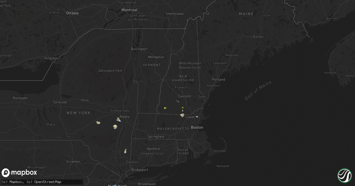
Hail Map in New Hampshire on August 13, 2025
Get this storm
August 13 map
$229
one time, instant access
Download today. No call, no setup
Keep the $229
Bought the map and want the full workflow? Apply the entire $229 to a subscription within 7 days. None of it is wasted.
Every map, not just this one
This buys you this map. Subscription and you get every map we run, in the markets you choose from a few cities to whole states to nationwide. Plus real-time alerts the moment a storm fires.
Contact data
Name, contact info, occupancy, even credit band for addresses in the footprint. You go from where it hit to who to call.
Become the source they trust
Unlimited branding weather history reports on demand. You already have the documented answer ready for the property owner, and you are the one who showed up with it.
Property data and RoofTrace estimates
Pull up any address you have got, its value and the exact code rules for that jurisdiction, straight from One Click Code. Then RoofTrace estimates the squares, pitch, and roof value, priced the way you price.
Storm reports in New Hampshire
New Hampshire
| Date | Description |
|---|---|
| 08/13/20256:40 PM CDT | Reported by amateur radio. |
| 08/13/20255:38 PM CDT | Observed at least 12 trees and numerous branches down across jaffrey following a severe storm. |
| 08/13/20255:18 PM CDT | Corrects the time of previous tstm wnd dmg report from jaffrey. Observed at least 12 trees and numerous branches down across jaffrey following a severe storm. |
| 08/13/20255:05 PM CDT | Emergency dispatch reported trees on wires along jaffrey rd |
| 08/13/20254:55 PM CDT | Observed hail on rt. 12 and lasted 7 to 8 minutes. Kestrel measured wind gust to 41 mph. |
| 08/13/20254:45 PM CDT | Large tree destroyed a garage on tinker rd before the fe everett parkway overpass. |
| 08/13/20254:38 PM CDT | Reports of numerous trees down north of town. Two trees partially blocking traffic on n. Main st. |
| 08/13/20254:30 PM CDT | Lar |
| 08/13/20254:30 PM CDT | Large tree down on top of crushed car. |
| 08/13/20254:25 PM CDT | Tree down on wires and second tree down on car on carter road. |
| 08/13/20254:10 PM CDT | Tree down on hunt street. |
| 08/13/20254:10 PM CDT | Tree down on ash street. |
| 08/13/20254:10 PM CDT | Tree down on highland street. |
| 08/13/20254:08 PM CDT | Hail fell for 5 to 6 minutes and gusty winds knocked down some large branches. Time estimated by radar. |
| 08/13/20254:00 PM CDT | Tree down blocking pepperell road. |
| 08/13/20254:00 PM CDT | Tree and wires down blocking west hollis rd. |
| 08/13/20253:44 PM CDT | Tree down on lawrence lane near junction of worcester road. |
| 08/13/20253:44 PM CDT | Wires down. |
All States Impacted by Hail Map on August 13, 2025
Cities Impacted by Hail Map on August 13, 2025
- Wolf Point, MT
- Selby, SD
- Gettysburg, SD
- Eagle Butte, SD
- Akaska, SD
- Java, SD
- Bowdle, SD
- Voorheesville, NY
- East Berne, NY
- Clarksville, NY
- Ravena, NY
- Selkirk, NY
- Feura Bush, NY
- Coeymans Hollow, NY
- Oak Hill, NY
- East Durham, NY
- Greenville, NY
- Jefferson, NY
- Harpersfield, NY
- Cornwallville, NY
- Westerlo, NY
- Delmar, NY
- Davenport, NY
- Freehold, NY
- Alcove, NY
- Schenevus, NY
- Worcester, NY
- Cairo, NY
- Acra, NY
- Woodland, MS
- Round Top, NY
- Houston, MS
- West Point, MS
- Lampasas, TX
- San Saba, TX
- Arlington, VT
- East Arlington, VT
- Manchester Center, VT
- Lititz, PA
- Hot Springs National Park, AR
- Maben, MS
- Parkersburg, WV
- Manchester, VT
- Gandeeville, WV
- Malvern, AR
- Mineral Wells, WV
- Manheim, PA
- Gorman, TX
- Danville, AR
- Silver Springs, FL
- Lagrangeville, NY
- Dexter, MO
- Buffalo, WY
- Gillette, WY
- Rozet, WY
- Imboden, AR
- Verbank, NY
- Lancaster, PA
- Hopewell Junction, NY
- Moorcroft, WY
- Weston, WY
- Hartman, AR
- Coal Hill, AR
- Clarksville, AR
- Ravenden, AR
- Roland, OK
- Pleasant Valley, NY
- Millbrook, NY
- Hastings, FL
- Muldrow, OK
- Poteau, OK
- Townsend, MA
- Pepperell, MA
- Bird In Hand, PA
- Leola, PA
- Daytona Beach, FL
- Kent, CT
- New Preston Marble Dale, CT
- Groton, MA
- Shirley, MA
- Fort McCoy, FL
- Belle Glade, FL
- Wynne, AR
- Sikeston, MO
- Brookline, NH
- Devils Tower, WY
- Kaycee, WY
- Midwest, WY
- Casper, WY
- Sundance, WY
- Patton, MO
- Sedgewickville, MO
- Howe, OK
- Hollis, NH
- Dunstable, MA
- Malta, ID
- Laurel, MS
- Ellisville, MS
- Jonesboro, AR
- Upton, WY
- Hulett, WY
- Alva, WY
- Beulah, WY
- Aladdin, WY
- Osage, WY
- Newcastle, WY
- Clermont, FL
- White Marsh, MD
- Perry Hall, MD
- Sedona, AZ
- Jacksonville, FL
- Amherst, NH
- Merrimack, NH
- Bedford, NH
- Hill City, SD
- Lead, SD
- Spearfish, SD
- Belle Fourche, SD
- Wiergate, TX
- Weare, NH
- Hillsborough, NH
- Fredericksburg, TX
- Hilliard, FL
- Callahan, FL
- Kingsville, MD
- Folkston, GA
- Stonewall, TX
- Upper Falls, MD
- Custer, SD
- Lance Creek, WY
- Edgemont, SD
- Florien, LA
- Boerne, TX
- Deadwood, SD
- Conde, SD
- Groton, SD
- Como, MS
- Sarah, MS
- Senatobia, MS
- Coldwater, MS
- Hornbeck, LA
- Lake, MS
- Hot Springs, SD
- Bonneau, SC
- Lumberton, MS
- Buffalo, SD
- Pringle, SD
- Brooklyn, MS
- Wiggins, MS
- Nisland, SD
- Vale, SD
- Newell, SD
- Saint Onge, SD
- Piedmont, SD
- Box Elder, SD
- Rapid City, SD
- Nemo, SD
- Black Hawk, SD
- Keystone, SD
- Hermosa, SD
- Buffalo Gap, SD
- Fairburn, SD
- Caputa, SD
- Ellsworth Afb, SD
- Stigler, OK
- Quinton, OK
- Andover, SD
- Oral, SD
- Wister, OK
- Boxford, MA
- Middleton, MA
- North Andover, MA
- New Underwood, SD
- Mud Butte, SD
- Union Center, SD
- Sturgis, SD
- Bristol, SD
- Jonesboro, LA
- Chatham, LA
- Fort Stewart, GA
- Longwood, FL
- Enning, SD
- Owanka, SD
- Wasta, SD
- Howes, SD
- White Owl, SD
- Draper, SD
- Ludlow, SD
- Bloomingdale, GA
- Reva, SD
- Oelrichs, SD
- Altamonte Springs, FL
- Casselberry, FL
- Maitland, FL
- Pine Ridge, SD
- Chadron, NE
- Swanzey, NH
- Ralph, SD
- McHenry, MS
- Guyton, GA
- Rushville, NE
- Hay Springs, NE
- Stamford, NY
- Manderson, SD
- Wounded Knee, SD
- Batesland, SD
- Porcupine, SD
- Hillside, NJ
- Linden, NJ
- Elizabethport, NJ
- Elizabeth, NJ
- Roselle, NJ
- Staten Island, NY
- Bayonne, NJ
- Newark, NJ
- Jersey City, NJ
- Kearny, NJ
- Wallace, SD
- Bradley, SD
- Gordon, NE
- Martin, SD
- Merriman, NE
- Winner, SD
- Coila, MS
- Wanblee, SD
- Ideal, SD
- Allen, SD
- Vivian, SD
- Florence, SD
- Tuthill, SD
- Norris, SD
- Wood, SD
- Presho, SD
- Bingham, NE
- Henry, SD
- Alliance, NE
- Webster, SD
- White River, SD
- Ellsworth, NE
- Lemmon, SD
- Saint Francis, SD
- Cody, NE
- Sandy Hook, MS
- Angie, LA
- Ashby, NE
- Nenzel, NE
- Kilgore, NE
- Valentine, NE
- Mission, SD
- Crookston, NE
- Parmelee, SD
- Rosebud, SD
- Witten, SD
- Okreek, SD
- Murdo, SD
- Blunt, SD
- Harrold, SD
- Springview, NE
- Mills, NE
- Colome, SD
- Gregory, SD
- Dallas, SD
- Pierpont, SD
- Highmore, SD
- Claremont, SD
- Burke, SD
- Holabird, SD
- Roslyn, SD
- Whitman, NE
- Lake City, SD
- Forman, ND
- Langford, SD
- Britton, SD
- Amherst, SD
- Long Pine, NE
- Chamberlain, SD
- Naper, NE
- Raleigh, MS
- Cogswell, ND
- Hecla, SD
- Colfax, LA
- Oakes, ND
- Atkinson, NE
- Herrick, SD
- Saint Charles, SD
- Bonesteel, SD
- Keene, NH
- Marlborough, NH
- Amelia, NE
- Chambers, NE
- Stuart, NE
- Fort Ransom, ND
- Montpelier, ND
- Ypsilanti, ND
- Ellendale, ND
- Burwell, NE
- Ewing, NE
- Petersburg, NE
- Albion, NE
- Primrose, NE
- Grenville, SD
- Cedar Rapids, NE
- Wessington Springs, SD
- Woonsocket, SD


