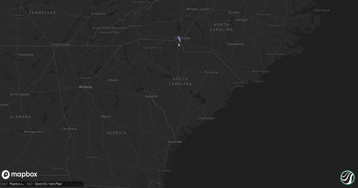
Hail Map in South Carolina on August 12, 2022
Get this storm
August 12 map
$229
one time, instant access
Download today. No call, no setup
Keep the $229
Bought the map and want the full workflow? Apply the entire $229 to a subscription within 7 days. None of it is wasted.
Every map, not just this one
This buys you this map. Subscription and you get every map we run, in the markets you choose from a few cities to whole states to nationwide. Plus real-time alerts the moment a storm fires.
Contact data
Name, contact info, occupancy, even credit band for addresses in the footprint. You go from where it hit to who to call.
Become the source they trust
Unlimited branding weather history reports on demand. You already have the documented answer ready for the property owner, and you are the one who showed up with it.
Property data and RoofTrace estimates
Pull up any address you have got, its value and the exact code rules for that jurisdiction, straight from One Click Code. Then RoofTrace estimates the squares, pitch, and roof value, priced the way you price.
Storm reports in South Carolina
South Carolina
| Date | Description |
|---|---|
| 08/12/20225:45 PM CDT | 911 call center reported power lines and trees down in multiple areas... Especially around tom hall st. |
| 08/12/20225:00 PM CDT | Emergency management reported powerlines and trees down near innsbruck ct and boulder rd. |
| 08/12/20223:24 PM CDT | The south carolina highway patrol reported a tree down due to thunderstorm outflow near the intersection of mewville road and combahee road. |
| 08/12/20221:44 PM CDT | The south carolina highway patrol reported a tree down due to thunderstorm outflow near the intersection of buelah road and lodge highway. |
| 08/12/20221:45 AM CDT | At 644 PM EDT, a severe thunderstorm was located near Fort Mill, or near Indian Land, moving south at 30 mph. HAZARD...60 mph wind gusts and quarter size hail. SOURCE...Radar indicated. IMPACT...Hail damage to vehicles is expected. Expect wind damage to trees and powerlines. Locations impacted include... Lancaster, Elgin, Heath Springs, Andrew Jackson State Park, USC Lancaster, Van Wyck, Irwin, Arrowood Estates, Bell Town Fire Station, Camp Creek Fire Station, Antioch, Kirk Air Base, Faith Christian School, Pleasant Hill, Unity Fire Station, Lancaster Mill, McWhirter Airfield, Bear Creek Park and McDonald Green Elementary School. |
| 08/12/20221:40 AM CDT | At 640 PM EDT, a severe thunderstorm was located 4 miles southwest of Indian Land, moving south at 30 mph. HAZARD...60 mph wind gusts. SOURCE...Radar indicated. IMPACT...Expect damage to trees and power lines. Locations impacted include... Lesslie, Great Falls, Marvin, Fort Lawn, Catawba, Jaars, Carolina Commons Shopping Center, Fishing Creek Reservoir, Rock Hill and Edgemoor. |
| 08/12/20221:15 AM CDT | At 615 PM EDT, a severe thunderstorm was located over Southwest Charlotte, or near Uptown Charlotte, moving south at 35 mph. HAZARD...60 mph wind gusts. SOURCE...Radar indicated. IMPACT...Expect damage to trees and powerlines. Locations impacted include... Indian Land, Carolina Commons Shopping Center and Community of Almond Glen. |
| 08/12/20221:12 AM CDT | At 612 PM EDT, a severe thunderstorm was located 6 miles southwest of Uptown Charlotte, or near Southwest Charlotte, moving south at 25 mph. HAZARD...60 mph wind gusts and penny size hail. SOURCE...Radar indicated. IMPACT...Expect damage to trees and power lines. Locations impacted include... Uptown Charlotte, Central Charlotte, South Charlotte, Southwest Charlotte, Weddington, Fort Mill, Pineville, Tega Cay, Wesley Chapel and Lesslie. |
| 08/12/202212:43 AM CDT | At 542 PM EDT, a severe thunderstorm was located 8 miles southwest of Huntersville, or 4 miles northeast of Mt Holly, moving southeast at 25 mph. HAZARD...60 mph wind gusts and penny size hail. SOURCE...Radar indicated. IMPACT...Expect damage to trees and power lines. Locations impacted include... Uptown Charlotte, Central Charlotte, Northeast Charlotte, Southwest Charlotte, East Charlotte, Northwest Charlotte, Mt Holly, Belmont, Stanley and Cramerton. |
All States Impacted by Hail Map on August 12, 2022
Cities Impacted by Hail Map on August 12, 2022
- Heart Butte, MT
- Craigmont, ID
- Cottonwood, ID
- Harrington, WA
- Oneill, NE
- Emmet, NE
- Lind, WA
- Ogden, UT
- Ritzville, WA
- Wickenburg, AZ
- Oroville, WA
- Trout Creek, MT
- Thompson Falls, MT
- Canton, MN
- Mabel, MN
- Dorchester, IA
- Decorah, IA
- Spring Grove, MN
- Mountain Home, ID
- Bruneau, ID
- Murphy, ID
- Judith Gap, MT
- Shawmut, MT
- Pendroy, MT
- Florence, AZ
- Garden Valley, ID
- Mccall, ID
- Cascade, ID
- Sedona, AZ
- Elma, IA
- Riceville, IA
- Verdigre, NE
- Imnaha, OR
- Lima, MT
- Halfway, OR
- Council, ID
- Oxbow, OR
- Cascade, MT
- Niobrara, NE
- Cambridge, ID
- Philipsburg, MT
- Fort Mill, SC
- Connell, WA
- Elk City, ID
- Rosalia, WA
- Spangle, WA
- Tucson, AZ
- Humboldt, AZ
- Dewey, AZ
- Scottsdale, AZ
- Bosler, WY
- Grand View, ID
- Sanford, FL
- Lake Mary, FL
- Paradise Valley, AZ
- Boise, ID
- Indian Valley, ID
- Lucile, ID
- Riggins, ID
- Loring, MT
- Bingham Canyon, UT
- West Jordan, UT
- Whitewater, MT
- Stuart, NE
- Mesa, AZ
- Mountain Home Afb, ID
- Atkinson, NE
- Fountain Hills, AZ
- Fort Mcdowell, AZ
- Phoenix, AZ
- Sells, AZ
- Shiner, TX
- Enterprise, OR
- Mesa, ID
- Superior, AZ
- Maricopa, AZ
- Tonopah, AZ
- Queen Creek, AZ
- Louise, TX
- Apache Junction, AZ
- Lynch, NE
- King Hill, ID
- Yellow Pine, ID
- Fairfield, WA
- Charlotte, NC


