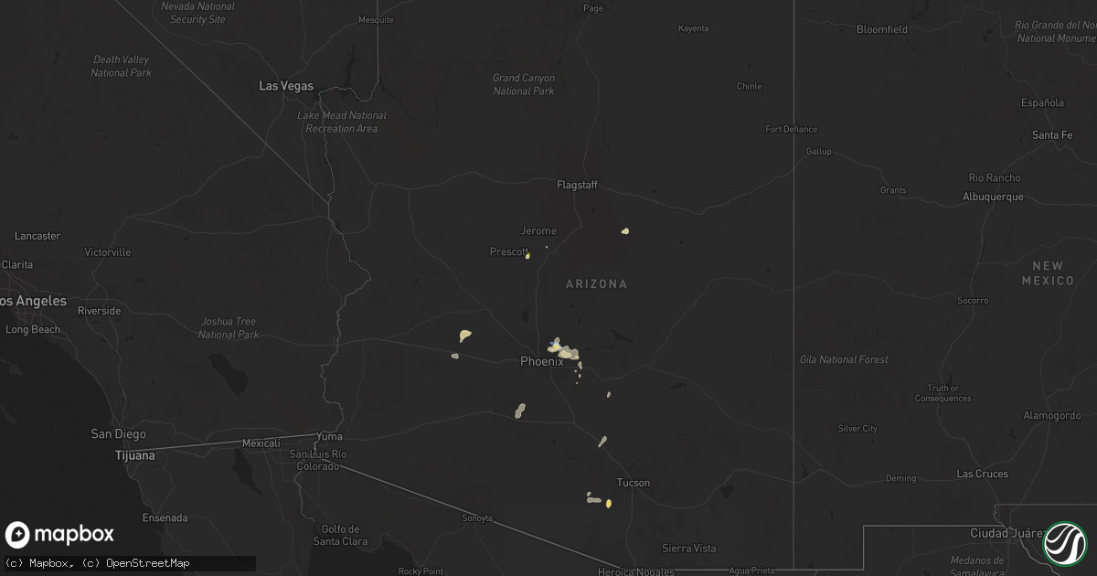
Hail Map in Arizona on August 12, 2022
Get this storm
August 12 map
$229
one time, instant access
Download today. No call, no setup
Keep the $229
Bought the map and want the full workflow? Apply the entire $229 to a subscription within 7 days. None of it is wasted.
Every map, not just this one
This buys you this map. Subscription and you get every map we run, in the markets you choose from a few cities to whole states to nationwide. Plus real-time alerts the moment a storm fires.
Contact data
Name, contact info, occupancy, even credit band for addresses in the footprint. You go from where it hit to who to call.
Become the source they trust
Unlimited branding weather history reports on demand. You already have the documented answer ready for the property owner, and you are the one who showed up with it.
Property data and RoofTrace estimates
Pull up any address you have got, its value and the exact code rules for that jurisdiction, straight from One Click Code. Then RoofTrace estimates the squares, pitch, and roof value, priced the way you price.
Storm reports in Arizona
Arizona
| Date | Description |
|---|---|
| 08/12/20226:40 PM CDT | Power line |
| 08/12/20226:00 PM CDT | Metal power poles blown over trapping 18 vehicles. |
| 08/12/20225:40 PM CDT | Quarter size hail... Timing estimated from radar. |
| 08/12/20225:37 PM CDT | Measured at ksdl... Scottsdale municipal airport. |
| 08/12/20225:22 PM CDT | Power lines down in area. |
| 08/12/20225:05 PM CDT | Corrects previous tstm wnd dmg report from 6 n east mesa. Power lines down in area. |
| 08/12/20224:45 PM CDT | Power lines down in area. |
| 08/12/20222:00 PM CDT | Severe thunderstorm produced 1 inch hail... Heavy rain... And gusty winds peaking at roughly 25 kts. |
| 08/12/20227:36 AM CDT | At 1235 PM MST, a severe thunderstorm was located 9 miles northeast of Starlight Pines, or 25 miles southwest of Winslow, and is nearly stationary. HAZARD...Half dollar size hail. SOURCE...Radar indicated. IMPACT...Damage to vehicles is expected. This severe thunderstorm will remain over mainly rural areas of Coconino County. |
| 08/12/20227:02 AM CDT | At 1201 PM MST, a severe thunderstorm was located 11 miles southeast of Desert View at Grand Canyon, and is nearly stationary. HAZARD...Quarter size hail wind gust up to 40 mph. SOURCE...Radar indicated. IMPACT...Damage to vehicles is expected. This severe thunderstorm will remain over mainly rural areas of Coconino County. |
| 08/12/20226:54 AM CDT | At 1153 AM MST, a severe thunderstorm was located over Dewey-humboldt, or 8 miles southeast of Prescott Valley, and is nearly stationary. HAZARD...60 mph wind gusts and quarter size hail. SOURCE...Radar indicated. IMPACT...Hail damage to vehicles is expected. Expect wind damage to roofs, siding, and trees. Locations impacted include... Dewey-humboldt. |
| 08/12/20226:53 AM CDT | At 1153 AM MST, a severe thunderstorm was located near Three Points, or 19 miles northwest of Green Valley, moving west at 15 mph. HAZARD...60 mph wind gusts and quarter size hail. SOURCE...Radar indicated. IMPACT...Hail damage to vehicles is expected. Expect wind damage to roofs, siding, and trees. Locations impacted include... Three Points. |
| 08/12/20226:51 AM CDT | At 1151 AM MST, a severe thunderstorm was located near Big Horn, or 19 miles southeast of Gila Bend, and is nearly stationary. HAZARD...60 mph wind gusts. SOURCE...Radar indicated. IMPACT...Expect damage to roofs, siding, and trees. Locations impacted include... Estrella, Freeman and Big Horn. This includes the following highways...AZ Interstate 8 between mile markers 128 and 160.AZ Route 238 between mile markers 15 and 24.AZ Route 347 between mile markers 161 and 165. |
| 08/12/20226:39 AM CDT | At 1139 AM MST, a severe thunderstorm was located over Kitt Peak, or 18 miles east of Sells, moving northwest at 5 mph. HAZARD...60 mph wind gusts and nickel size hail. SOURCE...Radar indicated. IMPACT...Expect damage to roofs, siding, and trees. Locations impacted include... San Isidro, Kitt Peak, Fresnal Canyon and Pan Tak. |
| 08/12/20221:41 AM CDT | At 640 PM MST, a severe thunderstorm was located just southeast of Ash Fork, or 27 miles north of Chino Valley, moving south at 10 mph. HAZARD...60 mph wind gusts and half dollar size hail. SOURCE...Radar indicated. IMPACT...Hail damage to vehicles is expected. Expect wind damage to roofs, siding, and trees. This severe thunderstorm will remain over mainly rural areas of Coconino and Yavapai Counties but includes Highway 89 from near Ash Fork south 10 miles. |
| 08/12/202212:30 AM CDT | At 530 PM MST, a severe thunderstorm was located over Tacna, or 26 miles east of Fortuna Foothills, moving north at 5 mph. HAZARD...60 mph wind gusts and penny size hail. SOURCE...Radar indicated. IMPACT...Expect damage to roofs, siding, and trees. Locations impacted include... Tacna, Tyson and Roll. This includes AZ Interstate 8 between mile markers 34 and 48. |
| 08/12/202212:10 AM CDT | At 509 PM MST, a severe thunderstorm was located 16 miles north of Tonopah, moving north at 5 mph. HAZARD...60 mph wind gusts and quarter size hail. SOURCE...Radar indicated. IMPACT...Hail damage to vehicles is expected. Expect wind damage to roofs, siding, and trees. This severe thunderstorm will remain over mainly rural areas of Maricopa County. |
| 08/12/202212:02 AM CDT | At 502 PM MST, a severe thunderstorm was located over Gladden, or 31 miles southeast of Alamo Lake, and is nearly stationary. HAZARD...60 mph wind gusts and penny size hail. SOURCE...Radar indicated. IMPACT...Expect damage to roofs, siding, and trees. Locations impacted include... Wenden, Gladden and Salome. This includes US Highway 60 between mile markers 58 and 81. |
| 08/11/202211:26 PM CDT | At 426 PM MST, a severe thunderstorm was located 11 miles west of Tonopah, moving northwest at 5 mph. HAZARD...60 mph wind gusts and nickel size hail. SOURCE...Radar indicated. IMPACT...Expect damage to roofs, siding, and trees. This severe thunderstorm will remain over mainly rural areas of eastern La Paz and Maricopa Counties.This includes AZ Interstate 10 between mile markers 71 and 92. |
| 08/11/202210:37 PM CDT | At 337 PM MST, severe thunderstorms were located along a line extending from near Scottsdale Airport to near Salt River Indian Community, and are nearly stationary. HAZARD...60 mph wind gusts and quarter size hail. SOURCE...Radar indicated. IMPACT...Hail damage to vehicles is expected. Expect wind damage to roofs, siding, and trees. Locations impacted include... Phoenix, Mesa, Scottsdale, Fountain Hills, Paradise Valley, New River, Cave Creek, Carefree, Piestewa Peak Park, Deer Valley Airport, Granite Reef Dam, Salt River Indian Community, North Mountain Park, Downtown Scottsdale and Scottsdale Airport.This includes the following highways...AZ Interstate 17 between mile markers 214 and 230.AZ Route 51 between mile markers 6 and 15.AZ Route 87 between mile markers 176 and 189. |
| 08/11/202210:18 PM CDT | At 318 PM MST, severe thunderstorms were located along a line extending from Paradise Valley to Salt River Indian Community to Downtown Mesa, moving west at 35 mph. HAZARD...60 mph wind gusts. SOURCE...Radar indicated. IMPACT...Expect damage to roofs, siding, and trees. Locations impacted include... Phoenix, Mesa, Chandler, Glendale, Scottsdale, Gilbert, Tempe, Avondale, Paradise Valley, Tolleson, Laveen, Cashion, Litchfield Park, Tempe Marketplace and Papago Park.This includes the following highways...AZ Interstate 10 between mile markers 129 and 160.AZ Interstate 17 between mile markers 195 and 207.AZ Route 51 between mile markers 1 and 8. |
| 08/11/202210:03 PM CDT | At 303 PM MST, severe thunderstorms were located along a line extending from near Fountain Hills to Granite Reef Dam to near East Mesa, and are nearly stationary. HAZARD...60 mph wind gusts and penny size hail. SOURCE...Radar indicated. IMPACT...Expect damage to roofs, siding, and trees. Locations impacted include... Mesa, Scottsdale, Gilbert, Apache Junction, Fountain Hills, East Mesa, Granite Reef Dam, Falcon Field Airport, McDowell Mountain Park, Usery Mountain Park, Superstition Springs Mall, Goldfield Ranch, Salt River Tubing Recreation Area and Fort McDowell.This includes the following highways...US Highway 60 between mile markers 184 and 192.AZ Route 87 between mile markers 180 and 196.AZ Route 202 between mile markers 15 and 31. |
| 08/11/20229:50 PM CDT | At 250 PM MST, a severe thunderstorm was located 12 miles west of Hilltop, or 14 miles northeast of Globe, moving northwest at 5 mph. HAZARD...60 mph wind gusts and nickel size hail. SOURCE...Radar indicated. IMPACT...Expect damage to roofs, siding, and trees. Locations impacted include... San Carlos.This includes the following highways...US Highway 60 between mile markers 255 and 281.AZ Route 70 between mile markers 261 and 271. |
| 08/11/20229:48 PM CDT | At 248 PM MST, a severe thunderstorm was located 15 miles northeast of Ajo, moving northwest at 10 mph. HAZARD...60 mph wind gusts and penny size hail. SOURCE...Radar indicated. IMPACT...Expect damage to roofs, siding, and trees. This severe thunderstorm will remain over mainly rural areas of Maricopa County.This includes AZ Route 85 between mile markers 13 and 32. |
| 08/11/20229:36 PM CDT | At 236 PM MST, a severe thunderstorm was located near Phoenix Mesa Gateway Airport, or 7 miles southwest of Apache Junction, moving northwest at 5 mph. HAZARD...60 mph wind gusts and penny size hail. SOURCE...Radar indicated. IMPACT...Expect damage to roofs, siding, and trees. Locations impacted include... Mesa, Chandler, Gilbert, Apache Junction, Queen Creek, Chandler Heights, Gilbert City Hall, Chandler City Hall, San Tan Village Mall, San Tan Valley, Seville, Phoenix Mesa Gateway Airport, San Tan Mountain Park, Superstition Springs Mall and Gold Camp.This includes the following highways...US Highway 60 between mile markers 188 and 196.AZ Route 87 near mile marker 166.AZ Route 202 between mile markers 29 and 47. |
| 08/11/20229:31 PM CDT | At 231 PM MST, a severe thunderstorm was located near Hickiwan, or 22 miles east of Ajo, moving west at 15 mph. HAZARD...60 mph wind gusts and quarter size hail. SOURCE...Radar indicated. IMPACT...Hail damage to vehicles is expected. Expect wind damage to roofs, siding, and trees. Locations impacted include... Hickiwan and Vaya Chin. |
| 08/11/20229:11 PM CDT | At 211 PM MST, a severe thunderstorm was located near Canyon Lake, or 13 miles north of Gold Canyon, and is nearly stationary. HAZARD...60 mph wind gusts and penny size hail. SOURCE...Radar indicated. IMPACT...Expect damage to roofs, siding, and trees. Locations impacted include... Sugarloaf Mountain, Saguaro Lake, Canyon Lake and Tortilla Flat. This includes AZ Route 87 between mile markers 197 and 208. |
| 08/11/20229:03 PM CDT | At 203 PM MST, a severe thunderstorm was located over Queen Valley, or 7 miles southeast of Gold Canyon, and is nearly stationary. HAZARD...60 mph wind gusts and penny size hail. SOURCE...Radar indicated. IMPACT...Expect damage to roofs, siding, and trees. Locations impacted include... Apache Junction, Gold Canyon, Florence Junction, Queen Valley, Superstition Mountains, Gold Camp, Kings Ranch, Lost Dutchman State Park and Goldfield.This includes the following highways...US Highway 60 between mile markers 195 and 219.AZ Route 79 between mile markers 148 and 150. |
| 08/11/20228:56 PM CDT | At 156 PM MST, a severe thunderstorm was located over Arizola, or over Casa Grande, and is nearly stationary. HAZARD...60 mph wind gusts and nickel size hail. SOURCE...Radar indicated. IMPACT...Expect damage to roofs, siding, and trees. Locations impacted include... Casa Grande and Arizola. This includes the following highways...AZ Interstate 10 between mile markers 188 and 200.AZ Interstate 8 between mile markers 173 and 178. |
| 08/11/20228:55 PM CDT | At 155 PM MST, a severe thunderstorm was located near Florence, and is nearly stationary. HAZARD...60 mph wind gusts and penny size hail. SOURCE...Radar indicated. IMPACT...Expect damage to roofs, siding, and trees. Locations impacted include... Florence.This includes AZ Route 79 between mile markers 133 and 143. |
| 08/11/20228:53 PM CDT | At 152 PM MST, a severe thunderstorm was located near Camp Creek, or 13 miles west of Sycamore Creek, and is nearly stationary. HAZARD...60 mph wind gusts, penny size hail, and accumulating hail. SOURCE...Radar indicated. IMPACT...Expect damage to roofs, siding, and trees. Locations impacted include... Camp Creek and Horseshoe Reservoir. |
| 08/11/20228:45 PM CDT | At 144 PM PDT/144 PM MST/, a line of severe thunderstorms was located 9 miles west of Temple Bar Campground, or 20 miles east of Boulder City, moving north at 10 mph. HAZARD...40-50 mph gusts at Lake Mead resulting in high crests and hazardous boating conditions. SOURCE...Radar indicated. IMPACT...Expect damage to roofs and trees as well as to small craft. Hazardous boating conditions expected. Locations impacted include... Boulder Beach, Callville Bay Campground, Lake Mead National Recreation Area, Temple Bar Campground, Boulder Beach Campground, Callville Bay, South Cove, Meadview, Hoover Dam and Temple Bar. |
| 08/11/20228:38 PM CDT | At 138 PM MST, a severe thunderstorm was located over Chui-Chu, or 12 miles south of Casa Grande, and is nearly stationary. HAZARD...60 mph wind gusts. SOURCE...Radar indicated. IMPACT...Expect damage to roofs, siding, and trees. Locations impacted include... Casa Grande, Arizona City, Arizola and Toltec. This includes the following highways...AZ Interstate 10 between mile markers 197 and 204.AZ Interstate 8 between mile markers 156 and 178. |
| 08/11/20228:28 PM CDT | At 127 PM MST, a severe thunderstorm was located near Picacho Peak State Park, or 20 miles northwest of Marana, moving northwest at 5 mph. HAZARD...60 mph wind gusts and nickel size hail. SOURCE...Radar indicated. IMPACT...Expect damage to roofs, siding, and trees. Locations impacted include... Eloy, Picacho, Picacho Peak State Park and Red Rock. |
All States Impacted by Hail Map on August 12, 2022
Cities Impacted by Hail Map on August 12, 2022
- Heart Butte, MT
- Craigmont, ID
- Cottonwood, ID
- Harrington, WA
- Oneill, NE
- Emmet, NE
- Lind, WA
- Ogden, UT
- Ritzville, WA
- Wickenburg, AZ
- Oroville, WA
- Trout Creek, MT
- Thompson Falls, MT
- Canton, MN
- Mabel, MN
- Dorchester, IA
- Decorah, IA
- Spring Grove, MN
- Mountain Home, ID
- Bruneau, ID
- Murphy, ID
- Judith Gap, MT
- Shawmut, MT
- Pendroy, MT
- Florence, AZ
- Garden Valley, ID
- Mccall, ID
- Cascade, ID
- Sedona, AZ
- Elma, IA
- Riceville, IA
- Verdigre, NE
- Imnaha, OR
- Lima, MT
- Halfway, OR
- Council, ID
- Oxbow, OR
- Cascade, MT
- Niobrara, NE
- Cambridge, ID
- Philipsburg, MT
- Fort Mill, SC
- Connell, WA
- Elk City, ID
- Rosalia, WA
- Spangle, WA
- Tucson, AZ
- Humboldt, AZ
- Dewey, AZ
- Scottsdale, AZ
- Bosler, WY
- Grand View, ID
- Sanford, FL
- Lake Mary, FL
- Paradise Valley, AZ
- Boise, ID
- Indian Valley, ID
- Lucile, ID
- Riggins, ID
- Loring, MT
- Bingham Canyon, UT
- West Jordan, UT
- Whitewater, MT
- Stuart, NE
- Mesa, AZ
- Mountain Home Afb, ID
- Atkinson, NE
- Fountain Hills, AZ
- Fort Mcdowell, AZ
- Phoenix, AZ
- Sells, AZ
- Shiner, TX
- Enterprise, OR
- Mesa, ID
- Superior, AZ
- Maricopa, AZ
- Tonopah, AZ
- Queen Creek, AZ
- Louise, TX
- Apache Junction, AZ
- Lynch, NE
- King Hill, ID
- Yellow Pine, ID
- Fairfield, WA
- Charlotte, NC


