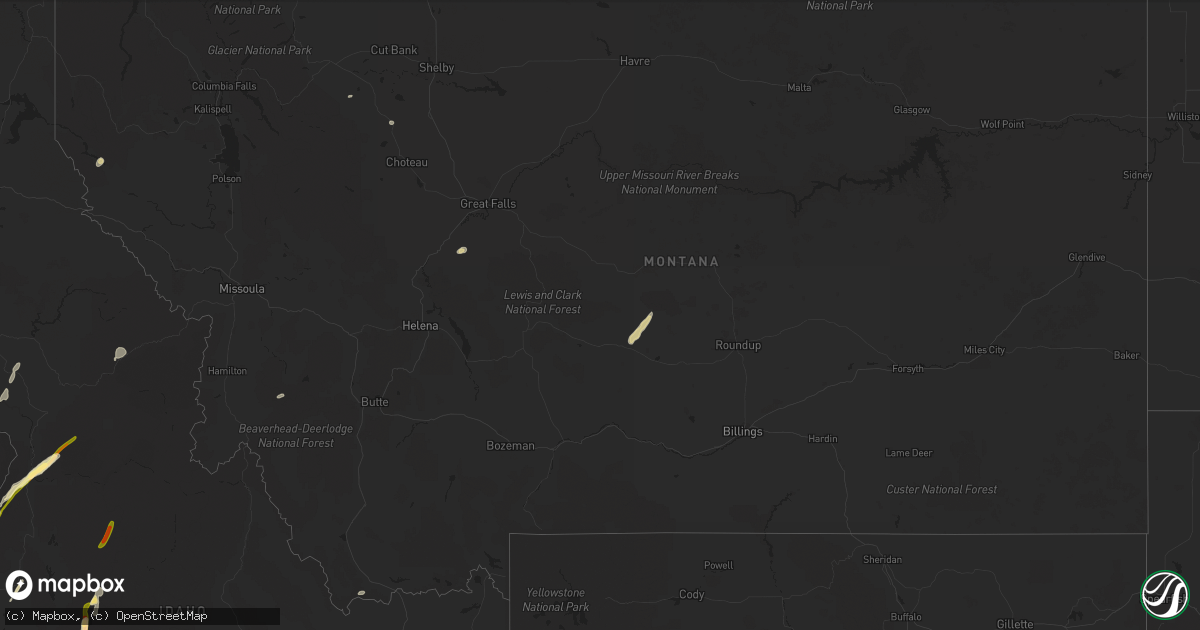
Hail Map in Montana on August 12, 2022
Get this storm
August 12 map
$229
one time, instant access
Download today. No call, no setup
Keep the $229
Bought the map and want the full workflow? Apply the entire $229 to a subscription within 7 days. None of it is wasted.
Every map, not just this one
This buys you this map. Subscription and you get every map we run, in the markets you choose from a few cities to whole states to nationwide. Plus real-time alerts the moment a storm fires.
Contact data
Name, contact info, occupancy, even credit band for addresses in the footprint. You go from where it hit to who to call.
Become the source they trust
Unlimited branding weather history reports on demand. You already have the documented answer ready for the property owner, and you are the one who showed up with it.
Property data and RoofTrace estimates
Pull up any address you have got, its value and the exact code rules for that jurisdiction, straight from One Click Code. Then RoofTrace estimates the squares, pitch, and roof value, priced the way you price.
Storm reports in Montana
Montana
| Date | Description |
|---|---|
| 08/12/20226:30 PM CDT | Winds are estimated to be from 60 to 70 mph. The time of the event was a guess by the observer. Station elevation: 2306 ft. |
| 08/12/20223:27 AM CDT | At 827 PM MDT, severe thunderstorms were located along a line extending from 22 miles northwest of Havre to 9 miles west of Beaver Creek, moving southeast at 40 mph. HAZARD...60 mph wind gusts. SOURCE...Radar indicated. IMPACT...Expect damage to roofs, siding, and trees. Locations impacted include... Havre, Chinook, Beaver Creek, Lohman, Kremlin and Cleveland. |
| 08/12/20222:36 AM CDT | At 736 PM MDT, severe thunderstorms were located along a line extending from 34 miles north of Gildford to 16 miles north of Inverness, moving east southeast at 35 mph. HAZARD...60 mph wind gusts. SOURCE...Radar indicated. IMPACT...Expect damage to roofs, siding, and trees. Locations impacted include... Havre, Azure, Beaver Creek, Gildford, Sangrey, Boneau, Agency, Parker School, Hingham, Rudyard, Laredo, Kremlin and Simpson. |
| 08/12/20222:13 AM CDT | At 713 PM MDT, severe thunderstorms were located along a line extending from 8 miles northeast of Fairfield to Cascade, moving northeast at 35 mph. HAZARD...60 mph wind gusts. SOURCE...Radar indicated. IMPACT...Expect damage to roofs, siding, and trees. Locations impacted include... Great Falls, Cascade, Dutton, Black Eagle, Fort Shaw, Fort Shaw, Power, Malmstrom Afb, Stockett, Tracy, Vaughn, First Peoples Buffalo Jump State Park, Centerville, Sun River, Ulm and Sand Coulee. |
| 08/12/20221:04 AM CDT | A local report indicates 58 MPH wind near 1 WNW INGOMAR |
| 08/12/202212:32 AM CDT | At 532 PM MDT, a severe thunderstorm was located near North Browning, or 24 miles west of Cut Bank, moving northeast at 25 mph. HAZARD...60 mph wind gusts and quarter size hail. SOURCE...Radar indicated. IMPACT...Hail damage to vehicles is expected. Expect wind damage to roofs, siding, and trees. Locations impacted include... North Browning and South Browning. |
| 08/12/202212:27 AM CDT | At 526 PM MDT, a severe thunderstorm was located over Port Of Morgan, or 20 miles northwest of Whitewater, moving southeast at 25 mph. HAZARD...60 mph wind gusts and quarter size hail. SOURCE...Radar indicated. IMPACT...Hail damage to vehicles is expected. Expect wind damage to roofs, siding, and trees. Locations impacted include... Whitewater, Loring and Port Of Morgan. |
| 08/11/202211:22 PM CDT | At 421 PM MDT, a severe thunderstorm was located 20 miles south of Philipsburg, or 23 miles west of Anaconda, moving northeast at 25 mph. HAZARD...60 mph wind gusts and quarter size hail. SOURCE...Radar indicated. IMPACT...Hail damage to vehicles is expected. Expect wind damage to roofs, siding, and trees. Locations impacted include... Georgetown and Porters Corner. |
| 08/11/202210:45 PM CDT | At 345 PM MDT, a severe thunderstorm was located 16 miles north of North Browning, or 27 miles northwest of Cut Bank, moving east at 15 mph. HAZARD...60 mph wind gusts and quarter size hail. SOURCE...Radar indicated. IMPACT...Hail damage to vehicles is expected. Expect wind damage to roofs, siding, and trees. This severe thunderstorm will remain over mainly rural areas of northeastern Glacier County. |
| 08/11/202210:31 PM CDT | At 330 PM MDT, a severe thunderstorm was located near Superior, moving northeast at 30 mph. HAZARD...60 mph wind gusts and quarter size hail. SOURCE...Radar indicated. IMPACT...Hail damage to vehicles is expected. Expect wind damage to roofs, siding, and trees. Locations impacted include... Camas Prairie and Perma. |
| 08/11/202210:26 PM CDT | At 326 PM MDT, a severe thunderstorm was located near Plains, or 13 miles north of Superior, moving northeast at 25 mph. HAZARD...60 mph wind gusts and nickel size hail. SOURCE...Radar indicated. IMPACT...Expect damage to roofs, siding, and trees. Locations impacted include... Plains, Paradise and Keystone. |
| 08/11/202210:16 PM CDT | At 316 PM MDT, a severe thunderstorm was located 16 miles southeast of Noxon, or 18 miles north of Thompson Falls, moving northeast at 45 mph. HAZARD...60 mph wind gusts and quarter size hail. SOURCE...Radar indicated. IMPACT...Hail damage to vehicles is expected. Expect wind damage to roofs, siding, and trees. Locations impacted include... White Pine, Trout Creek and Happys Inn. |
| 08/11/20229:40 PM CDT | At 240 PM MDT, a severe thunderstorm was located near De Borgia, or 18 miles south of Thompson Falls, moving northeast at 35 mph. HAZARD...60 mph wind gusts and quarter size hail. SOURCE...Radar indicated. IMPACT...Hail damage to vehicles is expected. Expect wind damage to roofs, siding, and trees. Locations impacted include... De Borgia, Haugan and St. Regis. |
| 08/11/20229:13 PM CDT | Corrected for site id. Site kmthavre60. |
| 08/11/20228:33 PM CDT | An ambient weather station measured a 70 mph gust. |
| 08/11/20228:30 PM CDT | Mesonet station fw1664 hingham. |
| 08/11/20228:30 PM CDT | Estimated a minimum wind gust of 70 mph. Time was approximated by spotter. |
| 08/11/20228:15 PM CDT | Mesonet station mtm76 cascade e mda. |
| 08/11/20228:15 PM CDT | Reported via facebook. Tree limb knocked down west of the town of vaughn. 6 to 8 inch diameter limb... Estimated from image. |
| 08/11/20227:37 PM CDT | Ambient sensor measured a 59 mph gust. |
| 08/11/20227:20 PM CDT | Mesonet station mtsbn sieben flats - mdt. |
All States Impacted by Hail Map on August 12, 2022
Cities Impacted by Hail Map on August 12, 2022
- Heart Butte, MT
- Craigmont, ID
- Cottonwood, ID
- Harrington, WA
- Oneill, NE
- Emmet, NE
- Lind, WA
- Ogden, UT
- Ritzville, WA
- Wickenburg, AZ
- Oroville, WA
- Trout Creek, MT
- Thompson Falls, MT
- Canton, MN
- Mabel, MN
- Dorchester, IA
- Decorah, IA
- Spring Grove, MN
- Mountain Home, ID
- Bruneau, ID
- Murphy, ID
- Judith Gap, MT
- Shawmut, MT
- Pendroy, MT
- Florence, AZ
- Garden Valley, ID
- Mccall, ID
- Cascade, ID
- Sedona, AZ
- Elma, IA
- Riceville, IA
- Verdigre, NE
- Imnaha, OR
- Lima, MT
- Halfway, OR
- Council, ID
- Oxbow, OR
- Cascade, MT
- Niobrara, NE
- Cambridge, ID
- Philipsburg, MT
- Fort Mill, SC
- Connell, WA
- Elk City, ID
- Rosalia, WA
- Spangle, WA
- Tucson, AZ
- Humboldt, AZ
- Dewey, AZ
- Scottsdale, AZ
- Bosler, WY
- Grand View, ID
- Sanford, FL
- Lake Mary, FL
- Paradise Valley, AZ
- Boise, ID
- Indian Valley, ID
- Lucile, ID
- Riggins, ID
- Loring, MT
- Bingham Canyon, UT
- West Jordan, UT
- Whitewater, MT
- Stuart, NE
- Mesa, AZ
- Mountain Home Afb, ID
- Atkinson, NE
- Fountain Hills, AZ
- Fort Mcdowell, AZ
- Phoenix, AZ
- Sells, AZ
- Shiner, TX
- Enterprise, OR
- Mesa, ID
- Superior, AZ
- Maricopa, AZ
- Tonopah, AZ
- Queen Creek, AZ
- Louise, TX
- Apache Junction, AZ
- Lynch, NE
- King Hill, ID
- Yellow Pine, ID
- Fairfield, WA
- Charlotte, NC


