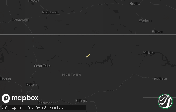
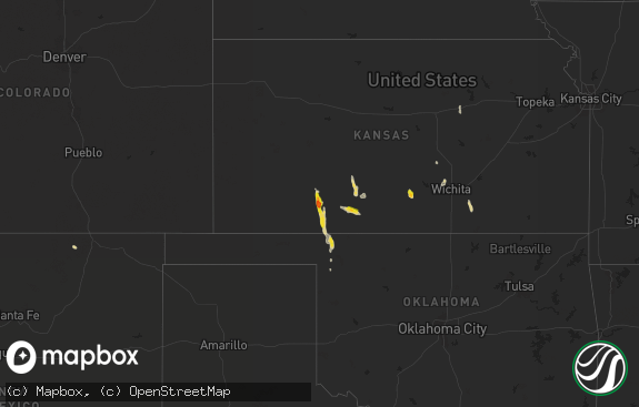
Hail Map in North Dakota on August 10, 2019
The weather event in North Dakota on August 10, 2019 includes Hail, Wind, and Tornado maps. 22 states and 401 cities were impacted and suffered possible damage. The total estimated number of properties impacted is 1,303.

Hail
Wind
Tornado
1,303
Estimated number of impacted properties by a 1.00" hail or larger0
Estimated number of impacted properties by a 1.75" hail or larger0
Estimated number of impacted properties by a 2.50" hail or largerStorm reports in North Dakota
North Dakota
| Date | Description |
|---|---|
| 08/10/20193:24 PM CDT | Raws mesonet station tt584 williams lookout. Time estimated via radar. |
| 08/10/20193:05 PM CDT | A local report indicates 1.00 inch wind near 14 N BURT |
| 08/10/20192:50 PM CDT | Hail was accompanied by 50 mph winds... Resulting in extensive crop and garden damage. |
| 08/10/20192:44 PM CDT | Time estimated from radar. |
| 08/10/20192:06 PM CDT | 0.50 inches of total rainfall along with quarter sized hail. |
| 08/10/20199:51 AM CDT | Lots of pea to dime size hail and heavy rain. Largest hail stone was the size of a quarter. |
| 08/10/20194:51 AM CDT | At 951 AM CDT, a severe thunderstorm was located near Lostwood, or 6 miles north of Stanley, moving east at 20 mph. HAZARD...60 mph wind gusts and half dollar size hail. SOURCE...Radar indicated. IMPACT...Hail damage to vehicles is expected. Expect wind damage to roofs, siding, and trees. This severe thunderstorm will be near... Palermo around 1015 AM CDT. |
| 08/10/20193:48 AM CDT | At 847 AM CDT, severe thunderstorms were located along a line extending from 7 miles north of Noonan to 8 miles northwest of Battleview, moving east at 25 mph. HAZARD...60 mph wind gusts and quarter size hail. SOURCE...Radar indicated. IMPACT...Hail damage to vehicles is expected. Expect wind damage to roofs, siding, and trees. Severe thunderstorms will be near... Columbus around 905 AM CDT. Lignite, Portal and Flaxton around 930 AM CDT.Other locations impacted by these severe thunderstorms include Larsonand Coteau. |
| 08/09/20199:15 PM CDT | At 215 PM MDT, a severe thunderstorm was located 7 miles northwest of New Leipzig, or 9 miles northwest of Elgin, moving southeast at 25 mph. HAZARD...Tennis ball size hail and 70 mph wind gusts. SOURCE...Radar indicated. IMPACT...People and animals outdoors will be injured. Expect hail damage to roofs, siding, windows, and vehicles. Expect considerable tree damage. Wind damage is also likely to mobile homes, roofs, and outbuildings. This severe thunderstorm will be near... New Leipzig around 230 PM MDT. Elgin around 235 PM MDT.Other locations impacted by this severe thunderstorm include Burt,Leith, Heil and Bentley. |
| 08/09/20198:35 PM CDT | At 135 PM MDT, a severe thunderstorm was located 14 miles south of Richardton, or 21 miles north of Mott, moving southeast at 20 mph. HAZARD...Ping pong ball size hail and 60 mph wind gusts. SOURCE...Radar indicated. IMPACT...People and animals outdoors will be injured. Expect hail damage to roofs, siding, windows, and vehicles. Expect wind damage to roofs, siding, and trees. This severe thunderstorm will remain over mainly rural areas of northeastern Hettinger, southeastern Stark and northwestern Grant Counties, including the following locations... Burt. |
| 08/09/20198:30 PM CDT | At 129 PM MDT, a severe thunderstorm was located 7 miles east of Lodgepole, or 14 miles southeast of Hettinger, moving east at 25 mph. HAZARD...Quarter size hail. SOURCE...Radar indicated. IMPACT...Damage to vehicles is expected. Locations impacted include... Lemmon, White Butte, Shadehill, and Shadehill Reservoir. |
| 08/09/20198:03 PM CDT | At 103 PM MDT, a severe thunderstorm was located 7 miles southeast of Gladstone, or 16 miles southeast of Dickinson, moving east at 20 mph. HAZARD...60 mph wind gusts and half dollar size hail. SOURCE...Radar indicated. IMPACT...Hail damage to vehicles is expected. Expect wind damage to roofs, siding, and trees. This severe thunderstorm will remain over mainly rural areas of southeastern Stark County, including the following locations... Lefor. |
All States Impacted by Hail Map on August 10, 2019
Cities Impacted by Hail Map on August 10, 2019
- Mountain Home Afb, ID
- Bruneau, ID
- Grand View, ID
- Waterville, WA
- Crawford, NE
- Harrison, NE
- Fremont, NE
- Belvidere, NE
- New Bern, NC
- Aurora, NC
- Bayboro, NC
- Drummond, MT
- Newcastle, WY
- Moorcroft, WY
- Clancy, MT
- Burgaw, NC
- Crosby, ND
- Columbus, ND
- Mcgregor, ND
- Wildrose, ND
- Noonan, ND
- Meadow, SD
- Bison, SD
- Toston, MT
- Winston, MT
- White Sulphur Springs, MT
- Two Dot, MT
- Martinsdale, MT
- Ringling, MT
- Townsend, MT
- Hoxie, KS
- Hill City, KS
- Palco, KS
- Red Lodge, MT
- Roberts, MT
- Venango, NE
- Grant, NE
- Moses Lake, WA
- Keystone, NE
- Arthur, NE
- Jacksonville, NC
- Oakfield, ME
- Boulder, MT
- Julesburg, CO
- Elsie, NE
- Madrid, NE
- Island Falls, ME
- Faith, SD
- Chattaroy, WA
- Deer Park, WA
- Decker, MT
- Holyoke, CO
- Mitchell, OR
- Saint Regis, MT
- Pullman, WA
- Minden, IA
- McClelland, IA
- Lusk, WY
- Lance Creek, WY
- Reeder, ND
- Scranton, ND
- Clearmont, WY
- Fairburn, SD
- Gillette, WY
- Scott City, KS
- Ludlow, SD
- Ralph, SD
- Grinnell, KS
- Supply, NC
- Delco, NC
- Alva, WY
- Crescent, IA
- Whitehall, MT
- Skowhegan, ME
- Divide, MT
- Folkston, GA
- Anaconda, MT
- Mescalero, NM
- Black Hawk, SD
- Piedmont, SD
- Garden City, KS
- Culbertson, NE
- Stratton, NE
- Trenton, NE
- Palisade, NE
- Wisdom, MT
- Hulett, WY
- Pilot Rock, OR
- Melville, MT
- Shawmut, MT
- Lead, SD
- Spearfish, SD
- Plainville, KS
- Green Cove Springs, FL
- Middleburg, FL
- Colby, KS
- Nemo, SD
- Rapid City, SD
- Clovis, NM
- Stanley, ND
- Ellsworth, NE
- Hayes Center, NE
- Wauneta, NE
- Sandpoint, ID
- Ellis, KS
- Morland, KS
- Wakeeney, KS
- Paradise, KS
- Waldo, KS
- Stockton, KS
- Natoma, KS
- Prairie City, OR
- McDonald, KS
- Bird City, KS
- Ransom, KS
- Mead, WA
- Corning, CA
- Orland, CA
- Clinton, MT
- Butte, MT
- Lucas, KS
- Buffalo, SD
- Benkelman, NE
- Max, NE
- McCook, NE
- Americus, KS
- Grantsboro, NC
- Lowland, NC
- Hobucken, NC
- Hartline, WA
- Sundance, WY
- Aladdin, WY
- Collyer, KS
- Chadron, NE
- Whitney, NE
- Yates Center, KS
- Rozet, WY
- Lodgepole, SD
- Winona, KS
- Emporia, KS
- Mud Butte, SD
- Luray, KS
- Ramsay, MT
- Hermosa, SD
- New Leipzig, ND
- Salina, KS
- Floyd, NM
- Portales, NM
- Shoup, ID
- Rocky Point, NC
- Lefor, ND
- Mott, ND
- Coyanosa, TX
- Wilson, KS
- Bunker Hill, KS
- Dorrance, KS
- Russell, KS
- Wallace, KS
- Eustis, NE
- Ogallala, NE
- Hay Springs, NE
- Minneapolis, KS
- Syracuse, KS
- Gove, KS
- Beulah, WY
- Brady, NE
- Sheridan Lake, CO
- Palermo, ND
- Keystone, SD
- Brookville, KS
- Edward, NC
- Rexford, KS
- Stockville, NE
- Waitsburg, WA
- Gypsum, KS
- Fontana, KS
- Paola, KS
- Coeur D Alene, ID
- Salmon, ID
- Harkers Island, NC
- Beaufort, NC
- Gloucester, NC
- Oakley, KS
- Deadwood, SD
- Quinter, KS
- Tensed, ID
- Saint Maries, ID
- Edson, KS
- Leland, NC
- Humboldt, KS
- Haxtun, CO
- Fleming, CO
- Goodland, KS
- Kanorado, KS
- Killdeer, ND
- Iola, KS
- Athol, ID
- Wilson Creek, WA
- Malaga, WA
- Pomeroy, WA
- Harrison, ID
- Cataldo, ID
- Thorp, WA
- Ellensburg, WA
- Alexander, ND
- Brewster, KS
- John Day, OR
- Mansfield, WA
- Powers Lake, ND
- Devils Tower, WY
- Osborne, KS
- Palatka, FL
- Custer, SD
- Mountain Home, ID
- Alton, KS
- Weston, WY
- Dayton, WA
- Jackson, MT
- Sunnyside, WA
- Moxee, WA
- Swanquarter, NC
- Carmen, ID
- Basin, MT
- Townsend, GA
- Young, AZ
- Condon, OR
- Hayden, ID
- Clay Center, KS
- Park, KS
- Grainfield, KS
- Cardwell, MT
- Solomon, KS
- Council Bluffs, IA
- Tarawa Terrace, NC
- Midway Park, NC
- Camp Lejeune, NC
- Sturgis, SD
- Bridger, MT
- Holbrook, NE
- Belleville, KS
- Coulee City, WA
- Houlton, ME
- Valley, NE
- Hahira, GA
- Valdosta, GA
- Davis Creek, CA
- Plummer, ID
- Wise River, MT
- Herington, KS
- Sylvan Grove, KS
- Catharine, KS
- Victoria, KS
- Ogallah, KS
- Hoisington, KS
- Bennington, NE
- Taiban, NM
- Taylor, ND
- Richardton, ND
- Gladstone, ND
- Maywood, NE
- Levant, KS
- Sumpter, OR
- Sharon Springs, KS
- Leoti, KS
- Strong City, KS
- Powell, WY
- Grassy Butte, ND
- Colon, NE
- Holly, CO
- Lamar, CO
- Jacksonville, FL
- Orange Park, FL
- Clifton, KS
- Lincolnville, KS
- Bates, OR
- Midway, GA
- Gothenburg, NE
- Weskan, KS
- Penobscot, ME
- Blue Hill, ME
- Maple Hill, NC
- Eads, CO
- Marienthal, KS
- Abilene, KS
- Talmage, KS
- Lewiston, NE
- Steinauer, NE
- Mattawa, WA
- Elgin, OR
- Ellsworth Afb, SD
- Box Elder, SD
- Cody, WY
- Dighton, KS
- Marlin, WA
- Bainville, MT
- Haddam, KS
- Sagle, ID
- Creston, WA
- Omaha, NE
- Beverly, KS
- Bigfork, MT
- Davenport, WA
- Prosser, WA
- Bowman, ND
- Amidon, ND
- Diller, NE
- Steele City, NE
- Long Creek, OR
- Sheridan, WY
- Monument, KS
- Lincoln, WA
- Curtis, NE
- Melrose, NM
- Big Timber, MT
- Richlands, NC
- Wallace, NC
- Harlowton, MT
- Adrian, OR
- Eckley, CO
- Yuma, CO
- Scranton, NC
- Tampa, KS
- Fort McCoy, FL
- Pollocksville, NC
- Viola, ID
- Palouse, WA
- Belhaven, NC
- Naches, WA
- Bingham, NE
- Tescott, KS
- Arapahoe, CO
- Lakeland, GA
- Naylor, GA
- Buffalo Gap, SD
- Piqua, KS
- Ellsworth, KS
- Tucson, AZ
- Hope, KS
- Worley, ID
- Vandemere, NC
- Saint George, GA
- Watford City, ND
- Tribune, KS
- Frenchtown, MT
- Missoula, MT
- Linn, KS
- Homedale, ID
- Marsing, ID
- Alto, NM
- Wilmington, NC
- Nahunta, GA
- De Witt, NE
- Alturas, CA
- Gibbonsville, ID
- North Fork, ID
- Murphy, ID
- Potlatch, ID
- Byram, MS
- Hettinger, ND
- Maysville, NC
- Bolivia, NC
- Ash, NC
- Bolton, NC
- Atwood, KS
- Allen, KS
- Durham, KS
- Ross, ND
- Clatonia, NE
- Hallam, NE
- Burlington, CO
- Ruidoso, NM
- Imperial, TX
- Cambridge, NE
- Saint Marys, GA
- Rushville, NE
- Dorchester, SC
- Moorefield, NE
- Jordan Valley, OR
- Elgin, ND
- Philipsburg, MT
- Ryegate, MT
- Hobson, MT
- Judith Gap, MT
- Buffalo, MT
- Boise, ID
- Thermopolis, WY
- Edgemont, SD
- Pueblo, CO
- Selden, KS
- Gem, KS
- Downs, KS
- Glasco, KS
- Cawker City, KS
- Simpson, KS
- Beloit, KS
- Mankato, KS
- Jamestown, KS
- Concordia, KS
- Portis, KS
- Glen Elder, KS
- Windom, MN


