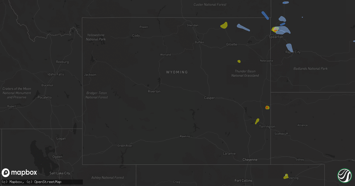
Hail Map in Wyoming on August 6, 2020
Get this storm
August 6 map
$229
one time, instant access
Download today. No call, no setup
Keep the $229
Bought the map and want the full workflow? Apply the entire $229 to a subscription within 7 days. None of it is wasted.
Every map, not just this one
This buys you this map. Subscription and you get every map we run, in the markets you choose from a few cities to whole states to nationwide. Plus real-time alerts the moment a storm fires.
Contact data
Name, contact info, occupancy, even credit band for addresses in the footprint. You go from where it hit to who to call.
Become the source they trust
Unlimited branding weather history reports on demand. You already have the documented answer ready for the property owner, and you are the one who showed up with it.
Property data and RoofTrace estimates
Pull up any address you have got, its value and the exact code rules for that jurisdiction, straight from One Click Code. Then RoofTrace estimates the squares, pitch, and roof value, priced the way you price.
Storm reports in Wyoming
Wyoming
| Date | Description |
|---|---|
| 08/06/20206:55 PM CDT | A local report indicates 73 MPH wind near 7 NW ROCKYPOINT |
| 08/06/20206:44 PM CDT | Up to golf ball hail... Hail accumulation on grass. |
| 08/06/20206:44 PM CDT | Corrects previous hail report from 15 se jay em. Hail accumulation on grass... Up to golf ball size hail stones. |
| 08/06/20206:39 PM CDT | Corrects previous hail report from 15 se jay em. |
| 08/06/20206:39 PM CDT | Hail up to the size of quarters with slight hail accumulation on the grass. |
| 08/06/20206:06 PM CDT | Rain fell in 15 minutes. Pea hail. |
| 08/06/20205:40 PM CDT | Rain fell in 15 minutes. Pea hail. |
| 08/06/20205:39 PM CDT | Hail quarter size to half-dollar size in fort laramie... Wy. |
| 08/06/20205:33 PM CDT | A local report indicates 1.00 inch wind near FORT LARAMIE |
| 08/06/20201:59 AM CDT | At 659 PM MDT, a severe thunderstorm was located over Clareton, or 26 miles west of Newcastle, moving east at 15 mph. HAZARD...Half dollar size hail. SOURCE...Radar indicated. IMPACT...Damage to vehicles is expected. This severe thunderstorm will remain over mainly rural areas of south central Weston County. |
| 08/06/20201:45 AM CDT | At 645 PM MDT, a severe thunderstorm was located 3 miles west of Belle Fourche, moving northeast at 5 mph. HAZARD...Ping pong ball size hail. SOURCE...Radar indicated. IMPACT...People and animals outdoors will be injured. Expect damage to roofs, siding, windows, and vehicles. This severe thunderstorm will be near... Belle Fourche around 700 PM MDT.This includes Interstate 90 in South Dakota between Mile Markers 5and 6. |
| 08/06/20201:14 AM CDT | At 613 PM MDT, severe thunderstorms were located along a line extending from 15 miles southwest of Ekalaka to near Lightning Flat, moving east at 20 mph. HAZARD...60 mph wind gusts and quarter size hail. SOURCE...Radar indicated. IMPACT...Hail damage to vehicles is expected. Expect wind damage to roofs, siding, and trees. Locations impacted include... Alzada, Ridgeway, Hammond, Belltower, Capitol, Albion, Boyes, Ridge and Mill Iron. |
| 08/06/20201:02 AM CDT | At 602 PM MDT, a severe thunderstorm was located 15 miles east of Reno Junction, or 16 miles east of Wright, moving east at 20 mph. HAZARD...60 mph wind gusts and half dollar size hail. SOURCE...Radar indicated. IMPACT...Hail damage to vehicles is expected. Expect wind damage to roofs, siding, and trees. Hail may accumulate on roadways causing hazardous travel. This severe thunderstorm will remain over mainly rural areas of southeastern Campbell and southwestern Weston Counties. |
| 08/06/202012:24 AM CDT | At 524 PM MDT, a severe thunderstorm was located 5 miles northwest of Weston, or 30 miles north of Gillette, moving east at 30 mph. HAZARD...60 mph wind gusts and quarter size hail. SOURCE...Radar indicated. IMPACT...Hail damage to vehicles is expected. Expect wind damage to roofs, siding, and trees. Hail may accumulate on roadways causing hazardous travel. This severe thunderstorm will be near... Oshoto around 605 PM MDT. New Haven around 615 PM MDT. |
| 08/05/202011:33 PM CDT | At 433 PM MDT, a severe thunderstorm was located near Spotted Horse, or 36 miles northwest of Gillette, moving east at 20 mph. HAZARD...Ping pong ball size hail and 60 mph wind gusts. SOURCE...Radar indicated. IMPACT...People and animals outdoors will be injured. Expect hail damage to roofs, siding, windows, and vehicles. Expect wind damage to roofs, siding, and trees. Hail may accumulate on roadways causing hazardous travel. This severe thunderstorm will be near... Recluse around 450 PM MDT. |
| 08/05/202011:29 PM CDT | At 429 PM MDT, a severe thunderstorm was located near Fort Laramie National Historic Site, or 20 miles west of Torrington, moving northeast at 25 mph. HAZARD...60 mph wind gusts and quarter size hail. SOURCE...Radar indicated. IMPACT...Hail damage to vehicles is expected. Expect wind damage to roofs, siding, and trees. This severe thunderstorm will be near... Fort Laramie around 440 PM MDT. Lingle around 445 PM MDT.Other locations impacted by this severe thunderstorm include Hwy 85At Dry Rawhide Creek. |
| 08/05/20208:15 PM CDT | Pea hail |
| 08/05/20207:10 PM CDT | Byg asos. Weakening showers coming off the bighorn mountains produced this downburst. |
| 08/05/20207:04 PM CDT | A local report indicates 68 MPH wind near 4 SE BANNER |
All States Impacted by Hail Map on August 6, 2020
Cities Impacted by Hail Map on August 6, 2020
- Belle Fourche, SD
- Crimora, VA
- Gordonsville, VA
- Keswick, VA
- Fort Defiance, VA
- Barboursville, VA
- Free Union, VA
- Grottoes, VA
- Louisa, VA
- Charlottesville, VA
- Weyers Cave, VA
- Crozet, VA
- Staunton, VA
- Verona, VA
- Mount Sidney, VA
- Earlysville, VA
- Orlando, FL
- Sterling, CO
- Vale, SD
- Nisland, SD
- Newell, SD
- Spearfish, SD
- Whitewood, SD
- Saint Onge, SD
- Buffalo, SD
- Piedmont, SD
- Sturgis, SD
- Rapid City, SD
- Black Hawk, SD
- Mud Butte, SD
- Fort Pierre, SD
- Hayes, SD
- Coon Rapids, IA
- Bayard, IA
- Audubon, IA
- Templeton, IA
- Dedham, IA
- Hulett, WY
- Weston, WY
- Devils Tower, WY
- Colby, KS
- Rexford, KS
- Selden, KS
- Caldwell, KS
- Milan, KS
- Bluff City, KS
- Austinville, VA
- Woodlawn, VA
- Ivanhoe, VA
- Galax, VA
- Fries, VA
- Ruckersville, VA
- Dyke, VA
- Powhatan, VA
- Goochland, VA
- Columbia, VA
- Cartersville, VA
- Boise City, OK
- Calhan, CO
- Rush, CO
- Ramah, CO
- Yoder, CO
- Merino, CO
- Hugo, CO
- Ordway, CO
- Olney Springs, CO
- Karval, CO
- Kit Carson, CO
- Haswell, CO
- Harrison, NE
- Creedmoor, NC
- Wake Forest, NC
- Crumpler, NC
- Jefferson, NC
- West Jefferson, NC
- Lansing, NC
- Grassy Creek, NC
- Adair, OK
- Pryor, OK
- Bluejacket, OK
- Vinita, OK
- Fort Laramie, WY
- Jay Em, WY
- Yoder, WY
- Gillette, WY
- Arvada, WY
- Recluse, WY
- Torrington, WY
- Van Tassell, WY
- Stinnett, TX
- Borger, TX
- Princeton, WV
- Patrick, SC
- Cheraw, SC
- Leasburg, NC
- Alzada, MT
- Cascade, MT
- Great Falls, MT
- Arlee, MT
- Solen, ND
- Flasher, ND
- Aladdin, WY
- Beulah, WY
- Newcastle, WY
- Pine Bluffs, WY
- Bushnell, NE
- Doswell, VA
- Beaverdam, VA
- Glen Allen, VA
- Montpelier, VA
- Ashland, VA
- Gate, OK
- North, VA
- Dutton, VA
- Cobbs Creek, VA
- Foster, VA
- Mathews, VA
- Boyes, MT
- Adel, IA
- Redfield, IA
- Stuart, IA
- Green Cove Springs, FL
- Okatie, SC
- Philip, SD
- Midland, SD
- Fork Union, VA
- Bremo Bluff, VA
- Wendell, NC
- Ree Heights, SD
- Highmore, SD
- Mill Hall, PA
- Sundance, WY
- Lemoyne, NE
- East Berlin, PA
- Wellsville, PA
- New Oxford, PA
- Ruther Glen, VA
- Loveland, CO
- Bellvue, CO
- Hardeeville, SC
- Ridgeland, SC
- Alma, GA
- Nicholls, GA
- Plattsmouth, NE
- Murray, NE
- Saint Charles, IA
- New Virginia, IA
- Bevington, IA
- Prole, IA
- Saint Marys, IA
- Wolf Creek, MT
- Zebulon, NC
- Dalton, GA
- Chatsworth, GA
- Presho, SD
- Kimball, SD
- Upton, WY
- Elkhorn, NE
- Omaha, NE
- Loganton, PA
- Saint Ignatius, MT
- Columbus, MT
- Big Timber, MT
- Reed Point, MT
- New Salem, ND
- Gann Valley, SD
- Madrid, IA
- Granger, IA
- Johnston, IA
- Ogden, IA
- Woodward, IA
- Polk City, IA
- Champion, NE
- Holyoke, CO
- Venango, NE
- Amherst, CO
- Grover, CO
- New Raymer, CO
- Rincon, GA
- Waycross, GA
- Blackshear, GA
- Clayhole, KY
- Middleburg, FL
- Winterset, IA
- Lock Haven, PA
- Beech Creek, PA
- Matheson, CO
- Winnsboro, SC
- Big Rock, VA
- Mouthcard, KY
- Grundy, VA
- Belcher, KY
- Elkhorn City, KY
- Lick Creek, KY
- Regina, KY
- Keystone, NE
- Ogallala, NE
- Rembert, SC
- Camden, SC
- Las Animas, CO
- Wright, WY
- Boys Town, NE
- Rolesville, NC
- Albemarle, NC
- Norwood, NC
- Canyon, TX
- Knightdale, NC
- Sparta, GA
- Crawfordville, GA
- Hinton, WV
- Wayside, WV
- Talcott, WV
- Forest Hill, WV
- Broadus, MT
- Tazewell, VA
- Okaton, SD
- Peyton, CO
- Reliance, SD
- Kennebec, SD
- Lower Brule, SD
- Oacoma, SD
- Pikeville, KY
- Lumberton, NC
- Fairmont, NC
- Rowland, NC
- Manchester, OK
- Medford, OK
- Great Falls, SC
- Heath Springs, SC
- Stephan, SD
- Welch, OK
- Dewy Rose, GA
- Bowdle, SD
- Hoven, SD
- Pukwana, SD
- Paxton, NE
- Grant, NE
- Pipestem, WV
- Padroni, CO
- Shelby, NC
- Lawndale, NC
- Lancaster, SC
- Claude, TX
- Axson, GA
- Agate, CO
- Bonner, MT
- Biddle, MT
- Menlo, IA
- Anton, CO
- Bastian, VA
- Sidney, NE
- Del Rio, TN
- Newport, TN
- Osage, WY
- Blackstone, VA
- Wilsons, VA
- Louisville, GA
- Bartow, GA
- Shields, ND
- Hammond, MT
- Harrold, SD
- Offutt Afb, NE
- Bellevue, NE
- Lamar, CO
- Rose, OK
- Salina, OK
- Pritchett, CO
- Columbia, NC
- Ford, VA
- Louisburg, NC
- Mount Gilead, NC
- Elberton, GA
- Crandall, GA
- Tatum, NM
- East Palatka, FL
- Goose Creek, SC
- Hanahan, SC
- Brandon, MN
- Evansville, MN
- McLaughlin, SD
- Fort Thompson, SD
- Clearmont, WY
- Wheatland, WY
- Woonsocket, SD
- Artesian, SD
- Wessington Springs, SD
- Linden, IA
- Panora, IA
- Dexter, IA
- Scranton, IA
- Jefferson, IA
- Spavinaw, OK
- Big Cabin, OK
- Enid, OK
- Calhoun, GA
- Pembroke, NC
- Fort Gibson, OK
- Deland, FL
- Apopka, FL
- Dupree, SD
- Glidden, IA
- Carroll, IA
- Millsboro, DE
- Letcher, SD
- Plankinton, SD
- Kenton, OK
- Renick, WV
- Cleveland, TN
- Old Fort, TN
- Bamberg, SC
- Waynesboro, GA
- Canton, GA
- Rowesville, SC
- Branchville, SC
- Hilliard, FL
- Folkston, GA
- Pierson, FL
- Lewellen, NE
- White Lake, SD
- Crawford, NE
- Iroquois, SD
- Bagley, IA
- Rippey, IA
- Weskan, KS
- Arapahoe, CO
- Iliff, CO
- Dahlgren, VA
- King George, VA
- Garden City, KS
- Raleigh, NC
- Cherokee, KS
- Girard, KS
- Pittsburg, KS
- Statesville, NC
- Durham, NC
- Ellenboro, NC
- Lenoir, NC
- Cherry Creek, SD
- Wall, SD
- La Vista, NE
- Woodland, PA
- Frenchville, PA
- Nickelsville, VA
- Lebanon, VA
- Bluefield, VA
- Rocky Gap, VA
- Flat Lick, KY
- Pence Springs, WV
- Ballard, WV
- Alderson, WV
- Buffalo, OK
- Millers Creek, NC
- State Road, NC
- Elkin, NC
- Morganton, NC
- Valdese, NC
- Skellytown, TX
- Ridgeway, SC
- Panhandle, TX
- Cumming, GA
- Denver City, TX
- Fort Stewart, GA
- Midville, GA
- Jesup, GA
- Coosawhatchie, SC
- Yemassee, SC
- Callahan, FL
- Almont, ND
- Raleigh, ND
- Ravalli, MT
- Van Meter, IA
- Hooper, NE
- Limon, CO
- Narrows, VA
- Bland, VA
- Winston Salem, NC
- Parrottsville, TN
- Mershon, GA
- Morriston, FL
- Norwood, GA
- Hinesville, GA
- Ludowici, GA
- Plains, TX
- Roy, MT
- Meadow, SD
- Dix, NE
- Manning, IA
- Harrisburg, NE
- Papillion, NE
- Wild Horse, CO
- Lynch Station, VA
- Youngsville, NC
- Franklinton, NC
- Aline, OK
- Mount Pleasant, NC
- Troy, VA
- Modoc, SC
- Douglas, GA
- Guyton, GA
- Miller, SD
- Rozet, WY
- Julesburg, CO
- Chamberlain, SD
- White Stone, VA
- Weems, VA
- Irvington, VA
- Shelbiana, KY
- Grand Junction, IA
- Summerville, GA
- Morven, NC
- Tahlequah, OK
- Hulbert, OK
- Advance, NC
- Clemmons, NC
- Bunch, OK
- Welling, OK
- Ellabell, GA
- Wellborn, FL
- Lusk, WY
- Gurley, NE
- Patterson, IA
- Cumming, IA
- Norwalk, IA
- Howard, PA
- Blanchard, PA
- Tribune, KS
- Simla, CO
- Ferrum, VA
- Thurmond, NC
- Peggs, OK
- Locust Grove, OK
- Camden, NC
- Moyock, NC
- Olar, SC
- Ehrhardt, SC
- Rocky Face, GA
- Greycliff, MT
- Java, SD
- Alpena, SD
- Union Center, SD
- Vivian, SD
- Springfield, GA
- Haxtun, CO
- Casar, NC
- Connelly Springs, NC
- Clayton, NC
- Beckley, WV
- Floyd, VA
- Yale, IA
- Vian, OK
- De Leon Springs, FL
- Loxahatchee, FL


