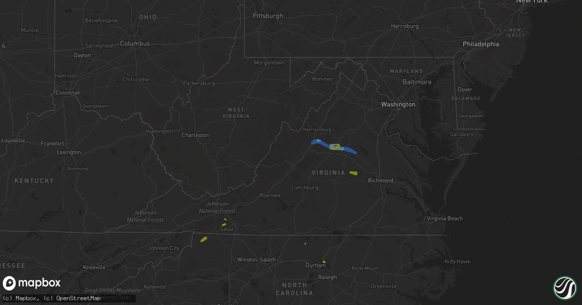
Hail Map in Virginia on August 6, 2020
Get this storm
August 6 map
$229
one time, instant access
Download today. No call, no setup
Keep the $229
Bought the map and want the full workflow? Apply the entire $229 to a subscription within 7 days. None of it is wasted.
Every map, not just this one
This buys you this map. Subscription and you get every map we run, in the markets you choose from a few cities to whole states to nationwide. Plus real-time alerts the moment a storm fires.
Contact data
Name, contact info, occupancy, even credit band for addresses in the footprint. You go from where it hit to who to call.
Become the source they trust
Unlimited branding weather history reports on demand. You already have the documented answer ready for the property owner, and you are the one who showed up with it.
Property data and RoofTrace estimates
Pull up any address you have got, its value and the exact code rules for that jurisdiction, straight from One Click Code. Then RoofTrace estimates the squares, pitch, and roof value, priced the way you price.
Storm reports in Virginia
Virginia
| Date | Description |
|---|---|
| 08/06/20206:40 PM CDT | Trees down near the intersection of va-645 sunset road and va-646 stanfield road. |
| 08/06/20206:31 PM CDT | Trees down on va-614 potomac drive near thirteenth street and twelfth street. |
| 08/06/20206:31 PM CDT | Trees down on va-624 owens drive near bedford lane... Dixon lane... Green hill lane... Jordan lane... Rose avenue... And walnut hill lane. |
| 08/06/20206:01 PM CDT | Numerous trees downed. Also golf ball sized hail. |
| 08/06/20205:50 PM CDT | Trees down on va-208 courthouse road near lawyers road. |
| 08/06/20205:34 PM CDT | Tree down on river road. Time from radar. |
| 08/06/20205:28 PM CDT | Multiple trees down and snapped. |
| 08/06/20205:26 PM CDT | Numerous trees downed. |
| 08/06/20205:14 PM CDT | Numerous trees downed throughout the county. |
| 08/06/20204:56 PM CDT | Corrects previous tstm wnd dmg report from 3 s coatesville. Numerous trees downed. Also golf ball sized hail. |
| 08/06/20204:55 PM CDT | Multiple trees down near montpelier. |
| 08/06/20204:45 PM CDT | Numerous trees down between fork union and dixie. |
| 08/06/20204:44 PM CDT | Numerous trees down throughout the county. |
| 08/06/20204:37 PM CDT | Large tree branches fell near 104 martinsburg ave. |
| 08/06/20204:20 PM CDT | Tree fell on a house at 26 teter rd. |
| 08/06/20204:14 PM CDT | Trees down at 116 blueberry rd |
| 08/06/20204:05 PM CDT | Tree down on the 3000 block of dickerson road |
| 08/06/20204:01 PM CDT | Tree on house on the 4000 block of windy cove lane |
| 08/06/20204:00 PM CDT | Tree down at the intersection of amicus rd and dunnes shope rd. |
| 08/06/20203:59 PM CDT | Numerous trees down near the intersection of earlysville road and panorama road |
| 08/06/20203:55 PM CDT | A local report indicates 1.00 inch wind near 1 NNE CHARLOTTESVILLE |
| 08/06/20203:53 PM CDT | A local report indicates 1.25 inch wind near FREE UNION |
| 08/06/20203:53 PM CDT | Multiple reports of trees down along middle river rd. |
| 08/06/20203:49 PM CDT | A local report indicates 2.00 inch wind near 2 WNW EARLYSVILLE |
| 08/06/20203:35 PM CDT | Received several pictures of limbs down in a persons back yard in fries. Some of which were 6 inches in diameter. |
| 08/06/20203:25 PM CDT | Tree down on pine mountain rd near riverside dr. Time estimated from radar. |
| 08/06/20203:13 PM CDT | Trees down at 400 block of harriston rd |
| 08/06/20203:11 PM CDT | Multiple large trees and snapped branches down in multiple directions between jollett springs mobile home park and va-778 harriston road. |
| 08/06/20203:10 PM CDT | Numerous trees down on the 300 block of dam town road |
| 08/06/20203:08 PM CDT | Tree down blocking grapefield rd near intersection with rayford ln. |
| 08/06/20203:07 PM CDT | Power lines down |
| 08/06/20203:03 PM CDT | Trees down at 153 middle lane rd |
| 08/06/20202:55 PM CDT | Numerous trees down near the intersection of east side hwy and jollett drive |
| 08/06/20202:53 PM CDT | A few trees were observed down along burkes garden rd coming over the ridge from gratton into burkes garden. |
| 08/06/20202:47 PM CDT | Tree down blocking franklin near endicott hill rd. Time estimated from radar. |
| 08/06/20202:44 PM CDT | Numerous trees down on the 1800 block of lee highway |
| 08/06/20202:28 PM CDT | Tree down on wold creek road. |
| 08/06/20202:25 PM CDT | Tree on power line on mountain valley rd near rockbridge county border. |
| 08/06/20202:18 PM CDT | Two trees blown down by thunderstorm winds on twin creeks drive. |
| 08/06/20202:15 PM CDT | Three trees down on indian draft rd near deerfield rd. |
| 08/06/20202:13 PM CDT | Tree down on wilderness rd. |
| 08/06/20202:03 PM CDT | Couple of trees down on mcclung dr near deerfield rd. |
| 08/06/20201:38 PM CDT | A local report indicates 1.00 inch wind near 2 SSW TERRYS FORK |
| 08/06/202012:17 PM CDT | Two trees reported down along poplar camp rd. |
| 08/06/202012:02 PM CDT | Hail the size of quarters. |
| 08/06/20205:44 AM CDT | At 1044 PM EDT, a severe thunderstorm was located over Belcher, or near Breaks Interstate, moving southeast at 20 mph. HAZARD...60 mph wind gusts and quarter size hail. SOURCE...Radar indicated. IMPACT...Hail damage to vehicles is expected. Expect wind damage to roofs, siding, and trees. Locations impacted include... Elkhorn City, Rockhouse, Toonerville, Marrowbone, Mouthcard, Cedarville, Belcher and Fedscreek. |
| 08/06/20204:07 AM CDT | At 906 PM EDT, a severe thunderstorm was located near Point Of Rocks, or 8 miles southwest of Harry Grove Stadium, moving north at 5 mph. HAZARD...60 mph wind gusts and quarter size hail. SOURCE...Radar indicated. IMPACT...Damaging winds will cause some trees and large branches to fall. This could injure those outdoors, as well as damage homes and vehicles. Roadways may become blocked by downed trees. Localized power outages are possible. Unsecured light objects may become projectiles. Locations impacted include... Frederick, Harry Grove Stadium, Ballenger Creek, Brunswick, Walkersville, Braddock Heights, Clover Hill, Discovery-Spring Garden, Point Of Rocks, Linganore-Bartonsville, Adamstown, Jefferson, Myersville, Buckeystown, Libertytown, Rosemont, Burkittsville, Doubs, Park Mills and Petersville. |
| 08/06/20203:47 AM CDT | At 847 PM EDT, a severe thunderstorm was located over Leesville, or near Huddleston, moving northeast at 20 mph. HAZARD...60 mph wind gusts and quarter size hail. SOURCE...Radar indicated. IMPACT...Hail damage to vehicles is expected. Expect wind damage to roofs, siding, and trees. Locations impacted include... Altavista... Hurt... Gretna... Brookneal... Phenix... Huddleston... and Penhook. |
| 08/06/20202:31 AM CDT | At 731 PM EDT, a severe thunderstorm was located over Dahlgren, and is nearly stationary. HAZARD...60 mph wind gusts and quarter size hail. SOURCE...Radar indicated. IMPACT...Damaging winds will cause some trees and large branches to fall. This could injure those outdoors, as well as damage homes and vehicles. Roadways may become blocked by downed trees. Localized power outages are possible. Unsecured light objects may become projectiles. Locations impacted include... Dahlgren, Nanjemoy Creek, Port Tobacco River, Popes Creek, Wicomico, Port Tobacco Village, Potomac Beach, Tompkinsville, Mount Victoria, Bel Alton, Newburg, Swan Point, Welcome, Faulkner and Berthaville. |
| 08/06/20202:22 AM CDT | At 722 PM EDT, a severe thunderstorm was located near Spotsylvania, or 12 miles southwest of Fredericksburg, and is nearly stationary. HAZARD...60 mph wind gusts. SOURCE...Radar indicated. IMPACT...Damaging winds will cause some trees and large branches to fall. This could injure those outdoors, as well as damage homes and vehicles. Roadways may become blocked by downed trees. Localized power outages are possible. Unsecured light objects may become projectiles. Locations impacted include... Massaponax, Spotsylvania, Gatewood, Chancellorsville, Partlow, Brokenburg, Post Oak, Thornburg, Cookstown, Snell and Alsop. |
| 08/06/20201:22 AM CDT | At 622 PM EDT, a severe thunderstorm was located over Mineral, moving east at 15 mph. HAZARD...60 mph wind gusts and quarter size hail. SOURCE...Radar indicated. IMPACT...Damaging winds will cause some trees and large branches to fall. This could injure those outdoors, as well as damage homes and vehicles. Roadways may become blocked by downed trees. Localized power outages are possible. Unsecured light objects may become projectiles. Locations impacted include... Glenora, Thornburg, Gatewood, Partlow, Brokenburg and Snell. |
| 08/06/20201:10 AM CDT | At 610 PM EDT, a severe thunderstorm was located over Cartersville, moving east at 15 mph. HAZARD...60 mph wind gusts and penny size hail. SOURCE...Radar indicated. IMPACT...Expect damage to trees and powerlines. This severe thunderstorm will be near, Trenholm around 625 PM EDT. Goochland and Macon around 650 PM EDT. Powhatan around 700 PM EDT.Other locations impacted by this severe thunderstorm includeHatchers, Rock Castle, Jefferson, Maidens, Provost, Three Square,Irwin, Tamworth, Elk Hill and Whiteville. |
| 08/06/20201:03 AM CDT | At 603 PM EDT, a severe thunderstorm was located over Scottsburg, or near South Boston, moving northeast at 10 mph. HAZARD...60 mph wind gusts and quarter size hail. SOURCE...Radar indicated. IMPACT...Hail damage to vehicles is expected. Expect wind damage to roofs, siding, and trees. Locations impacted include... South Boston... Halifax... Charlotte Court House... Redoak... Clover... Drakes Branch... and Scottsburg. |
| 08/06/202012:57 AM CDT | At 557 PM EDT, a severe thunderstorm was located near Boswells Tavern, or near Louisa, moving east at 20 mph. HAZARD...60 mph wind gusts and quarter size hail. SOURCE...Radar indicated. IMPACT...Minor damage to vehicles is possible. Expect wind damage to trees and powerlines. This severe thunderstorm will be near, Louisa around 615 PM EDT. Mineral around 625 PM EDT.Other locations impacted by this severe thunderstorm includePendleton, Louisa Airport, Fredericks Hall, Green Springs, Byrd Mill,Trevilians, Wares Crossroads, Vawter Corner and Cuckoo. |
| 08/06/202012:47 AM CDT | At 547 PM EDT, a severe thunderstorm was located near Montpelier, or 7 miles west of Randolph Macon College, moving north northeast at 15 mph. HAZARD...60 mph wind gusts and penny size hail. SOURCE...Radar indicated. IMPACT...Expect damage to trees and powerlines. This severe thunderstorm will be near, Ashland around 600 PM EDT. Kings Dominion around 615 PM EDT.Other locations impacted by this severe thunderstorm include Gilman,Oliver, Gum Tree, Coatesville, Hewlett, Goodall, Doswell and Noel. |
| 08/06/202012:43 AM CDT | At 543 PM EDT, a severe thunderstorm was located over Columbia, or near Fork Union, moving east at 15 mph. HAZARD...60 mph wind gusts and quarter size hail. SOURCE...Radar indicated. IMPACT...Minor damage to vehicles is possible. Expect wind damage to trees and powerlines. This severe thunderstorm will be near, Columbia and Lakeside Village around 555 PM EDT. Duncan around 600 PM EDT. Cartersville around 615 PM EDT. Fife around 620 PM EDT.Other locations impacted by this severe thunderstorm include Dixie,Elk Hill, Stage Junction, Tabscott, Carysbrook, Bremo Bluff,Wilmington, Pemberton, Tamworth and Caledonia. |
| 08/06/202012:28 AM CDT | At 528 PM EDT, a severe thunderstorm with a history of producing wind damage was located near Boswells Tavern, or 12 miles southwest of Orange, moving east at 20 mph. HAZARD...60 mph wind gusts and quarter size hail. SOURCE...Wind damage reports. IMPACT...Damaging winds will cause some trees and large branches to fall. This could injure those outdoors, as well as damage homes and vehicles. Roadways may become blocked by downed trees. Localized power outages are possible. Unsecured light objects may become projectiles. Locations impacted include... Orange, Gordonsville, Everona, Madison Run, Montpelier Station, Thornhill, Nasons, Montford, Lahore, Old Somerset, Unionville, Somerset, Barboursville and Madison Mills. |
| 08/06/202012:26 AM CDT | At 526 PM EDT, a severe thunderstorm was located near Leasburg, or 7 miles east of Yanceyville, moving northeast at 20 mph. HAZARD...60 mph wind gusts and quarter size hail. SOURCE...Radar indicated. IMPACT...Hail damage to vehicles is expected. Expect wind damage to roofs, siding, and trees. Locations impacted include... Yanceyville... Turbeville... Milton... Cluster Springs... Leasburg... Hamer... and Semora. |
| 08/06/202012:18 AM CDT | At 518 PM EDT, a severe thunderstorm was located 7 miles east of Charlottesville, moving east at 30 mph. HAZARD...60 mph wind gusts and quarter size hail. SOURCE...Radar indicated. IMPACT...Minor damage to vehicles is possible. Expect wind damage to trees and powerlines. This severe thunderstorm will be near, Boswells Tavern around 535 PM EDT. Ferncliff around 545 PM EDT. Louisa around 600 PM EDT.Other locations impacted by this severe thunderstorm include Waldrop,Green Springs, Byrd Mill, Trevilians, Zion Crossroads, Vawter Cornerand Gordonsville. |
| 08/05/202011:55 PM CDT | At 454 PM EDT, a severe thunderstorm was located over Free Union, or 9 miles northwest of Charlottesville, moving northeast at 10 mph. This is a very dangerous storm. HAZARD...80 mph wind gusts and golf ball size hail. SOURCE...Radar indicated. IMPACT...Expect considerable damage to trees and power lines, especially near Free Union and Earlysville. Your life is at significant risk if outdoors. In addition to some trees falling into homes, wind damage is possible to roofs, sheds, open garages, and mobile homes. Locations impacted include... Charlottesville, Stanardsville, Free Union, Campbell, Westmoreland, Hollymead, Ruckersville, Ivy, Quinque, Eheart, Barboursville, Stony Point, Flordon, Newtown, Amicus, Cobham, Cismont, Newcomb Hall, Keswick and Carrsbrook. |
| 08/05/202011:45 PM CDT | At 445 PM EDT, a severe thunderstorm was located near Maxwelton, or near Lewisburg, moving east at 10 mph. HAZARD...60 mph wind gusts and quarter size hail. SOURCE...Radar indicated. IMPACT...Hail damage to vehicles is expected. Expect wind damage to roofs, siding, and trees. Locations impacted include... Alleghany... Lewisburg... White Sulphur Springs... Renick... Falling Spring... Asbury... and Greenbrier River Trail. |
| 08/05/202011:24 PM CDT | At 424 PM EDT, a severe thunderstorm was located 7 miles east of Grottoes, or 15 miles northeast of Waynesboro, moving east at 20 mph. HAZARD...60 mph wind gusts and quarter size hail. SOURCE...Radar indicated. IMPACT...Damaging winds will cause some trees and large branches to fall. This could injure those outdoors, as well as damage homes and vehicles. Roadways may become blocked by downed trees. Localized power outages are possible. Unsecured light objects may become projectiles. Locations impacted include... Stanardsville, Free Union, Hollymead, Ruckersville, Mcmullen, Quinque, Boonesville, Lydia, Stony Point, Haneytown, Earlysville, Mission Home, Amicus, Advance Mills, Saint George and Shady Grove. |
| 08/05/202011:13 PM CDT | At 413 PM EDT, a severe thunderstorm was located over Lick Creek, or near Pipestem, moving northeast at 25 mph. HAZARD...60 mph wind gusts and half dollar size hail. SOURCE...Radar indicated. IMPACT...Hail damage to vehicles is expected. Expect wind damage to roofs, siding, and trees. Locations impacted include... Hinton... Athens... Peterstown... Union... Pipestem... Rich Creek... and Glen Lyn. |
| 08/05/202011:13 PM CDT | At 413 PM EDT, a severe thunderstorm was located near Brownsburg, or 10 miles northeast of Rockbridge Baths, moving east at 20 mph. HAZARD...60 mph wind gusts and quarter size hail. SOURCE...Radar indicated. IMPACT...Damaging winds will cause some trees and large branches to fall. This could injure those outdoors, as well as damage homes and vehicles. Roadways may become blocked by downed trees. Localized power outages are possible. Unsecured light objects may become projectiles. Locations impacted include... Stuarts Draft, Greenville, Middlebrook and Spottswood. |
| 08/05/202010:50 PM CDT | At 349 PM EDT, a severe thunderstorm was located over Flatridge, or near Sugar Grove, moving east at 15 mph. HAZARD...60 mph wind gusts and quarter size hail. SOURCE...Radar indicated. IMPACT...Hail damage to vehicles is expected. Expect wind damage to roofs, siding, and trees. Locations impacted include... Wytheville... Fries... Max Meadows... Speedwell... Sugar Grove... Troutdale... and Volney. |
| 08/05/202010:47 PM CDT | At 347 PM EDT, a severe thunderstorm was located just north of Staunton, and is nearly stationary. HAZARD...Isolated damaging wind gusts up to 60 mph. SOURCE...Radar indicated. IMPACT...Damaging winds will cause some trees and large branches to fall. This could injure those outdoors, as well as damage homes and vehicles. Roadways may become blocked by downed trees. Localized power outages are possible. Unsecured light objects may become projectiles. Locations impacted include... Grottoes, Crimora, Verona, Weyers Cave, New Hope, Mount Sidney, Mount Crawford, Port Republic, Hermitage, Fort Defiance and Staunton Airport. |
| 08/05/202010:40 PM CDT | At 340 PM EDT, a severe thunderstorm was located near Waiteville, or near Paint Bank, moving northeast at 5 mph. HAZARD...60 mph wind gusts and quarter size hail. SOURCE...Radar indicated. IMPACT...Hail damage to vehicles is expected. Expect wind damage to roofs, siding, and trees. Locations impacted include... New Castle... Paint Bank... Sweet Springs... Craig Springs... Potts Creek... Waiteville... and Earlehurst. |
| 08/05/202010:37 PM CDT | At 337 PM EDT, a severe thunderstorm was located over Blakes, or near Mathews, and is nearly stationary. HAZARD...60 mph wind gusts. SOURCE...Radar indicated. IMPACT...Expect damage to trees and powerlines. This severe thunderstorm will be near, Mathews around 405 PM EDT. Deltaville and Gwynn around 415 PM EDT.Other locations impacted by this severe thunderstorm include Diggs,Ruff, Moon, Laban, Cobbs Creek, Cardinal, Hudgins, Wilton, Amburg andStampers. |
| 08/05/202010:16 PM CDT | At 316 PM EDT, a severe thunderstorm was located over Endicott, or near Ferrum, moving east at 10 mph. HAZARD...60 mph wind gusts and quarter size hail. SOURCE...Radar indicated. IMPACT...Hail damage to vehicles is expected. Expect wind damage to roofs, siding, and trees. Locations impacted include... Ferrum... and Endicott. |
| 08/05/202010:15 PM CDT | At 315 PM EDT, a severe thunderstorm was located near Jordan Mines, moving east at 15 mph. HAZARD...60 mph wind gusts and quarter size hail. SOURCE...Radar indicated. IMPACT...Hail damage to vehicles is expected. Expect wind damage to roofs, siding, and trees. Locations impacted include... Covington... Clifton Forge... Jordan Mines... Iron Gate... Low Moor... Glen Wilton... and Longdale Furnace. |
| 08/05/202010:02 PM CDT | At 302 PM EDT, a severe thunderstorm was located near Jefferson, moving northeast at 15 mph. HAZARD...60 mph wind gusts and quarter size hail. SOURCE...Radar indicated. IMPACT...Hail damage to vehicles is expected. Expect wind damage to roofs, siding, and trees. Locations impacted include... Jefferson... West Jefferson... Lansing... Mouth Of Wilson... Bridle Creek... Stratford... and Grassy Creek. |
| 08/05/20209:55 PM CDT | At 254 PM EDT, a severe thunderstorm was located near Warm Springs, moving east at 20 mph. HAZARD...60 mph wind gusts and quarter size hail. SOURCE...Radar indicated. IMPACT...Hail damage to vehicles is expected. Expect wind damage to roofs, siding, and trees. Locations impacted include... Goshen... Warm Springs... Burnsville... Bells Valley... Yost... and Williamsville. |
| 08/05/20209:37 PM CDT | At 237 PM EDT, a severe thunderstorm was located over Pilot, moving northeast at 15 mph. HAZARD...60 mph wind gusts and quarter size hail. SOURCE...Radar indicated. IMPACT...Hail damage to vehicles is expected. Expect wind damage to roofs, siding, and trees. Locations impacted include... Pilot... Shawsville... Terrys Fork... Check... and Crockett Springs. |
| 08/05/20209:11 PM CDT | At 211 PM EDT, a severe thunderstorm was located 10 miles south of Franklin, moving east at 15 mph. HAZARD...60 mph wind gusts. SOURCE...Radar indicated. IMPACT...Damaging winds will cause some trees and large branches to fall. This could injure those outdoors, as well as damage homes and vehicles. Roadways may become blocked by downed trees. Localized power outages are possible. Unsecured light objects may become projectiles. Locations impacted include... Sugar Grove and Moyers. |
| 08/05/20209:02 PM CDT | At 202 PM EDT, a severe thunderstorm was located near Allisonia, moving northeast at 15 mph. HAZARD...60 mph wind gusts and quarter size hail. SOURCE...Radar indicated. IMPACT...Hail damage to vehicles is expected. Expect wind damage to roofs, siding, and trees. Locations impacted include... Indian Valley... Allisonia... Alum Ridge... and Copper Valley. |
| 08/05/20208:58 PM CDT | At 158 PM EDT, a severe thunderstorm was located near Pilot, moving northeast at 5 mph. HAZARD...60 mph wind gusts and quarter size hail. SOURCE...Radar indicated. IMPACT...Hail damage to vehicles is expected. Expect wind damage to roofs, siding, and trees. Locations impacted include... Pilot... Shawsville... Terrys Fork... Check... and Crockett Springs. |
| 08/05/20208:40 PM CDT | Numerous trees down between leesburg and purcellville. |
| 08/05/20208:35 PM CDT | Trees down on fulton place near simpson circle. |
| 08/05/20208:02 PM CDT | At 101 PM EDT, a severe thunderstorm was located over Ivanhoe, or 8 miles south of Max Meadows, moving east at 10 mph. HAZARD...60 mph wind gusts and quarter size hail. SOURCE...Radar indicated. IMPACT...Hail damage to vehicles is expected. Expect wind damage to roofs, siding, and trees. Locations impacted include... Patterson... Allisonia... Byllesby... Grahams Forge... Ivanhoe... Coleman Store... and Sylvatus. |
| 08/05/20207:53 PM CDT | Several large tree limbs down. Time from radar. |
All States Impacted by Hail Map on August 6, 2020
Cities Impacted by Hail Map on August 6, 2020
- Belle Fourche, SD
- Crimora, VA
- Gordonsville, VA
- Keswick, VA
- Fort Defiance, VA
- Barboursville, VA
- Free Union, VA
- Grottoes, VA
- Louisa, VA
- Charlottesville, VA
- Weyers Cave, VA
- Crozet, VA
- Staunton, VA
- Verona, VA
- Mount Sidney, VA
- Earlysville, VA
- Orlando, FL
- Sterling, CO
- Vale, SD
- Nisland, SD
- Newell, SD
- Spearfish, SD
- Whitewood, SD
- Saint Onge, SD
- Buffalo, SD
- Piedmont, SD
- Sturgis, SD
- Rapid City, SD
- Black Hawk, SD
- Mud Butte, SD
- Fort Pierre, SD
- Hayes, SD
- Coon Rapids, IA
- Bayard, IA
- Audubon, IA
- Templeton, IA
- Dedham, IA
- Hulett, WY
- Weston, WY
- Devils Tower, WY
- Colby, KS
- Rexford, KS
- Selden, KS
- Caldwell, KS
- Milan, KS
- Bluff City, KS
- Austinville, VA
- Woodlawn, VA
- Ivanhoe, VA
- Galax, VA
- Fries, VA
- Ruckersville, VA
- Dyke, VA
- Powhatan, VA
- Goochland, VA
- Columbia, VA
- Cartersville, VA
- Boise City, OK
- Calhan, CO
- Rush, CO
- Ramah, CO
- Yoder, CO
- Merino, CO
- Hugo, CO
- Ordway, CO
- Olney Springs, CO
- Karval, CO
- Kit Carson, CO
- Haswell, CO
- Harrison, NE
- Creedmoor, NC
- Wake Forest, NC
- Crumpler, NC
- Jefferson, NC
- West Jefferson, NC
- Lansing, NC
- Grassy Creek, NC
- Adair, OK
- Pryor, OK
- Bluejacket, OK
- Vinita, OK
- Fort Laramie, WY
- Jay Em, WY
- Yoder, WY
- Gillette, WY
- Arvada, WY
- Recluse, WY
- Torrington, WY
- Van Tassell, WY
- Stinnett, TX
- Borger, TX
- Princeton, WV
- Patrick, SC
- Cheraw, SC
- Leasburg, NC
- Alzada, MT
- Cascade, MT
- Great Falls, MT
- Arlee, MT
- Solen, ND
- Flasher, ND
- Aladdin, WY
- Beulah, WY
- Newcastle, WY
- Pine Bluffs, WY
- Bushnell, NE
- Doswell, VA
- Beaverdam, VA
- Glen Allen, VA
- Montpelier, VA
- Ashland, VA
- Gate, OK
- North, VA
- Dutton, VA
- Cobbs Creek, VA
- Foster, VA
- Mathews, VA
- Boyes, MT
- Adel, IA
- Redfield, IA
- Stuart, IA
- Green Cove Springs, FL
- Okatie, SC
- Philip, SD
- Midland, SD
- Fork Union, VA
- Bremo Bluff, VA
- Wendell, NC
- Ree Heights, SD
- Highmore, SD
- Mill Hall, PA
- Sundance, WY
- Lemoyne, NE
- East Berlin, PA
- Wellsville, PA
- New Oxford, PA
- Ruther Glen, VA
- Loveland, CO
- Bellvue, CO
- Hardeeville, SC
- Ridgeland, SC
- Alma, GA
- Nicholls, GA
- Plattsmouth, NE
- Murray, NE
- Saint Charles, IA
- New Virginia, IA
- Bevington, IA
- Prole, IA
- Saint Marys, IA
- Wolf Creek, MT
- Zebulon, NC
- Dalton, GA
- Chatsworth, GA
- Presho, SD
- Kimball, SD
- Upton, WY
- Elkhorn, NE
- Omaha, NE
- Loganton, PA
- Saint Ignatius, MT
- Columbus, MT
- Big Timber, MT
- Reed Point, MT
- New Salem, ND
- Gann Valley, SD
- Madrid, IA
- Granger, IA
- Johnston, IA
- Ogden, IA
- Woodward, IA
- Polk City, IA
- Champion, NE
- Holyoke, CO
- Venango, NE
- Amherst, CO
- Grover, CO
- New Raymer, CO
- Rincon, GA
- Waycross, GA
- Blackshear, GA
- Clayhole, KY
- Middleburg, FL
- Winterset, IA
- Lock Haven, PA
- Beech Creek, PA
- Matheson, CO
- Winnsboro, SC
- Big Rock, VA
- Mouthcard, KY
- Grundy, VA
- Belcher, KY
- Elkhorn City, KY
- Lick Creek, KY
- Regina, KY
- Keystone, NE
- Ogallala, NE
- Rembert, SC
- Camden, SC
- Las Animas, CO
- Wright, WY
- Boys Town, NE
- Rolesville, NC
- Albemarle, NC
- Norwood, NC
- Canyon, TX
- Knightdale, NC
- Sparta, GA
- Crawfordville, GA
- Hinton, WV
- Wayside, WV
- Talcott, WV
- Forest Hill, WV
- Broadus, MT
- Tazewell, VA
- Okaton, SD
- Peyton, CO
- Reliance, SD
- Kennebec, SD
- Lower Brule, SD
- Oacoma, SD
- Pikeville, KY
- Lumberton, NC
- Fairmont, NC
- Rowland, NC
- Manchester, OK
- Medford, OK
- Great Falls, SC
- Heath Springs, SC
- Stephan, SD
- Welch, OK
- Dewy Rose, GA
- Bowdle, SD
- Hoven, SD
- Pukwana, SD
- Paxton, NE
- Grant, NE
- Pipestem, WV
- Padroni, CO
- Shelby, NC
- Lawndale, NC
- Lancaster, SC
- Claude, TX
- Axson, GA
- Agate, CO
- Bonner, MT
- Biddle, MT
- Menlo, IA
- Anton, CO
- Bastian, VA
- Sidney, NE
- Del Rio, TN
- Newport, TN
- Osage, WY
- Blackstone, VA
- Wilsons, VA
- Louisville, GA
- Bartow, GA
- Shields, ND
- Hammond, MT
- Harrold, SD
- Offutt Afb, NE
- Bellevue, NE
- Lamar, CO
- Rose, OK
- Salina, OK
- Pritchett, CO
- Columbia, NC
- Ford, VA
- Louisburg, NC
- Mount Gilead, NC
- Elberton, GA
- Crandall, GA
- Tatum, NM
- East Palatka, FL
- Goose Creek, SC
- Hanahan, SC
- Brandon, MN
- Evansville, MN
- McLaughlin, SD
- Fort Thompson, SD
- Clearmont, WY
- Wheatland, WY
- Woonsocket, SD
- Artesian, SD
- Wessington Springs, SD
- Linden, IA
- Panora, IA
- Dexter, IA
- Scranton, IA
- Jefferson, IA
- Spavinaw, OK
- Big Cabin, OK
- Enid, OK
- Calhoun, GA
- Pembroke, NC
- Fort Gibson, OK
- Deland, FL
- Apopka, FL
- Dupree, SD
- Glidden, IA
- Carroll, IA
- Millsboro, DE
- Letcher, SD
- Plankinton, SD
- Kenton, OK
- Renick, WV
- Cleveland, TN
- Old Fort, TN
- Bamberg, SC
- Waynesboro, GA
- Canton, GA
- Rowesville, SC
- Branchville, SC
- Hilliard, FL
- Folkston, GA
- Pierson, FL
- Lewellen, NE
- White Lake, SD
- Crawford, NE
- Iroquois, SD
- Bagley, IA
- Rippey, IA
- Weskan, KS
- Arapahoe, CO
- Iliff, CO
- Dahlgren, VA
- King George, VA
- Garden City, KS
- Raleigh, NC
- Cherokee, KS
- Girard, KS
- Pittsburg, KS
- Statesville, NC
- Durham, NC
- Ellenboro, NC
- Lenoir, NC
- Cherry Creek, SD
- Wall, SD
- La Vista, NE
- Woodland, PA
- Frenchville, PA
- Nickelsville, VA
- Lebanon, VA
- Bluefield, VA
- Rocky Gap, VA
- Flat Lick, KY
- Pence Springs, WV
- Ballard, WV
- Alderson, WV
- Buffalo, OK
- Millers Creek, NC
- State Road, NC
- Elkin, NC
- Morganton, NC
- Valdese, NC
- Skellytown, TX
- Ridgeway, SC
- Panhandle, TX
- Cumming, GA
- Denver City, TX
- Fort Stewart, GA
- Midville, GA
- Jesup, GA
- Coosawhatchie, SC
- Yemassee, SC
- Callahan, FL
- Almont, ND
- Raleigh, ND
- Ravalli, MT
- Van Meter, IA
- Hooper, NE
- Limon, CO
- Narrows, VA
- Bland, VA
- Winston Salem, NC
- Parrottsville, TN
- Mershon, GA
- Morriston, FL
- Norwood, GA
- Hinesville, GA
- Ludowici, GA
- Plains, TX
- Roy, MT
- Meadow, SD
- Dix, NE
- Manning, IA
- Harrisburg, NE
- Papillion, NE
- Wild Horse, CO
- Lynch Station, VA
- Youngsville, NC
- Franklinton, NC
- Aline, OK
- Mount Pleasant, NC
- Troy, VA
- Modoc, SC
- Douglas, GA
- Guyton, GA
- Miller, SD
- Rozet, WY
- Julesburg, CO
- Chamberlain, SD
- White Stone, VA
- Weems, VA
- Irvington, VA
- Shelbiana, KY
- Grand Junction, IA
- Summerville, GA
- Morven, NC
- Tahlequah, OK
- Hulbert, OK
- Advance, NC
- Clemmons, NC
- Bunch, OK
- Welling, OK
- Ellabell, GA
- Wellborn, FL
- Lusk, WY
- Gurley, NE
- Patterson, IA
- Cumming, IA
- Norwalk, IA
- Howard, PA
- Blanchard, PA
- Tribune, KS
- Simla, CO
- Ferrum, VA
- Thurmond, NC
- Peggs, OK
- Locust Grove, OK
- Camden, NC
- Moyock, NC
- Olar, SC
- Ehrhardt, SC
- Rocky Face, GA
- Greycliff, MT
- Java, SD
- Alpena, SD
- Union Center, SD
- Vivian, SD
- Springfield, GA
- Haxtun, CO
- Casar, NC
- Connelly Springs, NC
- Clayton, NC
- Beckley, WV
- Floyd, VA
- Yale, IA
- Vian, OK
- De Leon Springs, FL
- Loxahatchee, FL


