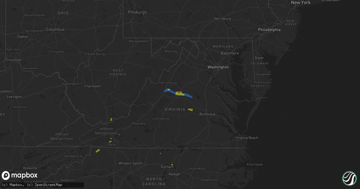
Hail Map on August 6, 2020
Get this storm
August 6 map
$229
one time, instant access
Download today. No call, no setup
Keep the $229
Bought the map and want the full workflow? Apply the entire $229 to a subscription within 7 days. None of it is wasted.
Every map, not just this one
This buys you this map. Subscription and you get every map we run, in the markets you choose from a few cities to whole states to nationwide. Plus real-time alerts the moment a storm fires.
Contact data
Name, contact info, occupancy, even credit band for addresses in the footprint. You go from where it hit to who to call.
Become the source they trust
Unlimited branding weather history reports on demand. You already have the documented answer ready for the property owner, and you are the one who showed up with it.
Property data and RoofTrace estimates
Pull up any address you have got, its value and the exact code rules for that jurisdiction, straight from One Click Code. Then RoofTrace estimates the squares, pitch, and roof value, priced the way you price.
States Impacted by Hail Map on August 6, 2020
Storm reports
Montana
| Date | Description |
|---|---|
| 08/06/20206:17 PM CDT | Tree damage including tree limb into house. |
| 08/06/20206:15 PM CDT | Large power pole snapped. |
| 08/06/20206:06 PM CDT | Ride at fair tipped over |
| 08/06/20205:30 PM CDT | Mesonet station ennm8 ennis raws. 59 mph wind gust. Time of event is estimated. |
| 08/06/20204:54 PM CDT | Mesonet station ekhm8... Elkhorn raws - 8 w townsend. |
| 08/06/20203:07 AM CDT | At 806 PM MDT, a severe thunderstorm was located near The Pines Rec Area, or 21 miles south of Glasgow, moving north at 10 mph. HAZARD...60 mph wind gusts and half dollar size hail. SOURCE...Radar indicated. IMPACT...Hail damage to vehicles is expected. Expect wind damage to roofs, siding, and trees. Locations impacted include... Fort Peck, Fort Peck Marina, Duck Creek Rec Area and Park Grove. |
| 08/06/20202:28 AM CDT | At 728 PM MDT, severe thunderstorms were located along a line extending from 11 miles east of Fort Shaw to 12 miles south of Great Falls, moving north at 45 mph. HAZARD...60 mph wind gusts. SOURCE...Radar indicated. IMPACT...Expect damage to roofs, siding, and trees. Locations impacted include... Great Falls, Black Eagle, Ulm, Malmstrom Afb, Sand Coulee, Stockett, Tracy, First Peoples Buffalo Jump State Park and Centerville. |
| 08/06/202012:09 AM CDT | At 506 PM MDT, a severe thunderstorm was located near Lockwood, or 7 miles southeast of Billings, moving east at 30 mph. Strongest storm is tracking along the Interstate 90/94, with strongest gusts expected east of Billings. HAZARD...60 mph wind gusts and nickel size hail. SOURCE...Radar indicated. IMPACT...Expect damage to roofs, siding, and trees. Locations impacted include... Billings, Lockwood, Billings Heights, Billings West End, Huntley, St. Xavier and Crow Indian Reservation. |
| 08/05/202011:57 PM CDT | At 457 PM MDT, a severe thunderstorm was located 12 miles northeast of Broadus, moving northeast at 5 mph. HAZARD...Quarter size hail and heavy rain. SOURCE...Radar indicated. IMPACT...Damage to vehicles is expected. Locations impacted include... Powderville. |
| 08/05/202011:50 PM CDT | Thunderstorm wind gust. |
| 08/05/202010:50 PM CDT | A tree was reported down across rattlesnake drive. |
| 08/05/202010:30 PM CDT | At 330 PM MDT, severe thunderstorms were located along a line extending from 21 miles east of Winifred to 9 miles east of Roy, moving northeast at 30 mph. HAZARD...60 mph wind gusts and quarter size hail. SOURCE...Radar indicated. IMPACT...Hail damage to vehicles is expected. Expect wind damage to roofs, siding, and trees. These severe thunderstorms will remain over mainly rural areas of northeastern Fergus County. |
| 08/05/20209:24 PM CDT | Time estimated from radar. |
| 08/05/20209:18 PM CDT | Mesonet station mtlom loma |
| 08/05/20208:30 PM CDT | Kgtf asos reports peak gust of 51kts at 0130z. Extensive blowing dust visible in fields northwest of the interstate. |
| 08/05/20208:07 PM CDT | Awos station k1im... India. |
| 08/05/20208:00 PM CDT | A local report indicates 60 MPH wind near ALZADA |
Georgia
| Date | Description |
|---|---|
| 08/06/20205:15 PM CDT | Approx half a dozen trees down about 1 mile east of canton center... Just off hwy 20. |
| 08/06/20205:10 PM CDT | Ammended from previous lsr: at least 10 trees down with isolated damage to some house roofing sw of canton in the area around bells ferry rd |
| 08/06/20204:55 PM CDT | Trees down nw of sutallee on sutallee ridge trail |
| 08/06/20204:09 PM CDT | Emergency management reported a tree down along wiregrass trail and fellwood drive. Another tree was down along zittroure drive. |
| 08/06/20204:08 PM CDT | Emergency management reported a tree down along east 9th street. |
| 08/06/20204:08 PM CDT | Report from the effingham county fire/rescue and ema of a tree down on west 15th street. |
| 08/06/20204:08 PM CDT | Emergency management reported a tree down along east 4th street. |
| 08/06/20204:08 PM CDT | The effingham county 911 call center reported a tree down on allison court. |
| 08/06/20204:06 PM CDT | Report from the effingham county fire/rescue and ema of a tree down on wisenbaker road. |
| 08/06/20204:00 PM CDT | The effingham 911 call center reported a tree down due to thunderstorm outflow near the intersection of courthouse road and midland road. |
| 08/06/20203:40 PM CDT | 911 call center reported huge tree snapped on the intersection of w hendricks st. And five forks rd. |
| 08/06/20203:40 PM CDT | 911 call center reported trees down on the intersection of floyd rd and ruby dr. |
| 08/06/20203:40 PM CDT | 911 call center reported trees and limbs down blocking roadway on the intersection brewers bridge rd and kathwood dr. |
| 08/06/20203:23 PM CDT | The effingham county 911 call center reported a tree down due to outflow near the intersection of central avenue and samuel smalls avenue. |
| 08/06/20203:15 PM CDT | The effingham county 911 call center reported a tree down due to outflow along highway 119 north near clyo. |
| 08/06/20203:03 PM CDT | Tree down along davenport road. |
| 08/06/20202:25 PM CDT | Several trees down around the western side of trion... And a report of wind damage to the roof of a home. |
| 08/06/20202:03 PM CDT | A tree and power lines were downed across the road near menlo |
| 08/06/202011:04 AM CDT | Report of a pine tree blown down off hwy 5 north of blue ridge on spring hill cir |
| 08/06/20203:57 AM CDT | At 857 PM EDT, a severe thunderstorm was located over Powelton, or 7 miles south of Crawfordville, moving north at 25 mph. HAZARD...60 mph wind gusts and penny size hail. SOURCE...Radar indicated. IMPACT...Expect damage to roofs, siding, and trees. Locations impacted include... Crawfordville, Sharon, Ficklin, Barnett, Lundberg, Raytown and Sandy Cross. |
| 08/06/202012:52 AM CDT | At 552 PM EDT, a severe thunderstorm was located over Bridgemill, or near Canton, moving northeast at 15 mph. HAZARD...60 mph wind gusts and penny size hail. SOURCE...Radar indicated. IMPACT...Expect damage to roofs, siding, and trees. Locations impacted include... Canton, Holly Springs, Buffington, Little River Landing, Hickory Flat, Sutallee and Bridgemill. |
| 08/05/202011:36 PM CDT | At 435 PM EDT, a severe thunderstorm was located near Port Wentworth, and is nearly stationary. HAZARD...60 mph wind gusts and quarter size hail. SOURCE...Radar indicated. IMPACT...Minor hail damage to vehicles is possible. Expect wind damage to trees and powerlines. Locations impacted include... Rincon, Port Wentworth, Hardeeville and Purysburgh. This warning includes... I-95 in South Carolina between mile markers 2 and 9. I-95 in Georgia between mile markers 110 and 112. |
| 08/05/202011:32 PM CDT | At 432 PM EDT, a severe thunderstorm was located 5 miles northwest of Elberton, moving east at 10 mph. HAZARD...60 mph wind gusts and quarter size hail. SOURCE...Radar indicated. IMPACT...Minor hail damage to vehicles is expected. Expect wind damage to trees and power lines. Locations impacted include... Dewy Rose, Ruckersville and Elberton. |
| 08/05/202011:06 PM CDT | At 406 PM EDT, severe thunderstorms were located along a line extending from 7 miles southwest of Nicholls to near Bristol, moving north at 20 mph. HAZARD...60 mph wind gusts. SOURCE...Radar indicated. IMPACT...Expect damage to roofs, siding, and trees. Locations impacted include... Douglas, Baxley, Alma, Broxton, Surrency, Nicholls, Snipesville, West Green, Pridgen and Denton. |
| 08/05/202010:55 PM CDT | At 355 PM EDT, a severe thunderstorm was located near North Georgia Speedway, or near Dalton, moving east at 5 mph. HAZARD...60 mph wind gusts and quarter size hail. SOURCE...Radar indicated. IMPACT...Hail damage to vehicles is expected. Expect wind damage to roofs, siding, and trees. Locations impacted include... Dalton, Chatsworth, Fort Mountain State Park, Ramhurst and North Georgia Speedway. |
| 08/05/20208:03 PM CDT | Tree downed onto the interstate on i-20 eastbound at mile marker 152.5 |
Tennessee
| Date | Description |
|---|---|
| 08/06/20201:30 PM CDT | Large trees uprooted... Damage to outbuildings and roof damamge to structures. |
| 08/06/202012:48 AM CDT | At 548 PM EDT, a severe thunderstorm was located over Parrottsville, or near Newport, moving north at 15 mph. HAZARD...60 mph wind gusts and nickel size hail. SOURCE...Radar indicated. IMPACT...Expect damage to roofs, siding, and trees. Locations impacted include... Newport, Parrottsville and Bybee. |
South Dakota
| Date | Description |
|---|---|
| 08/06/20203:35 AM CDT | At 835 PM MDT, a severe thunderstorm was located 10 miles northeast of Summerset, or 16 miles north of Rapid City, moving east at 35 mph. HAZARD...60 mph wind gusts. SOURCE...Radar indicated. IMPACT...Expect damage to roofs, siding, and trees. This severe thunderstorm will be near... Hereford around 905 PM MDT. Curlew Lake around 910 PM MDT.This includes Interstate 90 in South Dakota between Mile Markers 34and 53. |
| 08/06/20203:08 AM CDT | At 808 PM MDT, a severe thunderstorm was located over Castle Rock, or 29 miles northeast of Belle Fourche, moving east at 40 mph. HAZARD...70 mph wind gusts and quarter size hail. SOURCE...Radar indicated. IMPACT...Hail damage to vehicles is expected. Expect considerable tree damage. Wind damage is also likely to mobile homes, roofs, and outbuildings. This severe thunderstorm will be near... Dears Ears Butte around 825 PM MDT. Mud Butte around 850 PM MDT. |
| 08/06/202012:54 AM CDT | A local report indicates 61 MPH wind near 11 NNW WENDTE |
| 08/05/20209:59 PM CDT | A local report indicates 59 MPH wind near 1 ENE MUD BUTTE |
| 08/05/20209:49 PM CDT | A local report indicates 67 MPH wind near 1 ENE MUD BUTTE |
| 08/05/20209:18 PM CDT | A local report indicates 58 MPH wind near 8 N REDIG |
| 08/05/20209:16 PM CDT | A local report indicates 62 MPH wind near 1 N BUFFALO |
| 08/05/20209:10 PM CDT | A local report indicates 62 MPH wind near 12 WSW CASTLE ROCK |
| 08/05/20209:03 PM CDT | A local report indicates 90 MPH wind near 8 N REDIG |
| 08/05/20209:00 PM CDT | A local report indicates 73 MPH wind near 12 WSW CASTLE ROCK |
| 08/05/20208:56 PM CDT | A local report indicates 61 MPH wind near 27 WNW CASTLE ROCK |
| 08/05/20208:15 PM CDT | Numerous reports of at least golf ball sized hail in belle fourche. |
| 08/05/20208:10 PM CDT | A local report indicates 1.50 inch wind near BELLE FOURCHE |
| 08/05/20208:05 PM CDT | Biggest hail was north of stanley street. |
Nebraska
| Date | Description |
|---|---|
| 08/06/202012:42 AM CDT | At 542 PM MDT, a severe thunderstorm was located near Prairie Center, or 19 miles southeast of Lusk, moving east at 25 mph. HAZARD...60 mph wind gusts and half dollar size hail. SOURCE...Radar indicated. IMPACT...Hail damage to vehicles is expected. Expect wind damage to roofs, siding, and trees. Locations impacted include... Harrison, Prairie Center and Van Tassell. |
| 08/05/202011:47 PM CDT | At 447 AM CDT, a severe thunderstorm was located near Friend, or 26 miles southeast of York, moving east at 30 mph. HAZARD...60 mph wind gusts and quarter size hail. SOURCE...Radar indicated. IMPACT...Hail damage to vehicles is expected. Expect wind damage to roofs, siding, and trees. Locations impacted include... Crete, Wilber, Friend, Dorchester, De Witt, Swan Creek Reservoir Number 2, Walnut Creek Recreation Area and 11 Miles West Of Wilber. |
| 08/05/20209:10 PM CDT | At 210 AM CDT, a severe thunderstorm was located near Harvard, or 16 miles east of Hastings, moving east at 30 mph. HAZARD...Ping pong ball size hail. SOURCE...Radar indicated. IMPACT...People and animals outdoors will be injured. Expect damage to roofs, siding, windows, and vehicles. Locations impacted include... Geneva, Sutton, Harvard, Clay Center, Fairmont, Grafton, Saronville and Strang. |
| 08/05/20208:43 PM CDT | At 143 AM MDT, severe thunderstorms were located along a line extending from 10 miles north of Medicine Lake to 11 miles southwest of Merriman, moving east at 20 mph. HAZARD...Quarter size hail. SOURCE...Radar indicated. IMPACT...Damage to vehicles is expected. Locations impacted include... Cody, Merriman, Nenzel, Medicine Lake, Eli, Highway 61 Crossing The Niobrara River and Intersection of Highway 61 and Shadbolt Road.This includes the following highways... Highway 20 between mile markers 130 and 168. Highway 61 between mile markers 209 and 228. |
Wyoming
| Date | Description |
|---|---|
| 08/06/20206:55 PM CDT | A local report indicates 73 MPH wind near 7 NW ROCKYPOINT |
| 08/06/20206:44 PM CDT | Corrects previous hail report from 15 se jay em. Hail accumulation on grass... Up to golf ball size hail stones. |
| 08/06/20206:44 PM CDT | Up to golf ball hail... Hail accumulation on grass. |
| 08/06/20206:39 PM CDT | Corrects previous hail report from 15 se jay em. |
| 08/06/20206:39 PM CDT | Hail up to the size of quarters with slight hail accumulation on the grass. |
| 08/06/20206:06 PM CDT | Rain fell in 15 minutes. Pea hail. |
| 08/06/20205:40 PM CDT | Rain fell in 15 minutes. Pea hail. |
| 08/06/20205:39 PM CDT | Hail quarter size to half-dollar size in fort laramie... Wy. |
| 08/06/20205:33 PM CDT | A local report indicates 1.00 inch wind near FORT LARAMIE |
| 08/06/20201:59 AM CDT | At 659 PM MDT, a severe thunderstorm was located over Clareton, or 26 miles west of Newcastle, moving east at 15 mph. HAZARD...Half dollar size hail. SOURCE...Radar indicated. IMPACT...Damage to vehicles is expected. This severe thunderstorm will remain over mainly rural areas of south central Weston County. |
| 08/06/20201:45 AM CDT | At 645 PM MDT, a severe thunderstorm was located 3 miles west of Belle Fourche, moving northeast at 5 mph. HAZARD...Ping pong ball size hail. SOURCE...Radar indicated. IMPACT...People and animals outdoors will be injured. Expect damage to roofs, siding, windows, and vehicles. This severe thunderstorm will be near... Belle Fourche around 700 PM MDT.This includes Interstate 90 in South Dakota between Mile Markers 5and 6. |
| 08/06/20201:14 AM CDT | At 613 PM MDT, severe thunderstorms were located along a line extending from 15 miles southwest of Ekalaka to near Lightning Flat, moving east at 20 mph. HAZARD...60 mph wind gusts and quarter size hail. SOURCE...Radar indicated. IMPACT...Hail damage to vehicles is expected. Expect wind damage to roofs, siding, and trees. Locations impacted include... Alzada, Ridgeway, Hammond, Belltower, Capitol, Albion, Boyes, Ridge and Mill Iron. |
| 08/06/20201:02 AM CDT | At 602 PM MDT, a severe thunderstorm was located 15 miles east of Reno Junction, or 16 miles east of Wright, moving east at 20 mph. HAZARD...60 mph wind gusts and half dollar size hail. SOURCE...Radar indicated. IMPACT...Hail damage to vehicles is expected. Expect wind damage to roofs, siding, and trees. Hail may accumulate on roadways causing hazardous travel. This severe thunderstorm will remain over mainly rural areas of southeastern Campbell and southwestern Weston Counties. |
| 08/06/202012:24 AM CDT | At 524 PM MDT, a severe thunderstorm was located 5 miles northwest of Weston, or 30 miles north of Gillette, moving east at 30 mph. HAZARD...60 mph wind gusts and quarter size hail. SOURCE...Radar indicated. IMPACT...Hail damage to vehicles is expected. Expect wind damage to roofs, siding, and trees. Hail may accumulate on roadways causing hazardous travel. This severe thunderstorm will be near... Oshoto around 605 PM MDT. New Haven around 615 PM MDT. |
| 08/05/202011:33 PM CDT | At 433 PM MDT, a severe thunderstorm was located near Spotted Horse, or 36 miles northwest of Gillette, moving east at 20 mph. HAZARD...Ping pong ball size hail and 60 mph wind gusts. SOURCE...Radar indicated. IMPACT...People and animals outdoors will be injured. Expect hail damage to roofs, siding, windows, and vehicles. Expect wind damage to roofs, siding, and trees. Hail may accumulate on roadways causing hazardous travel. This severe thunderstorm will be near... Recluse around 450 PM MDT. |
| 08/05/202011:29 PM CDT | At 429 PM MDT, a severe thunderstorm was located near Fort Laramie National Historic Site, or 20 miles west of Torrington, moving northeast at 25 mph. HAZARD...60 mph wind gusts and quarter size hail. SOURCE...Radar indicated. IMPACT...Hail damage to vehicles is expected. Expect wind damage to roofs, siding, and trees. This severe thunderstorm will be near... Fort Laramie around 440 PM MDT. Lingle around 445 PM MDT.Other locations impacted by this severe thunderstorm include Hwy 85At Dry Rawhide Creek. |
| 08/05/20208:15 PM CDT | Pea hail |
| 08/05/20207:10 PM CDT | Byg asos. Weakening showers coming off the bighorn mountains produced this downburst. |
| 08/05/20207:04 PM CDT | A local report indicates 68 MPH wind near 4 SE BANNER |
Virginia
| Date | Description |
|---|---|
| 08/06/20206:40 PM CDT | Trees down near the intersection of va-645 sunset road and va-646 stanfield road. |
| 08/06/20206:31 PM CDT | Trees down on va-624 owens drive near bedford lane... Dixon lane... Green hill lane... Jordan lane... Rose avenue... And walnut hill lane. |
| 08/06/20206:31 PM CDT | Trees down on va-614 potomac drive near thirteenth street and twelfth street. |
| 08/06/20206:01 PM CDT | Numerous trees downed. Also golf ball sized hail. |
| 08/06/20205:50 PM CDT | Trees down on va-208 courthouse road near lawyers road. |
| 08/06/20205:34 PM CDT | Tree down on river road. Time from radar. |
| 08/06/20205:28 PM CDT | Multiple trees down and snapped. |
| 08/06/20205:26 PM CDT | Numerous trees downed. |
| 08/06/20205:14 PM CDT | Numerous trees downed throughout the county. |
| 08/06/20204:56 PM CDT | Corrects previous tstm wnd dmg report from 3 s coatesville. Numerous trees downed. Also golf ball sized hail. |
| 08/06/20204:55 PM CDT | Multiple trees down near montpelier. |
| 08/06/20204:45 PM CDT | Numerous trees down between fork union and dixie. |
| 08/06/20204:44 PM CDT | Numerous trees down throughout the county. |
| 08/06/20204:37 PM CDT | Large tree branches fell near 104 martinsburg ave. |
| 08/06/20204:20 PM CDT | Tree fell on a house at 26 teter rd. |
| 08/06/20204:14 PM CDT | Trees down at 116 blueberry rd |
| 08/06/20204:05 PM CDT | Tree down on the 3000 block of dickerson road |
| 08/06/20204:01 PM CDT | Tree on house on the 4000 block of windy cove lane |
| 08/06/20204:00 PM CDT | Tree down at the intersection of amicus rd and dunnes shope rd. |
| 08/06/20203:59 PM CDT | Numerous trees down near the intersection of earlysville road and panorama road |
| 08/06/20203:55 PM CDT | A local report indicates 1.00 inch wind near 1 NNE CHARLOTTESVILLE |
| 08/06/20203:53 PM CDT | Multiple reports of trees down along middle river rd. |
| 08/06/20203:53 PM CDT | A local report indicates 1.25 inch wind near FREE UNION |
| 08/06/20203:49 PM CDT | A local report indicates 2.00 inch wind near 2 WNW EARLYSVILLE |
| 08/06/20203:35 PM CDT | Received several pictures of limbs down in a persons back yard in fries. Some of which were 6 inches in diameter. |
| 08/06/20203:25 PM CDT | Tree down on pine mountain rd near riverside dr. Time estimated from radar. |
| 08/06/20203:13 PM CDT | Trees down at 400 block of harriston rd |
| 08/06/20203:11 PM CDT | Multiple large trees and snapped branches down in multiple directions between jollett springs mobile home park and va-778 harriston road. |
| 08/06/20203:10 PM CDT | Numerous trees down on the 300 block of dam town road |
| 08/06/20203:08 PM CDT | Tree down blocking grapefield rd near intersection with rayford ln. |
| 08/06/20203:07 PM CDT | Power lines down |
| 08/06/20203:03 PM CDT | Trees down at 153 middle lane rd |
| 08/06/20202:55 PM CDT | Numerous trees down near the intersection of east side hwy and jollett drive |
| 08/06/20202:53 PM CDT | A few trees were observed down along burkes garden rd coming over the ridge from gratton into burkes garden. |
| 08/06/20202:47 PM CDT | Tree down blocking franklin near endicott hill rd. Time estimated from radar. |
| 08/06/20202:44 PM CDT | Numerous trees down on the 1800 block of lee highway |
| 08/06/20202:28 PM CDT | Tree down on wold creek road. |
| 08/06/20202:25 PM CDT | Tree on power line on mountain valley rd near rockbridge county border. |
| 08/06/20202:18 PM CDT | Two trees blown down by thunderstorm winds on twin creeks drive. |
| 08/06/20202:15 PM CDT | Three trees down on indian draft rd near deerfield rd. |
| 08/06/20202:13 PM CDT | Tree down on wilderness rd. |
| 08/06/20202:03 PM CDT | Couple of trees down on mcclung dr near deerfield rd. |
| 08/06/20201:38 PM CDT | A local report indicates 1.00 inch wind near 2 SSW TERRYS FORK |
| 08/06/202012:17 PM CDT | Two trees reported down along poplar camp rd. |
| 08/06/202012:02 PM CDT | Hail the size of quarters. |
| 08/06/20205:44 AM CDT | At 1044 PM EDT, a severe thunderstorm was located over Belcher, or near Breaks Interstate, moving southeast at 20 mph. HAZARD...60 mph wind gusts and quarter size hail. SOURCE...Radar indicated. IMPACT...Hail damage to vehicles is expected. Expect wind damage to roofs, siding, and trees. Locations impacted include... Elkhorn City, Rockhouse, Toonerville, Marrowbone, Mouthcard, Cedarville, Belcher and Fedscreek. |
| 08/06/20204:07 AM CDT | At 906 PM EDT, a severe thunderstorm was located near Point Of Rocks, or 8 miles southwest of Harry Grove Stadium, moving north at 5 mph. HAZARD...60 mph wind gusts and quarter size hail. SOURCE...Radar indicated. IMPACT...Damaging winds will cause some trees and large branches to fall. This could injure those outdoors, as well as damage homes and vehicles. Roadways may become blocked by downed trees. Localized power outages are possible. Unsecured light objects may become projectiles. Locations impacted include... Frederick, Harry Grove Stadium, Ballenger Creek, Brunswick, Walkersville, Braddock Heights, Clover Hill, Discovery-Spring Garden, Point Of Rocks, Linganore-Bartonsville, Adamstown, Jefferson, Myersville, Buckeystown, Libertytown, Rosemont, Burkittsville, Doubs, Park Mills and Petersville. |
| 08/06/20203:47 AM CDT | At 847 PM EDT, a severe thunderstorm was located over Leesville, or near Huddleston, moving northeast at 20 mph. HAZARD...60 mph wind gusts and quarter size hail. SOURCE...Radar indicated. IMPACT...Hail damage to vehicles is expected. Expect wind damage to roofs, siding, and trees. Locations impacted include... Altavista... Hurt... Gretna... Brookneal... Phenix... Huddleston... and Penhook. |
| 08/06/20202:31 AM CDT | At 731 PM EDT, a severe thunderstorm was located over Dahlgren, and is nearly stationary. HAZARD...60 mph wind gusts and quarter size hail. SOURCE...Radar indicated. IMPACT...Damaging winds will cause some trees and large branches to fall. This could injure those outdoors, as well as damage homes and vehicles. Roadways may become blocked by downed trees. Localized power outages are possible. Unsecured light objects may become projectiles. Locations impacted include... Dahlgren, Nanjemoy Creek, Port Tobacco River, Popes Creek, Wicomico, Port Tobacco Village, Potomac Beach, Tompkinsville, Mount Victoria, Bel Alton, Newburg, Swan Point, Welcome, Faulkner and Berthaville. |
| 08/06/20202:22 AM CDT | At 722 PM EDT, a severe thunderstorm was located near Spotsylvania, or 12 miles southwest of Fredericksburg, and is nearly stationary. HAZARD...60 mph wind gusts. SOURCE...Radar indicated. IMPACT...Damaging winds will cause some trees and large branches to fall. This could injure those outdoors, as well as damage homes and vehicles. Roadways may become blocked by downed trees. Localized power outages are possible. Unsecured light objects may become projectiles. Locations impacted include... Massaponax, Spotsylvania, Gatewood, Chancellorsville, Partlow, Brokenburg, Post Oak, Thornburg, Cookstown, Snell and Alsop. |
| 08/06/20201:22 AM CDT | At 622 PM EDT, a severe thunderstorm was located over Mineral, moving east at 15 mph. HAZARD...60 mph wind gusts and quarter size hail. SOURCE...Radar indicated. IMPACT...Damaging winds will cause some trees and large branches to fall. This could injure those outdoors, as well as damage homes and vehicles. Roadways may become blocked by downed trees. Localized power outages are possible. Unsecured light objects may become projectiles. Locations impacted include... Glenora, Thornburg, Gatewood, Partlow, Brokenburg and Snell. |
| 08/06/20201:10 AM CDT | At 610 PM EDT, a severe thunderstorm was located over Cartersville, moving east at 15 mph. HAZARD...60 mph wind gusts and penny size hail. SOURCE...Radar indicated. IMPACT...Expect damage to trees and powerlines. This severe thunderstorm will be near, Trenholm around 625 PM EDT. Goochland and Macon around 650 PM EDT. Powhatan around 700 PM EDT.Other locations impacted by this severe thunderstorm includeHatchers, Rock Castle, Jefferson, Maidens, Provost, Three Square,Irwin, Tamworth, Elk Hill and Whiteville. |
| 08/06/20201:03 AM CDT | At 603 PM EDT, a severe thunderstorm was located over Scottsburg, or near South Boston, moving northeast at 10 mph. HAZARD...60 mph wind gusts and quarter size hail. SOURCE...Radar indicated. IMPACT...Hail damage to vehicles is expected. Expect wind damage to roofs, siding, and trees. Locations impacted include... South Boston... Halifax... Charlotte Court House... Redoak... Clover... Drakes Branch... and Scottsburg. |
| 08/06/202012:57 AM CDT | At 557 PM EDT, a severe thunderstorm was located near Boswells Tavern, or near Louisa, moving east at 20 mph. HAZARD...60 mph wind gusts and quarter size hail. SOURCE...Radar indicated. IMPACT...Minor damage to vehicles is possible. Expect wind damage to trees and powerlines. This severe thunderstorm will be near, Louisa around 615 PM EDT. Mineral around 625 PM EDT.Other locations impacted by this severe thunderstorm includePendleton, Louisa Airport, Fredericks Hall, Green Springs, Byrd Mill,Trevilians, Wares Crossroads, Vawter Corner and Cuckoo. |
| 08/06/202012:47 AM CDT | At 547 PM EDT, a severe thunderstorm was located near Montpelier, or 7 miles west of Randolph Macon College, moving north northeast at 15 mph. HAZARD...60 mph wind gusts and penny size hail. SOURCE...Radar indicated. IMPACT...Expect damage to trees and powerlines. This severe thunderstorm will be near, Ashland around 600 PM EDT. Kings Dominion around 615 PM EDT.Other locations impacted by this severe thunderstorm include Gilman,Oliver, Gum Tree, Coatesville, Hewlett, Goodall, Doswell and Noel. |
| 08/06/202012:43 AM CDT | At 543 PM EDT, a severe thunderstorm was located over Columbia, or near Fork Union, moving east at 15 mph. HAZARD...60 mph wind gusts and quarter size hail. SOURCE...Radar indicated. IMPACT...Minor damage to vehicles is possible. Expect wind damage to trees and powerlines. This severe thunderstorm will be near, Columbia and Lakeside Village around 555 PM EDT. Duncan around 600 PM EDT. Cartersville around 615 PM EDT. Fife around 620 PM EDT.Other locations impacted by this severe thunderstorm include Dixie,Elk Hill, Stage Junction, Tabscott, Carysbrook, Bremo Bluff,Wilmington, Pemberton, Tamworth and Caledonia. |
| 08/06/202012:28 AM CDT | At 528 PM EDT, a severe thunderstorm with a history of producing wind damage was located near Boswells Tavern, or 12 miles southwest of Orange, moving east at 20 mph. HAZARD...60 mph wind gusts and quarter size hail. SOURCE...Wind damage reports. IMPACT...Damaging winds will cause some trees and large branches to fall. This could injure those outdoors, as well as damage homes and vehicles. Roadways may become blocked by downed trees. Localized power outages are possible. Unsecured light objects may become projectiles. Locations impacted include... Orange, Gordonsville, Everona, Madison Run, Montpelier Station, Thornhill, Nasons, Montford, Lahore, Old Somerset, Unionville, Somerset, Barboursville and Madison Mills. |
| 08/06/202012:26 AM CDT | At 526 PM EDT, a severe thunderstorm was located near Leasburg, or 7 miles east of Yanceyville, moving northeast at 20 mph. HAZARD...60 mph wind gusts and quarter size hail. SOURCE...Radar indicated. IMPACT...Hail damage to vehicles is expected. Expect wind damage to roofs, siding, and trees. Locations impacted include... Yanceyville... Turbeville... Milton... Cluster Springs... Leasburg... Hamer... and Semora. |
| 08/06/202012:18 AM CDT | At 518 PM EDT, a severe thunderstorm was located 7 miles east of Charlottesville, moving east at 30 mph. HAZARD...60 mph wind gusts and quarter size hail. SOURCE...Radar indicated. IMPACT...Minor damage to vehicles is possible. Expect wind damage to trees and powerlines. This severe thunderstorm will be near, Boswells Tavern around 535 PM EDT. Ferncliff around 545 PM EDT. Louisa around 600 PM EDT.Other locations impacted by this severe thunderstorm include Waldrop,Green Springs, Byrd Mill, Trevilians, Zion Crossroads, Vawter Cornerand Gordonsville. |
| 08/05/202011:55 PM CDT | At 454 PM EDT, a severe thunderstorm was located over Free Union, or 9 miles northwest of Charlottesville, moving northeast at 10 mph. This is a very dangerous storm. HAZARD...80 mph wind gusts and golf ball size hail. SOURCE...Radar indicated. IMPACT...Expect considerable damage to trees and power lines, especially near Free Union and Earlysville. Your life is at significant risk if outdoors. In addition to some trees falling into homes, wind damage is possible to roofs, sheds, open garages, and mobile homes. Locations impacted include... Charlottesville, Stanardsville, Free Union, Campbell, Westmoreland, Hollymead, Ruckersville, Ivy, Quinque, Eheart, Barboursville, Stony Point, Flordon, Newtown, Amicus, Cobham, Cismont, Newcomb Hall, Keswick and Carrsbrook. |
| 08/05/202011:45 PM CDT | At 445 PM EDT, a severe thunderstorm was located near Maxwelton, or near Lewisburg, moving east at 10 mph. HAZARD...60 mph wind gusts and quarter size hail. SOURCE...Radar indicated. IMPACT...Hail damage to vehicles is expected. Expect wind damage to roofs, siding, and trees. Locations impacted include... Alleghany... Lewisburg... White Sulphur Springs... Renick... Falling Spring... Asbury... and Greenbrier River Trail. |
| 08/05/202011:24 PM CDT | At 424 PM EDT, a severe thunderstorm was located 7 miles east of Grottoes, or 15 miles northeast of Waynesboro, moving east at 20 mph. HAZARD...60 mph wind gusts and quarter size hail. SOURCE...Radar indicated. IMPACT...Damaging winds will cause some trees and large branches to fall. This could injure those outdoors, as well as damage homes and vehicles. Roadways may become blocked by downed trees. Localized power outages are possible. Unsecured light objects may become projectiles. Locations impacted include... Stanardsville, Free Union, Hollymead, Ruckersville, Mcmullen, Quinque, Boonesville, Lydia, Stony Point, Haneytown, Earlysville, Mission Home, Amicus, Advance Mills, Saint George and Shady Grove. |
| 08/05/202011:13 PM CDT | At 413 PM EDT, a severe thunderstorm was located near Brownsburg, or 10 miles northeast of Rockbridge Baths, moving east at 20 mph. HAZARD...60 mph wind gusts and quarter size hail. SOURCE...Radar indicated. IMPACT...Damaging winds will cause some trees and large branches to fall. This could injure those outdoors, as well as damage homes and vehicles. Roadways may become blocked by downed trees. Localized power outages are possible. Unsecured light objects may become projectiles. Locations impacted include... Stuarts Draft, Greenville, Middlebrook and Spottswood. |
| 08/05/202011:13 PM CDT | At 413 PM EDT, a severe thunderstorm was located over Lick Creek, or near Pipestem, moving northeast at 25 mph. HAZARD...60 mph wind gusts and half dollar size hail. SOURCE...Radar indicated. IMPACT...Hail damage to vehicles is expected. Expect wind damage to roofs, siding, and trees. Locations impacted include... Hinton... Athens... Peterstown... Union... Pipestem... Rich Creek... and Glen Lyn. |
| 08/05/202010:50 PM CDT | At 349 PM EDT, a severe thunderstorm was located over Flatridge, or near Sugar Grove, moving east at 15 mph. HAZARD...60 mph wind gusts and quarter size hail. SOURCE...Radar indicated. IMPACT...Hail damage to vehicles is expected. Expect wind damage to roofs, siding, and trees. Locations impacted include... Wytheville... Fries... Max Meadows... Speedwell... Sugar Grove... Troutdale... and Volney. |
| 08/05/202010:47 PM CDT | At 347 PM EDT, a severe thunderstorm was located just north of Staunton, and is nearly stationary. HAZARD...Isolated damaging wind gusts up to 60 mph. SOURCE...Radar indicated. IMPACT...Damaging winds will cause some trees and large branches to fall. This could injure those outdoors, as well as damage homes and vehicles. Roadways may become blocked by downed trees. Localized power outages are possible. Unsecured light objects may become projectiles. Locations impacted include... Grottoes, Crimora, Verona, Weyers Cave, New Hope, Mount Sidney, Mount Crawford, Port Republic, Hermitage, Fort Defiance and Staunton Airport. |
| 08/05/202010:40 PM CDT | At 340 PM EDT, a severe thunderstorm was located near Waiteville, or near Paint Bank, moving northeast at 5 mph. HAZARD...60 mph wind gusts and quarter size hail. SOURCE...Radar indicated. IMPACT...Hail damage to vehicles is expected. Expect wind damage to roofs, siding, and trees. Locations impacted include... New Castle... Paint Bank... Sweet Springs... Craig Springs... Potts Creek... Waiteville... and Earlehurst. |
| 08/05/202010:37 PM CDT | At 337 PM EDT, a severe thunderstorm was located over Blakes, or near Mathews, and is nearly stationary. HAZARD...60 mph wind gusts. SOURCE...Radar indicated. IMPACT...Expect damage to trees and powerlines. This severe thunderstorm will be near, Mathews around 405 PM EDT. Deltaville and Gwynn around 415 PM EDT.Other locations impacted by this severe thunderstorm include Diggs,Ruff, Moon, Laban, Cobbs Creek, Cardinal, Hudgins, Wilton, Amburg andStampers. |
| 08/05/202010:16 PM CDT | At 316 PM EDT, a severe thunderstorm was located over Endicott, or near Ferrum, moving east at 10 mph. HAZARD...60 mph wind gusts and quarter size hail. SOURCE...Radar indicated. IMPACT...Hail damage to vehicles is expected. Expect wind damage to roofs, siding, and trees. Locations impacted include... Ferrum... and Endicott. |
| 08/05/202010:15 PM CDT | At 315 PM EDT, a severe thunderstorm was located near Jordan Mines, moving east at 15 mph. HAZARD...60 mph wind gusts and quarter size hail. SOURCE...Radar indicated. IMPACT...Hail damage to vehicles is expected. Expect wind damage to roofs, siding, and trees. Locations impacted include... Covington... Clifton Forge... Jordan Mines... Iron Gate... Low Moor... Glen Wilton... and Longdale Furnace. |
| 08/05/202010:02 PM CDT | At 302 PM EDT, a severe thunderstorm was located near Jefferson, moving northeast at 15 mph. HAZARD...60 mph wind gusts and quarter size hail. SOURCE...Radar indicated. IMPACT...Hail damage to vehicles is expected. Expect wind damage to roofs, siding, and trees. Locations impacted include... Jefferson... West Jefferson... Lansing... Mouth Of Wilson... Bridle Creek... Stratford... and Grassy Creek. |
| 08/05/20209:55 PM CDT | At 254 PM EDT, a severe thunderstorm was located near Warm Springs, moving east at 20 mph. HAZARD...60 mph wind gusts and quarter size hail. SOURCE...Radar indicated. IMPACT...Hail damage to vehicles is expected. Expect wind damage to roofs, siding, and trees. Locations impacted include... Goshen... Warm Springs... Burnsville... Bells Valley... Yost... and Williamsville. |
| 08/05/20209:37 PM CDT | At 237 PM EDT, a severe thunderstorm was located over Pilot, moving northeast at 15 mph. HAZARD...60 mph wind gusts and quarter size hail. SOURCE...Radar indicated. IMPACT...Hail damage to vehicles is expected. Expect wind damage to roofs, siding, and trees. Locations impacted include... Pilot... Shawsville... Terrys Fork... Check... and Crockett Springs. |
| 08/05/20209:11 PM CDT | At 211 PM EDT, a severe thunderstorm was located 10 miles south of Franklin, moving east at 15 mph. HAZARD...60 mph wind gusts. SOURCE...Radar indicated. IMPACT...Damaging winds will cause some trees and large branches to fall. This could injure those outdoors, as well as damage homes and vehicles. Roadways may become blocked by downed trees. Localized power outages are possible. Unsecured light objects may become projectiles. Locations impacted include... Sugar Grove and Moyers. |
| 08/05/20209:02 PM CDT | At 202 PM EDT, a severe thunderstorm was located near Allisonia, moving northeast at 15 mph. HAZARD...60 mph wind gusts and quarter size hail. SOURCE...Radar indicated. IMPACT...Hail damage to vehicles is expected. Expect wind damage to roofs, siding, and trees. Locations impacted include... Indian Valley... Allisonia... Alum Ridge... and Copper Valley. |
| 08/05/20208:58 PM CDT | At 158 PM EDT, a severe thunderstorm was located near Pilot, moving northeast at 5 mph. HAZARD...60 mph wind gusts and quarter size hail. SOURCE...Radar indicated. IMPACT...Hail damage to vehicles is expected. Expect wind damage to roofs, siding, and trees. Locations impacted include... Pilot... Shawsville... Terrys Fork... Check... and Crockett Springs. |
| 08/05/20208:40 PM CDT | Numerous trees down between leesburg and purcellville. |
| 08/05/20208:35 PM CDT | Trees down on fulton place near simpson circle. |
| 08/05/20208:02 PM CDT | At 101 PM EDT, a severe thunderstorm was located over Ivanhoe, or 8 miles south of Max Meadows, moving east at 10 mph. HAZARD...60 mph wind gusts and quarter size hail. SOURCE...Radar indicated. IMPACT...Hail damage to vehicles is expected. Expect wind damage to roofs, siding, and trees. Locations impacted include... Patterson... Allisonia... Byllesby... Grahams Forge... Ivanhoe... Coleman Store... and Sylvatus. |
| 08/05/20207:53 PM CDT | Several large tree limbs down. Time from radar. |
West Virginia
| Date | Description |
|---|---|
| 08/06/20204:40 PM CDT | Tree down on sinking creek rd. Time estimated from radar. |
| 08/06/20204:15 PM CDT | Tree down on blue sulphur springs rd near sam radar rd. Time from radar. |
| 08/06/20204:03 PM CDT | Tree down along monroe street on southern edge of alderson. |
| 08/06/20203:58 PM CDT | Strong winds blew multiple large limbs down on route 12. |
| 08/06/20203:50 PM CDT | Strong winds brought down a large tree along route 12. |
| 08/06/20203:43 PM CDT | A local report indicates 1.00 inch wind near 3 ESE HINTON |
| 08/06/20202:53 PM CDT | Hailed quarter sized hail for over 5 minutes... Then hailed pea size for an additional 10. |
| 08/06/202012:49 AM CDT | At 549 PM EDT, a severe thunderstorm was located near Williamsburg, or near Rupert, moving northeast at 25 mph. HAZARD...60 mph wind gusts. SOURCE...Radar indicated. IMPACT...Expect damage to roofs, siding, and trees. Locations impacted include... Lewisburg... Rainelle... Rupert... Quinwood... Renick... Falling Spring... and Beartown State Park. |
| 08/05/202011:52 PM CDT | At 452 PM EDT, a severe thunderstorm was located near Talcott, or near Alderson, moving northeast at 30 mph. HAZARD...60 mph wind gusts and quarter size hail. SOURCE...Radar indicated. IMPACT...Hail damage to vehicles is expected. Expect wind damage to roofs, siding, and trees. Locations impacted include... Lewisburg... White Sulphur Springs... Ronceverte... Alderson... Asbury... Greenbrier River Trail... and Wayside.This includes The following Location The West Virginia StateFairgrounds. |
| 08/05/202010:45 PM CDT | At 345 PM EDT, a severe thunderstorm was located over Gratton, or near Burkes Garden, moving east at 20 mph. HAZARD...60 mph wind gusts and quarter size hail. SOURCE...Radar indicated. IMPACT...Hail damage to vehicles is expected. Expect wind damage to roofs, siding, and trees. Locations impacted include... Bluefield... Bland... Princeton... Bastian... Rocky Gap... Burkes Garden... and Ceres.This includes The following Location Mercer County Airport. |
| 08/05/202010:38 PM CDT | At 337 PM EDT, a severe thunderstorm was located over Oakvale, or near Athens, moving southeast at 25 mph. HAZARD...60 mph wind gusts and quarter size hail. SOURCE...Radar indicated. IMPACT...Hail damage to vehicles is expected. Expect wind damage to roofs, siding, and trees. Locations impacted include... Pearisburg... Narrows... Pembroke... Peterstown... Poplar Hill... Rich Creek... and Oakvale. |
| 08/05/202010:13 PM CDT | At 312 PM EDT, a severe thunderstorm was located near Kimberling, or near Rocky Gap, moving northeast at 20 mph. HAZARD...60 mph wind gusts and quarter size hail. SOURCE...Radar indicated. IMPACT...Hail damage to vehicles is expected. Expect wind damage to roofs, siding, and trees. Locations impacted include... Pearisburg... Narrows... Rich Creek... Glen Lyn... Mechanicsburg... Willowton... and Thessalia. |
Pennsylvania
| Date | Description |
|---|---|
| 08/06/20206:25 PM CDT | Corrects previous tstm wnd dmg report from 2 ese lake meade. Roof ripped off home on rife rd. Partial roof removed from barn on neighboring property. Rv and semi traile |
| 08/06/20206:15 PM CDT | Multiple trees down along roland rd. |
| 08/06/20206:15 PM CDT | Partial roof collapse on rife rd. |
New Jersey
| Date | Description |
|---|---|
| 08/06/20203:04 AM CDT | At 804 AM EDT, a severe thunderstorm was located over Dennisville, or 13 miles west of Ocean City, moving east at 35 mph. HAZARD...60 mph wind gusts and penny size hail. SOURCE...Radar indicated. IMPACT...Damage to roofs, siding, trees, and power lines is possible. Locations impacted include... Atlantic City, Ocean City, Cape May, Pleasantville, Somers Point, Ventnor City, Margate City, North Wildwood, Wildwood Crest, Woodbine, Sea Isle City, Estell Manor, Avalon, West Cape May, Longport, Stone Harbor, Corbin City, Cape May Court House, Scotch Bonnet and Beesleys Point.This includes the following highways... Garden State Parkway between mile markers 0 and 31. Atlantic City Expressway between mile markers 0 and 1. |
| 08/06/20202:52 AM CDT | At 752 AM EDT, a severe thunderstorm was located over Laurel Lake, or near Millville, moving east at 35 mph. HAZARD...70 mph wind gusts and penny size hail. SOURCE...Radar indicated. IMPACT...Expect considerable tree damage. Damage is likely to mobile homes, roofs, and outbuildings. Locations impacted include... Vineland, Millville, Cumberland, Somers Point, Laurel Lake, Weymouth, Estell Manor, Corbin City, Mauricetown, Belleplain Forest, Leesburg, Mays Landing, English Creek, Port Norris, Dividing Creek, Dorothy, Bricksboro, Mizpah, Port Elizabeth and Bivalve.This includes Garden State Parkway between mile markers 30 and 31. |
| 08/06/20202:27 AM CDT | At 726 AM EDT, a severe thunderstorm was located near Fortesque, or 15 miles east of Dover, moving east at 25 mph. HAZARD...70 mph wind gusts and penny size hail. SOURCE...Radar indicated. IMPACT...Expect considerable tree damage. Damage is likely to mobile homes, roofs, and outbuildings. Locations impacted include... Laurel Lake, Woodbine, Estell Manor, Mauricetown, Belleplain Forest, Leesburg, Port Norris, Dividing Creek, Bricksboro, Dennisville, Goshen, Port Elizabeth, Bivalve, Fortesque and Eldora. |
Maryland
| Date | Description |
|---|---|
| 08/06/20203:56 AM CDT | At 856 PM EDT, a severe thunderstorm was located near Leesburg, and is nearly stationary. HAZARD...Isolateed damaging wind gusts of up to 60 mph. SOURCE...Radar indicated. IMPACT...Damaging winds will cause some trees and large branches to fall. This could injure those outdoors, as well as damage homes and vehicles. Roadways may become blocked by downed trees. Localized power outages are possible. Unsecured light objects may become projectiles. Locations impacted include... Leesburg, Lansdowne, Poolesville, Purcellville, Brunswick, Point Of Rocks, Belmont, Adamstown, Jefferson, Lovettsville, Hamilton, Rosemont, Paeonian Springs, Gleedsville, Waterford, Doubs, Lucketts, Knoxville, Petersville and Tuscarora. |
| 08/06/20203:16 AM CDT | At 816 AM EDT, severe thunderstorms were located along a line extending from near Cape Henlopen State Park to Gumboro, moving east at 30 mph. HAZARD...60 mph wind gusts and penny size hail. SOURCE...Radar indicated. IMPACT...Damage to roofs, siding, trees, and power lines is possible. Locations impacted include... Millsboro, Lewes, Selbyville, Dagsboro, Millville, Henlopen Acres, Gumboro, Cape Henlopen State Park, Long Neck, Ocean View, Frankford, South Bethany and Dewey Beach. |
| 08/06/20202:15 AM CDT | At 714 PM EDT, a severe thunderstorm was located near Dahlgren, and is nearly stationary. HAZARD...60 mph wind gusts. SOURCE...Radar indicated. IMPACT...Damaging winds will cause some trees and large branches to fall. This could injure those outdoors, as well as damage homes and vehicles. Roadways may become blocked by downed trees. Localized power outages are possible. Unsecured light objects may become projectiles. Locations impacted include... King George, Dahlgren, Fairview Beach, Potomac Creek, Nanjemoy Creek, Passapatanzy, Rollins Fork, Weedonville, Ninde, Lambs Creek, Sealston, Berthaville, Jersey, Shiloh, Dogue and Potomac Beach. |
| 08/06/20201:49 AM CDT | At 648 AM EDT, severe thunderstorms were located along a line extending from near Green Spring to near Sandtown, moving east at 25 mph. HAZARD...70 mph wind gusts and quarter size hail. SOURCE...Law enforcement. IMPACT...Minor damage to vehicles is possible. Expect considerable tree damage. Wind damage is also likely to mobile homes, roofs, and outbuildings. Locations impacted include... Dover, Smyrna, Milford, Harrington, Camden, Clayton, Cheswold, Bowers, Woodside, Viola, Hartly, Rising Sun-Lebanon, Woodland Beach, Hazlettville, Delaney Corner, Dover Base Housing, Dover Speedway, Sandtown, Green Spring and Rising Sun. |
| 08/06/202012:36 AM CDT | At 536 AM EDT, severe thunderstorms were located along a line extending from 6 miles southwest of Newtown to 8 miles east of Breezy Point, moving east at 25 mph. HAZARD...70 mph wind gusts and penny size hail. SOURCE...Radar indicated. IMPACT...Expect considerable tree damage. Damage is likely to mobile homes, roofs, and outbuildings. Locations impacted include... Easton, Centerville, Talbot, Chestertown, Centreville, Romancoke, Oakland, Ridgely, Rock Hall, Trappe, St. Michaels, Church Hill, Preston, Millington, Sudlersville, Queen Anne, Old Town, Starr, Copperville and Morgnec. |
| 08/06/202012:25 AM CDT | At 525 AM EDT, a severe thunderstorm was located over Magothy River, moving east at 20 mph. HAZARD...60 mph wind gusts. SOURCE...Radar indicated. IMPACT...Damaging winds will cause some trees and large branches to fall. This could injure those outdoors, as well as damage homes and vehicles. Roadways may become blocked by downed trees. Localized power outages are possible. Unsecured light objects may become projectiles. Locations impacted include... Annapolis, Naval Academy, Pinehurst, Magothy River, Dobbins Island, Gibson Island, Bodkin Point, Sillery Bay, Severn River, Severna Park, Pasadena, Arnold, Lake Shore, Parole, Cape St. Claire, Highland Beach, Hillsmere Shores, Chelsea Beach, Belvedere Heights and Navy-Marine Corps Stadium. |
| 08/05/202011:33 PM CDT | At 432 AM EDT, a severe thunderstorm was located over Odenton, or near Crofton, moving east at 25 mph. HAZARD...60 mph wind gusts and quarter size hail. SOURCE...Radar indicated. IMPACT...Damaging winds will cause some trees and large branches to fall. This could injure those outdoors, as well as damage homes and vehicles. Roadways may become blocked by downed trees. Localized power outages are possible. Unsecured light objects may become projectiles. Locations impacted include... Severn, Crofton, Riviera Beach, Magothy River, Dobbins Island, Fort Smallwood State Park, Pinehurst, Gibson Island, Bodkin Point, Sillery Bay, Glen Burnie, Severna Park, Odenton, Pasadena, Arnold, Lake Shore, Parole, Fort Meade, Millersville and Green Haven. |
Oklahoma
| Date | Description |
|---|---|
| 08/06/20205:45 AM CDT | Six barns heavily damaged. One barn destroyed and moved off its foundation. Roof damage to one home. |
| 08/06/20205:40 AM CDT | Two power poles snapped and two poles leaning near county roads n 435 and west 460. |
| 08/06/20205:39 AM CDT | A local report indicates 58 MPH wind near 5 S ADAIR |
Colorado
| Date | Description |
|---|---|
| 08/06/20206:24 PM CDT | K1mw. |
| 08/06/20206:10 PM CDT | A local report indicates 1.00 inch wind near 1 WSW PAWNEE PASS |
| 08/06/20205:35 PM CDT | Time estimated by radar. |
| 08/06/20205:25 PM CDT | A local report indicates 1.00 inch wind near 7 NNW RUSH |
| 08/06/20204:15 PM CDT | Delayed report of a 4 inch diameter... 4 foot long tree branch down in byers. Report relayed via social media. Time estimated. |
| 08/06/20204:15 PM CDT | Strong winds as well. |
| 08/06/20203:55 PM CDT | Several four inch diameter tree branches broken... Along with a few dead trees blown down. Estimated gusts over 60mph. |
| 08/06/20203:27 AM CDT | At 827 PM MDT, severe thunderstorms were located along a line extending from 8 miles north of Kit Carson to 18 miles southeast of Boyero to 14 miles north of Haswell, moving southeast at 35 mph. HAZARD...60 mph wind gusts and quarter size hail. SOURCE...Radar indicated. IMPACT...Hail damage to vehicles is expected. Expect wind damage to roofs, siding, and trees. Locations impacted include... Kit Carson, Wild Horse and Aroya. |
| 08/06/20203:15 AM CDT | At 812 PM MDT, a severe thunderstorm was located 10 miles east of Karval, or 44 miles southeast of Limon, moving east at 20 mph. HAZARD...60 mph wind gusts and half dollar size hail. SOURCE...Radar indicated. IMPACT...Expect damage to roofs, siding, and trees. Hail damage to vehicles is expected. Locations impacted include... Boyero. |
| 08/06/20201:57 AM CDT | At 657 PM MDT, a severe thunderstorm was located 16 miles southwest of Forder, or 40 miles northeast of Pueblo, moving east at 15 mph. HAZARD...Ping pong ball size hail and 60 mph wind gusts. SOURCE...Radar indicated. IMPACT...People and animals outdoors will be injured. Expect hail damage to roofs, siding, windows, and vehicles. Expect wind damage to roofs, siding, and trees. This severe thunderstorm will remain over mainly rural areas of northwestern Crowley County. |
| 08/06/20201:25 AM CDT | At 625 PM MDT, a severe thunderstorm was located 15 miles south of Truckton, or 32 miles northeast of Pueblo, moving southwest at 10 mph. HAZARD...60 mph wind gusts and half dollar size hail. SOURCE...Radar indicated. IMPACT...Hail damage to vehicles is expected. Expect wind damage to roofs, siding, and trees. This severe thunderstorm will remain over mainly rural areas of southeastern El Paso, northwestern Crowley and northeastern Pueblo Counties. |
| 08/06/20201:19 AM CDT | At 619 PM MDT, a severe thunderstorm was located 13 miles west of Forder, or 43 miles northeast of Pueblo, moving east at 20 mph. HAZARD...Golf ball size hail and 60 mph wind gusts. SOURCE...Radar indicated. IMPACT...Expect damage to roofs, siding, and trees. People and animals outdoors will be injured. Expect hail damage to roofs, siding, windows, and vehicles. Locations impacted include... Kutch, Karval, Wild Horse Point, Forder and Punkin Center. |
| 08/06/20201:00 AM CDT | At 600 PM MDT, a severe thunderstorm was located 10 miles northeast of Punkin Center, or 26 miles south of Limon, moving east at 20 mph. HAZARD...Golf ball size hail and 60 mph wind gusts. SOURCE...Radar indicated. IMPACT...Expect damage to roofs, siding, and trees. People and animals outdoors will be injured. Expect hail damage to roofs, siding, windows, and vehicles. Locations impacted include... Boyero. |
| 08/06/202012:44 AM CDT | At 544 PM CDT, a severe thunderstorm was located 10 miles north of Boise City, moving southeast at 25 mph. HAZARD...60 mph wind gusts and quarter size hail. SOURCE...Radar indicated. IMPACT...Minor damage to roofs, siding, and trees is possible. Hail damage to vehicles is expected. Locations impacted include... Boise City, Keyes, Griggs and Sturgis. |
| 08/05/202011:25 PM CDT | At 424 PM MDT, a severe thunderstorm was located over Pawnee Pass, or 15 miles west of Sterling, and is nearly stationary. HAZARD...Ping pong ball size hail and 60 mph wind gusts. SOURCE...Radar indicated. IMPACT...Expect damage to roofs, siding, and trees. People and animals outdoors will be injured. Expect hail damage to roofs, siding, windows, and vehicles. Locations impacted include... Western Sterling, Logan Corners, Pawnee Pass and Willard. |
| 08/05/202011:19 PM CDT | At 418 PM MDT, a severe thunderstorm was located 8 miles north of Kutch, or 19 miles southwest of Limon, moving southeast at 10 mph. HAZARD...60 mph wind gusts and half dollar size hail. SOURCE...Radar indicated. IMPACT...Expect damage to roofs, siding, and trees. Hail damage to vehicles is expected. Locations impacted include... Kutch. |
| 08/05/202011:09 PM CDT | At 409 PM MDT, a severe thunderstorm was located 7 miles north of Rush, or 32 miles southwest of Limon, moving east at 10 mph. HAZARD...60 mph wind gusts and quarter size hail. SOURCE...Radar indicated. IMPACT...Hail damage to vehicles is expected. Expect wind damage to roofs, siding, and trees. Locations impacted include... Rush. |
| 08/05/202010:02 PM CDT | At 301 PM MDT, a severe thunderstorm was located near Manila Village, or 23 miles east of Denver, moving northeast at 10 mph. HAZARD...70 mph wind gusts and penny size hail. SOURCE...Trained weather spotters. A spotter near Byers reported tree damage at 255 PM MDT. IMPACT...Expect considerable tree damage. Damage is likely to mobile homes, roofs, and outbuildings. Locations impacted include... Eastern Aurora, Bennett, Strasburg, Byers and Manila Village. |
| 08/05/20209:51 PM CDT | At 250 PM MDT, a severe thunderstorm was located 5 miles north of Pawnee Buttes, or 29 miles southwest of Kimball, moving east at 20 mph. HAZARD...60 mph wind gusts and half dollar size hail. SOURCE...Radar indicated. IMPACT...Expect damage to roofs, siding, and trees. Hail damage to vehicles is expected. Locations impacted include... Grover, Pawnee Buttes and Keota. |
| 08/05/20209:35 PM CDT | At 235 PM MDT, a severe thunderstorm was located near Pine Bluffs, or 17 miles southwest of Kimball, moving southeast at 10 mph. HAZARD...60 mph wind gusts and half dollar size hail. SOURCE...Radar indicated. IMPACT...Hail damage to vehicles is expected. Expect wind damage to roofs, siding, and trees. This severe thunderstorm will remain over mainly rural areas of southwestern Kimball County.This includes Interstate 80 in Nebraska between mile markers 2 and14. |
Kentucky
| Date | Description |
|---|---|
| 08/06/20205:52 AM CDT | At 1051 PM EDT, a severe thunderstorm was located over Belcher, or near Breaks Interstate, moving southeast at 15 mph. HAZARD...60 mph wind gusts and quarter size hail. SOURCE...Radar indicated. IMPACT...Hail damage to vehicles is expected. Expect wind damage to roofs, siding, and trees. Locations impacted include... Breaks Interstate and Big Rock. |
| 08/06/20202:55 AM CDT | At 754 PM EDT, a severe thunderstorm was located over Buck, or 11 miles northwest of Hindman, moving east at 15 mph. HAZARD...60 mph wind gusts and quarter size hail. SOURCE...Radar indicated. IMPACT...Hail damage to vehicles is expected. Expect wind damage to roofs, siding, and trees. Locations impacted include... Daisydell, Decoy, Buck, Elmrock, Vail, Handshoe, Vest, Yellow Mountain and Soft Shell. |
| 08/05/20209:59 PM CDT | Large tree down over a road in mouthcard. |
| 08/05/20209:55 PM CDT | Multiple trees down on abner fork rd. One tree fell across the road onto a porch... With some minor gutter damage. |
| 08/05/20209:44 PM CDT | Report of a roof blown off of a commercial building near marrowbone on highway 460. |
South Carolina
| Date | Description |
|---|---|
| 08/06/20202:31 PM CDT | Sc highway patrol reported a tree down on highway 200 at highway 97. Time estimated by radar. |
| 08/06/20202:31 PM CDT | Sc highway patrol reported trees down on great falls hwy at spring park rd. Time estimated by radar. |
| 08/06/20201:21 PM CDT | Spotter reported hail fell across the town of cheraw with a few hailstones the size of quarters... Although most were nickel to penny sized. |
| 08/05/202011:54 PM CDT | At 454 PM EDT, a severe thunderstorm was located 7 miles southeast of Goodale State Park, or 9 miles southeast of Camden, moving northeast at 10 mph. HAZARD...60 mph wind gusts and quarter size hail. SOURCE...Radar indicated. IMPACT...Hail damage to vehicles is expected. Expect wind damage to roofs, siding, and trees. Locations impacted include... Camden, Lucknow, Antioch and Spring Hill. This includes Interstate 20 in South Carolina between mile markers 98and 117. |
| 08/05/202010:22 PM CDT | At 322 PM EDT, a severe thunderstorm was located near Liberty Hill, or 13 miles south of Lancaster, moving northeast at 25 mph. HAZARD...60 mph wind gusts and quarter size hail. SOURCE...Radar indicated. IMPACT...Hail damage to vehicles is expected. Expect wind damage to roofs, siding, and trees. Locations impacted include... Lancaster, Camden, Lake Wateree Dam, Kershaw, Elgin, Heath Springs, Lugoff, Westville, Cassatt, Liberty Hill, Goodale State Park, Lake Wateree State Park, Bethune, North Central High School, Bell Town Fire Station, North Towne Square Shopping Center, Mitford, Faith Christian School, Midway Elementary School and Pine Grove Fire Station.This includes Interstate 20 in South Carolina between mile markers 93and 98. |
| 08/05/20209:15 PM CDT | At 215 PM EDT, a severe thunderstorm was located near Cheraw State Park, or near Cheraw, moving northeast at 25 mph. HAZARD...60 mph wind gusts and quarter size hail. SOURCE...Radar indicated. IMPACT...Hail damage to vehicles is expected. Expect wind damage to roofs, siding, and trees. Locations impacted include... Cheraw, Cheraw Municipal Airport, Cheraw State Park, Northeastern Technical College and Cheraw Fish Hatchery. |
Iowa
| Date | Description |
|---|---|
| 08/06/202011:11 AM CDT | 1 to 1.5 inch. |
| 08/06/20206:11 AM CDT | At 1111 AM CDT, a severe thunderstorm was located over Coon Rapids, or 14 miles northwest of Guthrie Center, moving east at 30 mph. HAZARD...Quarter size hail. SOURCE...Radar indicated. IMPACT...Damage to vehicles is expected. Locations impacted include... Coon Rapids, Lake Panorama, Bayard, Bagley, Yale, Jamaica, Springbrook State Park and Lakin Slough Game Management Area. |
| 08/05/202010:35 PM CDT | At 334 PM CDT, a severe thunderstorm was located over Big Creek Lake, or 8 miles north of Johnston, moving southeast at 15 mph. HAZARD...Quarter size hail. SOURCE...Radar indicated. IMPACT...Damage to vehicles is expected. Locations impacted include... Ankeny, Johnston, Polk City, Saylorville, Madrid, Slater, Granger, Saylorville Lake, Big Creek Lake, Alleman, Sheldahl and Big Creek State Park.This includes Interstate 35 between mile markers 97 and 102. |
Florida
| Date | Description |
|---|---|
| 08/06/20206:12 PM CDT | Orlando international airport kmco asos reported a 63mph/55kt wind gust from the sw |
| 08/06/20205:28 PM CDT | Tree was reported down near a home on pringle circle just off of us 17. Time estimated by radar. |
| 08/06/20204:28 PM CDT | Tree was reported down near a home on pringle circle just off of us 17. Time estimated by radar. |
| 08/06/202012:17 AM CDT | At 517 PM EDT, a severe thunderstorm was located near Middleburg, moving northeast at 10 mph. HAZARD...60 mph wind gusts and quarter size hail. SOURCE...Radar indicated. IMPACT...Hail damage to vehicles is expected. Expect wind damage to roofs, siding, and trees. Locations impacted include... Orange Park, Green Cove Springs, Middleburg, Mandarin, Fruit Cove, Fleming Island, Oakleaf Plantation, Bellair-Meadowbrook Terrace, Switzerland and Nas Jax. |
Delaware
| Date | Description |
|---|---|
| 08/06/20207:30 AM CDT | A few reports of downed tree limbs and power lines in the angola and millsboro areas. Time estimated from radar. |
| 08/06/20207:17 AM CDT | Downed wires near gumboro. Time estimated from radar. |
| 08/06/20202:18 AM CDT | At 717 AM EDT, a severe thunderstorm was located over Woodland Beach, or 11 miles north of Dover, moving northeast at 25 mph. HAZARD...70 mph wind gusts. SOURCE...Radar indicated. IMPACT...Expect considerable tree damage. Damage is likely to mobile homes, roofs, and outbuildings. Locations impacted include... Vineland, Millville, Bridgeton, Cumberland, Pennsville, Smyrna, Salem, Laurel Lake, Alloway, Quinton, Greenwich, Shiloh, Newport, Woodland Beach, Hancocks Bridge, Newport Meadows, Port Penn, Hope Creek, Fairton and Cedarville. |
| 08/06/20202:13 AM CDT | At 712 AM EDT, a severe thunderstorm was located near Andrewsville, or 14 miles northwest of Georgetown, moving east at 25 mph. HAZARD...70 mph wind gusts. SOURCE...Radar indicated. IMPACT...Expect considerable tree damage. Damage is likely to mobile homes, roofs, and outbuildings. Locations impacted include... Georgetown, Milford, Harrington, Lewes, Milton, Bridgeville, Ellendale, Henlopen Acres, Cape Henlopen State Park, Andrewsville, Greenwood, Houston, Dewey Beach and Farmington. |
| 08/06/20201:13 AM CDT | At 612 AM EDT, severe thunderstorms were located along a line extending from near Kennedyville to near Trappe, moving east at 25 mph. HAZARD...70 mph wind gusts and penny size hail. SOURCE...Radar indicated. IMPACT...Expect considerable tree damage. Damage is likely to mobile homes, roofs, and outbuildings. Locations impacted include... Easton, Centerville, Smyrna, Chestertown, Denton, Centreville, Clayton, Federalsburg, Greensboro, Oakland, Ridgely, Trappe, St. Michaels, Church Hill, Preston, Oxford, Millington, Sudlersville, Goldsboro and Queen Anne. |
Texas
| Date | Description |
|---|---|
| 08/06/20203:21 AM CDT | At 821 PM CDT, a severe thunderstorm was located 7 miles east of Borger, moving southeast at 5 mph. HAZARD...60 mph wind gusts and quarter size hail. SOURCE...Radar indicated. IMPACT...Minor damage to roofs, siding, and trees is possible. Hail damage to vehicles is expected. Locations impacted include... Pampa, Borger and Skellytown. |
| 08/06/20202:15 AM CDT | At 715 PM CDT, a severe thunderstorm was located 5 miles east of Stinnett, or 12 miles north of Borger, moving east at 20 mph. HAZARD...70 mph wind gusts and penny size hail. SOURCE...Radar indicated. IMPACT...Expect some tree damage. Damage is likely to mobile homes, roofs, and outbuildings. Locations impacted include... Stinnett. |
| 08/05/20208:19 PM CDT | A local report indicates 59 MPH wind near 7 E BORGER |
| 08/05/20207:02 PM CDT | A local report indicates 73 MPH wind near 1 NNW STINNETT |
North Carolina
| Date | Description |
|---|---|
| 08/06/20206:10 PM CDT | Two trees down near the intersection of stafford mill road and north bunker hill road. |
| 08/06/20205:05 PM CDT | Numerous trees down and many snapped... Log barn blown over... And small shed blown 100 yards. Also small hail and at least minor flooding. |
| 08/06/20205:04 PM CDT | Numerous trees down in the clingman and roaring river areas. From a little after 6pm to 6:45pm. |
| 08/06/20204:55 PM CDT | Tree down on hwy 86. Time from radar. |
| 08/06/20204:44 PM CDT | One tree blown down. Time from radar. |
| 08/06/20204:38 PM CDT | Several large tree limbs down off the road near leasburg... Nc. |
| 08/06/20204:29 PM CDT | Tree down on olive hill church rd. Time from radar. |
| 08/06/20202:51 PM CDT | Tree down on power line on nc 97 near little river park. |
| 08/06/20202:51 PM CDT | Tree down across the roadway near riley hill road near jack mitchell road. |
| 08/06/20202:35 PM CDT | Power line down in grassy creek area. |
| 08/06/20202:10 PM CDT | Several trees and power lines down in the crumpler area and west toward lansing. Basically from about 3:15 to 3:30. |
| 08/06/20203:58 AM CDT | At 857 PM EDT, a severe thunderstorm was located 11 miles northwest of Shelby, or near Polkville, moving northeast at 15 mph. HAZARD...60 mph wind gusts and quarter size hail. SOURCE...Radar indicated. IMPACT...Minor hail damage to vehicles is expected. Expect wind damage to trees and power lines. Locations impacted include... Belwood, Lawndale, Polkville, Casar and Fallston. |
| 08/06/20201:32 AM CDT | At 632 PM EDT, severe thunderstorms were located along a line extending from near Monroeton to near Huntsville, moving northeast at 15 mph. HAZARD...60 mph wind gusts. SOURCE...Radar indicated. IMPACT...Expect damage to roofs, siding, and trees. Locations impacted include... Greensboro, Winston-Salem, Kernersville, Clemmons, Bermuda Run, Lewisville, Summerfield, Stokesdale, Walkertown and Rural Hall. |
| 08/06/202012:53 AM CDT | At 553 PM EDT, a severe thunderstorm was located over Burch, or near Fairview, moving east at 25 mph. HAZARD...60 mph wind gusts. SOURCE...Radar indicated. IMPACT...Expect damage to roofs, siding, and trees. Locations impacted include... Elkin... Fairview... Yadkinville... Jonesville... Dobson... Pilot Mountain... and Boonville. |
| 08/06/202012:43 AM CDT | At 542 PM EDT, a severe thunderstorm was located over Leasburg, or 9 miles west of Roxboro, moving northeast at 20 mph. HAZARD...60 mph wind gusts. SOURCE...Radar indicated. IMPACT...Expect damage to roofs, siding, and trees. Locations impacted include... Roxboro, Concord, Bethel Hill, Hyco Lake, Mayo Reservoir and Hyco Marina. |
| 08/05/202010:42 PM CDT | At 342 PM EDT, a severe thunderstorm was located near Zebulon, or 14 miles east of Raleigh, moving northeast at 15 mph. HAZARD...60 mph wind gusts and quarter size hail. SOURCE...Radar indicated. IMPACT...Hail damage to vehicles is expected. Expect wind damage to roofs, siding, and trees. Locations impacted include... Zebulon, Bailey, Bunn, Knightdale, Wendell, Spring Hope, Lucama, Middlesex, Sims and Pilot. |
| 08/05/20209:30 PM CDT | 911 call center reported trees and power lines down in drexel... Nc |
| 08/05/20209:03 PM CDT | At 203 PM EDT, a severe thunderstorm was located 7 miles south of Creedmoor, moving east at 20 mph. HAZARD...60 mph wind gusts. SOURCE...Radar indicated. IMPACT...Expect damage to roofs, siding, and trees. Locations impacted include... Wake Forest, Wendell, Rolesville, Youngsville, Falls Lake, Falls Lake State Rec Area, Falls Lake Boat Ramp, Purnell and Rollingview Marina. |
Cities Impacted by Hail Map on August 6, 2020
- Belle Fourche, SD
- Crimora, VA
- Gordonsville, VA
- Keswick, VA
- Fort Defiance, VA
- Barboursville, VA
- Free Union, VA
- Grottoes, VA
- Louisa, VA
- Charlottesville, VA
- Weyers Cave, VA
- Crozet, VA
- Staunton, VA
- Verona, VA
- Mount Sidney, VA
- Earlysville, VA
- Orlando, FL
- Sterling, CO
- Vale, SD
- Nisland, SD
- Newell, SD
- Spearfish, SD
- Whitewood, SD
- Saint Onge, SD
- Buffalo, SD
- Piedmont, SD
- Sturgis, SD
- Rapid City, SD
- Black Hawk, SD
- Mud Butte, SD
- Fort Pierre, SD
- Hayes, SD
- Coon Rapids, IA
- Bayard, IA
- Audubon, IA
- Templeton, IA
- Dedham, IA
- Hulett, WY
- Weston, WY
- Devils Tower, WY
- Colby, KS
- Rexford, KS
- Selden, KS
- Caldwell, KS
- Milan, KS
- Bluff City, KS
- Austinville, VA
- Woodlawn, VA
- Ivanhoe, VA
- Galax, VA
- Fries, VA
- Ruckersville, VA
- Dyke, VA
- Powhatan, VA
- Goochland, VA
- Columbia, VA
- Cartersville, VA
- Boise City, OK
- Calhan, CO
- Rush, CO
- Ramah, CO
- Yoder, CO
- Merino, CO
- Hugo, CO
- Ordway, CO
- Olney Springs, CO
- Karval, CO
- Kit Carson, CO
- Haswell, CO
- Harrison, NE
- Creedmoor, NC
- Wake Forest, NC
- Crumpler, NC
- Jefferson, NC
- West Jefferson, NC
- Lansing, NC
- Grassy Creek, NC
- Adair, OK
- Pryor, OK
- Bluejacket, OK
- Vinita, OK
- Fort Laramie, WY
- Jay Em, WY
- Yoder, WY
- Gillette, WY
- Arvada, WY
- Recluse, WY
- Torrington, WY
- Van Tassell, WY
- Stinnett, TX
- Borger, TX
- Princeton, WV
- Patrick, SC
- Cheraw, SC
- Leasburg, NC
- Alzada, MT
- Cascade, MT
- Great Falls, MT
- Arlee, MT
- Solen, ND
- Flasher, ND
- Aladdin, WY
- Beulah, WY
- Newcastle, WY
- Pine Bluffs, WY
- Bushnell, NE
- Doswell, VA
- Beaverdam, VA
- Glen Allen, VA
- Montpelier, VA
- Ashland, VA
- Gate, OK
- North, VA
- Dutton, VA
- Cobbs Creek, VA
- Foster, VA
- Mathews, VA
- Boyes, MT
- Adel, IA
- Redfield, IA
- Stuart, IA
- Green Cove Springs, FL
- Okatie, SC
- Philip, SD
- Midland, SD
- Fork Union, VA
- Bremo Bluff, VA
- Wendell, NC
- Ree Heights, SD
- Highmore, SD
- Mill Hall, PA
- Sundance, WY
- Lemoyne, NE
- East Berlin, PA
- Wellsville, PA
- New Oxford, PA
- Ruther Glen, VA
- Loveland, CO
- Bellvue, CO
- Hardeeville, SC
- Ridgeland, SC
- Alma, GA
- Nicholls, GA
- Plattsmouth, NE
- Murray, NE
- Saint Charles, IA
- New Virginia, IA
- Bevington, IA
- Prole, IA
- Saint Marys, IA
- Wolf Creek, MT
- Zebulon, NC
- Dalton, GA
- Chatsworth, GA
- Presho, SD
- Kimball, SD
- Upton, WY
- Elkhorn, NE
- Omaha, NE
- Loganton, PA
- Saint Ignatius, MT
- Columbus, MT
- Big Timber, MT
- Reed Point, MT
- New Salem, ND
- Gann Valley, SD
- Madrid, IA
- Granger, IA
- Johnston, IA
- Ogden, IA
- Woodward, IA
- Polk City, IA
- Champion, NE
- Holyoke, CO
- Venango, NE
- Amherst, CO
- Grover, CO
- New Raymer, CO
- Rincon, GA
- Waycross, GA
- Blackshear, GA
- Clayhole, KY
- Middleburg, FL
- Winterset, IA
- Lock Haven, PA
- Beech Creek, PA
- Matheson, CO
- Winnsboro, SC
- Big Rock, VA
- Mouthcard, KY
- Grundy, VA
- Belcher, KY
- Elkhorn City, KY
- Lick Creek, KY
- Regina, KY
- Keystone, NE
- Ogallala, NE
- Rembert, SC
- Camden, SC
- Las Animas, CO
- Wright, WY
- Boys Town, NE
- Rolesville, NC
- Albemarle, NC
- Norwood, NC
- Canyon, TX
- Knightdale, NC
- Sparta, GA
- Crawfordville, GA
- Hinton, WV
- Wayside, WV
- Talcott, WV
- Forest Hill, WV
- Broadus, MT
- Tazewell, VA
- Okaton, SD
- Peyton, CO
- Reliance, SD
- Kennebec, SD
- Lower Brule, SD
- Oacoma, SD
- Pikeville, KY
- Lumberton, NC
- Fairmont, NC
- Rowland, NC
- Manchester, OK
- Medford, OK
- Great Falls, SC
- Heath Springs, SC
- Stephan, SD
- Welch, OK
- Dewy Rose, GA
- Bowdle, SD
- Hoven, SD
- Pukwana, SD
- Paxton, NE
- Grant, NE
- Pipestem, WV
- Padroni, CO
- Shelby, NC
- Lawndale, NC
- Lancaster, SC
- Claude, TX
- Axson, GA
- Agate, CO
- Bonner, MT
- Biddle, MT
- Menlo, IA
- Anton, CO
- Bastian, VA
- Sidney, NE
- Del Rio, TN
- Newport, TN
- Osage, WY
- Blackstone, VA
- Wilsons, VA
- Louisville, GA
- Bartow, GA
- Shields, ND
- Hammond, MT
- Harrold, SD
- Offutt Afb, NE
- Bellevue, NE
- Lamar, CO
- Rose, OK
- Salina, OK
- Pritchett, CO
- Columbia, NC
- Ford, VA
- Louisburg, NC
- Mount Gilead, NC
- Elberton, GA
- Crandall, GA
- Tatum, NM
- East Palatka, FL
- Goose Creek, SC
- Hanahan, SC
- Brandon, MN
- Evansville, MN
- McLaughlin, SD
- Fort Thompson, SD
- Clearmont, WY
- Wheatland, WY
- Woonsocket, SD
- Artesian, SD
- Wessington Springs, SD
- Linden, IA
- Panora, IA
- Dexter, IA
- Scranton, IA
- Jefferson, IA
- Spavinaw, OK
- Big Cabin, OK
- Enid, OK
- Calhoun, GA
- Pembroke, NC
- Fort Gibson, OK
- Deland, FL
- Apopka, FL
- Dupree, SD
- Glidden, IA
- Carroll, IA
- Millsboro, DE
- Letcher, SD
- Plankinton, SD
- Kenton, OK
- Renick, WV
- Cleveland, TN
- Old Fort, TN
- Bamberg, SC
- Waynesboro, GA
- Canton, GA
- Rowesville, SC
- Branchville, SC
- Hilliard, FL
- Folkston, GA
- Pierson, FL
- Lewellen, NE
- White Lake, SD
- Crawford, NE
- Iroquois, SD
- Bagley, IA
- Rippey, IA
- Weskan, KS
- Arapahoe, CO
- Iliff, CO
- Dahlgren, VA
- King George, VA
- Garden City, KS
- Raleigh, NC
- Cherokee, KS
- Girard, KS
- Pittsburg, KS
- Statesville, NC
- Durham, NC
- Ellenboro, NC
- Lenoir, NC
- Cherry Creek, SD
- Wall, SD
- La Vista, NE
- Woodland, PA
- Frenchville, PA
- Nickelsville, VA
- Lebanon, VA
- Bluefield, VA
- Rocky Gap, VA
- Flat Lick, KY
- Pence Springs, WV
- Ballard, WV
- Alderson, WV
- Buffalo, OK
- Millers Creek, NC
- State Road, NC
- Elkin, NC
- Morganton, NC
- Valdese, NC
- Skellytown, TX
- Ridgeway, SC
- Panhandle, TX
- Cumming, GA
- Denver City, TX
- Fort Stewart, GA
- Midville, GA
- Jesup, GA
- Coosawhatchie, SC
- Yemassee, SC
- Callahan, FL
- Almont, ND
- Raleigh, ND
- Ravalli, MT
- Van Meter, IA
- Hooper, NE
- Limon, CO
- Narrows, VA
- Bland, VA
- Winston Salem, NC
- Parrottsville, TN
- Mershon, GA
- Morriston, FL
- Norwood, GA
- Hinesville, GA
- Ludowici, GA
- Plains, TX
- Roy, MT
- Meadow, SD
- Dix, NE
- Manning, IA
- Harrisburg, NE
- Papillion, NE
- Wild Horse, CO
- Lynch Station, VA
- Youngsville, NC
- Franklinton, NC
- Aline, OK
- Mount Pleasant, NC
- Troy, VA
- Modoc, SC
- Douglas, GA
- Guyton, GA
- Miller, SD
- Rozet, WY
- Julesburg, CO
- Chamberlain, SD
- White Stone, VA
- Weems, VA
- Irvington, VA
- Shelbiana, KY
- Grand Junction, IA
- Summerville, GA
- Morven, NC
- Tahlequah, OK
- Hulbert, OK
- Advance, NC
- Clemmons, NC
- Bunch, OK
- Welling, OK
- Ellabell, GA
- Wellborn, FL
- Lusk, WY
- Gurley, NE
- Patterson, IA
- Cumming, IA
- Norwalk, IA
- Howard, PA
- Blanchard, PA
- Tribune, KS
- Simla, CO
- Ferrum, VA
- Thurmond, NC
- Peggs, OK
- Locust Grove, OK
- Camden, NC
- Moyock, NC
- Olar, SC
- Ehrhardt, SC
- Rocky Face, GA
- Greycliff, MT
- Java, SD
- Alpena, SD
- Union Center, SD
- Vivian, SD
- Springfield, GA
- Haxtun, CO
- Casar, NC
- Connelly Springs, NC
- Clayton, NC
- Beckley, WV
- Floyd, VA
- Yale, IA
- Vian, OK
- De Leon Springs, FL
- Loxahatchee, FL