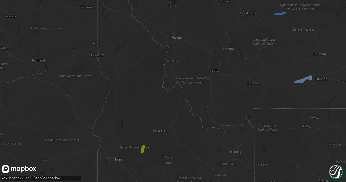
Hail Map in Idaho on July 23, 2020
Get this storm
July 23 map
$229
one time, instant access
Download today. No call, no setup
Keep the $229
Bought the map and want the full workflow? Apply the entire $229 to a subscription within 7 days. None of it is wasted.
Every map, not just this one
This buys you this map. Subscription and you get every map we run, in the markets you choose from a few cities to whole states to nationwide. Plus real-time alerts the moment a storm fires.
Contact data
Name, contact info, occupancy, even credit band for addresses in the footprint. You go from where it hit to who to call.
Become the source they trust
Unlimited branding weather history reports on demand. You already have the documented answer ready for the property owner, and you are the one who showed up with it.
Property data and RoofTrace estimates
Pull up any address you have got, its value and the exact code rules for that jurisdiction, straight from One Click Code. Then RoofTrace estimates the squares, pitch, and roof value, priced the way you price.
Storm reports in Idaho
Idaho
| Date | Description |
|---|---|
| 07/23/20206:55 PM CDT | A local report indicates 64 MPH wind near 17 WSW HAGERMAN |
| 07/23/20206:02 PM CDT | Mesonet station tt086 juniper butte. |
| 07/23/20205:53 PM CDT | Two trees down on the golf course. Observations in the area were near 50mph and time is estimated from those obs. |
| 07/23/20201:25 AM CDT | At 623 PM MDT, severe winds associated with thunderstorm outflows were located along a line extending from near Hailey to 9 miles north of Richfield to 14 miles southeast of Shoshone, moving east at 35 mph. HAZARD...60 mph wind gusts SOURCE...Public. IMPACT...Expect wind damage to roofs, siding, and trees. Locations impacted include... Hailey, Carey, Little Wood Reservoir, Picabo, Bellevue, Richfield, Minidoka, Craters Of The Moon, Gannett, Dietrich, Garfield Ranger Station, Kimama and Laidlaw Corrals Airport. |
| 07/23/20201:00 AM CDT | At 600 PM MDT, severe thunderstorms were located along a line extending from near Swan Falls to near Boise Stage Stop, moving northeast at 30 mph. HAZARD...60 mph wind gusts. SOURCE...Radar indicated. IMPACT...Expect damage to roofs, siding, and trees. Severe thunderstorms will be near... Boise Stage Stop around 610 PM MDT. Blacks Creek Reservoir around 630 PM MDT. |
| 07/23/202012:53 AM CDT | At 553 PM MDT, a severe thunderstorm was located near Graham Guard Station, or 19 miles southeast of Lowman, moving northeast at 15 mph. HAZARD...60 mph wind gusts and quarter size hail. SOURCE...Radar indicated. IMPACT...Hail damage to vehicles is expected. Expect wind damage to roofs, siding, and trees. Locations impacted include... Graham Guard Station and Dutch Creek Guard Station. |
| 07/23/202012:37 AM CDT | At 536 PM MDT, severe thunderstorms were located along a line extending from 7 miles south of Swan Falls to 6 miles south of Cinder Cone Butte, moving north at 20 mph. HAZARD...60 mph wind gusts and nickel size hail. SOURCE...Radar indicated. IMPACT...Expect damage to roofs, siding, and trees. Severe thunderstorms will be near... Murphy and Big Foot Butte around 550 PM MDT. Swan Falls, Melba, Cinder Cone Butte and Initial Point around 600 PM MDT. |
| 07/23/202012:36 AM CDT | At 535 PM MDT, a severe thunderstorm was located 15 miles southeast of Teton, or 16 miles southwest of Felt, moving northeast at 30 mph. HAZARD...60 mph wind gusts and quarter size hail. SOURCE...Radar indicated. IMPACT...Hail damage to vehicles is expected. Expect wind damage to roofs, siding, and trees. Locations impacted include... Felt, Tetonia, Tetonia Research Station and Green Canyon Hot Springs. |
| 07/23/202012:16 AM CDT | At 516 PM MDT, a severe thunderstorm was located over Clover Creek Crossing, or 34 miles south of Glenns Ferry, moving northeast at 20 mph. HAZARD...60 mph wind gusts and penny size hail. SOURCE...Radar indicated. IMPACT...Expect damage to roofs, siding, and trees. This severe thunderstorm will be near... Horse Butte and Coonskin Butte around 530 PM MDT. Roseworth around 600 PM MDT. |
| 07/22/202011:58 PM CDT | At 458 PM MDT, a severe thunderstorm was located near Delamar Mine, or 35 miles south of Nampa, moving east at 25 mph. HAZARD...60 mph wind gusts and quarter size hail. SOURCE...Radar indicated. IMPACT...Hail damage to vehicles is expected. Expect wind damage to roofs, siding, and trees. Locations impacted include... Silver City, Murphy, Reynolds and Delamar Mine. |
| 07/22/202011:39 PM CDT | At 438 PM MDT, a severe thunderstorm was located near Twin Butte, or 32 miles southwest of Glenns Ferry, moving northeast at 10 mph. HAZARD...60 mph wind gusts and half dollar size hail. SOURCE...Radar indicated. IMPACT...Hail damage to vehicles is expected. Expect wind damage to roofs, siding, and trees. This severe thunderstorm will be near... Bruneau Canyon Viewpoint around 510 PM MDT. Pot Hole Butte and Winter Camp Butte around 530 PM MDT. |
| 07/22/202011:24 PM CDT | At 424 PM MDT, a severe thunderstorm was located over Gedney Butte, or 37 miles north of Owyhee, moving southeast at 25 mph. HAZARD...60 mph wind gusts and half dollar size hail. SOURCE...Radar indicated. IMPACT...Hail damage to vehicles is expected. Expect wind damage to roofs, siding, and trees. This severe thunderstorm will be near... Blackstone Reservoir and Grasmere around 440 PM MDT. Monument Butte and Twin Butte around 450 PM MDT. Bruneau River Launch Site around 510 PM MDT. |
| 07/22/202011:08 PM CDT | At 408 PM MDT, a severe thunderstorm was located over Cow Lakes, or 24 miles northeast of Rome, moving northeast at 35 mph. HAZARD...60 mph wind gusts and quarter size hail. SOURCE...Radar indicated. IMPACT...Hail damage to vehicles is expected. Expect wind damage to roofs, siding, and trees. Locations impacted include... Mahogany Mountain, Succor Creek Reservoir, Malloy Ranch, Sheaville, Rockville School and Cow Lakes. |
| 07/22/202010:56 PM CDT | At 356 PM MDT, a severe thunderstorm was located near Hinton Reservoir, or 22 miles southwest of Mountain Home, moving northeast at 15 mph. HAZARD...60 mph wind gusts and half dollar size hail. SOURCE...Radar indicated. IMPACT...Hail damage to vehicles is expected. Expect wind damage to roofs, siding, and trees. This severe thunderstorm will be near... C J Strike Dam around 410 PM MDT. Bruneau around 420 PM MDT. C J Strike Reservoir around 430 PM MDT. Mountain Home Air Force Base around 440 PM MDT. |
| 07/22/20208:47 PM CDT | Awos station ksun hailey airport. |
| 07/22/20207:55 PM CDT | Multiple reports of large trees down on 5th and 8th street in bellevue as well as tendoy street just north of bellevue. |
| 07/22/20207:55 PM CDT | 3 healthy trees fell as a result of the thunderstorm outflow winds. |
| 07/22/20207:35 PM CDT | Mesonet station ric richfield. |
| 07/22/20207:30 PM CDT | Tree downed by strong winds from outflows. Shingle damage also noted. Time estimated based on nearby observations. |
All States Impacted by Hail Map on July 23, 2020
Cities Impacted by Hail Map on July 23, 2020
- Dunbarton, NH
- Weare, NH
- Bow, NH
- Contoocook, NH
- Hooksett, NH
- Henniker, NH
- Jordan Valley, OR
- Buffalo, SD
- Reva, SD
- Camp Crook, SD
- Interior, SD
- Kadoka, SD
- Prairie City, SD
- Marmarth, ND
- Bruneau, ID
- Grand View, ID
- Boise, ID
- Elizaville, NY
- Tivoli, NY
- Red Hook, NY
- Endicott, NY
- Johnson City, NY
- Great Bend, PA
- Binghamton, NY
- Conklin, NY
- Vestal, NY
- Susquehanna, PA
- Hallstead, PA
- Surgoinsville, TN
- Church Hill, TN
- Rogersville, TN
- Elizabethton, TN
- Roan Mountain, TN
- Unicoi, TN
- Hampton, TN
- Johnson City, TN
- Jonesborough, TN
- Erwin, TN
- Molt, MT
- Columbus, MT
- Park City, MT
- Reed Point, MT
- Big Timber, MT
- Coffee Creek, MT
- Geraldine, MT
- Outlook, MT
- Plentywood, MT
- Westmoreland, NH
- Putney, VT
- Newburyport, MA
- Salisbury, MA
- Newbury, MA
- Amherst, MA
- Belchertown, MA
- Granby, MA
- Ware, MA
- South Hadley, MA
- Andover, MA
- Lawrence, MA
- Boxford, MA
- Methuen, MA
- North Andover, MA
- Glendive, MT
- Wibaux, MT
- Baker, MT
- Larslan, MT
- Peerless, MT
- Frazer, MT
- Greensboro, NC
- Maxbass, ND
- Westhope, ND
- Upham, ND
- Kramer, ND
- Lansford, ND
- Souris, ND
- Newburg, ND
- Glenburn, ND
- Berthold, ND
- Scobey, MT
- Riverside, OR
- Plaza, ND
- Parshall, ND
- Ryder, ND
- Wellington, TX
- Port Haywood, VA
- Onemo, VA
- Yucca, AZ
- Wray, CO
- Haigler, NE
- Matador, TX
- Redstone, MT
- Wolf Point, MT
- Tioga, ND
- Des Lacs, ND
- Miami, TX
- Dickens, TX
- Afton, TX
- Grimesland, NC
- Washington, NC
- Teasdale, UT
- Norfolk, CT
- Carpio, ND
- Parksley, VA
- Bloxom, VA
- Goffstown, NH
- Manchester, NH
- Lillington, NC
- Pinckneyville, IL
- Cutler, IL
- Belle Fourche, SD
- Sainte Genevieve, MO
- Germantown, NY
- Ancram, NY
- Hudson, NY
- Shamrock, TX
- Saint Francis, KS
- Stratton, CO
- Bethune, CO
- Skull Valley, AZ
- Bowbells, ND
- Murphy, ID
- Barhamsville, VA
- Sunbury, NC
- Hobbsville, NC
- Vale, NC
- Wendell, NC
- Snyder, TX
- Mclean, TX
- Alamo, ND
- Ray, ND
- Epping, ND
- Flaxton, ND
- Dillon, MT
- Spencer, VA
- Martinsville, VA
- Supai, AZ
- Palermo, ND
- Stanley, ND
- Donnybrook, ND
- Waterloo, IL
- Weatherford, OK
- Williston, ND
- Aspermont, TX
- Dagmar, MT
- Medicine Lake, MT
- Sherwood, ND
- Tolley, ND
- Kenmare, ND
- Kirkland, AZ
- Reserve, MT
- Burlington, ND
- Richey, MT
- Paducah, TX
- Lignite, ND
- Turkey, TX
- Merry Hill, NC
- Blackfoot, ID
- Roxbury, MA
- Boston, MA
- Roxbury Crossing, MA
- Minot Afb, ND
- Bottineau, ND
- Savage, MT
- Newell, SD
- Conowingo, MD
- Colora, MD
- Williams, AZ
- Hanksville, UT
- Thompsonville, IL
- Edenton, NC
- West Point, KY
- Bulls Gap, TN
- Greeneville, TN
- Spring Hope, NC
- Williamston, NC
- Crosbyton, TX
- Weinert, TX
- Mohall, ND
- Falls Village, CT
- Hillsboro, MO
- Rocky Hill, NJ
- Princeton, NJ
- Belle Mead, NJ
- Skillman, NJ
- Red Bud, IL
- Evansville, IL
- Duchesne, UT
- Nortonville, KY
- West Memphis, AR
- Zebulon, NC
- Middlesex, NC
- Ava, IL
- Oxford, NC
- Powers Lake, ND
- Lambert, MT
- Bloomfield, MT
- Dell, MT
- Lima, MT
- Washington, DC
- Lansdale, PA
- Hatfield, PA
- Sedgewickville, MO
- Perryville, MO
- Whitakers, NC
- Newsoms, VA
- Courtland, VA
- Bremen, KY
- Monument Valley, UT
- Lexington, NC
- Thomasville, NC
- Sanford, NC
- Moncure, NC
- Nashville, NC
- Sidney, MT
- Fairview, MT
- Craryville, NY
- Piscataway, NJ
- Rhinebeck, NY
- Port Ewen, NY
- Ulster Park, NY
- Staatsburg, NY
- Carthage, TN
- Pleasant Shade, TN
- Louisburg, NC
- Bunn, NC
- Patrick Springs, VA
- Bassett, VA
- Fieldale, VA
- Unionville, TN
- Selmer, TN
- Stantonville, TN
- Ludlow, SD
- Claverack, NY
- Hollowville, NY
- Hillsdale, NY
- Burlington, CO
- Elkton, MD
- Firth, ID
- Virginia Beach, VA
- Hertford, NC
- Kenly, NC
- Fremont, NC
- Bloomsdale, MO
- Linden, NC
- Bunnlevel, NC
- Makoti, ND
- Dayton, NJ
- Matawan, NJ
- South Amboy, NJ
- Old Bridge, NJ
- Spotswood, NJ
- East Brunswick, NJ
- Englishtown, NJ
- Monroe Township, NJ
- Morganville, NJ
- Sayreville, NJ
- Helmetta, NJ
- Montauk, NY
- West Frankfort, IL
- Prairie Du Rocher, IL
- Fults, IL
- Baldwin, IL
- Memphis, TN
- Watonga, OK
- Hitchcock, OK
- Lenoir City, TN
- Grady, NM
- Tucumcari, NM
- Froid, MT
- Bainville, MT
- Holyoke, CO
- Ayer, MA
- South Boston, MA
- Dorchester, MA
- Elizabeth City, NC
- Fuquay Varina, NC
- Williamsburg, VA
- Spring Grove, VA
- Roaring River, NC
- Plymouth, NC
- Whiteville, TN
- Middleton, TN
- Hermleigh, TX
- Poplar, MT
- Arlington, VA
- Alexandria, VA
- Vernon, CO
- Parks, NE
- Bridgewater, NJ
- Somerville, NJ
- Sedley, VA
- Zuni, VA
- Ivor, VA
- Franklin, VA
- Clinton, NC
- Culbertson, MT
- Coalville, UT
- Holmdel, NJ
- Lincroft, NJ
- Colts Neck, NJ
- Battletown, KY
- Pikeville, KY
- Gatesville, NC
- Tyner, NC
- Belvidere, NC
- Eagleville, TN
- Rockvale, TN
- Chocowinity, NC
- Rexburg, ID
- Boulder, MT
- Stanley, ID
- Milltown, NJ
- North Brunswick, NJ
- Robbinsville, NJ
- Millstone Township, NJ
- Allentown, NJ
- Auburn, NH
- Bradford, NH
- Warner, NH
- Mountain Home Afb, ID
- West Point, VA
- Montross, VA
- Winton, NC
- Eure, NC
- Central City, KY
- Smithfield, NC
- Ahoskie, NC
- Shannon, NC
- Red Springs, NC
- Broadway, NC
- Thomas, OK
- Elida, NM


