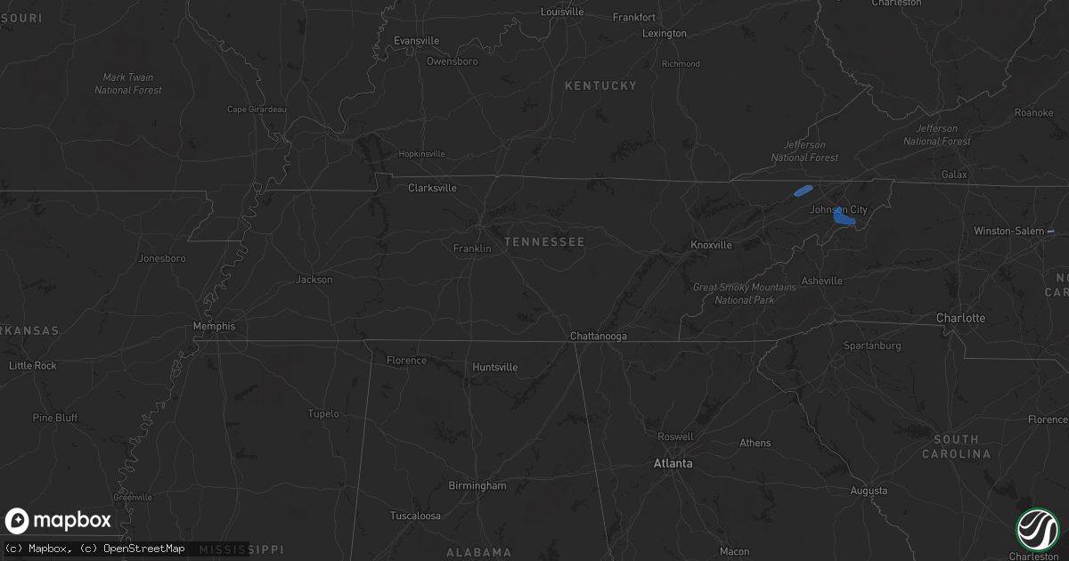
Hail Map in Tennessee on July 23, 2020
Get this storm
July 23 map
$229
one time, instant access
Download today. No call, no setup
Keep the $229
Bought the map and want the full workflow? Apply the entire $229 to a subscription within 7 days. None of it is wasted.
Every map, not just this one
This buys you this map. Subscription and you get every map we run, in the markets you choose from a few cities to whole states to nationwide. Plus real-time alerts the moment a storm fires.
Contact data
Name, contact info, occupancy, even credit band for addresses in the footprint. You go from where it hit to who to call.
Become the source they trust
Unlimited branding weather history reports on demand. You already have the documented answer ready for the property owner, and you are the one who showed up with it.
Property data and RoofTrace estimates
Pull up any address you have got, its value and the exact code rules for that jurisdiction, straight from One Click Code. Then RoofTrace estimates the squares, pitch, and roof value, priced the way you price.
Storm reports in Tennessee
Tennessee
| Date | Description |
|---|---|
| 07/23/20204:58 PM CDT | A few trees were blown down along ray sircy lane and rawls creek road. |
| 07/23/20204:56 PM CDT | Several trees down. |
| 07/23/20204:53 PM CDT | Several trees down across the area. |
| 07/23/20204:16 PM CDT | Trees down. |
| 07/23/20204:00 PM CDT | Report came from home weather station. |
| 07/23/20203:54 PM CDT | Several trees down. |
| 07/23/20203:50 PM CDT | A few trees down. |
| 07/23/20203:35 PM CDT | Several trees down. |
| 07/23/20202:30 PM CDT | A few trees down. |
| 07/23/20202:20 PM CDT | A few trees down along piney flats road. |
| 07/23/202011:50 AM CDT | One tree down across poole road in sale creek tn. Time estimated. |
| 07/23/20207:37 AM CDT | At 1237 PM EDT, a severe thunderstorm was located 8 miles northeast of Soddy-Daisy, or 10 miles southwest of Dayton, and is nearly stationary. HAZARD...60 mph wind gusts and quarter size hail. SOURCE...Radar indicated. IMPACT...Hail damage to vehicles is expected. Expect wind damage to roofs, siding, and trees. Locations impacted include... Soddy-Daisy, Sale Creek, Birchwood and Flat Top Mountain. |
| 07/23/20201:14 AM CDT | At 614 PM EDT, a severe thunderstorm was located 10 miles northwest of Newland, or 6 miles west of Elk Park, moving east at 20 mph. HAZARD...60 mph wind gusts. SOURCE...Radar indicated. IMPACT...Expect damage to trees and power lines. Locations impacted include... Newland, Banner Elk, Elk Park, Beech Mountain In Avery County, Crossnore, Sugar Mountain, Seven Devils, Grandfather Mountain State Park, B.R. Parkway-Linville Falls To Grandfather and Pineola. |
| 07/22/202011:21 PM CDT | At 421 PM EDT, a severe thunderstorm was located over Newport, moving east at 15 mph. HAZARD...60 mph wind gusts and penny size hail. SOURCE...Radar indicated. IMPACT...Expect damage to roofs, siding, and trees. Locations impacted include... Newport, Parrottsville, Caney Branch, Bybee, Del Rio and Cedar Creek.This includes Interstate 40 in Tennessee between mile markers 433 and439. |
| 07/22/202010:59 PM CDT | At 359 PM EDT, a severe thunderstorm was located near Dandridge, moving east at 10 mph. HAZARD...60 mph wind gusts and penny size hail. SOURCE...Radar indicated. IMPACT...Expect damage to roofs, siding, and trees. Locations impacted include... Newport, Dandridge, White Pine, Baneberry, Bybee, Chestnut Hill, Bird Crossing and Fairgarden.This includes Interstate 40 in Tennessee between mile markers 422 and442. |
All States Impacted by Hail Map on July 23, 2020
Cities Impacted by Hail Map on July 23, 2020
- Dunbarton, NH
- Weare, NH
- Bow, NH
- Contoocook, NH
- Hooksett, NH
- Henniker, NH
- Jordan Valley, OR
- Buffalo, SD
- Reva, SD
- Camp Crook, SD
- Interior, SD
- Kadoka, SD
- Prairie City, SD
- Marmarth, ND
- Bruneau, ID
- Grand View, ID
- Boise, ID
- Elizaville, NY
- Tivoli, NY
- Red Hook, NY
- Endicott, NY
- Johnson City, NY
- Great Bend, PA
- Binghamton, NY
- Conklin, NY
- Vestal, NY
- Susquehanna, PA
- Hallstead, PA
- Surgoinsville, TN
- Church Hill, TN
- Rogersville, TN
- Elizabethton, TN
- Roan Mountain, TN
- Unicoi, TN
- Hampton, TN
- Johnson City, TN
- Jonesborough, TN
- Erwin, TN
- Molt, MT
- Columbus, MT
- Park City, MT
- Reed Point, MT
- Big Timber, MT
- Coffee Creek, MT
- Geraldine, MT
- Outlook, MT
- Plentywood, MT
- Westmoreland, NH
- Putney, VT
- Newburyport, MA
- Salisbury, MA
- Newbury, MA
- Amherst, MA
- Belchertown, MA
- Granby, MA
- Ware, MA
- South Hadley, MA
- Andover, MA
- Lawrence, MA
- Boxford, MA
- Methuen, MA
- North Andover, MA
- Glendive, MT
- Wibaux, MT
- Baker, MT
- Larslan, MT
- Peerless, MT
- Frazer, MT
- Greensboro, NC
- Maxbass, ND
- Westhope, ND
- Upham, ND
- Kramer, ND
- Lansford, ND
- Souris, ND
- Newburg, ND
- Glenburn, ND
- Berthold, ND
- Scobey, MT
- Riverside, OR
- Plaza, ND
- Parshall, ND
- Ryder, ND
- Wellington, TX
- Port Haywood, VA
- Onemo, VA
- Yucca, AZ
- Wray, CO
- Haigler, NE
- Matador, TX
- Redstone, MT
- Wolf Point, MT
- Tioga, ND
- Des Lacs, ND
- Miami, TX
- Dickens, TX
- Afton, TX
- Grimesland, NC
- Washington, NC
- Teasdale, UT
- Norfolk, CT
- Carpio, ND
- Parksley, VA
- Bloxom, VA
- Goffstown, NH
- Manchester, NH
- Lillington, NC
- Pinckneyville, IL
- Cutler, IL
- Belle Fourche, SD
- Sainte Genevieve, MO
- Germantown, NY
- Ancram, NY
- Hudson, NY
- Shamrock, TX
- Saint Francis, KS
- Stratton, CO
- Bethune, CO
- Skull Valley, AZ
- Bowbells, ND
- Murphy, ID
- Barhamsville, VA
- Sunbury, NC
- Hobbsville, NC
- Vale, NC
- Wendell, NC
- Snyder, TX
- Mclean, TX
- Alamo, ND
- Ray, ND
- Epping, ND
- Flaxton, ND
- Dillon, MT
- Spencer, VA
- Martinsville, VA
- Supai, AZ
- Palermo, ND
- Stanley, ND
- Donnybrook, ND
- Waterloo, IL
- Weatherford, OK
- Williston, ND
- Aspermont, TX
- Dagmar, MT
- Medicine Lake, MT
- Sherwood, ND
- Tolley, ND
- Kenmare, ND
- Kirkland, AZ
- Reserve, MT
- Burlington, ND
- Richey, MT
- Paducah, TX
- Lignite, ND
- Turkey, TX
- Merry Hill, NC
- Blackfoot, ID
- Roxbury, MA
- Boston, MA
- Roxbury Crossing, MA
- Minot Afb, ND
- Bottineau, ND
- Savage, MT
- Newell, SD
- Conowingo, MD
- Colora, MD
- Williams, AZ
- Hanksville, UT
- Thompsonville, IL
- Edenton, NC
- West Point, KY
- Bulls Gap, TN
- Greeneville, TN
- Spring Hope, NC
- Williamston, NC
- Crosbyton, TX
- Weinert, TX
- Mohall, ND
- Falls Village, CT
- Hillsboro, MO
- Rocky Hill, NJ
- Princeton, NJ
- Belle Mead, NJ
- Skillman, NJ
- Red Bud, IL
- Evansville, IL
- Duchesne, UT
- Nortonville, KY
- West Memphis, AR
- Zebulon, NC
- Middlesex, NC
- Ava, IL
- Oxford, NC
- Powers Lake, ND
- Lambert, MT
- Bloomfield, MT
- Dell, MT
- Lima, MT
- Washington, DC
- Lansdale, PA
- Hatfield, PA
- Sedgewickville, MO
- Perryville, MO
- Whitakers, NC
- Newsoms, VA
- Courtland, VA
- Bremen, KY
- Monument Valley, UT
- Lexington, NC
- Thomasville, NC
- Sanford, NC
- Moncure, NC
- Nashville, NC
- Sidney, MT
- Fairview, MT
- Craryville, NY
- Piscataway, NJ
- Rhinebeck, NY
- Port Ewen, NY
- Ulster Park, NY
- Staatsburg, NY
- Carthage, TN
- Pleasant Shade, TN
- Louisburg, NC
- Bunn, NC
- Patrick Springs, VA
- Bassett, VA
- Fieldale, VA
- Unionville, TN
- Selmer, TN
- Stantonville, TN
- Ludlow, SD
- Claverack, NY
- Hollowville, NY
- Hillsdale, NY
- Burlington, CO
- Elkton, MD
- Firth, ID
- Virginia Beach, VA
- Hertford, NC
- Kenly, NC
- Fremont, NC
- Bloomsdale, MO
- Linden, NC
- Bunnlevel, NC
- Makoti, ND
- Dayton, NJ
- Matawan, NJ
- South Amboy, NJ
- Old Bridge, NJ
- Spotswood, NJ
- East Brunswick, NJ
- Englishtown, NJ
- Monroe Township, NJ
- Morganville, NJ
- Sayreville, NJ
- Helmetta, NJ
- Montauk, NY
- West Frankfort, IL
- Prairie Du Rocher, IL
- Fults, IL
- Baldwin, IL
- Memphis, TN
- Watonga, OK
- Hitchcock, OK
- Lenoir City, TN
- Grady, NM
- Tucumcari, NM
- Froid, MT
- Bainville, MT
- Holyoke, CO
- Ayer, MA
- South Boston, MA
- Dorchester, MA
- Elizabeth City, NC
- Fuquay Varina, NC
- Williamsburg, VA
- Spring Grove, VA
- Roaring River, NC
- Plymouth, NC
- Whiteville, TN
- Middleton, TN
- Hermleigh, TX
- Poplar, MT
- Arlington, VA
- Alexandria, VA
- Vernon, CO
- Parks, NE
- Bridgewater, NJ
- Somerville, NJ
- Sedley, VA
- Zuni, VA
- Ivor, VA
- Franklin, VA
- Clinton, NC
- Culbertson, MT
- Coalville, UT
- Holmdel, NJ
- Lincroft, NJ
- Colts Neck, NJ
- Battletown, KY
- Pikeville, KY
- Gatesville, NC
- Tyner, NC
- Belvidere, NC
- Eagleville, TN
- Rockvale, TN
- Chocowinity, NC
- Rexburg, ID
- Boulder, MT
- Stanley, ID
- Milltown, NJ
- North Brunswick, NJ
- Robbinsville, NJ
- Millstone Township, NJ
- Allentown, NJ
- Auburn, NH
- Bradford, NH
- Warner, NH
- Mountain Home Afb, ID
- West Point, VA
- Montross, VA
- Winton, NC
- Eure, NC
- Central City, KY
- Smithfield, NC
- Ahoskie, NC
- Shannon, NC
- Red Springs, NC
- Broadway, NC
- Thomas, OK
- Elida, NM


