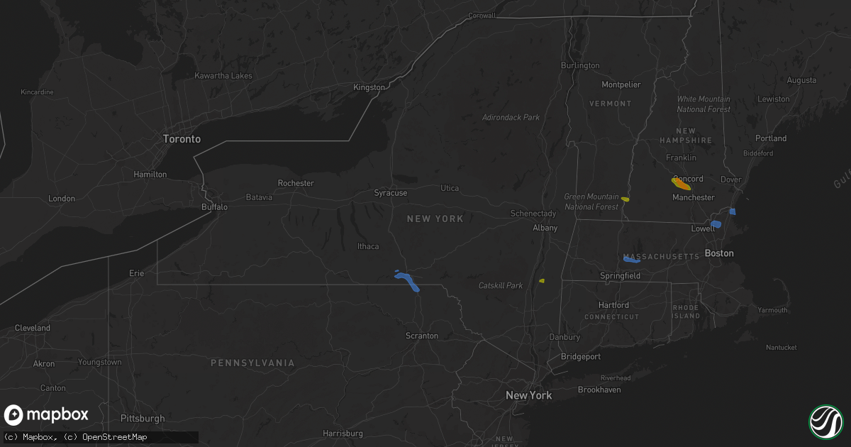
Hail Map in New York on July 23, 2020
Get this storm
July 23 map
$229
one time, instant access
Download today. No call, no setup
Keep the $229
Bought the map and want the full workflow? Apply the entire $229 to a subscription within 7 days. None of it is wasted.
Every map, not just this one
This buys you this map. Subscription and you get every map we run, in the markets you choose from a few cities to whole states to nationwide. Plus real-time alerts the moment a storm fires.
Contact data
Name, contact info, occupancy, even credit band for addresses in the footprint. You go from where it hit to who to call.
Become the source they trust
Unlimited branding weather history reports on demand. You already have the documented answer ready for the property owner, and you are the one who showed up with it.
Property data and RoofTrace estimates
Pull up any address you have got, its value and the exact code rules for that jurisdiction, straight from One Click Code. Then RoofTrace estimates the squares, pitch, and roof value, priced the way you price.
Storm reports in New York
New York
| Date | Description |
|---|---|
| 07/23/20206:14 PM CDT | Numerous downed trees and wires on jackson corners road |
| 07/23/20205:49 PM CDT | Downed tree and wires |
| 07/23/20205:43 PM CDT | Downed tree and wires |
| 07/23/20205:37 PM CDT | Downed tree and wires on black bridge road |
| 07/23/20205:31 PM CDT | Tree and power lines down |
| 07/23/20205:12 PM CDT | Downed tree and wires on county route 10 |
| 07/23/20203:47 PM CDT | Tree down across perry city rd |
| 07/23/20202:46 PM CDT | Tree down near mccarther park |
| 07/23/20202:36 PM CDT | Tree down on wires |
| 07/23/20202:36 PM CDT | Tree down across route 79 |
| 07/23/20202:36 PM CDT | Pole and wires down on clinton st. |
| 07/23/20202:26 PM CDT | Wires down sparking on truck on hazel ave. |
| 07/23/20202:23 PM CDT | Wires down on road on canterberry drive |
| 07/23/20202:22 PM CDT | Tree down across the road |
| 07/23/20202:20 PM CDT | Power line down on mills ave. |
| 07/23/20202:16 PM CDT | Tree on wires |
| 07/23/20202:10 PM CDT | Trees down in apalachin |
| 07/23/20201:59 PM CDT | Trees down in owego |
| 07/23/20201:44 PM CDT | Tree down in newark valley |
| 07/23/20201:13 PM CDT | Tree down in ithaca |
| 07/23/20204:43 AM CDT | At 942 PM EDT, severe thunderstorms were located along a line extending from near Seymour to near Milford, moving northeast at 30 mph. HAZARD...60 mph wind gusts and quarter size hail. SOURCE...Radar indicated. IMPACT...Minor hail damage to vehicles is possible. Expect wind damage to trees and power lines. Locations impacted include... Bridgeport, New Haven, Danbury, Meriden, Milford, Wallingford, Shelton, Naugatuck, Guilford, Southbury, Durham, Newtown, Fairfield, Hamden and Stratford. |
| 07/23/20204:07 AM CDT | At 907 PM EDT, severe thunderstorms were located along a line extending from Bridgeport--Stamford to near Trumbull, moving east at 30 mph. HAZARD...60 mph wind gusts and quarter size hail. SOURCE...Radar indicated. IMPACT...Minor hail damage to vehicles is possible. Expect wind damage to trees and power lines. Locations impacted include... Bridgeport, New Haven, Milford, Shelton, Newtown, Fairfield, Stratford, Trumbull, Ridgefield, Monroe, Wilton, Orange, Derby, Weston and Redding. |
| 07/23/202012:08 AM CDT | At 508 PM EDT, a severe thunderstorm was located near Austerlitz, or near Chatham, moving southeast at 20 mph. HAZARD...60 mph wind gusts. SOURCE...Radar indicated. IMPACT...Expect damage to roofs, siding, and trees. Locations impacted include... Great Barrington, Chatham, Lee, Lenox, Austerlitz, Housatonic, Ghent, Stockbridge, Canaan, Richmond, West Stockbridge, Alford, Tyringham, Glendale, North Hillsdale, Williamsville, Harlemville, North Egremont, Carey Corner and Buckleyville. |
| 07/22/202011:58 PM CDT | At 457 PM EDT, severe thunderstorms were located along a line extending from near Thompson, to near Gibson, to Hop Bottom, to near Springville, moving southeast at 25 mph. HAZARD...60 mph wind gusts and quarter size hail. SOURCE...Law enforcement. Trees and power lines have been blown down by this line of thunderstorms. IMPACT...Hail damage to vehicles is expected. Expect wind damage to roofs, siding, and trees. Locations impacted include... Scranton, Dunmore, Carbondale, Old Forge, Archbald, Blakely, Taylor, Dickson City, Moosic, and Olyphant. |
| 07/22/202010:56 PM CDT | At 355 PM EDT, severe thunderstorms were located along a line extending from near Chenango Bridge, to near Conklin, to near Brackney, to near Little Meadows, to near Le Raysville, moving southeast at 30 mph. HAZARD...60 mph wind gusts and nickel size hail. SOURCE...Law enforcement. Trees and power lines have been blown down by this line of thunderstorms. IMPACT...Expect damage to roofs, siding, and trees. Locations impacted include... Binghamton, Johnson City, Kirkwood, Conklin, Clarks Summit, Rush, Jackson, Clifford, Sanford and Susquehanna. |
| 07/22/20209:53 PM CDT | At 253 PM EDT, a severe thunderstorm was located over Delanson, or 12 miles west of Rotterdam, moving southeast at 30 mph. HAZARD...60 mph wind gusts. SOURCE...Radar indicated. IMPACT...Expect damage to roofs, siding, and trees. Locations impacted include... Albany, Rotterdam, Guilderland, Duanesburg, Berne, Voorheesville, Altamont, Delanson, New Scotland, Knox, Princetown, Clarksville, Esperance, Duane, East Berne, Rockwell Corners, Gifford, Quaker Street, Bramans Corners and Helderberg. |
| 07/22/20209:40 PM CDT | At 240 PM EDT, severe thunderstorms were located along a line extending from near South Danby to near Erin, moving east at 25 mph. HAZARD...60 mph wind gusts and quarter size hail. SOURCE...Radar indicated. IMPACT...Hail damage to vehicles is expected. Expect wind damage to roofs, siding, and trees. Locations impacted include... Barton, Owego, Newark Valley, Candor, Spencer, Van Etten, Nichols, Lockwood, Tioga Center and Lounsberry. |
| 07/22/20209:11 PM CDT | At 210 PM EDT, a cluster of severe thunderstorms was located over Enfield, or near Ithaca, moving east at 25 mph. HAZARD...60 mph wind gusts and quarter size hail. SOURCE...Radar indicated. IMPACT...Hail damage to vehicles is expected. Expect wind damage to roofs, siding, and trees. Locations impacted include... Ithaca, Newfield, Cayuga Heights, Lansing, Enfield, Danby, Caroline, Dryden, Berkshire and Richford. |
All States Impacted by Hail Map on July 23, 2020
Cities Impacted by Hail Map on July 23, 2020
- Dunbarton, NH
- Weare, NH
- Bow, NH
- Contoocook, NH
- Hooksett, NH
- Henniker, NH
- Jordan Valley, OR
- Buffalo, SD
- Reva, SD
- Camp Crook, SD
- Interior, SD
- Kadoka, SD
- Prairie City, SD
- Marmarth, ND
- Bruneau, ID
- Grand View, ID
- Boise, ID
- Elizaville, NY
- Tivoli, NY
- Red Hook, NY
- Endicott, NY
- Johnson City, NY
- Great Bend, PA
- Binghamton, NY
- Conklin, NY
- Vestal, NY
- Susquehanna, PA
- Hallstead, PA
- Surgoinsville, TN
- Church Hill, TN
- Rogersville, TN
- Elizabethton, TN
- Roan Mountain, TN
- Unicoi, TN
- Hampton, TN
- Johnson City, TN
- Jonesborough, TN
- Erwin, TN
- Molt, MT
- Columbus, MT
- Park City, MT
- Reed Point, MT
- Big Timber, MT
- Coffee Creek, MT
- Geraldine, MT
- Outlook, MT
- Plentywood, MT
- Westmoreland, NH
- Putney, VT
- Newburyport, MA
- Salisbury, MA
- Newbury, MA
- Amherst, MA
- Belchertown, MA
- Granby, MA
- Ware, MA
- South Hadley, MA
- Andover, MA
- Lawrence, MA
- Boxford, MA
- Methuen, MA
- North Andover, MA
- Glendive, MT
- Wibaux, MT
- Baker, MT
- Larslan, MT
- Peerless, MT
- Frazer, MT
- Greensboro, NC
- Maxbass, ND
- Westhope, ND
- Upham, ND
- Kramer, ND
- Lansford, ND
- Souris, ND
- Newburg, ND
- Glenburn, ND
- Berthold, ND
- Scobey, MT
- Riverside, OR
- Plaza, ND
- Parshall, ND
- Ryder, ND
- Wellington, TX
- Port Haywood, VA
- Onemo, VA
- Yucca, AZ
- Wray, CO
- Haigler, NE
- Matador, TX
- Redstone, MT
- Wolf Point, MT
- Tioga, ND
- Des Lacs, ND
- Miami, TX
- Dickens, TX
- Afton, TX
- Grimesland, NC
- Washington, NC
- Teasdale, UT
- Norfolk, CT
- Carpio, ND
- Parksley, VA
- Bloxom, VA
- Goffstown, NH
- Manchester, NH
- Lillington, NC
- Pinckneyville, IL
- Cutler, IL
- Belle Fourche, SD
- Sainte Genevieve, MO
- Germantown, NY
- Ancram, NY
- Hudson, NY
- Shamrock, TX
- Saint Francis, KS
- Stratton, CO
- Bethune, CO
- Skull Valley, AZ
- Bowbells, ND
- Murphy, ID
- Barhamsville, VA
- Sunbury, NC
- Hobbsville, NC
- Vale, NC
- Wendell, NC
- Snyder, TX
- Mclean, TX
- Alamo, ND
- Ray, ND
- Epping, ND
- Flaxton, ND
- Dillon, MT
- Spencer, VA
- Martinsville, VA
- Supai, AZ
- Palermo, ND
- Stanley, ND
- Donnybrook, ND
- Waterloo, IL
- Weatherford, OK
- Williston, ND
- Aspermont, TX
- Dagmar, MT
- Medicine Lake, MT
- Sherwood, ND
- Tolley, ND
- Kenmare, ND
- Kirkland, AZ
- Reserve, MT
- Burlington, ND
- Richey, MT
- Paducah, TX
- Lignite, ND
- Turkey, TX
- Merry Hill, NC
- Blackfoot, ID
- Roxbury, MA
- Boston, MA
- Roxbury Crossing, MA
- Minot Afb, ND
- Bottineau, ND
- Savage, MT
- Newell, SD
- Conowingo, MD
- Colora, MD
- Williams, AZ
- Hanksville, UT
- Thompsonville, IL
- Edenton, NC
- West Point, KY
- Bulls Gap, TN
- Greeneville, TN
- Spring Hope, NC
- Williamston, NC
- Crosbyton, TX
- Weinert, TX
- Mohall, ND
- Falls Village, CT
- Hillsboro, MO
- Rocky Hill, NJ
- Princeton, NJ
- Belle Mead, NJ
- Skillman, NJ
- Red Bud, IL
- Evansville, IL
- Duchesne, UT
- Nortonville, KY
- West Memphis, AR
- Zebulon, NC
- Middlesex, NC
- Ava, IL
- Oxford, NC
- Powers Lake, ND
- Lambert, MT
- Bloomfield, MT
- Dell, MT
- Lima, MT
- Washington, DC
- Lansdale, PA
- Hatfield, PA
- Sedgewickville, MO
- Perryville, MO
- Whitakers, NC
- Newsoms, VA
- Courtland, VA
- Bremen, KY
- Monument Valley, UT
- Lexington, NC
- Thomasville, NC
- Sanford, NC
- Moncure, NC
- Nashville, NC
- Sidney, MT
- Fairview, MT
- Craryville, NY
- Piscataway, NJ
- Rhinebeck, NY
- Port Ewen, NY
- Ulster Park, NY
- Staatsburg, NY
- Carthage, TN
- Pleasant Shade, TN
- Louisburg, NC
- Bunn, NC
- Patrick Springs, VA
- Bassett, VA
- Fieldale, VA
- Unionville, TN
- Selmer, TN
- Stantonville, TN
- Ludlow, SD
- Claverack, NY
- Hollowville, NY
- Hillsdale, NY
- Burlington, CO
- Elkton, MD
- Firth, ID
- Virginia Beach, VA
- Hertford, NC
- Kenly, NC
- Fremont, NC
- Bloomsdale, MO
- Linden, NC
- Bunnlevel, NC
- Makoti, ND
- Dayton, NJ
- Matawan, NJ
- South Amboy, NJ
- Old Bridge, NJ
- Spotswood, NJ
- East Brunswick, NJ
- Englishtown, NJ
- Monroe Township, NJ
- Morganville, NJ
- Sayreville, NJ
- Helmetta, NJ
- Montauk, NY
- West Frankfort, IL
- Prairie Du Rocher, IL
- Fults, IL
- Baldwin, IL
- Memphis, TN
- Watonga, OK
- Hitchcock, OK
- Lenoir City, TN
- Grady, NM
- Tucumcari, NM
- Froid, MT
- Bainville, MT
- Holyoke, CO
- Ayer, MA
- South Boston, MA
- Dorchester, MA
- Elizabeth City, NC
- Fuquay Varina, NC
- Williamsburg, VA
- Spring Grove, VA
- Roaring River, NC
- Plymouth, NC
- Whiteville, TN
- Middleton, TN
- Hermleigh, TX
- Poplar, MT
- Arlington, VA
- Alexandria, VA
- Vernon, CO
- Parks, NE
- Bridgewater, NJ
- Somerville, NJ
- Sedley, VA
- Zuni, VA
- Ivor, VA
- Franklin, VA
- Clinton, NC
- Culbertson, MT
- Coalville, UT
- Holmdel, NJ
- Lincroft, NJ
- Colts Neck, NJ
- Battletown, KY
- Pikeville, KY
- Gatesville, NC
- Tyner, NC
- Belvidere, NC
- Eagleville, TN
- Rockvale, TN
- Chocowinity, NC
- Rexburg, ID
- Boulder, MT
- Stanley, ID
- Milltown, NJ
- North Brunswick, NJ
- Robbinsville, NJ
- Millstone Township, NJ
- Allentown, NJ
- Auburn, NH
- Bradford, NH
- Warner, NH
- Mountain Home Afb, ID
- West Point, VA
- Montross, VA
- Winton, NC
- Eure, NC
- Central City, KY
- Smithfield, NC
- Ahoskie, NC
- Shannon, NC
- Red Springs, NC
- Broadway, NC
- Thomas, OK
- Elida, NM


