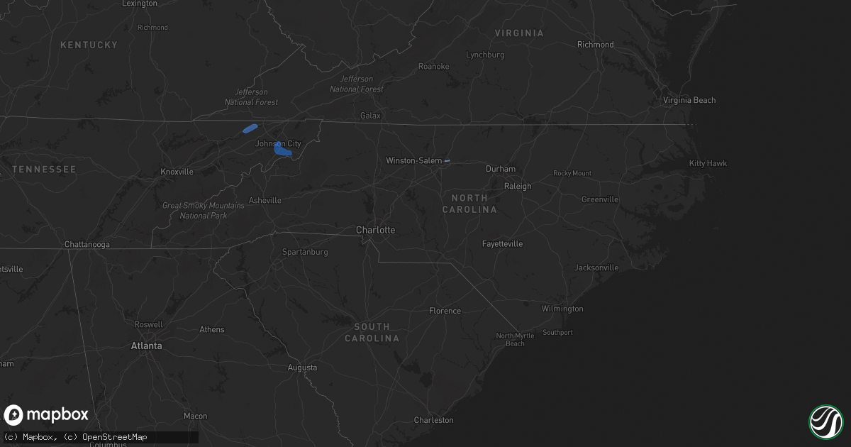
Hail Map in North Carolina on July 23, 2020
Get this storm
July 23 map
$229
one time, instant access
Download today. No call, no setup
Keep the $229
Bought the map and want the full workflow? Apply the entire $229 to a subscription within 7 days. None of it is wasted.
Every map, not just this one
This buys you this map. Subscription and you get every map we run, in the markets you choose from a few cities to whole states to nationwide. Plus real-time alerts the moment a storm fires.
Contact data
Name, contact info, occupancy, even credit band for addresses in the footprint. You go from where it hit to who to call.
Become the source they trust
Unlimited branding weather history reports on demand. You already have the documented answer ready for the property owner, and you are the one who showed up with it.
Property data and RoofTrace estimates
Pull up any address you have got, its value and the exact code rules for that jurisdiction, straight from One Click Code. Then RoofTrace estimates the squares, pitch, and roof value, priced the way you price.
Storm reports in North Carolina
North Carolina
| Date | Description |
|---|---|
| 07/23/20206:38 PM CDT | Tree down at intersection of larkins st. And walker st. |
| 07/23/20206:38 PM CDT | Power lines down at beaman st near northeast boulevard rd. |
| 07/23/20204:24 PM CDT | Multiple trees down at eagle ridge in garner. |
| 07/23/20203:56 PM CDT | Lightning struck house on barnsdale ridge rd... Kernersville. |
| 07/23/20203:19 PM CDT | Tree down at dortches rd and red oak. |
| 07/23/20203:17 PM CDT | Multiple trees and power lines down at exum and oak st. |
| 07/23/20203:09 PM CDT | Power lines down at talleyrand rd. And randleman rd. |
| 07/23/20202:54 PM CDT | Power lines down at craig st and randleman rd. |
| 07/23/20202:47 PM CDT | Power lines down at julian st. And omaha st. |
| 07/23/20202:33 PM CDT | Powerlines down on sykes ave and east wendover ave. |
| 07/23/20202:31 PM CDT | Tree down at 2200 block of shepard school rd. |
| 07/23/20202:10 PM CDT | Power line down at pippin rd and zebulon rd. |
| 07/23/20201:47 PM CDT | Trrees and powerliens down on hwy 96 and riley hill rd... Zebulon. |
| 07/23/20201:47 PM CDT | Tree down on pippin rd in zrbulon. |
| 07/23/20201:47 PM CDT | Storm spotter reported north of zebulon. |
| 07/23/20201:45 PM CDT | Several trees down 3miles east of walkerstown. |
| 07/23/20201:45 PM CDT | Tree down at vick rd and pleasant grove church rd. |
| 07/23/20201:43 PM CDT | Trees and powerlines down on shepard school rd. |
| 07/23/20201:30 PM CDT | County 911 call center reported trees and power lines down on foothills airport road. |
| 07/23/20201:30 PM CDT | Trees down in parking lot of wake forest baptist medical center. Some cars were also damaged as a result. |
| 07/23/20201:28 PM CDT | 911 call center reported trees down on smokey creek road. |
| 07/23/20201:15 PM CDT | Corrects previous tstm wnd dmg report from 1 s winston-salem. Multiple trees down... Including one on a house in winston-salem on queen street. Time estimated to be bet |
| 07/23/20201:01 PM CDT | Multiple trees down... Including one on a house in winston-salem on queen street. Time estimated to be between 2pm to 245pm. |
| 07/23/20202:30 AM CDT | At 730 PM EDT, a severe thunderstorm was located over Clinton, moving northeast at 15 mph. HAZARD...60 mph wind gusts. SOURCE...Radar indicated. IMPACT...Expect damage to roofs, siding, and trees. Locations impacted include... Clinton, Turkey and Hobbton. |
| 07/23/202012:46 AM CDT | At 545 PM EDT, a severe thunderstorm was located near Erwin, moving east at 20 mph. HAZARD...60 mph wind gusts. SOURCE...Radar indicated. IMPACT...Expect damage to roofs, siding, and trees. Locations impacted include... Johnson City, Elizabethton, Erwin, Jonesborough, Banner Hill, Central, Hampton, Midway, Pine Crest and Unicoi.This includes Interstate 26 in Tennessee between mile markers 22 and39. |
| 07/22/202011:40 PM CDT | At 440 PM EDT, a severe thunderstorm was located 10 miles northwest of Lincolnton, or 8 miles south of Mountain View, moving east at 15 mph. HAZARD...60 mph wind gusts and penny size hail. SOURCE...Radar indicated. IMPACT...Expect damage to trees and power lines. Locations impacted include... Newton, Lincolnton, Conover, Maiden, Claremont, Boger City, Iron Station, Startown, Cooksville and Propst. |
| 07/22/202010:58 PM CDT | At 358 PM EDT, a severe thunderstorm was located 6 miles east of Statesville, moving northeast at 30 mph. HAZARD...60 mph wind gusts and quarter size hail. SOURCE...Radar indicated. IMPACT...Minor hail damage to vehicles is expected. Expect wind damage to trees and power lines. Locations impacted include... Mocksville, Bermuda Run, Cooleemee, Cleveland, Fork Church, Advance, Turnersburg, Cool Springs, Sheffield and Farmington. |
| 07/22/202010:36 PM CDT | At 336 PM EDT, a severe thunderstorm was located over Spencer, moving northeast at 15 mph. HAZARD...60 mph wind gusts and quarter size hail. SOURCE...Radar indicated. IMPACT...Hail damage to vehicles is expected. Expect wind damage to roofs, siding, and trees. Locations impacted include... Martinsville... Rocky Mount... Axton... Penhook... Spencer... Bassett... and Sydnorsville.This includes The following Locations The Martinsville Speedway andMartinsville Airport. |
| 07/22/202010:19 PM CDT | At 318 PM EDT, a severe thunderstorm was located over Greensboro, moving east at 30 mph. HAZARD...60 mph wind gusts. SOURCE...Radar indicated. IMPACT...Expect damage to roofs, siding, and trees. Locations impacted include... Greensboro, High Point, Burlington, Graham, Mebane, Elon, McLeansville, Archdale, Summerfield and Gibsonville. |
| 07/22/20209:53 PM CDT | At 252 PM EDT, a severe thunderstorm was located over north Raleigh, moving southeast at 15 mph. HAZARD...60 mph wind gusts. SOURCE...Radar indicated. IMPACT...Expect damage to roofs, siding, and trees. Locations impacted include... Raleigh, Wake Forest, Zebulon, RDU International, Knightdale, Wendell, Rolesville, Falls Lake Boat Ramp, William B Umstead State Park and Falls Lake. |
| 07/22/20209:42 PM CDT | At 241 PM EDT, a severe thunderstorm was located near Nashville, moving southeast at 20 mph. HAZARD...60 mph wind gusts. SOURCE...Radar indicated. IMPACT...Expect damage to roofs, siding, and trees. Locations impacted include... Rocky Mount, Nashville, Dortches, Bailey, Bunn, Red Oak, Sharpsburg, Spring Hope, Pilot and Tar River Reservoir. |
| 07/22/20209:13 PM CDT | At 213 PM EDT, a severe thunderstorm was located 5 miles northeast of Morganton, or near Drexel, moving northeast at 10 mph. HAZARD...60 mph wind gusts and penny size hail. SOURCE...Radar indicated. IMPACT...Expect damage to trees and power lines. Locations impacted include... Lenoir, Morganton, Sawmills, Granite Falls, Valdese, Gamewell, Hudson, Cajah's Mountain, Drexel and Connelly Springs. |
All States Impacted by Hail Map on July 23, 2020
Cities Impacted by Hail Map on July 23, 2020
- Dunbarton, NH
- Weare, NH
- Bow, NH
- Contoocook, NH
- Hooksett, NH
- Henniker, NH
- Jordan Valley, OR
- Buffalo, SD
- Reva, SD
- Camp Crook, SD
- Interior, SD
- Kadoka, SD
- Prairie City, SD
- Marmarth, ND
- Bruneau, ID
- Grand View, ID
- Boise, ID
- Elizaville, NY
- Tivoli, NY
- Red Hook, NY
- Endicott, NY
- Johnson City, NY
- Great Bend, PA
- Binghamton, NY
- Conklin, NY
- Vestal, NY
- Susquehanna, PA
- Hallstead, PA
- Surgoinsville, TN
- Church Hill, TN
- Rogersville, TN
- Elizabethton, TN
- Roan Mountain, TN
- Unicoi, TN
- Hampton, TN
- Johnson City, TN
- Jonesborough, TN
- Erwin, TN
- Molt, MT
- Columbus, MT
- Park City, MT
- Reed Point, MT
- Big Timber, MT
- Coffee Creek, MT
- Geraldine, MT
- Outlook, MT
- Plentywood, MT
- Westmoreland, NH
- Putney, VT
- Newburyport, MA
- Salisbury, MA
- Newbury, MA
- Amherst, MA
- Belchertown, MA
- Granby, MA
- Ware, MA
- South Hadley, MA
- Andover, MA
- Lawrence, MA
- Boxford, MA
- Methuen, MA
- North Andover, MA
- Glendive, MT
- Wibaux, MT
- Baker, MT
- Larslan, MT
- Peerless, MT
- Frazer, MT
- Greensboro, NC
- Maxbass, ND
- Westhope, ND
- Upham, ND
- Kramer, ND
- Lansford, ND
- Souris, ND
- Newburg, ND
- Glenburn, ND
- Berthold, ND
- Scobey, MT
- Riverside, OR
- Plaza, ND
- Parshall, ND
- Ryder, ND
- Wellington, TX
- Port Haywood, VA
- Onemo, VA
- Yucca, AZ
- Wray, CO
- Haigler, NE
- Matador, TX
- Redstone, MT
- Wolf Point, MT
- Tioga, ND
- Des Lacs, ND
- Miami, TX
- Dickens, TX
- Afton, TX
- Grimesland, NC
- Washington, NC
- Teasdale, UT
- Norfolk, CT
- Carpio, ND
- Parksley, VA
- Bloxom, VA
- Goffstown, NH
- Manchester, NH
- Lillington, NC
- Pinckneyville, IL
- Cutler, IL
- Belle Fourche, SD
- Sainte Genevieve, MO
- Germantown, NY
- Ancram, NY
- Hudson, NY
- Shamrock, TX
- Saint Francis, KS
- Stratton, CO
- Bethune, CO
- Skull Valley, AZ
- Bowbells, ND
- Murphy, ID
- Barhamsville, VA
- Sunbury, NC
- Hobbsville, NC
- Vale, NC
- Wendell, NC
- Snyder, TX
- Mclean, TX
- Alamo, ND
- Ray, ND
- Epping, ND
- Flaxton, ND
- Dillon, MT
- Spencer, VA
- Martinsville, VA
- Supai, AZ
- Palermo, ND
- Stanley, ND
- Donnybrook, ND
- Waterloo, IL
- Weatherford, OK
- Williston, ND
- Aspermont, TX
- Dagmar, MT
- Medicine Lake, MT
- Sherwood, ND
- Tolley, ND
- Kenmare, ND
- Kirkland, AZ
- Reserve, MT
- Burlington, ND
- Richey, MT
- Paducah, TX
- Lignite, ND
- Turkey, TX
- Merry Hill, NC
- Blackfoot, ID
- Roxbury, MA
- Boston, MA
- Roxbury Crossing, MA
- Minot Afb, ND
- Bottineau, ND
- Savage, MT
- Newell, SD
- Conowingo, MD
- Colora, MD
- Williams, AZ
- Hanksville, UT
- Thompsonville, IL
- Edenton, NC
- West Point, KY
- Bulls Gap, TN
- Greeneville, TN
- Spring Hope, NC
- Williamston, NC
- Crosbyton, TX
- Weinert, TX
- Mohall, ND
- Falls Village, CT
- Hillsboro, MO
- Rocky Hill, NJ
- Princeton, NJ
- Belle Mead, NJ
- Skillman, NJ
- Red Bud, IL
- Evansville, IL
- Duchesne, UT
- Nortonville, KY
- West Memphis, AR
- Zebulon, NC
- Middlesex, NC
- Ava, IL
- Oxford, NC
- Powers Lake, ND
- Lambert, MT
- Bloomfield, MT
- Dell, MT
- Lima, MT
- Washington, DC
- Lansdale, PA
- Hatfield, PA
- Sedgewickville, MO
- Perryville, MO
- Whitakers, NC
- Newsoms, VA
- Courtland, VA
- Bremen, KY
- Monument Valley, UT
- Lexington, NC
- Thomasville, NC
- Sanford, NC
- Moncure, NC
- Nashville, NC
- Sidney, MT
- Fairview, MT
- Craryville, NY
- Piscataway, NJ
- Rhinebeck, NY
- Port Ewen, NY
- Ulster Park, NY
- Staatsburg, NY
- Carthage, TN
- Pleasant Shade, TN
- Louisburg, NC
- Bunn, NC
- Patrick Springs, VA
- Bassett, VA
- Fieldale, VA
- Unionville, TN
- Selmer, TN
- Stantonville, TN
- Ludlow, SD
- Claverack, NY
- Hollowville, NY
- Hillsdale, NY
- Burlington, CO
- Elkton, MD
- Firth, ID
- Virginia Beach, VA
- Hertford, NC
- Kenly, NC
- Fremont, NC
- Bloomsdale, MO
- Linden, NC
- Bunnlevel, NC
- Makoti, ND
- Dayton, NJ
- Matawan, NJ
- South Amboy, NJ
- Old Bridge, NJ
- Spotswood, NJ
- East Brunswick, NJ
- Englishtown, NJ
- Monroe Township, NJ
- Morganville, NJ
- Sayreville, NJ
- Helmetta, NJ
- Montauk, NY
- West Frankfort, IL
- Prairie Du Rocher, IL
- Fults, IL
- Baldwin, IL
- Memphis, TN
- Watonga, OK
- Hitchcock, OK
- Lenoir City, TN
- Grady, NM
- Tucumcari, NM
- Froid, MT
- Bainville, MT
- Holyoke, CO
- Ayer, MA
- South Boston, MA
- Dorchester, MA
- Elizabeth City, NC
- Fuquay Varina, NC
- Williamsburg, VA
- Spring Grove, VA
- Roaring River, NC
- Plymouth, NC
- Whiteville, TN
- Middleton, TN
- Hermleigh, TX
- Poplar, MT
- Arlington, VA
- Alexandria, VA
- Vernon, CO
- Parks, NE
- Bridgewater, NJ
- Somerville, NJ
- Sedley, VA
- Zuni, VA
- Ivor, VA
- Franklin, VA
- Clinton, NC
- Culbertson, MT
- Coalville, UT
- Holmdel, NJ
- Lincroft, NJ
- Colts Neck, NJ
- Battletown, KY
- Pikeville, KY
- Gatesville, NC
- Tyner, NC
- Belvidere, NC
- Eagleville, TN
- Rockvale, TN
- Chocowinity, NC
- Rexburg, ID
- Boulder, MT
- Stanley, ID
- Milltown, NJ
- North Brunswick, NJ
- Robbinsville, NJ
- Millstone Township, NJ
- Allentown, NJ
- Auburn, NH
- Bradford, NH
- Warner, NH
- Mountain Home Afb, ID
- West Point, VA
- Montross, VA
- Winton, NC
- Eure, NC
- Central City, KY
- Smithfield, NC
- Ahoskie, NC
- Shannon, NC
- Red Springs, NC
- Broadway, NC
- Thomas, OK
- Elida, NM


