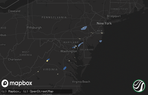
Hail Map in New Jersey on July 16, 2024
The weather event in New Jersey on July 16, 2024 includes Wind, Tornado, and Hail maps. 29 states and 1,322 cities were impacted and suffered possible damage. The total estimated number of properties impacted is 0.

Wind
Tornado
Hail
0
Estimated number of impacted properties by a 1.00" hail or larger0
Estimated number of impacted properties by a 1.75" hail or larger0
Estimated number of impacted properties by a 2.50" hail or largerStorm reports in New Jersey
New Jersey
| Date | Description |
|---|---|
| 07/16/20246:18 PM CDT | Sandy hook... Nj |
| 07/16/20245:48 PM CDT | Downed tree on nj 27 both directions north of cr 614/pearl st |
| 07/16/20245:47 PM CDT | Large tree uprooted leaning on a house along harmon rd near edison. Time estimated. |
| 07/16/20245:46 PM CDT | Numerous trees and branches down in fords... Nj. Time estimated by radar. |
| 07/16/20245:46 PM CDT | Nj dot - stmc: downed tree on us 1 southbound north of grandview av |
| 07/16/20245:45 PM CDT | Trees down in woodgridge. |
| 07/16/20245:45 PM CDT | Numerous trees either uprooted or snapped in roosevelt park in edison. Time estimated. |
| 07/16/20245:27 PM CDT | Downed tree on us 22 westbound glenside av |
| 07/16/20245:05 PM CDT | Multiple trees down on a house with people trapped inside on clover hill rd. No injuries at time of report. Time estimated from radar. |
| 07/16/20245:05 PM CDT | Large branches down. |
| 07/16/20245:05 PM CDT | Trained spotter relays measured wind gust on pws of 61.2mph. |
| 07/16/20245:05 PM CDT | Large branches cheshire nh 4294 7228 trees and wires down on pine street. |
| 07/16/20245:01 PM CDT | Numerous trees down on voorhees corner rd passed along by em. Time estimated. |
| 07/16/20245:00 PM CDT | Njwxnet: pittstown gusted to 61 mph. |
| 07/16/20245:00 PM CDT | Trees down in whitehouse station. |
| 07/16/20244:59 PM CDT | Em relays report of tree on top of a car with a person trapped inside. No injuries at time of report. Time estimated from radar. |
| 07/16/20244:57 PM CDT | Tree down on house in vernon twp... Nj. Time estimated by radar. |
| 07/16/20244:52 PM CDT | Numerous tree limbs and branches down in sussex... Nj. Time estimated by radar. |
| 07/16/20244:48 PM CDT | Nj dot - stmc: downed tree on nj 173 eastbound nj 173 |
| 07/16/20244:48 PM CDT | Nj dot - stmc: ma 4256 7316 several trees down in the town of cheshire. Time estimated from radar. |
| 07/16/20244:45 PM CDT | Em relays report of extensive tree damage in frenchtown. Will pass along more information when known. Time estimated from radar. |
| 07/16/20244:45 PM CDT | Nj dot - stmc: downed pole and downed tree on nj 29 both directions south of washington st |
| 07/16/20244:44 PM CDT | Numerous trees a wires down across the county from frankford twp... To sussex... To vernon twp. |
| 07/15/202410:41 PM CDT | Report of a tree down in commercial township. Time estimated. |
| 07/15/202410:04 PM CDT | Report of trees down on wires in upper elsinboro township. Time estimated. |
| 07/15/20249:14 PM CDT | Tree limbs fell onto a vehicle on berkley avenue in ocean township. Time estimated. |
| 07/15/20249:08 PM CDT | Trees down. Time estimated from radar. |
| 07/15/20248:50 PM CDT | Trees down. Time estimated from radar. |
| 07/15/20248:45 PM CDT | Trees down. Time estimated from radar. |
| 07/15/20248:35 PM CDT | Trained spotter estimated winds up to 60 mph. |
| 07/15/20248:30 PM CDT | Large tree down. Time estimated from radar. |
| 07/15/20248:25 PM CDT | Large tree limbs down. Time estimated from radar. |
| 07/15/20248:05 PM CDT | Trained spotter estimates 60 mph wind gust near burlington-bristol bridge. At least 3 transformers blown near location. |
| 07/15/20248:05 PM CDT | Report of a tree and wires down in burlington. Time estimated. |
| 07/15/20247:55 PM CDT | Nws employee relays report of wires down in palmyra. Time estimated. |
| 07/15/20247:53 PM CDT | Reports of numerous trees down on rte 206 near rocky hill. Time estimated. |
| 07/15/20247:48 PM CDT | Multiple sn reports of extensive tree damage with 4-8 inch diameter branches down. Time estimated. |
All States Impacted by Hail Map on July 16, 2024
Cities Impacted by Hail Map on July 16, 2024
- Ozawkie, KS
- Winchester, KS
- Hoyt, KS
- Holton, KS
- Oskaloosa, KS
- Denison, KS
- Meriden, KS
- Valley Falls, KS
- Nortonville, KS
- Topeka, KS
- Saint Marys, KS
- Rossville, KS
- Silver Lake, KS
- Maple Hill, KS
- Havensville, KS
- Onaga, KS
- Soldier, KS
- Belvue, KS
- Delia, KS
- Paxico, KS
- Emmett, KS
- Mayetta, KS
- Wamego, KS
- Lonedell, MO
- Dittmer, MO
- Richwoods, MO
- Edwardsville, IL
- Troy, IL
- Carlyle, IL
- Turney, MO
- Plattsburg, MO
- Tecumseh, KS
- Berryton, KS
- Grantville, KS
- Highland, IL
- Saint Jacob, IL
- Marine, IL
- Cameron, MO
- Cuba, MO
- De Soto, MO
- Alhambra, IL
- Lecompton, KS
- Perry, KS
- Lawrence, KS
- Trenton, IL
- Lebanon, IL
- Polo, MO
- Steelville, MO
- Wakarusa, KS
- Pocahontas, IL
- Rayville, MO
- Auburn, KS
- McLouth, KS
- Cook Sta, MO
- Salem, MO
- Imperial, MO
- Saint Louis, MO
- Tonganoxie, KS
- Easton, KS
- Atchison, KS
- Bonner Springs, KS
- Linwood, KS
- Leavenworth, KS
- Eudora, KS
- De Soto, KS
- Baldwin City, KS
- Basehor, KS
- Lenexa, KS
- Olathe, KS
- Kansas City, KS
- Sumner, MO
- Fletcher, MO
- Chillicothe, MO
- Arnold, MO
- Shawnee, KS
- Mendon, MO
- Rothville, MO
- Lansing, KS
- Riverside, MO
- Waldron, MO
- Farley, MO
- Platte City, MO
- Kansas City, MO
- Fort Leavenworth, KS
- Leawood, KS
- Prairie Village, KS
- Overland Park, KS
- Mission, KS
- Annada, MO
- Independence, MO
- Hamburg, IL
- Cairo, MO
- Moberly, MO
- Keytesville, MO
- Madison, MO
- Silex, MO
- Hawk Point, MO
- Jacksonville, MO
- Farmington, MO
- Curryville, MO
- Paris, MO
- Holliday, MO
- Osborn, MO
- Bowling Green, MO
- Santa Fe, MO
- Gasport, NY
- Stoutsville, MO
- Barker, NY
- Lyndonville, NY
- Middleport, NY
- Columbia, IL
- Perry, MO
- Eolia, MO
- Elsberry, MO
- Middletown, MO
- Vandalia, MO
- Foley, MO
- Cedar Hill, MO
- Millers Creek, NC
- Purlear, NC
- Theodore, AL
- Youngstown, FL
- Medina, NY
- Henderson, NY
- Henderson Harbor, NY
- Jordan, NY
- Weedsport, NY
- Cato, NY
- Watertown, NY
- Adams, NY
- Dexter, NY
- Adams Center, NY
- Sackets Harbor, NY
- The Villages, FL
- Fruitland Park, FL
- Memphis, NY
- Baldwinsville, NY
- Sumterville, FL
- Jamesville, NY
- Syracuse, NY
- Fayetteville, NY
- Jacksonville, FL
- Liverpool, NY
- Pennellville, NY
- Brewerton, NY
- Clay, NY
- Cicero, NY
- Kirkville, NY
- Chittenango, NY
- East Syracuse, NY
- Manlius, NY
- Minoa, NY
- Mallory, NY
- Central Square, NY
- West Monroe, NY
- Kannapolis, NC
- Rockwell, NC
- Constantia, NY
- Concord, NC
- Lisle, NY
- Berkshire, NY
- Richford, NY
- Covington, LA
- Folsom, LA
- Salisbury, NC
- Franklinton, LA
- Pavo, GA
- Lafayette, LA
- Rome, NY
- Three Mile Bay, NY
- Cape Vincent, NY
- Chaumont, NY
- La Fargeville, NY
- Evans Mills, NY
- Philadelphia, NY
- Fort Drum, NY
- Rodman, NY
- Belleville, NY
- Calcium, NY
- Ellisburg, NY
- Carthage, NY
- Sandy Creek, NY
- Brownville, NY
- Felts Mills, NY
- Mannsville, NY
- Black River, NY
- Natural Bridge, NY
- Harrisville, NY
- Wanakena, NY
- Croghan, NY
- Copenhagen, NY
- Lowville, NY
- Castorland, NY
- Lorraine, NY
- Waterloo, NY
- Montezuma, NY
- Lyons, NY
- Seneca Falls, NY
- Cayuga, NY
- North Rose, NY
- Sodus, NY
- Savannah, NY
- Auburn, NY
- Clyde, NY
- Port Byron, NY
- Wolcott, NY
- Sodus Point, NY
- Red Creek, NY
- Martville, NY
- Sterling, NY
- Skaneateles, NY
- Skaneateles Falls, NY
- Elbridge, NY
- Marcellus, NY
- Hannibal, NY
- Warners, NY
- Camillus, NY
- Nedrow, NY
- Fulton, NY
- Cazenovia, NY
- Phoenix, NY
- Canastota, NY
- Oneida, NY
- Bridgeport, NY
- Wampsville, NY
- Sherrill, NY
- Vernon, NY
- Vernon Center, NY
- Clinton, NY
- Whitesboro, NY
- Westmoreland, NY
- New York Mills, NY
- Utica, NY
- Durhamville, NY
- Verona, NY
- New Hartford, NY
- Verona Beach, NY
- Cleveland, NY
- Frankfort, NY
- Clark Mills, NY
- Quitman, GA
- Tylertown, MS
- Hickory, NC
- Luverne, AL
- Oswego, NY
- Bernhards Bay, NY
- Blossvale, NY
- Sylvan Beach, NY
- Oriskany, NY
- Yorkville, NY
- Camden, NY
- Hastings, NY
- North Bay, NY
- Taberg, NY
- Marcy, NY
- Stittville, NY
- Holland Patent, NY
- Lee Center, NY
- Westernville, NY
- Poland, NY
- Newport, NY
- Barneveld, NY
- Cold Brook, NY
- Remsen, NY
- Munnsville, NY
- Deansboro, NY
- Chadwicks, NY
- Sauquoit, NY
- Ilion, NY
- Prospect, NY
- Herkimer, NY
- Dolgeville, NY
- Salisbury Center, NY
- Mohawk, NY
- Little Falls, NY
- Middleville, NY
- Osteen, FL
- Warrior, AL
- Geneva, FL
- Bertrand, NE
- Bainbridge, NY
- Mount Upton, NY
- Unadilla, NY
- Oviedo, FL
- Eustis, NE
- Huntsville, AL
- Wallace, WV
- Hoffmeister, NY
- Saint Johnsville, NY
- Stratford, NY
- Johnstown, NY
- Caroga Lake, NY
- Gloversville, NY
- Mayfield, NY
- Piseco, NY
- Wells, NY
- Northville, NY
- Lake Pleasant, NY
- Cambridge, NE
- Oxford, NE
- Pueblo, CO
- Valentine, NE
- Stony Creek, NY
- Corinth, NY
- Hadley, NY
- Johnsburg, NY
- Broadalbin, NY
- Galway, NY
- Middle Grove, NY
- Greenfield Center, NY
- Lake Luzerne, NY
- Porter Corners, NY
- Warnerville, NY
- Johnstown, NE
- Mims, FL
- Pamplico, SC
- Effingham, SC
- Evans, GA
- Saint Cloud, FL
- Wilcox, NE
- Holdrege, NE
- Ainsworth, NE
- Oberon, ND
- Sheyenne, ND
- Hendley, NE
- Oley, PA
- Republican City, NE
- Naponee, NE
- Schoharie, NY
- Hazel Green, KY
- Middleburgh, NY
- Holbrook, NE
- Hildreth, NE
- Alma, NE
- Fort Plain, NY
- Fonda, NY
- Tribes Hill, NY
- Amsterdam, NY
- Fort Johnson, NY
- Hagaman, NY
- Fultonville, NY
- Fort Hunter, NY
- Ballston Spa, NY
- Rock City Falls, NY
- Rotterdam Junction, NY
- Schenectady, NY
- Pattersonville, NY
- Ballston Lake, NY
- Clifton Park, NY
- Saratoga Springs, NY
- Alplaus, NY
- Rexford, NY
- Burnt Hills, NY
- Chestertown, NY
- Athol, NY
- Warrensburg, NY
- Bolton Landing, NY
- Lake George, NY
- Diamond Point, NY
- Queensbury, NY
- Troy, NY
- Stillwater, NY
- Schuylerville, NY
- Cohoes, NY
- South Glens Falls, NY
- Schaghticoke, NY
- Round Lake, NY
- Fort Edward, NY
- Glens Falls, NY
- Mechanicville, NY
- Waterford, NY
- Melrose, NY
- Gansevoort, NY
- Boone, CO
- Avondale, CO
- Greensboro, AL
- Gallion, AL
- Camden, AL
- New Brockton, AL
- Enterprise, AL
- Mize, KY
- New Rockford, ND
- Altamont, NY
- Berne, NY
- Delanson, NY
- East Berne, NY
- Clanton, AL
- Elba, AL
- Show Low, AZ
- Norton, KS
- Kensington, KS
- Agra, KS
- Bloomington, NE
- Thedford, NE
- Fordland, MO
- Hellertown, PA
- Wilsonville, NE
- Beaver City, NE
- Quakertown, PA
- Kintnersville, PA
- Wood Lake, NE
- Beatrice, AL
- West Stockbridge, MA
- Austerlitz, NY
- Guilderland, NY
- Voorheesville, NY
- Johnsonville, SC
- Hemingway, SC
- Hudson Falls, NY
- Fort Ann, NY
- Cropseyville, NY
- Petersburg, NY
- Latham, NY
- Hampton, NY
- Comstock, NY
- Eagle Bridge, NY
- Valley Falls, NY
- Victory Mills, NY
- Granville, NY
- Greenwich, NY
- Argyle, NY
- Huletts Landing, NY
- Buskirk, NY
- Cossayuna, NY
- Cambridge, NY
- Kattskill Bay, NY
- Middle Granville, NY
- Hartford, NY
- North Pownal, VT
- North Bennington, VT
- North Granville, NY
- Shushan, NY
- Johnsonville, NY
- Whitehall, NY
- Fair Haven, VT
- Salem, NY
- Hague, NY
- Clemons, NY
- Hoosick Falls, NY
- Albany, NY
- Pine Apple, AL
- Newton, NJ
- Augusta, NJ
- Branchville, NJ
- Lafayette, NJ
- Sussex, NJ
- Weogufka, AL
- Lenox, MA
- Richmond, MA
- Slingerlands, NY
- Ottsville, PA
- Sugar City, CO
- Pittsfield, MA
- Birdsboro, PA
- Douglassville, PA
- Lake City, SC
- Stamford, NE
- Duanesburg, NY
- East Schodack, NY
- Wynantskill, NY
- Delmar, NY
- Coeymans, NY
- Malden Bridge, NY
- Sand Lake, NY
- Averill Park, NY
- Brainard, NY
- Selkirk, NY
- Niverville, NY
- Feura Bush, NY
- Schodack Landing, NY
- Watervliet, NY
- East Chatham, NY
- Ravena, NY
- Stephentown, NY
- West Sand Lake, NY
- South Bethlehem, NY
- East Greenbush, NY
- East Nassau, NY
- Nassau, NY
- Old Chatham, NY
- Kinderhook, NY
- Valatie, NY
- Castleton On Hudson, NY
- Stuyvesant, NY
- Poestenkill, NY
- Rensselaer, NY
- West Coxsackie, NY
- Glenmont, NY
- New Lebanon, NY
- Williamstown, MA
- Berlin, NY
- Pownal, VT
- Center Rutland, VT
- Poultney, VT
- Shaftsbury, VT
- West Pawlet, VT
- Manchester, VT
- Proctor, VT
- Danby, VT
- Bondville, VT
- Cuttingsville, VT
- Wells, VT
- Arlington, VT
- East Arlington, VT
- East Wallingford, VT
- Peru, VT
- Manchester Center, VT
- Dorset, VT
- Middletown Springs, VT
- Wallingford, VT
- Castleton, VT
- East Dorset, VT
- Bennington, VT
- West Rupert, VT
- West Rutland, VT
- Londonderry, VT
- Rutland, VT
- Pawlet, VT
- Belmont, VT
- North Clarendon, VT
- Bomoseen, VT
- Mount Holly, VT
- Stapleton, NE
- Jack, AL
- Vredenburgh, AL
- Hamburg, NJ
- Lenora, KS
- Logan, KS
- Almena, KS
- Frenchtown, NJ
- Pittstown, NJ
- Ringoes, NJ
- Stockton, NJ
- Flemington, NJ
- Three Bridges, NJ
- Neshanic Station, NJ
- Hillsborough, NJ
- Vernon, NJ
- Hewitt, NJ
- Glenwood, NJ
- Greenwood Lake, NY
- Highland Lakes, NJ
- Warwick, NY
- Monroe, NY
- Tuxedo Park, NY
- Chester, NY
- Harriman, NY
- Long Pine, NE
- Kenton, OK
- Tryon, NE
- Hinsdale, MA
- Windsor, MA
- Dalton, MA
- Rockford, AL
- Yellville, AR
- Boise City, OK
- Bassett, NE
- Maxwell, NE
- Higgins, TX
- Brewster, NE
- Cummington, MA
- Lanesborough, MA
- La Junta, CO
- Brady, NE
- Arnold, NE
- Purdum, NE
- Cavendish, VT
- Wardsboro, VT
- Jamaica, VT
- Stamford, VT
- Brownsville, VT
- Florence, VT
- Weston, VT
- Plainfield, NH
- South Woodstock, VT
- Bridgewater, VT
- West Dover, VT
- Wilmington, VT
- West Wardsboro, VT
- South Londonderry, VT
- Ludlow, VT
- Woodstock, VT
- Perkinsville, VT
- Proctorsville, VT
- Bridgewater Corners, VT
- Reading, VT
- Windsor, VT
- Hartland, VT
- Killington, VT
- Plymouth, VT
- Cornish, NH
- Springfield, VT
- West Townshend, VT
- Chester, VT
- North Springfield, VT
- North Hartland, VT
- Saxtons River, VT
- Williamsville, VT
- Monroe Bridge, MA
- Shelburne Falls, MA
- North Walpole, NH
- Chesterfield, NH
- East Dover, VT
- Savoy, MA
- Bellows Falls, VT
- Ascutney, VT
- Jacksonville, VT
- Putney, VT
- Charlemont, MA
- Readsboro, VT
- Whitingham, VT
- Adams, MA
- Bernardston, MA
- South Newfane, VT
- Buckland, MA
- Cambridgeport, VT
- Drury, MA
- Colrain, MA
- Alstead, NH
- Westminster, VT
- Walpole, NH
- Turners Falls, MA
- Claremont, NH
- Newfane, VT
- North Adams, MA
- Heath, MA
- West Chesterfield, NH
- Brattleboro, VT
- Rowe, MA
- Westmoreland, NH
- Grafton, VT
- Greenfield, MA
- Hinsdale, NH
- Meriden, NH
- Charlestown, NH
- Vernon, VT
- Townshend, VT
- West Halifax, VT
- Canaan, NY
- Cheshire, MA
- Easthampton, MA
- Williamsburg, MA
- Ashfield, MA
- Deerfield, MA
- Goshen, MA
- Becket, MA
- Huntington, MA
- Haydenville, MA
- Chesterfield, MA
- West Chesterfield, MA
- South Deerfield, MA
- Chester, MA
- Middlefield, MA
- Worthington, MA
- Plainfield, MA
- Berkshire, MA
- Conway, MA
- Bogue, KS
- Canadian, TX
- Kim, CO
- Independence, LA
- Elsmere, NE
- Horseshoe Bend, AR
- Oxford, AR
- Violet Hill, AR
- Wiseman, AR
- Ravenden, AR
- Williford, AR
- Las Animas, CO
- Brockwell, AR
- Asheville, NC
- Bethlehem, PA
- Center Valley, PA
- Summit, AR
- York, PA
- Taylor, NE
- Macungie, PA
- Emmaus, PA
- Allentown, PA
- Harriet, AR
- Morganton, NC
- Sidney, NY
- Peterman, AL
- Holden, LA
- Durham, OK
- Arnett, OK
- Mount Joy, PA
- Manheim, PA
- Anselmo, NE
- Dunning, NE
- Saint Joe, AR
- Lititz, PA
- Flippin, AR
- Manchester, PA
- Mount Wolf, PA
- Dover, PA
- Emigsville, PA
- Salem, AR
- Franklin, AR
- Bull Shoals, AR
- Coopersburg, PA
- Saint George, SC
- Lakeview, AR
- Northampton, MA
- Fitzwilliam, NH
- Leverett, MA
- Sullivan, NH
- Gill, MA
- Spofford, NH
- Keene, NH
- Marlborough, NH
- South Acworth, NH
- Templeton, MA
- Dublin, NH
- Hatfield, MA
- Montague, MA
- Gardner, MA
- Troy, NH
- Nelson, NH
- West Hatfield, MA
- Millers Falls, MA
- Royalston, MA
- Orange, MA
- New Salem, MA
- Athol, MA
- Rindge, NH
- Winchester, NH
- Amherst, MA
- Stoddard, NH
- Newport, NH
- Florence, MA
- Northfield, MA
- Wendell, MA
- Petersham, MA
- Swanzey, NH
- Wendell Depot, MA
- North Hatfield, MA
- Leeds, MA
- Shutesbury, MA
- Jaffrey, NH
- Erving, MA
- Lake Pleasant, MA
- Harrisville, NH
- Washington, NH
- Baldwinville, MA
- Sunderland, MA
- Winchendon, MA
- Marlow, NH
- Lempster, NH
- Ashuelot, NH
- Acworth, NH
- Warwick, MA
- Hadley, MA
- Gilsum, NH
- Bennington, NH
- Franklin, NH
- Bradford, NH
- New London, NH
- Grafton, NH
- Enfield, NH
- Greenfield, NH
- Hillsborough, NH
- Francestown, NH
- Canterbury, NH
- New Ipswich, NH
- North Sutton, NH
- Concord, NH
- Contoocook, NH
- Wilmot, NH
- Peterborough, NH
- Sanbornton, NH
- Newbury, NH
- Hill, NH
- Andover, NH
- Georges Mills, NH
- Sunapee, NH
- Tilton, NH
- Springfield, NH
- Antrim, NH
- Danbury, NH
- Salisbury, NH
- South Sutton, NH
- Grantham, NH
- Goshen, NH
- Elkins, NH
- Hancock, NH
- Ashburnham, MA
- Weare, NH
- Temple, NH
- Henniker, NH
- Warner, NH
- Belmont, NH
- Lyndeborough, NH
- Bow, NH
- Dunbarton, NH
- Wilton, NH
- New Boston, NH
- Sandisfield, MA
- Lenox Dale, MA
- Stockbridge, MA
- Otis, MA
- Lee, MA
- Monterey, MA
- Blandford, MA
- South Lee, MA
- Tyringham, MA
- Chatham, NY
- Housatonic, MA
- Great Barrington, MA
- Spencertown, NY
- Marion, AL
- Monroeville, AL
- Springfield, CO
- Bowman, SC
- Marshall, AR
- Branchville, SC
- Broken Bow, NE
- Calico Rock, AR
- Maytown, PA
- Marietta, PA
- Hanover, PA
- McSherrystown, PA
- Mountain Home, AR
- Midway, AR
- Poughkeepsie, AR
- Evening Shade, AR
- Amarillo, TX
- Merna, NE
- Ephrata, PA
- Big Flat, AR
- Ovett, MS
- Taloga, OK
- Moorefield, NE
- Ansley, NE
- Pittsfield, NH
- Center Barnstead, NH
- Gilmanton, NH
- Gilmanton Iron Works, NH
- Loudon, NH
- Chichester, NH
- Barnstead, NH
- Candia, NH
- Epsom, NH
- Raymond, NH
- Hooksett, NH
- Deerfield, NH
- Northwood, NH
- Suncook, NH
- Strafford, NH
- West Townsend, MA
- Brookline, NH
- Mont Vernon, NH
- Merrimack, NH
- Derry, NH
- Londonderry, NH
- Chester, NH
- Greenville, NH
- Manchester, NH
- Goffstown, NH
- Bedford, NH
- Milford, NH
- Auburn, NH
- Amherst, NH
- Hollis, NH
- Ashby, MA
- Litchfield, NH
- Fitchburg, MA
- Westminster, MA
- Dunstable, MA
- Groton, MA
- Nashua, NH
- Tyngsboro, MA
- Windham, NH
- Lunenburg, MA
- Pepperell, MA
- Hudson, NH
- Pelham, NH
- Townsend, MA
- Belchertown, MA
- Granby, MA
- Hubbardston, MA
- Ware, MA
- South Hadley, MA
- Barre, MA
- Hardwick, MA
- Southampton, MA
- East Otis, MA
- Russell, MA
- Westfield, MA
- Holyoke, MA
- Crawford, OK
- Smithville, AR
- Hydro, OK
- Keyes, OK
- Goodwell, OK
- Pampa, TX
- Stockton, KS
- Colony, OK
- Cordell, OK
- Gamaliel, AR
- Clarkridge, AR
- Fifty Six, AR
- Weatherford, OK
- Corn, OK
- Onia, AR
- Damar, KS
- Gilbert, AR
- Littlestown, PA
- Black Rock, AR
- Ash Flat, AR
- Red Lion, PA
- Narvon, PA
- Honey Brook, PA
- Elkhart, KS
- Spring Grove, PA
- Custer City, OK
- Sage, AR
- Oconto, NE
- Eddyville, NE
- Sumner, NE
- Overton, NE
- Mountain View, AR
- Coatesville, PA
- Parkesburg, PA
- Gap, PA
- Elkins Park, PA
- Philadelphia, PA
- Cheltenham, PA
- Huntingdon Valley, PA
- Willow Grove, PA
- Paradise, PA
- Kinzers, PA
- Christiana, PA
- Quarryville, PA
- Atglen, PA
- Meridian, MS
- Perryton, TX
- Burlington, CO
- Callaway, NE
- Mason City, NE
- Newmarket, NH
- Rochester, NH
- Epping, NH
- Lee, NH
- Barrington, NH
- West Nottingham, NH
- Nottingham, NH
- Newton, NH
- Dracut, MA
- Kingston, NH
- Merrimac, MA
- Methuen, MA
- Danville, NH
- Atkinson, NH
- Lowell, MA
- Salem, NH
- Newfields, NH
- North Chelmsford, MA
- Hampstead, NH
- Haverhill, MA
- Exeter, NH
- Fremont, NH
- Sandown, NH
- East Kingston, NH
- Plaistow, NH
- East Hampstead, NH
- Lancaster, MA
- Oakham, MA
- Sterling, MA
- Berlin, MA
- Hudson, MA
- Jefferson, MA
- Stow, MA
- Devens, MA
- Bolton, MA
- Westford, MA
- Holden, MA
- Rutland, MA
- Littleton, MA
- South Barre, MA
- Acton, MA
- Clinton, MA
- New Braintree, MA
- Gilbertville, MA
- Leominster, MA
- Shirley, MA
- Boylston, MA
- Ayer, MA
- West Boylston, MA
- Princeton, MA
- Boxborough, MA
- Harvard, MA
- Kendall, KS
- Syracuse, KS
- Jenkintown, PA
- Arapahoe, CO
- Timbo, AR
- Elm Creek, NE
- Vici, OK
- Lincoln University, PA
- Cochranville, PA
- West Grove, PA
- Avondale, PA
- Toughkenamon, PA
- Landenberg, PA
- Kennett Square, PA
- Grinnell, KS
- Spearville, KS
- Hanston, KS
- Jetmore, KS
- Dalhart, TX
- Booker, TX
- Bridgeport, NJ
- Chester, PA
- Swedesboro, NJ
- Elkton, MD
- Camden, NJ
- Oaklyn, NJ
- Texhoma, OK
- Funk, NE
- Tribune, KS
- Glencoe, AR
- Ford, KS
- Clarksboro, NJ
- Mount Royal, NJ
- Newark, DE
- Elk Mills, MD
- Pineville, AR
- Shamrock, TX
- Oxford, PA
- Audubon, NJ
- Gloucester City, NJ
- Mount Ephraim, NJ
- Sharon, OK
- Gibbstown, NJ
- Mickleton, NJ
- Pine, AZ
- Sidney, AR
- Edgemont, AR
- North East, MD
- Briscoe, TX
- Panhandle, TX
- Mantua, NJ
- Paulsboro, NJ
- Thorofare, NJ
- Drasco, AR
- Prim, AR
- Mullica Hill, NJ
- Higden, AR
- Cave City, AR
- Melbourne, AR
- Camargo, OK
- Stratford, TX
- Texhoma, TX
- Batesville, AR
- Mutual, OK
- Mountain View, OK
- Curtis, NE
- Bucklin, KS
- Woodward, OK
- Wright, KS
- Scott City, KS
- Healy, KS
- Davisboro, GA
- Bartow, GA
- Mooreland, OK
- Chester, OK
- Gruver, TX
- Borger, TX
- Stinnett, TX
- Lexington, NE
- Lamar, CO
- Campo, CO
- Pritchett, CO
- Holly, CO
- Two Buttes, CO
- Johnson, KS
- Manter, KS
- Walsh, CO
- Vilas, CO
- Lakin, KS
- Granada, CO
- Rolla, KS
- Guymon, OK
- Richfield, KS
- Copeland, KS
- Satanta, KS
- Sublette, KS
- Holcomb, KS
- Montezuma, KS
- Kismet, KS
- Hooker, OK
- Pierceville, KS
- Ingalls, KS
- Garden City, KS
- Moscow, KS
- Ulysses, KS
- Liberal, KS
- Cimarron, KS
- Hugoton, KS
- Deerfield, KS
- Beaver, OK
- Plains, KS
- Forgan, OK
- Turpin, OK
- Balko, OK
- Hardesty, OK
- Tyrone, OK
- Minneola, KS
- Wadley, GA
- Western Grove, AR
- Warwick, MD
- Earleville, MD
- Morse, TX
- Magness, AR
- Loomis, NE
- Kinsley, KS
- Cecilton, MD
- Kennedyville, MD
- Mount Judea, AR
- Fowler, KS
- Centreville, MD
- Rock Hall, MD
- Axtell, NE
- Fairview, OK
- Ensign, KS
- Spearman, TX
- Ingleside, MD
- Sudlersville, MD
- Barclay, MD
- Church Hill, MD
- Heber Springs, AR
- Chestertown, MD
- Meade, KS
- Cotter, AR
- Gassville, AR
- Lebanon Junction, KY
- Dover, DE
- Smyrna, DE
- Clayton, DE
- Queen Anne, MD
- Gage, OK
- Fargo, OK
- Shirley, AR
- Amesbury, MA
- Maynard, MA
- Canton, OK
- Longdale, OK
- Goldsboro, MD
- Henderson, MD
- Perryville, MO
- Englewood, KS
- Camden Wyoming, DE
- Wolf Lake, IL
- Laverne, OK
- Ashland, KS
- Follett, TX
- North Platte, NE
- Leslie, AR
- Dennard, AR
- Rosston, OK
- Norfork, AR
- Watonga, OK
- Shattuck, OK
- Waynoka, OK
- Hitchcock, OK
- Witts Springs, AR
- Hunter, OK
- Dodge City, KS
- Buffalo, OK
- Viola, DE
- Magnolia, DE
- Felton, DE
- Frederica, DE
- Okeene, OK
- Ridgely, MD
- Dover Afb, DE
- Landisville, PA
- Jonesboro, IL
- Quitman, AR
- Willcox, AZ
- Milford, DE
- Omega, OK
- Fort Supply, OK
- Stillwater, OK
- Perry, OK
- Kingfisher, OK
- Springfield, GA
- Monroe, NC
- San Simon, AZ
- Bowie, AZ
- Stroud, OK
- Greenbrier, AR
- Animas, NM
- Sunray, TX
- Cushing, OK
- Protection, KS
- Alva, OK
- Henderson, NC
- Offerle, KS
- Ripley, OK
- Burlington, OK
- Amorita, OK
- Guyton, GA
- Gate, OK
- May, OK
- Atkins, AR
- Wakita, OK
- Cherokee, OK
- Freedom, OK
- Perkins, OK
- Greensburg, KS
- Coldwater, KS
- Haviland, KS
- Seiling, OK
- Anthony, KS
- Freeport, KS
- Lake City, KS
- Nash, OK
- Sturkie, AR
- Medford, OK
- Bluff City, KS
- Caldwell, KS
- Nardin, OK
- Sun City, KS
- Kiowa, KS
- Coats, KS
- Medicine Lodge, KS
- Milan, KS
- Waldron, KS
- Blackwell, OK
- Hardtner, KS
- Harper, KS
- Attica, KS
- Sharon, KS
- Newkirk, OK
- Mayfield, KS
- Ponca City, OK
- Wellington, KS
- Isabel, KS
- Pawhuska, OK
- Wynona, OK
- Nashville, KS
- Oxford, KS
- Winfield, KS
- Bartlesville, OK
- Shidler, OK
- Arkansas City, KS
- Maple City, KS
- Burden, KS
- Peel, AR
- Cedarcreek, MO
- Protem, MO
- Lead Hill, AR
- Dewey, OK
- Dexter, KS
- Cedar Vale, KS
- Cambridge, KS
- Peru, KS
- Sedan, KS
- Omaha, AR
- Copan, OK
- Wann, OK
- Lenapah, OK
- Moline, KS
- Miami, OK
- Caney, KS
- Vinita, OK
- Rogersville, MO
- Welch, OK
- Edna, KS
- Coffeyville, KS
- S Coffeyville, OK
- Chetopa, KS
- Neosho, MO
- Granby, MO
- Baxter Springs, KS
- Quapaw, OK
- Mound Valley, KS
- Sarcoxie, MO
- Diamond, MO
- Altamont, KS
- Oswego, KS
- Pierce City, MO
- Galena, KS
- Red Oak, OK
- Joplin, MO
- Duenweg, MO
- La Russell, MO
- Stotts City, MO
- Shady Point, OK
- Wister, OK
- Webb City, MO
- Oronogo, MO
- Mount Vernon, MO
- Verona, MO
- Bruner, MO
- Republic, MO
- Billings, MO
- Nixa, MO
- Sparta, MO
- Ozark, MO
- Springfield, MO
- Brookline, MO
- Clever, MO
- Cartersville, GA
- Walling, TN
- White, GA
- Strafford, MO
- El Reno, OK
- Kearney, NE
- Riverdale, NE
- Amherst, NE
- Stennis Space Center, MS
- Lyme, NH
- Ava, NY
- Plymouth, NY
- Georgetown, NY
- North Pitcher, NY
- South Otselic, NY
- Cortland, NY
- Dryden, NY


