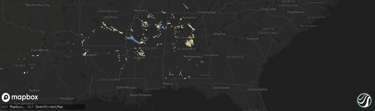
Hail Map in Alabama on July 9, 2022
The weather event in Alabama on July 9, 2022 includes Hail and Wind maps. 14 states and 493 cities were impacted and suffered possible damage. The total estimated number of properties impacted is 0.
Want more than just the map?
Turn this storm into a full workflow.
- Owner + property data so you know who to knock
- OnDemand branded weather history reports to win the "did we even have hail?" argument
- RoofTrace estimate so reps stop guessing numbers at the door
Bought this map? Upgrade within 7 days and we'll credit the $230. (10-15 min setup call)
Hail
Wind
0
Estimated number of impacted properties by a 1.00" hail or larger0
Estimated number of impacted properties by a 1.75" hail or larger0
Estimated number of impacted properties by a 2.50" hail or largerStorm reports in Alabama
Alabama
| Date | Description |
|---|---|
| 07/09/20226:48 PM CDT | A few trees were blown down in and around chelsea. |
| 07/09/20226:36 PM CDT | A few trees were blown down from woodstock to near west blocton. |
| 07/09/20226:23 PM CDT | Sporadic tree down reports including vestavia hills... Hoover... Mountain brook. |
| 07/09/20225:52 PM CDT | Report of 4 inch tree limbs down in yard... Carport across the street flipped... A large tree uprooted down the street... And large limbs down on neighbors house. Time |
| 07/09/20225:42 PM CDT | A few trees were blown down around pell city. |
| 07/09/20225:14 PM CDT | A few trees were blown down in and around guin. |
| 07/09/20225:07 PM CDT | A few trees were blown down in and around winfield. |
| 07/09/20225:00 PM CDT | A local report indicates 64 MPH wind near 1 N SOUTHSIDE |
| 07/09/20224:59 PM CDT | Corrects previous tstm wnd dmg report from 1 nnw guin. A few trees were blown down in and around guin. |
| 07/09/20224:46 PM CDT | Corrects previous tstm wnd dmg report from 7 s town creek. Report of 4 inch tree limbs down in yard... Carport across the street flipped... A large tree uprooted down t |
| 07/09/20224:38 PM CDT | Several trees were blown down in and around hamilton. |
| 07/09/20224:32 PM CDT | Several trees and power lines were blown down mainly just east of vincent to harpersville. A few roadways were blocked. |
| 07/09/20224:30 PM CDT | Tree downed at ricks ln and fuller store rd. |
| 07/09/20224:30 PM CDT | Damage to shed like structures... As well as tractor trailor rigs blown over |
| 07/09/20224:24 PM CDT | A local report indicates 68 MPH wind near 2 WNW GALLANT |
| 07/09/20224:22 PM CDT | Corrects previous tstm wnd dmg report from 5 sw leighton. Tree downed at ricks ln and fuller store rd. |
| 07/09/20224:21 PM CDT | A tree was reported down at 3171 ricks lane. Time was estimated from radar. |
| 07/09/20224:20 PM CDT | Tree downed at spring valley rd and three mile ln. |
| 07/09/20224:20 PM CDT | A tree was reported down at 848 golf drive near the intersection of gargis lane and bracken drive. Time was estimated from radar. |
| 07/09/20224:19 PM CDT | Corrects previous tstm wnd dmg report from 5 nne littleville. Tree downed at spring valley rd and three mile ln. |
| 07/09/20224:16 PM CDT | A storage shed was blown across a roadway and destroyed near hopewell road. |
| 07/09/20224:14 PM CDT | A tree was reported down at the intersection of pepi drive and 2nd street. |
| 07/09/20224:12 PM CDT | A tree was reported down at the intersection of reservation road and ccc camp road. |
| 07/09/20224:12 PM CDT | Report from mping: 3-inch tree limbs broken; power poles broken. |
| 07/09/20224:11 PM CDT | Corrects previous tstm wnd dmg report from 2 nnw muscle shoals. A tree was reported down at the intersection of reservation road and ccc camp road. |
| 07/09/20223:49 PM CDT | Multiple trees and power lines were blown down. A few manufactured homes were damaged. A storage shed was blown across a roadway and destroyed. |
| 07/09/20223:49 PM CDT | Corrects previous tstm wnd dmg report from 2 se strawberry. A storage shed was blown across a roadway and destroyed near hopewell road. |
| 07/09/20221:36 AM CDT | At 636 AM CDT, a severe thunderstorm was located near Glen, or 10 miles south of Corinth, moving southeast at 25 mph. HAZARD...60 mph wind gusts. SOURCE...Radar indicated. IMPACT...Expect damage to roofs, siding, and trees. Locations impacted include... Corinth, Booneville, Iuka, Tishomingo State Park, Burnsville, Glen, Tishomingo, Thrashers, Hinkle, Burton, Midway, Leedy, Farmington, Rienzi, Paden, Oldham, Thrasher, Dennis, Strickland and Blythe Crossing. |
| 07/09/20221:21 AM CDT | At 621 PM CDT, severe thunderstorms were located along a line extending from Birmingham to near Lake View, moving southeast at 35 mph. HAZARD...60 mph wind gusts. SOURCE...Radar indicated. IMPACT...Expect damage to roofs, siding, and trees. Locations impacted include... Birmingham, Hoover, Vestavia Hills, Alabaster, Bessemer, Homewood, Pelham, Mountain Brook, Trussville, Helena, Hueytown, Irondale, Leeds, Moody, Calera, Fairfield, Chelsea, Montevallo, Columbiana and Wilsonville. |
| 07/09/202212:06 AM CDT | At 505 PM CDT, a severe thunderstorm was located over Bon Air, or over Childersburg, moving southeast at 10 mph. HAZARD...60 mph wind gusts. SOURCE...Radar indicated. IMPACT...Expect damage to roofs, siding, and trees. Locations impacted include... Sylacauga, Childersburg, Oak Grove, Bon Air, Sycamore, Winterboro and Mignon. |
| 07/09/202212:00 AM CDT | At 500 PM CDT, a severe thunderstorm was located over Trinity, or 8 miles west of Decatur, moving southeast at 30 mph. HAZARD...60 mph wind gusts. SOURCE...Radar indicated. IMPACT...Expect damage to roofs, siding, and trees. Locations impacted include... Decatur, Hartselle, Priceville, Trinity, Hillsboro, Chalybeate Springs, Speake, Neel, Caddo and Basham. |
| 07/08/202211:41 PM CDT | At 441 PM CDT, severe thunderstorms were located along a line extending from near Helicon to near Lake Buttahatchee, moving southeast at 15 mph. HAZARD...60 mph wind gusts. SOURCE...Radar indicated. IMPACT...Expect damage to roofs, siding, and trees. Locations impacted include... Lynn, Arley, Double Springs, Addison, Nauvoo, Houston Recreational Area, Camp McDowell, Nesmith, Ashbank, Poplar Springs, Falls City, Moreland, Smith Lake, Helicon, Inmanfield, Sardis, Corinth Rec Area, Winston Free State Barn, Houston and Natural Bridge. |
| 07/08/202211:31 PM CDT | At 431 PM CDT, a severe thunderstorm was located near Altoona, or 10 miles west of Attalla, moving southeast at 20 mph. HAZARD...60 mph wind gusts. SOURCE...Radar indicated. IMPACT...Expect damage to roofs, siding, and trees. Locations impacted include... Gadsden, Rainbow City, Attalla, Hokes Bluff, Glencoe, Ashville, Ragland, Steele, Altoona, Walnut Grove, Reece City, Gadsden Mall, Neely Henry Lake, Southside, Whitney Junction, Alabama International Dragway, Gadsden Steam Plant, I 59 Rest Areas At Oneonta, Cobb City and Ramsey. |
| 07/08/202211:28 PM CDT | At 427 PM CDT, a severe thunderstorm was located over Vincent, or 7 miles north of Childersburg, moving southeast at 5 mph. HAZARD...60 mph wind gusts. SOURCE...Radar indicated. IMPACT...Expect damage to roofs, siding, and trees. Locations impacted include... Childersburg, Vincent, Harpersville and Logan Martin Dam. |
| 07/08/202210:57 PM CDT | At 356 PM CDT, a severe thunderstorm was located over McLarty, or 9 miles southeast of Arab, moving southeast at 15 mph. HAZARD...60 mph wind gusts. SOURCE...Radar indicated. IMPACT...Expect damage to roofs, siding, and trees. Locations impacted include... Douglas and Horton. |
| 07/08/202210:55 PM CDT | At 355 PM CDT, a severe thunderstorm was located near Shannon, or near Tombigbee State Park, moving southeast at 30 mph. HAZARD...60 mph wind gusts. SOURCE...Radar indicated. IMPACT...Expect damage to roofs, siding, and trees. Locations impacted include... Tupelo, Amory, Verona, Tombigbee State Park, Shannon, Plantersville, Smithville, Evergreen, Nettleton, Hatley, Skyline, Becker, Quincy, Cardsville, Turon, Wren, Bigbee, Jacinto, Parham and Old Union. |
| 07/08/202210:49 PM CDT | At 348 PM CDT, a severe thunderstorm was located near Brooksville, or 7 miles south of Arab, moving east at 20 mph. HAZARD...60 mph wind gusts. SOURCE...Radar indicated. IMPACT...Expect damage to roofs, siding, and trees. Locations impacted include... Attalla, Sardis City, Altoona, Snead, Susan Moore, Walnut Grove, McLarty, Aurora, Strawberry, Brooksville, Howelton, Mountainboro, Rockledge and Ramsey. |
| 07/08/202210:33 PM CDT | At 333 PM CDT, a severe thunderstorm was located 5 miles east of McIntosh, or 15 miles south of Jackson, and is nearly stationary. HAZARD...60 mph wind gusts and quarter size hail. SOURCE...Radar indicated. IMPACT...Hail damage to vehicles is expected. Expect wind damage to roofs, siding, and trees. Locations impacted include... McIntosh. |
| 07/08/202210:25 PM CDT | At 325 PM CDT, severe thunderstorms were located along a line extending from 5 miles east of Repton to 9 miles northeast of I65 And AL 113 to 4 miles south of Uriah, moving southeast at 10 mph. HAZARD...60 mph wind gusts and quarter size hail. SOURCE...Radar indicated. IMPACT...Hail damage to vehicles is expected. Expect wind damage to roofs, siding, and trees. Locations impacted include... Evergreen, McCullough, Castleberry, Repton, I65 And US 84, I65 And AL 113 and I65 And AL 21. |
| 07/08/20227:10 PM CDT | A few trees down in the jemison area with roadway blockage in some cases. |
All States Impacted by Hail Map on July 9, 2022
Cities Impacted by Hail Map on July 9, 2022
- Rugby, ND
- Brady, MT
- Dutton, MT
- Conrad, MT
- Valier, MT
- Ambrose, ND
- East Glacier Park, MT
- Underwood, ND
- Stanton, ND
- Polson, MT
- Bigfork, MT
- Monarch, MT
- Geyser, MT
- Raynesford, MT
- Neihart, MT
- Hazelton, ND
- Moffit, ND
- Bismarck, ND
- Menoken, ND
- Mandan, ND
- Belt, MT
- Holly Springs, MS
- Potts Camp, MS
- Stanford, MT
- Wilton, ND
- Clinton, MT
- Bonner, MT
- Deer Lodge, MT
- Chester, MT
- Shelby, MT
- Joplin, MT
- Galata, MT
- Rudyard, MT
- Inverness, MT
- Ledger, MT
- Lewisburg, TN
- Cornersville, TN
- Petersburg, TN
- Red Bay, AL
- Mchenry, ND
- New Rockford, ND
- Poyen, AR
- Malvern, AR
- Leola, AR
- Moscow, TN
- Arab, AL
- Rison, AR
- Douglas, ND
- Max, ND
- Sawyer, ND
- Minot, ND
- Ryder, ND
- Addison, AL
- Power, MT
- Fairfield, MT
- Winifred, MT
- Clancy, MT
- Helena, MT
- Double Springs, AL
- Oxford, MS
- Coffee Creek, MT
- Moundville, AL
- Philipsburg, MT
- Hingham, MT
- Box Elder, MT
- Gildford, MT
- Pope, MS
- Anaconda, MT
- Grenada, MS
- Holcomb, MS
- Tunica, MS
- Vaughn, MT
- Canton, MS
- Talladega, AL
- Pell City, AL
- Rayville, LA
- New Town, ND
- Slayton, MN
- Florence, AL
- Sheffield, AL
- Muscle Shoals, AL
- Lamar, MS
- Grand Marais, MN
- Cleveland, ND
- Mccall, ID
- Donnelly, ID
- Mesa, ID
- Council, ID
- Grants, NM
- Stevensville, MT
- Cherokee, AL
- Tuscumbia, AL
- Flora, MS
- Carbon Hill, AL
- Fulton, MS
- Boyle, MS
- Beach, ND
- Big Sandy, MT
- Selmer, TN
- Prescott, AR
- Blevins, AR
- Ashdown, AR
- Foreman, AR
- Judith Gap, MT
- Belfield, ND
- Mound Bayou, MS
- Shelby, MS
- Alligator, MS
- Duncan, MS
- Imnaha, OR
- Senatobia, MS
- Sarah, MS
- Madison, MS
- Brandon, MS
- Fulda, MN
- Avoca, MN
- Great Falls, MT
- Akron, AL
- Mount Pleasant, TX
- Regan, ND
- Velva, ND
- Wilsall, MT
- Ypsilanti, ND
- Jamestown, ND
- Hillsboro, AL
- Trinity, AL
- Baldwyn, MS
- Roundup, MT
- Blue Mountain, MS
- Logan, AL
- Cullman, AL
- Arley, AL
- Crane Hill, AL
- Vinemont, AL
- Butte, MT
- Mount Vernon, TX
- Jackson, MN
- Ashland, MS
- Lincoln, AL
- Riverside, AL
- Odenville, AL
- Ragland, AL
- Ashville, AL
- Shreveport, LA
- Mooringsport, LA
- Hackleburg, AL
- Yazoo City, MS
- Winona, MS
- Vaiden, MS
- Brewton, AL
- Delhi, LA
- Winnsboro, LA
- Baskin, LA
- Hico, TX
- West, MS
- Durant, MS
- Lexington, MS
- Cruger, MS
- Fort Shaw, MT
- Havre, MT
- Washburn, ND
- Medora, ND
- Medina, ND
- Heron Lake, MN
- Ramer, TN
- Guys, TN
- Michie, TN
- Alpine, AL
- West Point, MS
- Fort Benton, MT
- Grass Range, MT
- Cohagen, MT
- Denton, MT
- Fortuna, ND
- Hebron, ND
- South Heart, ND
- Gladstone, ND
- Lefor, ND
- New England, ND
- Dickinson, ND
- Richardton, ND
- New Salem, ND
- Amidon, ND
- Rhame, ND
- Taylor, ND
- Glen Ullin, ND
- Winston, MT
- East Helena, MT
- Condon, MT
- Granville, ND
- Voltaire, ND
- Karlsruhe, ND
- Towner, ND
- Winnett, MT
- Brusett, MT
- Mosby, MT
- Sand Springs, MT
- Courtland, MS
- Batesville, MS
- Almont, ND
- Carson, ND
- New Leipzig, ND
- Elgin, ND
- Buchanan, ND
- Floweree, MT
- Huntington, OR
- Cambridge, ID
- Midvale, ID
- Weiser, ID
- Hickory Flat, MS
- Kalispell, MT
- Mandaree, ND
- Rollins, MT
- Dayton, MT
- Lakeside, MT
- Somers, MT
- Choteau, MT
- Water Valley, MS
- Carthage, AR
- Grassy Butte, ND
- Killdeer, ND
- Fairfield, ND
- Manning, ND
- Dunn Center, ND
- Dodge, ND
- Halliday, ND
- Atlanta, TX
- Douglassville, TX
- Kilmichael, MS
- Collinston, LA
- Bastrop, LA
- Shawmut, MT
- Harlowton, MT
- Pine Bluff, AR
- Star City, AR
- Louisville, MS
- Calera, AL
- Tillar, AR
- Winchester, AR
- Pickens, AR
- Rolling Fork, MS
- Moulton, AL
- Childersburg, AL
- Jefferson, TX
- Leeds, AL
- Vandiver, AL
- Ferriday, LA
- Wagarville, AL
- Forsyth, MT
- Andalusia, AL
- Cropwell, AL
- Linden, TX
- Bivins, TX
- Franklin, AL
- Godley, TX
- Cleburne, TX
- Joshua, TX
- Range, AL
- Shelby, AL
- Columbiana, AL
- Jemison, AL
- Clanton, AL
- Sylacauga, AL
- Union Springs, AL
- Banks, AL
- San Angelo, TX
- Miles, TX
- Texarkana, TX
- Kinsey, MT
- Angela, MT
- Hamilton, AL
- Bear Creek, AL
- Florence, MS
- Graettinger, IA
- Milton, FL
- Millry, AL
- Harpersville, AL
- Ingomar, MT
- Pelahatchie, MS
- Morton, MS
- Vincent, AL
- Oakland, MS
- Jackson, MS
- Starkville, MS
- Macon, MS
- Tularosa, NM
- Jonesboro, TX
- Castleberry, AL
- Granbury, TX
- Chunchula, AL
- Citronelle, AL
- Maben, MS
- Mathiston, MS
- Wilsonville, AL
- Tupelo, MS
- Shannon, MS
- Pontotoc, MS
- Coila, MS
- Greenwood Springs, MS
- Smithville, MS
- Tremont, MS
- Bentonia, MS
- Cannon Ball, ND
- Linton, ND
- Solen, ND
- Nettleton, MS
- Clayton, AL
- Alabaster, AL
- Pelham, AL
- Dumas, AR
- Cedarbluff, MS
- Waskom, TX
- Greenwood, LA
- Marshall, TX
- Karnack, TX
- Dublin, TX
- Goldthwaite, TX
- Rowena, TX
- Drew, MS
- Repton, AL
- Lenox, AL
- Culleoka, TN
- Columbia, TN
- Jasper, AL
- Two Dot, MT
- Benton, MS
- Vaughan, MS
- Pickens, MS
- Pheba, MS
- Tolar, TX
- Midway, AL
- Leakey, TX
- Montevallo, AL
- Sterrett, AL
- Weogufka, AL
- Birmingham, AL
- Chelsea, AL
- Fosters, AL
- Braddock, ND
- Iuka, MS
- Counce, TN
- Corinth, MS
- Burnsville, MS
- Belcher, LA
- Greensboro, AL
- Ralph, AL
- Buhl, AL
- Gallant, AL
- Guntersville, AL
- Boaz, AL
- Holly Pond, AL
- Baileyton, AL
- Attalla, AL
- Blountsville, AL
- Steele, AL
- Oneonta, AL
- Joppa, AL
- Horton, AL
- Altoona, AL
- Delight, AR
- Ecru, MS
- Oak Ridge, LA
- Rising Star, TX
- Carbon, TX
- Tallulah, LA
- Evergreen, AL
- Lavina, MT
- Hodges, AL
- Musselshell, MT
- Socorro, NM
- Conner, MT
- Darby, MT
- Downsville, LA
- Berry, AL
- Aberdeen, MS
- Glenfield, ND
- Saltillo, MS
- Mooreville, MS
- Saint Anthony, ND
- Vicksburg, MS
- Newellton, LA
- Okolona, MS
- Sardis, MS
- Taylor, MS
- Tuscaloosa, AL
- Prairie, MS
- Sunflower, MS
- Indianola, MS
- Hayneville, AL
- Mer Rouge, LA
- Byram, MS
- McIntosh, AL
- Lena, MS
- McCarley, MS
- Guntown, MS
- Troy, AL
- Arkadelphia, AR
- Houston, AL
- Plantersville, MS
- Verona, MS
- Gilbert, LA
- Forest Grove, MT
- Rosebud, MT
- Ryegate, MT
- Custer, MT
- Melstone, MT
- Hysham, MT
- Clarksdale, MS
- Oil City, LA
- Vivian, LA
- Baker, FL
- Estherville, IA
- Wallingford, IA
- Flasher, ND
- Haleyville, AL
- Moody, AL
- Kintyre, ND
- Napoleon, ND
- Belden, MS
- Como, MS
- Vina, AL
- Springville, AL
- Shaw, MS
- Texarkana, AR
- Greenville, MS
- Maud, TX
- Ruthven, IA
- Little River, AL
- Coffeeville, MS
- Dexter, NM
- Roswell, NM
- Iredell, TX
- Meridian, TX
- Greenwood, MS
- Nashville, AR
- Eldridge, AL
- Wing, AL
- Jay, FL
- Natchez, MS
- Tappen, ND
- Lynn, AL
- Nauvoo, AL
- Livingston, AL
- Garrison, MT
- Big Sandy, TX
- Eva, AL
- Townley, AL
- Lometa, TX
- Evant, TX
- Jackson, AL
- Stockton, AL
- Clifton, TX
- Terry, MT
- Fallon, MT
- Ismay, MT
- Amory, MS
- Leland, MS
- Inverness, MS
- Itta Bena, MS
- Tchula, MS
- Belzoni, MS
- Moorhead, MS
- Hazen, ND
- Glendive, MT
- Golden Valley, ND
- Wibaux, MT
- Golva, ND
- Zap, ND
- Sentinel Butte, ND
- Beulah, ND
- Marmarth, ND
- Baker, MT
- Center, ND
- Baldwin, ND
- Denhoff, ND
- Goodrich, ND
- Wing, ND
- Hurdsfield, ND
- Bowdon, ND
- Mcclusky, ND
- Harvey, ND
- Fessenden, ND
- Cathay, ND
- Chaseley, ND
- Sykeston, ND
- Norwich, ND
- Willow City, ND
- Agate, ND
- Rolette, ND
- Drake, ND
- Balfour, ND
- Wolford, ND
- Mylo, ND


