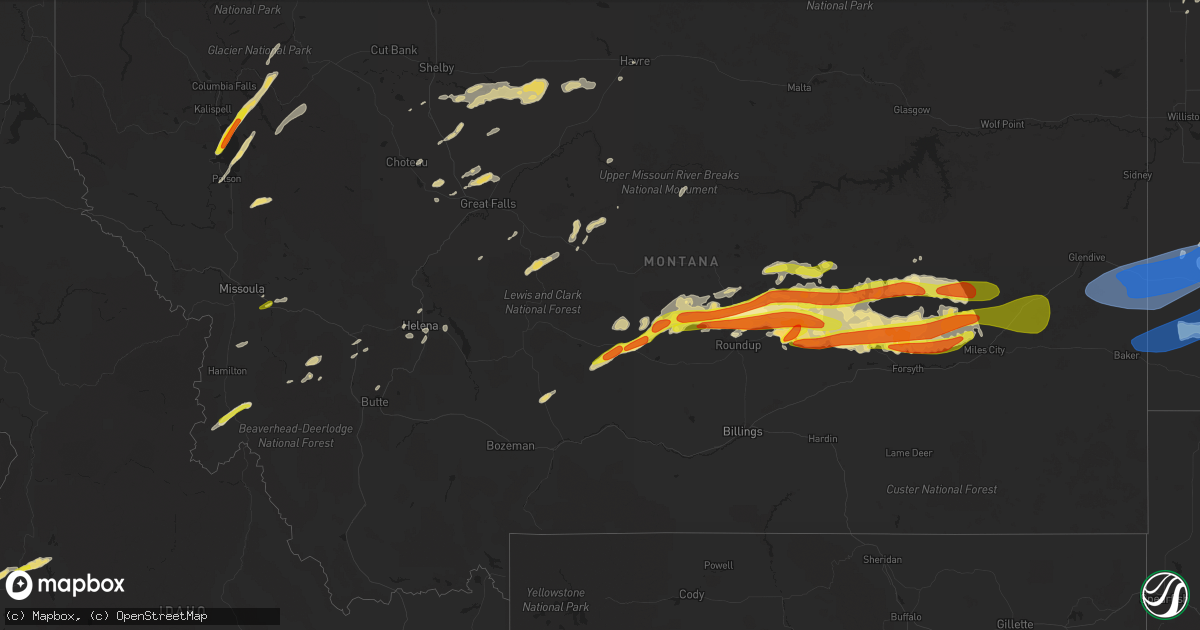
Hail Map in Montana on July 9, 2022
Get this storm
July 9 map
$229
one time, instant access
Download today. No call, no setup
Keep the $229
Bought the map and want the full workflow? Apply the entire $229 to a subscription within 7 days. None of it is wasted.
Every map, not just this one
This buys you this map. Subscription and you get every map we run, in the markets you choose from a few cities to whole states to nationwide. Plus real-time alerts the moment a storm fires.
Contact data
Name, contact info, occupancy, even credit band for addresses in the footprint. You go from where it hit to who to call.
Become the source they trust
Unlimited branding weather history reports on demand. You already have the documented answer ready for the property owner, and you are the one who showed up with it.
Property data and RoofTrace estimates
Pull up any address you have got, its value and the exact code rules for that jurisdiction, straight from One Click Code. Then RoofTrace estimates the squares, pitch, and roof value, priced the way you price.
Storm reports in Montana
Montana
| Date | Description |
|---|---|
| 07/09/20226:30 PM CDT | Photo retrieved via social media. Time estimated via radar. |
| 07/09/20226:26 PM CDT | A local report indicates 1.00 inch wind near BIGFORK |
| 07/09/20226:24 PM CDT | A local report indicates 1.50 inch wind near BIGFORK |
| 07/09/20226:15 PM CDT | Photo retrieved via social media. Time estimated via radar. |
| 07/09/20226:10 PM CDT | Photo retrieved via social media. Time estimated via radar. |
| 07/09/20226:06 PM CDT | Possible total loss at cherry orchard. Time estimated by radar. |
| 07/09/20226:00 PM CDT | Social media photo. Time estimated by radar. |
| 07/09/20225:21 PM CDT | A local report indicates 1.00 inch wind near CLINTON |
| 07/09/20227:38 AM CDT | At 1237 AM MDT, severe thunderstorms were located along a line extending from 6 miles north of Redstone to Richey, moving east at 70 mph. HAZARD...60 mph wind gusts and nickel size hail. SOURCE...Radar indicated. IMPACT...Expect damage to roofs, siding, and trees. Locations impacted include... Sidney, Glendive, Plentywood, Scobey, Poplar, Culbertson, Wibaux, Fairview, Brockton, Medicine Lake, Bainville, Froid, Richey, Westby, Flaxville, Savage, Intake, Lambert, Port Of Scobey and Redstone. |
| 07/09/20227:19 AM CDT | At 1219 AM MDT, a severe thunderstorm was located 17 miles east of Hillside, or 34 miles west of Terry, moving east at 20 mph. HAZARD...60 mph wind gusts and quarter size hail. SOURCE...Radar indicated. IMPACT...Hail damage to vehicles is expected. Expect wind damage to roofs, siding, and trees. Locations impacted include... Hillside and Crow Rock. |
| 07/09/20227:17 AM CDT | At 1216 AM MDT, a severe thunderstorm was located 8 miles southwest of Hillside, or 39 miles north of Forsyth, moving east at 30 mph. HAZARD...70 mph wind gusts and quarter size hail. SOURCE...Radar indicated. IMPACT...Hail damage to vehicles is expected. Expect considerable tree damage. Wind damage is also likely to mobile homes, roofs, and outbuildings. Locations impacted include... Rock Springs and Angela. |
| 07/09/20225:57 AM CDT | At 1055 PM MDT, severe thunderstorms were located along a line extending from 19 miles southeast of Hillside to 14 miles northwest of Miles City to 14 miles northeast of Forsyth, moving east at 40 mph. HAZARD...Golf ball size hail and 60 mph wind gusts. SOURCE...Radar indicated. IMPACT...People and animals outdoors will be injured. Expect hail and wind damage to roofs, siding, windows, and vehicles. Expect wind damage to roofs, siding, and trees. Severe thunderstorms will be near... Miles City around 1135 PM MDT.Other locations impacted by these severe thunderstorms include TwelveMile Dam, Locate, Moon Creek Ranch, Strawberry Hill Recreation Area,Matthews Recreation Area, Mizpah and Knowlton.These storms have a history of producing golfball or larger hail. |
| 07/09/20225:36 AM CDT | At 1036 PM MDT, severe thunderstorms were located along a line extending from near Richland to 6 miles east of Frazer, moving east at 75 mph. HAZARD...70 mph wind gusts and nickel size hail. SOURCE...Radar indicated. IMPACT...Expect considerable tree damage. Damage is likely to mobile homes, roofs, and outbuildings. Locations impacted include... Wolf Point, Plentywood, Scobey, Poplar, Culbertson, Richland, Nashua, Brockton, Medicine Lake, Bainville, Froid, Westby, Flaxville, Archer, Port Of Raymond, Peerless, Port Of Whitetail, Lustre, Madoc and Bredette. |
| 07/09/20225:11 AM CDT | At 1010 PM MDT, severe thunderstorms were located across northern Rosebud and northern Treasure counties, moving east at 40 mph. HAZARD...Golf ball size hail and 60 mph wind gusts. SOURCE...Radar indicated. IMPACT...People and animals outdoors will be injured. Expect hail and wind damage to roofs, siding, windows, and vehicles. Locations impacted include... Forsyth, Rosebud, Hathaway, Vananda, Rock Springs, Angela, Ingomar and Cartersville.This replaces all the warnings previously in effect for this area. |
| 07/09/20224:54 AM CDT | At 954 PM MDT, severe thunderstorms were located along a line extending from 10 miles south of Jordan to 12 miles south of Cohagen, moving northeast at 45 mph. HAZARD...70 mph wind gusts and quarter size hail. SOURCE...Radar indicated. IMPACT...Hail damage to vehicles is expected. Expect considerable tree damage. Wind damage is also likely to mobile homes, roofs, and outbuildings. Locations impacted include... Circle, Jordan, The Pines Rec Area, Sand Springs, Brockway, Hillside, Hell Creek Rec Area, Edwards, Flowing Wells Rest Area, Cohagen, Nelson Creek Rec Area, Rock Creek Rec Area, Brusett, Van Norman, Steve Fork, Mccloud, Haxby, Weldon, Crow Rock and Watkins. |
| 07/09/20224:45 AM CDT | At 945 PM MDT, severe thunderstorms were located along a line extending from 22 miles west of Opheim to 11 miles west of The Pines Rec Area, moving east at 55 mph. HAZARD...70 mph wind gusts and penny size hail. SOURCE...Radar indicated. IMPACT...Expect considerable tree damage. Damage is likely to mobile homes, roofs, and outbuildings. Locations impacted include... Glasgow, Wolf Point, Opheim, Richland, Nashua, Fort Peck, Duck Creek Rec Area, St. Marie, Peerless, Tampico, Lustre, Fort Peck Marina, Frazer, Port Of Opheim, Vandalia, Park Grove, Four Buttes, West Fork, Volt and Larslan. |
| 07/09/20224:40 AM CDT | At 939 PM MDT, a severe thunderstorm was located near Melstone, or 26 miles east of Roundup, moving east at 45 mph. HAZARD...Golf ball size hail and 60 mph wind gusts. SOURCE...Trained weather spotters. IMPACT...People and animals outdoors will be injured. Expect hail damage to roofs, siding, windows, and vehicles. Expect wind damage to roofs, siding, and trees. Locations impacted include... Melstone and Musselshell. This replaces the warning previously in effect for this area. |
| 07/09/20224:30 AM CDT | At 930 PM MDT, a severe thunderstorm was located over Hinsdale, or 22 miles northwest of Glasgow, moving northeast at 45 mph. HAZARD...60 mph wind gusts and nickel size hail. SOURCE...Radar indicated. IMPACT...Expect damage to roofs, siding, and trees. Locations impacted include... Opheim, Tampico, Hinsdale, St. Marie, Port Of Opheim, Vandalia, Thoeny, Baylor, Glentana and Larslan. |
| 07/09/20224:27 AM CDT | At 927 PM MDT, a severe thunderstorm was located 17 miles northwest of Hell Creek Rec Area, or 32 miles northwest of Jordan, moving east at 40 mph. HAZARD...60 mph wind gusts and quarter size hail. SOURCE...Radar indicated. IMPACT...Hail damage to vehicles is expected. Expect wind damage to roofs, siding, and trees. Locations impacted include... Fort Peck, The Pines Rec Area, Fort Peck Marina, Hell Creek Rec Area, Duck Creek Rec Area, Haxby and Park Grove. |
| 07/09/20224:27 AM CDT | At 926 PM MDT, severe thunderstorms were located along a line extending from 15 miles south of Sand Springs to 15 miles northwest of Hysham, moving east at 45 mph. HAZARD...Golf ball size hail and 60 mph wind gusts. SOURCE...Radar indicated. IMPACT...People and animals outdoors will be injured. Expect hail damage to roofs, siding, windows, and vehicles. Expect wind damage to roofs, siding, and trees. These severe thunderstorms will remain over mainly rural areas of northern Rosebud and northern Treasure Counties, including the following locations... Vananda and Ingomar.Golfball hail was reported in Melstone with this storm at 912 PM MDT.This replaces the warning previously in effect for this area. |
| 07/09/20224:17 AM CDT | At 917 PM MDT, severe thunderstorms were located along a line extending from 13 miles southwest of Winnett to near Flatwillow to 6 miles north of Roundup, moving east at 55 mph. HAZARD...60 mph wind gusts and quarter size hail. SOURCE...Radar indicated. IMPACT...Hail damage to vehicles is expected. Expect wind damage to roofs, siding, and trees. Locations impacted include... Winnett, Flatwillow, Mosby, Petrolia Lake, Cat Creek and Tiegen. |
| 07/09/20224:17 AM CDT | At 916 PM MDT, a severe thunderstorm was located 9 miles northeast of Roundup, moving east at 45 mph. HAZARD...60 mph wind gusts and quarter size hail. SOURCE...Radar indicated. IMPACT...Hail damage to vehicles, wind damage to roofs, siding, and trees. Locations impacted include... Musselshell.This replaces the warning previously in effect for this area. |
| 07/09/20224:14 AM CDT | At 913 PM MDT, a severe thunderstorm was located 27 miles south of Edwards, or 32 miles north of Hysham, moving east at 40 mph. HAZARD...Golf ball size hail and 60 mph wind gusts. SOURCE...Radar indicated. IMPACT...People and animals outdoors will be injured. Expect hail and wind damage to roofs, siding, windows, and vehicles. This severe thunderstorm will remain over mainly rural areas of northern Rosebud County, including the following locations... Rock Springs and Angela.This storm has a history of producing golfball hail over Musselshell county.This replaces the warning previously in effect for this area. |
| 07/09/20224:07 AM CDT | At 907 PM MDT, severe thunderstorms were located along a line extending from 8 miles northeast of Mosby to 7 miles southeast of Sand Springs to 25 miles south of Edwards, moving east at 40 mph. HAZARD...60 mph wind gusts and quarter size hail. SOURCE...Trained weather spotters. IMPACT...Hail damage to vehicles is expected. Expect wind damage to roofs, siding, and trees. Locations impacted include... Jordan, Sand Springs, Hell Creek Rec Area, Edwards, Cohagen, Mosby, Brusett, Hillside and Steve Fork. |
| 07/09/20223:59 AM CDT | At 859 PM MDT, a severe thunderstorm was located near Melstone, or 31 miles east of Roundup, moving east at 40 mph. HAZARD...60 mph wind gusts and half dollar size hail. SOURCE...Radar indicated. IMPACT...Hail damage to vehicles is expected. Expect wind damage to roofs, siding, and trees. This severe thunderstorm will remain over mainly rural areas of east central Musselshell, northeastern Yellowstone, northern Rosebud and northwestern Treasure Counties, including the following locations... Ingomar.This warning does not include the city of Billings. |
| 07/09/20223:49 AM CDT | At 848 PM MDT, a severe thunderstorm was located 7 miles north of Malta, moving east at 35 mph. HAZARD...70 mph wind gusts and quarter size hail. SOURCE...Radar indicated. This storm has a history of 78 mph winds. IMPACT...Hail damage to vehicles is expected. Expect considerable tree damage. Wind damage is also likely to mobile homes, roofs, and outbuildings. Locations impacted include... Malta, Saco, Hinsdale, Bowdoin and Sleeping Buffalo. |
| 07/09/20223:39 AM CDT | At 838 PM MDT, a severe thunderstorm was located 20 miles north of Ryegate, or 29 miles west of Roundup, moving northeast at 40 mph. HAZARD...60 mph wind gusts and quarter size hail. SOURCE...Radar indicated. IMPACT...Hail damage to vehicles. Expect wind damage to roofs, siding, and trees. This severe thunderstorm will remain over mainly rural areas of northwestern Musselshell and northeastern Golden Valley Counties. |
| 07/09/20223:12 AM CDT | At 811 PM MDT, a severe thunderstorm was located 11 miles northwest of Melstone, or 24 miles southeast of Winnett, moving east at 50 mph. HAZARD...Ping pong ball size hail and 60 mph wind gusts. SOURCE...Radar indicated. This storm has a history of producing golfball hail and breaking windows over northern Musselshell county. IMPACT...People and animals outdoors will be injured. Expect hail and wind damage to roofs, siding, windows, and vehicles. This severe thunderstorm will remain over mainly rural areas of northeastern Musselshell and northern Rosebud Counties.This replaces the warning previously in effect for this area. |
| 07/09/20223:08 AM CDT | At 807 PM MDT, a severe thunderstorm was located 8 miles southeast of Flatwillow, or 16 miles south of Winnett, moving east at 45 mph. HAZARD...Golf ball size hail and 60 mph wind gusts. SOURCE...Radar indicated. IMPACT...People and animals outdoors will be injured. Expect hail damage to roofs, siding, windows, and vehicles. Expect wind damage to roofs, siding, and trees. Locations impacted include... Winnett, Flatwillow, Sand Springs, Edwards, Mosby, Petrolia Lake, Steve Fork, Cat Creek and Tiegen. |
| 07/09/20222:55 AM CDT | Trees oriented different directions... Branches down. |
| 07/09/20222:53 AM CDT | At 753 PM MDT, severe thunderstorms were located along a line extending from 20 miles northeast of Chinook to near Harlem to 17 miles south of Fort Belknap, moving east at 45 mph. HAZARD...60 mph wind gusts and quarter size hail. SOURCE...Radar indicated. IMPACT...Hail damage to vehicles is expected. Expect wind damage to roofs, siding, and trees. Locations impacted include... Malta, Whitewater, Saco, Dodson, Loring, Port Of Morgan, Phillips, Chapman, Sleeping Buffalo, Wagner, Frenchman Reservoir and Bowdoin. |
| 07/09/20222:49 AM CDT | At 749 PM MDT, a severe thunderstorm was located near Stevensville, or 18 miles north of Hamilton, moving northeast at 30 mph. HAZARD...60 mph wind gusts and quarter size hail. SOURCE...Radar indicated. IMPACT...Hail damage to vehicles is expected. Expect wind damage to roofs, siding, and trees. Locations impacted include... Stevensville, Victor, Florence, Bell Crossing and Corvallis. |
| 07/09/20222:41 AM CDT | At 741 PM MDT, severe thunderstorms were located along a line extending from 17 miles west of Hays to 11 miles northeast of Roy, moving east at 75 mph. HAZARD...60 mph wind gusts and quarter size hail. SOURCE...Radar indicated. IMPACT...Hail damage to vehicles is expected. Expect wind damage to roofs, siding, and trees. Locations impacted include... Zortman, Fourchette, Devils Creek Rec Area, U L Bend Rec Area, Crooked Creek Rec Area, Brusett, Phillips, Landusky, Content, Sun Prairie, Fred Robinson Bridge and Valentine. |
| 07/09/20222:27 AM CDT | At 726 PM MDT, a severe thunderstorm was located 19 miles northwest of Roundup, moving east at 40 mph. HAZARD...Golf ball size hail and 60 mph wind gusts. SOURCE...Radar indicated. IMPACT...People and animals outdoors will be injured. Expect hail and wind damage to roofs, siding, windows, and vehicles. This severe thunderstorm will remain over mainly rural areas of northern Musselshell County.This storm has a history of producing golfball size hail.This replaces the warning previously in effect for this area. |
| 07/09/20222:20 AM CDT | At 719 PM MDT, severe thunderstorms were located along a line extending from 21 miles southeast of Lewistown to 17 miles south of Grass Range to 15 miles northwest of Roundup, moving east at 95 mph. HAZARD...Golf ball size hail and 60 mph wind gusts. SOURCE...Trained weather spotters. IMPACT...People and animals outdoors will be injured. Expect hail damage to roofs, siding, windows, and vehicles. Expect wind damage to roofs, siding, and trees. Locations impacted include... Winnett, Flatwillow, Sand Springs, Edwards, Mosby, Petrolia Lake, Cat Creek and Tiegen. |
| 07/09/20222:06 AM CDT | At 706 PM MDT, severe thunderstorms were located along a line extending from 21 miles south of St. Pierre to Stanford, moving east at 45 mph. HAZARD...70 mph wind gusts. SOURCE...Radar indicated. IMPACT...Expect considerable tree damage. Damage is likely to mobile homes, roofs, and outbuildings. Locations impacted include... Lewistown, Stanford, Denton, Winifred, Grass Range, Hays, Roy, Fergus, Windham, Moccasin, Fred Robinson Bridge, Danvers, Coffee Creek, Suffolk, Giltedge, Judith Landing, Hilger, Christina, Iliad and Benchland. |
| 07/09/20222:00 AM CDT | At 659 PM MDT, a severe thunderstorm was located 23 miles north of Deadmans Basin Reservoir, or 29 miles south of Lewistown, moving northeast at 45 mph. HAZARD...Golf ball size hail. SOURCE...Radar indicated. IMPACT...People and animals outdoors will be injured. Expect damage to roofs, siding, windows, and vehicles. This severe thunderstorm will remain over mainly rural areas of southeastern Fergus County. |
| 07/09/20221:58 AM CDT | At 658 PM MDT, a severe thunderstorm was located over Havre, moving east at 55 mph. HAZARD...60 mph wind gusts and penny size hail. SOURCE...Radar indicated. IMPACT...Expect damage to roofs, siding, and trees. Locations impacted include... Havre, Chinook, Harlem, Parker School, Beaver Creek, Agency, Fort Belknap, Turner, Azure, Sangrey, St. Pierre, Rocky Boy, Lohman, Lodge Pole, Cleveland, Zurich, Lloyd and Hogeland. |
| 07/09/20221:58 AM CDT | At 657 PM MDT, a severe thunderstorm was located 21 miles north of Deadmans Basin Reservoir, or 30 miles northeast of Harlowton, moving northeast at 50 mph. HAZARD...Golf ball size hail and 60 mph wind gusts. SOURCE...Radar indicated. This storm has a history of producing golfball size hail over Wheatland county. IMPACT...People and animals outdoors will be injured. Expect hail and wind damage to roofs, siding, windows, and vehicles. This severe thunderstorm will remain over mainly rural areas of eastern Wheatland, northwestern Musselshell and northeastern Golden Valley Counties.This replaces the warning previously in effect for this area. |
| 07/09/20221:53 AM CDT | Reported via mt dot site. |
| 07/09/20221:48 AM CDT | At 647 PM MDT, a severe thunderstorm was located 14 miles east of Ronan, or 19 miles southeast of Polson, moving east at 40 mph. HAZARD...60 mph wind gusts and quarter size hail. SOURCE...Radar indicated. IMPACT...Hail damage to vehicles is expected. Expect wind damage to roofs, siding, and trees. Locations impacted include... Condon and Salmon Prairie. |
| 07/09/20221:42 AM CDT | A local report indicates 60 MPH wind near 1 SSE BAKER |
| 07/09/20221:35 AM CDT | At 635 PM MDT, severe thunderstorms were located along a line extending from 23 miles northwest of Beaver Creek to 8 miles southeast of Gildford to 12 miles northwest of Big Sandy, moving east at 40 mph. HAZARD...70 mph wind gusts and penny size hail. SOURCE...Radar indicated. IMPACT...Expect considerable tree damage. Damage is likely to mobile homes, roofs, and outbuildings. Locations impacted include... Havre, Azure, Parker School, Beaver Creek, Agency, St. Pierre, Gildford, Sangrey, Boneau, Box Elder, Hingham, Rocky Boy, Laredo, Kremlin and Simpson. |
| 07/09/20221:35 AM CDT | A local report indicates 62 MPH wind near PLEVNA |
| 07/09/20221:33 AM CDT | At 633 PM MDT, a severe thunderstorm was located 16 miles southwest of Geyser, or 22 miles west of Stanford, moving east at 10 mph. HAZARD...60 mph wind gusts and quarter size hail. SOURCE...Radar indicated. IMPACT...Hail damage to vehicles is expected. Expect wind damage to roofs, siding, and trees. This severe thunderstorm will remain over mainly rural areas of west central Judith Basin and southeastern Cascade Counties. |
| 07/09/20221:31 AM CDT | At 631 PM MDT, a severe thunderstorm was located 7 miles west of Denton, or 15 miles north of Stanford, moving northeast at 40 mph. HAZARD...60 mph wind gusts and half dollar size hail. SOURCE...Radar indicated. IMPACT...Hail damage to vehicles is expected. Expect wind damage to roofs, siding, and trees. Locations impacted include... Denton, Coffee Creek, Judith Landing and Iliad. |
| 07/09/20221:26 AM CDT | At 625 PM MDT, severe thunderstorms were located along a line extending from 18 miles south of Moore to 7 miles east of Harlowton, moving east at 35 mph. HAZARD...Ping pong ball size hail and 60 mph wind gusts. SOURCE...Radar indicated. IMPACT...People and animals outdoors will be injured. Expect hail and wind damage to roofs, siding, windows, and vehicles. Severe thunderstorms will be near... Deadmans Basin Reservoir around 645 PM MDT.Other locations impacted by these severe thunderstorms includeFranklin, Judith Gap and Shawmut.This replaces the warning previously in effect for this area. |
| 07/09/202212:58 AM CDT | Ndawn site. |
| 07/09/202212:55 AM CDT | Relayed via facebook. |
| 07/09/202212:55 AM CDT | Relayed via facebook. |
| 07/09/202212:52 AM CDT | At 551 PM MDT, a severe thunderstorm was located 11 miles southwest of Harlowton, moving northeast at 40 mph. HAZARD...60 mph wind gusts and half dollar size hail. SOURCE...Radar indicated. IMPACT...Hail damage to vehicles is expected. Expect wind damage to roofs, siding, and trees. This severe thunderstorm will be near... Harlowton around 610 PM MDT.Other locations impacted by this severe thunderstorm include Shawmutand Twodot. |
| 07/09/202212:46 AM CDT | At 546 PM MDT, severe thunderstorms were located along a line extending from near Chester to 21 miles southeast of Lothair, moving east at 35 mph. HAZARD...60 mph wind gusts and quarter size hail. SOURCE...Radar indicated. IMPACT...Hail damage to vehicles is expected. Expect wind damage to roofs, siding, and trees. Locations impacted include... Chester, Joplin, Inverness, Gildford, Hingham, Rudyard and Tiber Dam. |
| 07/09/202212:43 AM CDT | At 542 PM MDT, a severe thunderstorm was located 12 miles west of Great Falls, moving east at 35 mph. HAZARD...60 mph wind gusts and penny size hail. SOURCE...Radar indicated. IMPACT...Expect damage to roofs, siding, and trees. Locations impacted include... Great Falls, Cascade, Belt, Black Eagle, Highwood, Floweree, Portage, Eden, Sluice Boxes State Park, Malmstrom Afb, Stockett, Tracy, Vaughn, First Peoples Buffalo Jump State Park, Centerville, Sun River, Armington, Ulm and Sand Coulee. |
| 07/09/202212:43 AM CDT | Reported by storm spotter. |
| 07/09/202212:43 AM CDT | Estimated by storm spotter. |
| 07/09/202212:30 AM CDT | A local report indicates 58 MPH wind near 3 WNW MILES CITY |
| 07/09/202212:26 AM CDT | 6 inch diameter tree branches down at mile marker 14 and 4 inch diameter branches down at mile marker 13 on kinsey rd./mt 489 |
| 07/09/202212:18 AM CDT | Picture of weather station relayed via facebook. |
| 07/09/202212:05 AM CDT | At 505 PM MDT, a severe thunderstorm was located 7 miles southwest of Woods Bay, or 15 miles north of Polson, moving northeast at 25 mph. HAZARD...Golf ball size hail and 60 mph wind gusts. SOURCE...Radar indicated. IMPACT...People and animals outdoors will be injured. Expect hail damage to roofs, siding, windows, and vehicles. Expect wind damage to roofs, siding, and trees. Locations impacted include... Woods Bay, Bigfork, Proctor, Somers, Lakeside, Rollins and Dayton. |
| 07/09/202212:01 AM CDT | At 501 PM MDT, a severe thunderstorm was located 8 miles northeast of Big Arm, or 14 miles north of Polson, moving northeast at 25 mph. HAZARD...Ping pong ball size hail and 60 mph wind gusts. SOURCE...Radar indicated. IMPACT...People and animals outdoors will be injured. Expect hail damage to roofs, siding, windows, and vehicles. Expect wind damage to roofs, siding, and trees. Locations impacted include... Woods Bay, Bigfork, Proctor, Somers, Lakeside, Rollins and Dayton. |
| 07/08/202211:51 PM CDT | Public reported |
| 07/08/202211:50 PM CDT | Via the fort peck dam site. |
| 07/08/202211:36 PM CDT | At 436 PM MDT, a severe thunderstorm was located 9 miles west of Lincoln, or 20 miles northeast of Drummond, moving northeast at 20 mph. HAZARD...60 mph wind gusts. SOURCE...Radar indicated. IMPACT...Expect damage to roofs, siding, and trees. Locations impacted include... Helmville. |
| 07/08/202211:34 PM CDT | At 434 PM MDT, a severe thunderstorm was located near Kings Point, or 8 miles north of Polson, moving northeast at 30 mph. HAZARD...Ping pong ball size hail and 60 mph wind gusts. SOURCE...Radar indicated. IMPACT...People and animals outdoors will be injured. Expect hail damage to roofs, siding, windows, and vehicles. Expect wind damage to roofs, siding, and trees. Locations impacted include... Woods Bay, Swan Lake, Bigfork, Kings Point, Finley Point and Rollins. |
| 07/08/202211:30 PM CDT | Report relayed via facebook. |
| 07/08/202211:15 PM CDT | Report relayed via facebook on an home weather station. |
| 07/08/202211:10 PM CDT | Via the saint marie marco site. |
| 07/08/202211:04 PM CDT | Corrects previous report from 1 nne glasgow. Highest gust from the glasgow asos station. |
| 07/08/202210:51 PM CDT | A local report indicates 1.25 inch wind near MELSTONE |
| 07/08/202210:49 PM CDT | A local report indicates 70 MPH wind near 6 N FORT PECK |
| 07/08/202210:47 PM CDT | A local report indicates 1.00 inch wind near 6 WSW MELSTONE |
| 07/08/202210:45 PM CDT | At 345 PM MDT, a severe thunderstorm was located 13 miles southwest of Philipsburg, or 23 miles west of Anaconda, moving northeast at 45 mph. HAZARD...60 mph wind gusts and quarter size hail. SOURCE...Radar indicated. IMPACT...Hail damage to vehicles is expected. Expect wind damage to roofs, siding, and trees. Locations impacted include... Philipsburg, Porters Corner, Princeton and Georgetown. |
| 07/08/202210:44 PM CDT | Via bluff creek raws site. |
| 07/08/202210:44 PM CDT | At 344 PM MDT, a severe thunderstorm was located 12 miles northwest of Dixon, or 20 miles southwest of Polson, moving northeast at 15 mph. HAZARD...60 mph wind gusts and quarter size hail. SOURCE...Radar indicated. IMPACT...Hail damage to vehicles is expected. Expect wind damage to roofs, siding, and trees. Locations impacted include... Round Butte and Charlo. |
| 07/08/202210:44 PM CDT | Via king coulee raws site. |
| 07/08/202210:37 PM CDT | A local report indicates 2.00 inch wind near 5 SE MUSSELSHELL |
| 07/08/202210:36 PM CDT | At 336 PM MDT, a severe thunderstorm was located 9 miles south of Bonner-West Riverside, or 12 miles southeast of Missoula, moving northeast at 20 mph. HAZARD...60 mph wind gusts and quarter size hail. SOURCE...Radar indicated. IMPACT...Hail damage to vehicles is expected. Expect wind damage to roofs, siding, and trees. Locations impacted include... Florence, Nimrod, Quigley, Clinton and Potomac. |
| 07/08/202210:30 PM CDT | Via the mt meso site at blm vandalia. |
| 07/08/202210:23 PM CDT | A local report indicates 1.00 inch wind near 9 NNE ROUNDUP |
| 07/08/202210:18 PM CDT | A local report indicates 1.75 inch wind near 9 N ROUNDUP |
| 07/08/202210:12 PM CDT | A local report indicates 1.75 inch wind near MELSTONE |
| 07/08/202210:06 PM CDT | Via saco mt dot site. |
| 07/08/202210:03 PM CDT | A local report indicates 1.75 inch wind near 6 WSW MELSTONE |
| 07/08/20229:58 PM CDT | A local report indicates 1.00 inch wind near 4 NE MOSBY |
| 07/08/20229:48 PM CDT | At 247 AM MDT, a severe thunderstorm was located 12 miles south of Brockway, or 21 miles south of Circle, moving east at 40 mph. HAZARD...60 mph wind gusts and quarter size hail. SOURCE...Doppler radar indicated. IMPACT...Hail damage to vehicles is expected. Expect wind damage to roofs, siding, and trees. Locations impacted include... Circle, Lindsay, Brockway, Hoyt, Mccloud and Watkins. |
| 07/08/20229:47 PM CDT | At 246 PM MDT, a severe thunderstorm was located near Darby, or 18 miles south of Hamilton, moving northeast at 35 mph. HAZARD...60 mph wind gusts and quarter size hail. SOURCE...Radar indicated. IMPACT...Hail damage to vehicles is expected. Expect wind damage to roofs, siding, and trees. Locations impacted include... Darby, Conner, Charlos Heights and Como. |
| 07/08/20229:45 PM CDT | A local report indicates 62 MPH wind near 13 NW ROUNDUP |
| 07/08/20229:37 PM CDT | At 237 AM CDT/137 AM MDT/, severe thunderstorms were located along a line extending from 11 miles east of Sidney to 10 miles southeast of Trotters to 4 miles southwest of Beach, moving east at 35 mph. HAZARD...60 mph wind gusts and nickel size hail. SOURCE...Radar indicated. IMPACT...Expect damage to roofs, siding, and trees. Locations impacted include... Arnegard, Grassy Butte, Medora and Watford City. |
| 07/08/20229:35 PM CDT | Observed via the malta asos site. |
| 07/08/20229:14 PM CDT | At 213 AM MDT, a severe thunderstorm was located over Hillside, or 36 miles southeast of Jordan, moving east at 15 mph. HAZARD...Quarter size hail. SOURCE...Radar indicated. IMPACT...Damage to vehicles is expected. Locations impacted include... Hillside and Crow Rock. |
| 07/08/20228:36 PM CDT | Broken windows |
| 07/08/20228:35 PM CDT | At 134 AM CDT/1234 AM MDT/, severe thunderstorms were located along a line extending from 9 miles southeast of Port Of Raymond to 5 miles southeast of Froid to 9 miles southwest of Lambert, moving east at 55 mph. HAZARD...60 mph wind gusts and penny size hail. SOURCE...Radar indicated. IMPACT...Expect damage to roofs, siding, and trees. Severe thunderstorms will be near... Westby around 1250 AM MDT. Alkabo around 200 AM CDT. Fortuna and Bonetrail around 205 AM CDT. Epping around 225 AM CDT. Crosby around 230 AM CDT. Ray around 235 AM CDT. Noonan around 240 AM CDT. Tioga around 245 AM CDT.Other locations impacted by these severe thunderstorms includeHamlet, Zahl, Cartwright, Sather Dam, Lewis And Clark State Park,Charbonneau, Appam, Ambrose, Spring Brook and White Tail BayRecreation Area. |
| 07/08/20228:29 PM CDT | Wind gust of 58 mph recorded at an ambient weather station in winifred. |
| 07/08/20228:23 PM CDT | At 123 AM MDT, severe thunderstorms were located along a line extending from 9 miles southwest of Bonetrail to 17 miles southwest of Wibaux, moving east at 50 mph. HAZARD...60 mph wind gusts and quarter size hail. SOURCE...Radar indicated. IMPACT...Hail damage to vehicles is expected. Expect wind damage to roofs, siding, and trees. Locations impacted include... Sidney, Wibaux, Fairview, Bainville, Savage, Intake, Carlyle, Snowden, Saint Phillip, Nohly, Wooley, Crane, Yates, Hodges, Mccabe, Midway and Burns. |
| 07/08/20228:00 PM CDT | Asos station khvr havre airport. 64 mph wind gust. |
| 07/08/20227:55 PM CDT | A local report indicates 1.00 inch wind near 20 NW LAVINA |
| 07/08/20227:48 PM CDT | A local report indicates 1.50 inch wind near 2 SE CONDON |
| 07/08/20227:28 PM CDT | A local report indicates 1.75 inch wind near 6 E HARLOWTON |
| 07/08/20227:25 PM CDT | Pea to quarter sized hail. |
| 07/08/20227:19 PM CDT | Pictures sent via social media. |
| 07/08/20227:16 PM CDT | Spotter sent report and pictures via social media. |
All States Impacted by Hail Map on July 9, 2022
Cities Impacted by Hail Map on July 9, 2022
- Rugby, ND
- Brady, MT
- Dutton, MT
- Conrad, MT
- Valier, MT
- Ambrose, ND
- East Glacier Park, MT
- Underwood, ND
- Stanton, ND
- Polson, MT
- Bigfork, MT
- Monarch, MT
- Geyser, MT
- Raynesford, MT
- Neihart, MT
- Hazelton, ND
- Moffit, ND
- Bismarck, ND
- Menoken, ND
- Mandan, ND
- Belt, MT
- Holly Springs, MS
- Potts Camp, MS
- Stanford, MT
- Wilton, ND
- Clinton, MT
- Bonner, MT
- Deer Lodge, MT
- Chester, MT
- Shelby, MT
- Joplin, MT
- Galata, MT
- Rudyard, MT
- Inverness, MT
- Ledger, MT
- Lewisburg, TN
- Cornersville, TN
- Petersburg, TN
- Red Bay, AL
- Mchenry, ND
- New Rockford, ND
- Poyen, AR
- Malvern, AR
- Leola, AR
- Moscow, TN
- Arab, AL
- Rison, AR
- Douglas, ND
- Max, ND
- Sawyer, ND
- Minot, ND
- Ryder, ND
- Addison, AL
- Power, MT
- Fairfield, MT
- Winifred, MT
- Clancy, MT
- Helena, MT
- Double Springs, AL
- Oxford, MS
- Coffee Creek, MT
- Moundville, AL
- Philipsburg, MT
- Hingham, MT
- Box Elder, MT
- Gildford, MT
- Pope, MS
- Anaconda, MT
- Grenada, MS
- Holcomb, MS
- Tunica, MS
- Vaughn, MT
- Canton, MS
- Talladega, AL
- Pell City, AL
- Rayville, LA
- New Town, ND
- Slayton, MN
- Florence, AL
- Sheffield, AL
- Muscle Shoals, AL
- Lamar, MS
- Grand Marais, MN
- Cleveland, ND
- Mccall, ID
- Donnelly, ID
- Mesa, ID
- Council, ID
- Grants, NM
- Stevensville, MT
- Cherokee, AL
- Tuscumbia, AL
- Flora, MS
- Carbon Hill, AL
- Fulton, MS
- Boyle, MS
- Beach, ND
- Big Sandy, MT
- Selmer, TN
- Prescott, AR
- Blevins, AR
- Ashdown, AR
- Foreman, AR
- Judith Gap, MT
- Belfield, ND
- Mound Bayou, MS
- Shelby, MS
- Alligator, MS
- Duncan, MS
- Imnaha, OR
- Senatobia, MS
- Sarah, MS
- Madison, MS
- Brandon, MS
- Fulda, MN
- Avoca, MN
- Great Falls, MT
- Akron, AL
- Mount Pleasant, TX
- Regan, ND
- Velva, ND
- Wilsall, MT
- Ypsilanti, ND
- Jamestown, ND
- Hillsboro, AL
- Trinity, AL
- Baldwyn, MS
- Roundup, MT
- Blue Mountain, MS
- Logan, AL
- Cullman, AL
- Arley, AL
- Crane Hill, AL
- Vinemont, AL
- Butte, MT
- Mount Vernon, TX
- Jackson, MN
- Ashland, MS
- Lincoln, AL
- Riverside, AL
- Odenville, AL
- Ragland, AL
- Ashville, AL
- Shreveport, LA
- Mooringsport, LA
- Hackleburg, AL
- Yazoo City, MS
- Winona, MS
- Vaiden, MS
- Brewton, AL
- Delhi, LA
- Winnsboro, LA
- Baskin, LA
- Hico, TX
- West, MS
- Durant, MS
- Lexington, MS
- Cruger, MS
- Fort Shaw, MT
- Havre, MT
- Washburn, ND
- Medora, ND
- Medina, ND
- Heron Lake, MN
- Ramer, TN
- Guys, TN
- Michie, TN
- Alpine, AL
- West Point, MS
- Fort Benton, MT
- Grass Range, MT
- Cohagen, MT
- Denton, MT
- Fortuna, ND
- Hebron, ND
- South Heart, ND
- Gladstone, ND
- Lefor, ND
- New England, ND
- Dickinson, ND
- Richardton, ND
- New Salem, ND
- Amidon, ND
- Rhame, ND
- Taylor, ND
- Glen Ullin, ND
- Winston, MT
- East Helena, MT
- Condon, MT
- Granville, ND
- Voltaire, ND
- Karlsruhe, ND
- Towner, ND
- Winnett, MT
- Brusett, MT
- Mosby, MT
- Sand Springs, MT
- Courtland, MS
- Batesville, MS
- Almont, ND
- Carson, ND
- New Leipzig, ND
- Elgin, ND
- Buchanan, ND
- Floweree, MT
- Huntington, OR
- Cambridge, ID
- Midvale, ID
- Weiser, ID
- Hickory Flat, MS
- Kalispell, MT
- Mandaree, ND
- Rollins, MT
- Dayton, MT
- Lakeside, MT
- Somers, MT
- Choteau, MT
- Water Valley, MS
- Carthage, AR
- Grassy Butte, ND
- Killdeer, ND
- Fairfield, ND
- Manning, ND
- Dunn Center, ND
- Dodge, ND
- Halliday, ND
- Atlanta, TX
- Douglassville, TX
- Kilmichael, MS
- Collinston, LA
- Bastrop, LA
- Shawmut, MT
- Harlowton, MT
- Pine Bluff, AR
- Star City, AR
- Louisville, MS
- Calera, AL
- Tillar, AR
- Winchester, AR
- Pickens, AR
- Rolling Fork, MS
- Moulton, AL
- Childersburg, AL
- Jefferson, TX
- Leeds, AL
- Vandiver, AL
- Ferriday, LA
- Wagarville, AL
- Forsyth, MT
- Andalusia, AL
- Cropwell, AL
- Linden, TX
- Bivins, TX
- Franklin, AL
- Godley, TX
- Cleburne, TX
- Joshua, TX
- Range, AL
- Shelby, AL
- Columbiana, AL
- Jemison, AL
- Clanton, AL
- Sylacauga, AL
- Union Springs, AL
- Banks, AL
- San Angelo, TX
- Miles, TX
- Texarkana, TX
- Kinsey, MT
- Angela, MT
- Hamilton, AL
- Bear Creek, AL
- Florence, MS
- Graettinger, IA
- Milton, FL
- Millry, AL
- Harpersville, AL
- Ingomar, MT
- Pelahatchie, MS
- Morton, MS
- Vincent, AL
- Oakland, MS
- Jackson, MS
- Starkville, MS
- Macon, MS
- Tularosa, NM
- Jonesboro, TX
- Castleberry, AL
- Granbury, TX
- Chunchula, AL
- Citronelle, AL
- Maben, MS
- Mathiston, MS
- Wilsonville, AL
- Tupelo, MS
- Shannon, MS
- Pontotoc, MS
- Coila, MS
- Greenwood Springs, MS
- Smithville, MS
- Tremont, MS
- Bentonia, MS
- Cannon Ball, ND
- Linton, ND
- Solen, ND
- Nettleton, MS
- Clayton, AL
- Alabaster, AL
- Pelham, AL
- Dumas, AR
- Cedarbluff, MS
- Waskom, TX
- Greenwood, LA
- Marshall, TX
- Karnack, TX
- Dublin, TX
- Goldthwaite, TX
- Rowena, TX
- Drew, MS
- Repton, AL
- Lenox, AL
- Culleoka, TN
- Columbia, TN
- Jasper, AL
- Two Dot, MT
- Benton, MS
- Vaughan, MS
- Pickens, MS
- Pheba, MS
- Tolar, TX
- Midway, AL
- Leakey, TX
- Montevallo, AL
- Sterrett, AL
- Weogufka, AL
- Birmingham, AL
- Chelsea, AL
- Fosters, AL
- Braddock, ND
- Iuka, MS
- Counce, TN
- Corinth, MS
- Burnsville, MS
- Belcher, LA
- Greensboro, AL
- Ralph, AL
- Buhl, AL
- Gallant, AL
- Guntersville, AL
- Boaz, AL
- Holly Pond, AL
- Baileyton, AL
- Attalla, AL
- Blountsville, AL
- Steele, AL
- Oneonta, AL
- Joppa, AL
- Horton, AL
- Altoona, AL
- Delight, AR
- Ecru, MS
- Oak Ridge, LA
- Rising Star, TX
- Carbon, TX
- Tallulah, LA
- Evergreen, AL
- Lavina, MT
- Hodges, AL
- Musselshell, MT
- Socorro, NM
- Conner, MT
- Darby, MT
- Downsville, LA
- Berry, AL
- Aberdeen, MS
- Glenfield, ND
- Saltillo, MS
- Mooreville, MS
- Saint Anthony, ND
- Vicksburg, MS
- Newellton, LA
- Okolona, MS
- Sardis, MS
- Taylor, MS
- Tuscaloosa, AL
- Prairie, MS
- Sunflower, MS
- Indianola, MS
- Hayneville, AL
- Mer Rouge, LA
- Byram, MS
- McIntosh, AL
- Lena, MS
- McCarley, MS
- Guntown, MS
- Troy, AL
- Arkadelphia, AR
- Houston, AL
- Plantersville, MS
- Verona, MS
- Gilbert, LA
- Forest Grove, MT
- Rosebud, MT
- Ryegate, MT
- Custer, MT
- Melstone, MT
- Hysham, MT
- Clarksdale, MS
- Oil City, LA
- Vivian, LA
- Baker, FL
- Estherville, IA
- Wallingford, IA
- Flasher, ND
- Haleyville, AL
- Moody, AL
- Kintyre, ND
- Napoleon, ND
- Belden, MS
- Como, MS
- Vina, AL
- Springville, AL
- Shaw, MS
- Texarkana, AR
- Greenville, MS
- Maud, TX
- Ruthven, IA
- Little River, AL
- Coffeeville, MS
- Dexter, NM
- Roswell, NM
- Iredell, TX
- Meridian, TX
- Greenwood, MS
- Nashville, AR
- Eldridge, AL
- Wing, AL
- Jay, FL
- Natchez, MS
- Tappen, ND
- Lynn, AL
- Nauvoo, AL
- Livingston, AL
- Garrison, MT
- Big Sandy, TX
- Eva, AL
- Townley, AL
- Lometa, TX
- Evant, TX
- Jackson, AL
- Stockton, AL
- Clifton, TX
- Terry, MT
- Fallon, MT
- Ismay, MT
- Amory, MS
- Leland, MS
- Inverness, MS
- Itta Bena, MS
- Tchula, MS
- Belzoni, MS
- Moorhead, MS
- Hazen, ND
- Glendive, MT
- Golden Valley, ND
- Wibaux, MT
- Golva, ND
- Zap, ND
- Sentinel Butte, ND
- Beulah, ND
- Marmarth, ND
- Baker, MT
- Center, ND
- Baldwin, ND
- Denhoff, ND
- Goodrich, ND
- Wing, ND
- Hurdsfield, ND
- Bowdon, ND
- Mcclusky, ND
- Harvey, ND
- Fessenden, ND
- Cathay, ND
- Chaseley, ND
- Sykeston, ND
- Norwich, ND
- Willow City, ND
- Agate, ND
- Rolette, ND
- Drake, ND
- Balfour, ND
- Wolford, ND
- Mylo, ND


