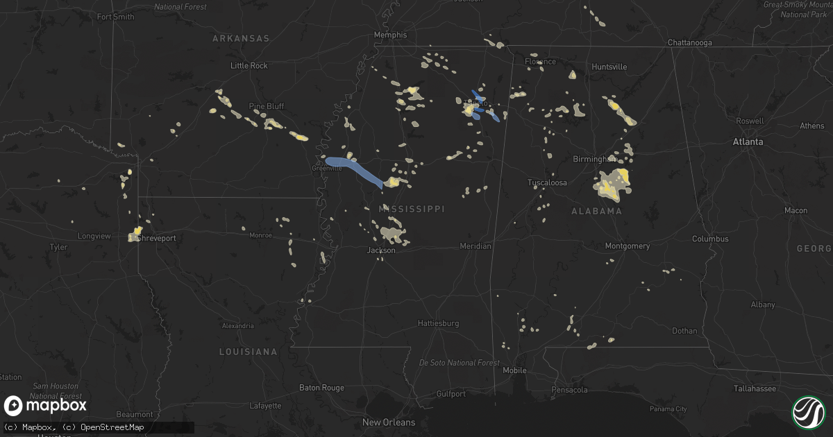
Hail Map in Mississippi on July 9, 2022
Get this storm
July 9 map
$229
one time, instant access
Download today. No call, no setup
Keep the $229
Bought the map and want the full workflow? Apply the entire $229 to a subscription within 7 days. None of it is wasted.
Every map, not just this one
This buys you this map. Subscription and you get every map we run, in the markets you choose from a few cities to whole states to nationwide. Plus real-time alerts the moment a storm fires.
Contact data
Name, contact info, occupancy, even credit band for addresses in the footprint. You go from where it hit to who to call.
Become the source they trust
Unlimited branding weather history reports on demand. You already have the documented answer ready for the property owner, and you are the one who showed up with it.
Property data and RoofTrace estimates
Pull up any address you have got, its value and the exact code rules for that jurisdiction, straight from One Click Code. Then RoofTrace estimates the squares, pitch, and roof value, priced the way you price.
Storm reports in Mississippi
Mississippi
| Date | Description |
|---|---|
| 07/09/20226:52 PM CDT | Two trees were blown down along highway 12 east near the choctaw and attala counties line... In the mccool area. |
| 07/09/20226:45 PM CDT | Tree downed across van williamson road at hwy 39. |
| 07/09/20226:18 PM CDT | Trees were blown down in several areas across the county. |
| 07/09/20226:18 PM CDT | A couple of trees were blown down in ackerman. |
| 07/09/20226:10 PM CDT | Three pine trees down hwy 25 south of louisville just north of george woods road. Road blocked. Report via social media. |
| 07/09/20225:56 PM CDT | A tree was blown down along highway 17 near county road 148. |
| 07/09/20225:55 PM CDT | Trees were blown down in multiple places in the county. A power line was brought down on double springs road. |
| 07/09/20225:55 PM CDT | Ob from kglh. |
| 07/09/20225:53 PM CDT | Reported at kglh. |
| 07/09/20225:42 PM CDT | A tree was blown down on highway 9 just before vampire road. Likely subsevere storm or related to outflow boundary. |
| 07/09/20225:38 PM CDT | A tree was blown down at the intersection of county roads 100 and 120. |
| 07/09/20224:55 PM CDT | Some medium size tree limbs were blown down near dorsey... Ms. |
| 07/09/20224:40 PM CDT | Several trees reported down across southern lee county. |
| 07/09/20224:40 PM CDT | Corrects previous tstm wnd dmg report from verona. Several trees reported down across southern lee county. Large trees fell on two homes in the verona area. |
| 07/09/20224:30 PM CDT | Tree down off of highway. Other reports of tree limbs down across eastern pontotoc county. |
| 07/09/20224:18 PM CDT | Large tree branch fell on a vehicle. |
| 07/09/20224:10 PM CDT | Several large tree limbs were blown down. |
| 07/09/20223:58 AM CDT | At 858 PM CDT, a severe thunderstorm was located near Gluckstadt, or near Canton, moving southeast at 20 mph. HAZARD...60 mph wind gusts. SOURCE...Radar indicated. IMPACT...Expect damage to roofs, siding, and trees. This severe thunderstorm will be near... Gluckstadt around 905 PM CDT. Madison around 915 PM CDT. Fannin and Goshen Springs around 935 PM CDT. Pisgah around 940 PM CDT. |
| 07/09/20223:28 AM CDT | At 828 PM CDT, a severe thunderstorm was located over Sharon, or 9 miles northeast of Canton, moving southeast at 20 mph. HAZARD...60 mph wind gusts. SOURCE...Radar indicated. IMPACT...Expect damage to roofs, siding, and trees. This severe thunderstorm will be near... Farmhaven around 850 PM CDT. Ludlow around 910 PM CDT. Leesburg around 915 PM CDT.Other locations impacted by this severe thunderstorm include Lena. |
| 07/09/20222:19 AM CDT | At 718 PM CDT, a severe thunderstorm was located near Durant, moving southeast at 30 mph. HAZARD...60 mph wind gusts. SOURCE...Radar indicated. IMPACT...Expect damage to roofs, siding, and trees. This severe thunderstorm will be near... Possumneck around 725 PM CDT. Hesterville around 735 PM CDT. Mcadams around 740 PM CDT. Kosciusko around 750 PM CDT. Smyrna around 805 PM CDT. Zama and Renfroe around 815 PM CDT.Other locations impacted by this severe thunderstorm include Mccool,Ethel, Sallis, Redwater and West. |
| 07/09/20221:53 AM CDT | At 653 PM CDT, a severe thunderstorm was located near Swiftown, or 13 miles south of Itta Bena, moving southeast at 35 mph. HAZARD...60 mph wind gusts and penny size hail. SOURCE...Radar indicated. IMPACT...Expect damage to roofs, siding, and trees. This severe thunderstorm will be near... Tchula around 710 PM CDT. Howard around 715 PM CDT. Lexington around 725 PM CDT. Emory around 730 PM CDT. Franklin and Bowling Green around 735 PM CDT. Durant around 745 PM CDT.Other locations impacted by this severe thunderstorm include West,Morgan City and Cruger. |
| 07/09/20221:13 AM CDT | At 613 PM CDT, a severe thunderstorm was located over Holly Ridge, or 7 miles west of Indianola, moving east at 30 mph. HAZARD...60 mph wind gusts and quarter size hail. SOURCE...Radar indicated. IMPACT...Hail damage to vehicles is expected. Expect wind damage to roofs, siding, and trees. This severe thunderstorm will be near... Indianola around 625 PM CDT. Inverness around 635 PM CDT. Moorhead around 640 PM CDT. Swiftown around 655 PM CDT. Quito around 705 PM CDT.Other locations impacted by this severe thunderstorm includeSchlater, Doddsville and Morgan City. |
| 07/09/202212:44 AM CDT | At 544 PM CDT, a severe thunderstorm was located over Mathiston, or 16 miles southwest of Montpelier, moving east at 15 mph. HAZARD...60 mph wind gusts and quarter size hail. SOURCE...Radar indicated. IMPACT...Hail damage to vehicles is expected. Expect wind damage to roofs, siding, and trees. This severe thunderstorm will be near... Maben around 550 PM CDT. |
| 07/09/202212:30 AM CDT | At least 50 trees and powerlines downed in the grand gulf area. Further investigation will be conducted in this area by a survey team. |
| 07/09/202212:28 AM CDT | At 528 PM CDT, a severe thunderstorm was located near McGehee, or 8 miles south of Rohwer, moving southeast at 35 mph. HAZARD...60 mph wind gusts and quarter size hail. SOURCE...Radar indicated. IMPACT...Hail damage to vehicles is expected. Expect wind damage to roofs, siding, and trees. This severe thunderstorm will be near... Scott and Lamont around 550 PM CDT. Winterville around 555 PM CDT. Greenville around 600 PM CDT. Metcalfe around 605 PM CDT. Leland around 610 PM CDT. |
| 07/09/202212:01 AM CDT | At 500 PM CDT, a severe thunderstorm was located over Winchester, or 7 miles south of Dumas, moving southeast at 45 mph. HAZARD...60 mph wind gusts and penny size hail. SOURCE...Radar indicated. IMPACT...Expect damage to roofs, siding, and trees. Locations impacted include... Dumas... Rohwer... Arkansas City... Tillar... Winchester... Jersey Point... Omega... Lucca Landing... McGehee... Kelso... Reed... Halley... Selma... Masonville... Yukon... McArthur... Pickens in Desha County... |
| 07/08/202211:51 PM CDT | At 451 PM CDT, a severe thunderstorm was located near Tombigbee State Park, moving southeast at 45 mph. HAZARD...60 mph wind gusts. SOURCE...Radar indicated. IMPACT...Expect damage to roofs, siding, and trees. Locations impacted include... Tupelo, Fulton, Verona, Tombigbee State Park, Plantersville, Mantachie, Smithville, New Salem, Evergreen, Skyline, Abney, Cardsville, Turon, Tilden, Mooreville, Eggville, Ballardsville, Dorsey, Jacinto and Parham. |
| 07/08/202211:32 PM CDT | At 431 PM CDT, a severe thunderstorm was located near Smithville, or 10 miles east of Amory, moving southeast at 20 mph. HAZARD...60 mph wind gusts. SOURCE...Radar indicated. IMPACT...Expect damage to roofs, siding, and trees. Locations impacted include... Amory, Smithville, Hatley, Gattman, Sipsey Fork, Quincy, Turon, Greenwood Springs, Splunge, Wise Gap, Athens and Parham. |
| 07/08/202211:30 PM CDT | At 430 PM CDT, a severe thunderstorm was located over Shannon, or near Verona, moving southeast at 20 mph. HAZARD...60 mph wind gusts and nickel size hail. SOURCE...Radar indicated. IMPACT...Expect damage to roofs, siding, and trees. Locations impacted include... Amory, Aberdeen, Verona, Okolona, Shannon, New Wren, Nettleton, Hatley, Becker, Wren, Bigbee, Leotis and Old Union. |
| 07/08/202211:27 PM CDT | At 427 PM CDT, a severe thunderstorm was located near Keownville, or 8 miles east of New Albany, moving southeast at 20 mph. HAZARD...60 mph wind gusts and nickel size hail. SOURCE...Radar indicated. IMPACT...Expect damage to roofs, siding, and trees. Locations impacted include... Tupelo, New Albany, Baldwyn, Verona, Trace State Park, Saltillo, Guntown, Ecru, Keownville, New Harmony, Blair, Furrs, Sherman, Blue Springs, Graham, Endville, Beech Springs, Union Hill, Palmetto and Alpine. |
| 07/08/202211:20 PM CDT | At 420 PM CDT, severe thunderstorms were located along a line extending from near Haleyville to near Okolona, moving southeast at 25 mph. HAZARD...60 mph wind gusts. SOURCE...Radar indicated. IMPACT...Expect damage to roofs, siding, and trees. Locations impacted include... Hamilton, Winfield, Haleyville, Vernon, Sulligent, Guin, Hackleburg, Brilliant, Glen Allen, Detroit, Beaverton, Gu- Win, Weston, Blooming Grove, Lamar County Airport, Brinn, Lake Buttahatchee, Crews, Bedford and Bear Creek. |
| 07/08/202210:58 PM CDT | At 358 PM CDT, a severe thunderstorm was located 9 miles west of Blue Mountain, or 14 miles northwest of New Albany, moving southeast at 25 mph. HAZARD...60 mph wind gusts. SOURCE...Radar indicated. IMPACT...Expect damage to roofs, siding, and trees. Locations impacted include... New Albany, Blue Mountain, Keownville, Etta, Pinedale, Hickory Flat, Potts Camp, Myrtle, Shari, Poolville, Graham, Old Myrtle, Pumpkin Center, Baker, Bethel, Smalco, Glenfield, Cotton Plant, Union Hill and Winborn. |
| 07/08/20229:30 PM CDT | Multiple trees downed and some snapped in half. Downed tree on garage and possible power lines downed. |
| 07/08/20229:30 PM CDT | Two large oaks and one medium sized oak trees were uprooted. |
| 07/08/20229:29 PM CDT | At 229 PM CDT, a severe thunderstorm was located near Burgess, or 7 miles east of John W Kyle State Park, moving east at 20 mph. HAZARD...60 mph wind gusts and quarter size hail. SOURCE...Radar indicated. IMPACT...Hail damage to vehicles is expected. Expect wind damage to roofs, siding, and trees. Locations impacted include... Oxford, Holly Springs National Forest, Burgess, Cambridge, Denmark, Abbeville, Altus, Keel, Teckville, Burt, College Hill Station, College Hill and Lafayette Springs. |
| 07/08/20229:25 PM CDT | Trees were blown down... Mainly in the northern part of the county. Some trees fell onto power lines. |
| 07/08/20229:00 PM CDT | Several trees and numerous large branches down. |
| 07/08/20228:38 PM CDT | A tree was blown down on sherrill road. |
| 07/08/20228:33 PM CDT | Trees were blown down on john day road. |
| 07/08/20228:02 PM CDT | A tree was blown down on red dog road. |
| 07/08/20227:47 PM CDT | A tree was blown down on highway 43 near cauthen road. |
| 07/08/20227:15 PM CDT | Trees were blown down on ebenezer road. |
All States Impacted by Hail Map on July 9, 2022
Cities Impacted by Hail Map on July 9, 2022
- Rugby, ND
- Brady, MT
- Dutton, MT
- Conrad, MT
- Valier, MT
- Ambrose, ND
- East Glacier Park, MT
- Underwood, ND
- Stanton, ND
- Polson, MT
- Bigfork, MT
- Monarch, MT
- Geyser, MT
- Raynesford, MT
- Neihart, MT
- Hazelton, ND
- Moffit, ND
- Bismarck, ND
- Menoken, ND
- Mandan, ND
- Belt, MT
- Holly Springs, MS
- Potts Camp, MS
- Stanford, MT
- Wilton, ND
- Clinton, MT
- Bonner, MT
- Deer Lodge, MT
- Chester, MT
- Shelby, MT
- Joplin, MT
- Galata, MT
- Rudyard, MT
- Inverness, MT
- Ledger, MT
- Lewisburg, TN
- Cornersville, TN
- Petersburg, TN
- Red Bay, AL
- Mchenry, ND
- New Rockford, ND
- Poyen, AR
- Malvern, AR
- Leola, AR
- Moscow, TN
- Arab, AL
- Rison, AR
- Douglas, ND
- Max, ND
- Sawyer, ND
- Minot, ND
- Ryder, ND
- Addison, AL
- Power, MT
- Fairfield, MT
- Winifred, MT
- Clancy, MT
- Helena, MT
- Double Springs, AL
- Oxford, MS
- Coffee Creek, MT
- Moundville, AL
- Philipsburg, MT
- Hingham, MT
- Box Elder, MT
- Gildford, MT
- Pope, MS
- Anaconda, MT
- Grenada, MS
- Holcomb, MS
- Tunica, MS
- Vaughn, MT
- Canton, MS
- Talladega, AL
- Pell City, AL
- Rayville, LA
- New Town, ND
- Slayton, MN
- Florence, AL
- Sheffield, AL
- Muscle Shoals, AL
- Lamar, MS
- Grand Marais, MN
- Cleveland, ND
- Mccall, ID
- Donnelly, ID
- Mesa, ID
- Council, ID
- Grants, NM
- Stevensville, MT
- Cherokee, AL
- Tuscumbia, AL
- Flora, MS
- Carbon Hill, AL
- Fulton, MS
- Boyle, MS
- Beach, ND
- Big Sandy, MT
- Selmer, TN
- Prescott, AR
- Blevins, AR
- Ashdown, AR
- Foreman, AR
- Judith Gap, MT
- Belfield, ND
- Mound Bayou, MS
- Shelby, MS
- Alligator, MS
- Duncan, MS
- Imnaha, OR
- Senatobia, MS
- Sarah, MS
- Madison, MS
- Brandon, MS
- Fulda, MN
- Avoca, MN
- Great Falls, MT
- Akron, AL
- Mount Pleasant, TX
- Regan, ND
- Velva, ND
- Wilsall, MT
- Ypsilanti, ND
- Jamestown, ND
- Hillsboro, AL
- Trinity, AL
- Baldwyn, MS
- Roundup, MT
- Blue Mountain, MS
- Logan, AL
- Cullman, AL
- Arley, AL
- Crane Hill, AL
- Vinemont, AL
- Butte, MT
- Mount Vernon, TX
- Jackson, MN
- Ashland, MS
- Lincoln, AL
- Riverside, AL
- Odenville, AL
- Ragland, AL
- Ashville, AL
- Shreveport, LA
- Mooringsport, LA
- Hackleburg, AL
- Yazoo City, MS
- Winona, MS
- Vaiden, MS
- Brewton, AL
- Delhi, LA
- Winnsboro, LA
- Baskin, LA
- Hico, TX
- West, MS
- Durant, MS
- Lexington, MS
- Cruger, MS
- Fort Shaw, MT
- Havre, MT
- Washburn, ND
- Medora, ND
- Medina, ND
- Heron Lake, MN
- Ramer, TN
- Guys, TN
- Michie, TN
- Alpine, AL
- West Point, MS
- Fort Benton, MT
- Grass Range, MT
- Cohagen, MT
- Denton, MT
- Fortuna, ND
- Hebron, ND
- South Heart, ND
- Gladstone, ND
- Lefor, ND
- New England, ND
- Dickinson, ND
- Richardton, ND
- New Salem, ND
- Amidon, ND
- Rhame, ND
- Taylor, ND
- Glen Ullin, ND
- Winston, MT
- East Helena, MT
- Condon, MT
- Granville, ND
- Voltaire, ND
- Karlsruhe, ND
- Towner, ND
- Winnett, MT
- Brusett, MT
- Mosby, MT
- Sand Springs, MT
- Courtland, MS
- Batesville, MS
- Almont, ND
- Carson, ND
- New Leipzig, ND
- Elgin, ND
- Buchanan, ND
- Floweree, MT
- Huntington, OR
- Cambridge, ID
- Midvale, ID
- Weiser, ID
- Hickory Flat, MS
- Kalispell, MT
- Mandaree, ND
- Rollins, MT
- Dayton, MT
- Lakeside, MT
- Somers, MT
- Choteau, MT
- Water Valley, MS
- Carthage, AR
- Grassy Butte, ND
- Killdeer, ND
- Fairfield, ND
- Manning, ND
- Dunn Center, ND
- Dodge, ND
- Halliday, ND
- Atlanta, TX
- Douglassville, TX
- Kilmichael, MS
- Collinston, LA
- Bastrop, LA
- Shawmut, MT
- Harlowton, MT
- Pine Bluff, AR
- Star City, AR
- Louisville, MS
- Calera, AL
- Tillar, AR
- Winchester, AR
- Pickens, AR
- Rolling Fork, MS
- Moulton, AL
- Childersburg, AL
- Jefferson, TX
- Leeds, AL
- Vandiver, AL
- Ferriday, LA
- Wagarville, AL
- Forsyth, MT
- Andalusia, AL
- Cropwell, AL
- Linden, TX
- Bivins, TX
- Franklin, AL
- Godley, TX
- Cleburne, TX
- Joshua, TX
- Range, AL
- Shelby, AL
- Columbiana, AL
- Jemison, AL
- Clanton, AL
- Sylacauga, AL
- Union Springs, AL
- Banks, AL
- San Angelo, TX
- Miles, TX
- Texarkana, TX
- Kinsey, MT
- Angela, MT
- Hamilton, AL
- Bear Creek, AL
- Florence, MS
- Graettinger, IA
- Milton, FL
- Millry, AL
- Harpersville, AL
- Ingomar, MT
- Pelahatchie, MS
- Morton, MS
- Vincent, AL
- Oakland, MS
- Jackson, MS
- Starkville, MS
- Macon, MS
- Tularosa, NM
- Jonesboro, TX
- Castleberry, AL
- Granbury, TX
- Chunchula, AL
- Citronelle, AL
- Maben, MS
- Mathiston, MS
- Wilsonville, AL
- Tupelo, MS
- Shannon, MS
- Pontotoc, MS
- Coila, MS
- Greenwood Springs, MS
- Smithville, MS
- Tremont, MS
- Bentonia, MS
- Cannon Ball, ND
- Linton, ND
- Solen, ND
- Nettleton, MS
- Clayton, AL
- Alabaster, AL
- Pelham, AL
- Dumas, AR
- Cedarbluff, MS
- Waskom, TX
- Greenwood, LA
- Marshall, TX
- Karnack, TX
- Dublin, TX
- Goldthwaite, TX
- Rowena, TX
- Drew, MS
- Repton, AL
- Lenox, AL
- Culleoka, TN
- Columbia, TN
- Jasper, AL
- Two Dot, MT
- Benton, MS
- Vaughan, MS
- Pickens, MS
- Pheba, MS
- Tolar, TX
- Midway, AL
- Leakey, TX
- Montevallo, AL
- Sterrett, AL
- Weogufka, AL
- Birmingham, AL
- Chelsea, AL
- Fosters, AL
- Braddock, ND
- Iuka, MS
- Counce, TN
- Corinth, MS
- Burnsville, MS
- Belcher, LA
- Greensboro, AL
- Ralph, AL
- Buhl, AL
- Gallant, AL
- Guntersville, AL
- Boaz, AL
- Holly Pond, AL
- Baileyton, AL
- Attalla, AL
- Blountsville, AL
- Steele, AL
- Oneonta, AL
- Joppa, AL
- Horton, AL
- Altoona, AL
- Delight, AR
- Ecru, MS
- Oak Ridge, LA
- Rising Star, TX
- Carbon, TX
- Tallulah, LA
- Evergreen, AL
- Lavina, MT
- Hodges, AL
- Musselshell, MT
- Socorro, NM
- Conner, MT
- Darby, MT
- Downsville, LA
- Berry, AL
- Aberdeen, MS
- Glenfield, ND
- Saltillo, MS
- Mooreville, MS
- Saint Anthony, ND
- Vicksburg, MS
- Newellton, LA
- Okolona, MS
- Sardis, MS
- Taylor, MS
- Tuscaloosa, AL
- Prairie, MS
- Sunflower, MS
- Indianola, MS
- Hayneville, AL
- Mer Rouge, LA
- Byram, MS
- McIntosh, AL
- Lena, MS
- McCarley, MS
- Guntown, MS
- Troy, AL
- Arkadelphia, AR
- Houston, AL
- Plantersville, MS
- Verona, MS
- Gilbert, LA
- Forest Grove, MT
- Rosebud, MT
- Ryegate, MT
- Custer, MT
- Melstone, MT
- Hysham, MT
- Clarksdale, MS
- Oil City, LA
- Vivian, LA
- Baker, FL
- Estherville, IA
- Wallingford, IA
- Flasher, ND
- Haleyville, AL
- Moody, AL
- Kintyre, ND
- Napoleon, ND
- Belden, MS
- Como, MS
- Vina, AL
- Springville, AL
- Shaw, MS
- Texarkana, AR
- Greenville, MS
- Maud, TX
- Ruthven, IA
- Little River, AL
- Coffeeville, MS
- Dexter, NM
- Roswell, NM
- Iredell, TX
- Meridian, TX
- Greenwood, MS
- Nashville, AR
- Eldridge, AL
- Wing, AL
- Jay, FL
- Natchez, MS
- Tappen, ND
- Lynn, AL
- Nauvoo, AL
- Livingston, AL
- Garrison, MT
- Big Sandy, TX
- Eva, AL
- Townley, AL
- Lometa, TX
- Evant, TX
- Jackson, AL
- Stockton, AL
- Clifton, TX
- Terry, MT
- Fallon, MT
- Ismay, MT
- Amory, MS
- Leland, MS
- Inverness, MS
- Itta Bena, MS
- Tchula, MS
- Belzoni, MS
- Moorhead, MS
- Hazen, ND
- Glendive, MT
- Golden Valley, ND
- Wibaux, MT
- Golva, ND
- Zap, ND
- Sentinel Butte, ND
- Beulah, ND
- Marmarth, ND
- Baker, MT
- Center, ND
- Baldwin, ND
- Denhoff, ND
- Goodrich, ND
- Wing, ND
- Hurdsfield, ND
- Bowdon, ND
- Mcclusky, ND
- Harvey, ND
- Fessenden, ND
- Cathay, ND
- Chaseley, ND
- Sykeston, ND
- Norwich, ND
- Willow City, ND
- Agate, ND
- Rolette, ND
- Drake, ND
- Balfour, ND
- Wolford, ND
- Mylo, ND


