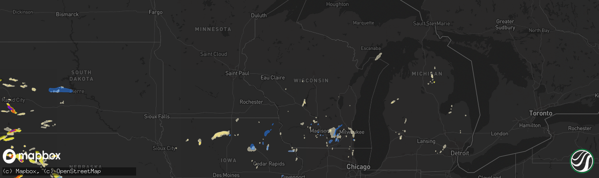
Hail Map in Wisconsin on July 9, 2020
The weather event in Wisconsin on July 9, 2020 includes Hail and Wind maps. 25 states and 527 cities were impacted and suffered possible damage. The total estimated number of properties impacted is 0.
Want more than just the map?
Turn this storm into a full workflow.
- Owner + property data so you know who to knock
- OnDemand branded weather history reports to win the "did we even have hail?" argument
- RoofTrace estimate so reps stop guessing numbers at the door
Bought this map? Upgrade within 7 days and we'll credit the $230. (10-15 min setup call)
Hail
Wind
0
Estimated number of impacted properties by a 1.00" hail or larger0
Estimated number of impacted properties by a 1.75" hail or larger0
Estimated number of impacted properties by a 2.50" hail or largerStorm reports in Wisconsin
Wisconsin
| Date | Description |
|---|---|
| 07/09/20206:35 PM CDT | Several large trees down. |
| 07/09/20206:26 PM CDT | Trees and part of a power line down near delavan lake. Time estimated from radar. |
| 07/09/20205:03 PM CDT | Tree damage in the area. Part of a large tree in road at grand ave and 6th street. |
| 07/09/20205:00 PM CDT | Tree and power line damage in the sauk city area. |
| 07/09/20204:45 PM CDT | Trees and power lines down in arena. Time estimated from radar. |
| 07/09/20203:00 PM CDT | Large tree down. |
| 07/09/20202:10 PM CDT | A few trees reported down in necedah... Germantown... And clearfield areas. Time estimated. |
| 07/09/20202:00 PM CDT | Trees reported down across highway 80 between necedah and new lisbon. Also... Reports of trees down on highway 58... County road a... County road g and several others. |
| 07/09/20201:20 PM CDT | Several sources reported tree damage. |
| 07/09/20207:15 AM CDT | A local report indicates 1.00 inch wind near CORNELL |
| 07/09/20207:00 AM CDT | Reports of power line down in north menomonie and a 12 inch diameter tree snapped off 10 feet above ground in downtown area. Approximate time. |
| 07/09/20202:53 AM CDT | At 752 PM CDT, severe thunderstorms were located along a line extending from Lomira to near Fox Point, moving northeast at 35 mph. HAZARD...60 mph wind gusts and penny size hail. SOURCE...Public. Numerous trees and powerlines have been reported down with these storms this evening. IMPACT...Expect damage to roofs, siding, and trees. Locations impacted include... Sheboygan, Fond Du Lac, West Bend, Port Washington, Plymouth, Sheboygan Falls, Mayville, Saukville, Kewaskum, Howards Grove, Oostburg, Lomira, Belgium, Fredonia, Kohler, Cedar Grove, Campbellsport, Random Lake, Theresa and Newburg.People attending Indy Car at Road America should seek safe shelterimmediately! |
| 07/09/20202:24 AM CDT | At 723 PM CDT, severe thunderstorms were located along a line extending from Hustisford to Pewaukee, moving northeast at 45 mph. HAZARD...60 mph wind gusts and penny size hail. SOURCE...Radar indicated. IMPACT...Expect damage to roofs, siding, and trees. Locations impacted include... Northern Milwaukee, Wauwatosa, Brookfield, Menomonee Falls, West Bend, Mequon, Hartford, Whitefish Bay, Pewaukee, Brown Deer, Grafton, Cedarburg, Port Washington, Sussex, Hartland, Jackson, Fox Point, Slinger, Saukville and Bayside.This includes the following Locations Schlitz Audobon Nature Center,Bayshore Shopping Center, Timmerman Airport, Mayfair Mall, andPewaukee Lake. |
| 07/09/20201:59 AM CDT | At 657 PM CDT, severe thunderstorms were located along a line extending from Lake Mills to Potter Lake, moving northeast at 30 mph. HAZARD...60 mph wind gusts and penny size hail. SOURCE...Public. Trees have been reported down across portions of Walworth County with these storms. IMPACT...Expect damage to roofs, siding, and trees. Locations impacted include... Watertown, Pewaukee, Hartland, Delafield, Lake Mills, Waterloo, Wales, Okauchee Lake, Oconomowoc, Ottawa, Merton, Johnson Creek, Dousman, Lac La Belle, Ixonia, Ashippun, Lebanon, Nashotah, Milford and Waterville.This includes the following Location Pewaukee Lake. |
| 07/09/20201:31 AM CDT | At 630 PM CDT, severe thunderstorms were located along a line extending from near Milton to near Como, moving north at 40 mph. HAZARD...60 mph wind gusts and penny size hail. SOURCE...Radar indicated. IMPACT...Expect damage to roofs, siding, and trees. Locations impacted include... Whitewater, Fort Atkinson, Elkhorn, Delavan, Jefferson, Lake Geneva, Mukwonago, Lake Mills, Milton, East Troy, Wales, Ottawa, Johnson Creek, Dousman, North Prairie, Palmyra, Lake Ripley, Como, Potter Lake and Lake Koshkonong.This includes the following Locations Ottawa Lake Recreation Area andPinewoods Campground. |
| 07/09/20201:04 AM CDT | At 604 AM CDT, a severe thunderstorm was located near New Richmond, or 16 miles north of River Falls, moving northeast at 40 mph. HAZARD...60 mph wind gusts and quarter size hail. SOURCE...Radar indicated. IMPACT...Hail damage to vehicles is expected. Expect wind damage to roofs, siding, and trees. Locations impacted include... New Richmond, Amery, Clear Lake, Cylon, Deer Park, Deronda and Houlton. |
| 07/09/202012:51 AM CDT | At 550 AM CDT, a severe thunderstorm was located near Roberts, or near River Falls, moving east at 30 mph. HAZARD...60 mph wind gusts and half dollar size hail. SOURCE...Radar indicated. IMPACT...Hail damage to vehicles is expected. Expect wind damage to roofs, siding, and trees. Locations impacted include... River Falls, Hammond, Baldwin, Roberts and Woodville. This includes Interstate 94 in Wisconsin between mile markers 6 and24. |
| 07/09/202012:23 AM CDT | At 522 PM CDT, severe thunderstorms were located along a line extending from near Poynette to Madison, moving northeast at 45 mph. HAZARD...60 mph wind gusts and nickel size hail. SOURCE...Emergency management. Trees and powerlines were reported down in the Sauk City area with this storm. IMPACT...Expect damage to roofs, siding, and trees. Locations impacted include... Sun Prairie, Beaver Dam, Waunakee, Windsor, Columbus, Deforest, Poynette, Pardeeville, Randolph, Fall River, Rio, Cambria, Fox Lake, Arlington, Wyocena, Reeseville, Otsego, Richwood, Clyman and Friesland. |
| 07/08/202011:55 PM CDT | At 455 PM CDT, severe thunderstorms were located along a line extending from Reedsburg to near Cross Plains, moving northeast at 45 mph. HAZARD...60 mph wind gusts and nickel size hail. SOURCE...Radar indicated. IMPACT...Expect damage to roofs, siding, and trees. Locations impacted include... Middleton, Waunakee, Baraboo, Portage, Reedsburg, Mount Horeb, Windsor, Prairie Du Sac, Sauk City, Wisconsin Dells, Lake Wisconsin, Deforest, Cross Plains, Lodi, Lake Delton, Poynette, Pardeeville, Mazomanie, Montello and West Baraboo.This includes the following Locations Mirror Lake State Park,Gibraltar Rock Natural Area County Park, Pine Island State WildlifeArea, Kilbourn Dam, Historic Indian Agency House, French CreekWildlife Area, and Alliant Energy Portage Power Plant. |
| 07/08/202011:28 PM CDT | At 428 PM CDT, severe thunderstorms were located along a line extending from near Spring Green to near Blanchardville, moving north at 45 mph. HAZARD...60 mph wind gusts and nickel size hail. SOURCE...Radar indicated. IMPACT...Expect damage to roofs, siding, and trees. Locations impacted include... Mount Horeb, Dodgeville, Prairie Du Sac, Sauk City, Cross Plains, Mazomanie, Spring Green, Black Earth, Barneveld, Blue Mounds, Arena, Ridgeway, Clyde, Governor Dodge St Park, Blue Mound St Park and Marxville.This includes the following Locations Hyde's Mill and The House onthe Rock. |
| 07/08/202011:22 PM CDT | At 421 PM CDT, a severe thunderstorm was located near Zwingle, or 8 miles south of Dubuque, moving east at 35 mph. HAZARD...60 mph wind gusts. SOURCE...Radar indicated. IMPACT...Expect damage to roofs, siding, and trees. Locations impacted include... Dubuque, Galena, Asbury, Bellevue, East Dubuque, Peosta, La Motte, Menominee, Council Hill, St. Donatus, Centralia, Sageville, Bernard, Zwingle, Durango, Rice, Graf, Dubuque Regional Airport, Garry Owen and Aiken. |
| 07/08/202011:21 PM CDT | At 421 PM CDT, severe thunderstorms were located along a line extending from 9 miles south of Wonewoc to near Spring Green, moving east at 25 mph. HAZARD...60 mph wind gusts and penny size hail. SOURCE...Radar indicated. IMPACT...Expect damage to roofs, siding, and trees. Locations impacted include... Baraboo, Reedsburg, Prairie Du Sac, Sauk City, Lake Delton, Spring Green, West Baraboo, Plain, Bluffview, North Freedom, La Valle, Rock Springs, Loganville, Ironton, Lime Ridge, Hill Point and Devils Lake St Park.This includes the following Location Mirror Lake State Park. |
| 07/08/202010:08 PM CDT | At 308 PM CDT, a severe thunderstorm was located over Newburg, or near West Bend, moving northeast at 25 mph. HAZARD...60 mph wind gusts and nickel size hail. SOURCE...Radar indicated. IMPACT...Expect damage to roofs, siding, and trees. Locations impacted include... West Bend, Saukville, Oostburg, Belgium, Fredonia, Cedar Grove, Random Lake, Newburg, Cascade, Adell, Waldo, Silver Creek, Beechwood, Waubeka, Fillmore, Boltonville, Gibbsville, Batavia, Hingham and Keowns. |
| 07/08/20209:17 PM CDT | At 217 PM CDT, a severe thunderstorm was located near Reedsburg, moving northeast at 15 mph. HAZARD...60 mph wind gusts and nickel size hail. SOURCE...Radar indicated. IMPACT...Expect damage to roofs, siding, and trees. Locations impacted include... Reedsburg, Wisconsin Dells, Lake Delton, North Freedom, La Valle, Rock Springs, Loganville, Ironton, Lime Ridge and Hill Point.This includes the following Locations Mirror Lake State Park andKilbourn Dam. |
| 07/08/20208:39 PM CDT | At 139 AM CDT, a severe thunderstorm was located near Norway, or near Iron Mountain, moving east at 25 mph. HAZARD...60 mph wind gusts and penny size hail. SOURCE...Radar indicated. IMPACT...Expect damage to roofs, siding, and trees. Locations impacted include... Iron Mountain, Kingsford, Norway, Felch, Foster City, Niagara, Aurora, Waucedah, Faithorn, Quinnesec, Loretto and Granite Bluff. |
| 07/08/20208:03 PM CDT | At 102 AM CDT, a severe thunderstorm was located near Tipler, or 16 miles south of Iron River, moving east at 35 mph. HAZARD...60 mph wind gusts and quarter size hail. SOURCE...Radar indicated. IMPACT...Hail damage to vehicles is expected. Expect wind damage to roofs, siding, and trees. Locations impacted include... Kingsford, Florence, Homestead, Fern, Tipler, Wisconsin Slough Natural Area, Whisker Lake Wilderness, Niagara, Aurora and Commonwealth. |
| 07/08/20207:25 PM CDT | A couple of large tree branches down at cliffside park. |
| 07/08/20207:20 PM CDT | Large tree down in caledonia. Time estimated from radar. |
| 07/08/20207:17 PM CDT | Racine batten airport measured 59 knot gust. |
| 07/08/20207:14 PM CDT | Multiple large uprooted trees on lac la belle dr. Relayed through broadcast media. |
| 07/08/20207:02 PM CDT | Trees and power lines down between dousman and eagle on highway 67. Time estimated from radar. |
All States Impacted by Hail Map on July 9, 2020
Cities Impacted by Hail Map on July 9, 2020
- Iliff, CO
- Peetz, CO
- Cedar Falls, IA
- Dike, IA
- Hudson, IA
- Ashby, NE
- Hyannis, NE
- Merriman, NE
- Bingham, NE
- Vale, SD
- Sturgis, SD
- Whitewood, SD
- Bayard, NE
- Dalton, NE
- Broadwater, NE
- Bridgeport, NE
- Dickens, TX
- Paducah, TX
- Newell, SD
- Knoxville, TN
- Mapleton, ME
- Morrow, OH
- South Lebanon, OH
- Memphis, TX
- Rozet, WY
- Bennett, CO
- Strasburg, CO
- Cozad, NE
- Brady, NE
- Gothenburg, NE
- Spragueville, IA
- Bellevue, IA
- Preston, IA
- Ellsworth, NE
- Watkins, CO
- Bluff City, KS
- Caldwell, KS
- Medford, OK
- Freeport, KS
- Stoneham, CO
- Potter, NE
- Custer, SD
- Fountain, MI
- Branch, MI
- Wheatland, WY
- Bertrand, NE
- Owatonna, MN
- Bagley, WI
- Byers, CO
- Allen, SD
- Johnson Creek, WI
- Jefferson, WI
- Lake Mills, WI
- Crawford, NE
- Lakeside, NE
- Gillette, WY
- Whitney, NE
- Hermosa, SD
- Keystone, SD
- Commerce City, CO
- Brighton, CO
- Henderson, CO
- Lewiston, MI
- Beulah, WY
- Grenola, KS
- Latham, KS
- Norwalk, OH
- Belle Fourche, SD
- Aladdin, WY
- Spearfish, SD
- Sundance, WY
- Moorcroft, WY
- Kensett, IA
- Saint Ansgar, IA
- Northwood, IA
- Grafton, IA
- New Raymer, CO
- Merino, CO
- Ashland, ME
- Neenah, WI
- Deer Trail, CO
- Pine Ridge, SD
- Harrison, NE
- Marsland, NE
- Saint Cloud, WI
- Bellevue, OH
- Orchard, CO
- Kersey, CO
- Roggen, CO
- Sycamore, PA
- Graysville, PA
- North Platte, NE
- Byron Center, MI
- Lyons, KS
- Little River, KS
- Upton, WY
- Waldron, KS
- Laurens, IA
- Pocahontas, IA
- Rockford, MI
- Ada, MI
- Belmont, MI
- Morley, MI
- Sand Lake, MI
- Pierson, MI
- Howard City, MI
- Luzerne, MI
- Dexter, MI
- Edgemont, SD
- Chadron, NE
- Oelrichs, SD
- Hemingford, NE
- Alliance, NE
- Guernsey, WY
- Midland, SD
- Wichita, KS
- Sheffield, IA
- East Troy, WI
- Childress, TX
- Matador, TX
- Cambridge Springs, PA
- Union City, PA
- Grover, CO
- Tryon, NE
- Hershey, NE
- Lu Verne, IA
- Livermore, IA
- Corwith, IA
- Hardy, IA
- Renwick, IA
- Waynesfield, OH
- Wapakoneta, OH
- Murdock, KS
- Cheney, KS
- Merrillan, WI
- Alma Center, WI
- Canton, IL
- Arthur, NE
- Sutherland, NE
- Oregon, WI
- Ellis, KS
- Kanawha, IA
- Whitman, NE
- Limon, CO
- Padroni, CO
- Denver, CO
- Aurora, CO
- Bay Port, MI
- Sebewaing, MI
- Agate, CO
- Elkhorn, WI
- Grand Rapids, OH
- Rapid City, SD
- Claflin, KS
- Holyrood, KS
- Cee Vee, TX
- Tell, TX
- Mazeppa, MN
- Garden, MI
- Garner, IA
- Britt, IA
- Goodell, IA
- Klemme, IA
- Hay Springs, NE
- Mio, MI
- Burrton, KS
- Fairburn, SD
- Sedgwick, CO
- Ovid, CO
- Fonda, IA
- Irons, MI
- Custer, MI
- Patten, ME
- Sandusky, OH
- Monroeville, OH
- Watson, AR
- Alta, IA
- Black Earth, WI
- Mazomanie, WI
- New Underwood, SD
- Union Center, SD
- Port Clinton, OH
- Merrimac, WI
- Wall, SD
- Wasta, SD
- Howes, SD
- Enning, SD
- Brighton, MI
- Milford, MI
- South Lyon, MI
- Rockford, TN
- Muskego, WI
- Brooksville, MS
- Torrington, WY
- Winthrop, IA
- Coopersville, MI
- Marne, MI
- Merigold, MS
- Cleveland, MS
- Butler, KY
- California, KY
- Oshkosh, NE
- Bushton, KS
- Brooklyn, WI
- Belleville, WI
- Conway Springs, KS
- North Fairfield, OH
- Willard, OH
- Venedocia, OH
- Williamstown, KY
- Dry Ridge, KY
- Havelock, IA
- Rock Island, IL
- Milan, IL
- Summers, AR
- Westville, OK
- Mineral Point, WI
- Julesburg, CO
- Lexington, NE
- Otis, KS
- Bison, KS
- La Crosse, KS
- Albert, KS
- Larned, KS
- Rush Center, KS
- Pawnee Rock, KS
- Maineville, OH
- Kings Mills, OH
- Lebanon, OH
- Cresco, IA
- New Lisbon, WI
- Necedah, WI
- Waterloo, IA
- Argonia, KS
- Danville, KS
- Maryville, TN
- Keenesburg, CO
- Bokoshe, OK
- Shady Point, OK
- Poteau, OK
- Cameron, OK
- Dix, NE
- Spiro, OK
- Galena, IL
- Nevada, OH
- Marion, OH
- Dousman, WI
- Carpenter, WY
- Lenoir City, TN
- La Salle, CO
- Hudson, CO
- Fort Lupton, CO
- Haven, KS
- Wayland, IA
- Lake Cormorant, MS
- Burlington, IA
- Oquawka, IL
- Gladstone, IL
- Morral, OH
- Belle Plaine, IA
- Luzerne, IA
- Marengo, IA
- Ladora, IA
- Victor, IA
- Ogallah, KS
- Hayes, SD
- Lake Villa, IL
- Sandy Lake, PA
- Grand Rapids, MI
- Blairsville, GA
- Harper, KS
- Scenic, SD
- Kenosha, WI
- Okaton, SD
- Lake Zurich, IL
- Elm Creek, NE
- Martin, SD
- Imlay City, MI
- Capac, MI
- Hartville, WY
- Humboldt, IA
- Rutland, IA
- Clear Lake, IA
- Goldfield, IA
- Thornton, IA
- Meservey, IA
- Hays, KS
- Nash, OK
- Wakita, OK
- Chelsea, MI
- Cambridge, WI
- Saint Francis, WI
- South Milwaukee, WI
- Cudahy, WI
- Milwaukee, WI
- Oak Creek, WI
- Keystone, IA
- Dougherty, IA
- Claremont, MN
- Oxford, KS
- Aurelia, IA
- Lima, OH
- Buckland, OH
- Delphos, OH
- Roscommon, MI
- Elwood, NE
- Fairmont, WV
- Shinnston, WV
- Bridgeport, WV
- Liberty, IN
- Luther, MI
- Maxwell, NE
- Leon, KS
- Pekin, IL
- Green Valley, IL
- Wellington, TX
- Hutchinson, KS
- Pretty Prairie, KS
- Lincoln, AR
- Canehill, AR
- Cuba, IL
- Sussex, WI
- Pewaukee, WI
- Bunker Hill, KS
- Dorrance, KS
- Wilson, KS
- Corry, PA
- Spartansburg, PA
- Shelby, MS
- Duncan, MS
- Fairbank, IA
- Frankfort, KY
- Indianola, PA
- Cheswick, PA
- Allison Park, PA
- Pittsburgh, PA
- Wanblee, SD
- Long Valley, SD
- Atlanta, MI
- West Mansfield, OH
- Raymond, OH
- Fort Atkinson, WI
- Geneseo, KS
- Boyle, MS
- Buhler, KS
- Mound Bayou, MS
- Lodi, WI
- Mullen, NE
- Stockbridge, MI
- Castalia, OH
- Clyde, OH
- Randolph, WI
- Cambria, WI
- Wellington, KS
- Waukegan, IL
- Zion, IL
- Whitmore Lake, MI
- Ellinwood, KS
- Mills River, NC
- Horse Shoe, NC
- Masonville, IA
- Lamont, IA
- Portage, WI
- Lance Creek, WY
- Ellijay, GA
- Unionville, MI
- Hanna City, IL
- Correctionville, IA
- Marshfield, WI
- Cashton, WI
- Westby, WI
- Van Wert, OH
- Ohio City, OH
- Bucyrus, OH
- London Mills, IL
- Farmington, IL
- Avon, IL
- Fairview, IL
- Bushnell, IL
- Ellisville, IL
- Prairie City, IL
- Racine, WI
- Cottonwood, ID
- Whitewater, WI
- Elkhart Lake, WI
- Kiel, WI
- Evansdale, IA
- Grandville, MI
- Wyoming, MI
- Presque Isle, ME
- Lewistown, IL
- Edgerton, WI
- Milton, WI
- Kingman, KS
- Norwich, KS
- Raymond, IA
- Palms, MI
- Deckerville, MI
- Toxey, AL
- Lewisburg, OH
- Mount Hope, KS
- Gunnison, MS
- Poplar Grove, IL
- Sharon, WI
- Capron, IL
- Crab Orchard, TN
- Rockwood, TN
- Salina, OK
- Spavinaw, OK
- Lake Forest, IL
- Great Lakes, IL
- Lake Bluff, IL
- North Chicago, IL
- Clutier, IA
- Rushville, NE
- Winfield, KS
- Plain, WI
- Lone Rock, WI
- Loganville, WI
- Hillpoint, WI
- Spring Green, WI
- Anthony, KS
- Maynard, IA
- Darlington, WI
- Hoisington, KS
- Palmyra, WI
- Mukwonago, WI
- Eagle, WI
- Oconomowoc, WI
- Stoneboro, PA
- Gibsonburg, OH
- Lindsey, OH
- Janesville, WI
- Beloit, WI
- Reinbeck, IA
- La Porte City, IA
- Sullivan, WI
- Watertown, WI
- Helenville, WI
- Hazel Green, WI
- East Dubuque, IL
- Deadwood, SD
- Arena, WI
- Ironton, OH
- Princeville, IL
- Dunlap, IL
- Edwards, IL
- Brimfield, IL
- Twinsburg, OH
- Stapleton, NE
- Plymouth, OH
- Solon, OH
- McCracken, KS
- Schoenchen, KS
- Rubicon, WI
- Ordway, CO
- Jasper, GA
- Fort Pierre, SD
- Milesville, SD
- Middle Point, OH
- Biggsville, IL
- Joy, IL
- Reynolds, IL
- Aledo, IL
- Andalusia, IL
- Taylor Ridge, IL
- Crook, CO
- Thornton, CO
- Venango, NE
- Sauk City, WI
- Prairie Du Sac, WI
- Dane, WI
- Deforest, WI
- Arlington, WI
- Madison, WI
- Stoughton, WI
- Avalon, WI
- Hartford, WI
- Ixonia, WI
- Janesville, IA
- Oelwein, IA
- Hazleton, IA
- Elgin, IA
- Fayette, IA
- West Union, IA
- Ossian, IA
- Castalia, IA
- Clermont, IA
- Waukon, IA
- Postville, IA
- La Motte, IA
- Zwingle, IA
- Dubuque, IA
- Grandview, IA
- Letts, IA
- Yarmouth, IA
- Mount Union, IA
- Mount Pleasant, IA
- Muscatine, IA
- Wapello, IA
- Morning Sun, IA
- New London, IA
- Columbus Junction, IA
- Winfield, IA
- Conesville, IA
- Moscow, IA
- Wilton, IA
- Bentonville, AR
- Siloam Springs, AR
- Rogers, AR
- Cave Springs, AR
- Farmington, AR
- Lowell, AR
- Gentry, AR
- Fayetteville, AR
- Springdale, AR
- Uniontown, AR
- Evansville, AR
- Natural Dam, AR
- Rudy, AR
- Van Buren, AR
- Cedarville, AR
- Stilwell, OK
- Odessa, NE
- Willow Island, NE
- Overton, NE
- Kearney, NE


