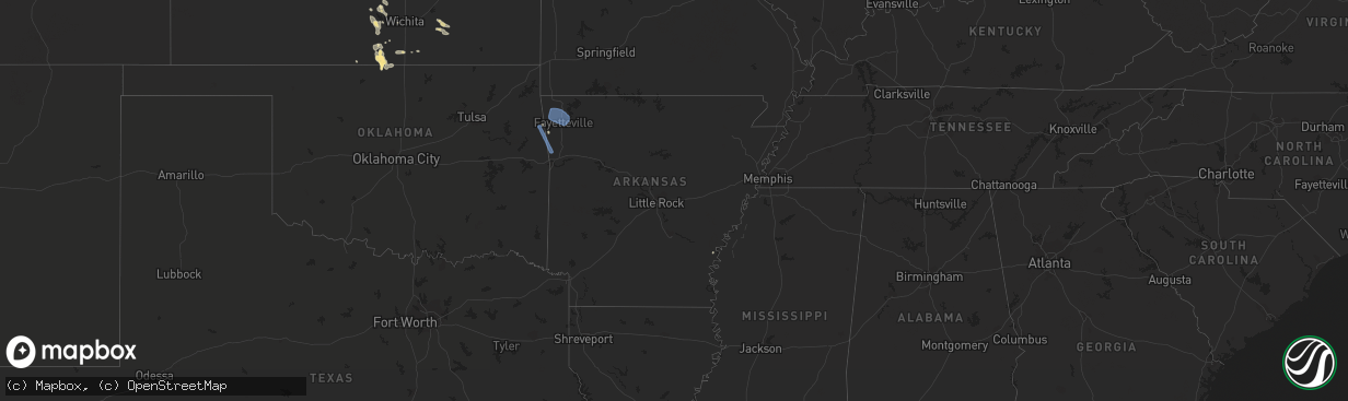
Hail Map in Arkansas on July 9, 2020
The weather event in Arkansas on July 9, 2020 includes Hail and Wind maps. 25 states and 527 cities were impacted and suffered possible damage. The total estimated number of properties impacted is 0.
Want more than just the map?
Turn this storm into a full workflow.
- Owner + property data so you know who to knock
- OnDemand branded weather history reports to win the "did we even have hail?" argument
- RoofTrace estimate so reps stop guessing numbers at the door
Bought this map? Upgrade within 7 days and we'll credit the $230. (10-15 min setup call)
Hail
Wind
0
Estimated number of impacted properties by a 1.00" hail or larger0
Estimated number of impacted properties by a 1.75" hail or larger0
Estimated number of impacted properties by a 2.50" hail or largerStorm reports in Arkansas
Arkansas
| Date | Description |
|---|---|
| 07/09/20201:42 PM CDT | Social media video of a large mature tree being blown over was shown on an evening news segment. |
| 07/09/202012:51 PM CDT | Trees and powerlines down. |
| 07/09/202011:25 AM CDT | Tree down in alma. |
| 07/09/202010:25 AM CDT | Several trees down in springdale near highway 412. |
| 07/09/202010:11 AM CDT | Tree down in west fayetteville. |
| 07/09/202010:06 AM CDT | Observed by kxna asos |
| 07/09/20207:57 AM CDT | At 1256 PM CDT, severe thunderstorms were located along a line extending from Dardanelle to Petit Jean River WMA to near Fourche Valley, moving southeast at 30 mph. HAZARD...60 mph wind gusts and penny size hail. SOURCE...Radar indicated. IMPACT...Expect damage to roofs, siding, and trees. Locations impacted include... Russellville... Danville... Perryville... Dardanelle... Atkins... Pottsville... Ola... London... Oppelo... Perry... Adona... Sequoya Park... Lake Dardanelle State Park... Petit Jean River WMA... Mosley... Taral... Carden Bottoms... Mt Nebo State Park... Gravelly... Fourche Valley...This includes Interstate 40 between mile markers 77 and 92. |
| 07/09/20207:29 AM CDT | At 1227 PM CDT, severe thunderstorms were located along a line extending from near Booneville to near Oliver to near Howe, moving southeast at 25 mph. HAZARD...60 mph wind gusts and penny size hail. SOURCE...Radar indicated. IMPACT...Expect damage to roofs, siding, and trees. Locations impacted include... Mena... Booneville... Waldron... Beauchamp... Cardiff... Mountain Fork... Oliver... Morgan Springs... Queen Wilhelmina State Park... Muddy Creek WMA... Bates... Acorn... Black Fork... Winfield... Olio... Ink... Boles... Grayson... Shady Grove... Ione... |
| 07/09/20206:51 AM CDT | At 1150 AM CDT, severe thunderstorms were located along a line extending from near Wister to Ozark, moving east at 25 mph. HAZARD...60 mph wind gusts and quarter size hail. SOURCE...Radar indicated. IMPACT...Hail damage to vehicles may occur. Expect wind damage to roofs, siding, and trees. Locations impacted include... Clarksville... Booneville... Waldron... Paris... Lamar... Dover... Mansfield... London... Magazine... Knoxville... Subiaco... Hartman... Hector... Scranton... Ratcliff... Blue Mountain... Beauchamp... Cardiff... Hoyt... Midway in Logan County...This includes Interstate 40 between mile markers 44 and 76. |
| 07/08/20208:45 PM CDT | At 145 PM CDT, a severe thunderstorm was located near Lake Cormorant, or 11 miles southwest of Horn Lake, moving east at 30 mph. HAZARD...60 mph wind gusts. SOURCE...Radar indicated. IMPACT...Expect damage to roofs, siding, and trees. Locations impacted include... Southaven, Horn Lake, Hernando, Walls, Horseshoe Lake, Lake Cormorant, Eudora, Robinsonville, Lynchburg, Robinson Gin, Newport, Clack, Trinity, Alden, Twin Lakes, Frees Corners, Nesbit, West Days, Seyppel and Bruins. |
| 07/08/20208:39 PM CDT | At 139 PM CDT, severe thunderstorms were located along a line extending from Houston to near Jessieville to 10 miles west of Lake Ouachita State Park, moving southeast at 45 mph. HAZARD...60 mph wind gusts. SOURCE...Radar indicated. IMPACT...Expect damage to roofs, siding, and trees. Locations impacted include... Little Rock... North Little Rock... Hot Springs... Benton... Sherwood... West Little Rock... Maumelle... Bryant... Hot Springs Village... Downtown Little Rock... Morrilton... Perryville... North Little Rock Airport... Southwest Little Rock... Haskell... Mayflower... Argenta... Oppelo... Mountain Pine... Perry...This includes the following highways... Interstate 30 between mile markers 106 and 127, and mile marker 129and near mile marker 142. Interstate 40 between mile markers 138 and 154. Interstate 430 between mile markers 1 and 12. Interstate 630 between mile markers 2 and 7. US Highway 67 between mile markers 2 and 3. |
| 07/08/20208:33 PM CDT | At 133 PM CDT, a severe thunderstorm was located over Parnell, or near Cabot, moving east at 20 mph. HAZARD...60 mph wind gusts and quarter size hail. SOURCE...Radar indicated. IMPACT...Hail damage to vehicles is expected. Expect wind damage to roofs, siding, and trees. Locations impacted include... Jacksonville... Cabot... Lonoke... Carlisle... Barrettsville... McCreanor... Parnell... Prairie Center... Sisemore... Meto... South Bend... Screeton... Furlow... Woodlawn... Kerr... Fairview in Lonoke County... Galloway... This includes the following highways... Interstate 40 between mile markers 162 and 188. US Highway 67 between mile markers 12 and 17. |
All States Impacted by Hail Map on July 9, 2020
Cities Impacted by Hail Map on July 9, 2020
- Iliff, CO
- Peetz, CO
- Cedar Falls, IA
- Dike, IA
- Hudson, IA
- Ashby, NE
- Hyannis, NE
- Merriman, NE
- Bingham, NE
- Vale, SD
- Sturgis, SD
- Whitewood, SD
- Bayard, NE
- Dalton, NE
- Broadwater, NE
- Bridgeport, NE
- Dickens, TX
- Paducah, TX
- Newell, SD
- Knoxville, TN
- Mapleton, ME
- Morrow, OH
- South Lebanon, OH
- Memphis, TX
- Rozet, WY
- Bennett, CO
- Strasburg, CO
- Cozad, NE
- Brady, NE
- Gothenburg, NE
- Spragueville, IA
- Bellevue, IA
- Preston, IA
- Ellsworth, NE
- Watkins, CO
- Bluff City, KS
- Caldwell, KS
- Medford, OK
- Freeport, KS
- Stoneham, CO
- Potter, NE
- Custer, SD
- Fountain, MI
- Branch, MI
- Wheatland, WY
- Bertrand, NE
- Owatonna, MN
- Bagley, WI
- Byers, CO
- Allen, SD
- Johnson Creek, WI
- Jefferson, WI
- Lake Mills, WI
- Crawford, NE
- Lakeside, NE
- Gillette, WY
- Whitney, NE
- Hermosa, SD
- Keystone, SD
- Commerce City, CO
- Brighton, CO
- Henderson, CO
- Lewiston, MI
- Beulah, WY
- Grenola, KS
- Latham, KS
- Norwalk, OH
- Belle Fourche, SD
- Aladdin, WY
- Spearfish, SD
- Sundance, WY
- Moorcroft, WY
- Kensett, IA
- Saint Ansgar, IA
- Northwood, IA
- Grafton, IA
- New Raymer, CO
- Merino, CO
- Ashland, ME
- Neenah, WI
- Deer Trail, CO
- Pine Ridge, SD
- Harrison, NE
- Marsland, NE
- Saint Cloud, WI
- Bellevue, OH
- Orchard, CO
- Kersey, CO
- Roggen, CO
- Sycamore, PA
- Graysville, PA
- North Platte, NE
- Byron Center, MI
- Lyons, KS
- Little River, KS
- Upton, WY
- Waldron, KS
- Laurens, IA
- Pocahontas, IA
- Rockford, MI
- Ada, MI
- Belmont, MI
- Morley, MI
- Sand Lake, MI
- Pierson, MI
- Howard City, MI
- Luzerne, MI
- Dexter, MI
- Edgemont, SD
- Chadron, NE
- Oelrichs, SD
- Hemingford, NE
- Alliance, NE
- Guernsey, WY
- Midland, SD
- Wichita, KS
- Sheffield, IA
- East Troy, WI
- Childress, TX
- Matador, TX
- Cambridge Springs, PA
- Union City, PA
- Grover, CO
- Tryon, NE
- Hershey, NE
- Lu Verne, IA
- Livermore, IA
- Corwith, IA
- Hardy, IA
- Renwick, IA
- Waynesfield, OH
- Wapakoneta, OH
- Murdock, KS
- Cheney, KS
- Merrillan, WI
- Alma Center, WI
- Canton, IL
- Arthur, NE
- Sutherland, NE
- Oregon, WI
- Ellis, KS
- Kanawha, IA
- Whitman, NE
- Limon, CO
- Padroni, CO
- Denver, CO
- Aurora, CO
- Bay Port, MI
- Sebewaing, MI
- Agate, CO
- Elkhorn, WI
- Grand Rapids, OH
- Rapid City, SD
- Claflin, KS
- Holyrood, KS
- Cee Vee, TX
- Tell, TX
- Mazeppa, MN
- Garden, MI
- Garner, IA
- Britt, IA
- Goodell, IA
- Klemme, IA
- Hay Springs, NE
- Mio, MI
- Burrton, KS
- Fairburn, SD
- Sedgwick, CO
- Ovid, CO
- Fonda, IA
- Irons, MI
- Custer, MI
- Patten, ME
- Sandusky, OH
- Monroeville, OH
- Watson, AR
- Alta, IA
- Black Earth, WI
- Mazomanie, WI
- New Underwood, SD
- Union Center, SD
- Port Clinton, OH
- Merrimac, WI
- Wall, SD
- Wasta, SD
- Howes, SD
- Enning, SD
- Brighton, MI
- Milford, MI
- South Lyon, MI
- Rockford, TN
- Muskego, WI
- Brooksville, MS
- Torrington, WY
- Winthrop, IA
- Coopersville, MI
- Marne, MI
- Merigold, MS
- Cleveland, MS
- Butler, KY
- California, KY
- Oshkosh, NE
- Bushton, KS
- Brooklyn, WI
- Belleville, WI
- Conway Springs, KS
- North Fairfield, OH
- Willard, OH
- Venedocia, OH
- Williamstown, KY
- Dry Ridge, KY
- Havelock, IA
- Rock Island, IL
- Milan, IL
- Summers, AR
- Westville, OK
- Mineral Point, WI
- Julesburg, CO
- Lexington, NE
- Otis, KS
- Bison, KS
- La Crosse, KS
- Albert, KS
- Larned, KS
- Rush Center, KS
- Pawnee Rock, KS
- Maineville, OH
- Kings Mills, OH
- Lebanon, OH
- Cresco, IA
- New Lisbon, WI
- Necedah, WI
- Waterloo, IA
- Argonia, KS
- Danville, KS
- Maryville, TN
- Keenesburg, CO
- Bokoshe, OK
- Shady Point, OK
- Poteau, OK
- Cameron, OK
- Dix, NE
- Spiro, OK
- Galena, IL
- Nevada, OH
- Marion, OH
- Dousman, WI
- Carpenter, WY
- Lenoir City, TN
- La Salle, CO
- Hudson, CO
- Fort Lupton, CO
- Haven, KS
- Wayland, IA
- Lake Cormorant, MS
- Burlington, IA
- Oquawka, IL
- Gladstone, IL
- Morral, OH
- Belle Plaine, IA
- Luzerne, IA
- Marengo, IA
- Ladora, IA
- Victor, IA
- Ogallah, KS
- Hayes, SD
- Lake Villa, IL
- Sandy Lake, PA
- Grand Rapids, MI
- Blairsville, GA
- Harper, KS
- Scenic, SD
- Kenosha, WI
- Okaton, SD
- Lake Zurich, IL
- Elm Creek, NE
- Martin, SD
- Imlay City, MI
- Capac, MI
- Hartville, WY
- Humboldt, IA
- Rutland, IA
- Clear Lake, IA
- Goldfield, IA
- Thornton, IA
- Meservey, IA
- Hays, KS
- Nash, OK
- Wakita, OK
- Chelsea, MI
- Cambridge, WI
- Saint Francis, WI
- South Milwaukee, WI
- Cudahy, WI
- Milwaukee, WI
- Oak Creek, WI
- Keystone, IA
- Dougherty, IA
- Claremont, MN
- Oxford, KS
- Aurelia, IA
- Lima, OH
- Buckland, OH
- Delphos, OH
- Roscommon, MI
- Elwood, NE
- Fairmont, WV
- Shinnston, WV
- Bridgeport, WV
- Liberty, IN
- Luther, MI
- Maxwell, NE
- Leon, KS
- Pekin, IL
- Green Valley, IL
- Wellington, TX
- Hutchinson, KS
- Pretty Prairie, KS
- Lincoln, AR
- Canehill, AR
- Cuba, IL
- Sussex, WI
- Pewaukee, WI
- Bunker Hill, KS
- Dorrance, KS
- Wilson, KS
- Corry, PA
- Spartansburg, PA
- Shelby, MS
- Duncan, MS
- Fairbank, IA
- Frankfort, KY
- Indianola, PA
- Cheswick, PA
- Allison Park, PA
- Pittsburgh, PA
- Wanblee, SD
- Long Valley, SD
- Atlanta, MI
- West Mansfield, OH
- Raymond, OH
- Fort Atkinson, WI
- Geneseo, KS
- Boyle, MS
- Buhler, KS
- Mound Bayou, MS
- Lodi, WI
- Mullen, NE
- Stockbridge, MI
- Castalia, OH
- Clyde, OH
- Randolph, WI
- Cambria, WI
- Wellington, KS
- Waukegan, IL
- Zion, IL
- Whitmore Lake, MI
- Ellinwood, KS
- Mills River, NC
- Horse Shoe, NC
- Masonville, IA
- Lamont, IA
- Portage, WI
- Lance Creek, WY
- Ellijay, GA
- Unionville, MI
- Hanna City, IL
- Correctionville, IA
- Marshfield, WI
- Cashton, WI
- Westby, WI
- Van Wert, OH
- Ohio City, OH
- Bucyrus, OH
- London Mills, IL
- Farmington, IL
- Avon, IL
- Fairview, IL
- Bushnell, IL
- Ellisville, IL
- Prairie City, IL
- Racine, WI
- Cottonwood, ID
- Whitewater, WI
- Elkhart Lake, WI
- Kiel, WI
- Evansdale, IA
- Grandville, MI
- Wyoming, MI
- Presque Isle, ME
- Lewistown, IL
- Edgerton, WI
- Milton, WI
- Kingman, KS
- Norwich, KS
- Raymond, IA
- Palms, MI
- Deckerville, MI
- Toxey, AL
- Lewisburg, OH
- Mount Hope, KS
- Gunnison, MS
- Poplar Grove, IL
- Sharon, WI
- Capron, IL
- Crab Orchard, TN
- Rockwood, TN
- Salina, OK
- Spavinaw, OK
- Lake Forest, IL
- Great Lakes, IL
- Lake Bluff, IL
- North Chicago, IL
- Clutier, IA
- Rushville, NE
- Winfield, KS
- Plain, WI
- Lone Rock, WI
- Loganville, WI
- Hillpoint, WI
- Spring Green, WI
- Anthony, KS
- Maynard, IA
- Darlington, WI
- Hoisington, KS
- Palmyra, WI
- Mukwonago, WI
- Eagle, WI
- Oconomowoc, WI
- Stoneboro, PA
- Gibsonburg, OH
- Lindsey, OH
- Janesville, WI
- Beloit, WI
- Reinbeck, IA
- La Porte City, IA
- Sullivan, WI
- Watertown, WI
- Helenville, WI
- Hazel Green, WI
- East Dubuque, IL
- Deadwood, SD
- Arena, WI
- Ironton, OH
- Princeville, IL
- Dunlap, IL
- Edwards, IL
- Brimfield, IL
- Twinsburg, OH
- Stapleton, NE
- Plymouth, OH
- Solon, OH
- McCracken, KS
- Schoenchen, KS
- Rubicon, WI
- Ordway, CO
- Jasper, GA
- Fort Pierre, SD
- Milesville, SD
- Middle Point, OH
- Biggsville, IL
- Joy, IL
- Reynolds, IL
- Aledo, IL
- Andalusia, IL
- Taylor Ridge, IL
- Crook, CO
- Thornton, CO
- Venango, NE
- Sauk City, WI
- Prairie Du Sac, WI
- Dane, WI
- Deforest, WI
- Arlington, WI
- Madison, WI
- Stoughton, WI
- Avalon, WI
- Hartford, WI
- Ixonia, WI
- Janesville, IA
- Oelwein, IA
- Hazleton, IA
- Elgin, IA
- Fayette, IA
- West Union, IA
- Ossian, IA
- Castalia, IA
- Clermont, IA
- Waukon, IA
- Postville, IA
- La Motte, IA
- Zwingle, IA
- Dubuque, IA
- Grandview, IA
- Letts, IA
- Yarmouth, IA
- Mount Union, IA
- Mount Pleasant, IA
- Muscatine, IA
- Wapello, IA
- Morning Sun, IA
- New London, IA
- Columbus Junction, IA
- Winfield, IA
- Conesville, IA
- Moscow, IA
- Wilton, IA
- Bentonville, AR
- Siloam Springs, AR
- Rogers, AR
- Cave Springs, AR
- Farmington, AR
- Lowell, AR
- Gentry, AR
- Fayetteville, AR
- Springdale, AR
- Uniontown, AR
- Evansville, AR
- Natural Dam, AR
- Rudy, AR
- Van Buren, AR
- Cedarville, AR
- Stilwell, OK
- Odessa, NE
- Willow Island, NE
- Overton, NE
- Kearney, NE


