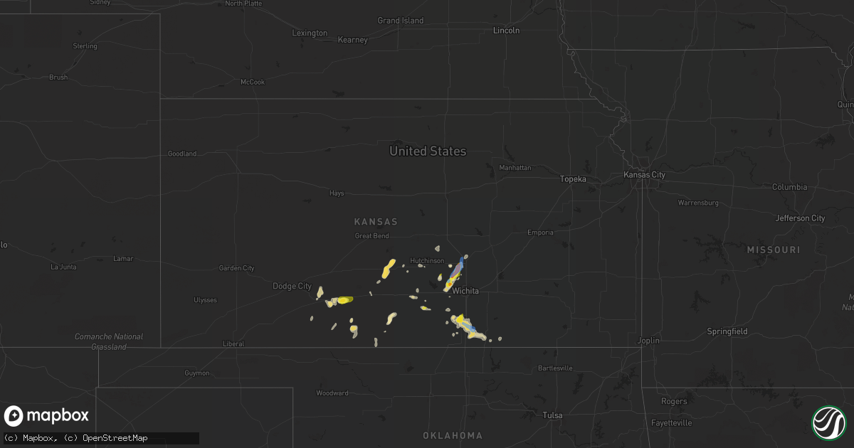
Hail Map in Kansas on June 22, 2022
Get this storm
June 22 map
$229
one time, instant access
Download today. No call, no setup
Keep the $229
Bought the map and want the full workflow? Apply the entire $229 to a subscription within 7 days. None of it is wasted.
Every map, not just this one
This buys you this map. Subscription and you get every map we run, in the markets you choose from a few cities to whole states to nationwide. Plus real-time alerts the moment a storm fires.
Contact data
Name, contact info, occupancy, even credit band for addresses in the footprint. You go from where it hit to who to call.
Become the source they trust
Unlimited branding weather history reports on demand. You already have the documented answer ready for the property owner, and you are the one who showed up with it.
Property data and RoofTrace estimates
Pull up any address you have got, its value and the exact code rules for that jurisdiction, straight from One Click Code. Then RoofTrace estimates the squares, pitch, and roof value, priced the way you price.
Storm reports in Kansas
Kansas
| Date | Description |
|---|---|
| 06/22/20226:03 PM CDT | Semi trailer blown over. |
| 06/22/20226:00 PM CDT | Power pole and tree downed. |
| 06/22/20225:46 PM CDT | Corrects previous hail report from bentley. 1 to 1.25 inch hail. Lots of tree limbs broken... Power pole damage & lines down. |
| 06/22/20225:33 PM CDT | Delayed report. Very large tree down via social media. Time est based on radar. |
| 06/22/20225:30 PM CDT | Also reported 60mph winds. |
| 06/22/20225:10 PM CDT | Ping pong ball sized hail and significant tree limbs down. |
| 06/22/20225:05 PM CDT | Damage to house roof and barn roof... Time est. Based on radar. |
| 06/22/20225:05 PM CDT | Sig. Tree damage via social media. |
| 06/22/20225:00 PM CDT | Social media images. |
| 06/22/20224:55 PM CDT | Multiple limbs ... Power poles damaged and lines down in several places. Time est. Based on radar. |
| 06/22/20224:53 PM CDT | City of bentley police chief reported they had ping pong ball sized hail and estimated 70 mph straight line winds. Damaged to 4 houses with both roof and window damage. |
| 06/22/20224:35 PM CDT | Has nickel and quarter sized hail... E70 mph wind. Tree limbs down and damage light poles. |
| 06/22/20224:30 PM CDT | Delayed report. Was accompanied by 70 to 80 mph winds. |
| 06/22/20224:30 PM CDT | Delayed report. Quite a bit of damage in the andale area... Including some fences and trees blown down... Along with a damaged light pole. An air conditioner was moved |
| 06/22/20224:16 PM CDT | Delayed report... Strong straight-line winds out of the east. Cars and trucks shaking and pulled over on i-35. Estimated 60-70 mph winds. |
| 06/22/20224:02 PM CDT | Dime size hail and 60 mph winds reported just east of wellington. |
| 06/22/20224:00 PM CDT | Est. 70-75 mph winds. |
| 06/22/20222:56 AM CDT | At 756 PM CDT, a severe thunderstorm was located near Bucklin, moving northeast at 20 mph. HAZARD...60 mph wind gusts and half dollar size hail. SOURCE...Radar indicated. IMPACT...Hail damage to vehicles is expected. Expect wind damage to roofs, siding, and trees. This severe thunderstorm will be near... Windhorst around 810 PM CDT.Other locations in the path of this severe thunderstorm includeOfferle. |
| 06/22/20221:59 AM CDT | At 659 PM CDT, a severe thunderstorm was located 7 miles north of Sylvia, or 7 miles northeast of Zenith, moving northeast at 20 mph. HAZARD...60 mph wind gusts and half dollar size hail. SOURCE...Radar indicated. IMPACT...Hail damage to vehicles is expected. Expect wind damage to roofs, siding, and trees. This severe thunderstorm will remain over mainly rural areas of northwestern Reno County. |
| 06/22/20221:34 AM CDT | At 634 PM CDT, a severe thunderstorm was located 10 miles southeast of Wilmore, moving northeast at 20 mph. HAZARD...60 mph wind gusts and quarter size hail. SOURCE...Radar indicated. IMPACT...Hail damage to vehicles is expected. Expect wind damage to roofs, siding, and trees. Locations impacted include... Sun City. |
| 06/22/20221:10 AM CDT | At 609 PM CDT, a severe thunderstorm was located very near Neola, moving north at 15 mph. HAZARD...60 mph wind gusts and quarter size hail. SOURCE...Radar indicated. IMPACT...Hail damage to vehicles is expected. Expect wind damage to roofs, siding, and trees. This severe thunderstorm will be near... Neola around 615 PM CDT.Other locations in the path of this severe thunderstorm includeStafford and Zenith. |
| 06/22/20221:04 AM CDT | At 603 PM CDT, a severe thunderstorm was located near Hardy, moving east at 10 mph. HAZARD...60 mph wind gusts and quarter size hail. SOURCE...Radar indicated. IMPACT...Hail damage to vehicles is expected. Expect wind damage to roofs, siding, and trees. Locations impacted include... Hardy. |
| 06/22/202212:36 AM CDT | At 536 PM CDT, a severe thunderstorm was located near Greensburg, moving east at 25 mph. HAZARD...60 mph wind gusts and nickel size hail. SOURCE...Radar indicated. IMPACT...Expect damage to roofs, siding, and trees. This severe thunderstorm will be near... Haviland around 550 PM CDT.Other locations in the path of this severe thunderstorm includeWellsford, Croft and Cullison. |
| 06/21/202211:55 PM CDT | At 454 PM CDT, a severe thunderstorm was located over Bentley, or near Sedgwick, moving northeast at 20 mph. HAZARD...70 mph wind gusts and ping pong ball size hail. SOURCE...Radar indicated. IMPACT...People and animals outdoors will be injured. Expect hail damage to roofs, siding, windows, and vehicles. Expect considerable tree damage. Wind damage is also likely to mobile homes, roofs, and outbuildings. Locations impacted include... Newton, Hesston, Halstead, North Newton, Sedgwick, Burrton, Walton and Newton Airport.This includes Interstate 135 between Mile Markers 23 and 43. |
| 06/21/202211:26 PM CDT | At 426 PM CDT, a severe thunderstorm was located near Oxford, moving east at 10 mph. HAZARD...60 mph wind gusts and penny size hail. SOURCE...Radar indicated. IMPACT...Expect damage to roofs, siding, and trees. Locations impacted include... Arkansas City, Winfield, Wellington, Mulvane, Belle Plaine, Oxford, Udall, South Haven, Geuda Springs, Rock, Hunnewell, Perth, Riverdale, Strother Field Airport, Wellington Airport and Winfield City Lake.This includes Interstate 35 between Mile Markers 1 and 33. |
| 06/21/202211:18 PM CDT | At 417 PM CDT, a severe thunderstorm was located near Goddard, moving east at 10 mph. HAZARD...60 mph wind gusts and quarter size hail. SOURCE...Radar indicated. IMPACT...Hail damage to vehicles is expected. Expect wind damage to roofs, siding, and trees. Locations impacted include... Wichita, Derby, Andover, Haysville, Park City, Valley Center, Bel Aire, Mulvane, Goddard, Rose Hill, Maize, Clearwater, Cheney, Sedgwick, Colwich, Garden Plain, Mount Hope, Downtown Wichita, Kechi and Andale.This includes the following highways... Interstate 135 between Mile Markers 0 and 22. Interstate 35 between Mile Markers 34 and 54. |
| 06/21/202210:59 PM CDT | At 359 PM CDT, a severe thunderstorm was located near Wellington, moving east at 15 mph. HAZARD...60 mph wind gusts and quarter size hail. SOURCE...Radar indicated. IMPACT...Hail damage to vehicles is expected. Expect wind damage to roofs, siding, and trees. Locations impacted include... Mulvane, Belle Plaine and Oxford. |
| 06/21/202210:24 PM CDT | At 324 PM CDT, a severe thunderstorm was located near Wellington, moving east at 10 mph. HAZARD...60 mph wind gusts and quarter size hail. SOURCE...Radar indicated. IMPACT...Hail damage to vehicles is expected. Expect wind damage to roofs, siding, and trees. Locations impacted include... Wellington, Conway Springs, Argonia, Mayfield, Milan, Riverdale and Wellington Airport.This includes Interstate 35 between Mile Markers 13 and 32. |
| 06/21/20229:02 PM CDT | A local report indicates 67 MPH wind near 3 ESE MISSLER |
| 06/21/20228:01 PM CDT | Mesonet station ur350 4.4 ne hayne |
All States Impacted by Hail Map on June 22, 2022
Cities Impacted by Hail Map on June 22, 2022
- Bedford, PA
- Xenia, OH
- Jamestown, OH
- New Lexington, OH
- Somerset, OH
- Blossburg, PA
- Wellsboro, PA
- Clifton Springs, NY
- Shortsville, NY
- Caldwell, OH
- Macksburg, OH
- Dexter City, OH
- Greensburg, PA
- Benezett, PA
- Huntingdon, PA
- State College, PA
- Boalsburg, PA
- Markleysburg, PA
- Palmyra, NY
- Bloomingdale, OH
- Coolville, OH
- Guysville, OH
- Frenchville, PA
- Cumberland, MD
- Oldtown, MD
- Chillicothe, OH
- Philippi, WV
- Lost Creek, WV
- Bridgeport, WV
- Mount Clare, WV
- Brave, PA
- Blacksville, WV
- Spraggs, PA
- Holbrook, PA
- New Freeport, PA
- Aleppo, PA
- Wind Ridge, PA
- West Point, KY
- Cedar Grove, IN
- New Trenton, IN
- West Harrison, IN
- Brookville, IN
- South Webster, OH
- Minford, OH
- Bush, LA
- Covington, LA
- Franklinton, LA
- Cincinnati, OH
- Harrison, OH
- Burkesville, KY
- Henryville, IN
- Memphis, IN
- Borden, IN
- Hopewell, PA
- Saxton, PA
- Woodbury, PA
- Keedysville, MD
- Fairplay, MD
- Sharpsburg, MD
- Shepherdstown, WV
- Falling Waters, WV
- Boonsboro, MD
- Martinsburg, WV
- Kearneysville, WV
- Hagerstown, MD
- Williamsport, MD
- Gerrardstown, WV
- Clear Brook, VA
- Winchester, VA
- Berkeley Springs, WV
- Gore, VA
- Cross Junction, VA
- Stephenson, VA
- Glengary, WV
- Stephens City, VA
- Hedgesville, WV
- Wellington, KS
- Caldwell, KS
- Ray, OH
- South Bloomingville, OH
- McArthur, OH
- Londonderry, OH
- Oregonia, OH
- Clarksville, OH
- Milroy, IN
- Greensburg, IN
- Rushville, IN
- Bloomfield, IN
- Saint Marys, PA
- Hebron, KY
- North Bend, OH
- Addyston, OH
- Cleves, OH
- Latrobe, PA
- Newkirk, OK
- Mineral Wells, WV
- Flemington, WV
- Moatsville, WV
- Luray, VA
- Strasburg, VA
- Rileyville, VA
- Bentonville, VA
- Front Royal, VA
- Fort Valley, VA
- New Washington, IN
- Nabb, IN
- Charlestown, IN
- Westport, KY
- Marysville, IN
- Harpers Ferry, WV
- Shenandoah Junction, WV
- Halstead, KS
- Valley Center, KS
- Sedgwick, KS
- Bentley, KS
- Colwich, KS
- Aurora, IN
- Rising Sun, IN
- Romney, WV
- Shanks, WV
- Bidwell, OH
- Vinton, OH
- Gallipolis, OH
- Ganado, AZ
- Milton, WV
- Glenwood, WV
- Ashton, WV
- Greensburg, KS
- Haviland, KS
- Hickman, KY
- Union City, TN
- Duck, WV
- Nelsonville, OH
- New Marshfield, OH
- Elkton, VA
- Shenandoah, VA
- Harrisonburg, VA
- Broadway, VA
- Fisherville, KY
- Simpsonville, KY
- Patriot, IN
- Martin, TN
- Chester, WV
- Aliquippa, PA
- Oakdale, PA
- New Cumberland, WV
- Burgettstown, PA
- Industry, PA
- Midland, PA
- Hookstown, PA
- Georgetown, PA
- Imperial, PA
- Coraopolis, PA
- McDonald, PA
- Clinton, PA
- New Manchester, WV
- Crescent, PA
- Monaca, PA
- East Liverpool, OH
- Shippingport, PA
- Byrdstown, TN
- Louisville, KY
- Belpre, OH
- Fleming, OH
- Marietta, OH
- Stafford, KS
- Butler, KY
- Foster, KY
- Albany, OH
- Athens, OH
- Mullinville, KS
- Oak Hill, OH
- West Union, OH
- Seaman, OH
- Winchester, OH
- Wilkesville, OH
- Langsville, OH
- Kingman, KS
- Offerle, KS
- Bucklin, KS
- Willcox, AZ
- Warsaw, KY
- Lexington, IN
- Needham, AL
- Goshen, KY
- Crestwood, KY
- Prospect, KY
- Coldwater, KS
- Purgitsville, WV
- Baker, WV
- Rio, WV
- Old Fields, WV
- Moorefield, WV
- Buffalo, WV
- Culloden, WV
- Hamlin, WV
- Hurricane, WV
- Medicine Lodge, KS
- Nashville, KS
- Garden Plain, KS
- Andale, KS
- Newton, KS
- Goddard, KS
- Mount Hope, KS
- Isabel, KS
- Wilmore, KS
- Morgantown, WV
- Maidsville, WV
- Waverly, WV
- Crown City, OH
- Lesage, WV
- Fairfield, OH
- Hamilton, OH
- Batavia, OH
- Williamsburg, OH
- Sylvia, KS
- St John, KS
- Costa, WV
- Ridgeview, WV
- Ashford, WV
- Alum Creek, WV
- Nellis, WV
- Ona, WV
- Summersville, WV
- Drennen, WV
- Haven, KS
- Ebensburg, PA
- Colver, PA
- Cranberry, PA
- Knox, PA
- Waterford, OH
- Stockport, OH
- Adah, PA
- New Salem, PA
- McClellandtown, PA
- Bath, IN
- Oxford, OH
- Glouster, OH
- Griffithsville, WV
- Sod, WV
- Centre Hall, PA
- Bellefonte, PA
- Spivey, KS
- Norwich, KS
- Tornado, WV
- Saint Albans, WV
- Ivydale, WV
- Foster, WV
- Danville, WV
- Madison, WV
- Loysburg, PA
- Mercersburg, PA
- Altoona, PA
- Dysart, PA
- Howard, PA
- Brockport, NY
- Hamlin, NY
- Hilton, NY
- New Bethlehem, PA
- Milesburg, PA
- Okeana, OH
- Weedville, PA
- Lilly, PA
- Cassandra, PA
- Fredericksburg, VA
- Farmington, PA
- Bruceton Mills, WV
- Fairchance, PA
- Gibbon Glade, PA
- Jane Lew, WV
- Salem, WV
- Minneola, KS
- Milton, KY
- Pool, WV
- Quinwood, WV
- Mount Nebo, WV
- Wasco, CA
- Birch Tree, MO
- Winona, MO
- Bloomery, WV
- Great Cacapon, WV
- Greenville, VA
- Milam, WV
- Moundsville, WV
- Glen Easton, WV
- Proctor, WV
- Williamsville, MO
- Plevna, KS
- Dudley, MO
- Elk Horn, KY
- Columbia, KY
- Hacker Valley, WV
- Edinburg, VA
- Lucasville, OH
- Fairmont, WV
- Thornton, WV
- Bedford, KY
- Winfield, WV
- Eleanor, WV
- Scott Depot, WV
- Red House, WV
- Belle Plaine, KS
- Arkansas City, KS
- Oxford, KS
- Geuda Springs, KS
- South Haven, KS
- Honeoye Falls, NY
- Mendon, NY
- Pittsford, NY
- Madison, VA
- Rochelle, VA
- Vienna, WV
- Williamstown, WV
- Parkersburg, WV
- Clay, WV
- Victor, WV
- Swiss, WV
- Seth, WV
- Peytona, WV
- Dayton, PA
- White, PA
- Scottdale, PA
- Acme, PA
- Indiana, PA
- Coudersport, PA
- Markleton, PA
- Confluence, PA
- Lowell, OH
- Beverly, OH
- Jackson, OH
- Wallace, WV
- Clarksburg, WV
- Frankfort, OH
- Lovettsville, VA
- Purcellville, VA
- Charles Town, WV
- Round Hill, VA
- Moores Hill, IN
- Dillsboro, IN
- Elizabeth, IN
- Laconia, IN
- North Vernon, IN
- Scipio, IN
- Westport, IN
- Stafford, VA
- Fulks Run, VA
- Bergton, VA
- Corydon, IN
- Apple Grove, WV
- Fraziers Bottom, WV
- Orgas, WV
- Comfort, WV
- Spout Spring, VA
- Red House, VA
- Appomattox, VA
- Concord, VA
- Addison, PA
- West Hamlin, WV
- Scottown, OH
- Cubero, NM
- Bloomfield, NY
- Victor, NY
- Pittsburgh, PA
- Fallentimber, PA
- Walker, WV
- Newport, OH
- Saint Marys, WV
- Tarentum, PA
- Saxonburg, PA
- Gibsonia, PA
- Russellton, PA
- Valencia, PA
- Cheswick, PA
- Bairdford, PA
- Belleville, WV
- Ravenswood, WV
- Butlerville, IN
- Glassport, PA
- Mckeesport, PA
- Elrama, PA
- Dravosburg, PA
- Clairton, PA
- Webster, PA
- Monongahela, PA
- Finleyville, PA
- West Mifflin, PA
- West Elizabeth, PA
- Belle Vernon, PA
- Elizabeth, PA
- Deputy, IN
- Long Bottom, OH
- Reedsville, OH
- Breeding, KY
- North Newton, KS
- Walton, KS
- Hardtner, KS
- Monterville, WV
- Pickens, WV
- Sardinia, OH
- Madison, IN
- Masonic Home, KY
- New Albany, IN
- Jeffersonville, IN
- Clarksville, IN
- South Charleston, WV
- Georgetown, IN
- Lanesville, IN
- Pratt, KS
- Conway Springs, KS
- Grandin, MO
- Vincent, OH
- Reno, OH
- Ambridge, PA
- Baden, PA
- Beaver, PA
- Freedom, PA
- Sewickley, PA
- Shubuta, MS
- Vossburg, MS
- Vail, AZ
- Elgin, AZ
- Julian, WV
- Alkol, WV
- Yawkey, WV
- Russellville, OH
- Georgetown, OH
- Sanders, KY
- Vevay, IN
- Worthville, KY
- Ghent, KY
- Inman, KS
- Twilight, WV
- Jeffrey, WV
- Racine, WV
- Bob White, WV
- Gordon, WV
- Bim, WV
- Van, WV
- Dexter, KS
- Maple City, KS
- Scottsburg, IN
- Underwood, IN
- Grafton, WV
- Independence, WV
- Homer City, PA
- Penn Run, PA
- Wilmington, OH
- Ford City, PA
- Bulger, PA
- Petersburg, KY
- Hanover, IN
- Kendall, NY
- Holley, NY
- Home, PA
- Clymer, PA
- Marion Center, PA
- Martinsburg, PA
- Lansing, WV
- Lookout, WV
- Edmond, WV
- Waterloo, OH
- Smithfield, PA
- Uniontown, PA
- Masontown, PA
- La Grange, KY
- Newburg, WV
- Farmington, WV
- Barrackville, WV
- Tunnelton, WV
- Pomeroy, OH
- Winfield, KS
- Waterport, NY
- Aroda, VA
- Pratts, VA
- New Middletown, IN
- Murdock, KS
- Bogalusa, LA
- Milan, KS
- Argonia, KS
- Springville, TN
- Buchanan, TN
- Big Sandy, TN
- Pewee Valley, KY
- Maize, KS
- Vandergrift, PA
- Leechburg, PA
- Fort Hill, PA
- Everett, PA
- Creighton, PA
- Bakerstown, PA
- Commodore, PA
- Lost City, WV
- Wardensville, WV
- Hamden, OH
- Kingston, OH
- Woodford, VA
- Glens Fork, KY
- Mayfield, KS
- Trenton, OH
- Gloster, MS
- Anacoco, LA
- Willow Wood, OH
- Hutchinson, KS
- Partridge, KS
- Pickerington, OH
- Carroll, OH
- Adena, OH
- Cadiz, OH
- Rockport, WV
- West College Corner, IN
- Harmony, PA
- Paris Crossing, IN
- Wallback, WV
- Nebo, WV
- Nitro, WV
- Charleston, WV
- Palestine, WV
- Creston, WV
- Leon, WV
- Cranberry Township, PA
- Allison Park, PA
- Mars, PA
- Bradfordwoods, PA
- Wexford, PA
- Natrona Heights, PA
- Sarver, PA
- Warrendale, PA
- Guilford, IN
- Lawrenceburg, IN
- Bellbrook, OH
- Spring Valley, OH
- Port William, OH
- Dayton, OH
- Waynesville, OH
- Owensville, OH
- Fayetteville, OH
- Mount Orab, OH
- Blanchester, OH
- Quicksburg, VA
- Mount Jackson, VA
- Basye, VA
- Turon, KS
- Iuka, KS
- Castlewood, VA
- Lebanon, VA
- Evans City, PA
- Newark, NY
- New Enterprise, PA
- Rochester, NY
- Campbellsburg, KY
- Kittanning, PA
- Worthington, PA
- Midland, OH
- Bradford, PA
- Salamanca, NY
- Woodstock, VA
- Marienville, PA
- Tionesta, PA
- Karthaus, PA
- Canal Winchester, OH
- Leesville, LA
- Elizabeth, WV
- Petroleum, WV
- Mayport, PA
- Punxsutawney, PA
- Timblin, PA
- Kent, NY
- Lebanon, OH
- Poplar Bluff, MO
- Creekside, PA
- Shelocta, PA
- Rural Valley, PA
- Millfield, OH
- Chauncey, OH
- Belva, WV
- Madera, CA
- Cameron, WV
- Clarington, OH
- Powhatan Point, OH
- Parkhill, PA
- Johnstown, PA
- Washington, WV
- Creola, OH
- Zaleski, OH
- New Plymouth, OH
- Stanley, VA
- Carrollton, KY
- Sparta, KY
- Mesquite, NM
- Osage, WV
- Mount Morris, PA
- Dilliner, PA
- Stewart, OH
- Pottersdale, PA
- Freeport, PA
- Whipple, OH
- Lower Salem, OH
- Mannington, WV
- Northern Cambria, PA
- Shade, OH
- Russell Springs, KY
- Puxico, MO
- Wappapello, MO
- Abbyville, KS
- Syria, VA
- Union, KY
- Walton, KY
- Verona, KY
- Vidalia, LA
- Otisco, IN
- Sellersburg, IN
- Peck, KS
- Manchester, OH
- Vanceburg, KY
- Ripley, OH
- Buena Vista, PA
- Yukon, PA
- Herminie, PA
- Smithton, PA
- Bridgeville, PA
- Carnegie, PA
- Homestead, PA
- Greenock, PA
- Presto, PA
- Bethel Park, PA
- South Park, PA
- Lowber, PA
- West Newton, PA
- Duquesne, PA
- Rillton, PA
- McKees Rocks, PA
- Irwin, PA
- Wyano, PA
- Sutersville, PA
- New Kensington, PA
- Ligonier, PA
- Ranson, WV
- Inwood, WV
- Mauckport, IN
- Fort Knox, KY
- Bardstown, KY
- Boston, KY
- Lebanon Junction, KY
- Shepherdsville, KY
- Olympia, KY
- Carlisle, KY
- Sharpsburg, KY
- Moorefield, KY
- Owingsville, KY
- Laurel, IN
- Fort Lee, VA
- Henrico, VA
- Petersburg, VA
- Bowling Green, VA
- Sandston, VA
- Ashland, VA
- Richmond, VA
- Milford, VA
- Mechanicsville, VA
- Ruther Glen, VA
- Prince George, VA
- King George, VA
- Disputanta, VA
- Chesterfield, VA
- Hanover, VA
- Port Royal, VA
- Hopewell, VA
- Colonial Heights, VA
- Chester, VA
- Glen Allen, VA
- Doswell, VA
- Mitchells, VA
- Culpeper, VA
- Elkwood, VA
- Marshall, VA
- Stevensburg, VA
- Reva, VA
- Delaplane, VA
- Brandy Station, VA
- Brightwood, VA
- Hume, VA
- Midland, VA
- Warrenton, VA
- Remington, VA
- Castleton, VA
- The Plains, VA
- Amissville, VA
- Rapidan, VA
- Rixeyville, VA
- Jeffersonton, VA
- Upperville, VA
- Broad Run, VA
- Locust Dale, VA
- Bealeton, VA


