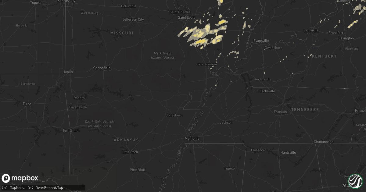
Hail Map in Illinois on June 21, 2011
Get this storm
June 21 map
$229
one time, instant access
Download today. No call, no setup
Keep the $229
Bought the map and want the full workflow? Apply the entire $229 to a subscription within 7 days. None of it is wasted.
Every map, not just this one
This buys you this map. Subscription and you get every map we run, in the markets you choose from a few cities to whole states to nationwide. Plus real-time alerts the moment a storm fires.
Contact data
Name, contact info, occupancy, even credit band for addresses in the footprint. You go from where it hit to who to call.
Become the source they trust
Unlimited branding weather history reports on demand. You already have the documented answer ready for the property owner, and you are the one who showed up with it.
Property data and RoofTrace estimates
Pull up any address you have got, its value and the exact code rules for that jurisdiction, straight from One Click Code. Then RoofTrace estimates the squares, pitch, and roof value, priced the way you price.
Storm reports in Illinois
Illinois
| Date | Description |
|---|---|
| 06/21/20116:58 PM CDT | At i-39 and 1 mile north of rt 18 |
| 06/21/20116:54 PM CDT | One tree blown down |
| 06/21/20116:53 PM CDT | Eastbound i80 between mile marker 70 and 71 numerous power poles down and shed blown on shoulder. |
| 06/21/20116:50 PM CDT | Ten-inch diameter tree down at alexander road and six points road |
| 06/21/20116:50 PM CDT | Numerous small branches down requiring crews to clean up. |
| 06/21/20116:50 PM CDT | A local report indicates 75 MPH wind near PERU |
| 06/21/20116:50 PM CDT | Delayed report. Large tree fell on a van...severely damaging it. Another large tree fell on a fence. Other large tree limbs down. Time estimated. |
| 06/21/20116:45 PM CDT | Several trees down and 4 power poles down in town. Power out. |
| 06/21/20116:45 PM CDT | A couple of trees down just south of hennepin. |
| 06/21/20116:43 PM CDT | Trees down blocking a farm road just east of chester |
| 06/21/20116:40 PM CDT | Trees down. A tree limb fell on a car shattering the windshield. |
| 06/21/20116:36 PM CDT | Estimated 60 mph wind gust. |
| 06/21/20116:35 PM CDT | Numerous trees and tree limbs blown down |
| 06/21/20116:35 PM CDT | Lacon awos 61 mph wind gust. |
| 06/21/20116:32 PM CDT | Power lines down |
| 06/21/20116:32 PM CDT | 6 inch diameter tree branches down. |
| 06/21/20116:32 PM CDT | Estimated 60 mph wind gust. |
| 06/21/20116:30 PM CDT | Several trees blown down. |
| 06/21/20116:30 PM CDT | Delayed report. Tree limbs and power lines down. Time estimated. |
| 06/21/20116:30 PM CDT | Measured 60 mph wind gust at county courthouse. |
| 06/21/20116:30 PM CDT | Delayed report. Tree limbs and power lines down. Time estimated. |
| 06/21/20116:30 PM CDT | Delayed report. Tree limbs and power lines down near the mall. |
| 06/21/20116:25 PM CDT | Several trees blown down |
| 06/21/20116:20 PM CDT | Trees blown down |
| 06/21/20116:15 PM CDT | Delayed report. Tree limbs and power lines down. Time estimated. |
| 06/21/20116:15 PM CDT | Injury reported in sesser after storm. Man removing tree from roof was unjured. Extent of injuries unknown. |
| 06/21/20116:10 PM CDT | Large tree limb down on power line |
| 06/21/20116:10 PM CDT | 3 inch diameter branches blown down. |
| 06/21/20116:10 PM CDT | Large tree blown onto trailer significantly damaging trailer. 2 small outbuildings destroyed. |
| 06/21/20116:05 PM CDT | Power lines down and power out in town |
| 06/21/20116:00 PM CDT | Powerlines blown down. |
| 06/21/20115:55 PM CDT | Large glass window blown out at telephone company office building on 17th and charleston streets...window was 10 by 15 feet. From swop observer. |
| 06/21/20115:55 PM CDT | A local report indicates 69 MPH wind near CHARLESTON |
| 06/21/20115:45 PM CDT | Large glass window blown out at telephone company office building on 17th and charleston streets...window was 10 by 15 feet. From swop observer. |
| 06/21/20115:34 PM CDT | Large limbs down on streets and in park. |
| 06/21/20115:30 PM CDT | 18 ft camper overturned and limbs down at wayne fitzgerrell campground. |
| 06/21/20115:25 PM CDT | Large tree uprooted. |
| 06/21/20115:15 PM CDT | Estimated 7 inch diameter tree branch blown down. |
| 06/21/20115:15 PM CDT | Volunteer firefighter. Estimated 60 mph wind gust. |
| 06/21/20115:05 PM CDT | Limbs and powerlines down. |
| 06/21/20115:05 PM CDT | Wind gusts to 65 mph. About 20 trees uprooted and blown down - about 18 in dia. Building under construction downtown leveled. |
| 06/21/20115:00 PM CDT | Tree blown down and metal roof blown off shed. |
| 06/21/20115:00 PM CDT | Large tree limb down on power lines |
| 06/21/20115:00 PM CDT | Roof blown off firehouse. |
| 06/21/20114:59 PM CDT | Trees and power lines blown down |
| 06/21/20114:55 PM CDT | Trees down in oblong. |
| 06/21/20114:40 PM CDT | 6 inch diameter tree blown down and 4 inch branches broken |
| 06/21/20114:30 PM CDT | Trees down on meridian road |
| 06/21/20114:30 PM CDT | Trees down on holly road |
| 06/21/20114:30 PM CDT | *** 1 inj *** a microburst occurred...peak wind 90 mph...avg path width 2.3 miles...path length 5 miles. Hundreds of trees snapped or uprooted...including a couple doze |
| 06/21/20114:30 PM CDT | Trees down on sunnybrook road |
| 06/21/20114:13 PM CDT | Large tree blown onto roof of home...estimates the wind gust was 70-80 mph |
| 06/21/20114:08 PM CDT | A local report indicates 60 MPH wind near HOYLETON |
| 06/21/20114:01 PM CDT | Six to eight inch limbs down blocking roadways. |
| 06/21/20114:00 PM CDT | Power pole blown down. |
| 06/21/20114:00 PM CDT | A local report indicates 60 MPH wind near AVISTON |
| 06/21/20114:00 PM CDT | Power lines down and pea size hail |
| 06/21/20114:00 PM CDT | Shingles blown off roof and a wall fence blown down |
| 06/21/20113:53 PM CDT | Delayed report. Reported by spotter. |
| 06/21/20113:38 PM CDT | A local report indicates 60 MPH wind near NORRIS CITY |
| 06/21/20113:37 PM CDT | Power lines and trees down. |
| 06/21/20113:31 PM CDT | Tent meant to withstand 45 mph winds blown over. |
| 06/21/20113:30 PM CDT | 6 inch tree limb blown down |
| 06/21/20113:10 PM CDT | A local report indicates 1.00 inch wind near 2 ENE FOSTER POND |
| 06/21/20112:57 PM CDT | Numerous 3 inch diamter tree limbs down. |
| 06/20/20119:17 PM CDT | Intersection of north and ridgeland with multiple 30 foot long branches down. |
| 06/20/20119:16 PM CDT | 9600 laramie. 12 inch trees uprooted |
| 06/20/20119:09 PM CDT | 1 mile north of bradley st and i294 |
| 06/20/20119:08 PM CDT | A local report indicates 60 MPH wind near LIBERTYVILLE |
| 06/20/20119:00 PM CDT | Milwaukee and lake cook rd. Limbs 6-14 inches in diameter down. |
| 06/20/20119:00 PM CDT | A local report indicates 60 MPH wind near 1 E ELGIN |
| 06/20/20119:00 PM CDT | Sidewall of aluminum shed blown in |
| 06/20/20119:00 PM CDT | Several trees down |
| 06/20/20119:00 PM CDT | A local report indicates 60 MPH wind near ELK GROVE VILLAGE |
| 06/20/20119:00 PM CDT | A local report indicates 65 MPH wind near HOFFMAN ESTATES |
| 06/20/20118:55 PM CDT | 5-6 inch diameter branches down |
| 06/20/20118:54 PM CDT | A local report indicates 70 MPH wind near SCHAUMBURG |
| 06/20/20118:54 PM CDT | 70kt gust on 1-min data...value was still increasing at this time. |
| 06/20/20118:52 PM CDT | Wolf rd. Willow tree pulled up from roots. |
| 06/20/20118:52 PM CDT | Greenwood rd and charles rd |
| 06/20/20118:51 PM CDT | Large tree limbs down. Golf and wolf rds |
| 06/20/20118:50 PM CDT | Several large trees down. One tree down on a car. Possible tornado. Two blocks east of edens expressway near dempster. Approximately 5000 west and 8600 north. |
| 06/20/20118:50 PM CDT | Persistant 50 mph winds. |
| 06/20/20118:50 PM CDT | Multiple large trees down and sections of the city without power. |
| 06/20/20118:48 PM CDT | Storm survey confirmed an ef-1 tornado touched down near we go trail and golf road lifting near kensington road and north pine st. Path width was approximately 200 yard |
| 06/20/20118:48 PM CDT | 12 inch diameter tree branches down near skokie village hall |
| 06/20/20118:47 PM CDT | Several trees down in clarmin. |
| 06/20/20118:46 PM CDT | Estimated 65 mph wind gusts caused structural damage to roofs and downed 18 inch limbs from trees near the 59th and fairview intersection to the 63rd and main street in |
| 06/20/20118:45 PM CDT | Delayed report. A tree 14 inches in diameter fell on a car near fordham way and longford lane. |
| 06/20/20118:45 PM CDT | A local report indicates 60 MPH wind near SCHAUMBURG |
| 06/20/20118:45 PM CDT | 3 medium trees blown over |
| 06/20/20118:45 PM CDT | A local report indicates 69 MPH wind near 4 NNW EVANSTON |
| 06/20/20118:45 PM CDT | Delayed report. Neighborhoods just west and northeast of cumberland circle had multiple whole trees down. |
| 06/20/20118:45 PM CDT | Delayed report. Near the intersection of fairview and gierz a tree 14 inches in diameter uprooted on the parkway. |
| 06/20/20118:43 PM CDT | *** 2 inj *** local media reports two people in serious to critical condition after their car was crushed by a falling tree near farragut avenue and leavitt avenue. Tim |
| 06/20/20118:41 PM CDT | Large tree fallen on rt 53 one mile north of roosevelt road. Tree is covering the entire lane on the north bound side. |
| 06/20/20118:41 PM CDT | A local report indicates 60 MPH wind near WEST CHICAGO |
| 06/20/20118:41 PM CDT | Dupage county eoc |
| 06/20/20118:41 PM CDT | Trees falling over in wielder park and there are numerous lightning flashes. |
| 06/20/20118:37 PM CDT | Numerous branches down and power outages |
| 06/20/20118:37 PM CDT | A local report indicates 59 MPH wind near 4 SSE CAROL STREAM |
| 06/20/20118:35 PM CDT | Small trees down |
| 06/20/20118:32 PM CDT | Single tree fell on a house |
| 06/20/20118:31 PM CDT | Storm survey confirmed an ef-1 tornado touched down near sunnydale park and lifted near 55th and main in downers grove. Path width was approximately 200 yards and path |
| 06/20/20118:30 PM CDT | 15 inch diameter tree split down the middle. 6 inch diameter branch broken off. |
| 06/20/20118:30 PM CDT | Lot awos measurement. |
| 06/20/20118:30 PM CDT | Small tree limb damage. |
| 06/20/20118:30 PM CDT | A local report indicates 71 MPH wind near 5 W BOLINGBROOK |
| 06/20/20118:28 PM CDT | Rooselvelt and county farm rd. Transformers exploding |
| 06/20/20118:25 PM CDT | A local report indicates 58 MPH wind near 4 WSW LISLE |
| 06/20/20118:15 PM CDT | Caton farm and essington |
| 06/20/20118:11 PM CDT | One block south of four seasons blvd and victoria circle. |
| 06/20/20118:10 PM CDT | Normantown rd and hudson |
| 06/20/20117:58 PM CDT | Several power poles snapped on calmus lake school road |
| 06/20/20117:20 PM CDT | A local report indicates 71 MPH wind near PONTIAC |
| 06/20/20117:15 PM CDT | A local report indicates 71 MPH wind near EL PASO |
| 06/20/20117:05 PM CDT | Powerline down |
| 06/20/20117:05 PM CDT | 12 inch diameter tree snapped by wind gust. |
| 06/20/20117:05 PM CDT | Large tree limb down on road |
| 06/20/20117:05 PM CDT | Tree down at rt 9 and 1600 e |
All States Impacted by Hail Map on June 21, 2011
Cities Impacted by Hail Map on June 21, 2011
- Elberton, GA
- Tignall, GA
- Raleigh, MS
- Lake, MS
- Forest, MS
- Willard, OH
- Elsie, MI
- Fort Gratiot, MI
- Laurinburg, NC
- Taylorsville, NC
- Moravian Falls, NC
- Oakdale, LA
- Elmore, AL
- Wetumpka, AL
- Burnet, TX
- Hopedale, IL
- Leakey, TX
- Aberdeen, NC
- Youngstown, OH
- East Palestine, OH
- New Middletown, OH
- New Springfield, OH
- Petersburg, OH
- Garden City, TX
- Shelby, MI
- Hart, MI
- Waterloo, IL
- Valmeyer, IL
- Waycross, GA
- Hamilton, TX
- Jonesboro, TX
- Hico, TX
- Nacogdoches, TX
- Cushing, TX
- Chesnee, SC
- Madison, NC
- Versailles, IL
- Chambersburg, IL
- Louisville, OH
- Mansfield, OH
- Keshena, WI
- Pelion, SC
- West Columbia, SC
- Gaston, SC
- Wagener, SC
- Columbia, SC
- Leesville, SC
- Swansea, SC
- Lexington, SC
- Neeses, SC
- Gilbert, SC
- Hopkins, SC
- Salley, SC
- North, SC
- Saint Matthews, SC
- Eastover, SC
- Yeaddiss, KY
- Wooton, KY
- Smilax, KY
- Canton, TX
- Ben Wheeler, TX
- Trappe, MD
- Brownwood, TX
- Cross Plains, TX
- Rising Star, TX
- Parkersburg, WV
- Williamstown, WV
- Looneyville, WV
- Spencer, WV
- Walton, WV
- Clendenin, WV
- Amma, WV
- Left Hand, WV
- Gandeeville, WV
- Midkiff, TX
- Midland, TX
- Corsicana, TX
- Barry, TX
- Alderson, WV
- Waupaca, WI
- Amherst, WI
- Trivoli, IL
- Farmington, IL
- New Castle, VA
- Pembroke, VA
- Waiteville, WV
- Stoneboro, PA
- Fort Worth, TX
- Rowena, TX
- Rocky Mount, VA
- Glade Hill, VA
- Bonne Terre, MO
- French Village, MO
- Amelia, OH
- Goldsboro, TX
- Coleman, TX
- Ware Shoals, SC
- Bokeelia, FL
- Jackson, MI
- D Hanis, TX
- Batesburg, SC
- Portsmouth, OH
- Metropolis, IL
- Carbon, TX
- Eastland, TX
- Cisco, TX
- Pennville, IN
- Keystone, IN
- Montpelier, IN
- Graford, TX
- Ozona, TX
- Cynthiana, KY
- Robert Lee, TX
- Sterling City, TX
- Zeeland, MI
- Hudsonville, MI
- Paint Rock, TX
- Voss, TX
- Mulkeytown, IL
- Du Quoin, IL
- Scheller, IL
- Tamaroa, IL
- Sesser, IL
- Grapeland, TX
- Crockett, TX
- Palo Pinto, TX
- Mineral Wells, TX
- Menard, TX
- Eden, TX
- Catlettsburg, KY
- Louisa, KY
- Decatur, TX
- Dallas, TX
- Ferguson, NC
- Purlear, NC
- Croton, OH
- Reynoldsburg, OH
- Pataskala, OH
- Blacklick, OH
- Johnstown, OH
- New Albany, OH
- Columbus, OH
- Pickerington, OH
- Waterford, PA
- Julian, WV
- Manchester, KY
- Society Hill, SC
- Lucasville, OH
- Ramsey, IL
- Broadway, NC
- Terrell, TX
- Charleston, WV
- Newberry, SC
- Silverstreet, SC
- Chappells, SC
- Mabank, TX
- Kemp, TX
- Ennis, TX
- Laurens, SC
- Neshkoro, WI
- Berlin, WI
- Chapin, SC
- Cuba, IL
- Ipava, IL
- Lewistown, IL
- Royalton, IL
- Christopher, IL
- Troup, TX
- Macy, IN
- Akron, IN
- Baird, TX
- Rayle, GA
- Shepherd, MI
- Alma, MI
- Saint Louis, MI
- Millsap, TX
- Ranger, TX
- Bangor, MI
- Lawrence, MI
- Allegan, MI
- Pullman, MI
- Paw Paw, MI
- Grand Junction, MI
- Bloomingdale, MI
- Southern Pines, NC
- Ragland, AL
- Rockville, IN
- Iraan, TX
- Mertzon, TX
- Barnhart, TX
- Santa Anna, TX
- Bangs, TX
- Broken Bow, OK
- Vestaburg, MI
- Miles, TX
- Eola, TX
- Martinsburg, WV
- South Webster, OH
- Oak Hill, OH
- Garrison, TX
- Mount Enterprise, TX
- Princeton, LA
- Haughton, LA
- Frisco City, AL
- Danville, VA
- Rock Hill, SC
- Breckenridge, TX
- Strawn, TX
- South Charleston, WV
- Varney, KY
- Pikeville, KY
- Sainte Genevieve, MO
- Saint Mary, MO
- York, SC
- Charlotte, NC
- Clover, SC
- Italy, TX
- Roseboro, NC
- Canton, IL
- Cassopolis, MI
- Niles, MI
- Edwardsburg, MI
- Collettsville, NC
- Herod, IL
- Harrisburg, IL
- Blountsville, AL
- Penn Laird, VA
- Shenandoah, VA
- Keezletown, VA
- McGaheysville, VA
- Harrisonburg, VA
- Elkton, VA
- Holton, MI
- Twin Lake, MI
- Hopkins, MI
- Wayland, MI
- Caledonia, MI
- Byron Center, MI
- Dorr, MI
- Ohio, IL
- Fresno, OH
- Kimbolton, OH
- Coshocton, OH
- Plainfield, OH
- West Lafayette, OH
- Newcomerstown, OH
- Medina, TX
- Rural Retreat, VA
- Sugar Grove, VA
- Speedwell, VA
- Steubenville, OH
- New Manchester, WV
- Toronto, OH
- Chester, WV
- New Cumberland, WV
- Weirton, WV
- Beecher City, IL
- Brownstown, IL
- Cowden, IL
- Java, VA
- Ithaca, MI
- Gray Court, SC
- Logan, OH
- Glenmora, LA
- Red Bud, IL
- Hecker, IL
- Fults, IL
- New Athens, IL
- Durand, MI
- Fort Bragg, NC
- Raeford, NC
- Blooming Grove, TX
- Alto, TX
- Genesee, PA
- Bronte, TX
- Norton, TX
- Winters, TX
- Annapolis, MO
- Rockford, MI
- Cedar Springs, MI
- Enoree, SC
- Woodruff, SC
- Pauline, SC
- North Street, MI
- Hughes Springs, TX
- Avinger, TX
- Douglassville, TX
- Linden, TX
- Marietta, TX
- Milam, TX
- Bronson, TX
- Daphne, AL
- Lilesville, NC
- Dobson, NC
- Ohatchee, AL
- Blanchard, MI
- Riverdale, MI
- Milton, NC
- Sutherlin, VA
- Semora, NC
- Ringgold, VA
- Alton, VA
- Blanch, NC
- Wadsworth, IL
- Saluda, SC
- Genoa City, WI
- Conway, SC
- Muskegon, MI
- Austinville, VA
- Woodlawn, VA
- Celina, OH
- Red Springs, NC
- Lumber Bridge, NC
- Shannon, NC
- Clinton, NC
- Stevens Point, WI
- Highland, IL
- Aviston, IL
- Trenton, IL
- Shawano, WI
- Boones Mill, VA
- Hardy, VA
- Ashley, IL
- Waltonville, IL
- Du Bois, IL
- Forney, TX
- Pineville, LA
- Glen Saint Mary, FL
- Macclenny, FL
- Palestine, TX
- Covington, VA
- Krotz Springs, LA
- Clio, SC
- Blenheim, SC
- Big Lake, TX
- Waverly, WV
- Newport, OH
- Marietta, OH
- Reno, OH
- San Saba, TX
- Easton, MD
- Americus, GA
- Ellaville, GA
- Aiken, SC
- Perryville, MO
- Bowling Green, OH
- Malone, TX
- Potosi, MO
- South Bend, IN
- Hunt, TX
- Edgefield, SC
- Woodstock, VA
- Lowndesboro, AL
- Selma, AL
- Hayneville, AL
- Tyler, AL
- Bancroft, WI
- Freetown, IN
- Uvalde, TX
- Pittsburg, TX
- Gilmer, TX
- Winnsboro, TX
- Johnston, SC
- Rhome, TX
- Justin, TX
- Argyle, TX
- Axton, VA
- Cascade, VA
- Melissa, TX
- Prosper, TX
- Mckinney, TX
- Celina, TX
- Elkview, WV
- Blackville, SC
- Springfield, SC
- Spring Creek, PA
- Pittsfield, PA
- Tennessee Colony, TX
- Montalba, TX
- Iva, SC
- Starr, SC
- Anderson, SC
- Clifton, TX
- Valley Mills, TX
- Lillington, NC
- Sanford, NC
- Baltimore, OH
- Everett, PA
- Rosedale, IN
- Montezuma, IN
- Mecca, IN
- Carlsbad, TX
- Reidsville, NC
- Utopia, TX
- Lawndale, NC
- Shelby, NC
- Pollok, TX
- Frohna, MO
- Rockwood, IL
- Jeffersonville, GA
- Belfry, KY
- Forest Hills, KY
- Canada, KY
- South Williamson, KY
- Sidney, KY
- Hot Springs, VA
- Etna Green, IN
- Bourbon, IN
- Montello, WI
- Rembert, SC
- Sumter, SC
- Dalzell, SC
- Huntington, IN
- Union Grove, WI
- Crothersville, IN
- Paris Crossing, IN
- Cincinnati, OH
- Brookeland, TX
- Delbarton, WV
- San Augustine, TX
- Princeton, WI
- Max Meadows, VA
- Wytheville, VA
- Leander, TX
- Marble Falls, TX
- Sandersville, GA
- Warthen, GA
- Sparta, GA
- Bannister, MI
- Freeland, MI
- Ava, IL
- Campbell Hill, IL
- Percy, IL
- Steeleville, IL
- Cutler, IL
- Chester, IL
- Waterford, WI
- Pandora, OH
- Wapakoneta, OH
- Granville, IL
- Mark, IL
- San Angelo, TX
- Ballinger, TX
- Rochelle, TX
- Brookesmith, TX
- Christiansburg, VA
- Shawsville, VA
- Fayetteville, NC
- Stedman, NC
- Indianola, MS
- Shaw, MS
- Athens, WI
- Hartford, MI
- Decatur, MI
- Dewy Rose, GA
- Collins, NY
- Springville, NY
- Lawtons, NY
- Anna, IL
- Dongola, IL
- White Mills, KY
- Sonora, KY
- Glendale, KY
- Blackwell, TX
- Indianapolis, IN
- Greenwood, IN
- Mount Croghan, SC
- Jefferson, SC
- Continental, OH
- Marshall, NC
- Chandler, TX
- Brownsboro, TX
- Murchison, TX
- Hernshaw, WV
- Oak Harbor, OH
- Breaux Bridge, LA
- Arnaudville, LA
- Byron, MI
- Fowlerville, MI
- White Cloud, MI
- Leopolis, WI
- Tigerton, WI
- Bowler, WI
- Bandera, TX
- Hondo, TX
- Midland, PA
- Battle Creek, MI
- Chesterfield, SC
- Cheraw, SC
- Patrick, SC
- Ovalo, TX
- Bedford, KY
- Stanfield, NC
- Oakboro, NC
- Marshville, NC
- Monroe, NC
- Tremont, IL
- Paradise, TX
- Springtown, TX
- Boyd, TX
- Purdon, TX
- Foster, WV
- Danville, WV
- Madison, WV
- Downers Grove, IL
- Glen Ellyn, IL
- Woodridge, IL
- Lisle, IL
- Waco, TX
- Elm Mott, TX
- West, TX
- North Augusta, SC
- Trenton, SC
- Benton, IL
- Weatherford, TX
- Poolville, TX
- Massillon, OH
- Lakemore, OH
- North Canton, OH
- Akron, OH
- Clinton, OH
- Uniontown, OH
- Fishersville, VA
- Waynesboro, VA
- Staunton, VA
- Howard City, MI
- Pierson, MI
- Morley, MI
- Newaygo, MI
- Sand Lake, MI
- Gallatin, TN
- Townville, PA
- Titusville, PA
- Centerville, PA
- Landenberg, PA
- Newark, DE
- West Grove, PA
- Avondale, PA
- Scottsburg, IN
- Jefferson, TX
- Vivian, LA
- Caddo Mills, TX
- Franklinville, NY
- Mount Olivet, KY
- Boston, NY
- Pitkin, LA
- West Plains, MO
- Pottersville, MO
- Lucas, OH
- Stilesville, IN
- Tyler, TX
- Iuka, IL
- Woodlawn, IL
- Centralia, IL
- Walnut Hill, IL
- Irvington, IL
- Dix, IL
- Salem, IL
- Kell, IL
- Texico, IL
- Richview, IL
- Coatesville, IN
- Bainbridge, IN
- Wautoma, WI
- Rusk, TX
- Wirtz, VA
- Avilla, IN
- Venedocia, OH
- Spencerville, OH
- Spring Lake, NC
- Chillicothe, IL
- Magnolia, IL
- Hennepin, IL
- Lacon, IL
- Dalzell, IL
- Henry, IL
- Putnam, IL
- Spring Valley, IL
- McNabb, IL
- Sparland, IL
- Washburn, IL
- Ladd, IL
- Lebanon Junction, KY
- Shepherdsville, KY
- Dexter, GA
- Dudley, GA
- Chester, GA
- Browns Summit, NC
- Penhook, VA
- Moneta, VA
- Sandy Level, VA
- Huddleston, VA
- Union Hall, VA
- Climax, MI
- East Leroy, MI
- Union City, MI
- Fulton, MI
- Colon, MI
- Sherwood, MI
- Athens, MI
- Vicksburg, MI
- Leonidas, MI
- Sugarcreek, OH
- Dundee, OH
- Mount Gilead, NC
- Candor, NC
- Santo, TX
- Apple Springs, TX
- Carroll, OH
- Canal Winchester, OH
- Millersport, OH
- Etna, OH
- Stout, OH
- Blue Creek, OH
- White Sulphur Springs, WV
- Wade, NC
- Harrod, OH
- Lima, OH
- Bluffton, OH
- Flora, IL
- Andover, NY
- Canisteo, NY
- Charles Town, WV
- Harpers Ferry, WV
- Morton, IL
- Catawba, VA
- Spruce Pine, NC
- Marion, NC
- Fort Jennings, OH
- Delphos, OH
- Hinton, WV
- Salem, VA
- Roanoke, VA
- Table Grove, IL
- Elmwood, IL
- Smithfield, IL
- Kenosha, WI
- Dawson, TX
- Morven, NC
- Alexandria, LA
- Fremont, OH
- Bailey, MI
- Grant, MI
- Ravenna, MI
- Oberlin, LA
- Greer, SC
- Duncan, SC
- Moore, SC
- Spartanburg, SC
- Blowing Rock, NC
- Del Rio, TN
- Newport, TN
- Parrottsville, TN
- Hot Springs, NC
- Lincolnton, GA
- Washington, GA
- Salem, IN
- Mena, AR
- Crane, TX
- Coulterville, IL
- Deer Creek, IL
- Mackinaw, IL
- Clintonville, WI
- Westfield, PA
- New Market, AL
- Gurley, AL
- Four Oaks, NC
- Benson, NC
- Polkton, NC
- Peachland, NC
- Doole, TX
- Millersview, TX
- Seymour, IN
- Aurora, IN
- Rising Sun, IN
- Fort Stockton, TX
- Boaz, AL
- Altoona, AL
- Saginaw, MI
- Richland, TX
- Piketon, OH
- McDermott, OH
- Antioch, IL
- Bristol, WI
- Crossville, TN
- Pikeville, TN
- Goldthwaite, TX
- Kaufman, TX
- Wedgefield, SC
- Branchland, WV
- West Hamlin, WV
- Gretna, VA
- Pittsville, VA
- Fremont, MI
- Carlyle, IL
- North Vernon, IN
- Hendersonville, NC
- Dry Creek, LA
- Sugartown, LA
- Deridder, LA
- Jackson Springs, NC
- Parsons, WV
- Montrose, WV
- Lynx, OH
- West Union, OH
- Manchester, OH
- Fox Lake, WI
- Brandon, WI
- Waupun, WI
- Fairwater, WI
- Markesan, WI
- Knoxville, PA
- Hephzibah, GA
- Augusta, GA
- Blythe, GA
- Gouldbusk, TX
- Long Branch, TX
- Richland Springs, TX
- Watervliet, MI
- White Pine, TN
- Early, TX
- Sand Fork, WV
- Burnsville, WV
- Butlerville, IN
- Scurry, TX
- Spring Lake, MI
- Fruitport, MI
- South Portsmouth, KY
- Vale, NC
- Grand Cane, LA
- Mansfield, LA
- Belpre, OH
- Washington, WV
- Quinlan, TX
- Cumby, TX
- Point, TX
- Lone Oak, TX
- Greenville, TX
- Festus, MO
- Crystal City, MO
- Clyde, TX
- Burkett, TX
- Kirbyville, TX
- Fredericktown, MO
- Erie, MI
- Silsbee, TX
- New Madrid, MO
- Grand Haven, MI
- Allendale, MI
- Coopersville, MI
- Calera, AL
- Ada, MI
- Lawton, MI
- Mattawan, MI
- Schoolcraft, MI
- Bellville, OH
- Gorman, TX
- Wortham, TX
- Ruby, SC
- Wadesboro, NC
- Kerens, TX
- Trinidad, TX
- Aubrey, TX
- Troutville, VA
- Baltic, OH
- Bay City, MI
- Auburn, MI
- Sabinsville, PA
- Danville, OH
- Glenmont, OH
- Reston, VA
- Asheville, NC
- Ladonia, TX
- Pecan Gap, TX
- West End, NC
- Rosedale, WV
- Orma, WV
- Lawn, TX
- Chillicothe, OH
- Frankfort, OH
- Neopit, WI
- Diana, TX
- Harleton, TX
- Center, TX
- Perrin, TX
- Whitt, TX
- Eden, NC
- North Springfield, PA
- De Soto, MO
- Alvord, TX
- Merryville, LA
- Canton, NC
- Chatham, VA
- Grand Valley, PA
- Buchanan Dam, TX
- Bluffton, TX
- Pinebluff, NC
- Hoffman, NC
- Normantown, WV
- Webberville, MI
- De Berry, TX
- Marshall, TX
- Stoneville, NC
- Cranesville, PA
- Girard, PA
- Clearville, PA
- Seaford, DE
- Eldorado, IL
- Huntington, TX
- Iowa, LA
- Seneca, IL
- Marseilles, IL
- Fowler, OH
- Burghill, OH
- Brookfield, OH
- Tatum, TX
- Clear Brook, VA
- Berryville, VA
- Summit Point, WV
- Kearneysville, WV
- Liberty Hill, TX
- Bertram, TX
- Crossett, AR
- Ashley, IN
- Waterloo, IN
- Auburn, IN
- East Lynn, WV
- Novice, TX
- Opelousas, LA
- Scandinavia, WI
- Amherst Junction, WI
- Royse City, TX
- Kings Mountain, NC
- Cherryville, NC
- Wolfe City, TX
- White Hall, IL
- Roodhouse, IL
- Grand Rapids, MI
- Edmore, MI
- Commerce, TX
- Spartansburg, PA
- Stone, KY
- Malakoff, TX
- Prosperity, SC
- Milledgeville, IL
- Wooster, OH
- Shock, WV
- Nashville, IL
- Addieville, IL
- Oakdale, IL
- Hanna City, IL
- Brimfield, IL
- Timpson, TX
- Gary, TX
- Hartwell, GA
- Parkton, NC
- Hope Mills, NC
- Whiteville, NC
- Nakina, NC
- Ash, NC
- Ponder, TX
- Bedford, PA
- Springville, AL
- Sabinal, TX
- Lowellville, OH
- Enon Valley, PA
- Campbell, OH
- Hubbard, OH
- New Waterford, OH
- Struthers, OH
- Noble, IL
- Olney, IL
- Mount Erie, IL
- Hedgesville, WV
- Mayfield, KY
- Cape Coral, FL
- Tenaha, TX
- Kingsville, OH
- Conneaut, OH
- Boone, NC
- Deep Gap, NC
- Acme, LA
- Ashville, AL
- Pell City, AL
- Odin, IL
- Ashland, KY
- Kenova, WV
- Huntington, WV
- Chesapeake, OH
- Ceredo, WV
- South Point, OH
- Middleton, MI
- Sumner, MI
- De Kalb, TX
- South Shore, KY
- New Hill, NC
- Moncure, NC
- Sanger, TX
- Huntsville, AL
- Owens Cross Roads, AL
- Churubusco, IN
- Laotto, IN
- Lenoir, NC
- Mingus, TX
- Pageland, SC
- New Carlisle, IN
- Coushatta, LA
- Cygnet, OH
- Pemberville, OH
- Portage, OH
- Belgrade, MO
- Astoria, IL
- Caddo, TX
- Emerson, KY
- Carlton, GA
- Lexington, GA
- Kimper, KY
- Huddy, KY
- Williamson, WV
- McAndrews, KY
- Commiskey, IN
- Smiths Creek, MI
- Goodells, MI
- Stanardsville, VA
- Union, WV
- Pinsonfork, KY
- Hardy, KY
- Lenzburg, IL
- Marissa, IL
- Prattville, AL
- Kiahsville, WV
- Dunlow, WV
- Aynor, SC
- Petersburg, KY
- Burlington, KY
- Barboursville, WV
- Ft Mitchell, KY
- Erlanger, KY
- Flower Mound, TX
- Lewisville, TX
- Mingo Junction, OH
- Mineral Point, MO
- Bedford, IN
- Orleans, MI
- Ionia, MI
- Belding, MI
- Fenwick, MI
- Rattan, OK
- Golconda, IL
- Wheelersburg, OH
- Belle, WV
- Tad, WV
- Ripplemead, VA
- Lampasas, TX
- North Salem, IN
- Albion, MI
- Verbena, AL
- Marbury, AL
- Ragley, LA
- Waxhaw, NC
- Letohatchee, AL
- Shreveport, LA
- Maxwelton, WV
- Lewisburg, WV
- Renick, WV
- Caldwell, WV
- Frankford, WV
- Asbury, WV
- Ronceverte, WV
- Cabin Creek, WV
- Belvidere, TN
- Winchester, TN
- Mishawaka, IN
- Varna, IL
- Lowpoint, IL
- Moscow, OH
- Bethel, OH
- Morgan, TX
- Gordon, GA
- Hinckley, IL
- Blanket, TX
- Zephyr, TX
- Atlanta, LA
- Dry Prong, LA
- Georgetown, LA
- Winnfield, LA
- Bullard, TX
- Morrice, MI
- Bancroft, MI
- Quincy, KY
- Cuba, NY
- Olean, NY
- Lindside, WV
- Henderson, TX
- Montague, MI
- Marne, MI
- Jenison, MI
- Ward, SC
- Maryneal, TX
- Dalton, OH
- Addison, IL
- Villa Park, IL
- Hilham, TN
- Columbia, LA
- Charlottesville, VA
- Afton, VA
- North Garden, VA
- Crozet, VA
- Greenwood, VA
- Carmi, IL
- Grantsville, WV
- Mount Zion, WV
- Natchitoches, LA
- Carthage, TX
- Prairie Hill, TX
- Ozark, IL
- Cross Hill, SC
- Greenwood, SC
- Ninety Six, SC
- Mountville, SC
- Middletown, VA
- Stephens City, VA
- Hallsville, TX
- Howard, OH
- Glenville, WV
- Cedarville, WV
- Burlington, WI
- Walsh, IL
- Sparta, IL
- Tilden, IL
- Ellis Grove, IL
- Baldwin, IL
- Okawville, IL
- Evansville, IL
- Oxford, PA
- Deputy, IN
- Knippa, TX
- Dowagiac, MI
- Lohn, TX
- Talpa, TX
- Rockwood, TX
- Mullin, TX
- Mereta, TX
- Valera, TX
- Washington, IL
- Wolf Point, MT
- Nicholls, GA
- Plymouth, IN
- Monticello, AR
- Wells, TX
- Holland, MI
- West Olive, MI
- Wyoming, MI
- Nunica, MI
- Bogata, TX
- Wingate, TX
- Tuscola, TX
- Eldred, IL
- Albion, IN
- Greensboro, NC
- Cadet, MO
- Grayville, IL
- Bone Gap, IL
- Browns, IL
- Mount Carmel, IL
- Grayson, LA
- Lakeland, FL
- Austin, IN
- Vancourt, TX
- Bridgeport, TX
- Leipsic, OH
- Ottawa, OH
- Perrinton, MI
- Corry, PA
- Garland, PA
- West Union, WV
- New Milton, WV
- Auburn, WV
- Troy, WV
- Coxs Mills, WV
- Greenville, IL
- Batavia, OH
- Prairie Du Rocher, IL
- Robbins, NC
- Genoa, WV
- Fort Gay, WV
- Pinehurst, NC
- Autryville, NC
- Vass, NC
- Carthage, NC
- Salemburg, NC
- Moorefield, WV
- Bend, TX
- Lometa, TX
- Elkville, IL
- Vergennes, IL
- Chloe, WV
- Ferris, TX
- Kentwood, LA
- Mount Hermon, LA
- Asheboro, NC
- Franksville, WI
- Heavener, OK
- Waldron, AR
- Minier, IL
- Eureka, IL
- Columbus, TX
- Garwood, TX
- Zavalla, TX
- Upton, KY
- Kent City, MI
- Mexia, TX
- Sadieville, KY
- Madison, IN
- Joaquin, TX
- Pineland, TX
- Chireno, TX
- Douglass, TX
- Wiergate, TX
- Jasper, TX
- Broaddus, TX
- Kennard, TX
- Beckville, TX
- Groveton, TX
- Pleasant Prairie, WI
- Fillmore, IN
- Danville, IN
- Berkeley Springs, WV
- Crockett, VA
- Wakarusa, IN
- Deforest, WI
- Rio, WI
- Arlington, WI
- Spicewood, TX
- Trussville, AL
- Pinson, AL
- Remlap, AL
- Oneonta, AL
- Wayne, WV
- Howe, IN
- Lagrange, IN
- Victoria, TX
- Salamanca, NY
- Little Valley, NY
- Carrollton, TX
- Empire, OH
- Stratton, OH
- Sparta, MI
- Shelbyville, MI
- Whitehall, MI
- Rothbury, MI
- Fennville, MI
- Grandville, MI
- Gobles, MI
- Comstock Park, MI
- Middleville, MI
- Conklin, MI
- Hamilton, MI
- Vinton, VA
- Hooks, TX
- Hodgenville, KY
- Wallace, SC
- Hamlet, NC
- Dingess, WV
- Chapmanville, WV
- Hartsville, SC
- Horton, AL
- Dupont, IN
- Cochran, GA
- Atlanta, TX
- Naples, TX
- Cochecton, NY
- Narrowsburg, NY
- Lake Huntington, NY
- Pottsville, TX
- Comanche, TX
- Bryan, OH
- Ney, OH
- Scottsville, VA
- Milford, OH
- Kempner, TX
- Hawkinsville, GA
- Damascus, AR
- Bee Branch, AR
- Corunna, MI
- Owosso, MI
- Allegany, NY
- Hastings, MI
- Nashville, MI
- Dowling, MI
- Ottawa, IL
- Brenton, WV
- Rockford, AL
- Jackson, OH
- Vallonia, IN
- Campbellsburg, IN
- Taylor, AR
- Orange, TX
- Athens, TX
- Tamms, IL
- Pearisburg, VA
- Olaton, KY
- Caneyville, KY
- Peterstown, WV
- Mulga, AL
- Broadview Heights, OH
- North Royalton, OH
- Rohwer, AR
- Gap Mills, WV
- East Peoria, IL
- Belington, WV
- Felton, DE
- Shongaloo, LA
- Fort Myers, FL
- Saint Charles, IL
- Geneva, IL
- Clayton, GA
- Sod, WV
- Lancaster, PA
- Lititz, PA
- East Petersburg, PA
- Marshall, IN
- Pinckneyville, IL
- Milwaukee, WI
- Kalamazoo, MI
- Portage, MI
- Fairview, IL
- Ladoga, IN
- New Haven, MI
- Casco, MI
- Albers, IL
- New Baden, IL
- Randleman, NC
- McLeansboro, IL
- Ellery, IL
- Golden Gate, IL
- Albion, IL
- Waynesboro, GA
- Lanark, IL
- Mount Orab, OH
- Donalds, SC
- Hodges, SC
- Canton, OH
- Canal Fulton, OH
- Keysville, GA
- Wrens, GA
- Frametown, WV
- Gassaway, WV
- Hancock, WI
- Coloma, WI
- Iredell, TX
- Brookfield, WI
- New Berlin, WI
- Elm Grove, WI
- South Pittsburg, TN
- Beulah, MS
- McDavid, FL
- Saint Albans, WV
- Greencastle, IN
- Cammal, PA
- Pomaria, SC
- Little Mountain, SC
- Van, TX
- West Salem, IL
- Moores Hill, IN
- Newton, TX
- Bon Wier, TX
- Call, TX
- Maumee, OH
- Lambertville, MI
- Northwood, OH
- North Baltimore, OH
- Perrysburg, OH
- Temperance, MI
- Wayne, OH
- Rossford, OH
- Toledo, OH
- Ottawa Lake, MI
- Sheridan, MI
- Carson City, MI
- Pleasureville, KY
- Owenton, KY
- Frankfort, KY
- Mayslick, KY
- Germantown, KY
- Guntersville, AL
- Albertville, AL
- Hemphill, TX
- Montgomery, AL
- Blairs, VA
- Mentone, IN
- Tippecanoe, IN
- Rochester, IN
- Caulfield, MO
- Summit Argo, IL
- La Grange, IL
- Coolidge, TX
- Groesbeck, TX
- Mart, TX
- Streetman, TX
- Waukesha, WI
- Enfield, IL
- Coloma, MI
- Clymer, NY
- Mayodan, NC
- Sandy Ridge, NC
- Fred, TX
- Spurger, TX
- Dunn, NC
- Godwin, NC
- Muskego, WI
- Kansasville, WI
- Reeves, LA
- Limestone, NY
- Great Valley, NY
- Hinsdale, NY
- Xenia, IL
- Center Point, LA
- Deville, LA
- Minford, OH
- Big Creek, WV
- Webster, KY
- Dowell, IL
- Creston, NC
- Todd, NC
- Wharncliffe, WV
- Matewan, WV
- Scott Air Force Base, IL
- Mascoutah, IL
- Lebanon, IL
- Ceresco, MI
- Elgin, SC
- Lugoff, SC
- Medina, TN
- Milan, TN
- Marshall, MI
- Homer, MI
- Anniston, AL
- Fort Meade, FL
- Cheshire, OH
- Middleport, OH
- Pomeroy, OH
- Mason, WV
- Belleville, IL
- Hollytree, AL
- West Liberty, IL
- Ingleside, IL
- Round Lake, IL
- Lake Villa, IL
- Telford, TN
- Limestone, TN
- Lynchburg, TN
- Otway, OH
- Peebles, OH
- Marston, NC
- Three Rivers, MI
- Oneida, TN
- Lecompte, LA
- Valliant, OK
- Hesperia, MI
- Cross Plains, IN
- Versailles, IN
- Beach City, OH
- New Boston, TX
- Robertsdale, AL
- May, TX
- Ringold, OK
- Tow, TX
- Jacksonville, TX
- Pocahontas, IL
- Navarre, OH
- Tiskilwa, IL
- Perrysville, OH
- Lodi, OH
- Spencer, OH
- Denton, MD
- Rarden, OH
- Eagle, MI
- Grand Ledge, MI
- Pilot Point, TX
- Gaffney, SC
- Theodore, AL
- Bennettsville, SC
- Naples, FL
- Lamar, SC
- Dayton, OH
- Dillsboro, IN
- Homerville, OH
- Sheridan, IL
- Abbeville, SC
- Due West, SC
- Secondcreekx, WV
- Marion, LA
- Lincoln University, PA
- Hockessin, DE
- Wilmington, DE
- Elkton, MD
- Coudersport, PA
- Prestonsburg, KY
- Stanville, KY
- Lebanon, IN
- Houston, MS
- Atlanta, IL
- Forest Hill, LA
- Smithfield, NC
- McCamey, TX
- Patoka, IL
- Sardinia, OH
- Georgetown, OH
- Winchester, OH
- Russellville, OH
- Ripley, OH
- Old Fields, WV
- Eau Claire, MI
- Benton Harbor, MI
- Rockingham, NC
- Oconomowoc, WI
- Longview, TX
- Guys Mills, PA
- Cochranton, PA
- Cooperstown, PA
- Larue, TX
- Frankston, TX
- Preston, MD
- Oxford, MD
- Toney, AL
- Lenore, WV
- Logan, WV
- Harts, WV
- Holden, WV
- Jefferson, OH
- Rome, OH
- Rockwall, TX
- China Spring, TX
- Crawford, TX
- Calhoun, IL
- Naval Air Station Jrb, TX
- Mount Vernon, IL
- Modoc, IL
- Freeburg, IL
- Bluford, IL
- Buckner, IL
- Opdyke, IL
- Bloomsdale, MO
- Franklin Furnace, OH
- Cleburne, TX
- Burleson, TX
- Loudonville, OH
- Equality, IL
- Monroe, LA
- Mount Gilead, OH
- Mulberry, FL
- Lancaster, TX
- Desoto, TX
- Aquilla, TX
- Elmore, OH
- Ridgeway, VA
- Martinsville, VA
- Norwood, NC
- Albemarle, NC
- Augusta, KY
- Brooksville, KY
- State Road, NC
- Elkin, NC
- Lake, WV
- Arab, AL
- Holly Pond, AL
- Pedro, OH
- Axson, GA
- Millwood, GA
- Montgomery, LA
- Jackson, SC
- Gordon, TX
- Huntland, TN
- Bradford, IL
- Jackson Center, PA
- Wolcottville, IN
- North Richland Hills, TX
- Haslet, TX
- Azle, TX
- Haltom City, TX
- Erie, PA
- Sandy Hook, KY
- Webbville, KY
- Herculaneum, MO
- Krum, TX
- Boyce, LA
- Dundee, IL
- Smyrna, SC
- Millers Creek, NC
- Apex, NC
- Lynchburg, OH
- Hillsboro, OH
- Walker, WV
- Pulaski, VA
- Henderson, KY
- Boomer, NC
- North Judson, IN
- Bowling Green, FL
- Stonefort, IL
- Sinclairville, NY
- Cherry Creek, NY
- Jackson, AL
- Lake Panasoffkee, FL
- Hope Hull, AL
- Wingett Run, OH
- New Matamoras, OH
- Leland, MS
- Wild Rose, WI
- McGregor, TX
- Whitwell, TN
- Sequatchie, TN
- Chatfield, TX
- Keeling, VA
- Raccoon, KY
- Ransom, KY
- Phyllis, KY
- Foster, KY
- Felicity, OH
- Falmouth, KY
- Williamsburg, OH
- New Richmond, OH
- Hamersville, OH
- Fountain Inn, SC
- Sumner, IL
- Saint Pauls, NC
- Sheffield, TX
- Barberton, OH
- South Haven, MI
- Woodworth, LA
- Greenville, MI
- Independence, OH
- Cleveland, OH
- Meridian, TX
- Cross Fork, PA
- Gaines, PA
- Hurricane, WV
- Carrollton, IL
- Fort McKavett, TX
- Plain Dealing, LA
- Curtice, OH
- Medora, IN
- Norman, IN
- Orland Park, IL
- Norris City, IL
- Broughton, IL
- Gatesville, TX
- London, OH
- Iola, WI
- Rosholt, WI
- Mercer, PA
- Zionsville, IN
- Waverly, NY
- Rosiclare, IL
- Llano, TX
- North Collins, NY
- Kershaw, SC
- Middleburg, PA
- Winfield, PA
- Verona, IL
- Ransom, IL
- Morris, IL
- Grand Ridge, IL
- Streator, IL
- Elliston, VA
- Pilot, VA
- McKean, PA
- Fairview, PA
- Edinboro, PA
- Deatsville, AL
- Cordova, NC
- Garland, NC
- Ellerbe, NC
- Wagram, NC
- Eagle Springs, NC
- Kinder, LA
- Russellville, IN
- Friendship, NY
- Melvin, TX
- Rosine, KY
- Horse Branch, KY
- Cromwell, KY
- Seth, WV
- Shelbyville, TX
- Marathon, TX
- Elkhart, IN
- Bridgeport, IL
- Farmersville, TX
- Nevada, TX
- West Portsmouth, OH
- Waverly, OH
- Monticello, MS
- Campbell, TX
- Belton, SC
- Honea Path, SC
- Pelzer, SC
- Simpsonville, SC
- Westport, KY
- La Grange, KY
- Pendleton, KY
- Millboro, VA
- Buncombe, IL
- Greenville, PA
- Grand Prairie, TX
- Tiffin, OH
- Cambridge, MD
- Grayson, KY
- Williston, SC
- Saranac, MI
- Gowanda, NY
- Anna, OH
- Valley Head, WV
- Exchange, WV
- Copen, WV
- Lake Village, AR
- Sharon, SC
- Etoile, TX
- Leopold, IN
- Saint Marys, OH
- Buckland, OH
- Wilkesboro, NC
- Fairview, NC
- Eustace, TX
- Elwell, MI
- Inwood, WV
- Bunker Hill, WV
- Butler, OH
- Fredericktown, OH
- Ramseur, NC
- Staley, NC
- Liberty, NC
- Whipple, OH
- Lower Salem, OH
- Crandall, TX
- Frost, TX
- Hubbard, TX
- Brecksville, OH
- Bedford, OH
- Maple Heights, OH
- Newport, KY
- Latonia, KY
- Hebron, KY
- North Bend, OH
- Addyston, OH
- Alva, FL
- Dunkirk, IN
- Hartford City, IN
- Virgie, KY
- Jenkins, KY
- Ona, FL
- Parrish, FL
- Brownstown, IN
- Greenville, WV
- Wolfcreek, WV
- Bonnie, IL
- Belle Rive, IL
- Burr Oak, MI
- Bronson, MI
- Waterloo, OH
- Blanchester, OH
- Pleasant Plain, OH
- Troupsburg, NY
- Woodhull, NY
- Harrison Valley, PA
- Grant, AL
- New Hope, AL
- Marion, WI
- Transfer, PA
- Washington Boro, PA
- Millersville, PA
- Conestoga, PA
- Bridgeport, AL
- Lakeville, IN
- Dublin, TX
- Gustine, TX
- Dorset, OH
- Doe Hill, VA
- Warm Springs, VA
- Woodway, TX
- Fayetteville, OH
- Kermit, WV
- Pilgrim, KY
- Lovely, KY
- Culloden, WV
- Geneva, OH
- Hurlock, MD
- East New Market, MD
- Royal Oak, MD
- Callands, VA
- Merigold, MS
- Cleveland, MS
- Cedar Run, PA
- Clarks Mills, PA
- Youngsville, PA
- Norman Park, GA
- Alabaster, AL
- Eskdale, WV
- Orgas, WV
- Gunter, TX
- Van Alstyne, TX
- Cheneyville, LA
- Ville Platte, LA
- Henderson, MD
- Vandalia, IL
- Shobonier, IL
- Racine, WI
- Garrison, KY
- Greenup, KY
- Providence, NC
- Yanceyville, NC
- Carrier Mills, IL
- Deer Lodge, TN
- Lehigh Acres, FL
- Nappanee, IN
- Lake Charles, LA
- Pineville, NC
- Gowen, MI
- Lowell, MI
- Polk, OH
- West Salem, OH
- Ashland, OH
- Roebuck, SC
- Pollock, LA
- Blacksburg, SC
- Valley View, TX
- South Elgin, IL
- Elgin, IL
- Lufkin, TX
- Longville, LA
- Gainestown, AL
- Balsam Grove, NC
- East Liverpool, OH
- Beaver Dam, KY
- Celeste, TX
- Austin, PA
- Brookport, IL
- Sturtevant, WI
- Vincent, AL
- Lafayette, IN
- Delphi, IN
- East Prairie, MO
- Salt Rock, WV
- Hamlin, WV
- Medina, OH
- Litchfield, OH
- Bowling Green, KY
- Olivet, MI
- New Era, MI
- Irving, TX
- Addison, TX
- Rushville, IL
- Jeromesville, OH
- Pekin, IL
- Alkol, WV
- Raleigh, IL
- Galatia, IL
- Port Republic, VA
- Broadway, VA
- Scottville, MI
- Monetta, SC
- Springboro, OH
- Stryker, OH
- Defiance, OH
- Sherwood, OH
- Tuscola, IL
- Arenzville, IL
- Meredosia, IL
- Beardstown, IL
- Redgranite, WI
- Cloverdale, OH
- Lancaster, SC
- Delhi, LA
- Crofton, KY
- Evans, LA
- Flat Rock, IL
- Winfield, WV
- Nitro, WV
- Poca, WV
- Kenna, WV
- Rush, KY
- Prichard, WV
- Warrensville, NC
- Valparaiso, IN
- Portage, IN
- Hobart, IN
- Goreville, IL
- Carbondale, IL
- Marion, IL
- Black Mountain, NC
- Big Prairie, OH
- Killbuck, OH
- Talladega, AL
- Farina, IL
- Edgewood, IL
- Darlington, PA
- Williamsburg, KY
- Ashford, WV
- Alum Creek, WV
- Ridgeview, WV
- Sumerco, WV
- Nellis, WV
- Aledo, TX
- Calhoun Falls, SC
- Farmerville, LA
- Algonquin, IL
- Carpentersville, IL
- Smoot, WV
- Crawfordsville, IN
- Maud, TX
- Blacksburg, VA
- Cardington, OH
- Kerrville, TX
- Maurertown, VA
- Kinsman, OH
- Farmdale, OH
- Turners Station, KY
- Callaway, VA
- Bent Mountain, VA
- Marcellus, MI
- Clifton Forge, VA
- Lewisville, AR
- Negley, OH
- Rogers, OH
- Mooresboro, NC
- Sunbright, TN
- Tioga, TX
- Bogue Chitto, MS
- Cameron, NC
- Rootstown, OH
- Kent, OH
- Ravenna, OH
- Mogadore, OH
- Camp Wood, TX
- Jeffersonville, OH
- Lyon, MS
- Newton, WV
- Clarksdale, MS
- Thurmond, NC
- Liverpool, IL
- Fort Mill, SC
- Ruffin, NC
- Pelham, NC
- Louisville, IL
- Eutaw, AL
- Wills Point, TX
- Edgewood, TX
- Grand Saline, TX
- Hales Corners, WI
- Franklin, WI
- Greenwood, NY
- Wellsville, NY
- Alfred Station, NY
- Hornell, NY
- Breeden, WV
- Roachdale, IN
- Airville, PA
- Brogue, PA
- McColl, SC
- Sidney, TX
- Black Creek, NY
- Pisgah Forest, NC
- Millersburg, OH
- Shreve, OH
- Scio, NY
- Clear Spring, MD
- Falling Waters, WV
- Columbia City, IN
- Mohawk, WV
- Panther, WV
- Denton, TX
- Banner Elk, NC
- Princeton, AL
- Estillfork, AL
- Roanoke, TX
- Keller, TX
- Botkins, OH
- Green Mountain, NC
- Bakersville, NC
- Waveland, IN
- Yancey, TX
- Lizton, IN
- Comfort, WV
- Cartersville, VA
- Hartford, TN
- Green Springs, OH
- Clyde, OH
- Vevay, IN
- Bennington, IN
- Almond, WI
- Richmond, IL
- Elora, TN
- Fordoche, LA
- Paoli, IN
- Hardinsburg, IN
- Orleans, IN
- Bartelso, IL
- Olive Branch, IL
- Thebes, IL
- Sterling, IL
- Chadwick, IL
- Wellsville, OH
- Rio Frio, TX
- Madison, WI
- Barton, NY
- Nichols, NY
- Linn, WV
- Elliott, SC
- Lynchburg, SC
- Timmonsville, SC
- Glenwood, WV
- Lanesville, IN
- Twinsburg, OH
- Ooltewah, TN
- Chattanooga, TN
- Argenta, IL


