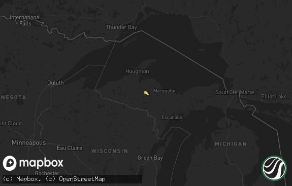
Hail Map in Michigan on June 11, 2021
The weather event in Michigan on June 11, 2021 includes Hail and Wind maps. 18 states and 711 cities were impacted and suffered possible damage. The total estimated number of properties impacted is 0.

Hail
Wind
0
Estimated number of impacted properties by a 1.00" hail or larger0
Estimated number of impacted properties by a 1.75" hail or larger0
Estimated number of impacted properties by a 2.50" hail or largerStorm reports in Michigan
Michigan
| Date | Description |
|---|---|
| 06/11/20215:00 PM CDT | Multiple trees down. Time estimated based on radar. |
| 06/11/20213:25 PM CDT | Multiple trees down. |
| 06/11/20213:10 PM CDT | Several trees down on middle rd reported by bait shop employee. |
| 06/11/20212:50 PM CDT | Multiple trees down. |
| 06/11/20212:39 PM CDT | County dispatch reported trees down across gladwin county with buckeye township and billings township the hardest hit. Time estimated from radar. |
| 06/10/202110:47 PM CDT | At 347 PM EDT, a severe thunderstorm was located over Beaverton, or near Gladwin, moving southeast at 20 mph. HAZARD...60 mph wind gusts and quarter size hail. SOURCE...Radar indicated. IMPACT...Hail damage to vehicles is expected. Expect wind damage to roofs, siding, and trees. This severe thunderstorm will remain over mainly rural areas of southern Gladwin County. |
| 06/10/202110:46 PM CDT | At 345 PM EDT, a severe thunderstorm was located near Harrison, or 13 miles west of Gladwin, moving south at 10 mph. HAZARD...60 mph wind gusts and quarter size hail. SOURCE...Radar indicated. IMPACT...Hail damage to vehicles is possible. Expect wind damage to trees. Locations impacted include... Clare... Farwell... Harrison... Long Lake... |
| 06/10/202110:19 PM CDT | At 319 PM EDT, a severe thunderstorm was located over Skeels, or near Gladwin, moving southeast at 10 mph. HAZARD...60 mph wind gusts and quarter size hail. SOURCE...Radar indicated. IMPACT...Hail damage to vehicles is expected. Expect wind damage to roofs, siding, and trees. This severe thunderstorm will be near... Hockaday around 330 PM EDT.Other locations in the path of this severe thunderstorm includeGladwin, Wooden Shoe Village, Beaverton and Winegars. |
| 06/10/20218:04 PM CDT | Delayed report: tree with rot toppled at the base. Branches down elsewhere in town. Via phone and twitter. Time estimated from radar. |
| 06/10/20217:35 PM CDT | Corrects previous non-tstm wnd gst report from 2 sw fishers lake. Awos station khai three rivers. |
All States Impacted by Hail Map on June 11, 2021
Cities Impacted by Hail Map on June 11, 2021
- Mayetta, KS
- Saint Joseph, MO
- Savannah, MO
- Cosby, MO
- Brooklyn, WI
- Evansville, WI
- Albany, WI
- Mound City, MO
- Westfield, WI
- Montello, WI
- Oxford, WI
- Cashton, WI
- Westby, WI
- Waurika, OK
- Arkansas City, KS
- Newkirk, OK
- Geuda Springs, KS
- Warsaw, MO
- Welda, KS
- Kincaid, KS
- Everest, KS
- Mayfield, KS
- Milan, KS
- Caldwell, KS
- Harshaw, WI
- Lake Tomahawk, WI
- Rhinelander, WI
- Greeley, KS
- Lane, KS
- Richmond, KS
- Garnett, KS
- Frontenac, KS
- Girard, KS
- Pittsburg, KS
- Cherokee, KS
- Weir, KS
- Walnut, KS
- Humboldt, KS
- Piqua, KS
- Neosho Falls, KS
- La Harpe, KS
- Colony, KS
- Elsmore, KS
- Savonburg, KS
- Iola, KS
- Owen, WI
- Withee, WI
- Medford, WI
- Tishomingo, OK
- Columbus, GA
- Oxford, KS
- Valley View, TX
- Towanda, KS
- Benton, KS
- Augusta, KS
- Andover, KS
- Wichita, KS
- Valley Center, KS
- Mill Creek, OK
- Sulphur, OK
- Cook, NE
- Brock, NE
- Johnson, NE
- Tecumseh, NE
- Auburn, NE
- Superior, WI
- Foxboro, WI
- Pontiac, MO
- Isabella, MO
- Oskaloosa, KS
- Valley Falls, KS
- Rush Springs, OK
- Ninnekah, OK
- Bradley, OK
- Muenster, TX
- Burneyville, OK
- Cambridge, WI
- Edgerton, WI
- Wellington, KS
- Kaw City, OK
- Burbank, OK
- Fairfax, OK
- Winfield, KS
- Mapleton, KS
- Uniontown, KS
- Redfield, KS
- Bronson, KS
- Easton, KS
- Atchison, KS
- Leavenworth, KS
- Cassoday, KS
- El Dorado, KS
- Potwin, KS
- Burns, KS
- Wilmington, IL
- Welch, MN
- Elmwood, WI
- Menomonie, WI
- Maiden Rock, WI
- Red Wing, MN
- Bay City, WI
- Goodhue, MN
- Plum City, WI
- Cannon Falls, MN
- Hager City, WI
- Ellsworth, WI
- Lanesville, IN
- Louisville, KY
- Elizabeth, IN
- New Albany, IN
- Turney, MO
- Stewartsville, MO
- Plattsburg, MO
- Lathrop, MO
- Babcock, WI
- Pittsville, WI
- Hennessey, OK
- Nemaha, NE
- Talmage, NE
- Brownville, NE
- Burr, NE
- Sterling, NE
- Erie, KS
- Baraboo, WI
- North Freedom, WI
- Berryton, KS
- Lecompton, KS
- Malta, IL
- Clare, IL
- Esmond, IL
- Kirkland, IL
- Saint Jo, TX
- Shelby, NE
- Hardin, MO
- Norborne, MO
- Tecumseh, KS
- Grantville, KS
- Topeka, KS
- Collinsville, TX
- Lindenwood, IL
- Davis Junction, IL
- Rochelle, IL
- Holcomb, IL
- Stillman Valley, IL
- Monroe Center, IL
- Dekalb, IL
- Sycamore, IL
- El Reno, OK
- Hinton, OK
- Waterloo, WI
- Nocona, TX
- Sparta, WI
- Gainesville, TX
- Whitesboro, TX
- Burlington, IA
- Sperry, IA
- Mediapolis, IA
- Pomona, KS
- Lyndon, KS
- Ottawa, KS
- Quenemo, KS
- Scranton, KS
- Vassar, KS
- Carbondale, KS
- Overbrook, KS
- Elizabeth, AR
- Viola, AR
- Ryan, OK
- Walters, OK
- Merrimac, WI
- Hayward, WI
- Edgar, WI
- Pawnee, OK
- Tioga, TX
- Forestburg, TX
- Stoughton, WI
- Alex, OK
- Blanchard, OK
- Chickasha, OK
- Circleville, KS
- Holton, KS
- Endeavor, WI
- Aubrey, TX
- Ringling, OK
- Garland, NE
- Raymond, NE
- Dorchester, NE
- Milford, NE
- Beaver Crossing, NE
- Genoa, NE
- Thorp, WI
- Stanley, WI
- Anthony, KS
- La Monte, MO
- Hughesville, MO
- Comanche, OK
- Duncan, OK
- Era, TX
- Sanger, TX
- Rosston, TX
- Decatur, TX
- Loco, OK
- Graettinger, IA
- Ringsted, IA
- Wahoo, NE
- Mead, NE
- Moran, KS
- Prudenville, MI
- Warrens, WI
- Farwell, MI
- Lake, MI
- Harrison, MI
- Gladwin, MI
- Clare, MI
- Camden, MO
- Bloomer, WI
- Colfax, WI
- Powhattan, KS
- Fairview, KS
- Saginaw, MN
- Cloquet, MN
- Asbury, MO
- Opolis, KS
- Staplehurst, NE
- Boyd, WI
- Cornell, WI
- Howe, TX
- Sherman, TX
- Foster, OK
- Jim Falls, WI
- Houghton Lake, MI
- Humboldt, NE
- Dawson, NE
- Silver Creek, NE
- Saint Edward, NE
- Wakita, OK
- Amorita, OK
- Manchester, OK
- Craig, MO
- Bluff City, KS
- Little Elm, TX
- Prosper, TX
- Celina, TX
- Frisco, TX
- Marlow, OK
- Shannon, MS
- Nettleton, MS
- Ithaca, NE
- Ceresco, NE
- Ashland, NE
- Gratiot, WI
- Warren, IL
- South Wayne, WI
- Clarks, NE
- Rolfe, IA
- Mallard, IA
- Bennington, IN
- Morrison, OK
- Perry, OK
- Hiawatha, KS
- Elgin, OK
- Cushing, OK
- Stroud, OK
- Millersburg, IN
- Ligonier, IN
- Udall, KS
- Mulvane, KS
- Douglass, KS
- Clarkson, KY
- Leitchfield, KY
- Bee Spring, KY
- Temple, OK
- Hastings, OK
- Springfield, MN
- Eagle, WI
- East Troy, WI
- Whitewater, WI
- Crete, NE
- Denton, NE
- Utica, NE
- Gresham, NE
- Ulysses, NE
- Cable, WI
- Linwood, NE
- Hampton, NE
- Marquette, NE
- Oregon, MO
- Troy, KS
- Highland, KS
- Collins, MO
- Humansville, MO
- Denton, TX
- Drummond, WI
- Blair, NE
- Merrill, WI
- Tomahawk, WI
- Irma, WI
- Columbus, KS
- Galena, KS
- Hepler, KS
- Carl Junction, MO
- Scammon, KS
- Stark, KS
- Fordland, MO
- Seymour, MO
- Helena, MO
- South Haven, KS
- Three Rivers, MI
- Constantine, MI
- Beaverton, MI
- Clinton, IA
- Albany, IL
- Fulton, IL
- Cordova, IL
- Camanche, IA
- Centralia, KS
- Corning, KS
- Conway Springs, KS
- Clearwater, KS
- Columbus, NE
- David City, NE
- Douglas, NE
- Overland Park, KS
- Leawood, KS
- Lena, IL
- Winslow, IL
- Nora, IL
- Darlington, WI
- Humphrey, NE
- Platte Center, NE
- Magnolia, KY
- Canmer, KY
- Emmett, KS
- Onaga, KS
- Kansas City, MO
- Grandview, MO
- Depew, OK
- Fort Scott, KS
- Black River Falls, WI
- Chaseburg, WI
- Fort Atkinson, WI
- Lincoln, MO
- Whiting, KS
- Denison, KS
- Netawaka, KS
- Farlington, KS
- Arma, KS
- Leon, OK
- Montague, TX
- York, NE
- Sabetha, KS
- Lodi, WI
- Prairie Du Sac, WI
- Pawnee City, NE
- Table Rock, NE
- Galesburg, KS
- Saint Paul, KS
- Chanute, KS
- Adams, NE
- Bowie, TX
- Oconomowoc, WI
- Unadilla, NE
- Palmyra, NE
- Ozawkie, KS
- Meriden, KS
- Lublin, WI
- Cherokee, OK
- Burlington, OK
- Helena, OK
- Jet, OK
- Goltry, OK
- Waldron, KS
- Nash, OK
- Mckinney, TX
- Allen, TX
- Bruno, NE
- Sweet Springs, MO
- Marshall, OK
- Bolivar, MO
- Delafield, WI
- Soldier, KS
- Havensville, KS
- Deforest, WI
- Le Roy, KS
- Morrisville, MO
- Lincoln, NE
- Malcolm, NE
- Beatrice, NE
- Calera, OK
- Lyndon Station, WI
- Palmyra, WI
- Osceola, NE
- Ava, MO
- Squires, MO
- Thornfield, MO
- Reedsburg, WI
- Wisconsin Dells, WI
- Petersburg, NE
- Kansas City, KS
- Frankfort, KY
- Buckner, MO
- Oak Grove, MO
- Sibley, MO
- Lawrence, KS
- Osborn, MO
- Lawson, MO
- Kearney, MO
- Holt, MO
- Clarksdale, MO
- Sadler, TX
- Ponder, TX
- Rhome, TX
- Madison, NE
- Albion, NE
- Newman Grove, NE
- Lindsay, NE
- Fullerton, NE
- Monroe, NE
- Seymour, IN
- Centerville, KS
- Blue Mound, KS
- Parker, KS
- Rantoul, KS
- Fulton, KS
- Mound City, KS
- Princeton, KS
- Lancaster, KS
- Krum, TX
- Spencer, WI
- Durant, OK
- Dodd City, TX
- Bonham, TX
- Windom, TX
- Honey Grove, TX
- Ladonia, TX
- Johnson Creek, WI
- Lake Mills, WI
- Jefferson, WI
- Wakarusa, KS
- Fenwick, MI
- Goff, KS
- Henderson, AR
- Gepp, AR
- Richmond, KY
- Du Bois, NE
- McCool Junction, NE
- Friend, NE
- Exeter, NE
- Cordova, NE
- Waco, NE
- Fairmont, NE
- Bruner, MO
- Richmond, MO
- Excelsior Springs, MO
- Orrick, MO
- Argonia, KS
- Viola, KS
- Haysville, KS
- Goddard, KS
- Mcconnell Afb, KS
- Harper, KS
- Danville, KS
- Peck, KS
- Freeport, KS
- Derby, KS
- Belle Plaine, KS
- Milton, KS
- Sparks, OK
- Chandler, OK
- Plano, TX
- Phenix City, AL
- Wausau, WI
- Athens, WI
- Necedah, WI
- Dunnegan, MO
- Calumet, OK
- Higginsville, MO
- Corder, MO
- Easton, MO
- Rosendale, MO
- Muskego, WI
- Terral, OK
- Topeka, IN
- Shipshewana, IN
- Goshen, IN
- Sun Prairie, WI
- Wathena, KS
- Forest City, MO
- Lowell, WI
- Juneau, WI
- Watertown, WI
- Reeseville, WI
- Beaver Dam, WI
- Frankfort, OH
- Clarksburg, OH
- Morrill, KS
- Stromsburg, NE
- Salem, NE
- Gamaliel, AR
- Tonkawa, OK
- Blackwell, OK
- Lorida, FL
- Delia, KS
- Ector, TX
- Valparaiso, NE
- Panama, NE
- Tuskegee, AL
- Rising City, NE
- Houstonia, MO
- Tallahassee, FL
- Shepherd, MI
- Mount Pleasant, MI
- Dousman, WI
- Schuyler, NE
- Hordville, NE
- Polk, NE
- Midway, AL
- Steinauer, NE
- Osage City, KS
- Helenville, WI
- Surprise, NE
- Bradshaw, NE
- Central City, NE
- Benedict, NE
- Aurora, NE
- Chillicothe, OH
- Liberty, MO
- Concordia, MO
- Jacksboro, TX
- Haddock, GA
- Brainard, NE
- Billings, OK
- Dennison, MN
- Nerstrand, MN
- Ionia, MO
- Sedalia, MO
- Green Ridge, MO
- Okarche, OK
- Marathon, WI
- Robinson, KS
- Basehor, KS
- Lenexa, KS
- Weston, MO
- Bonner Springs, KS
- Shawnee, KS
- Rushville, MO
- Lansing, KS
- Sheridan, MI
- Greensburg, KY
- Bellwood, NE
- Weston, NE
- Adams, WI
- Grand Marsh, WI
- Deerfield, WI
- Cottage Grove, WI
- Hoyt, KS
- Seward, NE
- Sunset, TX
- Morris, IL
- Williamsburg, KS
- Willard, MO
- Brighton, MO
- Aldrich, MO
- Walnut Grove, MO
- Kingston, OK
- Bennet, NE
- Cherry Valley, IL
- Rockford, IL
- Waukesha, WI
- Pleasant Dale, NE
- Martell, NE
- Roca, NE
- Yates Center, KS
- Westphalia, KS
- Omaha, NE
- Owenton, KY
- Worthville, KY
- Windsor, MO
- Plattsmouth, NE
- Louisville, NE
- Cedar Creek, NE
- Dublin, GA
- McLouth, KS
- Burlingame, KS
- Kechi, KS
- Ashton, IL
- Steward, IL
- Freedom, IN
- Spencer, IN
- Poland, IN
- Bowling Green, IN
- Marshfield, WI
- Waverly, MO
- Alma, MO
- Roff, OK
- Fitzhugh, OK
- South Range, WI
- Viroqua, WI
- Stanton, MI
- Muscotah, KS
- Horton, KS
- Oneida, KS
- Seneca, KS
- Bern, KS
- Burchard, NE
- Ringgold, TX
- Pittsview, AL
- Yale, OK
- Mukwonago, WI
- West Burlington, IA
- Carthage, MO
- Joplin, MO
- Denison, TX
- Marshall, WI
- Davenport, OK
- Harveyville, KS
- Pond Creek, OK
- Clarkridge, AR
- Dane, WI
- Wellington, MO
- Grain Valley, MO
- Levasy, MO
- Bates City, MO
- Napoleon, MO
- Firth, NE
- Cortland, NE
- Carnegie, OK
- Pilot Point, TX
- Healdton, OK
- Agency, MO
- Gower, MO
- Colbert, OK
- Nashotah, WI
- Hartland, WI
- Gunter, TX
- Franklin, WI
- Red Rock, OK
- Bexar, AR
- Dolph, AR
- Wideman, AR
- Elk Creek, NE
- Syracuse, NE
- Hickman, NE
- Amber, OK
- Amazonia, MO
- Elwood, KS
- Ontonagon, MI
- North Prairie, WI
- Middlebury, IN
- White Pigeon, MI
- Kennard, NE
- Lindsay, TX
- Elk Mound, WI
- Spring Valley, WI
- Platte City, MO
- Waldron, MO
- Fort Leavenworth, KS
- Raymore, MO
- Cummings, KS
- Mission, KS
- Perry, KS
- Pleasant Hill, MO
- Tonganoxie, KS
- Lees Summit, MO
- Lone Jack, MO
- Effingham, KS
- Nortonville, KS
- Winchester, KS
- Prairie Village, KS
- Greenwood, MO
- Polo, MO
- Warrensburg, MO
- Mayview, MO
- Holden, MO
- Missouri City, MO
- Blue Springs, MO
- Smithville, MO
- Independence, MO
- Rayville, MO
- Odessa, MO
- Henrietta, MO
- Cameron, MO
- Trimble, MO
- Centerview, MO
- Lexington, MO
- Edgerton, MO
- Knob Noster, MO
- Cole Camp, MO
- Smithton, MO
- Edwards, MO
- Preston, MO
- Cross Timbers, MO
- Pleasant Hope, MO
- Springfield, MO
- Theodosia, MO
- Shidler, OK
- Marland, OK
- Ponca City, OK
- Ralston, OK
- Glencoe, OK
- Stillwater, OK
- Graham, OK
- Wilson, OK
- Ratliff City, OK
- Ardmore, OK
- Springer, OK
- Verden, OK
- Pocasset, OK
- Calico Rock, AR
- Mountain Home, AR
- Gainesville, MO


