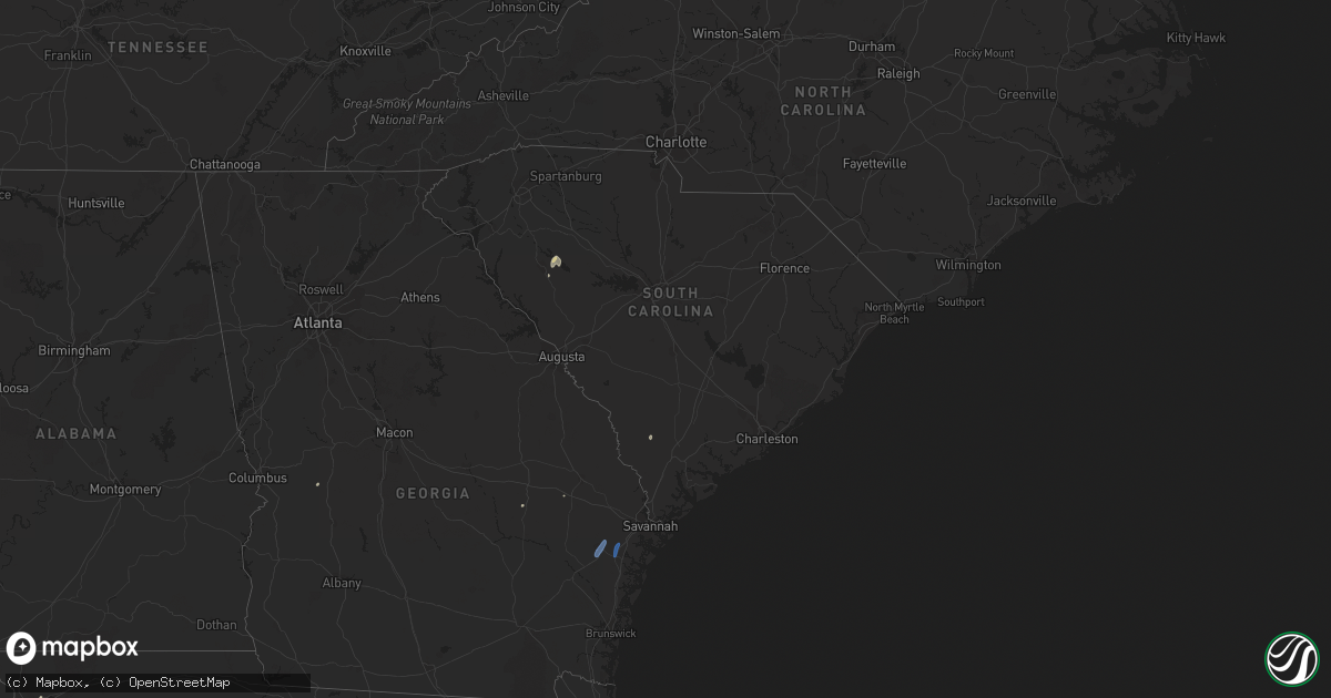
Hail Map in South Carolina on June 8, 2019
Get this storm
June 8 map
$229
one time, instant access
Download today. No call, no setup
Keep the $229
Bought the map and want the full workflow? Apply the entire $229 to a subscription within 7 days. None of it is wasted.
Every map, not just this one
This buys you this map. Subscription and you get every map we run, in the markets you choose from a few cities to whole states to nationwide. Plus real-time alerts the moment a storm fires.
Contact data
Name, contact info, occupancy, even credit band for addresses in the footprint. You go from where it hit to who to call.
Become the source they trust
Unlimited branding weather history reports on demand. You already have the documented answer ready for the property owner, and you are the one who showed up with it.
Property data and RoofTrace estimates
Pull up any address you have got, its value and the exact code rules for that jurisdiction, straight from One Click Code. Then RoofTrace estimates the squares, pitch, and roof value, priced the way you price.
Storm reports in South Carolina
South Carolina
| Date | Description |
|---|---|
| 06/08/20192:50 PM CDT | Schp reported trees down on roadway near joneswire road and martin neese road in lexington county. Time approximated by radar. |
| 06/08/20191:12 PM CDT | Sc highway patrol reported a tree down. Time estimated by radar. |
| 06/08/20193:10 AM CDT | At 809 PM EDT, a severe thunderstorm was located over Graniteville, or near Aiken, moving northeast at 30 mph. HAZARD...60 mph wind gusts. SOURCE...Radar indicated. IMPACT...Expect damage to roofs, siding, and trees. Locations impacted include... Aiken, Aiken Mall, New Ellenton, USC Aiken, Aiken Municipal Airport, Citizens Park, Gloverville, Edgefield County Airport, Graniteville, Burnettown, Wagener, Monetta, Vaucluse, New Holland and Murphy Village. |
| 06/08/20192:42 AM CDT | At 742 PM EDT, a severe thunderstorm was located 8 miles south of Springfield, moving northeast at 30 mph. HAZARD...60 mph wind gusts. SOURCE...Radar indicated. IMPACT...Expect damage to trees and powerlines. Locations impacted include... Savannah, Pooler, Bluffton, Ridgeland, Springfield, I-16/I-95 Interchange, Jasper and Rincon.This warning includes... I-16 between mile markers 149 and 160. I-95 in South Carolina between mile markers 2 and 25. I-95 in Georgia between mile markers 97 and 112. |
| 06/07/201911:28 PM CDT | At 428 PM EDT, a severe thunderstorm was located near Fort Gordon, moving northeast at 15 mph. HAZARD...60 mph wind gusts and penny size hail. SOURCE...Radar indicated. IMPACT...Expect damage to roofs, siding, and trees. Locations impacted include... North Augusta, Grovetown, Evans, Martinez, Fort Gordon, Augusta, Belvedere, Clearwater, Hephzibah, Glendale, South Augusta, Midtown, Summerville, Augusta Mall, Daniel Field, Augusta Regional Airport, Village Plaza Shopping Center, Augusta National Golf Club, Blythe and West End Augusta. |
| 06/07/201910:55 PM CDT | At 353 PM EDT, severe thunderstorms were located along a line extending from 11 miles southeast of Batesburg-Leesville to near Gaston, moving north at 30 mph. HAZARD...60 mph wind gusts and penny size hail. SOURCE...Radar indicated. IMPACT...Expect damage to roofs, siding, and trees. Locations impacted include... Columbia, Lexington, West Columbia, Cayce, Irmo, Forest Acres, Batesburg-Leesville, Springdale, St. Andrews, Dentsville, Lake Murray Dam, Oak Grove, Red Bank, South Congaree, Pine Ridge, Gaston, Prosperity, Arcadia Lakes, Columbia International University and Harbison State Forest. |
| 06/07/201910:25 PM CDT | At 324 PM EDT, a severe thunderstorm was located 12 miles north of Blackville, or 15 miles north of Denmark, moving north at 25 mph. HAZARD...60 mph wind gusts and quarter size hail. SOURCE...Radar indicated. IMPACT...Hail damage to vehicles is expected. Expect wind damage to roofs, siding, and trees. Locations impacted include... Swansea, Wagener, North, Pelion, Springfield, Salley, Neeses, Norway, Perry, Woodford, Livingston, Perry Airport and Thor. |
| 06/07/20197:25 PM CDT | Tree down near the intersection of calf pen bay road and firetower road. Time estimated by radar. |
All States Impacted by Hail Map on June 8, 2019
Cities Impacted by Hail Map on June 8, 2019
- Goodland, KS
- McDonald, KS
- Colby, KS
- Levant, KS
- Longmont, CO
- Boulder, CO
- Lafayette, CO
- Strasburg, CO
- Byers, CO
- Burwell, NE
- Stuart, NE
- Bassett, NE
- Sargent, NE
- Atkinson, NE
- Taylor, NE
- Amelia, NE
- Edson, KS
- Winona, KS
- Brewster, KS
- Glen Elder, KS
- Grinnell, KS
- Ainsworth, NE
- Johnstown, NE
- Tryon, NE
- Seneca, NE
- Ansley, NE
- Anselmo, NE
- Broken Bow, NE
- Westerville, NE
- Comstock, NE
- Merna, NE
- Oberlin, KS
- Franktown, CO
- Castle Rock, CO
- Elizabeth, CO
- Flagler, CO
- Bird City, KS
- Sedalia, CO
- Brady, NE
- Maxwell, NE
- Newfolden, MN
- Viking, MN
- Deer Trail, CO
- Bennett, CO
- Selden, KS
- Wellington, CO
- Wellfleet, NE
- Holbrook, NE
- Bertrand, NE
- Elwood, NE
- Eustis, NE
- Arapahoe, NE
- North Platte, NE
- Atwood, KS
- Cheyenne, WY
- Keenesburg, CO
- Hudson, CO
- Brighton, CO
- Arlington, KS
- Turon, KS
- Cunningham, KS
- Kingman, KS
- Hoxie, KS
- Palisade, NE
- Nekoma, KS
- Saint Francis, KS
- Herndon, KS
- Erie, CO
- Louisville, CO
- Wannaska, MN
- Roseau, MN
- Salol, MN
- Ramah, CO
- Agate, CO
- Stratton, NE
- Trenton, NE
- McCracken, KS
- Matheson, CO
- Limon, CO
- Watkins, CO
- Aurora, CO
- Parker, CO
- Kiowa, CO
- Quinter, KS
- Long Pine, NE
- Hayes Center, NE
- Orleans, NE
- Oxford, NE
- Tipton, KS
- Thief River Falls, MN
- Vidalia, GA
- Lyons, GA
- Grygla, MN
- Elbert, CO
- La Salle, CO
- Simla, CO
- Kenesaw, NE
- Calhan, CO
- Hennessey, OK
- Berthoud, CO
- Platteville, CO
- Mead, CO
- Shickley, NE
- Geneva, NE
- Brownell, KS
- Register, GA
- Vernon, CO
- Wray, CO
- Eckley, CO
- Wallace, KS
- Monument, KS
- Utica, KS
- Morland, KS
- Middle River, MN
- Ord, NE
- Arcadia, NE
- Crookston, MN
- Ames, OK
- Drummond, OK
- Ransom, KS
- Arnold, KS
- Curtis, NE
- Thedford, NE
- Cheyenne Wells, CO
- Carr, CO
- Nunn, CO
- Sutton, NE
- Hudson, KS
- St John, KS
- Collyer, KS
- Wakita, OK
- Nash, OK
- Burlington, OK
- Jet, OK
- Norcatur, KS
- Idalia, CO
- Yuma, CO
- Wakeeney, KS
- Gregory, SD
- Healy, KS
- Dighton, KS
- Gove, KS
- Naper, NE
- Butte, NE
- Scott City, KS
- Norton, KS
- Bonesteel, SD
- Ravenna, NE
- Grover, CO
- Loomis, NE
- Burlington, CO
- Kit Carson, CO
- Hoisington, KS
- Sharon, KS
- Grainfield, KS
- Hays, KS
- Ellis, KS
- Hill City, KS
- Dickens, NE
- Wallace, NE
- Denver, CO
- Thornton, CO
- Henderson, CO
- Abbyville, KS
- Helena, OK
- Edison, NE
- Gothenburg, NE
- Leoti, KS
- McCamey, TX
- Culbertson, NE
- Geneseo, KS
- Commerce City, CO
- Otis, KS
- Olmitz, KS
- Fe Warren Afb, WY
- Farnam, NE
- Moorefield, NE
- Stapleton, NE
- Claflin, KS
- McCook, NE
- Borup, MN
- Georgetown, MN
- Holdrege, NE
- Smithfield, NE
- Cambridge, NE
- Stamford, NE
- Broomfield, CO
- Oakley, KS
- Burke, SD
- Boynton Beach, FL
- Gorham, KS
- Russell, KS
- Penokee, KS
- Ogallah, KS
- Naponee, NE
- Buena Vista, GA
- Cozad, NE
- Englewood, CO
- Littleton, CO
- Raymond, KS
- Pompano Beach, FL
- Coral Springs, FL
- Meno, OK
- Amenia, ND
- Phillipsburg, KS
- Kanorado, KS
- Larned, KS
- Bison, KS
- Carpenter, WY
- Guide Rock, NE
- Blue Hill, NE
- Elm Creek, NE
- Atlanta, NE
- Overton, NE
- Gatzke, MN
- Waldron, KS
- Hazelton, KS
- Kiowa, KS
- Rush Center, KS
- Euclid, MN
- Buxton, ND
- West Palm Beach, FL
- Murdock, KS
- Milton, FL
- Arnold, NE
- Ellinwood, KS
- Miami Gardens, FL
- Opa Locka, FL
- Greenwood, SC
- Ericson, NE
- Beloit, KS
- Wiggins, CO
- Sebring, FL
- Caledonia, ND
- Sylvia, KS
- Stafford, KS
- Platte, SD
- Great Bend, KS
- Wheatland, ND
- Indianola, NE
- Reynolds, ND
- Roggen, CO
- Varnville, SC
- Alma, NE
- Downs, KS
- Portis, KS
- Ness City, KS
- Medicine Lodge, KS
- Hitchcock, SD
- Minden, NE
- Pawnee Rock, KS
- Red Cloud, NE
- Max, NE
- Kersey, CO
- Plevna, KS
- Theodore, AL
- Irvington, AL
- Lake Worth, FL
- Genoa, CO
- Delray Beach, FL
- Boca Raton, FL
- Victoria, KS
- Marienthal, KS
- Fertile, MN
- Pleasanton, NE
- Park, KS
- Benkelman, NE
- Warren, MN
- Doland, SD
- Cherokee, OK
- Waterloo, SC
- Cross Hill, SC
- Chambers, NE
- Bloomington, NE
- Ninety Six, SC
- Holyrood, KS
- Sterling, KS
- Pretty Prairie, KS
- Mills, NE
- Brewster, NE
- Gary, MN
- Nielsville, MN
- Leonard, ND
- North Loup, NE
- Kearney, NE
- Alexander, KS
- Isabel, KS
- Bushton, KS
- Goltry, OK
- Ringwood, OK
- Wauneta, NE
- Schoenchen, KS
- Bazine, KS
- La Crosse, KS
- Bunker Hill, KS
- Dorrance, KS
- Pfeifer, KS
- Liebenthal, KS
- Albert, KS
- Plainville, KS
- Bogue, KS
- Palco, KS
- Funk, NE
- Lone Tree, CO
- Louviers, CO
- Hinesville, GA
- Fort Stewart, GA
- Midway, GA
- Fleming, GA
- Argusville, ND
- Felton, MN
- Horace, ND
- Hendrum, MN
- Fargo, ND
- Halstad, MN
- Ada, MN
- Mapleton, ND
- West Fargo, ND
- Perley, MN
- Glyndon, MN
- Twin Valley, MN
- Ulen, MN
- Moorhead, MN
- Harwood, ND
- Davenport, ND
- Kindred, ND


