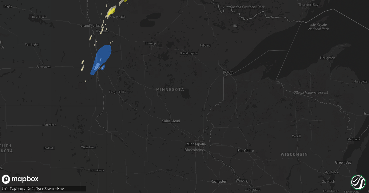
Hail Map in Minnesota on June 8, 2019
Get this storm
June 8 map
$229
one time, instant access
Download today. No call, no setup
Keep the $229
Bought the map and want the full workflow? Apply the entire $229 to a subscription within 7 days. None of it is wasted.
Every map, not just this one
This buys you this map. Subscription and you get every map we run, in the markets you choose from a few cities to whole states to nationwide. Plus real-time alerts the moment a storm fires.
Contact data
Name, contact info, occupancy, even credit band for addresses in the footprint. You go from where it hit to who to call.
Become the source they trust
Unlimited branding weather history reports on demand. You already have the documented answer ready for the property owner, and you are the one who showed up with it.
Property data and RoofTrace estimates
Pull up any address you have got, its value and the exact code rules for that jurisdiction, straight from One Click Code. Then RoofTrace estimates the squares, pitch, and roof value, priced the way you price.
Storm reports in Minnesota
Minnesota
| Date | Description |
|---|---|
| 06/08/20194:00 PM CDT | Several trees were snapped or uprooted in a farmstead. |
| 06/08/20193:50 PM CDT | Downburst winds broke down several large 4 to 6 inch diameter tree branches around a farmstead. Report posted via social media. Time estimated based on radar and nearby |
| 06/08/20193:40 PM CDT | A gustnado developed on two convergent thunderstorm outflow boundaries and slowly moved across a field. A persistent rotating dust plume was evident on video posted via |
| 06/08/20193:20 PM CDT | A local report indicates 1.25 inch wind near 3 SSE WANNASKA |
| 06/08/20193:20 PM CDT | Tree uprooted. |
| 06/08/20193:15 PM CDT | Tree uprooted. |
| 06/08/20193:15 PM CDT | Tree uprooted. |
| 06/08/20193:08 PM CDT | Marble to quarter size hail. |
| 06/08/20193:05 PM CDT | Peak wind measured at the mndot rwis near on hwy 89 near gatzke. |
| 06/08/20193:00 PM CDT | Siding was torn off a house. Report and photo posted via social media. |
| 06/08/20192:56 PM CDT | Peak wind measured by the ndawn sensor near ada. |
| 06/08/20192:30 PM CDT | Wind driven hail broke the yard light. |
| 06/08/20192:27 PM CDT | Spotter also reported trees uprooted and power outage in and near glyndon. |
| 06/08/20192:15 PM CDT | A local report indicates 1.00 inch wind near 10 W THIEF RIVER FALLS |
| 06/07/201910:49 PM CDT | At 349 PM CDT, severe thunderstorms were located along a line extending from near Skime to 8 miles east of High Landing to near Fosston, moving northeast at 25 mph. HAZARD...60 mph wind gusts and quarter size hail. SOURCE...Radar indicated. IMPACT...Hail damage to vehicles is expected. Expect wind damage to roofs, siding, and trees. Locations impacted include... Fosston, McIntosh, Clearbrook, Oklee, Gonvick, Grygla and Goodridge. |
| 06/07/201910:27 PM CDT | At 327 PM CDT, severe thunderstorms were located along a line extending from near Rosewood to near St. Hilaire to near Terrebonne, moving northeast at 50 mph. HAZARD...60 mph wind gusts and quarter size hail. SOURCE...Radar indicated. IMPACT...Hail damage to vehicles is expected. Expect wind damage to roofs, siding, and trees. Locations impacted include... Thief River Falls, Red Lake Falls, Middle River, Plummer, St. Hilaire, Goodridge and Holt. |
| 06/07/201910:18 PM CDT | At 317 PM CDT, a severe thunderstorm was located over Pencer, or 13 miles south of Roseau, moving northeast at 50 mph. HAZARD...60 mph wind gusts and quarter size hail. SOURCE...Radar indicated. IMPACT...Hail damage to vehicles is expected. Expect wind damage to roofs, siding, and trees. This severe thunderstorm will be near... Pencer and Hayes Lake State Park around 320 PM CDT. Malung around 325 PM CDT. Salol around 335 PM CDT. Warroad and Swift around 345 PM CDT. Springsteel Island and Longworth around 350 PM CDT. |
| 06/07/201910:13 PM CDT | At 312 PM CDT, severe thunderstorms were located along a line extending from Lockhart to near Felton to near Baker, moving north northeast at 30 mph. HAZARD...60 mph wind gusts and quarter size hail. SOURCE...Radar indicated. IMPACT...Hail damage to vehicles is expected. Expect wind damage to roofs, siding, and trees. Locations impacted include... Barnesville, Hawley, Ada, Glyndon, Mahnomen, Fertile and Twin Valley.This includes Interstate 94 in Minnesota between mile markers 8 and27. |
| 06/07/20199:26 PM CDT | At 225 PM CDT, severe thunderstorms were located along a line extending from near Middle River to near Dakota Junction to near Terrebonne to near Lockhart, moving east at 25 mph. HAZARD...60 mph wind gusts and quarter size hail. SOURCE...Radar indicated. IMPACT...Hail damage to vehicles is expected. Expect wind damage to roofs, siding, and trees. Severe thunderstorms will be near... Middle River, Terrebonne and Dakota Junction around 230 PM CDT. Plummer and Brooks around 235 PM CDT. Mavie around 245 PM CDT. Oklee around 255 PM CDT. Goodridge around 300 PM CDT.Other locations impacted by these severe thunderstorms include ThiefRiver Falls Airport. |
| 06/07/20199:12 PM CDT | At 212 PM CDT, severe thunderstorms were located along a line extending from near Halstad to 7 miles east of Hendrum to near Dilworth, moving east at 35 mph. HAZARD...60 mph wind gusts and quarter size hail. SOURCE...Radar indicated. IMPACT...Hail damage to vehicles is expected. Expect wind damage to roofs, siding, and trees. Locations impacted include... Ada, Mahnomen, Fertile, Twin Valley, Harwood, McIntosh and Halstad.This includes Interstate 29 between mile markers 67 and 76. |
| 06/07/20198:44 PM CDT | At 144 PM CDT, a severe thunderstorm was located near Euclid, or 21 miles east of Grand Forks, moving north at 25 mph. HAZARD...60 mph wind gusts and quarter size hail. SOURCE...Radar indicated. IMPACT...Hail damage to vehicles is expected. Expect wind damage to roofs, siding, and trees. This severe thunderstorm will be near... Euclid and Dorothy around 155 PM CDT. Carpenters Corner around 230 PM CDT. Rosewood around 240 PM CDT. Viking around 245 PM CDT. |
| 06/07/20198:18 PM CDT | At 118 PM CDT, a severe thunderstorm was located over Leonard, or 23 miles southwest of Fargo, moving northeast at 25 mph. HAZARD...60 mph wind gusts and quarter size hail. SOURCE...Radar indicated. IMPACT...Hail damage to vehicles is expected. Expect wind damage to roofs, siding, and trees. This severe thunderstorm will be near... Davenport around 130 PM CDT. Durbin around 140 PM CDT. Casselton around 150 PM CDT. Mapleton around 155 PM CDT. West Fargo around 200 PM CDT.Other locations impacted by this severe thunderstorm includeCasselton Airport and West Argusville.This includes the following highways... Interstate 29 between mile markers 72 and 83. Interstate 94 in North Dakota between mile markers 327 and 344. |
| 06/07/20197:34 PM CDT | First reported as a funnel by spotters near the sand hills golf course... This tornado touched down just north of the norman county line and tracked to the ene for arou |
All States Impacted by Hail Map on June 8, 2019
Cities Impacted by Hail Map on June 8, 2019
- Goodland, KS
- McDonald, KS
- Colby, KS
- Levant, KS
- Longmont, CO
- Boulder, CO
- Lafayette, CO
- Strasburg, CO
- Byers, CO
- Burwell, NE
- Stuart, NE
- Bassett, NE
- Sargent, NE
- Atkinson, NE
- Taylor, NE
- Amelia, NE
- Edson, KS
- Winona, KS
- Brewster, KS
- Glen Elder, KS
- Grinnell, KS
- Ainsworth, NE
- Johnstown, NE
- Tryon, NE
- Seneca, NE
- Ansley, NE
- Anselmo, NE
- Broken Bow, NE
- Westerville, NE
- Comstock, NE
- Merna, NE
- Oberlin, KS
- Franktown, CO
- Castle Rock, CO
- Elizabeth, CO
- Flagler, CO
- Bird City, KS
- Sedalia, CO
- Brady, NE
- Maxwell, NE
- Newfolden, MN
- Viking, MN
- Deer Trail, CO
- Bennett, CO
- Selden, KS
- Wellington, CO
- Wellfleet, NE
- Holbrook, NE
- Bertrand, NE
- Elwood, NE
- Eustis, NE
- Arapahoe, NE
- North Platte, NE
- Atwood, KS
- Cheyenne, WY
- Keenesburg, CO
- Hudson, CO
- Brighton, CO
- Arlington, KS
- Turon, KS
- Cunningham, KS
- Kingman, KS
- Hoxie, KS
- Palisade, NE
- Nekoma, KS
- Saint Francis, KS
- Herndon, KS
- Erie, CO
- Louisville, CO
- Wannaska, MN
- Roseau, MN
- Salol, MN
- Ramah, CO
- Agate, CO
- Stratton, NE
- Trenton, NE
- McCracken, KS
- Matheson, CO
- Limon, CO
- Watkins, CO
- Aurora, CO
- Parker, CO
- Kiowa, CO
- Quinter, KS
- Long Pine, NE
- Hayes Center, NE
- Orleans, NE
- Oxford, NE
- Tipton, KS
- Thief River Falls, MN
- Vidalia, GA
- Lyons, GA
- Grygla, MN
- Elbert, CO
- La Salle, CO
- Simla, CO
- Kenesaw, NE
- Calhan, CO
- Hennessey, OK
- Berthoud, CO
- Platteville, CO
- Mead, CO
- Shickley, NE
- Geneva, NE
- Brownell, KS
- Register, GA
- Vernon, CO
- Wray, CO
- Eckley, CO
- Wallace, KS
- Monument, KS
- Utica, KS
- Morland, KS
- Middle River, MN
- Ord, NE
- Arcadia, NE
- Crookston, MN
- Ames, OK
- Drummond, OK
- Ransom, KS
- Arnold, KS
- Curtis, NE
- Thedford, NE
- Cheyenne Wells, CO
- Carr, CO
- Nunn, CO
- Sutton, NE
- Hudson, KS
- St John, KS
- Collyer, KS
- Wakita, OK
- Nash, OK
- Burlington, OK
- Jet, OK
- Norcatur, KS
- Idalia, CO
- Yuma, CO
- Wakeeney, KS
- Gregory, SD
- Healy, KS
- Dighton, KS
- Gove, KS
- Naper, NE
- Butte, NE
- Scott City, KS
- Norton, KS
- Bonesteel, SD
- Ravenna, NE
- Grover, CO
- Loomis, NE
- Burlington, CO
- Kit Carson, CO
- Hoisington, KS
- Sharon, KS
- Grainfield, KS
- Hays, KS
- Ellis, KS
- Hill City, KS
- Dickens, NE
- Wallace, NE
- Denver, CO
- Thornton, CO
- Henderson, CO
- Abbyville, KS
- Helena, OK
- Edison, NE
- Gothenburg, NE
- Leoti, KS
- McCamey, TX
- Culbertson, NE
- Geneseo, KS
- Commerce City, CO
- Otis, KS
- Olmitz, KS
- Fe Warren Afb, WY
- Farnam, NE
- Moorefield, NE
- Stapleton, NE
- Claflin, KS
- McCook, NE
- Borup, MN
- Georgetown, MN
- Holdrege, NE
- Smithfield, NE
- Cambridge, NE
- Stamford, NE
- Broomfield, CO
- Oakley, KS
- Burke, SD
- Boynton Beach, FL
- Gorham, KS
- Russell, KS
- Penokee, KS
- Ogallah, KS
- Naponee, NE
- Buena Vista, GA
- Cozad, NE
- Englewood, CO
- Littleton, CO
- Raymond, KS
- Pompano Beach, FL
- Coral Springs, FL
- Meno, OK
- Amenia, ND
- Phillipsburg, KS
- Kanorado, KS
- Larned, KS
- Bison, KS
- Carpenter, WY
- Guide Rock, NE
- Blue Hill, NE
- Elm Creek, NE
- Atlanta, NE
- Overton, NE
- Gatzke, MN
- Waldron, KS
- Hazelton, KS
- Kiowa, KS
- Rush Center, KS
- Euclid, MN
- Buxton, ND
- West Palm Beach, FL
- Murdock, KS
- Milton, FL
- Arnold, NE
- Ellinwood, KS
- Miami Gardens, FL
- Opa Locka, FL
- Greenwood, SC
- Ericson, NE
- Beloit, KS
- Wiggins, CO
- Sebring, FL
- Caledonia, ND
- Sylvia, KS
- Stafford, KS
- Platte, SD
- Great Bend, KS
- Wheatland, ND
- Indianola, NE
- Reynolds, ND
- Roggen, CO
- Varnville, SC
- Alma, NE
- Downs, KS
- Portis, KS
- Ness City, KS
- Medicine Lodge, KS
- Hitchcock, SD
- Minden, NE
- Pawnee Rock, KS
- Red Cloud, NE
- Max, NE
- Kersey, CO
- Plevna, KS
- Theodore, AL
- Irvington, AL
- Lake Worth, FL
- Genoa, CO
- Delray Beach, FL
- Boca Raton, FL
- Victoria, KS
- Marienthal, KS
- Fertile, MN
- Pleasanton, NE
- Park, KS
- Benkelman, NE
- Warren, MN
- Doland, SD
- Cherokee, OK
- Waterloo, SC
- Cross Hill, SC
- Chambers, NE
- Bloomington, NE
- Ninety Six, SC
- Holyrood, KS
- Sterling, KS
- Pretty Prairie, KS
- Mills, NE
- Brewster, NE
- Gary, MN
- Nielsville, MN
- Leonard, ND
- North Loup, NE
- Kearney, NE
- Alexander, KS
- Isabel, KS
- Bushton, KS
- Goltry, OK
- Ringwood, OK
- Wauneta, NE
- Schoenchen, KS
- Bazine, KS
- La Crosse, KS
- Bunker Hill, KS
- Dorrance, KS
- Pfeifer, KS
- Liebenthal, KS
- Albert, KS
- Plainville, KS
- Bogue, KS
- Palco, KS
- Funk, NE
- Lone Tree, CO
- Louviers, CO
- Hinesville, GA
- Fort Stewart, GA
- Midway, GA
- Fleming, GA
- Argusville, ND
- Felton, MN
- Horace, ND
- Hendrum, MN
- Fargo, ND
- Halstad, MN
- Ada, MN
- Mapleton, ND
- West Fargo, ND
- Perley, MN
- Glyndon, MN
- Twin Valley, MN
- Ulen, MN
- Moorhead, MN
- Harwood, ND
- Davenport, ND
- Kindred, ND


