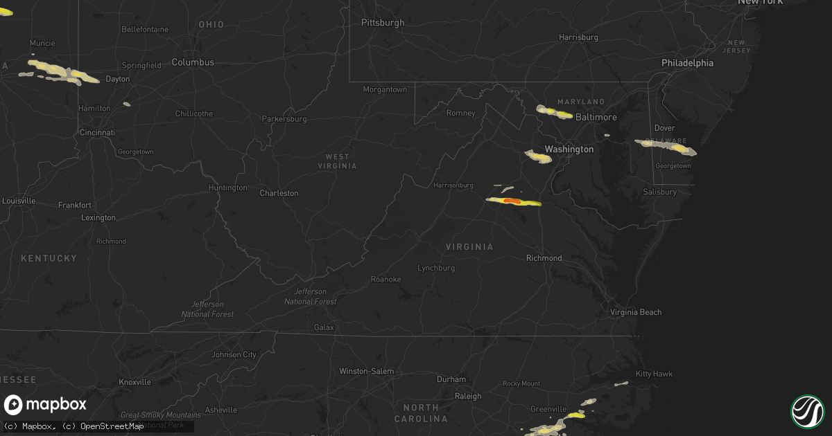
Hail Map in Virginia on May 30, 2019
Get this storm
May 30 map
$229
one time, instant access
Download today. No call, no setup
Keep the $229
Bought the map and want the full workflow? Apply the entire $229 to a subscription within 7 days. None of it is wasted.
Every map, not just this one
This buys you this map. Subscription and you get every map we run, in the markets you choose from a few cities to whole states to nationwide. Plus real-time alerts the moment a storm fires.
Contact data
Name, contact info, occupancy, even credit band for addresses in the footprint. You go from where it hit to who to call.
Become the source they trust
Unlimited branding weather history reports on demand. You already have the documented answer ready for the property owner, and you are the one who showed up with it.
Property data and RoofTrace estimates
Pull up any address you have got, its value and the exact code rules for that jurisdiction, straight from One Click Code. Then RoofTrace estimates the squares, pitch, and roof value, priced the way you price.
Storm reports in Virginia
Virginia
| Date | Description |
|---|---|
| 05/30/20196:39 PM CDT | Trees were down blocking two lanes on interstate 95 around mile marker 124. |
| 05/30/20196:10 PM CDT | Dozens of trees down on the edge of a recently logged forest near price road and lake country lane. All trees oriented generally west to east... Indicating straight-lin |
| 05/30/20196:09 PM CDT | A local report indicates 1.00 inch wind near 3 SSE VERDIERSVILLE |
| 05/30/20195:54 PM CDT | A local report indicates 1.75 inch wind near 1 SW NASONS |
| 05/30/20195:52 PM CDT | Tree down on spotters property in orange. |
| 05/30/20195:50 PM CDT | A local report indicates 1.25 inch wind near 1 ENE ORANGE |
| 05/30/20195:50 PM CDT | Tree down on homewood drive and rapidan road. |
| 05/30/20195:39 PM CDT | Multiple reports of trees down along south blue ridge turnpike near uno. |
| 05/30/20195:14 PM CDT | Tree down near the intersection of spotswood trail and powell mountain road. |
| 05/30/20195:10 PM CDT | Multiple trees down in the price road with over 20 trees reported down. |
| 05/30/20195:03 PM CDT | Tree reported down on hawfield road. |
| 05/30/20194:48 PM CDT | Multiple trees down. Metal roofing peeled back on a house. Porch damaged. |
| 05/30/20194:35 PM CDT | Barn destroyed off of rt. 11 in mt. Crawford. |
| 05/30/20194:35 PM CDT | Multiple trees down near airport road and kiser road. |
| 05/30/20192:56 PM CDT | A local report indicates 63 MPH wind near 2 E WOODBRIDGE |
| 05/30/20192:53 PM CDT | Tree down on general drive and cooper street |
| 05/30/20192:48 PM CDT | Tree down on wharf lane near olde port lane. |
| 05/30/20192:48 PM CDT | Tree down on a house on the 15000 block of illinois road. |
| 05/30/20192:48 PM CDT | Tree down on the 1700 block of featherstone road. |
| 05/30/20192:48 PM CDT | Tree on house on the 14000 block of pratt street. |
| 05/30/20192:39 PM CDT | Tree down on pole road and carlwood road. |
| 05/30/20192:39 PM CDT | Tree down at lukens lane and old mill road. |
| 05/30/20192:36 PM CDT | Trees down near intersection of john j kingman road and gunston road. |
| 05/30/20192:36 PM CDT | A local report indicates 66 MPH wind near DAVISON ARMY AIRFLD |
| 05/30/20192:27 PM CDT | Tree down on glenister drive. |
| 05/30/20192:17 PM CDT | Trees down in multiple locations along clifton road. |
| 05/30/20192:10 PM CDT | Multiple trees down in the price road with over 20 trees reported down. |
| 05/30/20192:09 PM CDT | Tree down on 7800 block of wall street in manassas. |
| 05/30/20192:06 PM CDT | Wires down on old centreville road and compton road. |
| 05/30/20192:03 PM CDT | Tree reported down on hawfield road. |
| 05/30/20192:01 PM CDT | Tree down on powerlines near country club road and stoneybrook lane |
| 05/30/20191:58 PM CDT | Tree down near the intersection of groveton road and general longstreet line. |
| 05/30/20191:56 PM CDT | A local report indicates 71 MPH wind near GAINESVILLE |
| 05/30/20191:38 PM CDT | Tree down on to powerlines on the 6200 block of lee street. |
| 05/30/20191:37 PM CDT | Tree down on powerlines on the 4200 block of mosby street. |
| 05/30/20191:35 PM CDT | Tree down on powerlines on the 3500 block of milestone road. |
| 05/30/20196:41 AM CDT | At 1140 PM EDT, severe thunderstorms were located along a line extending from near Seaford to near Isle Of Wight to near Carrsville, moving east at 40 mph. HAZARD...60 mph wind gusts. SOURCE...Radar indicated. IMPACT...Expect damage to trees and powerlines. Severe thunderstorms will be near, Hampton, Langley AFB, Seaford and Tabb around 1145 PM EDT. Grand View around 1150 PM EDT. Suffolk, Crittenden and Driver around 1155 PM EDT. Downtown Suffolk, Churchland, Portsmouth and Western Branch around 1205 AM EDT. Old Dominion University, Downtown Norfolk, Downtown Portsmouth, Ghent and Norfolk NAS around 1210 AM EDT. Norfolk State University, Ocean View, Norview and Bowers Hill around 1215 AM EDT. Virginia Wesleyan University, Kempsville, Regent University, Norfolk, Chesapeake and Norfolk International around 1220 AM EDT. Deep Creek and Cradock around 1225 AM EDT.Other locations impacted by these severe thunderstorms include SouthNorfolk, Rudee Heights, Portlock, Longview, Huntersville, Oriana,Chuckatuck, Pungo, Bayside and Wilroy. |
| 05/30/20192:33 AM CDT | At 733 PM EDT, a severe thunderstorm was located over Davenport, moving east at 30 mph. HAZARD...60 mph wind gusts and quarter size hail. SOURCE...Radar indicated. IMPACT...Hail damage to vehicles is expected. Expect wind damage to roofs, siding, and trees. Locations impacted include... Davenport. |
| 05/30/20191:31 AM CDT | At 631 PM EDT, a severe thunderstorm was located near Madison, moving east at 35 mph. HAZARD...60 mph wind gusts and quarter size hail. SOURCE...Radar indicated. IMPACT...Damaging winds will cause some trees and large branches to fall. This could injure those outdoors, as well as damage homes and vehicles. Roadways may become blocked by downed trees. Localized power outages are possible. Unsecured light objects may become projectiles. Locations impacted include... Orange, Ruckersville, Eheart, Oakpark, Verdiersville, Everona, Montpelier Station, Newtown, Nasons, Madison Mills, Montford, Mitchells, Old Somerset, Unionville, Somerset, Locust Dale, Raccoon Ford, Rhoadesville, Rapidan and Madison Run. |
| 05/30/201912:54 AM CDT | At 554 PM EDT, a severe thunderstorm was located near Massanutten, or 11 miles southeast of Harrisonburg, moving east at 35 mph. HAZARD...Ping pong ball size hail and 60 mph wind gusts. SOURCE...Radar indicated. IMPACT...Damaging winds will cause some trees and large branches to fall. This could injure those outdoors, as well as damage homes and vehicles. Roadways may become blocked by downed trees. Localized power outages are possible. Unsecured light objects may become projectiles. Locations impacted include... Madison, Stanardsville, Elkton, Ruckersville, Quinque, Lydia, Haneytown, Newtown, Amicus, Shady Grove, Hood, Mcmullen, Boonesville, Pratts, Rochelle, Mission Home, Swift Run, Shelby, Dawsonville and Fletcher. |
| 05/30/201912:26 AM CDT | At 526 PM EDT, a severe thunderstorm was located near Bridgewater, or 10 miles southwest of Harrisonburg, moving east at 35 mph. HAZARD...60 mph wind gusts and quarter size hail. SOURCE...Radar indicated. IMPACT...Damaging winds will cause some trees and large branches to fall. This could injure those outdoors, as well as damage homes and vehicles. Roadways may become blocked by downed trees. Localized power outages are possible. Unsecured light objects may become projectiles. Locations impacted include... Harrisonburg, Bridgewater, Grottoes, Massanutten, Elkton, Weyers Cave, Dayton, Mount Sidney, Mount Crawford, Rocky Bar, Penn Laird, Port Republic, Pleasant Valley, Moscow, Montezuma, Mount Solon, Sangerville, Fort Defiance, Keezletown and Mcgaheysville. |
| 05/29/201911:19 PM CDT | At 419 PM EDT, severe thunderstorms were located along a line extending from near Dunkirk to near Nanjemoy Creek, moving east at 45 mph. HAZARD...60 mph wind gusts. SOURCE...Radar indicated. IMPACT...Damaging winds will cause some trees and large branches to fall. This could injure those outdoors, as well as damage homes and vehicles. Roadways may become blocked by downed trees. Localized power outages are possible. Unsecured light objects may become projectiles. Locations impacted include... Waldorf, Lexington Park, Chesapeake Ranch Estates, La Plata, Shady Side, Chesapeake Beach, Deale, Leonardtown, Dahlgren, Prince Frederick, Hallowing Point, Saint Leonard Creek, Sheridan Point, Calvert Cliffs, Port Tobacco River, Flag Harbor, Popes Creek, California, Golden Beach and Dunkirk. |
| 05/29/201911:05 PM CDT | Tree down on home. Time estimated from radar. |
| 05/29/201910:55 PM CDT | Tree down on w constance road. Time estimated from radar. |
| 05/29/201910:50 PM CDT | Trees downed onto power lines along hornsbyville rd. |
| 05/29/201910:15 PM CDT | Tree down causing damage to aluminum carport on runnymede road. |
| 05/29/20199:41 PM CDT | At 241 PM EDT, a severe thunderstorm was located 8 miles south of Front Royal, moving east at 35 mph. HAZARD...60 mph wind gusts and quarter size hail. SOURCE...Radar indicated. IMPACT...Damaging winds will cause some trees and large branches to fall. This could injure those outdoors, as well as damage homes and vehicles. Roadways may become blocked by downed trees. Localized power outages are possible. Unsecured light objects may become projectiles. Locations impacted include... Front Royal, Warrenton, The Plains, Linden, Hume, Marshall, Chester Gap, Opal, Flint Hill, Washington, Huntly, Hackleys Crossroads, Amissville, Cresthill, Karo, Turnbull, Glen Echo, Bentonville, Meadowville and Arco. |
| 05/29/20199:20 PM CDT | At 220 PM EDT, a severe thunderstorm was located near Shepherdstown, moving east at 25 mph. HAZARD...60 mph wind gusts. SOURCE...Radar indicated. IMPACT...Damaging winds will cause some trees and large branches to fall. This could injure those outdoors, as well as damage homes and vehicles. Roadways may become blocked by downed trees. Localized power outages are possible. Unsecured light objects may become projectiles. Locations impacted include... Frederick, Shepherdstown, Harry Grove Stadium, Ballenger Creek, Brunswick, Walkersville, Boonsboro, Braddock Heights, New Market, Harpers Ferry, Clover Hill, Discovery-Spring Garden, Linganore-Bartonsville, Adamstown, Jefferson, Myersville, Keedysville, Buckeystown, Libertytown and Sharpsburg. |
| 05/29/20197:10 PM CDT | A local report indicates 1.00 inch wind near 1 WSW PARKER |
All States Impacted by Hail Map on May 30, 2019
Cities Impacted by Hail Map on May 30, 2019
- Newman Lake, WA
- Fredericksburg, TX
- Llano, TX
- Coleman, TX
- Burkett, TX
- Del Rio, TX
- Rocksprings, TX
- Hillsboro, IN
- Kingman, IN
- Bloomingdale, IN
- Pantego, NC
- Roper, NC
- Grifton, NC
- Kinston, NC
- Dover, NC
- Hallettsville, TX
- West Lafayette, IN
- Rapidan, VA
- Unionville, VA
- Orange, VA
- Whitestown, IN
- Mason, TX
- Fort Stockton, TX
- Red Bluff, CA
- Covington, IN
- Mountain Home, TX
- Ijamsville, MD
- West Friendship, MD
- Damascus, MD
- Cooksville, MD
- Adamstown, MD
- Monrovia, MD
- Frederick, MD
- Jefferson, MD
- Buckeystown, MD
- Mount Airy, MD
- Woodbine, MD
- Clarksburg, MD
- Glenwood, MD
- Leakey, TX
- Hunt, TX
- Stonewall, TX
- Sonora, TX
- Eldorado, TX
- Greensboro, MD
- Coyanosa, TX
- Chico, CA
- Corning, CA
- Lebanon, IN
- Comstock, TX
- New Paris, OH
- Lewisville, IN
- Hagerstown, IN
- Markleville, IN
- Cambridge City, IN
- Boston, IN
- Centerville, IN
- New Lebanon, OH
- Lewisburg, OH
- Middletown, IN
- Shirley, IN
- Camden, OH
- Richmond, IN
- Milton, IN
- Falmouth, IN
- Straughn, IN
- New Castle, IN
- West Alexandria, OH
- Eaton, OH
- Brownsville, IN
- Liberty, IN
- Connersville, IN
- Farmersville, OH
- Greens Fork, IN
- Quemado, TX
- Clearlake, CA
- Lower Lake, CA
- Menard, TX
- Westpoint, IN
- Lafayette, IN
- Wingate, IN
- Uvalde, TX
- Biggs, CA
- Oroville, CA
- Gridley, CA
- Johnson City, TX
- Hye, TX
- Aroda, VA
- Somerset, VA
- Ruckersville, VA
- Fredericksburg, VA
- Spotsylvania, VA
- Rochelle, VA
- Barboursville, VA
- Rhoadesville, VA
- Locust Grove, VA
- Forbestown, CA
- Strawberry Valley, CA
- Bristow, VA
- Fairfax, VA
- Catharpin, VA
- Fairfax Station, VA
- Gainesville, VA
- Clifton, VA
- Broad Run, VA
- Haymarket, VA
- Centreville, VA
- The Plains, VA
- Manassas, VA
- Brackettville, TX
- Goodfield, IL
- Eureka, IL
- Congerville, IL
- Deer Creek, IL
- Sweetwater, TX
- Nolan, TX
- Merkel, TX
- Dryden, TX
- Ozona, TX
- Gonzales, TX
- Jamestown, IN
- Faison, NC
- Mount Olive, NC
- Warsaw, NC
- Roscoe, TX
- Crystal City, TX
- Willows, CA
- Orland, CA
- Glenn, CA
- London, TX
- Berry Creek, CA
- Sprague, WA
- Mulberry, IN
- Frankfort, IN
- Michigantown, IN
- Bath, NC
- Washington, NC
- Pinetown, NC
- Chocowinity, NC
- Big Wells, TX
- Asherton, TX
- Ingram, TX
- Challenge, CA
- Snyder, TX
- Colville, WA
- Arnold, MD
- Gibson Island, MD
- Reva, VA
- Vanceboro, NC
- Ayden, NC
- Attica, IN
- Danville, IL
- Williamsport, IN
- Bismarck, IL
- State Line, IN
- Veedersburg, IN
- Kokomo, IN
- Converse, IN
- Miami, IN
- Greentown, IN
- Bunker Hill, IN
- Amboy, IN
- Galveston, IN
- Walton, IN
- Whitleyville, TN
- Moss, TN
- Willow City, TX
- Sheffield, TX
- Iraan, TX
- Cost, TX
- Laredo, TX
- Midland, TX
- Crawfordsville, IN
- Lizton, IN
- Brownsburg, IN
- Pittsboro, IN
- North Salem, IN
- Forest Ranch, CA
- Magalia, CA
- Paradise, CA
- Trenton, NC
- Cutler, IN
- Rossville, IN
- Radiant, VA
- Pioche, NV
- Secor, IL
- Marshall, IN
- Batesville, TX
- Hamilton City, CA
- Columbia, NC
- Milford, DE
- Charlottesville, IN
- Knightstown, IN
- Greenfield, IN
- Tuscola, TX
- La Pryor, TX
- Cuero, TX
- Battle Ground, IN
- Camptonville, CA
- Alpine, TX
- Northport, WA
- McCamey, TX
- Brownwood, TX
- Polson, MT
- Celina, TN
- Hamlin, TX
- Arrowsmith, IL
- Saybrook, IL
- Grandfalls, TX
- Pecos, TX
- Fairmount, IN
- Jonesboro, IN
- Hartford City, IN
- Gas City, IN
- Upland, IN
- Dexter, NM
- Hagerman, NM
- Weimar, TX
- La Grange, NC
- Hookerton, NC
- Cove City, NC
- Seven Springs, NC
- Grimesland, NC
- Deep Run, NC
- Jenkins, KY
- Queen Anne, MD
- Ridgely, MD
- Harrington, DE
- Felton, DE
- Chattaroy, WA
- Roseboro, NC
- Salemburg, NC
- Autryville, NC
- Republic, WA
- Greenwood, DE
- Lincoln, DE
- Goldsboro, MD
- Milton, DE
- Centreville, MD
- Houston, DE
- Eagle Pass, TX
- Yoakum, TX
- Shiner, TX
- New Ross, IN
- Davenport, WA
- House, NM
- Cotulla, TX
- Elk, WA
- Clinton, NC
- Imperial, TX
- Middletown, MD
- Gaithersburg, MD
- Brookeville, MD
- Braddock Heights, MD
- Glenelg, MD
- Plymouth, NC
- Novice, TX
- Swayzee, IN
- Cheney, WA
- Ernul, NC
- Valley, WA
- Moscow, ID
- Midkiff, TX
- Rushville, IN
- Oregonia, OH
- Clarksville, OH
- Calypso, NC
- Brookston, IN
- Kettle Falls, WA
- El Campo, TX
- Winterville, NC
- Greenville, NC
- Louise, TX
- Marion, IN
- Otterbein, IN
- Medina, TX
- Mitchells, VA
- Culpeper, VA
- Columbus, TX
- Gifford, WA
- Fort Hancock, TX
- Waynesville, OH
- Nixon, TX
- Rosharon, TX
- Belhaven, NC
- Greenville, OH
- Junction, TX
- Bellflower, IL
- Foosland, IL
- Kerrville, TX
- Winters, TX
- Manvel, TX
- Hext, TX
- Marfa, TX
- Marathon, TX
- Fort Davis, TX
- Valentine, TX
- New Market, MD


