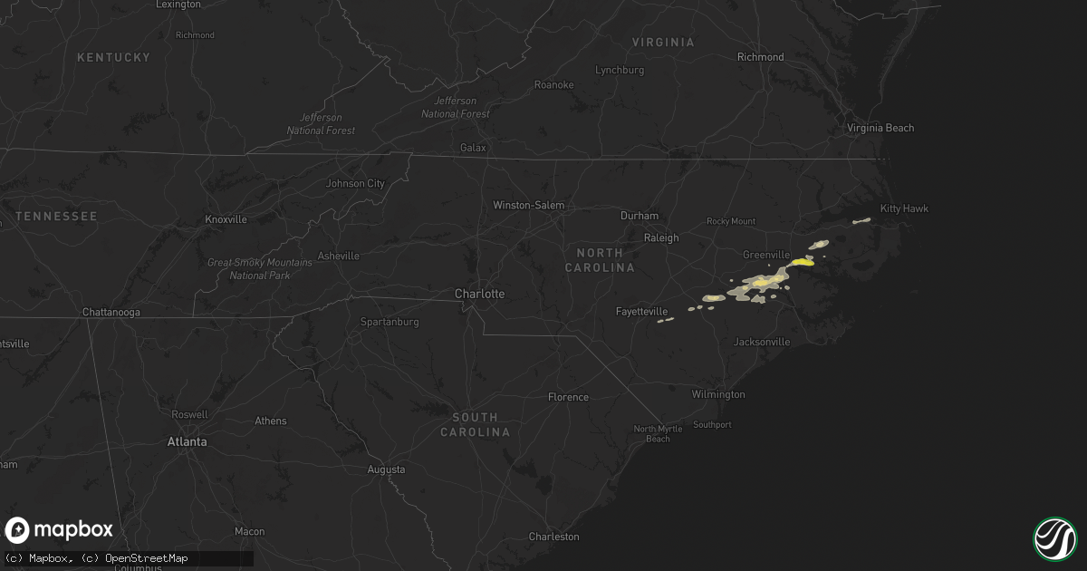
Hail Map in North Carolina on May 30, 2019
Get this storm
May 30 map
$229
one time, instant access
Download today. No call, no setup
Keep the $229
Bought the map and want the full workflow? Apply the entire $229 to a subscription within 7 days. None of it is wasted.
Every map, not just this one
This buys you this map. Subscription and you get every map we run, in the markets you choose from a few cities to whole states to nationwide. Plus real-time alerts the moment a storm fires.
Contact data
Name, contact info, occupancy, even credit band for addresses in the footprint. You go from where it hit to who to call.
Become the source they trust
Unlimited branding weather history reports on demand. You already have the documented answer ready for the property owner, and you are the one who showed up with it.
Property data and RoofTrace estimates
Pull up any address you have got, its value and the exact code rules for that jurisdiction, straight from One Click Code. Then RoofTrace estimates the squares, pitch, and roof value, priced the way you price.
Storm reports in North Carolina
North Carolina
| Date | Description |
|---|---|
| 05/30/20196:55 PM CDT | Quarter size hail in bath. |
| 05/30/20196:55 PM CDT | Trees and wires down in the area along with a light pole. |
| 05/30/20196:55 PM CDT | Cocorahs observer reported quarter size hail at 7:55 pm. |
| 05/30/20196:50 PM CDT | Quarter size hail and 50 mph winds east of washington. |
| 05/30/20196:45 PM CDT | 2 telephone poles snapped near the base... Large tree branches down. Picture sent to us by tideland electric. |
| 05/30/20196:25 PM CDT | Media shared photos of tree down on house in town of parkton. |
| 05/30/20196:25 PM CDT | Public reported damage in parkton... Nc area. Semi flipped on 71 near malloy rd. Several power lines and trees down in town. |
| 05/30/20196:17 PM CDT | Trees and power lines down in farmville. |
| 05/30/20195:45 PM CDT | Measured at kfbg asos. |
| 05/30/20195:29 PM CDT | Measured at kpob asos. |
| 05/30/20195:30 AM CDT | Edgewater ridge court. |
| 05/30/20194:14 AM CDT | At 912 PM EDT, a severe thunderstorm was located near Tuscarora, or 11 miles west of New Bern, moving southeast at 30 mph. This storm has a history of producing damaging winds and knocking down trees. HAZARD...70 mph wind gusts. SOURCE...Trained weather spotters. IMPACT...Expect considerable tree damage. Damage is likely to mobile homes, roofs, and outbuildings. Locations impacted include... New Bern, James City, Trent Woods, River Bend, Jasper, Tuscarora, Rhems, Olympia, Croatan, Riverdale, Catfish Lake, Neuse Forest, Fairfield Harbour, Coastal Carolina Regional Airport, Bridgeton, Cove City, Pollocksville and Trenton. |
| 05/30/20193:54 AM CDT | At 853 PM EDT, severe thunderstorms were located along a line extending from near Clinton to Fort Barnwell, moving east at 45 mph. HAZARD...60 mph wind gusts. SOURCE...Radar indicated. IMPACT...Expect damage to roofs, siding, and trees. Locations impacted include... Jacksonville, Kinston, Wallace, Warsaw, Half Moon, Phillips Crossroads, Kornegay, Rose Hill, Richlands, Beulaville, Deep Run, Maysville, Bowdens, Beautancus, Comfort, Kenansville, Fort Barnwell, Chinquapin, Belgrade and Potters Hill. |
| 05/30/20193:46 AM CDT | Report via wxii. |
| 05/30/20193:36 AM CDT | At 836 PM EDT, severe thunderstorms were located along a line extending from near Cayton to 6 miles west of Tuscarora, moving southeast at 30 mph. HAZARD...60 mph wind gusts and quarter size hail. SOURCE...Radar indicated. IMPACT...Hail damage to vehicles is expected. Expect wind damage to roofs, siding, and trees. Locations impacted include... New Bern, James City, Trent Woods, River Bend, Maysville, Askins, Cayton, Jasper, Tuscarora, Rhems, Janeiro, Grantsboro, Riverdale, Olympia, Croatan, Merritt, Ernul, Catfish Lake, Neuse Forest and Fairfield Harbour. |
| 05/30/20192:58 AM CDT | At 755 PM EDT, a line of severe thunderstorms near Calypso to Chocowinity, moving east at 30 mph. HAZARD...60 mph wind gusts and quarter size hail. SOURCE...Radar indicated. IMPACT...Hail damage to vehicles is expected. Expect wind damage to roofs, siding, and trees. Locations impacted include... Kinston, Washington, Warsaw, La Grange, Mount Olive, Grifton, Kornegay, Deep Run, Blounts Creek, Vanceboro, Cayton, Shelmerdine, Bowdens, Calico, Beautancus, Fort Barnwell, Jasper, Dawson, Wilmar and Graingers. |
| 05/30/20192:38 AM CDT | At 737 PM EDT, a severe thunderstorm was located over Wenona, or 10 miles southeast of Plymouth, moving northeast at 45 mph. HAZARD...60 mph wind gusts and quarter size hail. SOURCE...Radar indicated. IMPACT...Hail damage to vehicles is expected. Expect wind damage to roofs, siding, and trees. Locations impacted include... Gum Neck, Pungo, Columbia, Woodley, Pike Road, Wenona, Pungo Lake, Phelps Lake, Frying Pan Landing and Creswell. |
| 05/30/20192:35 AM CDT | At 734 PM EDT, a severe thunderstorm was located near Jason, or 9 miles north of La Grange, moving northeast at 45 mph. HAZARD...60 mph wind gusts and nickel size hail. SOURCE...Trained weather spotters. IMPACT...Expect damage to roofs, siding, and trees. Locations impacted include... Greenville, Kinston, Washington, Winterville, Ayden, Farmville, La Grange, Grifton, Stokes, Snow Hill, Bell Arthur, Pactolus, House, Shelmerdine, Black Jack, Bruce, Dawson, Institute, Jason and Ormondsville. |
| 05/30/20192:20 AM CDT | At 720 PM EDT, a severe thunderstorm was located over River Road, moving east at 25 mph. HAZARD...60 mph wind gusts and quarter size hail. SOURCE...Radar indicated. IMPACT...Hail damage to vehicles is expected. Expect wind damage to roofs, siding, and trees. Locations impacted include... Washington, River Road, Belhaven, Pinetown, Ransomville, Ponzer, Pamlico Beach, Lowland, Bunyan, Leechville, Winsteadville, Core Point, South Creek, Sidney Crossroads, Bayview, Terra Ceia, Yeatesville, Aurora Ferry Terminal, Goose Creek State Park and Bayview Ferry Terminal. |
| 05/29/20198:25 PM CDT | Trees down on wires near highway 17. |
| 05/29/20198:14 PM CDT | Trees and wires down along highway 55. |
| 05/29/20197:55 PM CDT | Trees and wires down across northwest jones county near wise forks and along the border with lenoir county. |
| 05/29/20197:55 PM CDT | Quarter size hail reported near the intersection of beautancus road and summerlins cross road. |
| 05/29/20197:54 PM CDT | Numerous trees down across the county. Time and location estimated by radar. |
| 05/29/20197:46 PM CDT | More trees down on highway 403 near beautancus road. |
| 05/29/20197:44 PM CDT | White oak bridge road not passable due to trees down. |
| 05/29/20197:44 PM CDT | Trees and wires down in the sand hill area of northeast lenoir county. |
| 05/29/20197:43 PM CDT | Trees and wires down along highway 403... Enough to close the road down. |
| 05/29/20197:42 PM CDT | Numerous trees down in faison. Trees on highways 117 and 403. |
| 05/29/20197:34 PM CDT | Trees and wires down throughout the city of kinston. |
| 05/29/20197:29 PM CDT | Spotter reported 1 tree down and measured a 64 mph gust on his personal weather station. Dime size hail was also reported. |
| 05/29/20197:27 PM CDT | Tree down blocking roadway. |
| 05/29/20197:25 PM CDT | Utility/power pole down. |
| 05/29/20197:19 PM CDT | Several trees blown down on pineview cemetery road. |
All States Impacted by Hail Map on May 30, 2019
Cities Impacted by Hail Map on May 30, 2019
- Newman Lake, WA
- Fredericksburg, TX
- Llano, TX
- Coleman, TX
- Burkett, TX
- Del Rio, TX
- Rocksprings, TX
- Hillsboro, IN
- Kingman, IN
- Bloomingdale, IN
- Pantego, NC
- Roper, NC
- Grifton, NC
- Kinston, NC
- Dover, NC
- Hallettsville, TX
- West Lafayette, IN
- Rapidan, VA
- Unionville, VA
- Orange, VA
- Whitestown, IN
- Mason, TX
- Fort Stockton, TX
- Red Bluff, CA
- Covington, IN
- Mountain Home, TX
- Ijamsville, MD
- West Friendship, MD
- Damascus, MD
- Cooksville, MD
- Adamstown, MD
- Monrovia, MD
- Frederick, MD
- Jefferson, MD
- Buckeystown, MD
- Mount Airy, MD
- Woodbine, MD
- Clarksburg, MD
- Glenwood, MD
- Leakey, TX
- Hunt, TX
- Stonewall, TX
- Sonora, TX
- Eldorado, TX
- Greensboro, MD
- Coyanosa, TX
- Chico, CA
- Corning, CA
- Lebanon, IN
- Comstock, TX
- New Paris, OH
- Lewisville, IN
- Hagerstown, IN
- Markleville, IN
- Cambridge City, IN
- Boston, IN
- Centerville, IN
- New Lebanon, OH
- Lewisburg, OH
- Middletown, IN
- Shirley, IN
- Camden, OH
- Richmond, IN
- Milton, IN
- Falmouth, IN
- Straughn, IN
- New Castle, IN
- West Alexandria, OH
- Eaton, OH
- Brownsville, IN
- Liberty, IN
- Connersville, IN
- Farmersville, OH
- Greens Fork, IN
- Quemado, TX
- Clearlake, CA
- Lower Lake, CA
- Menard, TX
- Westpoint, IN
- Lafayette, IN
- Wingate, IN
- Uvalde, TX
- Biggs, CA
- Oroville, CA
- Gridley, CA
- Johnson City, TX
- Hye, TX
- Aroda, VA
- Somerset, VA
- Ruckersville, VA
- Fredericksburg, VA
- Spotsylvania, VA
- Rochelle, VA
- Barboursville, VA
- Rhoadesville, VA
- Locust Grove, VA
- Forbestown, CA
- Strawberry Valley, CA
- Bristow, VA
- Fairfax, VA
- Catharpin, VA
- Fairfax Station, VA
- Gainesville, VA
- Clifton, VA
- Broad Run, VA
- Haymarket, VA
- Centreville, VA
- The Plains, VA
- Manassas, VA
- Brackettville, TX
- Goodfield, IL
- Eureka, IL
- Congerville, IL
- Deer Creek, IL
- Sweetwater, TX
- Nolan, TX
- Merkel, TX
- Dryden, TX
- Ozona, TX
- Gonzales, TX
- Jamestown, IN
- Faison, NC
- Mount Olive, NC
- Warsaw, NC
- Roscoe, TX
- Crystal City, TX
- Willows, CA
- Orland, CA
- Glenn, CA
- London, TX
- Berry Creek, CA
- Sprague, WA
- Mulberry, IN
- Frankfort, IN
- Michigantown, IN
- Bath, NC
- Washington, NC
- Pinetown, NC
- Chocowinity, NC
- Big Wells, TX
- Asherton, TX
- Ingram, TX
- Challenge, CA
- Snyder, TX
- Colville, WA
- Arnold, MD
- Gibson Island, MD
- Reva, VA
- Vanceboro, NC
- Ayden, NC
- Attica, IN
- Danville, IL
- Williamsport, IN
- Bismarck, IL
- State Line, IN
- Veedersburg, IN
- Kokomo, IN
- Converse, IN
- Miami, IN
- Greentown, IN
- Bunker Hill, IN
- Amboy, IN
- Galveston, IN
- Walton, IN
- Whitleyville, TN
- Moss, TN
- Willow City, TX
- Sheffield, TX
- Iraan, TX
- Cost, TX
- Laredo, TX
- Midland, TX
- Crawfordsville, IN
- Lizton, IN
- Brownsburg, IN
- Pittsboro, IN
- North Salem, IN
- Forest Ranch, CA
- Magalia, CA
- Paradise, CA
- Trenton, NC
- Cutler, IN
- Rossville, IN
- Radiant, VA
- Pioche, NV
- Secor, IL
- Marshall, IN
- Batesville, TX
- Hamilton City, CA
- Columbia, NC
- Milford, DE
- Charlottesville, IN
- Knightstown, IN
- Greenfield, IN
- Tuscola, TX
- La Pryor, TX
- Cuero, TX
- Battle Ground, IN
- Camptonville, CA
- Alpine, TX
- Northport, WA
- McCamey, TX
- Brownwood, TX
- Polson, MT
- Celina, TN
- Hamlin, TX
- Arrowsmith, IL
- Saybrook, IL
- Grandfalls, TX
- Pecos, TX
- Fairmount, IN
- Jonesboro, IN
- Hartford City, IN
- Gas City, IN
- Upland, IN
- Dexter, NM
- Hagerman, NM
- Weimar, TX
- La Grange, NC
- Hookerton, NC
- Cove City, NC
- Seven Springs, NC
- Grimesland, NC
- Deep Run, NC
- Jenkins, KY
- Queen Anne, MD
- Ridgely, MD
- Harrington, DE
- Felton, DE
- Chattaroy, WA
- Roseboro, NC
- Salemburg, NC
- Autryville, NC
- Republic, WA
- Greenwood, DE
- Lincoln, DE
- Goldsboro, MD
- Milton, DE
- Centreville, MD
- Houston, DE
- Eagle Pass, TX
- Yoakum, TX
- Shiner, TX
- New Ross, IN
- Davenport, WA
- House, NM
- Cotulla, TX
- Elk, WA
- Clinton, NC
- Imperial, TX
- Middletown, MD
- Gaithersburg, MD
- Brookeville, MD
- Braddock Heights, MD
- Glenelg, MD
- Plymouth, NC
- Novice, TX
- Swayzee, IN
- Cheney, WA
- Ernul, NC
- Valley, WA
- Moscow, ID
- Midkiff, TX
- Rushville, IN
- Oregonia, OH
- Clarksville, OH
- Calypso, NC
- Brookston, IN
- Kettle Falls, WA
- El Campo, TX
- Winterville, NC
- Greenville, NC
- Louise, TX
- Marion, IN
- Otterbein, IN
- Medina, TX
- Mitchells, VA
- Culpeper, VA
- Columbus, TX
- Gifford, WA
- Fort Hancock, TX
- Waynesville, OH
- Nixon, TX
- Rosharon, TX
- Belhaven, NC
- Greenville, OH
- Junction, TX
- Bellflower, IL
- Foosland, IL
- Kerrville, TX
- Winters, TX
- Manvel, TX
- Hext, TX
- Marfa, TX
- Marathon, TX
- Fort Davis, TX
- Valentine, TX
- New Market, MD


