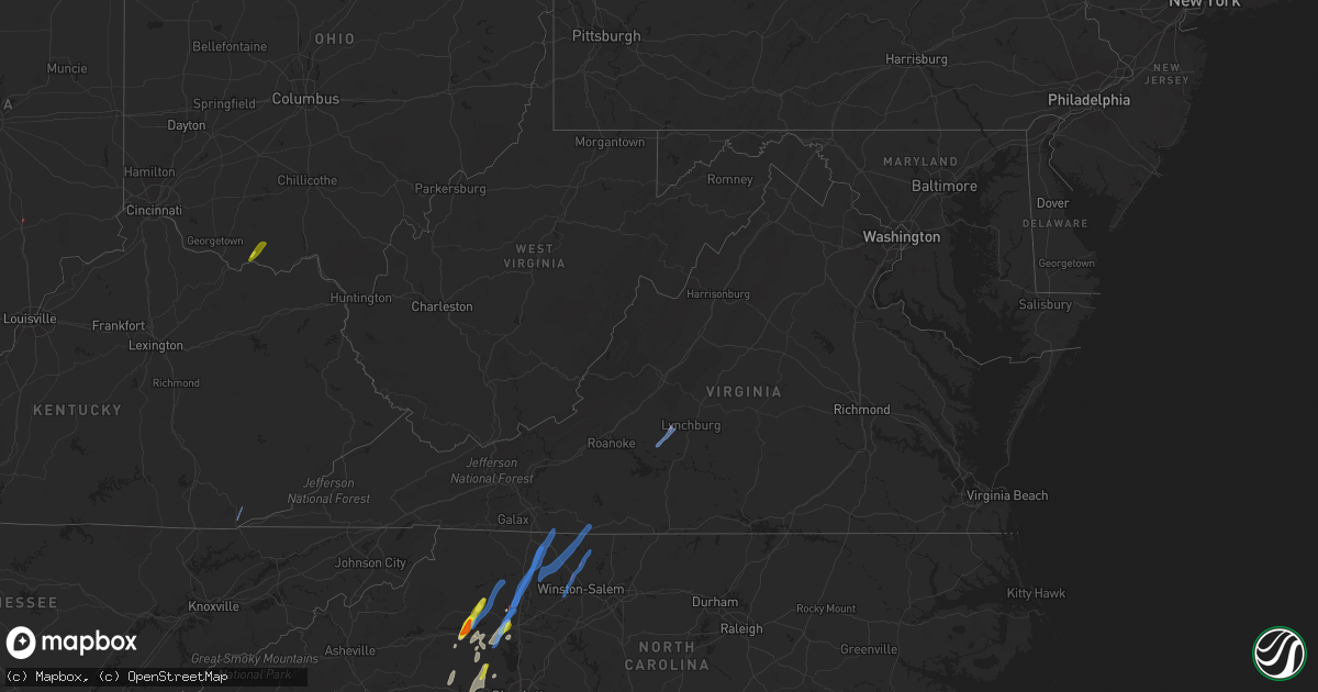
Hail Map in Virginia on May 26, 2022
Get this storm
May 26 map
$229
one time, instant access
Download today. No call, no setup
Keep the $229
Bought the map and want the full workflow? Apply the entire $229 to a subscription within 7 days. None of it is wasted.
Every map, not just this one
This buys you this map. Subscription and you get every map we run, in the markets you choose from a few cities to whole states to nationwide. Plus real-time alerts the moment a storm fires.
Contact data
Name, contact info, occupancy, even credit band for addresses in the footprint. You go from where it hit to who to call.
Become the source they trust
Unlimited branding weather history reports on demand. You already have the documented answer ready for the property owner, and you are the one who showed up with it.
Property data and RoofTrace estimates
Pull up any address you have got, its value and the exact code rules for that jurisdiction, straight from One Click Code. Then RoofTrace estimates the squares, pitch, and roof value, priced the way you price.
Storm reports in Virginia
Virginia
| Date | Description |
|---|---|
| 05/26/20226:58 AM CDT | One tree down across the road due to thunderstorm winds along the 700 block of david giles lane. |
| 05/26/20226:47 AM CDT | One tree down due to thunderstorm winds along the 850 block of pinecroft road. |
| 05/26/20226:44 AM CDT | One tree down due to thunderstorm winds at the intersection of deerfield lane and keswick drive. |
| 05/26/20226:42 AM CDT | One tree down across the road due to thunderstorm winds along the 2600 block of moorfield bridge road. |
| 05/26/20226:39 AM CDT | One tree down due to thunderstorm winds along the 1600 block of loomfixer lake road. |
| 05/26/20226:25 AM CDT | Corrects previous tstm wnd dmg report from 2 ne goode. Damage to at least 20 homes... 2 mobile homes destroyed... And numerous trees uprooted in the area of langford ln |
| 05/26/20226:25 AM CDT | *** 3 inj *** corrects previous tstm wnd dmg report from 2 ne goode. Damage to at least 20 homes... 2 mobile homes destroyed... And numerous trees uprooted in the area |
| 05/26/20226:25 AM CDT | Damage to residences... Trees... And power lines in the area of langford ln... Bethany church circle/crockett. Time estimated from radar. |
| 05/26/20226:07 AM CDT | At 1106 PM EDT, severe thunderstorms were located along a line extending from Montvale to Moneta to near Sago, moving northeast at 45 mph. HAZARD...60 mph wind gusts. SOURCE...Radar indicated. IMPACT...Expect damage to roofs, siding, and trees. Locations impacted include... Lynchburg... Lexington... Buena Vista... Bedford... Altavista... Amherst... and Hurt.This includes The following Locations VMI, Liberty University, TheNational D-Day Memorial, and Lynchburg Airport. |
| 05/26/20223:30 AM CDT | Corrects previous tstm wnd dmg report from villa heights. 1 tree down on power line on english rd. Time estimated from radar. |
| 05/26/20223:29 AM CDT | Corrects previous tstm wnd dmg report from 1 nw collinsville. 1 tree fell on powerline... Tree and powerline down in roadway on seminole drive. |
| 05/26/20223:20 AM CDT | At 820 PM EDT, a severe thunderstorm was located near Love Valley, or 12 miles south of Ronda, moving northeast at 35 mph. HAZARD...60 mph wind gusts. SOURCE...Radar indicated. IMPACT...Expect damage to roofs, siding, and trees. Locations impacted include... Mount Airy... Elkin... Fairview... Flat Rock... Yadkinville... Jonesville... and Dobson. |
| 05/26/20223:15 AM CDT | Corrects previous tstm wnd dmg report from 3 wsw fieldale. 1 tree down at intersection of wingfield orchard rd and stones diary rd. |
| 05/25/202210:33 PM CDT | 1 tree down in 200 block of arcadia rd. Time estimated from radar. |
| 05/25/202210:25 PM CDT | One tree down. |
| 05/25/20229:36 PM CDT | 1 tree down on power line. Time estimated from radar. |
| 05/25/20229:24 PM CDT | 1 tree fell on powerline... Tree and powerline down in roadway on seminole drive. Time estimated from radar. |
| 05/25/20229:18 PM CDT | Telephone lines down. Time estimated from radar. |
| 05/25/20229:06 PM CDT | 1 tree down at intersection of wingfield orchard rd and stones diary rd. Time estimated from radar. |
| 05/25/20228:35 PM CDT | Six trees down along route 103. Time estimated from radar. |
| 05/25/20228:35 PM CDT | 1 tree down on cox ridge rd. Time estimated from radar. |
| 05/25/20228:23 PM CDT | 1 tree down in laurel fork. |
| 05/25/20228:13 PM CDT | 1 tree down on kinzer rd. Time estimated from radar. |
| 05/25/20228:05 PM CDT | 1 tree down in fancy gap. Time estimated from radar. |
| 05/25/20227:53 PM CDT | 1 tree down along newbern rd. Time estimated from radar. |
| 05/25/20227:51 PM CDT | 1 tree down on allen street. Time estimated from radar. |
| 05/25/20227:47 PM CDT | 1 tree down on chestnut ridge rd. Time estimated from radar. |
All States Impacted by Hail Map on May 26, 2022
Cities Impacted by Hail Map on May 26, 2022
- Bessemer City, NC
- Dallas, NC
- Lincolnton, NC
- Newton, NC
- Fort Atkinson, WI
- Marshall, WI
- Shelby, NC
- Lawndale, NC
- Jefferson, WI
- Johnson Creek, WI
- Hickory, NC
- Granite Falls, NC
- Connelly Springs, NC
- Hildebran, NC
- Taylorsville, NC
- Havana, IL
- Kilbourne, IL
- Oconomowoc, WI
- Watertown, WI
- Sullivan, WI
- Ixonia, WI
- Helenville, WI
- Adrian, GA
- Stanley, NC
- Iron Station, NC
- Alexis, NC
- Maiden, NC
- Vale, NC
- Janesville, WI
- Oblong, IL
- Willow Hill, IL
- Statesville, NC
- Stony Point, NC
- West Union, OH
- Manchester, OH
- Fox Lake, WI
- Beaver Dam, WI
- Hiddenite, NC
- Berwick, IL
- Avon, IL
- Roseville, IL
- Alexis, IL
- Gerlaw, IL
- Monmouth, IL
- Good Hope, IL
- Cameron, IL
- Paris, IL
- Gaffney, SC
- Blacksburg, SC
- Clinton, IN
- Martinsville, IL
- Marshall, IL
- Dennison, IL
- Vermilion, IL
- Catawba, NC
- Eldridge, IA
- Kings Mountain, NC
- Gastonia, NC
- Milton, WI
- West Terre Haute, IN
- Manito, IL
- Forest City, IL
- Topeka, IL
- Davenport, IA
- Chandlerville, IL
- Oakford, IL
- Liverpool, IL
- Lewistown, IL
- Cambridge, WI
- Edgerton, WI
- Grover, NC
- Conover, NC
- Claremont, NC
- Griggsville, IL
- Stoughton, WI
- Ashland, IL
- Lynchburg, VA
- Forest, VA
- Bedford, VA
- Goode, VA
- Moravian Falls, NC
- Wilkesboro, NC
- Roaring River, NC
- North Wilkesboro, NC
- Harmony, NC
- Ararat, VA
- Union Grove, NC
- Ararat, NC
- Hamptonville, NC
- Jonesville, NC
- Mount Airy, NC
- Dobson, NC
- Claudville, VA
- Boonville, NC
- Olin, NC
- Yadkinville, NC
- Elkin, NC
- Pilot Mountain, NC
- Tobaccoville, NC
- Pinnacle, NC
- Stuart, VA
- Lawsonville, NC
- Westfield, NC
- Spencer, VA
- Critz, VA
- Danbury, NC
- King, NC
- East Bend, NC
- Siloam, NC
- Clemmons, NC
- Winston Salem, NC
- Rural Hall, NC
- Lewisville, NC
- Pfafftown, NC
- Walnut Cove, NC
- Germanton, NC
- Pineville, KY
- Middlesboro, KY
- Seymour, IN
- Bloomingdale, IN
- Montezuma, IN
- Kingman, IN
- Waynetown, IN
- Shannon, IL
- Blue Creek, OH
- Peebles, OH
- Jewell, GA
- Norwood, GA
- Warrenton, GA
- Tennille, GA
- Sparta, GA
- Sandersville, GA
- Warthen, GA
- Mitchell, GA


