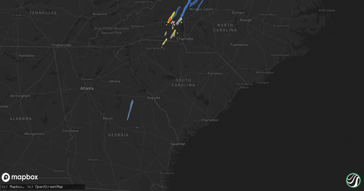
Hail Map in South Carolina on May 26, 2022
Get this storm
May 26 map
$229
one time, instant access
Download today. No call, no setup
Keep the $229
Bought the map and want the full workflow? Apply the entire $229 to a subscription within 7 days. None of it is wasted.
Every map, not just this one
This buys you this map. Subscription and you get every map we run, in the markets you choose from a few cities to whole states to nationwide. Plus real-time alerts the moment a storm fires.
Contact data
Name, contact info, occupancy, even credit band for addresses in the footprint. You go from where it hit to who to call.
Become the source they trust
Unlimited branding weather history reports on demand. You already have the documented answer ready for the property owner, and you are the one who showed up with it.
Property data and RoofTrace estimates
Pull up any address you have got, its value and the exact code rules for that jurisdiction, straight from One Click Code. Then RoofTrace estimates the squares, pitch, and roof value, priced the way you price.
Storm reports in South Carolina
South Carolina
| Date | Description |
|---|---|
| 05/26/20225:02 PM CDT | Multiple trees down. |
| 05/26/20224:22 PM CDT | Quarter size hail. |
| 05/26/20224:10 PM CDT | Multiple trees blown down. |
| 05/26/20224:10 PM CDT | Tree down on car at blacksburg hwy and blackwell rd. |
| 05/26/20224:04 PM CDT | Mccormick dispatch reported trees down on country club dr at hwy 7. Time estimated by radar. |
| 05/26/20223:50 PM CDT | Tree fell on a house. |
| 05/26/20223:50 PM CDT | *** 1 fatal *** corrects previous tstm wnd dmg report from 1 ese gaffney. Occupant died when tree fell on house. |
| 05/26/20224:16 AM CDT | Social media photos show a downed tree near the intersection of park st. |
| 05/26/20223:45 AM CDT | At 845 PM EDT, severe thunderstorms were located along a line extending from 6 miles south of Yadkinville to 7 miles west of Mocksville to 9 miles north of Huntersville to 11 miles southwest of Uptown Charlotte, moving northeast at 30 mph. HAZARD...60 mph wind gusts and quarter size hail. SOURCE...Radar indicated. IMPACT...Minor hail damage to vehicles is expected. Expect wind damage to trees and power lines. Locations impacted include... Uptown Charlotte, Huntersville, Kannapolis, Downtown Concord, Salisbury, Statesville, Mocksville, Central Charlotte, Northeast Charlotte and Southwest Charlotte. |
| 05/26/202212:29 AM CDT | At 528 PM EDT, a severe thunderstorm was located 9 miles southeast of Shelby, or over Grover, moving northeast at 15 mph. HAZARD...60 mph wind gusts and quarter size hail. SOURCE...Radar indicated. IMPACT...Minor hail damage to vehicles is expected. Expect wind damage to trees and power lines. Locations impacted include... Kings Mountain, Cherryville, Bessemer City, Dallas, Grover, Patterson Springs, Waco, Earl, Kings Mountain State Park and Crowders Mountain State Park. |
| 05/25/202211:48 PM CDT | At 448 PM EDT, severe thunderstorms were located along a line extending from near Lincolnton to near Mistletoe State Park, moving northeast at 40 mph. HAZARD...60 mph wind gusts. SOURCE...Radar indicated. IMPACT...Expect damage to trees and powerlines. Locations impacted include... McCormick, Lincolnton, Elijah Clark State Park, Mistletoe State Park, Mccormick County Airport, Parksville, Plum Branch, Bordeaux, Winfield, Knox Scout Reservation, Double Branches, Curry Hill, New Hope, Long Cane Creek Picnic Area, Hickory Knob State Resort Park, Loce, Hester's Ferry Campground, Leah, Mount Carmel and Baker Creek State Park. |
All States Impacted by Hail Map on May 26, 2022
Cities Impacted by Hail Map on May 26, 2022
- Bessemer City, NC
- Dallas, NC
- Lincolnton, NC
- Newton, NC
- Fort Atkinson, WI
- Marshall, WI
- Shelby, NC
- Lawndale, NC
- Jefferson, WI
- Johnson Creek, WI
- Hickory, NC
- Granite Falls, NC
- Connelly Springs, NC
- Hildebran, NC
- Taylorsville, NC
- Havana, IL
- Kilbourne, IL
- Oconomowoc, WI
- Watertown, WI
- Sullivan, WI
- Ixonia, WI
- Helenville, WI
- Adrian, GA
- Stanley, NC
- Iron Station, NC
- Alexis, NC
- Maiden, NC
- Vale, NC
- Janesville, WI
- Oblong, IL
- Willow Hill, IL
- Statesville, NC
- Stony Point, NC
- West Union, OH
- Manchester, OH
- Fox Lake, WI
- Beaver Dam, WI
- Hiddenite, NC
- Berwick, IL
- Avon, IL
- Roseville, IL
- Alexis, IL
- Gerlaw, IL
- Monmouth, IL
- Good Hope, IL
- Cameron, IL
- Paris, IL
- Gaffney, SC
- Blacksburg, SC
- Clinton, IN
- Martinsville, IL
- Marshall, IL
- Dennison, IL
- Vermilion, IL
- Catawba, NC
- Eldridge, IA
- Kings Mountain, NC
- Gastonia, NC
- Milton, WI
- West Terre Haute, IN
- Manito, IL
- Forest City, IL
- Topeka, IL
- Davenport, IA
- Chandlerville, IL
- Oakford, IL
- Liverpool, IL
- Lewistown, IL
- Cambridge, WI
- Edgerton, WI
- Grover, NC
- Conover, NC
- Claremont, NC
- Griggsville, IL
- Stoughton, WI
- Ashland, IL
- Lynchburg, VA
- Forest, VA
- Bedford, VA
- Goode, VA
- Moravian Falls, NC
- Wilkesboro, NC
- Roaring River, NC
- North Wilkesboro, NC
- Harmony, NC
- Ararat, VA
- Union Grove, NC
- Ararat, NC
- Hamptonville, NC
- Jonesville, NC
- Mount Airy, NC
- Dobson, NC
- Claudville, VA
- Boonville, NC
- Olin, NC
- Yadkinville, NC
- Elkin, NC
- Pilot Mountain, NC
- Tobaccoville, NC
- Pinnacle, NC
- Stuart, VA
- Lawsonville, NC
- Westfield, NC
- Spencer, VA
- Critz, VA
- Danbury, NC
- King, NC
- East Bend, NC
- Siloam, NC
- Clemmons, NC
- Winston Salem, NC
- Rural Hall, NC
- Lewisville, NC
- Pfafftown, NC
- Walnut Cove, NC
- Germanton, NC
- Pineville, KY
- Middlesboro, KY
- Seymour, IN
- Bloomingdale, IN
- Montezuma, IN
- Kingman, IN
- Waynetown, IN
- Shannon, IL
- Blue Creek, OH
- Peebles, OH
- Jewell, GA
- Norwood, GA
- Warrenton, GA
- Tennille, GA
- Sparta, GA
- Sandersville, GA
- Warthen, GA
- Mitchell, GA


