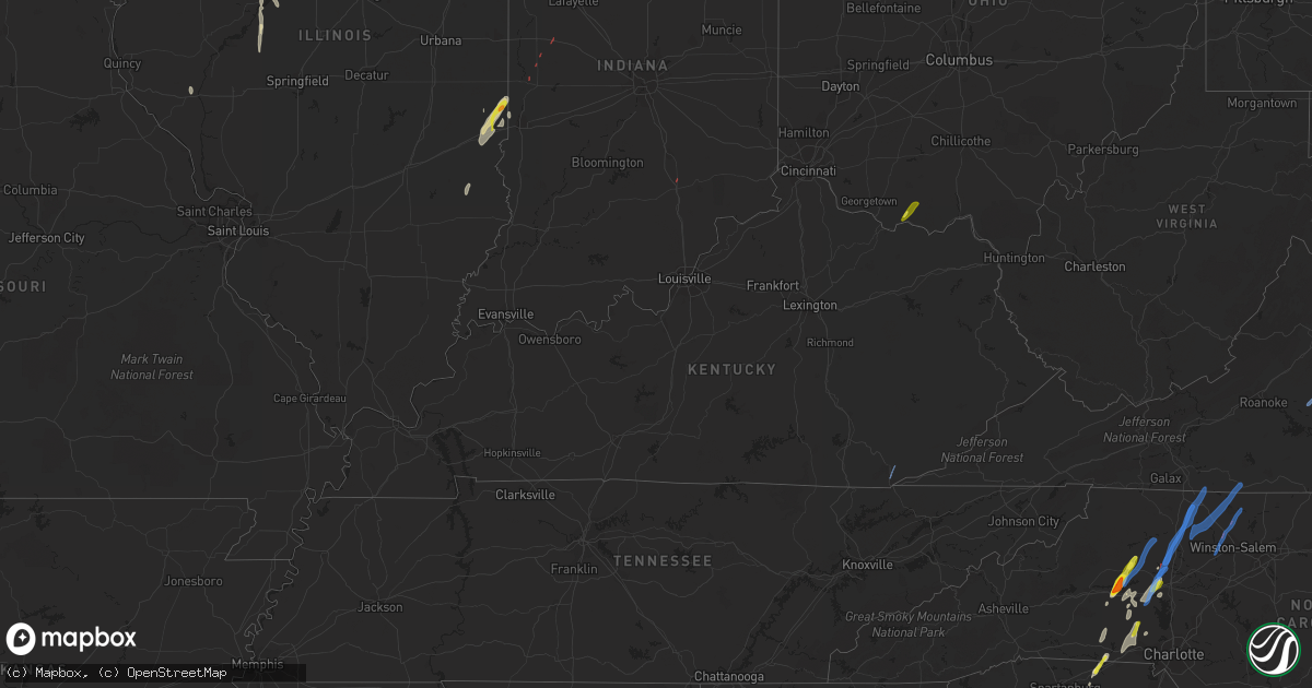
Hail Map in Kentucky on May 26, 2022
Get this storm
May 26 map
$229
one time, instant access
Download today. No call, no setup
Keep the $229
Bought the map and want the full workflow? Apply the entire $229 to a subscription within 7 days. None of it is wasted.
Every map, not just this one
This buys you this map. Subscription and you get every map we run, in the markets you choose from a few cities to whole states to nationwide. Plus real-time alerts the moment a storm fires.
Contact data
Name, contact info, occupancy, even credit band for addresses in the footprint. You go from where it hit to who to call.
Become the source they trust
Unlimited branding weather history reports on demand. You already have the documented answer ready for the property owner, and you are the one who showed up with it.
Property data and RoofTrace estimates
Pull up any address you have got, its value and the exact code rules for that jurisdiction, straight from One Click Code. Then RoofTrace estimates the squares, pitch, and roof value, priced the way you price.
Storm reports in Kentucky
Kentucky
| Date | Description |
|---|---|
| 05/26/20226:50 PM CDT | An ef1 tornado touched down on little white oak road uprooting several trees... And tearing off a large section of the roof of a home and destroying the adjacent garage |
| 05/26/20225:23 PM CDT | Tree knocked down at 14 east water street. |
| 05/26/20225:06 PM CDT | Tree limbs were reported to have been blown down in the vicinity of the intersection of camargo levee road and welch road and the highway department had been called to |
| 05/26/20224:58 PM CDT | Tree knocked down near intersection of state routes 213 and 1057. |
| 05/26/20224:57 PM CDT | Tree limbs were reported to have been blown down onto kidville road and the highway department was called to removed them from the roadway. |
| 05/26/20224:51 PM CDT | A tree was reported down to local dispatch. |
| 05/26/20224:45 PM CDT | A tree was reported down on log lick road to county dispatch. Time estimated from radar. |
| 05/26/20224:27 PM CDT | State highway garage reported a tree down along state highway 2011 at 2.5 mile marker. |
| 05/26/20224:19 PM CDT | Emergency manager reports trees down in the pilot knob area. Time estimated from radar. |
| 05/26/20224:16 PM CDT | Emergency manager reports tree down on peytontown road. Time estimated from radar. |
| 05/26/20224:07 PM CDT | A large tree was blown down on bluetick road and reported via a picture on social media. |
| 05/26/20224:02 PM CDT | Reports of trees down. |
| 05/26/20224:02 PM CDT | A tree was reported to have been blown down along north wilderness road a little north of mount vernon. |
| 05/26/20223:58 PM CDT | State highway garage reported a tree down along ky state rt. 188 at 1.7 mile marker. |
| 05/26/20223:53 PM CDT | Lincoln county emergency manager reported trees down and shingle damage near us 150 and boone road. |
| 05/26/20223:47 PM CDT | A tree was blown down along bandy road. |
| 05/26/20223:38 PM CDT | Reports of trees down. |
| 05/26/20223:32 PM CDT | Trees were reported to have been blow down onto powerlines on etna road. |
| 05/26/20223:28 PM CDT | Reports of trees down. |
| 05/26/20223:26 PM CDT | Report from mping: tree damage such as uprooted or snapped trees. |
| 05/26/20223:12 PM CDT | A tree was reported to have been blown down on webster drive in the city of monticello. |
| 05/26/20222:59 PM CDT | A tree was reported to have been blown down on ky highway 789 near ramseys point road and the highway department was called to remove the tree from the roadway. |
| 05/26/20222:46 PM CDT | Reports of power line down at the state park entrance. |
| 05/26/20222:37 PM CDT | Trees down blocking the 52 mile marker on the cumberland parkway. |
| 05/26/20222:37 PM CDT | Trees down at mm 56 cumberland parkway... Corrects location from previous report 2 ese columbia. |
| 05/26/20222:04 AM CDT | At 704 PM EDT/604 PM CDT/, a severe thunderstorm was located 14 miles southwest of Carefree Town, moving northeast at 55 mph. HAZARD...60 mph wind gusts. SOURCE...Radar indicated. IMPACT...Expect damage to roofs, siding, and trees. This severe thunderstorm will be near... Carefree Town around 720 PM EDT. |
| 05/26/202212:56 AM CDT | At 556 PM EDT, a severe thunderstorm was located over Lewisburg, moving northeast at 30 mph. HAZARD...60 mph wind gusts. SOURCE...Radar indicated. IMPACT...Expect damage to trees and power lines. Locations impacted include... Maysville, Washington, West Union, Manchester, Aberdeen, Winchester, Lewisburg, Tollesboro, Decatur, Cherry Fork, Concord, Trinity, Murphysville, Bradysville, Mays Lick, Rectorville, Ribolt, Peed, Bentonville and Helena. |
| 05/26/202212:56 AM CDT | At 556 PM EDT, severe thunderstorms were located along a line extending from Sideview to near Westbend to Shade, moving east at 30 mph. HAZARD...60 mph wind gusts. SOURCE...Radar indicated. IMPACT...Expect damage to roofs, siding, and trees. Severe thunderstorms will be near... Camargo around 605 PM EDT. Jeffersonville around 610 PM EDT. Zachariah around 615 PM EDT.Other locations in the path of these severe thunderstorms includeReynoldsville and Pine Ridge. |
| 05/26/202212:44 AM CDT | At 543 PM EDT, a severe thunderstorm was located near Winchester, moving northeast at 35 mph. HAZARD...60 mph wind gusts. SOURCE...Radar indicated. IMPACT...Expect damage to roofs, siding, and trees. This severe thunderstorm will remain over mainly rural areas of Clark and southeastern Bourbon Counties, including the following locations... Goffs Corner, Pretty Run, Rightangle, Constant Station, Lyndale, Mina, Bunker Hill, Agawam, Ruckerville and Hunt. |
| 05/26/202212:32 AM CDT | At 532 PM EDT, a severe thunderstorm was located near Maysville, moving northeast at 35 mph. HAZARD...60 mph wind gusts. SOURCE...Radar indicated. IMPACT...Expect damage to trees and power lines. Locations impacted include... Maysville, West Union, Manchester, Aberdeen, Decatur, Cherry Fork, Bentonville, Trinity, Dunkinsville, Bradysville, State Route 348 at State Route 125 and Cedar Mills. |
| 05/26/202212:31 AM CDT | At 531 PM EDT, a severe thunderstorm was located near Carlisle, moving northeast at 35 mph. HAZARD...60 mph wind gusts. SOURCE...Radar indicated. IMPACT...Expect damage to roofs, siding, and trees. This severe thunderstorm will remain over mainly rural areas of northeastern Nicholas County, including the following locations... Sprout, Weston, Moorefield, Pleasant Valley and Myers. |
| 05/26/202212:21 AM CDT | At 520 PM EDT, severe thunderstorms were located along a line extending from 8 miles northwest of Richmond to near Locust Branch, moving east at 45 mph. HAZARD...60 mph wind gusts. SOURCE...Radar indicated. IMPACT...Expect damage to roofs, siding, and trees. Severe thunderstorms will be near... Winchester and Harris Ferry around 540 PM EDT. |
| 05/26/202212:19 AM CDT | At 519 PM EDT, a severe thunderstorm was located near Sharpsburg, or 13 miles north of Mount Sterling, moving northeast at 45 mph. HAZARD...60 mph wind gusts. SOURCE...Radar indicated. IMPACT...Expect damage to roofs, siding, and trees. This severe thunderstorm will be near... Pecks Ridge around 535 PM EDT.Other locations in the path of this severe thunderstorm includeCraintown, Flemingsburg and Mount Carmel. |
| 05/26/202212:04 AM CDT | At 503 PM EDT, a severe thunderstorm was located near Sideview, moving northeast at 45 mph. HAZARD...60 mph wind gusts. SOURCE...Radar indicated. IMPACT...Expect damage to roofs, siding, and trees. Locations impacted include... Carlisle. |
| 05/26/202212:01 AM CDT | At 500 PM EDT, a severe thunderstorm was located near Lancaster, moving northeast at 45 mph. HAZARD...60 mph wind gusts. SOURCE...Radar indicated. IMPACT...Expect damage to roofs, siding, and trees. This severe thunderstorm will be near... Richmond around 520 PM EDT. |
| 05/25/202211:44 PM CDT | At 444 PM EDT, a severe thunderstorm was located near Stanford, moving northeast at 45 mph. HAZARD...60 mph wind gusts. SOURCE...Radar indicated. IMPACT...Expect damage to roofs, siding, and trees. This severe thunderstorm will be near... Lancaster around 500 PM EDT.Other locations in the path of this severe thunderstorm includeRichmond. |
| 05/25/202211:39 PM CDT | At 439 PM EDT, severe thunderstorms were located along a line extending from near Gum Sulphur to Valley Oak to Elihu, moving northeast at 45 mph. HAZARD...60 mph wind gusts. SOURCE...Radar indicated. IMPACT...Expect damage to roofs, siding, and trees. Severe thunderstorms will be near... Hansford around 450 PM EDT. Sand Springs around 455 PM EDT.Other locations in the path of these severe thunderstorms includeBurr, Dudley Station and Sand Hill. |
| 05/25/202211:11 PM CDT | At 411 PM EDT, severe thunderstorms were located along a line extending from near Magnum to Faubush to Monticello, moving northeast at 60 mph. HAZARD...60 mph wind gusts. Small hail is also possible. SOURCE...Radar indicated. IMPACT...Expect damage to roofs, siding, and trees. Severe thunderstorms will be near... Pointer around 415 PM EDT. Hogue around 420 PM EDT. Science Hill around 425 PM EDT. Somerset Pulaski Airport around 430 PM EDT.Other locations in the path of these severe thunderstorms include BeeLick and Dabney. |
| 05/25/202210:44 PM CDT | At 344 PM EDT, severe thunderstorms were located along a line extending from 9 miles south of Columbia to near Cabell to near Albany, moving northeast at 50 mph. HAZARD...70 mph wind gusts and quarter size hail. SOURCE...Radar indicated. IMPACT...Hail damage to vehicles is expected. Expect considerable tree damage. Wind damage is also likely to mobile homes, roofs, and outbuildings. Severe thunderstorms will be near... Zula around 355 PM EDT. Cabell around 400 PM EDT.Other locations in the path of these severe thunderstorms includeParnell and Magnum. |
| 05/25/20229:54 PM CDT | At 253 PM CDT, a severe thunderstorm was located over Jamestown, moving northeast at 50 mph. HAZARD...60 mph wind gusts. SOURCE...Radar indicated. IMPACT...Expect damage to roofs, siding, and trees. This severe thunderstorm will remain over mainly rural areas of east central Russell County, including the following locations... Jabez, Ono, Vinnie, Eli, Whittle, Rose Crossroads, Karlus, Esto and Russell Springs. |
All States Impacted by Hail Map on May 26, 2022
Cities Impacted by Hail Map on May 26, 2022
- Bessemer City, NC
- Dallas, NC
- Lincolnton, NC
- Newton, NC
- Fort Atkinson, WI
- Marshall, WI
- Shelby, NC
- Lawndale, NC
- Jefferson, WI
- Johnson Creek, WI
- Hickory, NC
- Granite Falls, NC
- Connelly Springs, NC
- Hildebran, NC
- Taylorsville, NC
- Havana, IL
- Kilbourne, IL
- Oconomowoc, WI
- Watertown, WI
- Sullivan, WI
- Ixonia, WI
- Helenville, WI
- Adrian, GA
- Stanley, NC
- Iron Station, NC
- Alexis, NC
- Maiden, NC
- Vale, NC
- Janesville, WI
- Oblong, IL
- Willow Hill, IL
- Statesville, NC
- Stony Point, NC
- West Union, OH
- Manchester, OH
- Fox Lake, WI
- Beaver Dam, WI
- Hiddenite, NC
- Berwick, IL
- Avon, IL
- Roseville, IL
- Alexis, IL
- Gerlaw, IL
- Monmouth, IL
- Good Hope, IL
- Cameron, IL
- Paris, IL
- Gaffney, SC
- Blacksburg, SC
- Clinton, IN
- Martinsville, IL
- Marshall, IL
- Dennison, IL
- Vermilion, IL
- Catawba, NC
- Eldridge, IA
- Kings Mountain, NC
- Gastonia, NC
- Milton, WI
- West Terre Haute, IN
- Manito, IL
- Forest City, IL
- Topeka, IL
- Davenport, IA
- Chandlerville, IL
- Oakford, IL
- Liverpool, IL
- Lewistown, IL
- Cambridge, WI
- Edgerton, WI
- Grover, NC
- Conover, NC
- Claremont, NC
- Griggsville, IL
- Stoughton, WI
- Ashland, IL
- Lynchburg, VA
- Forest, VA
- Bedford, VA
- Goode, VA
- Moravian Falls, NC
- Wilkesboro, NC
- Roaring River, NC
- North Wilkesboro, NC
- Harmony, NC
- Ararat, VA
- Union Grove, NC
- Ararat, NC
- Hamptonville, NC
- Jonesville, NC
- Mount Airy, NC
- Dobson, NC
- Claudville, VA
- Boonville, NC
- Olin, NC
- Yadkinville, NC
- Elkin, NC
- Pilot Mountain, NC
- Tobaccoville, NC
- Pinnacle, NC
- Stuart, VA
- Lawsonville, NC
- Westfield, NC
- Spencer, VA
- Critz, VA
- Danbury, NC
- King, NC
- East Bend, NC
- Siloam, NC
- Clemmons, NC
- Winston Salem, NC
- Rural Hall, NC
- Lewisville, NC
- Pfafftown, NC
- Walnut Cove, NC
- Germanton, NC
- Pineville, KY
- Middlesboro, KY
- Seymour, IN
- Bloomingdale, IN
- Montezuma, IN
- Kingman, IN
- Waynetown, IN
- Shannon, IL
- Blue Creek, OH
- Peebles, OH
- Jewell, GA
- Norwood, GA
- Warrenton, GA
- Tennille, GA
- Sparta, GA
- Sandersville, GA
- Warthen, GA
- Mitchell, GA


