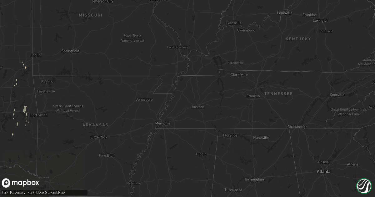
Hail Map in Oklahoma on May 19, 2011
Get this storm
May 19 map
$229
one time, instant access
Download today. No call, no setup
Keep the $229
Bought the map and want the full workflow? Apply the entire $229 to a subscription within 7 days. None of it is wasted.
Every map, not just this one
This buys you this map. Subscription and you get every map we run, in the markets you choose from a few cities to whole states to nationwide. Plus real-time alerts the moment a storm fires.
Contact data
Name, contact info, occupancy, even credit band for addresses in the footprint. You go from where it hit to who to call.
Become the source they trust
Unlimited branding weather history reports on demand. You already have the documented answer ready for the property owner, and you are the one who showed up with it.
Property data and RoofTrace estimates
Pull up any address you have got, its value and the exact code rules for that jurisdiction, straight from One Click Code. Then RoofTrace estimates the squares, pitch, and roof value, priced the way you price.
Storm reports in Oklahoma
Oklahoma
| Date | Description |
|---|---|
| 05/19/20116:20 PM CDT | A local report indicates 59 MPH wind near FORT COBB |
| 05/19/20116:10 PM CDT | Two meteorologists observed a brief tornado that lasted less than one minute. |
| 05/19/20115:10 PM CDT | Report via ham radio. |
| 05/19/20114:49 PM CDT | Hwys 115/19 |
| 05/19/20114:39 PM CDT | Hwys 19/54 |
| 05/19/20114:11 PM CDT | Hail was beginning to cover the road. |
| 05/19/20113:38 PM CDT | A local report indicates 1.25 inch wind near 4 W PLAINVIEW |
| 05/19/20113:13 PM CDT | A local report indicates 1.50 inch wind near BLAIR |
| 05/19/20112:39 PM CDT | A local report indicates 1.75 inch wind near 3 W DUKE |
| 05/19/20112:39 PM CDT | Wildlife official reported numerous stone sizes ranging from dimes to a few ping pong ball sized stones. |
| 05/19/20112:15 PM CDT | A local report indicates 1.75 inch wind near 6 S HAMMON |
| 05/19/20112:14 PM CDT | A local report indicates 1.00 inch wind near 4 W MARTHA |
| 05/19/20112:11 PM CDT | A local report indicates 1.75 inch wind near 4 S HAMMON |
| 05/19/20111:40 PM CDT | A local report indicates 1.75 inch wind near ELDORADO |
| 05/19/20111:35 PM CDT | A local report indicates 1.00 inch wind near 4 N SAYRE |
| 05/19/20115:00 AM CDT | Thunderstorm wind damage near southeast 47th and shields in oklahoma city. |
| 05/18/201111:44 PM CDT | A local report indicates 58 MPH wind near WILL ROGERS AIRPORT |
| 05/18/20119:37 PM CDT | A local report indicates 1.00 inch wind near LAWTON |
| 05/18/20119:15 PM CDT | Delayed report of power poles down in the chattanooga area. Time estimated. |
| 05/18/20119:10 PM CDT | A local report indicates 2.75 inch wind near CHATTANOOGA |
| 05/18/20118:25 PM CDT | A local report indicates 1.75 inch wind near 6 SW FREDERICK |
| 05/18/20117:50 PM CDT | A local report indicates 1.00 inch wind near 3 W TUTTLE |
| 05/18/20117:25 PM CDT | A local report indicates 1.75 inch wind near 1 N DAVIDSON |
All States Impacted by Hail Map on May 19, 2011
Cities Impacted by Hail Map on May 19, 2011
- Wahoo, NE
- Saint Francis, KS
- Rush Center, KS
- Larned, KS
- Bison, KS
- La Crosse, KS
- Nekoma, KS
- Rozel, KS
- Elk City, OK
- Hammon, OK
- Butler, OK
- Sheffield, TX
- Fort Stockton, TX
- Iraan, TX
- Dryden, TX
- Smith Center, KS
- Gaylord, KS
- Lebanon, KS
- Vernon, TX
- Mason City, NE
- Camden Wyoming, DE
- Hartly, DE
- Dover, DE
- Waldo, KS
- Paradise, KS
- Great Bend, KS
- Gail, TX
- Ackerly, TX
- Hunter, KS
- Sylvan Grove, KS
- Barnard, KS
- Lucas, KS
- Lincoln, KS
- Leedey, OK
- Ansley, NE
- Woodston, KS
- Haviland, KS
- Clyde, KS
- Concordia, KS
- Aurora, KS
- Miltonvale, KS
- Canute, OK
- Foss, OK
- Hampton, NJ
- Pittstown, NJ
- Spearville, KS
- Wright, KS
- Ford, KS
- Dodge City, KS
- Minneola, KS
- Jansen, NE
- Fairbury, NE
- Russell, KS
- Big Spring, TX
- Tescott, KS
- Delphos, KS
- Minneapolis, KS
- Beverly, KS
- Burdett, KS
- Altus, OK
- Duke, OK
- Olustee, OK
- Blair, OK
- Hallam, NE
- Clatonia, NE
- Mohnton, PA
- Reading, PA
- Plainville, KS
- Spivey, KS
- Childress, TX
- Paducah, TX
- Faxon, OK
- Loveland, OK
- Chattanooga, OK
- Grandfield, OK
- Walters, OK
- Cache, OK
- Midland, TX
- Magnolia, DE
- Dover Afb, DE
- Freedom, OK
- Coldwater, KS
- Snyder, TX
- Lawrence, NE
- Nelson, NE
- Pleasant Dale, NE
- Milford, NE
- Buffalo, OK
- Protection, KS
- Superior, NE
- Guide Rock, NE
- Gotebo, OK
- Lawton, OK
- Fort Cobb, OK
- Roosevelt, OK
- Hobart, OK
- Carnegie, OK
- Mountain Park, OK
- Headrick, OK
- Mountain View, OK
- Gould, OK
- Hollis, OK
- Anadarko, OK
- Townsend, DE
- Middletown, DE
- Raymond, KS
- Ellinwood, KS
- Chase, KS
- Hudson, KS
- St John, KS
- Lyons, KS
- Bushton, KS
- Geneseo, KS
- Garland, NE
- Knott, TX
- Odessa, TX
- Sayre, OK
- Erick, OK
- Willow, OK
- Morrowville, KS
- Pryor, OK
- Adair, OK
- Cheyenne, OK
- Hanston, KS
- Ensign, KS
- Jetmore, KS
- Montezuma, KS
- Cimarron, KS
- Chickasha, OK
- Verden, OK
- Frederick, OK
- Oklaunion, TX
- Davidson, OK
- Lincoln, NE
- Covington, OK
- Fort Morgan, CO
- Endicott, NE
- Valparaiso, NE
- Raymond, NE
- Ceresco, NE
- Ballinger, TX
- Rowena, TX
- Odell, NE
- Diller, NE
- Winters, TX
- Talpa, TX
- Kingman, KS
- Pretty Prairie, KS
- Girard, TX
- Jayton, TX
- Ninnekah, OK
- Bradley, OK
- Alex, OK
- Rotan, TX
- Eldorado, OK
- Stanton, TX
- Sentinel, OK
- Dill City, OK
- Carter, OK
- Granite, OK
- Snyder, OK
- De Witt, NE
- Scandia, KS
- Belleville, KS
- Bird City, KS
- Pleasanton, NE
- Coahoma, TX
- Tuttle, OK
- Ira, TX
- Alton, KS
- Portis, KS
- Osborne, KS
- Minco, OK
- Amherst, NE
- Riverdale, NE
- Kearney, NE
- Bennington, NE
- Omaha, NE
- Ness City, KS
- Quanah, TX
- Sutton, NE
- Dorchester, NE
- Deweese, NE
- Claflin, KS
- Hoisington, KS
- Rush Springs, OK
- Yukon, OK
- Piedmont, OK
- Macksville, KS
- Fort Supply, OK
- Mooreland, OK
- Colorado City, TX
- Westbrook, TX
- Fluvanna, TX
- Hermleigh, TX
- Beloit, KS
- Crowell, TX
- Wilber, NE
- Tobias, NE
- Novice, TX
- Bee, NE
- Dwight, NE
- Imperial, NE
- Grant, NE
- Madrid, NE
- Axtell, NE
- Fairland, OK
- Enid, OK
- Whitefield, OK
- Corn, OK
- Wakeeney, KS
- Ransom, KS
- Ogallah, KS
- Bokoshe, OK
- Keota, OK
- Murray, NE
- Plattsmouth, NE
- Colon, NE
- Cedar Bluffs, NE
- Morse Bluff, NE
- North Bend, NE
- Malmo, NE
- Pocasset, OK
- Pawnee Rock, KS
- Hollister, OK
- Dickens, TX
- Sewell, NJ
- Blackwood, NJ
- Bunker Hill, KS
- Dorrance, KS
- Ames, NE
- Hooper, NE
- Fremont, NE
- Douglas, OK
- Kingfisher, OK
- Apache, OK
- Mead, NE
- Lenorah, TX
- Seymour, TX
- Chillicothe, TX
- Tipton, OK
- Vici, OK
- Cheyenne Wells, CO
- Aspermont, TX
- Oklahoma City, OK
- Watonga, OK
- Wilburton, OK
- San Angelo, TX
- Big Lake, TX
- Mangum, OK
- Otis, KS
- Garden City, TX
- Olmitz, KS
- Wilson, KS
- Gorham, KS
- Oley, PA
- Temple, PA
- Newcastle, OK
- Gracemont, OK
- Amber, OK
- Mustang, OK
- Union City, OK
- Lone Wolf, OK
- Greensburg, KS
- Kinta, OK
- Stigler, OK
- Mccurtain, OK
- Byers, KS
- Geronimo, OK
- Camargo, OK
- Swanton, NE
- Plymouth, NE
- Clinton, OK
- Weatherford, OK
- Bessie, OK
- Cordell, OK
- Baltimore, MD
- Nottingham, MD
- Rosedale, MD
- Montross, VA
- Robert Lee, TX
- Crete, NE
- Western, NE
- Burr Oak, KS
- Mankato, KS
- Esbon, KS
- Clifton, KS
- Morganville, KS
- Belvidere, NE
- Alexandria, NE
- Rule, TX
- Canadian, TX
- Fleetwood, PA
- Scribner, NE
- Davey, NE
- Meridian, OK
- Luther, OK
- Elmer, OK
- Milford, NJ
- Asbury, NJ
- Edgar, NE
- Fairfield, NE
- Saronville, NE
- Clay Center, NE
- Sterling, NE
- Easton, MD
- Federalsburg, MD
- Preston, MD
- Milligan, NE
- Malcolm, NE
- Seward, NE
- Ochopee, FL
- Luray, KS
- Wilmore, KS
- Essex, MD
- Hennessey, OK
- Pratt, KS
- Downs, KS
- Pfeifer, KS
- Alexander, KS
- Palmer, KS
- Plains, KS
- Agenda, KS
- Glasco, KS
- Kinsley, KS
- Linn, KS
- Albert, KS
- Fowler, KS
- Simpson, KS
- Carney, OK
- Ellis, KS
- Miles, TX
- Harrah, OK
- Marlow, OK
- Elgin, OK
- Middle River, MD
- Perry Hall, MD
- Braddyville, IA
- Clarinda, IA
- Cedar, KS
- Natoma, KS
- Ong, NE
- Norwich, KS
- Harper, KS
- Hollenberg, KS
- Spur, TX
- Hubbell, NE
- Munden, KS
- Narka, KS
- Woodward, OK
- El Reno, OK
- Binger, OK
- Hinton, OK
- Cuba, KS
- Newalla, OK
- Wellston, OK
- Mcloud, OK
- Shamrock, TX
- Wellington, TX
- Vinson, OK
- Bronte, TX
- Sicklerville, NJ
- Ozona, TX
- Mertzon, TX
- Barnhart, TX
- Belvidere, NJ
- Oxford, NJ
- Exeter, NE
- Windom, KS
- Midkiff, TX
- Rising City, NE
- David City, NE
- Ulysses, NE
- Porum, OK
- Warner, OK
- Phillipsburg, NJ
- Stewartsville, NJ
- Comstock, TX
- Chatsworth, NJ
- Vincentown, NJ
- Egg Harbor City, NJ
- Jones, OK
- Arapahoe, CO
- Penokee, KS
- Eldorado, TX
- Haddam, KS
- Crescent, OK
- Washington, KS
- Choctaw, OK
- Meeker, OK
- Elsie, NE
- Funk, NE
- Indiahoma, OK
- Devol, OK
- Akron, CO
- Friend, NE
- Arcadia, NE
- Clearmont, MO
- Gresham, NE
- Surprise, NE
- Ohiowa, NE
- Anton, CO
- Denton, NE
- Martell, NE
- Paxton, NE
- Taloga, OK
- Hebron, NE
- Post, TX
- Justiceburg, TX
- Marshall, OK
- Fairmont, OK
- Sallisaw, OK
- Great Meadows, NJ
- Washington, NJ
- Port Murray, NJ
- Miami, OK
- Old Glory, TX
- Merino, CO
- Warsaw, VA
- Carrier, OK
- Vian, OK
- Hammonton, NJ
- Carleton, NE
- Bruning, NE
- Okarche, OK
- Athol, KS
- Blanchard, OK
- Steele City, NE
- Murdock, KS
- Fletcher, OK
- Cement, OK
- Washington, OK
- Rocky, OK
- Wheatland, OK
- Norman, OK
- Afton, TX
- Harrold, TX
- Cyril, OK
- Altus Afb, OK
- Electra, TX
- Calumet, OK
- Victoria, KS
- Hays, KS
- Anthony, KS
- Red Cloud, NE
- Englewood, KS
- Ashland, KS
- Benkelman, NE


