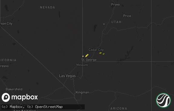
Hail Map in Utah on April 21, 2011
The weather event in Utah on April 21, 2011 includes Hail map. 16 states and 531 cities were impacted and suffered possible damage. The total estimated number of properties impacted is 0.

Hail
0
Estimated number of impacted properties by a 1.00" hail or larger0
Estimated number of impacted properties by a 1.75" hail or larger0
Estimated number of impacted properties by a 2.50" hail or largerStorm reports in Utah
Utah
| Date | Description |
|---|---|
| 04/21/20113:02 PM CDT | Semi truck blown over |
| 04/21/20112:30 PM CDT | 18-24 inch diameter tree snapped and landed on house causing minor roof damage in the avenues |
| 04/21/20112:30 PM CDT | Odgen peak - ogp 9570 ft |
| 04/21/20112:30 PM CDT | At least two dozen large trees down in huntsville. Several of the down trees damaged structures with one house with moderate damage. Many powerlines down. |
| 04/21/20112:26 PM CDT | A parked small privately owned air plane was flipped over by the strong winds at the bountiful airport. |
| 04/21/20112:25 PM CDT | Large trees down in rose park |
| 04/21/20112:24 PM CDT | A local report indicates 61 MPH wind near 9 SW LEHI |
| 04/21/20112:20 PM CDT | Multiple trees down in the ogden area. |
| 04/21/20112:20 PM CDT | Baccus sensor |
| 04/21/20112:20 PM CDT | Multiple trees down. Powerlines reported down across the county. |
| 04/21/20112:15 PM CDT | Light pole fell on 2 cars at salt lake international airport |
| 04/21/20112:15 PM CDT | Vernon hill sensor |
| 04/21/20112:15 PM CDT | Ditto |
| 04/21/20112:14 PM CDT | Salt lake city airport sensor |
| 04/21/20112:10 PM CDT | Trees down in tremonton. Windows blown out in vehicles. |
| 04/21/20112:05 PM CDT | Lake point sensor |
| 04/21/20111:50 PM CDT | White sage sensor |
| 04/21/20111:45 PM CDT | Camel back mountain |
| 04/21/20111:45 PM CDT | Simpson springs dugway |
| 04/21/20111:45 PM CDT | Baker lab sensor |
| 04/21/20111:45 PM CDT | English village sensor |
| 04/21/20111:35 PM CDT | Tower grid sensor |
| 04/21/20111:35 PM CDT | Nw decon pad dugway sensor |
| 04/21/20111:33 PM CDT | Fish springs sensor |
| 04/21/20111:33 PM CDT | Camel back mountain station |
| 04/21/20111:33 PM CDT | I80 at grassey sensor |
| 04/21/20111:33 PM CDT | Uttr sensor |
| 04/21/20111:30 PM CDT | Snowbasin sensor |
| 04/21/20111:30 PM CDT | Gunnison island sensor |
| 04/21/20111:30 PM CDT | Lakeside mountain sensor |
| 04/21/20111:10 PM CDT | Upper cedar mountain sensor |
| 04/21/20111:10 PM CDT | Playa station sensor |
| 04/21/201112:50 PM CDT | Diddle knoll sensor |
| 04/21/201112:15 PM CDT | Wendover peak sensor |
| 04/21/201112:00 PM CDT | I-80 mp 1 sensor |
All States Impacted by Hail Map on April 21, 2011
Cities Impacted by Hail Map on April 21, 2011
- Dwight, KS
- Alta Vista, KS
- Junction City, KS
- Round Mountain, TX
- Llano, TX
- Stilwell, OK
- Bunch, OK
- Eskridge, KS
- Braymer, MO
- Kansas City, MO
- Chelsea, OK
- Mena, AR
- Marble Falls, TX
- Burnet, TX
- Tescott, KS
- Edisto Island, SC
- Hollywood, SC
- Dryden, TX
- Charleston, SC
- Antlers, OK
- Carrollton, MO
- Norborne, MO
- Eldorado, TX
- Sonora, TX
- Athens, LA
- Homer, LA
- Barnsdall, OK
- Mccurtain, OK
- Woodbine, KS
- Herington, KS
- Hope, KS
- Umpire, AR
- Wickes, AR
- Grannis, AR
- Gillham, AR
- Poteau, OK
- Stigler, OK
- Kinta, OK
- Johns Island, SC
- Wadmalaw Island, SC
- Yazoo City, MS
- Galena, MO
- Rapid City, SD
- Fayetteville, AR
- Springdale, AR
- Orrick, MO
- Broken Bow, OK
- Eagletown, OK
- Ashdown, AR
- Foreman, AR
- Ozona, TX
- Bentonia, MS
- Benton, MS
- Lawrence, KS
- Lecompton, KS
- Roby, TX
- Sylvester, TX
- Sweetwater, TX
- Merkel, TX
- La Plata, MO
- Lincoln, AR
- Menard, TX
- Bentonville, AR
- Raymore, MO
- Belton, MO
- Haynesville, LA
- Midway, GA
- Riceboro, GA
- Summers, AR
- Garfield, AR
- Cookson, OK
- Farmington, AR
- Eureka Springs, AR
- Rogers, AR
- Golden, MO
- Prairie Grove, AR
- Berryville, AR
- Vian, OK
- Welling, OK
- Sallisaw, OK
- Shell Knob, MO
- Westville, OK
- Canehill, AR
- Lowell, AR
- Kansas City, KS
- Leavenworth, KS
- Tonganoxie, KS
- Bonner Springs, KS
- Basehor, KS
- Waldron, MO
- Dickens, NE
- Wellfleet, NE
- Del Rio, TX
- Rocksprings, TX
- Charleston Afb, SC
- North Charleston, SC
- Summerville, SC
- Ladson, SC
- Magnolia, AR
- Huger, SC
- Goose Creek, SC
- Freeburg, MO
- Richton, MS
- Waynesboro, MS
- Hazlehurst, MS
- Crystal Springs, MS
- Colorado City, TX
- Westbrook, TX
- Jacksonboro, SC
- Green Pond, SC
- Round O, SC
- Adams Run, SC
- Ocilla, GA
- Walterboro, SC
- Winslow, AR
- Creighton, MO
- Fitzgerald, GA
- Nahunta, GA
- Folkston, GA
- Rattan, OK
- Snow, OK
- Nashoba, OK
- Clayton, OK
- Finley, OK
- Vaughan, MS
- Lexington, NE
- Hermann, MO
- Linn, MO
- Chamois, MO
- Morrison, MO
- Berger, MO
- Mount Sterling, MO
- Smithville, OK
- Fort Stockton, TX
- Richmond Hill, GA
- Thomasville, AL
- Townsend, GA
- Darien, GA
- Brunswick, GA
- Hawley, TX
- Lockesburg, AR
- Talala, OK
- Eucha, OK
- Isle Of Palms, SC
- Mount Pleasant, SC
- Tallulah, LA
- Holden, MO
- Centerview, MO
- Fairfax, OK
- Ralston, OK
- Hodgen, OK
- Vicksburg, MS
- Murfreesboro, AR
- Bella Vista, AR
- Pineville, MO
- Waldron, AR
- Heavener, OK
- Owensville, MO
- Bland, MO
- Dawson, NE
- Perrin, TX
- Poolville, TX
- Bridgeport, TX
- Paradise, TX
- Springtown, TX
- Afton, OK
- Beaufort, SC
- Emerson, AR
- Berryton, KS
- De Queen, AR
- Norman, AR
- Wheeling, MO
- Meadville, MO
- Lincolnville, KS
- Sullivans Island, SC
- Dorchester, SC
- Council Grove, KS
- Wilsey, KS
- Quanah, TX
- Smithville, MO
- Ramona, OK
- Mineral Springs, AR
- Nashville, AR
- Saratoga, AR
- Ozan, AR
- Vinita, OK
- Sontag, MS
- Wesson, MS
- Monticello, MS
- Georgetown, SC
- Reeds Spring, MO
- Cape Fair, MO
- Ridgeland, SC
- Coosawhatchie, SC
- Higginsville, MO
- Mayview, MO
- Easton, MO
- Linneus, MO
- Oskaloosa, KS
- Reading, KS
- Clarksville, AR
- Chester, AR
- Cedarville, AR
- Rudy, AR
- Richmond, MO
- Jayess, MS
- New Cambria, MO
- Anson, TX
- Arcadia, LA
- Minden, LA
- Savannah, GA
- Jay, OK
- Gypsum, KS
- Abilene, KS
- Watts, OK
- Topeka, KS
- Summerfield, LA
- Bernice, LA
- Lost Springs, KS
- Comstock, TX
- Rotan, TX
- Buckner, AR
- Stamps, AR
- Drexel, MO
- Adrian, MO
- Westphalia, MO
- Koeltztown, MO
- Sibley, MO
- Camden, MO
- Hardin, MO
- Henrietta, MO
- Greensburg, LA
- Amite, LA
- Talihina, OK
- Wister, OK
- Amsterdam, MO
- Mountainburg, AR
- Fairfax, MO
- Snyder, TX
- Jayton, TX
- Lisbon, LA
- Dubach, LA
- Nemaha, NE
- Cove, AR
- Wetmore, KS
- Powhattan, KS
- Netawaka, KS
- Chula, GA
- Fleming, CO
- Greenwood, AR
- Hackett, AR
- Fort Smith, AR
- Cameron, OK
- Pinopolis, SC
- Grove, OK
- Lansing, KS
- McLouth, KS
- Perry, KS
- Shawnee, KS
- Wakarusa, KS
- Platte City, MO
- Alma, KS
- Paxico, KS
- Maple Hill, KS
- White City, KS
- Allen, KS
- Carbondale, KS
- Linwood, KS
- Tecumseh, KS
- Overbrook, KS
- Auburn, KS
- Harveyville, KS
- Lees Summit, MO
- Bradley, AR
- Taylor, AR
- Texarkana, AR
- Sparta, MO
- Ozark, MO
- Kingsville, MO
- Salisbury, MO
- Hartshorne, OK
- Wilburton, OK
- Hazlehurst, GA
- Tarkio, MO
- White Oak, GA
- Ridgeville, SC
- Harleyville, SC
- Chillicothe, TX
- Shady Point, OK
- Bokoshe, OK
- Howe, OK
- Prairie Du Rocher, IL
- Waynesville, GA
- Hortense, GA
- Liberty, MO
- Garland City, AR
- Natural Dam, AR
- West Fork, AR
- Brady, NE
- Moorefield, NE
- Maxwell, NE
- Proctor, OK
- Prescott, AR
- Dixon, MO
- Sylvan Grove, KS
- Lincoln, KS
- Oologah, OK
- Vera, OK
- Collinsville, OK
- Marion, KS
- Tampa, KS
- Durham, KS
- Hillsboro, KS
- Rolla, MO
- Briggs, TX
- Fort Hood, TX
- Kempner, TX
- Copperas Cove, TX
- Killeen, TX
- Burlingame, KS
- Osage City, KS
- Mayersville, MS
- Sondheimer, LA
- Vienna, MO
- Manhattan, KS
- Dawn, MO
- Cowgill, MO
- Ellsworth, KS
- Utica, MS
- Saint Simons Island, GA
- Ozark, AR
- Bates City, MO
- Oak Grove, MO
- London, TX
- Lake Providence, LA
- Pioneer, LA
- Lamar, AR
- Hagarville, AR
- Salem, NE
- Verdon, NE
- Elmer, MO
- Ethel, MO
- Brookville, KS
- Keota, OK
- Hominy, OK
- Seymour, TX
- Lenexa, KS
- Junction, TX
- Osceola, MO
- Quincy, MO
- Canton, MS
- Redwood, MS
- Columbia, MS
- Sumrall, MS
- Siloam Springs, AR
- Gentry, AR
- Appleton City, MO
- Deepwater, MO
- Ira, TX
- Butler, AL
- Wann, OK
- Madison, MS
- Highlandville, MO
- Tuskahoma, OK
- Maysville, MO
- Amity, MO
- Watson, OK
- Marionville, MO
- Climax Springs, MO
- Edwards, MO
- Marland, OK
- Haxtun, CO
- Huntington, AR
- Hermleigh, TX
- McCaulley, TX
- Archie, MO
- Odessa, MO
- Vandervoort, AR
- Haworth, OK
- Hayes Center, NE
- Ramona, KS
- Rosebud, MO
- Cuba, MO
- Sullivan, MO
- Roseland, LA
- Bogard, MO
- Tina, MO
- Colcord, OK
- Valley Park, MS
- Junction City, AR
- Charleston, AR
- Branch, AR
- Ratcliff, AR
- Yemassee, SC
- Saint Joseph, MO
- Americus, KS
- Emporia, KS
- Altus, AR
- Paris, AR
- Hartman, AR
- Coal Hill, AR
- Excelsior Springs, MO
- Lewisville, AR
- Big Cabin, OK
- Levasy, MO
- Independence, MO
- Rayville, MO
- Buckner, MO
- Blue Springs, MO
- Vernon, TX
- Rolling Fork, MS
- Dierks, AR
- Arkadelphia, AR
- Ludowici, GA
- Hatfield, AR
- Old Glory, TX
- Aspermont, TX
- Crane, MO
- Concordia, MO
- Fulton, AR
- Bluejacket, OK
- Horatio, AR
- Wamego, KS
- Coffeyville, KS
- Huntsville, AR
- Red Oak, OK
- Ruth, MS
- Decatur, MS
- Pine Grove, LA
- Clinton, LA
- Hardeeville, SC
- Moncks Corner, SC
- Harrisonville, MO
- Lawson, MO
- Chapman, KS
- Rogersville, MO
- East Carbon, UT
- Hiawatha, KS
- Robinson, KS
- Kanopolis, KS
- Riley, KS
- Fort Riley, KS
- Ogden, KS
- Hamer, ID
- Nowata, OK
- Corning, KS
- La Cygne, KS
- Aurora, MO
- Bern, KS
- Humboldt, NE
- Horseshoe Bay, TX
- Fredericksburg, TX
- Willow City, TX
- Stanberry, MO
- Meridian, MS
- S Coffeyville, OK
- Idabel, OK
- Paducah, TX
- Shongaloo, LA
- Wallace, NE
- Bosworth, MO
- Red Rock, OK
- Seabrook, SC
- Beverly, KS
- Hindsville, AR
- Satartia, MS
- Sanderson, TX
- Silver Creek, MS
- Albion, OK
- Hugo, OK
- Centerton, AR
- Billings, MO
- Clever, MO
- Waverly, MO
- Atlanta, MO
- Kearney, MO
- Tinsley, MS
- Seligman, MO
- Eagle Rock, MO
- Salina, KS
- Evansville, AR
- Fairland, OK
- Wyandotte, OK
- Avery, TX
- Clarksville, TX
- Kentwood, LA
- Denham Springs, LA
- Flora, MS
- Enterprise, KS
- Elkins, AR
- Malta Bend, MO
- Roxie, MS
- Boswell, OK
- Soper, OK
- Fouke, AR
- Weaubleau, MO
- Pittsburg, OK
- New Boston, MO
- Brookfield, MO
- Gothenburg, NE
- Cozad, NE
- Corder, MO
- Alma, MO
- Paxton, NE
- Cassville, MO
- Winchester, KS
- Easton, KS
- Hope, AR
- Warrensburg, MO
- State Line, MS
- Ruffin, SC
- Kingsland, TX
- Missouri City, MO
- Lampasas, TX
- Wathena, KS
- Rushville, MO
- Barnard, MO
- Graham, MO
- Winthrop, AR
- Wynona, OK
- Culbertson, NE
- New Cambria, KS
- Inkom, ID
- Maysville, AR
- Bennington, KS
- Pawhuska, OK
- Ruston, LA
- Abilene, TX
- Blairstown, MO
- Solomon, KS
- Odell, TX


