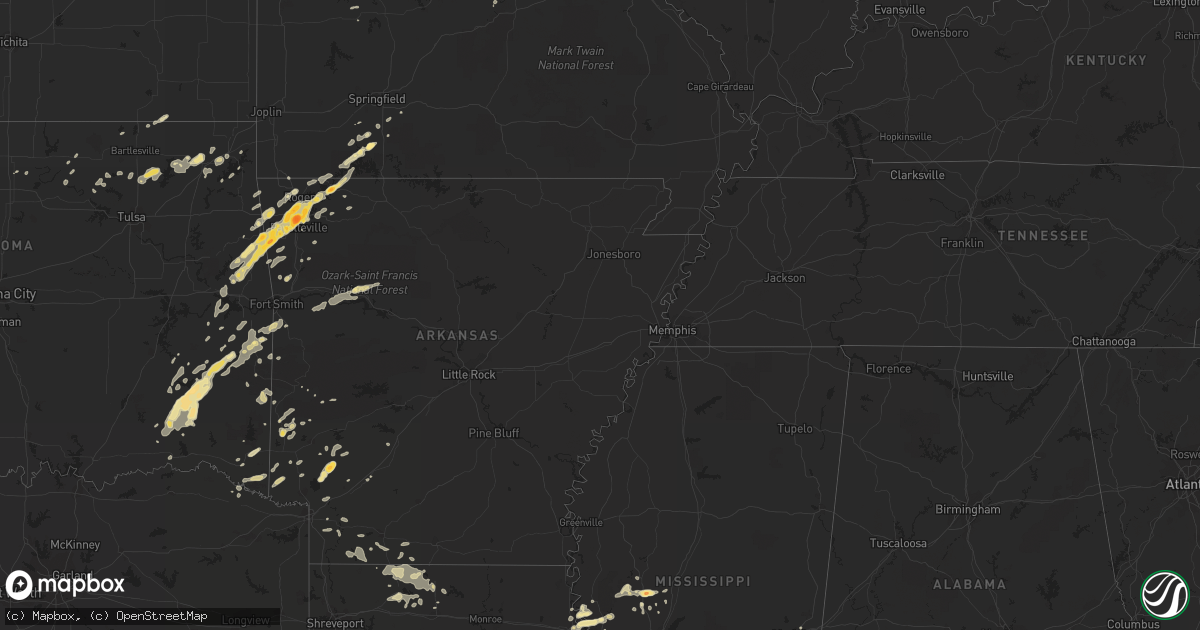
Hail Map in South Carolina on April 21, 2011
Get this storm
April 21 map
$229
one time, instant access
Download today. No call, no setup
Keep the $229
Bought the map and want the full workflow? Apply the entire $229 to a subscription within 7 days. None of it is wasted.
Every map, not just this one
This buys you this map. Subscription and you get every map we run, in the markets you choose from a few cities to whole states to nationwide. Plus real-time alerts the moment a storm fires.
Contact data
Name, contact info, occupancy, even credit band for addresses in the footprint. You go from where it hit to who to call.
Become the source they trust
Unlimited branding weather history reports on demand. You already have the documented answer ready for the property owner, and you are the one who showed up with it.
Property data and RoofTrace estimates
Pull up any address you have got, its value and the exact code rules for that jurisdiction, straight from One Click Code. Then RoofTrace estimates the squares, pitch, and roof value, priced the way you price.
Storm reports in South Carolina
South Carolina
| Date | Description |
|---|---|
| 04/21/20115:40 PM CDT | Quarter to half dollar size hail reported along bears bluff rd. |
| 04/21/20114:40 PM CDT | Quarter sized hail reported at johnson hagood stadium. |
| 04/21/20114:31 PM CDT | Quarter sized hail reported along foster street. |
| 04/21/20114:30 PM CDT | The public reported quarter size hail at the village square. Several cars had light to moderate hail damage. |
| 04/21/20114:30 PM CDT | Quarter size hail reported at the ashley hall plantation subdivision in west ashley |
| 04/21/20114:30 PM CDT | Golf ball sized hail reported along raul wallenberg blvd. |
| 04/21/20114:25 PM CDT | Golf ball size hail reported near 61 and wallenberg drive in west ashley |
| 04/21/20114:25 PM CDT | Quarter sized hail reported along bayhill drive. |
| 04/21/20114:22 PM CDT | Golf ball size hail reported at the grand oaks subdivision in west ashley |
| 04/21/20114:20 PM CDT | Quarter sized hail reported along glen oaks court. |
| 04/21/20114:02 PM CDT | A local report indicates 1.50 inch wind near 3 SE SUMMERVILLE |
| 04/21/20114:00 PM CDT | Quarter sized hail reported in cane bay plantation. |
| 04/21/20113:55 PM CDT | A local report indicates 1.00 inch wind near 2 S SUMMERVILLE |
| 04/21/20113:52 PM CDT | A local report indicates 1.00 inch wind near 6 NNE JEDBURG |
All States Impacted by Hail Map on April 21, 2011
Cities Impacted by Hail Map on April 21, 2011
- Dwight, KS
- Alta Vista, KS
- Junction City, KS
- Round Mountain, TX
- Llano, TX
- Stilwell, OK
- Bunch, OK
- Eskridge, KS
- Braymer, MO
- Kansas City, MO
- Chelsea, OK
- Mena, AR
- Marble Falls, TX
- Burnet, TX
- Tescott, KS
- Edisto Island, SC
- Hollywood, SC
- Dryden, TX
- Charleston, SC
- Antlers, OK
- Carrollton, MO
- Norborne, MO
- Eldorado, TX
- Sonora, TX
- Athens, LA
- Homer, LA
- Barnsdall, OK
- Mccurtain, OK
- Woodbine, KS
- Herington, KS
- Hope, KS
- Umpire, AR
- Wickes, AR
- Grannis, AR
- Gillham, AR
- Poteau, OK
- Stigler, OK
- Kinta, OK
- Johns Island, SC
- Wadmalaw Island, SC
- Yazoo City, MS
- Galena, MO
- Rapid City, SD
- Fayetteville, AR
- Springdale, AR
- Orrick, MO
- Broken Bow, OK
- Eagletown, OK
- Ashdown, AR
- Foreman, AR
- Ozona, TX
- Bentonia, MS
- Benton, MS
- Lawrence, KS
- Lecompton, KS
- Roby, TX
- Sylvester, TX
- Sweetwater, TX
- Merkel, TX
- La Plata, MO
- Lincoln, AR
- Menard, TX
- Bentonville, AR
- Raymore, MO
- Belton, MO
- Haynesville, LA
- Midway, GA
- Riceboro, GA
- Summers, AR
- Garfield, AR
- Cookson, OK
- Farmington, AR
- Eureka Springs, AR
- Rogers, AR
- Golden, MO
- Prairie Grove, AR
- Berryville, AR
- Vian, OK
- Welling, OK
- Sallisaw, OK
- Shell Knob, MO
- Westville, OK
- Canehill, AR
- Lowell, AR
- Kansas City, KS
- Leavenworth, KS
- Tonganoxie, KS
- Bonner Springs, KS
- Basehor, KS
- Waldron, MO
- Dickens, NE
- Wellfleet, NE
- Del Rio, TX
- Rocksprings, TX
- Charleston Afb, SC
- North Charleston, SC
- Summerville, SC
- Ladson, SC
- Magnolia, AR
- Huger, SC
- Goose Creek, SC
- Freeburg, MO
- Richton, MS
- Waynesboro, MS
- Hazlehurst, MS
- Crystal Springs, MS
- Colorado City, TX
- Westbrook, TX
- Jacksonboro, SC
- Green Pond, SC
- Round O, SC
- Adams Run, SC
- Ocilla, GA
- Walterboro, SC
- Winslow, AR
- Creighton, MO
- Fitzgerald, GA
- Nahunta, GA
- Folkston, GA
- Rattan, OK
- Snow, OK
- Nashoba, OK
- Clayton, OK
- Finley, OK
- Vaughan, MS
- Lexington, NE
- Hermann, MO
- Linn, MO
- Chamois, MO
- Morrison, MO
- Berger, MO
- Mount Sterling, MO
- Smithville, OK
- Fort Stockton, TX
- Richmond Hill, GA
- Thomasville, AL
- Townsend, GA
- Darien, GA
- Brunswick, GA
- Hawley, TX
- Lockesburg, AR
- Talala, OK
- Eucha, OK
- Isle Of Palms, SC
- Mount Pleasant, SC
- Tallulah, LA
- Holden, MO
- Centerview, MO
- Fairfax, OK
- Ralston, OK
- Hodgen, OK
- Vicksburg, MS
- Murfreesboro, AR
- Bella Vista, AR
- Pineville, MO
- Waldron, AR
- Heavener, OK
- Owensville, MO
- Bland, MO
- Dawson, NE
- Perrin, TX
- Poolville, TX
- Bridgeport, TX
- Paradise, TX
- Springtown, TX
- Afton, OK
- Beaufort, SC
- Emerson, AR
- Berryton, KS
- De Queen, AR
- Norman, AR
- Wheeling, MO
- Meadville, MO
- Lincolnville, KS
- Sullivans Island, SC
- Dorchester, SC
- Council Grove, KS
- Wilsey, KS
- Quanah, TX
- Smithville, MO
- Ramona, OK
- Mineral Springs, AR
- Nashville, AR
- Saratoga, AR
- Ozan, AR
- Vinita, OK
- Sontag, MS
- Wesson, MS
- Monticello, MS
- Georgetown, SC
- Reeds Spring, MO
- Cape Fair, MO
- Ridgeland, SC
- Coosawhatchie, SC
- Higginsville, MO
- Mayview, MO
- Easton, MO
- Linneus, MO
- Oskaloosa, KS
- Reading, KS
- Clarksville, AR
- Chester, AR
- Cedarville, AR
- Rudy, AR
- Richmond, MO
- Jayess, MS
- New Cambria, MO
- Anson, TX
- Arcadia, LA
- Minden, LA
- Savannah, GA
- Jay, OK
- Gypsum, KS
- Abilene, KS
- Watts, OK
- Topeka, KS
- Summerfield, LA
- Bernice, LA
- Lost Springs, KS
- Comstock, TX
- Rotan, TX
- Buckner, AR
- Stamps, AR
- Drexel, MO
- Adrian, MO
- Westphalia, MO
- Koeltztown, MO
- Sibley, MO
- Camden, MO
- Hardin, MO
- Henrietta, MO
- Greensburg, LA
- Amite, LA
- Talihina, OK
- Wister, OK
- Amsterdam, MO
- Mountainburg, AR
- Fairfax, MO
- Snyder, TX
- Jayton, TX
- Lisbon, LA
- Dubach, LA
- Nemaha, NE
- Cove, AR
- Wetmore, KS
- Powhattan, KS
- Netawaka, KS
- Chula, GA
- Fleming, CO
- Greenwood, AR
- Hackett, AR
- Fort Smith, AR
- Cameron, OK
- Pinopolis, SC
- Grove, OK
- Lansing, KS
- McLouth, KS
- Perry, KS
- Shawnee, KS
- Wakarusa, KS
- Platte City, MO
- Alma, KS
- Paxico, KS
- Maple Hill, KS
- White City, KS
- Allen, KS
- Carbondale, KS
- Linwood, KS
- Tecumseh, KS
- Overbrook, KS
- Auburn, KS
- Harveyville, KS
- Lees Summit, MO
- Bradley, AR
- Taylor, AR
- Texarkana, AR
- Sparta, MO
- Ozark, MO
- Kingsville, MO
- Salisbury, MO
- Hartshorne, OK
- Wilburton, OK
- Hazlehurst, GA
- Tarkio, MO
- White Oak, GA
- Ridgeville, SC
- Harleyville, SC
- Chillicothe, TX
- Shady Point, OK
- Bokoshe, OK
- Howe, OK
- Prairie Du Rocher, IL
- Waynesville, GA
- Hortense, GA
- Liberty, MO
- Garland City, AR
- Natural Dam, AR
- West Fork, AR
- Brady, NE
- Moorefield, NE
- Maxwell, NE
- Proctor, OK
- Prescott, AR
- Dixon, MO
- Sylvan Grove, KS
- Lincoln, KS
- Oologah, OK
- Vera, OK
- Collinsville, OK
- Marion, KS
- Tampa, KS
- Durham, KS
- Hillsboro, KS
- Rolla, MO
- Briggs, TX
- Fort Hood, TX
- Kempner, TX
- Copperas Cove, TX
- Killeen, TX
- Burlingame, KS
- Osage City, KS
- Mayersville, MS
- Sondheimer, LA
- Vienna, MO
- Manhattan, KS
- Dawn, MO
- Cowgill, MO
- Ellsworth, KS
- Utica, MS
- Saint Simons Island, GA
- Ozark, AR
- Bates City, MO
- Oak Grove, MO
- London, TX
- Lake Providence, LA
- Pioneer, LA
- Lamar, AR
- Hagarville, AR
- Salem, NE
- Verdon, NE
- Elmer, MO
- Ethel, MO
- Brookville, KS
- Keota, OK
- Hominy, OK
- Seymour, TX
- Lenexa, KS
- Junction, TX
- Osceola, MO
- Quincy, MO
- Canton, MS
- Redwood, MS
- Columbia, MS
- Sumrall, MS
- Siloam Springs, AR
- Gentry, AR
- Appleton City, MO
- Deepwater, MO
- Ira, TX
- Butler, AL
- Wann, OK
- Madison, MS
- Highlandville, MO
- Tuskahoma, OK
- Maysville, MO
- Amity, MO
- Watson, OK
- Marionville, MO
- Climax Springs, MO
- Edwards, MO
- Marland, OK
- Haxtun, CO
- Huntington, AR
- Hermleigh, TX
- McCaulley, TX
- Archie, MO
- Odessa, MO
- Vandervoort, AR
- Haworth, OK
- Hayes Center, NE
- Ramona, KS
- Rosebud, MO
- Cuba, MO
- Sullivan, MO
- Roseland, LA
- Bogard, MO
- Tina, MO
- Colcord, OK
- Valley Park, MS
- Junction City, AR
- Charleston, AR
- Branch, AR
- Ratcliff, AR
- Yemassee, SC
- Saint Joseph, MO
- Americus, KS
- Emporia, KS
- Altus, AR
- Paris, AR
- Hartman, AR
- Coal Hill, AR
- Excelsior Springs, MO
- Lewisville, AR
- Big Cabin, OK
- Levasy, MO
- Independence, MO
- Rayville, MO
- Buckner, MO
- Blue Springs, MO
- Vernon, TX
- Rolling Fork, MS
- Dierks, AR
- Arkadelphia, AR
- Ludowici, GA
- Hatfield, AR
- Old Glory, TX
- Aspermont, TX
- Crane, MO
- Concordia, MO
- Fulton, AR
- Bluejacket, OK
- Horatio, AR
- Wamego, KS
- Coffeyville, KS
- Huntsville, AR
- Red Oak, OK
- Ruth, MS
- Decatur, MS
- Pine Grove, LA
- Clinton, LA
- Hardeeville, SC
- Moncks Corner, SC
- Harrisonville, MO
- Lawson, MO
- Chapman, KS
- Rogersville, MO
- East Carbon, UT
- Hiawatha, KS
- Robinson, KS
- Kanopolis, KS
- Riley, KS
- Fort Riley, KS
- Ogden, KS
- Hamer, ID
- Nowata, OK
- Corning, KS
- La Cygne, KS
- Aurora, MO
- Bern, KS
- Humboldt, NE
- Horseshoe Bay, TX
- Fredericksburg, TX
- Willow City, TX
- Stanberry, MO
- Meridian, MS
- S Coffeyville, OK
- Idabel, OK
- Paducah, TX
- Shongaloo, LA
- Wallace, NE
- Bosworth, MO
- Red Rock, OK
- Seabrook, SC
- Beverly, KS
- Hindsville, AR
- Satartia, MS
- Sanderson, TX
- Silver Creek, MS
- Albion, OK
- Hugo, OK
- Centerton, AR
- Billings, MO
- Clever, MO
- Waverly, MO
- Atlanta, MO
- Kearney, MO
- Tinsley, MS
- Seligman, MO
- Eagle Rock, MO
- Salina, KS
- Evansville, AR
- Fairland, OK
- Wyandotte, OK
- Avery, TX
- Clarksville, TX
- Kentwood, LA
- Denham Springs, LA
- Flora, MS
- Enterprise, KS
- Elkins, AR
- Malta Bend, MO
- Roxie, MS
- Boswell, OK
- Soper, OK
- Fouke, AR
- Weaubleau, MO
- Pittsburg, OK
- New Boston, MO
- Brookfield, MO
- Gothenburg, NE
- Cozad, NE
- Corder, MO
- Alma, MO
- Paxton, NE
- Cassville, MO
- Winchester, KS
- Easton, KS
- Hope, AR
- Warrensburg, MO
- State Line, MS
- Ruffin, SC
- Kingsland, TX
- Missouri City, MO
- Lampasas, TX
- Wathena, KS
- Rushville, MO
- Barnard, MO
- Graham, MO
- Winthrop, AR
- Wynona, OK
- Culbertson, NE
- New Cambria, KS
- Inkom, ID
- Maysville, AR
- Bennington, KS
- Pawhuska, OK
- Ruston, LA
- Abilene, TX
- Blairstown, MO
- Solomon, KS
- Odell, TX


