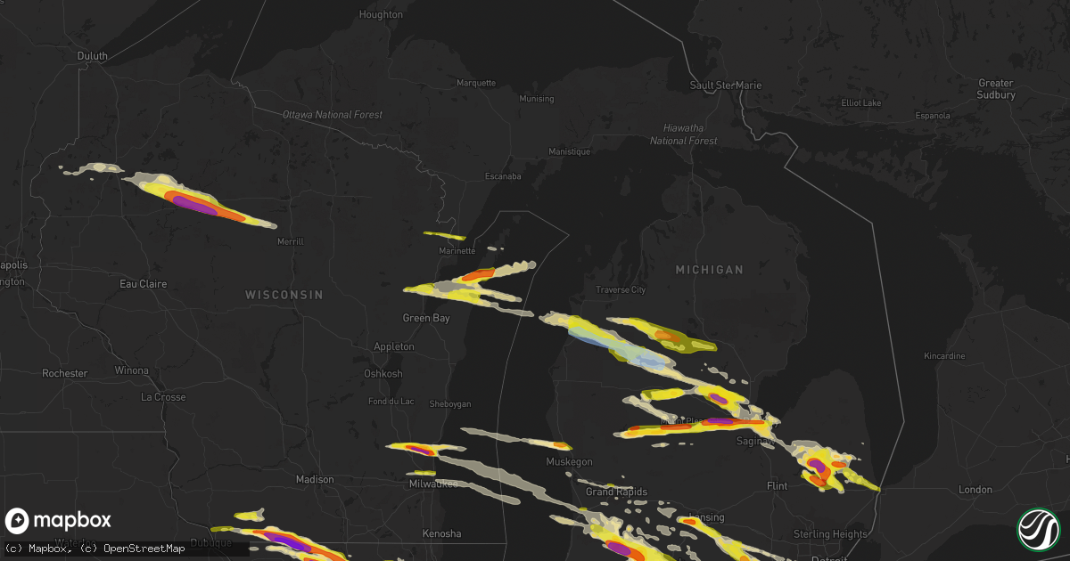
Hail Map in Michigan on April 7, 2020
Get this storm
April 7 map
$229
one time, instant access
Download today. No call, no setup
Keep the $229
Bought the map and want the full workflow? Apply the entire $229 to a subscription within 7 days. None of it is wasted.
Every map, not just this one
This buys you this map. Subscription and you get every map we run, in the markets you choose from a few cities to whole states to nationwide. Plus real-time alerts the moment a storm fires.
Contact data
Name, contact info, occupancy, even credit band for addresses in the footprint. You go from where it hit to who to call.
Become the source they trust
Unlimited branding weather history reports on demand. You already have the documented answer ready for the property owner, and you are the one who showed up with it.
Property data and RoofTrace estimates
Pull up any address you have got, its value and the exact code rules for that jurisdiction, straight from One Click Code. Then RoofTrace estimates the squares, pitch, and roof value, priced the way you price.
Storm reports in Michigan
Michigan
| Date | Description |
|---|---|
| 04/07/20206:55 PM CDT | . |
| 04/07/20206:28 PM CDT | Delayed report. Photo of large hail. |
| 04/07/20206:25 PM CDT | A local report indicates 1.75 inch wind near 3 ESE EDENVILLE |
| 04/07/20206:22 PM CDT | A local report indicates 1.00 inch wind near WALKER |
| 04/07/20205:30 PM CDT | A local report indicates 1.50 inch wind near 2 SW WHITEHALL |
| 04/07/20205:25 PM CDT | A local report indicates 1.00 inch wind near WHITEHALL |
| 04/07/20205:25 PM CDT | Corrects previous hail report from 1 ssw whitehall. Time estimated from radar. |
| 04/07/20205:15 PM CDT | A local report indicates 1.00 inch wind near 1 ENE WILDWOOD |
| 04/07/20205:15 PM CDT | A local report indicates 1.00 inch wind near BEAR LAKE |
| 04/07/20205:08 PM CDT | A local report indicates 1.00 inch wind near 1 ENE CADILLAC |
| 04/07/20205:00 PM CDT | A local report indicates 1.00 inch wind near ARCADIA |
| 04/07/20205:47 AM CDT | At 1046 PM EDT, a severe thunderstorm was located over Hudson, moving southeast at 50 mph. HAZARD...Half dollar size hail. SOURCE...Radar indicated. IMPACT...Damage to vehicles is expected. This severe thunderstorm will be near... Clayton around 1050 PM EDT. Morenci around 1055 PM EDT.Other locations impacted by this severe thunderstorm include Seneca,Manitou Beach-Devils Lake, Lime Creek, Munson, Ogden Center,Canandaigua, Palmyra, Sand Creek, Rome Center and Jasper. |
| 04/07/20205:44 AM CDT | At 1044 PM EDT, a severe thunderstorm was located 8 miles northeast of Pioneer, or 8 miles southwest of Hudson, moving southeast at 55 mph. HAZARD...60 mph wind gusts and quarter size hail. SOURCE...Radar indicated. IMPACT...Hail damage to vehicles is expected. Expect wind damage to roofs, siding, and trees. Locations impacted include... Napoleon, Wauseon, Archbold, Swanton, Delta, Hudson, West Unity, Pioneer, Fayette, Liberty Center, Pittsford, Ransom, Metamora, Lyons, Waldron, Texas, Prattville, Oakshade, Alvordton and Grelton.This includes Interstate 80 in Ohio between mile markers 19 and 48. |
| 04/07/20205:21 AM CDT | At 1021 PM EDT, a severe thunderstorm was located near Bristol, or near Elkhart, moving east at 30 mph. HAZARD...70 mph wind gusts and quarter size hail. SOURCE...Radar indicated. IMPACT...Hail damage to vehicles is expected. Expect considerable tree damage. Wind damage is also likely to mobile homes, roofs, and outbuildings. Locations impacted include... Elkhart, Dunlap, Middlebury, Bristol, Topeka, Shipshewana, Honeyville and Emma.This includes Interstate 80 in Indiana between mile markers 95 and104. |
| 04/07/20204:54 AM CDT | At 954 PM EDT, severe thunderstorms were located along a line extending from near Albion to 5 miles southwest of Homer, moving east at 50 mph. HAZARD...60 mph wind gusts and quarter size hail. SOURCE...Radar indicated. IMPACT...Hail damage to vehicles is expected. Expect wind damage to roofs, siding, and trees. Locations impacted include... Jackson... Vandercook Lake... Brooklyn... Grass Lake... Leoni... Spring Arbor... Napoleon... Sandstone... Norvell... Pulaski... Concord... Horton... Parma... Hanover... Oak Point... Sunset Beach... Michigan Center... |
| 04/07/20204:31 AM CDT | At 931 PM EDT, a severe thunderstorm was located near Midland, moving east at 60 mph. HAZARD...Ping pong ball size hail. SOURCE...Radar indicated. IMPACT...People and animals outdoors will be injured. Expect damage to roofs, siding, windows, and vehicles. This severe thunderstorm will be near... Freeland around 935 PM EDT. Auburn around 940 PM EDT. Zilwaukee around 945 PM EDT. Bay City and Kawkawlin around 950 PM EDT. Essexville and Munger around 955 PM EDT.Other locations impacted by this severe thunderstorm include Willard,Bay City State Recreation Area, Indiantown and Carrollton. |
| 04/07/20204:17 AM CDT | At 917 PM EDT, a severe thunderstorm was located near Manchester, moving southeast at 40 mph. HAZARD...60 mph wind gusts. SOURCE...Radar indicated. IMPACT...Expect damage to roofs, siding, and trees. This severe thunderstorm will be near... Manchester around 920 PM EDT.Other locations impacted by this severe thunderstorm includeBridgewater, Pittsfield Township, Pleasant Lake and Whittaker. |
| 04/07/20204:13 AM CDT | At 913 PM EDT, severe thunderstorms were located along a line extending from near Hastings to 7 miles north of Paw Paw, moving southeast at 40 mph. HAZARD...Golf ball size hail and 60 mph wind gusts. SOURCE...Radar indicated. IMPACT...People and animals outdoors will be injured. Expect hail damage to roofs, siding, windows, and vehicles. Expect wind damage to roofs, siding, and trees. Locations impacted include... Kalamazoo... Portage... Albion... Marshall... Westwood... Battle Creek... Vicksburg... Galesburg... Homer... Union City... Schoolcraft... Climax... Richland... Burlington... Brownlee Park... Comstock Northwest... Level Park-Oak Park... South Gull Lake... Alamo... Fulton... |
| 04/07/20204:12 AM CDT | At 911 PM EDT, a severe thunderstorm was located over Shepherd, or 7 miles southeast of Mount Pleasant, moving east at 60 mph. HAZARD...Quarter size hail. SOURCE...Radar indicated. IMPACT...Damage to vehicles is expected. This severe thunderstorm will be near... Oil City around 915 PM EDT. Midland around 935 PM EDT.Other locations impacted by this severe thunderstorm include Laporte,Porter Township, Gordonville and Poseyville. |
| 04/07/20204:05 AM CDT | At 904 PM EDT, a severe thunderstorm was located south of Mount Pleasant and west of Shepherd, moving east at 60 mph. HAZARD...Golf ball size hail. SOURCE...Radar indicated. IMPACT...People and animals outdoors will be injured. Expect damage to roofs, siding, windows, and vehicles. Locations impacted include... Shepherd... |
| 04/07/20203:59 AM CDT | At 858 PM EDT, severe thunderstorms were located along a line extending from 5 miles east of Lake Odessa to near Middleville to near Otsego, moving east at 60 mph. HAZARD...60 mph wind gusts and quarter size hail. SOURCE...Radar indicated. IMPACT...Hail damage to vehicles is expected. Expect wind damage to roofs, siding, and trees. Locations impacted include... Lansing... Charlotte... Hastings... Eaton Rapids... Waverly... Grand Ledge... Middleville... Potterville... Nashville... Bellevue... Edgemont Park... Orangeville... Irving... Assyria... Kalamo... Olivet... Brookfield... Dimondale... Vermontville... Woodland... |
| 04/07/20203:53 AM CDT | At 852 PM EDT, severe thunderstorms were located along a line extending from near Twin Lakes Area to near Hockaday to 8 miles southwest of Roscommon Township, moving southeast at 55 mph. HAZARD...60 mph wind gusts and quarter size hail. SOURCE...Radar indicated. IMPACT...Hail damage to vehicles is expected. Expect wind damage to roofs, siding, and trees. Severe thunderstorms will be near... West Branch and Bowmanville around 900 PM EDT. Alger and Skidway Lake around 910 PM EDT. Gladwin, Sterling and Hockaday around 915 PM EDT. Standish, Maple Ridge, Wooden Shoe Village and Winegars around 920 PM EDT. Omer around 925 PM EDT. Twining, Turner and Rhodes around 930 PM EDT. Au Gres around 935 PM EDT.Other locations impacted by these severe thunderstorms includePrescott. |
| 04/07/20203:41 AM CDT | At 840 PM EDT, severe thunderstorms were located along a line extending from near Peck to near Brown City to near Lum, moving southeast at 65 mph. HAZARD...Quarter size hail. SOURCE...Radar indicated. IMPACT...Damage to vehicles is expected. Severe thunderstorms will be near... Yale and Capac around 855 PM EDT. Lakeport, Armada and Emmett around 900 PM EDT. Richmond and Memphis around 905 PM EDT. Port Huron and Marysville around 910 PM EDT. St. Clair and Marine City around 920 PM EDT.Other locations impacted by these severe thunderstorms includeAnchorville, North Street, Adair, Lynn Township, Rattle Run,Goodells, Brockway, Smiths Creek, Fair Haven and Wadhams. |
| 04/07/20203:36 AM CDT | At 836 PM EDT, a severe thunderstorm was located near Morley, or 15 miles south of Big Rapids, moving east at 50 mph. HAZARD...Quarter size hail. SOURCE...Radar indicated. IMPACT...Damage to vehicles is expected. Locations impacted include... Howard City... Edmore... Lakeview... Morley... Canadian Lakes... Mcbride... Sylvester... Westville... Cedar Lake... Entrican... Amble... Six Lakes... Altona... Vestaburg... Blanchard... Wyman... Winn... |
| 04/07/20203:35 AM CDT | At 835 PM EDT, severe thunderstorms were located along a line extending from near Gregory to 5 miles southeast of Mason to near Leslie, moving southeast at 30 mph. HAZARD...Golf ball size hail and 60 mph wind gusts. SOURCE...Radar indicated. IMPACT...People and animals outdoors will be injured. Expect hail damage to roofs, siding, windows, and vehicles. Expect wind damage to roofs, siding, and trees. Locations impacted include... Jackson... Mason... Vandercook Lake... Leslie... Stockbridge... Brooklyn... Grass Lake... Leoni... Napoleon... Aurelius... Onondaga... Norvell... Bunker Hill... Dansville... Eden... Fitchburg... Oak Point... Topkins... Rives Junction... Sunset Beach... |
| 04/07/20203:29 AM CDT | At 829 PM EDT, severe thunderstorms were located along a line extending from Marlette to near North Branch, moving southeast at 55 mph. HAZARD...Quarter size hail. SOURCE...Radar indicated. IMPACT...Damage to vehicles is expected. Severe thunderstorms will be near... Brown City around 840 PM EDT. Peck and Melvin around 845 PM EDT.Other locations impacted by these severe thunderstorms include BirchBeach, Watertown, Lexington Heights, Roseburg, Amador, Juhl andValley Center. |
| 04/07/20203:26 AM CDT | At 825 PM EDT, a severe thunderstorm was located near Houghton Lake, moving east at 50 mph. HAZARD...60 mph wind gusts and quarter size hail. SOURCE...Radar indicated. IMPACT...Hail damage to vehicles is expected. Expect wind damage to roofs, siding, and trees. This severe thunderstorm will be near... Houghton Lake around 830 PM EDT. Prudenville, Roscommon Township and Roscommon County Airport around 835 PM EDT. Nester Township around 845 PM EDT. Twin Lakes Area around 850 PM EDT. |
| 04/07/20203:25 AM CDT | At 825 PM EDT, a severe thunderstorm was located near Stockbridge, or 12 miles southeast of Mason, moving southeast at 50 mph. HAZARD...60 mph wind gusts and half dollar size hail. SOURCE...Radar indicated. IMPACT...Hail damage to vehicles is expected. Expect wind damage to roofs, siding, and trees. This severe thunderstorm will be near... Gregory around 835 PM EDT. Chelsea and Pinckney around 840 PM EDT. Dexter and Hamburg around 850 PM EDT. Ann Arbor and Whitmore Lake around 855 PM EDT. Dixboro around 900 PM EDT. Ypsilanti and Salem around 905 PM EDT.Other locations impacted by this severe thunderstorm includePlainfield, Hudson Mills Metropark, Island Lake State RecreationArea, Delhi Mills, Barton Hills, Pinckney State Recreation Area,Hudson Mills, Parkers Corners, Lakeland and Lyndon Township. |
| 04/07/20203:19 AM CDT | At 819 PM EDT, severe thunderstorms were located along a line extending from near Lowell to near Freeport, moving east at 35 mph. HAZARD...60 mph wind gusts and quarter size hail. SOURCE...Radar indicated. IMPACT...Hail damage to vehicles is expected. Expect wind damage to roofs, siding, and trees. Locations impacted include... Ionia... Portland... Lake Odessa... Saranac... Sebewa... Lyons... Muir... Mulliken... Pewamo... Clarksville... |
| 04/07/20203:19 AM CDT | At 819 PM EDT, severe thunderstorms were located along a line extending from near Mayville to near Millington, moving southeast at 60 mph. HAZARD...Quarter size hail. SOURCE...Radar indicated. IMPACT...Damage to vehicles is expected. Severe thunderstorms will be near... Clifford around 825 PM EDT. North Branch and Columbiaville around 830 PM EDT. Lapeer and Brown City around 840 PM EDT. Lum around 845 PM EDT. Imlay City and Dryden around 850 PM EDT. Almont around 855 PM EDT.Other locations impacted by these severe thunderstorms includeGoodland Township, East Dayton, Burnside, Attica, Kings Mill,Silverwood and Fostoria. |
| 04/07/20203:16 AM CDT | At 816 PM EDT, severe thunderstorms were located along a line extending from near Beechwood to 11 miles west of Saugatuck, moving east at 45 mph. HAZARD...60 mph wind gusts and quarter size hail. SOURCE...Radar indicated. IMPACT...Hail damage to vehicles is expected. Expect wind damage to roofs, siding, and trees. Locations impacted include... Holland... Allegan... Plainwell... Wayland... Otsego... Fennville... Saugatuck... Martin... Saugatuck SP... Dorr... Ganges... Hamilton... Douglas... Hopkins... Burnips... Bradley... North Dorr... Castle Park... Pullman... Shelbyville... |
| 04/07/20203:12 AM CDT | At 812 PM EDT, severe thunderstorms were located along a line extending from near Sparta to near Walker to near Caledonia, moving east at 20 mph. HAZARD...60 mph wind gusts and quarter size hail. SOURCE...Radar indicated. IMPACT...Hail damage to vehicles is expected. Expect wind damage to roofs, siding, and trees. Locations impacted include... Grand Rapids... Lowell... Wyoming... Kentwood... Walker... East Grand Rapids... Rockford... Sparta... Caledonia... Forest Hills... Northview... Grandville... Ada... Grattan... Cedar Springs... Sand Lake... Cutlerville... Belmont... Alto... Alaska... |
| 04/07/20203:01 AM CDT | At 801 PM EDT, a severe thunderstorm was located near Edenville, or 11 miles northeast of Sanford, moving east at 65 mph. HAZARD...Half dollar size hail. SOURCE...Radar indicated. IMPACT...Damage to vehicles is expected. This severe thunderstorm will be near... Pinconning around 815 PM EDT.Other locations impacted by this severe thunderstorm include Crumpand Mount Forest. |
| 04/07/20202:54 AM CDT | At 754 PM EDT, severe thunderstorms were located along a line extending from near Grand Ledge to near Potterville to 7 miles northeast of Nashville, moving southeast at 50 mph. HAZARD...60 mph wind gusts and quarter size hail. SOURCE...Radar indicated. IMPACT...Hail damage to vehicles is expected. Expect wind damage to roofs, siding, and trees. Locations impacted include... Lansing... Charlotte... Mason... Eaton Rapids... Waverly... Haslett... East Lansing... Grand Ledge... Williamston... Potterville... Leslie... Stockbridge... Edgemont Park... Aurelius... Onondaga... Bunker Hill... Brookfield... Webberville... Dimondale... Dansville... |
| 04/07/20202:54 AM CDT | At 753 PM EDT, a severe thunderstorm was located over Zilwaukee, or near Bay City, moving southeast at 60 mph. HAZARD...Quarter size hail. SOURCE...Radar indicated. IMPACT...Damage to vehicles is expected. This severe thunderstorm will remain over mainly rural areas of southeastern Bay and northeastern Saginaw Counties, including the following locations... Carrollton, Gera, Buena Vista Township, Arthur and Indiantown. |
| 04/07/20202:53 AM CDT | At 752 PM EDT, a severe thunderstorm was located near Edenville, or near Coleman, moving east at 65 mph. HAZARD...Ping pong ball size hail. SOURCE...Radar indicated. IMPACT...People and animals outdoors will be injured. Expect damage to roofs, siding, windows, and vehicles. This severe thunderstorm will be near... Rhodes around 805 PM EDT. |
| 04/07/20202:48 AM CDT | At 748 PM EDT, a severe thunderstorm was located near Manton, or 14 miles north of Cadillac, moving east at 55 mph. HAZARD...Quarter size hail. SOURCE...Radar indicated. IMPACT...Damage to vehicles is expected. This severe thunderstorm will be near... Morey and Jennings around 800 PM EDT. Lake City around 805 PM EDT. Falmouth around 810 PM EDT. Moddersville around 820 PM EDT.Other locations impacted by this severe thunderstorm includeStittsville and Merritt. |
| 04/07/20202:42 AM CDT | At 742 PM EDT, severe thunderstorms were located along a line extending from 10 miles north of Quanicassee to 6 miles northeast of Essexville to Auburn, moving east at 60 mph. HAZARD...Half dollar size hail. SOURCE...Radar indicated. IMPACT...Damage to vehicles is expected. Severe thunderstorms will be near... Quanicassee around 750 PM EDT. Akron and Unionville around 755 PM EDT. Caro, Cass City, Reese and Gagetown around 805 PM EDT. Vassar and Fairgrove around 810 PM EDT. Mayville around 825 PM EDT. Kingston around 830 PM EDT.Other locations impacted by these severe thunderstorms include EastDayton, Deford, Colling, Wilmot, Colwood, Wisner, Ellington, Gilford,Watrousville and Silverwood. |
| 04/07/20202:42 AM CDT | At 742 PM EDT, severe thunderstorms were located along a line extending from Lake Isabella to near Mecosta, moving southeast at 45 mph. HAZARD...60 mph wind gusts and quarter size hail. SOURCE...Radar indicated. IMPACT...Hail damage to vehicles is expected. Expect wind damage to roofs, siding, and trees. Locations impacted include... Mount Pleasant... Shepherd... Mecosta... Winn... Blanchard... |
| 04/07/20202:17 AM CDT | At 717 PM EDT, severe thunderstorms were located along a line extending from 6 miles southwest of Roosevelt Park to 32 miles west of Grand Haven, moving east at 35 mph. HAZARD...60 mph wind gusts and quarter size hail. SOURCE...Radar indicated. IMPACT...Hail damage to vehicles is expected. Expect wind damage to roofs, siding, and trees. Locations impacted include... Holland... Grand Haven... Hudsonville... Zeeland... Coopersville... Ferrysburg... Fruitport... Beechwood... Jenison... Norton Shores... Spring Lake... Wright... Lamont... Drenthe... Grand Valley... Bauer... Jamestown... Allendale... Olive Center... Nunica... |
| 04/07/20202:14 AM CDT | At 713 PM EDT, a severe thunderstorm was located 7 miles south of Evart, moving east at 60 mph. HAZARD...60 mph wind gusts and quarter size hail. SOURCE...Radar indicated. IMPACT...Hail damage to vehicles is expected. Expect wind damage to roofs, siding, and trees. Locations impacted include... Mount Pleasant... Big Rapids... Clare... Reed City... Farwell... Rosebush... Barryton... Lake Isabella... Lake... Paris... Hersey... Brinton... Rodney... Gibos Corners... Loomis... Delwin... Chippewa Lake... Beal City... Weidman... |
| 04/07/20202:13 AM CDT | At 713 PM EDT, severe thunderstorms were located along a line extending from near Belding to near Lowell, moving southeast at 65 mph. HAZARD...60 mph wind gusts and quarter size hail. SOURCE...Radar indicated. IMPACT...Hail damage to vehicles is expected. Expect wind damage to roofs, siding, and trees. Locations impacted include... Ionia... Belding... Portland... Lake Odessa... Saranac... Orleans... Sebewa... Lyons... Muir... Mulliken... Pewamo... Hubbardston... Clarksville... Palo... Smyrna... |
| 04/07/20202:10 AM CDT | At 710 PM EDT, severe thunderstorms were located along a line extending from near Vogel Center to near Lucas, moving east at 55 mph. HAZARD...60 mph wind gusts and quarter size hail. SOURCE...Radar indicated. IMPACT...Hail damage to vehicles is expected. Expect wind damage to roofs, siding, and trees. Locations impacted include... Marion... Highland... Temple... Pisgah Heights... Dighton... Ina... Leota... Park Lake... |
| 04/07/20202:06 AM CDT | At 705 PM EDT, severe thunderstorms were located along a line extending from Winegars to near Beaverton to near Clare, moving southeast at 60 mph. HAZARD...Quarter size hail. SOURCE...Radar indicated. IMPACT...Damage to vehicles is expected. Severe thunderstorms will be near... Bentley around 715 PM EDT. Pinconning, Sanford and Edenville around 725 PM EDT. Auburn around 740 PM EDT. Kawkawlin and Linwood around 745 PM EDT. Bay City and Essexville around 750 PM EDT.Other locations impacted by these severe thunderstorms include MountForest, Averill, Bombay, Crump, Willard, Hope, Bay City StateRecreation Area and North Bradley. |
| 04/07/20201:54 AM CDT | At 654 PM EDT, a severe thunderstorm was located over Mitchell State Park, or over Cadillac, moving southeast at 35 mph. HAZARD...Quarter size hail. SOURCE...Radar indicated. IMPACT...Damage to vehicles is expected. This severe thunderstorm will be near... Lucas around 705 PM EDT. Mcbain around 710 PM EDT. Falmouth around 720 PM EDT. Vogel Center around 725 PM EDT.Other locations impacted by this severe thunderstorm include Merritt. |
| 04/07/20201:49 AM CDT | At 649 PM EDT, severe thunderstorms were located along a line extending from Skeels to 9 miles west of Gladwin to 7 miles east of Evart, moving east at 55 mph. HAZARD...60 mph wind gusts and quarter size hail. SOURCE...Radar indicated. IMPACT...Hail damage to vehicles is expected. Expect wind damage to roofs, siding, and trees. Severe thunderstorms will be near... Gladwin and Skeels around 655 PM EDT. Beaverton and Hockaday around 700 PM EDT. Wooden Shoe Village and Winegars around 705 PM EDT. Rhodes around 715 PM EDT. |
| 04/07/20201:20 AM CDT | At 620 PM EDT, a severe thunderstorm was located near Kaleva, or 12 miles south of Thompsonville, moving southeast at 50 mph. HAZARD...Half dollar size hail. SOURCE...Radar indicated. IMPACT...Damage to vehicles is expected. This severe thunderstorm will be near... Harrietta and Yuma around 630 PM EDT. Hoxeyville around 635 PM EDT. Boon around 640 PM EDT. Mitchell State Park around 650 PM EDT. |
| 04/07/20201:05 AM CDT | At 604 PM EDT, severe thunderstorms were located along a line extending from near Jennings to near Mitchell State Park to near Hoxeyville, moving southeast at 55 mph. HAZARD...60 mph wind gusts and quarter size hail. SOURCE...Radar indicated. IMPACT...Hail damage to vehicles is expected. Expect wind damage to roofs, siding, and trees. Locations impacted include... Clare... Evart... Marion... Farwell... Highland... Lake... Le Roy... Tustin... Gibos Corners... Lake George... Ashton... Sears... Temple... Pisgah Heights... Avondale... Dighton... Ina... Leota... Park Lake... Stambaugh Corner... |
| 04/07/202012:52 AM CDT | At 552 PM EDT, a severe thunderstorm was located 21 miles west of Montague, or 29 miles northwest of Muskegon, moving east at 40 mph. HAZARD...60 mph wind gusts and quarter size hail. SOURCE...Radar indicated. IMPACT...Hail damage to vehicles is expected. Expect wind damage to roofs, siding, and trees. Locations impacted include... Muskegon... Newaygo... North Muskegon... Whitehall... Montague... Lakewood Club... Grant... Dalton... Holton... Bridgeton... Casnovia... Brunswick... Wolf Lake... Twin Lake... Slocum... Bailey... |
| 04/07/202012:51 AM CDT | At 550 PM EDT, a severe thunderstorm was located near Arcadia, or 10 miles southwest of Frankfort, moving southeast at 55 mph. HAZARD...60 mph wind gusts and quarter size hail. SOURCE...Radar indicated. IMPACT...Hail damage to vehicles is expected. Expect wind damage to roofs, siding, and trees. This severe thunderstorm will be near... Pierport around 555 PM EDT. Onekama, Bear Lake and Wildwood around 600 PM EDT. Norwalk around 605 PM EDT. Kaleva, Copemish and Brethren around 610 PM EDT.Other locations impacted by this severe thunderstorm include BlaineTownship, Star Crossing and Pere Marquette State Forest. |
| 04/07/202012:37 AM CDT | At 535 PM EDT, severe thunderstorms were located along a line extending from near Mesick to near Brethren to near Norwalk, moving east at 65 mph. HAZARD...60 mph wind gusts and quarter size hail. SOURCE...Radar indicated. Hail up to three-quarters of an inch has been reported with this storm. IMPACT...Hail damage to vehicles is expected. Expect wind damage to roofs, siding, and trees. Severe thunderstorms will be near... Sherman, Mesick and Yuma around 540 PM EDT. Harrietta around 545 PM EDT. Boon and Meauwataka around 550 PM EDT. Cadillac and Manton around 555 PM EDT. Mitchell State Park around 605 PM EDT. |
| 04/07/202012:12 AM CDT | At 512 PM EDT, a severe thunderstorm was located near Pierport, or 13 miles southwest of Frankfort, moving east at 55 mph. HAZARD...Quarter size hail. SOURCE...Radar indicated. IMPACT...Damage to vehicles is expected. Locations impacted include... Arcadia, Kaleva, Onekama, Copemish, Brethren, Norwalk, Pierport, Orchard Beach State Park and Pere Marquette State Forest. |
| 04/06/20209:58 PM CDT | Picture shared on social media |
| 04/06/20209:40 PM CDT | Hillsdale county em reported trees and power lines down. Time estimated from radar. |
| 04/06/20209:18 PM CDT | . |
| 04/06/20209:02 PM CDT | Golf ball hail near intersection of 14th and south hampton |
| 04/06/20208:54 PM CDT | A local report indicates 1.00 inch wind near 5 ENE PINE CREEK |
| 04/06/20208:50 PM CDT | A local report indicates 1.00 inch wind near 1 SE MARSHALL |
| 04/06/20208:42 PM CDT | Near the intersection of salzburg and s saginaw road. |
| 04/06/20208:40 PM CDT | . |
| 04/06/20208:39 PM CDT | A local report indicates 1.50 inch wind near 3 S BROWNLEE PARK |
| 04/06/20208:38 PM CDT | Report from mping: quarter |
| 04/06/20208:38 PM CDT | Mostly nickel size hail with some quarter size hail |
| 04/06/20208:37 PM CDT | Half dollar to ping pong ball size hail. |
| 04/06/20208:36 PM CDT | A local report indicates 1.00 inch wind near 2 SSE SPRINGFIELD |
| 04/06/20208:36 PM CDT | A local report indicates 1.00 inch wind near MIDLAND |
| 04/06/20208:29 PM CDT | 1.75 to 2.00 inch hail 2 miles south of m-20 on s meridian road |
| 04/06/20208:29 PM CDT | Near the intersection of w stewart road and s 8 mile road. |
| 04/06/20208:29 PM CDT | Photo shared via social media near the intersection of east miller road and south woodcock road. |
| 04/06/20208:28 PM CDT | A local report indicates 1.25 inch wind near 2 S MOUNT PLEASANT |
| 04/06/20208:27 PM CDT | Report from mping: golf ball |
| 04/06/20208:26 PM CDT | A local report indicates 2.00 inch wind near PLAINWELL |
| 04/06/20208:25 PM CDT | A local report indicates 1.50 inch wind near 6 W ANN ARBOR |
| 04/06/20208:25 PM CDT | Delayed report. Photo via social media. |
| 04/06/20208:23 PM CDT | Report from mping: half dollar |
| 04/06/20208:21 PM CDT | Report from mping: half dollar |
| 04/06/20208:20 PM CDT | A local report indicates 1.00 inch wind near 6 W ANN ARBOR |
| 04/06/20208:17 PM CDT | Report from mping: quarter |
| 04/06/20208:17 PM CDT | Delayed report. Two photos from oshtemo twp via social media. |
| 04/06/20208:14 PM CDT | Report along atkins road. |
| 04/06/20208:13 PM CDT | Pictured shared on social media with time estimated via radar |
| 04/06/20208:12 PM CDT | Report from mping: quarter |
| 04/06/20208:11 PM CDT | Report from mping: quarter |
| 04/06/20208:10 PM CDT | A local report indicates 2.00 inch wind near PLAINWELL |
| 04/06/20208:09 PM CDT | Report from mping: quarter |
| 04/06/20208:08 PM CDT | A local report indicates 1.00 inch wind near AVOCA |
| 04/06/20208:03 PM CDT | Tree down across plains road. |
| 04/06/20208:00 PM CDT | Time estimated from radar. |
| 04/06/20207:55 PM CDT | A local report indicates 1.75 inch wind near 3 W OTSEGO |
| 04/06/20207:52 PM CDT | A local report indicates 1.00 inch wind near YALE |
| 04/06/20207:50 PM CDT | Time estimated on radar |
| 04/06/20207:50 PM CDT | Quarter to golf ball size hail |
| 04/06/20207:49 PM CDT | Delayed report. |
| 04/06/20207:47 PM CDT | Report from mping: quarter |
| 04/06/20207:47 PM CDT | Delayed report. Photos of golf ball size hail. Possibly hen egg size. |
| 04/06/20207:46 PM CDT | Ping pong ball to golf ball size hail |
| 04/06/20207:45 PM CDT | A local report indicates 1.00 inch wind near DORR |
| 04/06/20207:40 PM CDT | Delayed report. Photos of golf ball size hail. Possibly hen egg size. |
| 04/06/20207:39 PM CDT | Report along slater road. |
| 04/06/20207:37 PM CDT | 1.75 to 2.00 inch hail |
| 04/06/20207:36 PM CDT | Time estimated from radar. |
| 04/06/20207:36 PM CDT | A local report indicates 1.25 inch wind near BROWN CITY |
| 04/06/20207:35 PM CDT | Hail covered the ground and dented the roof of a shed. |
| 04/06/20207:32 PM CDT | Time estimated based on radar. |
| 04/06/20207:30 PM CDT | Time estimated. |
| 04/06/20207:29 PM CDT | Quarter to ping pong ball size hail. Time based on radar. |
| 04/06/20207:27 PM CDT | A local report indicates 1.00 inch wind near 1 SSE HOLLAND |
| 04/06/20207:26 PM CDT | A local report indicates 1.00 inch wind near 2 SSW COMSTOCK PARK |
| 04/06/20207:25 PM CDT | A local report indicates 1.00 inch wind near 2 NE HOLLAND |
| 04/06/20207:20 PM CDT | A local report indicates 1.75 inch wind near GRAND LEDGE |
| 04/06/20207:03 PM CDT | Quarter to half dollar size hail from numerous sources in manton. |
| 04/06/20207:00 PM CDT | A local report indicates 1.00 inch wind near 4 SSW GRAND LEDGE |
All States Impacted by Hail Map on April 7, 2020
Cities Impacted by Hail Map on April 7, 2020
- New Kensington, PA
- Natrona Heights, PA
- Brackenridge, PA
- Tarentum, PA
- Bryant, IN
- Keystone, IN
- Geneva, IN
- Hartford City, IN
- Montpelier, IN
- Portland, IN
- Pennville, IN
- Galloway, OH
- Columbus, OH
- Pomeroy, OH
- Middleport, OH
- Marion, IA
- Berwick, PA
- South Solon, OH
- Bloomingburg, OH
- New Holland, OH
- Jeffersonville, OH
- Washington Court House, OH
- Kewanna, IN
- Springville, IA
- Alburnett, IA
- Jamestown, OH
- Cedarville, OH
- Taylor Ridge, IL
- Maple Heights, OH
- Independence, OH
- Bedford, OH
- Cleveland, OH
- Gratiot, WI
- South Whitley, IN
- Patriot, OH
- Gallipolis, OH
- Hope, MI
- Beaverton, MI
- Saegertown, PA
- Conneautville, PA
- Springboro, PA
- Venango, PA
- Joy, IL
- North English, IA
- Wapello, IA
- Letts, IA
- Alexis, IL
- Columbus Junction, IA
- North Henderson, IL
- Kalona, IA
- Riverside, IA
- Galesburg, IL
- Ainsworth, IA
- Muscatine, IA
- Seaton, IL
- New Boston, IL
- Parnell, IA
- Lone Tree, IA
- Wataga, IL
- Conesville, IA
- Aledo, IL
- Wellman, IA
- Clare, IL
- Monroe Center, IL
- Sycamore, IL
- Genoa, IL
- Kingston, IL
- Saint Charles, IL
- Hampshire, IL
- Esmond, IL
- Maple Park, IL
- Kirkland, IL
- Wauseon, OH
- Hopkins, MI
- Coldwater, MI
- Clayton, MI
- Union City, MI
- Martin, MI
- Litchfield, MI
- Marshall, MI
- Jasper, MI
- Hillsdale, MI
- Sand Creek, MI
- Galesburg, MI
- Augusta, MI
- Otsego, MI
- Delton, MI
- Ceresco, MI
- Richland, MI
- Delta, OH
- Homer, MI
- East Leroy, MI
- Jonesville, MI
- Morenci, MI
- Metamora, OH
- Pittsford, MI
- Kalamazoo, MI
- Plainwell, MI
- Osseo, MI
- Lyons, OH
- Fayette, OH
- Bellevue, MI
- Waldron, MI
- Allen, MI
- Hickory Corners, MI
- Burlington, MI
- Allegan, MI
- Battle Creek, MI
- Quincy, MI
- Hudson, MI
- Tekonsha, MI
- Climax, MI
- Arcadia, MI
- Bear Lake, MI
- Forestville, WI
- Algoma, WI
- Marlette, MI
- Brown City, MI
- Shickshinny, PA
- Orangeville, PA
- Clinton, OH
- Marshallville, OH
- Canal Fulton, OH
- Kennan, WI
- Hawkins, WI
- Catawba, WI
- Tony, WI
- Glen Flora, WI
- Ladysmith, WI
- Cedar Rapids, IA
- Colona, IL
- Donahue, IA
- Martelle, IA
- Stockton, IA
- Pleasant Valley, IA
- New Liberty, IA
- Norway, IA
- Anamosa, IA
- Fairfax, IA
- Walcott, IA
- Lowden, IA
- Moline, IL
- Hiawatha, IA
- Eldridge, IA
- Stanwood, IA
- Tipton, IA
- Hampton, IL
- Clarence, IA
- Olin, IA
- Bettendorf, IA
- Atkins, IA
- Wheatland, IA
- Solon, IA
- Silvis, IL
- Mechanicsville, IA
- Mount Vernon, IA
- Davenport, IA
- Calamus, IA
- Durant, IA
- Long Grove, IA
- Wilton, IA
- Lisbon, IA
- East Moline, IL
- Carbon Cliff, IL
- Dixon, IA
- Bennett, IA
- Ely, IA
- Browntown, WI
- Shullsburg, WI
- Orangeville, IL
- Juda, WI
- South Wayne, WI
- Davis, IL
- Monroe, WI
- Darlington, WI
- Rock City, IL
- Winslow, IL
- Dakota, IL
- Slinger, WI
- Grafton, WI
- Saukville, WI
- West Bend, WI
- Jackson, WI
- Hartford, WI
- Cedarburg, WI
- Durand, IL
- Winnebago, IL
- Bourbon, IN
- Alum Bridge, WV
- New Milton, WV
- Weston, WV
- Camden, WV
- Bay City, MI
- Saginaw, MI
- University Center, MI
- Essexville, MI
- Munger, MI
- Potterville, MI
- Grand Ledge, MI
- Rockford, IL
- Pecatonica, IL
- Milwaukee, WI
- Aurora, OH
- Mantua, OH
- McDonald, OH
- Mineral Ridge, OH
- Girard, OH
- Niles, OH
- Warren, OH
- Middleville, MI
- Caledonia, MI
- Star City, IN
- Winamac, IN
- Centerburg, OH
- Croton, OH
- Marietta, OH
- New Matamoras, OH
- Dexter City, OH
- Wingett Run, OH
- Whipple, OH
- Lower Salem, OH
- Macksburg, OH
- Mesick, MI
- Lake City, MI
- Buckley, MI
- Merritt, MI
- Manton, MI
- Kingsley, MI
- Humboldt, IL
- Hersey, MI
- Evart, MI
- Brodnax, VA
- Kenbridge, VA
- Rock Cave, WV
- New Boston, MI
- Belleville, MI
- Lakewood, NY
- Jamestown, NY
- Pinconning, MI
- Leroy, MI
- Cadillac, MI
- Rhodes, MI
- Harrison, MI
- Brethren, MI
- Onekama, MI
- Coleman, MI
- Clare, MI
- Marion, MI
- Midland, MI
- Gladwin, MI
- Linwood, MI
- Tustin, MI
- Wellston, MI
- Kaleva, MI
- Copemish, MI
- Boon, MI
- Auburn, MI
- Harrietta, MI
- Lake, MI
- McBain, MI
- Sanford, MI
- Chippewa Lake, MI
- Mecosta, MI
- Rodney, MI
- Valley City, OH
- Luxemburg, WI
- Casco, WI
- Sobieski, WI
- Pulaski, WI
- Little Suamico, WI
- Abrams, WI
- Brussels, WI
- Sturgeon Bay, WI
- Oconto, WI
- Krakow, WI
- Harrisville, WV
- Cairo, WV
- Milford, IN
- New Paris, IN
- Brunswick, OH
- Litchfield, OH
- Medina, OH
- North Royalton, OH
- Wadsworth, OH
- Spencer, OH
- Strongsville, OH
- Wellington, OH
- Columbia Station, OH
- Hinckley, OH
- Seville, OH
- McConnell, IL
- Winnetka, IL
- Glenview, IL
- Golf, IL
- Chicago, IL
- Wilmette, IL
- Morton Grove, IL
- Evanston, IL
- Skokie, IL
- Jackson, OH
- Thurman, OH
- Oak Hill, OH
- Vinton, OH
- Portage, IN
- Lake Station, IN
- Valparaiso, IN
- Hobart, IN
- Warsaw, VA
- Kilmarnock, VA
- White Stone, VA
- Weems, VA
- Machipongo, VA
- Cape Charles, VA
- Irvington, VA
- Farnham, VA
- Heathsville, VA
- Lancaster, VA
- Bruce, WI
- Exeland, WI
- Lake Odessa, MI
- Pandora, OH
- Bluffton, OH
- Cambridge Springs, PA
- Mcconnelsville, OH
- Blue Rock, OH
- Middlebourne, WV
- Friendly, WV
- Graysville, OH
- Lowell, OH
- Reno, OH
- Caldwell, OH
- Ellenboro, WV
- Cumberland, OH
- Saint Marys, WV
- Pennsboro, WV
- Chandlersville, OH
- Marysville, OH
- Ostrander, OH
- Coxs Mills, WV
- Beachwood, OH
- Shell Lake, WI
- Spooner, WI
- Blanchard, MI
- Shepherd, MI
- Mount Pleasant, MI
- Cherry Valley, IL
- Syracuse, IN
- Millersburg, IN
- Goshen, IN
- Menomonee Falls, WI
- Iowa City, IA
- Walker, WV
- Waverly, WV
- Olmsted Falls, OH
- North Olmsted, OH
- Elyria, OH
- Lorain, OH
- Avon, OH
- North Ridgeville, OH
- Sheffield Lake, OH
- Westlake, OH
- Circleville, OH
- Kingston, OH
- Laurelville, OH
- Croswell, MI
- Preston, MD
- Kenilworth, IL
- Niles, IL
- Des Plaines, IL
- Clifford, MI
- Imlay City, MI
- Fostoria, MI
- Attica, MI
- Mayville, MI
- North Branch, MI
- Nashville, MI
- Vermontville, MI
- Saint Louis, MI
- Merrill, MI
- Breckenridge, MI
- Freeland, MI
- Mchenry, IL
- Weidman, MI
- Berne, IN
- Calumet City, IL
- Plymouth, MI
- Mattawan, MI
- Ottawa Lake, MI
- Toledo, OH
- Erie, MI
- Lambertville, MI
- Temperance, MI
- Victoria, VA
- Lunenburg, VA
- Keysville, VA
- Wanatah, IN
- Hillsdale, IN
- Chillicothe, OH
- Wellston, OH
- Ray, OH
- Beaver, OH
- Emmett, MI
- Lowell, MI
- Alto, MI
- Farwell, MI
- Mecca, IN
- Rosedale, IN
- Montezuma, IN
- Clinton, IN
- Chrisman, IL
- Rockville, IN
- Dana, IN
- Port Washington, WI
- Rubicon, WI
- Robins, IA
- Grand Mound, IA
- Toddville, IA
- Palo, IA
- North Judson, IN
- San Pierre, IN
- Huntsville, OH
- Bellefontaine, OH
- Mount Zion, WV
- Arnoldsburg, WV
- Edmore, MI
- Morley, MI
- Howard City, MI
- Six Lakes, MI
- Newaygo, MI
- Lakeview, MI
- Charlotte, MI
- Dowling, MI
- Dorr, MI
- Shelbyville, MI
- Wayland, MI
- Monterey, IN
- Westville, IN
- Hammond, IN
- Hanna, IN
- Whiting, IN
- Gary, IN
- Dolton, IL
- Alsip, IL
- Union Mills, IN
- La Porte, IN
- La Crosse, IN
- Riverdale, IL
- Blue Island, IL
- East Chicago, IN
- Knox, IN
- Havertown, PA
- Haverford, PA
- Broomall, PA
- Ardmore, PA
- Wynnewood, PA
- Monroe, MI
- Maybee, MI
- Frewsburg, NY
- Russell, PA
- West Union, WV
- Cass, WV
- Arbovale, WV
- Durbin, WV
- Casstown, OH
- Troy, OH
- New Carlisle, OH
- Houghton Lake, MI
- Prudenville, MI
- Belmont, WI
- Pitsburg, OH
- Yellow Springs, OH
- Enon, OH
- West Milton, OH
- Medway, OH
- Tipp City, OH
- South Charleston, OH
- Vandalia, OH
- Greenville, OH
- London, OH
- Springfield, OH
- Laura, OH
- Englewood, OH
- Dayton, OH
- Fairborn, OH
- Ludlow Falls, OH
- Arcanum, OH
- Union City, IN
- Union City, OH
- Southgate, MI
- Allen Park, MI
- Lincoln Park, MI
- Taylor, MI
- Holland, MI
- Hamilton, MI
- Silverwood, MI
- Columbiaville, MI
- Allenton, MI
- Capac, MI
- Otter Lake, MI
- Lapeer, MI
- Melvin, MI
- Peck, MI
- Yale, MI
- Millington, MI
- Cambridge, IL
- Milan, IL
- Moscow, IA
- Reynolds, IL
- Orion, IL
- Sherrard, IL
- Lynn Center, IL
- Illinois City, IL
- West Liberty, IA
- Atalissa, IA
- Andalusia, IL
- Niles, MI
- Grand Rapids, MI
- Saint Marys, OH
- Whitehall, MI
- Sears, MI
- Barryton, MI
- Montague, MI
- Troy, WV
- Willow Springs, IL
- Bidwell, OH
- French Creek, WV
- Helvetia, WV
- Pickens, WV
- Tallmansville, WV
- Mill Creek, WV
- Nappanee, IN
- Walkersville, WV
- Saline, MI
- Hickory Hills, IL
- Palos Hills, IL
- Chicago Ridge, IL
- Bridgeview, IL
- Oak Lawn, IL
- Willowbrook, IL
- Freeport, MI
- Newton Falls, OH
- Leavittsburg, OH
- Massillon, OH
- Doylestown, OH
- North Lawrence, OH
- Buckhannon, WV
- Chelsea, MI
- Kingston, MI
- Vassar, MI
- Grand Rapids, OH
- Federalsburg, MD
- Bridgeville, DE
- Grass Lake, MI
- Munith, MI
- Ann Arbor, MI
- Stockbridge, MI
- Dexter, MI
- Manchester, MI
- Loves Park, IL
- Belvidere, IL
- Rockton, IL
- Machesney Park, IL
- Whitmore Lake, MI
- Mequon, WI
- Byron, IL
- Leaf River, IL
- Crivitz, WI
- Kawkawlin, MI
- Creston, OH
- Crooksville, OH
- Roseville, OH
- Berea, OH
- Brecksville, OH
- Macedonia, OH
- Hudson, OH
- Brookpark, OH
- Northfield, OH
- Chagrin Falls, OH
- Broadview Heights, OH
- Solon, OH
- Avon Lake, OH
- Celoron, NY
- Ashville, NY
- Bemus Point, NY
- Carsonville, MI
- Woodland, MI
- Birchwood, WI
- Buchanan, MI
- Sawyer, MI
- Three Oaks, MI
- New Troy, MI
- Galien, MI
- Nunica, MI
- Coopersville, MI
- Spring Lake, MI
- Mineral Point, WI
- Platteville, WI
- Deltaville, VA
- Callao, VA
- Ireland, WV
- Berkey, OH
- Byron Center, MI
- Blissfield, MI
- Athens, MI
- Adrian, MI
- Swanton, OH
- Dimondale, MI
- Mulliken, MI
- Lansing, MI
- Eaton Rapids, MI
- Mason, MI
- Pleasant Lake, MI
- Holt, MI
- Gregory, MI
- Britton, MI
- Pinckney, MI
- Clinton, MI
- Leslie, MI
- Dansville, MI
- Milan, MI
- Remus, MI
- Rockford, MI
- Belmont, MI
- South Rockwood, MI
- Flat Rock, MI
- Rockwood, MI
- Carleton, MI
- Romulus, MI
- Richwood, OH
- Michigan City, IN
- North Liberty, IA
- Parma, MI
- Albion, MI
- Olivet, MI
- Springport, MI
- Athens, OH
- Tobaccoville, NC
- Rural Hall, NC
- Ripley, NY
- Cuba City, WI
- Poplar Grove, IL
- Ridott, IL
- Warren, IL
- Stillman Valley, IL
- Argyle, WI
- Davis Junction, IL
- Lena, IL
- Freeport, IL
- Garden Prairie, IL
- Stockton, IL
- Nora, IL
- Ogema, WI
- Westboro, WI
- Rib Lake, WI
- Kelleys Island, OH
- Albion, IN
- Lakeview, OH
- Jane Lew, WV
- Hertel, WI
- Hudsonville, MI
- Jerome, MI
- Holland, OH
- Iron Ridge, WI
- Saugatuck, MI
- Douglas, MI
- North Adams, MI
- Zeeland, MI
- Fennville, MI
- Sylvania, OH
- Liberty Center, OH
- Hastings, MI
- Monticello, IA
- Langworthy, IA
- Elberon, VA
- Waverly, VA
- Spring Grove, VA
- Dendron, VA
- Selbyville, WV
- Crawford, WV
- Kanawha Head, WV
- Valley Head, WV
- Napier, WV
- Huttonsville, WV
- Hacker Valley, WV
- Kimmell, IN
- Granville, OH
- Newark, OH
- Hagerstown, MD
- Mechanicsburg, OH
- Urbana, OH
- Muskegon, MI
- Saint John, IN
- Crown Point, IN
- Frankenmuth, MI
- Bridgeport, MI
- Sunfield, MI
- Smithville, WV
- Auburn, WV
- Twin Lake, MI
- Caledonia, IL
- Westmont, IL
- Clarendon Hills, IL
- Downers Grove, IL
- Oak Brook, IL
- Albany, OH
- McArthur, OH
- Hamden, OH
- Wilkesville, OH
- Reese, MI
- Fairgrove, MI
- North Street, MI
- Jeddo, MI
- White Cloud, MI
- Smiths Creek, MI
- Port Huron, MI
- Fort Gratiot, MI
- Akron, MI
- Riverdale, MI
- Avoca, MI
- Memphis, MI
- Caro, MI
- Donnelsville, OH
- Palestine, OH
- Winchester, IN
- Bradford, OH
- New Castle, PA
- Orlando, WV
- Burnsville, WV
- Glenville, WV
- Linn, WV
- Sand Fork, WV
- Stanton, MI
- Delaware, OH
- Central City, IA
- Malvern, PA
- Newtown Square, PA
- West Chester, PA
- Rockbridge, OH
- Logan, OH
- Canton, MI
- Ypsilanti, MI
- Sigel, PA
- Forest Hill, MD
- Jarrettsville, MD
- Centerville, PA
- Guys Mills, PA
- Townville, PA
- Titusville, PA
- Chicago Heights, IL
- Crete, IL
- Steger, IL
- Raymond, OH
- Belle Center, OH
- Rushsylvania, OH
- Laotto, IN
- Avilla, IN
- Union Pier, MI
- New Buffalo, MI
- Novelty, OH
- Saint Helen, MI
- Woodstock, IL
- Newbury, OH
- Kendallville, IN
- Corunna, IN
- Ashley, IN
- Falmouth, MI
- Hillsdale, IL
- Stoutsville, OH
- Adelphi, OH
- Roanoke, IN
- Columbia City, IN
- Lakeside, MI
- Bridgman, MI
- Harbert, MI
- New Carlisle, IN
- Grovertown, IN
- Plymouth, IN
- Fort Wayne, IN
- Yoder, IN
- Slippery Rock, PA
- Coralville, IA
- Big Rapids, MI
- Paris, MI
- Webster, WI
- Siren, WI
- Sarona, WI
- West Chicago, IL
- Warrenville, IL
- Wheaton, IL
- Winfield, IL
- Vesuvius, VA
- Grandview, IA
- Marengo, IL
- Pleasantville, PA
- Butler, WI
- Rocky River, OH
- Columbus Grove, OH
- Menominee, MI
- South Lyon, MI
- Tecumseh, MI
- Dundee, MI
- Roscoe, IL
- Newport, OH
- Belmont, WV
- Cromwell, IN
- Ligonier, IN
- Dayton, PA
- Campbell, OH
- Struthers, OH
- Youngstown, OH
- Canfield, OH
- Lowellville, OH
- Slatyfork, WV
- Willshire, OH
- Decatur, IN
- Monroe, IN
- Rockford, OH
- Mendon, OH
- Argos, IN
- Marion, IN
- Dunkirk, IN
- Groveport, OH
- Lockbourne, OH
- Grove City, OH
- Orient, OH
- Ashville, OH
- Ashtabula, OH
- Goshen, VA
- Craigsville, VA
- Radisson, WI
- Winter, WI
- Merrill, WI
- Porterfield, WI
- Wallace, MI
- Paw Paw, MI
- Chesterton, IN
- Oberlin, OH
- Williamstown, WV
- Horner, WV
- Warsaw, IN
- Etna Green, IN
- Leesburg, IN
- Paris, IL
- New Plymouth, OH
- Creola, OH
- Vicksburg, MI
- Scotts, MI
- Fulton, MI
- Pleasant Hill, OH
- Brookville, OH
- Williamsport, OH
- Mount Sterling, OH
- North Hampton, OH
- Piqua, OH
- Clarksburg, OH
- Xenia, OH
- Covington, OH
- Seaford, DE
- Hometown, IL
- Merrillville, IN
- Griffith, IN
- Midlothian, IL
- Palos Heights, IL
- La Grange, IL
- South Holland, IL
- Palos Park, IL
- Evergreen Park, IL
- Posen, IL
- Crestwood, IL
- Worth, IL
- Darien, IL
- Robbins, IL
- Pierceton, IN
- Claypool, IN
- Erie, PA
- Freeport, PA
- Vandergrift, PA
- Bentley, MI
- Bryn Mawr, PA
- Stone Lake, WI
- Tomahawk, WI
- Alberta, VA
- Hiram, OH
- Gibsonia, PA
- Pewaukee, WI
- Sussex, WI
- Windham, OH
- Du Bois, PA
- Charleston, IL
- Jonesboro, IN
- Upland, IN
- Fowlerton, IN
- Fairmount, IN
- Elwell, MI
- Clarksville, MI
- Ada, MI
- South Bend, IN
- Walkerton, IN
- Bremen, IN
- Lakeville, IN
- Dryden, MI
- Metamora, MI
- Mill Creek, IN
- Rolling Prairie, IN
- Streetsboro, OH
- Lewisville, OH
- Summerfield, OH
- Rutland, OH
- Langsville, OH
- Lawrenceville, VA
- New Haven, IN
- New Marshfield, OH
- South Bloomingville, OH
- Baileys Harbor, WI
- Fish Creek, WI
- Dublin, OH
- Nelsonville, OH
- Amesville, OH
- Millfield, OH
- The Plains, OH
- Chauncey, OH
- Munster, IN
- Dyer, IN
- Lansing, IL
- Hazel Crest, IL
- Homewood, IL
- Highland, IN
- Country Club Hills, IL
- Schererville, IN
- Glenwood, IL
- Ridgeville, IN
- Redkey, IN
- Muncie, IN
- Eaton, IN
- Albany, IN
- Houston, OH
- Enfield, NC
- Ashley, OH
- Grantsburg, WI
- Wyoming, MI
- Edwardsburg, MI
- Berea, WV
- Pullman, WV
- Ossian, IN
- Vermilion, OH
- German Valley, IL
- Petroleum, WV
- Parkersburg, WV
- Elburn, IL
- West Branch, IA
- Rockton, PA
- Carrollton, MI
- Gallipolis Ferry, WV
- Rio Grande, OH
- Haviland, OH
- Paulding, OH
- Marne, MI
- Barronett, WI
- Woodsfield, OH
- Middlebrook, VA
- Raphine, VA
- Ojibwa, WI
- Apple River, IL
- Scales Mound, IL
- Garrettsville, OH
- Limaville, OH
- Atwater, OH
- Alliance, OH
- Inkster, MI
- Westland, MI
- Wayne, MI
- Dearborn Heights, MI
- Mentone, IN
- Warren, PA
- Concord, MI
- Hanover, MI
- Smithfield, VA
- Suffolk, VA
- Arlington Heights, IL
- Northbrook, IL
- Mount Prospect, IL
- Prospect Heights, IL
- Glen Ellyn, IL
- Russia, OH
- Versailles, OH
- Paris, OH
- Louisville, OH
- East Canton, OH
- Sullivan, IL
- Ridgeway, OH
- West Mansfield, OH
- Fort Jennings, OH
- Oxford, IA
- Amanda, OH
- Granger, IN
- Elkhart, IN
- Burbank, OH
- West Salem, OH
- Grandville, MI
- Columbiana, OH
- Leetonia, OH
- Salem, OH
- Henderson, WV
- Apple Grove, WV
- Fletcher, OH
- Willis, MI
- Mishawaka, IN
- Richfield, OH
- Warren, IN
- Van Buren, IN
- Vestaburg, MI
- Portland, MI
- Rittman, OH
- Elgin, IL
- Dekalb, IL
- Cedarville, IL
- Fort Loramie, OH
- Burkettsville, OH
- New Weston, OH
- Saint Henry, OH
- Salamonia, IN
- Rossburg, OH
- Fort Recovery, OH
- Tippecanoe, IN
- Lairdsville, PA
- Hughesville, PA
- Stillwater, PA
- Unityville, PA
- Muncy, PA
- Millville, PA
- Nescopeck, PA
- Benton, PA
- Le Claire, IA
- Port Byron, IL
- Newhall, IA
- Rock Island, IL
- Montpelier, IA
- Blue Grass, IA
- Coal Valley, IL
- Nichols, IA
- Fruitland, IA
- Manistee, MI
- Thompsonville, MI
- Fife Lake, MI
- Houghton Lake Heights, MI
- Ellicott City, MD
- Marriottsville, MD
- Woodstock, MD
- West Friendship, MD
- Sykesville, MD
- Somerset, OH
- New Lexington, OH
- Mount Perry, OH
- Philo, OH
- Washingtonville, OH
- East Sparta, OH
- Canton, OH
- Sunbury, OH
- Oconto Falls, WI
- Dickeyville, WI
- Potosi, WI
- Justice, IL
- Wasco, IL
- Lombard, IL
- Bristol, IN
- Middlebury, IN
- Union, MI
- Kingsford Heights, IN
- Hamlet, IN
- Parkton, MD
- White Hall, MD
- Street, MD
- Aberdeen, MD
- Monkton, MD
- Fallston, MD
- Churchville, MD
- Bel Air, MD
- Brentwood, MD
- Cabin John, MD
- Riverdale, MD
- Potomac, MD
- Capitol Heights, MD
- Chevy Chase, MD
- Hyattsville, MD
- Washington, DC
- Bladensburg, MD
- Takoma Park, MD
- Mount Rainier, MD
- Bethesda, MD
- Glen Echo, MD
- Edinboro, PA
- Mount Solon, VA
- Beverly, OH
- Stewart, OH
- Blue Grass, VA
- Doe Hill, VA
- Webster Springs, WV
- Head Waters, VA
- Cleveland, WV
- Dunmore, WV
- Copen, WV
- Little Hocking, OH
- McDowell, VA
- Mineral Wells, WV
- Brohard, WV
- Cowen, WV
- Heaters, WV
- Belpre, OH
- Diana, WV
- Davisville, WV
- Flatwoods, WV
- Malta, OH
- Churchville, VA
- Big Springs, WV
- Bartow, WV
- Vienna, WV
- Vincent, OH
- West Augusta, VA
- Coal Run, OH
- Fishersville, VA
- Lyndhurst, VA
- Waynesboro, VA
- Swoope, VA
- Stockport, OH
- Williamsville, VA
- Washington, WV
- Elizabeth, WV
- Bergoo, WV
- Sutton, WV
- Monterville, WV
- Cutler, OH
- Stuarts Draft, VA
- Monterey, VA
- Macfarlan, WV
- Chesterhill, OH
- Staunton, VA
- Fleming, OH
- Waterford, OH
- Green Bank, WV
- Craigsville, WV
- Fenwick, WV
- Camden On Gauley, WV
- Tioga, WV
- Summersville, WV
- Calvin, WV
- Slickville, PA
- Bethel Park, PA
- Glassport, PA
- North Lima, OH
- Bolivar, PA
- Bradfordwoods, PA
- New Waterford, OH
- Champion, PA
- Blairsville, PA
- Mount Braddock, PA
- Wickhaven, PA
- Indianola, PA
- Homestead, PA
- New Springfield, OH
- Stoystown, PA
- Clinton, PA
- Turtle Creek, PA
- Midland, PA
- Webster, PA
- Mars, PA
- Perryopolis, PA
- Valencia, PA
- Eighty Four, PA
- Irwin, PA
- Pitcairn, PA
- Donegal, PA
- Waltersburg, PA
- Elizabeth, PA
- Roscoe, PA
- Lawrence, PA
- Jerome, PA
- Warrendale, PA
- Greenock, PA
- Saxonburg, PA
- Boswell, PA
- New Alexandria, PA
- Luxor, PA
- Jeannette, PA
- Crabtree, PA
- Hollsopple, PA
- Youngstown, PA
- Bessemer, PA
- Smithton, PA
- Coraopolis, PA
- Edinburg, PA
- Lowber, PA
- Jones Mills, PA
- East Palestine, OH
- Bakerstown, PA
- Somerset, PA
- Butler, PA
- Tarrs, PA
- Yukon, PA
- Shippingport, PA
- East Liverpool, OH
- Cranberry Township, PA
- Dickerson Run, PA
- Ardara, PA
- Rector, PA
- Harrison City, PA
- Sutersville, PA
- Monessen, PA
- Grindstone, PA
- Bovard, PA
- Windber, PA
- Georgetown, PA
- Indian Head, PA
- Bradenville, PA
- Mill Run, PA
- Derry, PA
- Rochester, PA
- Gray, PA
- Allenport, PA
- Morgan, PA
- Bunola, PA
- Markleton, PA
- Delmont, PA
- Carnegie, PA
- Cuddy, PA
- Elco, PA
- Wyano, PA
- Ruffs Dale, PA
- Mckeesport, PA
- Rogers, OH
- Petersburg, OH
- Koppel, PA
- Josephine, PA
- Negley, OH
- New Florence, PA
- Conway, PA
- Trafford, PA
- Fombell, PA
- Export, PA
- Manor, PA
- Adamsburg, PA
- Duquesne, PA
- North Versailles, PA
- Clarksburg, PA
- Wexford, PA
- Seward, PA
- Hillsville, PA
- Ellwood City, PA
- Apollo, PA
- Finleyville, PA
- Callery, PA
- Vanderbilt, PA
- West Elizabeth, PA
- Evans City, PA
- Hooversville, PA
- Portersville, PA
- Allison Park, PA
- Connellsville, PA
- Seanor, PA
- Black Lick, PA
- Bulger, PA
- Greensburg, PA
- Charleroi, PA
- Meadow Lands, PA
- Penn, PA
- Wampum, PA
- Ohiopyle, PA
- Darragh, PA
- New Brighton, PA
- Dunbar, PA
- Loyalhanna, PA
- Oakmont, PA
- Muse, PA
- Clairton, PA
- Freedom, PA
- West Newton, PA
- Sewickley, PA
- New Stanton, PA
- New Galilee, PA
- Rillton, PA
- Westmoreland City, PA
- Davidsville, PA
- Sturgeon, PA
- Fayette City, PA
- East McKeesport, PA
- Washington, PA
- Cheswick, PA
- Canonsburg, PA
- Normalville, PA
- Beaver Falls, PA
- Everson, PA
- Jennerstown, PA
- Jenners, PA
- Ligonier, PA
- Confluence, PA
- Acme, PA
- Rockwood, PA
- Harwick, PA
- White, PA
- Scottdale, PA
- Aliquippa, PA
- Lemont Furnace, PA
- Grapeville, PA
- Friedens, PA
- Murrysville, PA
- McDonald, PA
- Presto, PA
- Verona, PA
- Coal Center, PA
- Sarver, PA
- West Pittsburg, PA
- Russellton, PA
- Industry, PA
- Saltsburg, PA
- Ambridge, PA
- West Mifflin, PA
- Elton, PA
- New Eagle, PA
- Uniontown, PA
- Crescent, PA
- Avonmore, PA
- Alverton, PA
- Larimer, PA
- Johnstown, PA
- Arona, PA
- Forbes Road, PA
- Beaver, PA
- Pleasant Unity, PA
- Hidden Valley, PA
- Houston, PA
- Wilmerding, PA
- Leechburg, PA
- Hostetter, PA
- Youngwood, PA
- Mount Pleasant, PA
- Acosta, PA
- Robinson, PA
- Braddock, PA
- Dunlevy, PA
- Stahlstown, PA
- Elrama, PA
- New Middletown, OH
- Leetsdale, PA
- East Pittsburgh, PA
- Cecil, PA
- McKees Rocks, PA
- Dawson, PA
- Salix, PA
- Buena Vista, PA
- Venetia, PA
- Bentleyville, PA
- Oakdale, PA
- Monongahela, PA
- Baden, PA
- Smock, PA
- Zelienople, PA
- South Park, PA
- Monroeville, PA
- New Derry, PA
- Donora, PA
- Darlington, PA
- Dravosburg, PA
- Hookstown, PA
- Hannastown, PA
- Hunker, PA
- Monaca, PA
- Lisbon, OH
- Melcroft, PA
- Springdale, PA
- Enon Valley, PA
- Stockdale, PA
- Bairdford, PA
- Strabane, PA
- Claridge, PA
- Bridgeville, PA
- South Heights, PA
- North Apollo, PA
- Pittsburgh, PA
- Van Voorhis, PA
- Star Junction, PA
- Latrobe, PA
- Renfrew, PA
- Creighton, PA
- Harmony, PA
- Herminie, PA
- Belle Vernon, PA
- Quecreek, PA
- Glenshaw, PA
- Southview, PA
- East Vandergrift, PA
- Imperial, PA
- Madison, PA
- Laughlintown, PA
- Frostburg, MD
- Grantsville, MD
- Lonaconing, MD
- Oldtown, MD
- Green Spring, WV
- Glengary, WV
- Berkeley Springs, WV
- Paw Paw, WV
- Great Cacapon, WV
- Cross Junction, VA
- Hedgesville, WV
- Winchester, VA
- Cumberland, MD
- Ridgeley, WV
- Bunker Hill, WV
- Slanesville, WV
- Gerrardstown, WV
- Levels, WV
- Wiley Ford, WV
- Springfield, WV
- Bloomery, WV
- Buckeystown, MD
- Shenandoah Junction, WV
- Shepherdstown, WV
- Washington Grove, MD
- Jefferson, MD
- Kearneysville, WV
- Rockville, MD
- New Market, MD
- Keedysville, MD
- Monrovia, MD
- Barnesville, MD
- Gaithersburg, MD
- Sharpsburg, MD
- Inwood, WV
- Germantown, MD
- Derwood, MD
- Boonsboro, MD
- Boyds, MD
- Clarksburg, MD
- Damascus, MD
- Mount Airy, MD
- Olney, MD
- Braddock Heights, MD
- Martinsburg, WV
- Adamstown, MD
- Dickerson, MD
- Montgomery Village, MD
- Middletown, MD
- Rohrersville, MD
- Brownsville, MD
- Harpers Ferry, WV
- Frederick, MD
- Knoxville, MD
- Ijamsville, MD
- Burkittsville, MD
- Brookeville, MD
- Adrian, WV
- Mabie, WV
- Hot Springs, VA
- Millboro, VA
- Warm Springs, VA
- Bacova, VA
- Monroe, VA
- Madison Heights, VA
- Lynchburg, VA
- Amherst, VA
- Rockbridge Baths, VA
- Lexington, VA
- Buena Vista, VA
- Meherrin, VA
- Roseland, VA
- Tyro, VA
- Greenville, VA
- Montebello, VA
- Steeles Tavern, VA
- Deerfield, VA
- Carrollton, OH
- Navarre, OH
- Cadiz, OH
- Hopedale, OH
- Bowerston, OH
- Sandyville, OH
- Dellroy, OH
- Scio, OH
- Waynesburg, OH
- Sherrodsville, OH
- Amsterdam, OH
- Jewett, OH
- Magnolia, OH
- Mineral City, OH
- Grafton, OH
- Bloomingdale, OH
- Barberton, OH
- Uniontown, OH
- North Canton, OH
- Akron, OH


