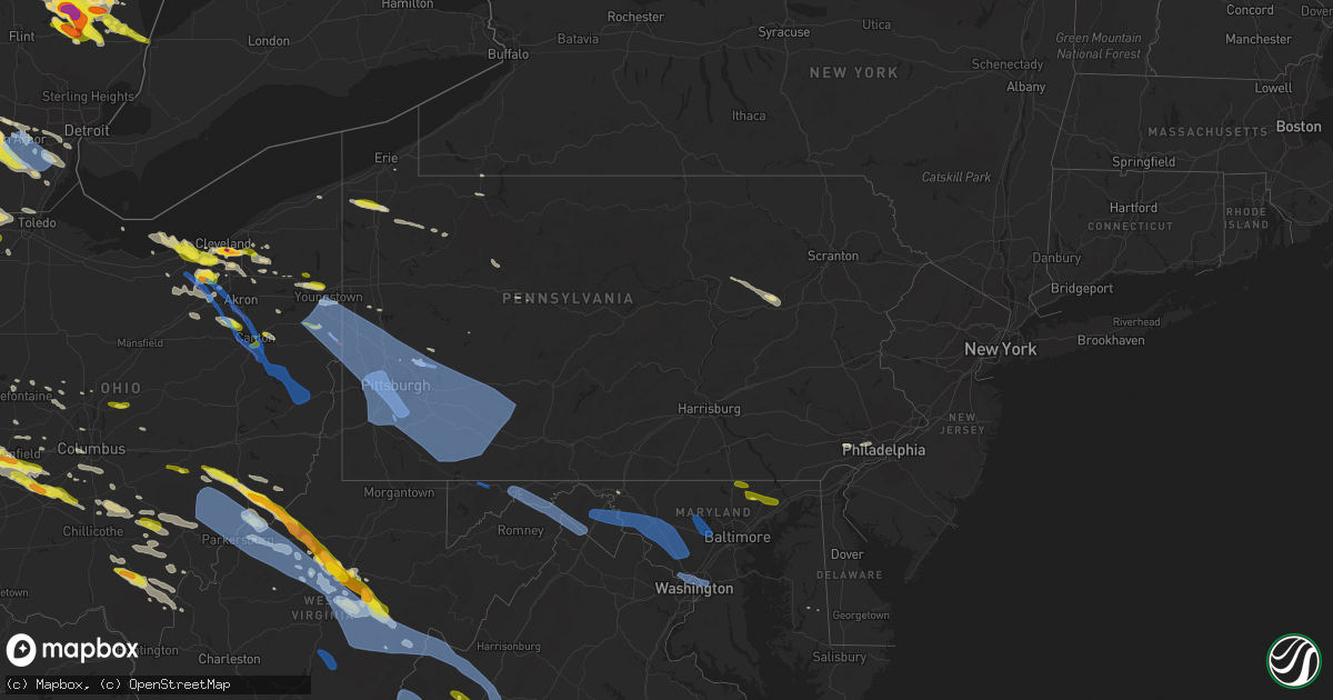
Hail Map in Pennsylvania on April 7, 2020
Get this storm
April 7 map
$229
one time, instant access
Download today. No call, no setup
Keep the $229
Bought the map and want the full workflow? Apply the entire $229 to a subscription within 7 days. None of it is wasted.
Every map, not just this one
This buys you this map. Subscription and you get every map we run, in the markets you choose from a few cities to whole states to nationwide. Plus real-time alerts the moment a storm fires.
Contact data
Name, contact info, occupancy, even credit band for addresses in the footprint. You go from where it hit to who to call.
Become the source they trust
Unlimited branding weather history reports on demand. You already have the documented answer ready for the property owner, and you are the one who showed up with it.
Property data and RoofTrace estimates
Pull up any address you have got, its value and the exact code rules for that jurisdiction, straight from One Click Code. Then RoofTrace estimates the squares, pitch, and roof value, priced the way you price.
Storm reports in Pennsylvania
Pennsylvania
| Date | Description |
|---|---|
| 04/07/20206:47 AM CDT | At 1147 PM EDT, a severe thunderstorm was located near Grove City, moving east at 45 mph. HAZARD...Wind gusts to 60 mph. SOURCE...Radar. IMPACT...Expect damage to trees and power lines, resulting in some power outages. Locations impacted include... Grove City... Harrisville... Parker... Emlenton... Bruin... Clintonville... Eau Claire... Barkeyville... Cherry Valley... This includes Interstate 80 in Pennsylvania between mile markers 23and 44, and near mile marker 46. |
| 04/07/20206:32 AM CDT | Tree fell on car blocking nemacolon road |
| 04/07/20206:31 AM CDT | At 1131 PM EDT, a severe thunderstorm was located over Titusville, or 12 miles north of Oil City, moving east at 45 mph. HAZARD...Wind gusts to 60 mph. SOURCE...Radar. IMPACT...Expect damage to trees and power lines, resulting in some power outages. Locations impacted include... Pleasantville... |
| 04/07/20206:27 AM CDT | At 1127 PM EDT, a severe thunderstorm was located near Tionesta, or 17 miles northeast of Oil City, moving east at 45 mph. HAZARD...Wind gusts to 60 mph and quarter-size hail. SOURCE...Radar. IMPACT...Minor hail damage to vehicles is possible. Expect wind damage to trees and power lines, resulting in some power outages. Locations impacted include... Marienville... Tionesta... Kellettville... West Hickory... East Hickory... Starr... |
| 04/07/20206:12 AM CDT | At 1112 PM EDT, severe thunderstorms were located along a line extending from 11 miles north of Conneaut to 9 miles northwest of Euclid, moving southeast at 60 mph. HAZARD...60 mph wind gusts and quarter size hail. SOURCE...Radar indicated. IMPACT...Minor damage to vehicles is possible. Expect damage to trees and power lines. Locations impacted include... Cleveland, Warren, Painesville, Ashtabula, Willowick, Meadville, Conneaut, Ravenna, Chardon, Fairport Harbor, Geneva-On-The-Lake, Euclid, Mentor, Cleveland Heights, Kent, Solon, Willoughby, Hudson, Niles and Twinsburg. |
| 04/07/20206:01 AM CDT | Trees down completely blocking orchard rd between houston rd and sr 551 |
| 04/07/20205:45 AM CDT | Tree fell on car blocking nemacolon road |
| 04/07/20205:43 AM CDT | Wires down at intersection of s 2nd street and knoll ave. |
| 04/07/20205:21 AM CDT | At 1021 PM EDT, a severe thunderstorm was located 7 miles southeast of Albion, or 12 miles northwest of Meadville, moving east at 40 mph. HAZARD...60 mph wind gusts and quarter size hail. SOURCE...Radar indicated. IMPACT...Minor damage to vehicles is possible. Expect damage to trees and power lines. Locations impacted include... Titusville, Cambridge Springs, Riceville, Lincolnville, Canadohta Lake, Saegertown, Conneautville, Hydetown, Springboro, Blooming Valley, Townville, Spartansburg, Venango and Woodcock. |
| 04/07/20204:04 AM CDT | Trees and wires down in vicinity of 1615 skyhill rd. |
| 04/07/20203:42 AM CDT | Arnold palmer municiple airport has 2 hangers completely destroyed... 1 severely damaged... 1 plane completely destroyed... 1 plane heavily damaged. |
| 04/07/20203:25 AM CDT | Roof blown off building constitution blvd near cts services. |
| 04/07/20202:19 AM CDT | 221 ridge ave. Roof blown of church blocking roadway. |
| 04/07/20201:31 AM CDT | Damage to press box... Bleachers... Scoreboard... Sheds and fences at meyersdale high school. |
| 04/07/20201:29 AM CDT | Trees and wires down across southern huntingdon county... Including the robertsdale area. |
| 04/07/20201:25 AM CDT | Damage to a roof and trees in new buena vista. |
| 04/07/20201:20 AM CDT | Multiple trees down on kingwood rd. |
| 04/07/20201:20 AM CDT | Several large trees were uprooted or snapped just south of rockwood. |
| 04/07/20201:15 AM CDT | Multiple trees and wires down on center ave. |
| 04/07/20201:10 AM CDT | Tree down on a house on meadow drive. |
| 04/07/20201:10 AM CDT | Multiple trees down on grove ave. |
| 04/07/20201:05 AM CDT | Several trees knocked down in davidsville. |
| 04/07/20201:05 AM CDT | 2 homes with trees through their roof. Numerous trees down. |
| 04/07/20201:00 AM CDT | Reported trees down and some structural damage in saltlick township. |
| 04/07/20201:00 AM CDT | Trees down and damage to roof of tavern. |
| 04/07/20201:00 AM CDT | Edited event time based on radar data. Tree fell on car blocking nemacolon road |
| 04/07/202012:54 AM CDT | Several large trees down all over east keefer road |
| 04/07/202012:51 AM CDT | Large tree down near the intersection of skate ln and longanecker road |
| 04/07/202012:50 AM CDT | Damage to roofing with gutters peeled off. |
| 04/07/202012:49 AM CDT | Large commercial garage blown off foundation. |
| 04/07/202012:48 AM CDT | Tree down on residence. |
| 04/07/202012:46 AM CDT | Tree down on residence. |
| 04/07/202012:42 AM CDT | Edited event time to match radar data. Arnold palmer municiple airport has 2 hangers completely destroyed... 1 severely damaged... 1 plane completely destroyed... 1 pla |
| 04/07/202012:40 AM CDT | 701 peer street roof blown off garage and garage displaced from foundation. Also sign for greg's pub blown off building. |
| 04/07/202012:36 AM CDT | Tree down on residence. |
| 04/07/202012:34 AM CDT | Tree down on residence in west newton. |
| 04/07/202012:33 AM CDT | A local report indicates 62 MPH wind near JEANNETTE |
| 04/07/202012:33 AM CDT | Trees down on willowbrook road in rostraver twp. |
| 04/07/202012:30 AM CDT | Trees and power lines down with power outages |
| 04/07/202012:30 AM CDT | Downed trees and penny sized hail |
| 04/07/202012:30 AM CDT | Tree down on mars hill rd. |
| 04/07/202012:30 AM CDT | Numerous trees down along vernon rd in rostraver twp. |
| 04/07/202012:29 AM CDT | A local report indicates 61 MPH wind near 1 W WEST MIFFLIN |
| 04/07/202012:25 AM CDT | Report of numerous trees down and uprooted. Also reported snapped flagpoles. Time estimated based on radar. |
| 04/07/202012:25 AM CDT | Parts of brick storefront brought down in clairton. |
| 04/07/202012:25 AM CDT | Numerous trees and wires down across bell township |
| 04/07/202012:23 AM CDT | Tree blown over in mcmurray. |
| 04/07/202012:22 AM CDT | Numerous trees and wires down across washington township. |
| 04/07/202012:20 AM CDT | Penndot instrumentation measurement at interstate 79 northbound at exit 60 crafton |
| 04/07/202012:20 AM CDT | Large tree down in a yard. Power lines also down around mt. Lebanon.. Castle shannon border. |
| 04/07/202012:18 AM CDT | Report of multiple trees and power lines down around northmoreland park. |
| 04/07/202012:18 AM CDT | Report of trees down along county road 780. Time estimated based on radar. Corrected for date. |
| 04/07/202012:17 AM CDT | The nws storm servey determined an ef-0 tornado touched down along riverview street near lower burrell. The maximum wind speed was estimated at 70 mph... With a path le |
| 04/07/202012:16 AM CDT | Top of trees snapped off in penn hills. Time estimated based on radar data. |
| 04/07/202012:15 AM CDT | Large tree on house |
| 04/07/202012:15 AM CDT | A local report indicates 1.25 inch wind near TARENTUM |
| 04/07/202012:15 AM CDT | 1005 chaintown rd. Garage collapsed with telephone pole snapped off. |
| 04/07/202012:15 AM CDT | Numerous trees and wires down. |
| 04/07/202012:15 AM CDT | Public reports widespread damage to trees...fences...awnings and other structures. |
| 04/07/202012:14 AM CDT | Roof blown off st. Mary of czestochowa in new kensington. |
| 04/07/202012:14 AM CDT | Tree fell into a home in frazer township. |
| 04/07/202012:14 AM CDT | Numerous trees and wires down in new kensington. |
| 04/07/202012:13 AM CDT | Roof damage to three houses. Blown down trees around area. |
| 04/07/202012:13 AM CDT | Changed time to match radar data. 221 ridge ave. Roof blown of church blocking roadway. |
| 04/07/202012:12 AM CDT | Tree down on residence in lower burrell. |
| 04/07/202012:11 AM CDT | The nws storm survey determined an ef-1 tornado touched down approximately 3 miles nw of tarentum... And continued to new kensington. The maximum wind speed was estimat |
| 04/07/202012:11 AM CDT | 600 wampum ave. A 40 foot pine tree fell on residence. No reported injuries. |
| 04/07/202012:10 AM CDT | Report of trees down and roof damage with trampolines moved around. |
| 04/07/202012:09 AM CDT | Report of roof damage and trees down plus moved trampoline. Time estimated based on radar. |
| 04/07/202012:09 AM CDT | Personal report of several trees down in persons yard and at least 1 that hit their house. |
| 04/07/202012:08 AM CDT | Report of small tree limbs down and moving trampoline 60 feet. Time estimated based on radar. |
| 04/07/202012:08 AM CDT | Report of multiple trees snapped or uprooted. Time estimated based on radar. |
| 04/07/202012:06 AM CDT | 65 knot gust measured at pit asos |
| 04/07/202012:06 AM CDT | Tree down at intersection of coraopolis rd and route 51 |
| 04/07/202012:05 AM CDT | Multiple trees and power lines down in the borough of sewickly |
| 04/07/202012:04 AM CDT | Report of large tree uprooted. Time estimated based on radar. |
| 04/07/202012:03 AM CDT | Multiple trees and power lines down across the area |
| 04/07/202012:00 AM CDT | Numerous trees down. Playhouse blown over 100 yds away. |
| 04/07/202012:00 AM CDT | Tree limbs down and siding blown off house. |
| 04/07/202012:00 AM CDT | 127 blue valley drive... Cranbery twp. 7 large trees downed by thunderstorm winds. |
| 04/07/202012:00 AM CDT | Can hear trees falling in the woods adjacent to the nws office. Winds have been gusting to near 70 mph for almost 10 minutes continuously. Power out. |
| 04/06/202011:54 PM CDT | House blown off foundation about 1 mile north of sunflower corner. Time estimated based on radar data. |
| 04/06/202011:50 PM CDT | Porch roof blown off |
| 04/06/202011:50 PM CDT | House collapsed on foundation. |
| 04/06/202011:50 PM CDT | Tree down on house. |
| 04/06/202011:48 PM CDT | Many trees down on farm at 132 shadyrest road. 7-8 healthy and 3 dead trees were downed... One fell on a garage. |
| 04/06/202011:46 PM CDT | Tree on residence. |
| 04/06/202011:45 PM CDT | Report of shingle damage to roof and many broken limbs. Time estimated based on radar. |
| 04/06/202011:45 PM CDT | Trees uprooted... Power lines down... Damage to multiple structures |
| 04/06/202011:44 PM CDT | Report of many snapped trees along dehaven road. Time estimated based on radar. |
| 04/06/202011:44 PM CDT | 615 wayne avenue large pine tree uprooted and fell on garage. |
| 04/06/202011:43 PM CDT | Building leveled in ellwood city. Additional report of another commercial building with a roof ripped off. |
| 04/06/202011:42 PM CDT | Edited time based on radar data. Wires down at intersection of s 2nd street and knoll ave. |
| 04/06/202011:42 PM CDT | Tree down on home. |
| 04/06/202011:40 PM CDT | Numerous trees and utility poles down in the wampum area near state route 18 |
| 04/06/202011:40 PM CDT | 834 cresent ave pine tree fell on residence and vehicle. No injuries reported. |
| 04/06/202011:38 PM CDT | Edited event time based on radar data. Trees down completely blocking orchard rd between houston rd and sr 551 |
| 04/06/202011:35 PM CDT | Tree down in driveway |
| 04/06/202011:31 PM CDT | Damage to press box... Bleachers... Scoreboard... Sheds and fences at meyersdale high school. |
| 04/06/202011:31 PM CDT | Edited time based on radar data. Trees and wires down in vicinity of 1615 skyhill rd. |
| 04/06/202011:25 PM CDT | Downed trees on power lines in neshannock township on state route 18 |
| 04/06/202011:20 PM CDT | Several large trees were uprooted or snapped just south of rockwood. |
| 04/06/202011:15 PM CDT | Tree down along kinzua rd. |
| 04/06/202010:59 PM CDT | Scattered downed trees and power lines down along n. Neshannock rd. |
| 04/06/202010:59 PM CDT | Trees and power lines down around the sharpsville area. |
| 04/06/202010:59 PM CDT | Numerous trees and power lines down along rte 62 |
| 04/06/202010:55 PM CDT | Barn destroyed... Wind damage to house and trees down. Time estimated from radar. |
| 04/06/202010:47 PM CDT | Numerous trees down near addre4ss of 17650 route 666... West hickory twp. |
| 04/06/202010:28 PM CDT | Report from mping: quarter |
| 04/06/20209:39 PM CDT | Report via social media. |
All States Impacted by Hail Map on April 7, 2020
Cities Impacted by Hail Map on April 7, 2020
- New Kensington, PA
- Natrona Heights, PA
- Brackenridge, PA
- Tarentum, PA
- Bryant, IN
- Keystone, IN
- Geneva, IN
- Hartford City, IN
- Montpelier, IN
- Portland, IN
- Pennville, IN
- Galloway, OH
- Columbus, OH
- Pomeroy, OH
- Middleport, OH
- Marion, IA
- Berwick, PA
- South Solon, OH
- Bloomingburg, OH
- New Holland, OH
- Jeffersonville, OH
- Washington Court House, OH
- Kewanna, IN
- Springville, IA
- Alburnett, IA
- Jamestown, OH
- Cedarville, OH
- Taylor Ridge, IL
- Maple Heights, OH
- Independence, OH
- Bedford, OH
- Cleveland, OH
- Gratiot, WI
- South Whitley, IN
- Patriot, OH
- Gallipolis, OH
- Hope, MI
- Beaverton, MI
- Saegertown, PA
- Conneautville, PA
- Springboro, PA
- Venango, PA
- Joy, IL
- North English, IA
- Wapello, IA
- Letts, IA
- Alexis, IL
- Columbus Junction, IA
- North Henderson, IL
- Kalona, IA
- Riverside, IA
- Galesburg, IL
- Ainsworth, IA
- Muscatine, IA
- Seaton, IL
- New Boston, IL
- Parnell, IA
- Lone Tree, IA
- Wataga, IL
- Conesville, IA
- Aledo, IL
- Wellman, IA
- Clare, IL
- Monroe Center, IL
- Sycamore, IL
- Genoa, IL
- Kingston, IL
- Saint Charles, IL
- Hampshire, IL
- Esmond, IL
- Maple Park, IL
- Kirkland, IL
- Wauseon, OH
- Hopkins, MI
- Coldwater, MI
- Clayton, MI
- Union City, MI
- Martin, MI
- Litchfield, MI
- Marshall, MI
- Jasper, MI
- Hillsdale, MI
- Sand Creek, MI
- Galesburg, MI
- Augusta, MI
- Otsego, MI
- Delton, MI
- Ceresco, MI
- Richland, MI
- Delta, OH
- Homer, MI
- East Leroy, MI
- Jonesville, MI
- Morenci, MI
- Metamora, OH
- Pittsford, MI
- Kalamazoo, MI
- Plainwell, MI
- Osseo, MI
- Lyons, OH
- Fayette, OH
- Bellevue, MI
- Waldron, MI
- Allen, MI
- Hickory Corners, MI
- Burlington, MI
- Allegan, MI
- Battle Creek, MI
- Quincy, MI
- Hudson, MI
- Tekonsha, MI
- Climax, MI
- Arcadia, MI
- Bear Lake, MI
- Forestville, WI
- Algoma, WI
- Marlette, MI
- Brown City, MI
- Shickshinny, PA
- Orangeville, PA
- Clinton, OH
- Marshallville, OH
- Canal Fulton, OH
- Kennan, WI
- Hawkins, WI
- Catawba, WI
- Tony, WI
- Glen Flora, WI
- Ladysmith, WI
- Cedar Rapids, IA
- Colona, IL
- Donahue, IA
- Martelle, IA
- Stockton, IA
- Pleasant Valley, IA
- New Liberty, IA
- Norway, IA
- Anamosa, IA
- Fairfax, IA
- Walcott, IA
- Lowden, IA
- Moline, IL
- Hiawatha, IA
- Eldridge, IA
- Stanwood, IA
- Tipton, IA
- Hampton, IL
- Clarence, IA
- Olin, IA
- Bettendorf, IA
- Atkins, IA
- Wheatland, IA
- Solon, IA
- Silvis, IL
- Mechanicsville, IA
- Mount Vernon, IA
- Davenport, IA
- Calamus, IA
- Durant, IA
- Long Grove, IA
- Wilton, IA
- Lisbon, IA
- East Moline, IL
- Carbon Cliff, IL
- Dixon, IA
- Bennett, IA
- Ely, IA
- Browntown, WI
- Shullsburg, WI
- Orangeville, IL
- Juda, WI
- South Wayne, WI
- Davis, IL
- Monroe, WI
- Darlington, WI
- Rock City, IL
- Winslow, IL
- Dakota, IL
- Slinger, WI
- Grafton, WI
- Saukville, WI
- West Bend, WI
- Jackson, WI
- Hartford, WI
- Cedarburg, WI
- Durand, IL
- Winnebago, IL
- Bourbon, IN
- Alum Bridge, WV
- New Milton, WV
- Weston, WV
- Camden, WV
- Bay City, MI
- Saginaw, MI
- University Center, MI
- Essexville, MI
- Munger, MI
- Potterville, MI
- Grand Ledge, MI
- Rockford, IL
- Pecatonica, IL
- Milwaukee, WI
- Aurora, OH
- Mantua, OH
- McDonald, OH
- Mineral Ridge, OH
- Girard, OH
- Niles, OH
- Warren, OH
- Middleville, MI
- Caledonia, MI
- Star City, IN
- Winamac, IN
- Centerburg, OH
- Croton, OH
- Marietta, OH
- New Matamoras, OH
- Dexter City, OH
- Wingett Run, OH
- Whipple, OH
- Lower Salem, OH
- Macksburg, OH
- Mesick, MI
- Lake City, MI
- Buckley, MI
- Merritt, MI
- Manton, MI
- Kingsley, MI
- Humboldt, IL
- Hersey, MI
- Evart, MI
- Brodnax, VA
- Kenbridge, VA
- Rock Cave, WV
- New Boston, MI
- Belleville, MI
- Lakewood, NY
- Jamestown, NY
- Pinconning, MI
- Leroy, MI
- Cadillac, MI
- Rhodes, MI
- Harrison, MI
- Brethren, MI
- Onekama, MI
- Coleman, MI
- Clare, MI
- Marion, MI
- Midland, MI
- Gladwin, MI
- Linwood, MI
- Tustin, MI
- Wellston, MI
- Kaleva, MI
- Copemish, MI
- Boon, MI
- Auburn, MI
- Harrietta, MI
- Lake, MI
- McBain, MI
- Sanford, MI
- Chippewa Lake, MI
- Mecosta, MI
- Rodney, MI
- Valley City, OH
- Luxemburg, WI
- Casco, WI
- Sobieski, WI
- Pulaski, WI
- Little Suamico, WI
- Abrams, WI
- Brussels, WI
- Sturgeon Bay, WI
- Oconto, WI
- Krakow, WI
- Harrisville, WV
- Cairo, WV
- Milford, IN
- New Paris, IN
- Brunswick, OH
- Litchfield, OH
- Medina, OH
- North Royalton, OH
- Wadsworth, OH
- Spencer, OH
- Strongsville, OH
- Wellington, OH
- Columbia Station, OH
- Hinckley, OH
- Seville, OH
- McConnell, IL
- Winnetka, IL
- Glenview, IL
- Golf, IL
- Chicago, IL
- Wilmette, IL
- Morton Grove, IL
- Evanston, IL
- Skokie, IL
- Jackson, OH
- Thurman, OH
- Oak Hill, OH
- Vinton, OH
- Portage, IN
- Lake Station, IN
- Valparaiso, IN
- Hobart, IN
- Warsaw, VA
- Kilmarnock, VA
- White Stone, VA
- Weems, VA
- Machipongo, VA
- Cape Charles, VA
- Irvington, VA
- Farnham, VA
- Heathsville, VA
- Lancaster, VA
- Bruce, WI
- Exeland, WI
- Lake Odessa, MI
- Pandora, OH
- Bluffton, OH
- Cambridge Springs, PA
- Mcconnelsville, OH
- Blue Rock, OH
- Middlebourne, WV
- Friendly, WV
- Graysville, OH
- Lowell, OH
- Reno, OH
- Caldwell, OH
- Ellenboro, WV
- Cumberland, OH
- Saint Marys, WV
- Pennsboro, WV
- Chandlersville, OH
- Marysville, OH
- Ostrander, OH
- Coxs Mills, WV
- Beachwood, OH
- Shell Lake, WI
- Spooner, WI
- Blanchard, MI
- Shepherd, MI
- Mount Pleasant, MI
- Cherry Valley, IL
- Syracuse, IN
- Millersburg, IN
- Goshen, IN
- Menomonee Falls, WI
- Iowa City, IA
- Walker, WV
- Waverly, WV
- Olmsted Falls, OH
- North Olmsted, OH
- Elyria, OH
- Lorain, OH
- Avon, OH
- North Ridgeville, OH
- Sheffield Lake, OH
- Westlake, OH
- Circleville, OH
- Kingston, OH
- Laurelville, OH
- Croswell, MI
- Preston, MD
- Kenilworth, IL
- Niles, IL
- Des Plaines, IL
- Clifford, MI
- Imlay City, MI
- Fostoria, MI
- Attica, MI
- Mayville, MI
- North Branch, MI
- Nashville, MI
- Vermontville, MI
- Saint Louis, MI
- Merrill, MI
- Breckenridge, MI
- Freeland, MI
- Mchenry, IL
- Weidman, MI
- Berne, IN
- Calumet City, IL
- Plymouth, MI
- Mattawan, MI
- Ottawa Lake, MI
- Toledo, OH
- Erie, MI
- Lambertville, MI
- Temperance, MI
- Victoria, VA
- Lunenburg, VA
- Keysville, VA
- Wanatah, IN
- Hillsdale, IN
- Chillicothe, OH
- Wellston, OH
- Ray, OH
- Beaver, OH
- Emmett, MI
- Lowell, MI
- Alto, MI
- Farwell, MI
- Mecca, IN
- Rosedale, IN
- Montezuma, IN
- Clinton, IN
- Chrisman, IL
- Rockville, IN
- Dana, IN
- Port Washington, WI
- Rubicon, WI
- Robins, IA
- Grand Mound, IA
- Toddville, IA
- Palo, IA
- North Judson, IN
- San Pierre, IN
- Huntsville, OH
- Bellefontaine, OH
- Mount Zion, WV
- Arnoldsburg, WV
- Edmore, MI
- Morley, MI
- Howard City, MI
- Six Lakes, MI
- Newaygo, MI
- Lakeview, MI
- Charlotte, MI
- Dowling, MI
- Dorr, MI
- Shelbyville, MI
- Wayland, MI
- Monterey, IN
- Westville, IN
- Hammond, IN
- Hanna, IN
- Whiting, IN
- Gary, IN
- Dolton, IL
- Alsip, IL
- Union Mills, IN
- La Porte, IN
- La Crosse, IN
- Riverdale, IL
- Blue Island, IL
- East Chicago, IN
- Knox, IN
- Havertown, PA
- Haverford, PA
- Broomall, PA
- Ardmore, PA
- Wynnewood, PA
- Monroe, MI
- Maybee, MI
- Frewsburg, NY
- Russell, PA
- West Union, WV
- Cass, WV
- Arbovale, WV
- Durbin, WV
- Casstown, OH
- Troy, OH
- New Carlisle, OH
- Houghton Lake, MI
- Prudenville, MI
- Belmont, WI
- Pitsburg, OH
- Yellow Springs, OH
- Enon, OH
- West Milton, OH
- Medway, OH
- Tipp City, OH
- South Charleston, OH
- Vandalia, OH
- Greenville, OH
- London, OH
- Springfield, OH
- Laura, OH
- Englewood, OH
- Dayton, OH
- Fairborn, OH
- Ludlow Falls, OH
- Arcanum, OH
- Union City, IN
- Union City, OH
- Southgate, MI
- Allen Park, MI
- Lincoln Park, MI
- Taylor, MI
- Holland, MI
- Hamilton, MI
- Silverwood, MI
- Columbiaville, MI
- Allenton, MI
- Capac, MI
- Otter Lake, MI
- Lapeer, MI
- Melvin, MI
- Peck, MI
- Yale, MI
- Millington, MI
- Cambridge, IL
- Milan, IL
- Moscow, IA
- Reynolds, IL
- Orion, IL
- Sherrard, IL
- Lynn Center, IL
- Illinois City, IL
- West Liberty, IA
- Atalissa, IA
- Andalusia, IL
- Niles, MI
- Grand Rapids, MI
- Saint Marys, OH
- Whitehall, MI
- Sears, MI
- Barryton, MI
- Montague, MI
- Troy, WV
- Willow Springs, IL
- Bidwell, OH
- French Creek, WV
- Helvetia, WV
- Pickens, WV
- Tallmansville, WV
- Mill Creek, WV
- Nappanee, IN
- Walkersville, WV
- Saline, MI
- Hickory Hills, IL
- Palos Hills, IL
- Chicago Ridge, IL
- Bridgeview, IL
- Oak Lawn, IL
- Willowbrook, IL
- Freeport, MI
- Newton Falls, OH
- Leavittsburg, OH
- Massillon, OH
- Doylestown, OH
- North Lawrence, OH
- Buckhannon, WV
- Chelsea, MI
- Kingston, MI
- Vassar, MI
- Grand Rapids, OH
- Federalsburg, MD
- Bridgeville, DE
- Grass Lake, MI
- Munith, MI
- Ann Arbor, MI
- Stockbridge, MI
- Dexter, MI
- Manchester, MI
- Loves Park, IL
- Belvidere, IL
- Rockton, IL
- Machesney Park, IL
- Whitmore Lake, MI
- Mequon, WI
- Byron, IL
- Leaf River, IL
- Crivitz, WI
- Kawkawlin, MI
- Creston, OH
- Crooksville, OH
- Roseville, OH
- Berea, OH
- Brecksville, OH
- Macedonia, OH
- Hudson, OH
- Brookpark, OH
- Northfield, OH
- Chagrin Falls, OH
- Broadview Heights, OH
- Solon, OH
- Avon Lake, OH
- Celoron, NY
- Ashville, NY
- Bemus Point, NY
- Carsonville, MI
- Woodland, MI
- Birchwood, WI
- Buchanan, MI
- Sawyer, MI
- Three Oaks, MI
- New Troy, MI
- Galien, MI
- Nunica, MI
- Coopersville, MI
- Spring Lake, MI
- Mineral Point, WI
- Platteville, WI
- Deltaville, VA
- Callao, VA
- Ireland, WV
- Berkey, OH
- Byron Center, MI
- Blissfield, MI
- Athens, MI
- Adrian, MI
- Swanton, OH
- Dimondale, MI
- Mulliken, MI
- Lansing, MI
- Eaton Rapids, MI
- Mason, MI
- Pleasant Lake, MI
- Holt, MI
- Gregory, MI
- Britton, MI
- Pinckney, MI
- Clinton, MI
- Leslie, MI
- Dansville, MI
- Milan, MI
- Remus, MI
- Rockford, MI
- Belmont, MI
- South Rockwood, MI
- Flat Rock, MI
- Rockwood, MI
- Carleton, MI
- Romulus, MI
- Richwood, OH
- Michigan City, IN
- North Liberty, IA
- Parma, MI
- Albion, MI
- Olivet, MI
- Springport, MI
- Athens, OH
- Tobaccoville, NC
- Rural Hall, NC
- Ripley, NY
- Cuba City, WI
- Poplar Grove, IL
- Ridott, IL
- Warren, IL
- Stillman Valley, IL
- Argyle, WI
- Davis Junction, IL
- Lena, IL
- Freeport, IL
- Garden Prairie, IL
- Stockton, IL
- Nora, IL
- Ogema, WI
- Westboro, WI
- Rib Lake, WI
- Kelleys Island, OH
- Albion, IN
- Lakeview, OH
- Jane Lew, WV
- Hertel, WI
- Hudsonville, MI
- Jerome, MI
- Holland, OH
- Iron Ridge, WI
- Saugatuck, MI
- Douglas, MI
- North Adams, MI
- Zeeland, MI
- Fennville, MI
- Sylvania, OH
- Liberty Center, OH
- Hastings, MI
- Monticello, IA
- Langworthy, IA
- Elberon, VA
- Waverly, VA
- Spring Grove, VA
- Dendron, VA
- Selbyville, WV
- Crawford, WV
- Kanawha Head, WV
- Valley Head, WV
- Napier, WV
- Huttonsville, WV
- Hacker Valley, WV
- Kimmell, IN
- Granville, OH
- Newark, OH
- Hagerstown, MD
- Mechanicsburg, OH
- Urbana, OH
- Muskegon, MI
- Saint John, IN
- Crown Point, IN
- Frankenmuth, MI
- Bridgeport, MI
- Sunfield, MI
- Smithville, WV
- Auburn, WV
- Twin Lake, MI
- Caledonia, IL
- Westmont, IL
- Clarendon Hills, IL
- Downers Grove, IL
- Oak Brook, IL
- Albany, OH
- McArthur, OH
- Hamden, OH
- Wilkesville, OH
- Reese, MI
- Fairgrove, MI
- North Street, MI
- Jeddo, MI
- White Cloud, MI
- Smiths Creek, MI
- Port Huron, MI
- Fort Gratiot, MI
- Akron, MI
- Riverdale, MI
- Avoca, MI
- Memphis, MI
- Caro, MI
- Donnelsville, OH
- Palestine, OH
- Winchester, IN
- Bradford, OH
- New Castle, PA
- Orlando, WV
- Burnsville, WV
- Glenville, WV
- Linn, WV
- Sand Fork, WV
- Stanton, MI
- Delaware, OH
- Central City, IA
- Malvern, PA
- Newtown Square, PA
- West Chester, PA
- Rockbridge, OH
- Logan, OH
- Canton, MI
- Ypsilanti, MI
- Sigel, PA
- Forest Hill, MD
- Jarrettsville, MD
- Centerville, PA
- Guys Mills, PA
- Townville, PA
- Titusville, PA
- Chicago Heights, IL
- Crete, IL
- Steger, IL
- Raymond, OH
- Belle Center, OH
- Rushsylvania, OH
- Laotto, IN
- Avilla, IN
- Union Pier, MI
- New Buffalo, MI
- Novelty, OH
- Saint Helen, MI
- Woodstock, IL
- Newbury, OH
- Kendallville, IN
- Corunna, IN
- Ashley, IN
- Falmouth, MI
- Hillsdale, IL
- Stoutsville, OH
- Adelphi, OH
- Roanoke, IN
- Columbia City, IN
- Lakeside, MI
- Bridgman, MI
- Harbert, MI
- New Carlisle, IN
- Grovertown, IN
- Plymouth, IN
- Fort Wayne, IN
- Yoder, IN
- Slippery Rock, PA
- Coralville, IA
- Big Rapids, MI
- Paris, MI
- Webster, WI
- Siren, WI
- Sarona, WI
- West Chicago, IL
- Warrenville, IL
- Wheaton, IL
- Winfield, IL
- Vesuvius, VA
- Grandview, IA
- Marengo, IL
- Pleasantville, PA
- Butler, WI
- Rocky River, OH
- Columbus Grove, OH
- Menominee, MI
- South Lyon, MI
- Tecumseh, MI
- Dundee, MI
- Roscoe, IL
- Newport, OH
- Belmont, WV
- Cromwell, IN
- Ligonier, IN
- Dayton, PA
- Campbell, OH
- Struthers, OH
- Youngstown, OH
- Canfield, OH
- Lowellville, OH
- Slatyfork, WV
- Willshire, OH
- Decatur, IN
- Monroe, IN
- Rockford, OH
- Mendon, OH
- Argos, IN
- Marion, IN
- Dunkirk, IN
- Groveport, OH
- Lockbourne, OH
- Grove City, OH
- Orient, OH
- Ashville, OH
- Ashtabula, OH
- Goshen, VA
- Craigsville, VA
- Radisson, WI
- Winter, WI
- Merrill, WI
- Porterfield, WI
- Wallace, MI
- Paw Paw, MI
- Chesterton, IN
- Oberlin, OH
- Williamstown, WV
- Horner, WV
- Warsaw, IN
- Etna Green, IN
- Leesburg, IN
- Paris, IL
- New Plymouth, OH
- Creola, OH
- Vicksburg, MI
- Scotts, MI
- Fulton, MI
- Pleasant Hill, OH
- Brookville, OH
- Williamsport, OH
- Mount Sterling, OH
- North Hampton, OH
- Piqua, OH
- Clarksburg, OH
- Xenia, OH
- Covington, OH
- Seaford, DE
- Hometown, IL
- Merrillville, IN
- Griffith, IN
- Midlothian, IL
- Palos Heights, IL
- La Grange, IL
- South Holland, IL
- Palos Park, IL
- Evergreen Park, IL
- Posen, IL
- Crestwood, IL
- Worth, IL
- Darien, IL
- Robbins, IL
- Pierceton, IN
- Claypool, IN
- Erie, PA
- Freeport, PA
- Vandergrift, PA
- Bentley, MI
- Bryn Mawr, PA
- Stone Lake, WI
- Tomahawk, WI
- Alberta, VA
- Hiram, OH
- Gibsonia, PA
- Pewaukee, WI
- Sussex, WI
- Windham, OH
- Du Bois, PA
- Charleston, IL
- Jonesboro, IN
- Upland, IN
- Fowlerton, IN
- Fairmount, IN
- Elwell, MI
- Clarksville, MI
- Ada, MI
- South Bend, IN
- Walkerton, IN
- Bremen, IN
- Lakeville, IN
- Dryden, MI
- Metamora, MI
- Mill Creek, IN
- Rolling Prairie, IN
- Streetsboro, OH
- Lewisville, OH
- Summerfield, OH
- Rutland, OH
- Langsville, OH
- Lawrenceville, VA
- New Haven, IN
- New Marshfield, OH
- South Bloomingville, OH
- Baileys Harbor, WI
- Fish Creek, WI
- Dublin, OH
- Nelsonville, OH
- Amesville, OH
- Millfield, OH
- The Plains, OH
- Chauncey, OH
- Munster, IN
- Dyer, IN
- Lansing, IL
- Hazel Crest, IL
- Homewood, IL
- Highland, IN
- Country Club Hills, IL
- Schererville, IN
- Glenwood, IL
- Ridgeville, IN
- Redkey, IN
- Muncie, IN
- Eaton, IN
- Albany, IN
- Houston, OH
- Enfield, NC
- Ashley, OH
- Grantsburg, WI
- Wyoming, MI
- Edwardsburg, MI
- Berea, WV
- Pullman, WV
- Ossian, IN
- Vermilion, OH
- German Valley, IL
- Petroleum, WV
- Parkersburg, WV
- Elburn, IL
- West Branch, IA
- Rockton, PA
- Carrollton, MI
- Gallipolis Ferry, WV
- Rio Grande, OH
- Haviland, OH
- Paulding, OH
- Marne, MI
- Barronett, WI
- Woodsfield, OH
- Middlebrook, VA
- Raphine, VA
- Ojibwa, WI
- Apple River, IL
- Scales Mound, IL
- Garrettsville, OH
- Limaville, OH
- Atwater, OH
- Alliance, OH
- Inkster, MI
- Westland, MI
- Wayne, MI
- Dearborn Heights, MI
- Mentone, IN
- Warren, PA
- Concord, MI
- Hanover, MI
- Smithfield, VA
- Suffolk, VA
- Arlington Heights, IL
- Northbrook, IL
- Mount Prospect, IL
- Prospect Heights, IL
- Glen Ellyn, IL
- Russia, OH
- Versailles, OH
- Paris, OH
- Louisville, OH
- East Canton, OH
- Sullivan, IL
- Ridgeway, OH
- West Mansfield, OH
- Fort Jennings, OH
- Oxford, IA
- Amanda, OH
- Granger, IN
- Elkhart, IN
- Burbank, OH
- West Salem, OH
- Grandville, MI
- Columbiana, OH
- Leetonia, OH
- Salem, OH
- Henderson, WV
- Apple Grove, WV
- Fletcher, OH
- Willis, MI
- Mishawaka, IN
- Richfield, OH
- Warren, IN
- Van Buren, IN
- Vestaburg, MI
- Portland, MI
- Rittman, OH
- Elgin, IL
- Dekalb, IL
- Cedarville, IL
- Fort Loramie, OH
- Burkettsville, OH
- New Weston, OH
- Saint Henry, OH
- Salamonia, IN
- Rossburg, OH
- Fort Recovery, OH
- Tippecanoe, IN
- Lairdsville, PA
- Hughesville, PA
- Stillwater, PA
- Unityville, PA
- Muncy, PA
- Millville, PA
- Nescopeck, PA
- Benton, PA
- Le Claire, IA
- Port Byron, IL
- Newhall, IA
- Rock Island, IL
- Montpelier, IA
- Blue Grass, IA
- Coal Valley, IL
- Nichols, IA
- Fruitland, IA
- Manistee, MI
- Thompsonville, MI
- Fife Lake, MI
- Houghton Lake Heights, MI
- Ellicott City, MD
- Marriottsville, MD
- Woodstock, MD
- West Friendship, MD
- Sykesville, MD
- Somerset, OH
- New Lexington, OH
- Mount Perry, OH
- Philo, OH
- Washingtonville, OH
- East Sparta, OH
- Canton, OH
- Sunbury, OH
- Oconto Falls, WI
- Dickeyville, WI
- Potosi, WI
- Justice, IL
- Wasco, IL
- Lombard, IL
- Bristol, IN
- Middlebury, IN
- Union, MI
- Kingsford Heights, IN
- Hamlet, IN
- Parkton, MD
- White Hall, MD
- Street, MD
- Aberdeen, MD
- Monkton, MD
- Fallston, MD
- Churchville, MD
- Bel Air, MD
- Brentwood, MD
- Cabin John, MD
- Riverdale, MD
- Potomac, MD
- Capitol Heights, MD
- Chevy Chase, MD
- Hyattsville, MD
- Washington, DC
- Bladensburg, MD
- Takoma Park, MD
- Mount Rainier, MD
- Bethesda, MD
- Glen Echo, MD
- Edinboro, PA
- Mount Solon, VA
- Beverly, OH
- Stewart, OH
- Blue Grass, VA
- Doe Hill, VA
- Webster Springs, WV
- Head Waters, VA
- Cleveland, WV
- Dunmore, WV
- Copen, WV
- Little Hocking, OH
- McDowell, VA
- Mineral Wells, WV
- Brohard, WV
- Cowen, WV
- Heaters, WV
- Belpre, OH
- Diana, WV
- Davisville, WV
- Flatwoods, WV
- Malta, OH
- Churchville, VA
- Big Springs, WV
- Bartow, WV
- Vienna, WV
- Vincent, OH
- West Augusta, VA
- Coal Run, OH
- Fishersville, VA
- Lyndhurst, VA
- Waynesboro, VA
- Swoope, VA
- Stockport, OH
- Williamsville, VA
- Washington, WV
- Elizabeth, WV
- Bergoo, WV
- Sutton, WV
- Monterville, WV
- Cutler, OH
- Stuarts Draft, VA
- Monterey, VA
- Macfarlan, WV
- Chesterhill, OH
- Staunton, VA
- Fleming, OH
- Waterford, OH
- Green Bank, WV
- Craigsville, WV
- Fenwick, WV
- Camden On Gauley, WV
- Tioga, WV
- Summersville, WV
- Calvin, WV
- Slickville, PA
- Bethel Park, PA
- Glassport, PA
- North Lima, OH
- Bolivar, PA
- Bradfordwoods, PA
- New Waterford, OH
- Champion, PA
- Blairsville, PA
- Mount Braddock, PA
- Wickhaven, PA
- Indianola, PA
- Homestead, PA
- New Springfield, OH
- Stoystown, PA
- Clinton, PA
- Turtle Creek, PA
- Midland, PA
- Webster, PA
- Mars, PA
- Perryopolis, PA
- Valencia, PA
- Eighty Four, PA
- Irwin, PA
- Pitcairn, PA
- Donegal, PA
- Waltersburg, PA
- Elizabeth, PA
- Roscoe, PA
- Lawrence, PA
- Jerome, PA
- Warrendale, PA
- Greenock, PA
- Saxonburg, PA
- Boswell, PA
- New Alexandria, PA
- Luxor, PA
- Jeannette, PA
- Crabtree, PA
- Hollsopple, PA
- Youngstown, PA
- Bessemer, PA
- Smithton, PA
- Coraopolis, PA
- Edinburg, PA
- Lowber, PA
- Jones Mills, PA
- East Palestine, OH
- Bakerstown, PA
- Somerset, PA
- Butler, PA
- Tarrs, PA
- Yukon, PA
- Shippingport, PA
- East Liverpool, OH
- Cranberry Township, PA
- Dickerson Run, PA
- Ardara, PA
- Rector, PA
- Harrison City, PA
- Sutersville, PA
- Monessen, PA
- Grindstone, PA
- Bovard, PA
- Windber, PA
- Georgetown, PA
- Indian Head, PA
- Bradenville, PA
- Mill Run, PA
- Derry, PA
- Rochester, PA
- Gray, PA
- Allenport, PA
- Morgan, PA
- Bunola, PA
- Markleton, PA
- Delmont, PA
- Carnegie, PA
- Cuddy, PA
- Elco, PA
- Wyano, PA
- Ruffs Dale, PA
- Mckeesport, PA
- Rogers, OH
- Petersburg, OH
- Koppel, PA
- Josephine, PA
- Negley, OH
- New Florence, PA
- Conway, PA
- Trafford, PA
- Fombell, PA
- Export, PA
- Manor, PA
- Adamsburg, PA
- Duquesne, PA
- North Versailles, PA
- Clarksburg, PA
- Wexford, PA
- Seward, PA
- Hillsville, PA
- Ellwood City, PA
- Apollo, PA
- Finleyville, PA
- Callery, PA
- Vanderbilt, PA
- West Elizabeth, PA
- Evans City, PA
- Hooversville, PA
- Portersville, PA
- Allison Park, PA
- Connellsville, PA
- Seanor, PA
- Black Lick, PA
- Bulger, PA
- Greensburg, PA
- Charleroi, PA
- Meadow Lands, PA
- Penn, PA
- Wampum, PA
- Ohiopyle, PA
- Darragh, PA
- New Brighton, PA
- Dunbar, PA
- Loyalhanna, PA
- Oakmont, PA
- Muse, PA
- Clairton, PA
- Freedom, PA
- West Newton, PA
- Sewickley, PA
- New Stanton, PA
- New Galilee, PA
- Rillton, PA
- Westmoreland City, PA
- Davidsville, PA
- Sturgeon, PA
- Fayette City, PA
- East McKeesport, PA
- Washington, PA
- Cheswick, PA
- Canonsburg, PA
- Normalville, PA
- Beaver Falls, PA
- Everson, PA
- Jennerstown, PA
- Jenners, PA
- Ligonier, PA
- Confluence, PA
- Acme, PA
- Rockwood, PA
- Harwick, PA
- White, PA
- Scottdale, PA
- Aliquippa, PA
- Lemont Furnace, PA
- Grapeville, PA
- Friedens, PA
- Murrysville, PA
- McDonald, PA
- Presto, PA
- Verona, PA
- Coal Center, PA
- Sarver, PA
- West Pittsburg, PA
- Russellton, PA
- Industry, PA
- Saltsburg, PA
- Ambridge, PA
- West Mifflin, PA
- Elton, PA
- New Eagle, PA
- Uniontown, PA
- Crescent, PA
- Avonmore, PA
- Alverton, PA
- Larimer, PA
- Johnstown, PA
- Arona, PA
- Forbes Road, PA
- Beaver, PA
- Pleasant Unity, PA
- Hidden Valley, PA
- Houston, PA
- Wilmerding, PA
- Leechburg, PA
- Hostetter, PA
- Youngwood, PA
- Mount Pleasant, PA
- Acosta, PA
- Robinson, PA
- Braddock, PA
- Dunlevy, PA
- Stahlstown, PA
- Elrama, PA
- New Middletown, OH
- Leetsdale, PA
- East Pittsburgh, PA
- Cecil, PA
- McKees Rocks, PA
- Dawson, PA
- Salix, PA
- Buena Vista, PA
- Venetia, PA
- Bentleyville, PA
- Oakdale, PA
- Monongahela, PA
- Baden, PA
- Smock, PA
- Zelienople, PA
- South Park, PA
- Monroeville, PA
- New Derry, PA
- Donora, PA
- Darlington, PA
- Dravosburg, PA
- Hookstown, PA
- Hannastown, PA
- Hunker, PA
- Monaca, PA
- Lisbon, OH
- Melcroft, PA
- Springdale, PA
- Enon Valley, PA
- Stockdale, PA
- Bairdford, PA
- Strabane, PA
- Claridge, PA
- Bridgeville, PA
- South Heights, PA
- North Apollo, PA
- Pittsburgh, PA
- Van Voorhis, PA
- Star Junction, PA
- Latrobe, PA
- Renfrew, PA
- Creighton, PA
- Harmony, PA
- Herminie, PA
- Belle Vernon, PA
- Quecreek, PA
- Glenshaw, PA
- Southview, PA
- East Vandergrift, PA
- Imperial, PA
- Madison, PA
- Laughlintown, PA
- Frostburg, MD
- Grantsville, MD
- Lonaconing, MD
- Oldtown, MD
- Green Spring, WV
- Glengary, WV
- Berkeley Springs, WV
- Paw Paw, WV
- Great Cacapon, WV
- Cross Junction, VA
- Hedgesville, WV
- Winchester, VA
- Cumberland, MD
- Ridgeley, WV
- Bunker Hill, WV
- Slanesville, WV
- Gerrardstown, WV
- Levels, WV
- Wiley Ford, WV
- Springfield, WV
- Bloomery, WV
- Buckeystown, MD
- Shenandoah Junction, WV
- Shepherdstown, WV
- Washington Grove, MD
- Jefferson, MD
- Kearneysville, WV
- Rockville, MD
- New Market, MD
- Keedysville, MD
- Monrovia, MD
- Barnesville, MD
- Gaithersburg, MD
- Sharpsburg, MD
- Inwood, WV
- Germantown, MD
- Derwood, MD
- Boonsboro, MD
- Boyds, MD
- Clarksburg, MD
- Damascus, MD
- Mount Airy, MD
- Olney, MD
- Braddock Heights, MD
- Martinsburg, WV
- Adamstown, MD
- Dickerson, MD
- Montgomery Village, MD
- Middletown, MD
- Rohrersville, MD
- Brownsville, MD
- Harpers Ferry, WV
- Frederick, MD
- Knoxville, MD
- Ijamsville, MD
- Burkittsville, MD
- Brookeville, MD
- Adrian, WV
- Mabie, WV
- Hot Springs, VA
- Millboro, VA
- Warm Springs, VA
- Bacova, VA
- Monroe, VA
- Madison Heights, VA
- Lynchburg, VA
- Amherst, VA
- Rockbridge Baths, VA
- Lexington, VA
- Buena Vista, VA
- Meherrin, VA
- Roseland, VA
- Tyro, VA
- Greenville, VA
- Montebello, VA
- Steeles Tavern, VA
- Deerfield, VA
- Carrollton, OH
- Navarre, OH
- Cadiz, OH
- Hopedale, OH
- Bowerston, OH
- Sandyville, OH
- Dellroy, OH
- Scio, OH
- Waynesburg, OH
- Sherrodsville, OH
- Amsterdam, OH
- Jewett, OH
- Magnolia, OH
- Mineral City, OH
- Grafton, OH
- Bloomingdale, OH
- Barberton, OH
- Uniontown, OH
- North Canton, OH
- Akron, OH


