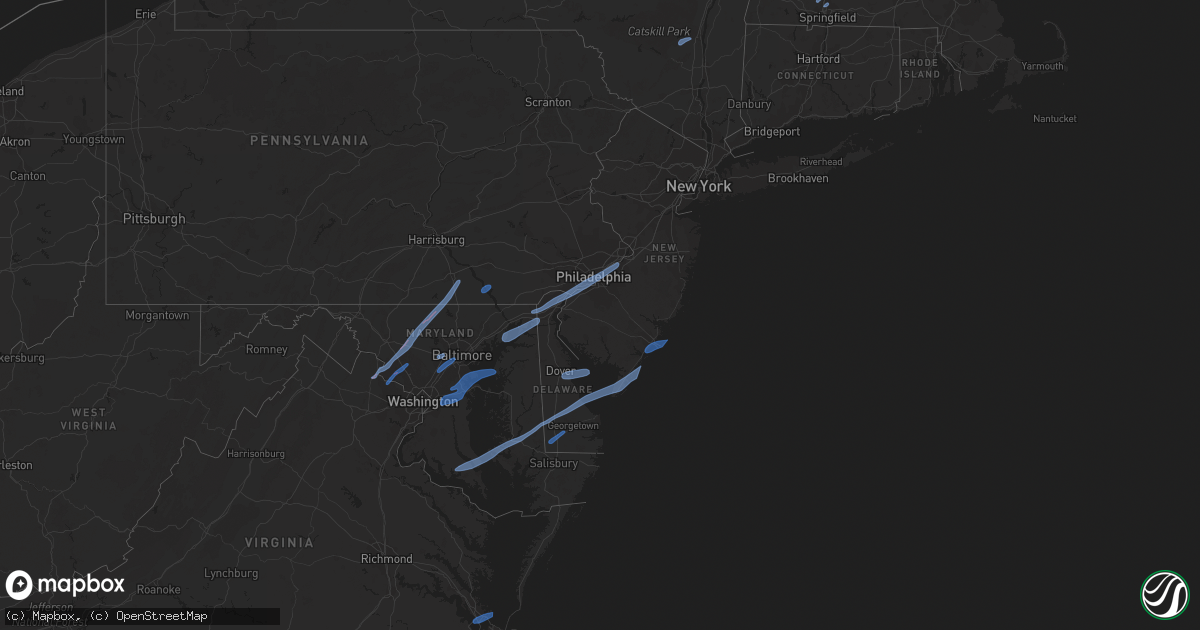
Hail Map in Pennsylvania on February 7, 2020
Get this storm
February 7 map
$229
one time, instant access
Download today. No call, no setup
Keep the $229
Bought the map and want the full workflow? Apply the entire $229 to a subscription within 7 days. None of it is wasted.
Every map, not just this one
This buys you this map. Subscription and you get every map we run, in the markets you choose from a few cities to whole states to nationwide. Plus real-time alerts the moment a storm fires.
Contact data
Name, contact info, occupancy, even credit band for addresses in the footprint. You go from where it hit to who to call.
Become the source they trust
Unlimited branding weather history reports on demand. You already have the documented answer ready for the property owner, and you are the one who showed up with it.
Property data and RoofTrace estimates
Pull up any address you have got, its value and the exact code rules for that jurisdiction, straight from One Click Code. Then RoofTrace estimates the squares, pitch, and roof value, priced the way you price.
Storm reports in Pennsylvania
Pennsylvania
| Date | Description |
|---|---|
| 02/07/20209:40 AM CST | A few reports of power lines down from strong winds in the croydon area. Time estimated from radar. |
| 02/07/20209:32 AM CST | Downed trees from strong winds. Time estimated from radar. |
| 02/07/20209:32 AM CST | Several reports of power lines down near somerton... Bustleton... And huntingdon valley. Time estimated from radar. |
| 02/07/20209:30 AM CST | Tree down in newtown. Time estimated from radar. |
| 02/07/20209:28 AM CST | Downed tree blocking the road near the intersection of huntingdon road and edmund road. |
| 02/07/20209:26 AM CST | Several reports of power outages in buckingham... Pineville... And lahaska areas. Time estimated from radar. |
| 02/07/20209:26 AM CST | Downed power lines from strong winds near whitaker avenue. Time estimated from radar. |
| 02/07/20209:18 AM CST | Downed tree near the intersection of cedar hill road and stongs lane. Time estimated from radar. |
| 02/07/20209:18 AM CST | Downed power lines from strong winds near province island. Time estimated from radar. |
| 02/07/20209:16 AM CST | Downed tree near academy park high school. Time estimated from radar. |
| 02/07/20209:16 AM CST | Downed trees on vehicles near poplar street and woodland terrace. Time estimated from radar. |
| 02/07/20209:12 AM CST | Downed tree on wires. Time estimated from radar. |
| 02/07/20209:10 AM CST | Reports over social media with photos of multiple trees down. Time estimated from radar. |
| 02/07/20209:10 AM CST | Downed telephone pole from strong winds. Time estimated from radar. |
| 02/07/20209:08 AM CST | Downed trees and wires near incinerator road. Time estimated from radar. |
| 02/07/20209:08 AM CST | Trees and power lines down in lansdale. Time estimated from radar. |
| 02/07/20209:07 AM CST | Downed utility on pa-320. Time estimated from radar. |
| 02/07/20209:07 AM CST | Several large trees snapped or uprooted near the border of upper gwynedd and towamencin twps. Multiple properties damaged due to downed trees and limbs. Time estimated |
| 02/07/20209:06 AM CST | Downed tree and wires near forwood street. Time estimated from radar. |
| 02/07/20209:06 AM CST | Roof blown off a building. Time estimated from radar. |
| 02/07/20209:06 AM CST | Downed trees and wires blocking ward street. Time estimated from radar. |
| 02/07/20209:06 AM CST | Downed trees closed pennell road between mount alverson and glendale. Time estimated from radar. |
| 02/07/20209:04 AM CST | Several reports of power lines down near evansburg state park. Time estimated from radar. |
| 02/07/20209:02 AM CST | Tree down on i-95. Time estimated from radar. |
| 02/07/20208:54 AM CST | Downed power lines from strong winds near bridlewood boulevard. Time estimated from radar. |
| 02/07/20208:51 AM CST | Downed wires near copeland school road and kenmara drive. |
| 02/07/20208:50 AM CST | Several reports of trees and power lines down near pughtown... Royersford... Phoenixville... And st. Peters. Time estimated from radar. |
| 02/07/20208:48 AM CST | Downed tree on wires. Time estimated from radar. |
| 02/07/20208:46 AM CST | Downed power lines from strong winds near canterbury drive. Time estimated from radar. |
| 02/07/20208:32 AM CST | Downed tree blocking the road near the intersection of lorane road and ahrens road. Time estimated from radar. |
| 02/07/20208:30 AM CST | Several trees and power lines down. |
| 02/07/20208:30 AM CST | Downed tree and wires near the intersection of five points road and glenrose road. Time estimated from radar. |
| 02/07/20208:28 AM CST | Downed power lines from strong winds near elkdale road. Time estimated from radar. |
| 02/07/20208:26 AM CST | Video and photos show gusty winds with a portion of a warehouse exterior wall pushed inward. |
| 02/07/20208:26 AM CST | Downed tree on wires. Time estimated from radar. |
| 02/07/20208:22 AM CST | Several power lines down near manor road and horseshoe pike. Strong winds well in advance of precipitation. |
| 02/07/20208:12 AM CST | Downed tree near the intersection of kaolin road and round hill road. Strong winds well in advance of precipitation. |
| 02/07/20208:06 AM CST | Downed tree on wires near the intersection of wollaston road and street road. Strong gusts well in advance of precipitation. |
| 02/07/20208:02 AM CST | A local report indicates 58 MPH wind near LANCASTER AIRPORT |
| 02/07/20207:55 AM CST | Many large trees down along landisville road between spooky nook rd and graystone rd. |
| 02/07/20207:50 AM CST | Trees and wires down in martic twp. |
| 02/07/20207:35 AM CST | Trees and wires down in york twp. Time estimated from radar. |
| 02/07/20207:25 AM CST | Trees and wires down in west manheim twp. Time estimated from radar. |
| 02/07/20207:20 AM CST | Damage to several farm bldgs at brodbeck rd and fiscal rd. Roof off barn with partial bldg collapse. Roof off silo landed several hundred yards away. Numerous trees dow |
| 02/07/20207:15 AM CST | Trees and wires down in west manheim twp. Time estimated from radar. |
| 02/07/20207:15 AM CST | Tree down on home in heidelberg twp. Time estimated from radar. |
| 02/07/20204:14 AM CST | At 1013 AM EST, severe thunderstorms were located along a line extending from near Ambler to Darby Township to near Quinton, moving northeast at 55 mph. HAZARD...70 mph wind gusts and penny size hail. SOURCE...Radar indicated. IMPACT...Expect considerable tree damage. Damage is likely to mobile homes, roofs, and outbuildings. Locations impacted include... Philadelphia, Trenton, Camden, New Brunswick, Perth Amboy, Gloucester City, Somerset, Edison, Cherry Hill, Old Bridge, Bensalem, Jackson, East Brunswick, Evesham, South Brunswick, Sayreville, Mount Laurel, North Brunswick, Marlboro and Manalapan.This includes the following highways... Atlantic City Expressway between mile markers 30 and 44. Garden State Parkway between mile markers 116 and 134. Interstate 195 in New Jersey between mile markers 0 and 27. Interstate 287 in New Jersey between mile markers 0 and 12. Interstate 295 in New Jersey between mile markers 9 and 76. Interstate 95 in Pennsylvania between mile markers 13 and 40. New Jersey Turnpike between exits 1 and 13. Interstate 476 in Pennsylvania between mile markers 18 and 19. Pennsylvania Turnpike between exits 333 and 353. Northeast Extension near exit A20. Interstate 676 in New Jersey between mile markers 0 and 4. Interstate 676 in Pennsylvania between mile markers 0 and 1. Interstate 76 in New Jersey between mile markers 0 and 3. Interstate 76 in Pennsylvania between mile markers 332 and 351. |
| 02/07/20203:43 AM CST | At 942 AM EST, severe thunderstorms were located along a line extending from near Bally to near Lionville-Marchwood, moving northeast at 45 mph. HAZARD...70 mph wind gusts and penny size hail. SOURCE...Radar indicated. IMPACT...Expect considerable tree damage. Damage is likely to mobile homes, roofs, and outbuildings. Locations impacted include... Allentown, Easton, Bethlehem, Pottstown, Phoenixville, Lansdale, West Norriton, Forks, East Norriton, Emmaus, Northampton, Quakertown, Perkasie, Doylestown, Byram, Wilson, Downingtown, Souderton, Bedminster and Washington.This includes the following highways... Interstate 78 in New Jersey between mile markers 0 and 17. Interstate 80 in New Jersey between mile markers 2 and 4. Interstate 78 in Pennsylvania between mile markers 41 and 76. Pennsylvania Turnpike between exits 312 and 320. Northeast Extension between exits A31 and A56. |
All States Impacted by Hail Map on February 7, 2020
Cities Impacted by Hail Map on February 7, 2020
- Easthampton, MA
- Southampton, MA
- Holyoke, MA
- Chicopee, MA
- South Hadley, MA
- Accord, NY
- Stone Ridge, NY
- Kingston, NY
- Hurley, NY
- West Hurley, NY
- Olivebridge, NY
- Leesburg, VA
- Glen Rock, PA
- Seven Valleys, PA
- Dallastown, PA
- Westminster, MD
- Red Lion, PA
- New Windsor, MD
- Monrovia, MD
- Mount Airy, MD
- Dickerson, MD
- Barnesville, MD
- Clarksburg, MD
- Manchester, MD
- Damascus, MD
- Hampstead, MD
- York, PA
- Beallsville, MD
- Ijamsville, MD
- Airville, PA
- Holtwood, PA
- Pequea, PA
- Rio Grande, NJ
- Avalon, NJ
- Bridgeville, DE
- Ocean View, NJ
- Lincoln, DE
- Cape May, NJ
- East New Market, MD
- Wildwood, NJ
- Greenwood, DE
- Lusby, MD
- Hollywood, MD
- Cambridge, MD
- Villas, NJ
- Leonardtown, MD
- Ellendale, DE
- Taylors Island, MD
- Hurlock, MD
- Sea Isle City, NJ
- Solomons, MD
- Church Creek, MD
- Milford, DE
- Madison, MD
- Federalsburg, MD
- California, MD
- Woolford, MD
- Dowell, MD
- Stone Harbor, NJ
- Cape May Court House, NJ
- Seaford, DE
- Dover, DE
- Camden Wyoming, DE
- Magnolia, DE
- Dover Afb, DE
- Severna Park, MD
- Millersville, MD
- Odenton, MD
- Arnold, MD
- Upper Marlboro, MD
- Bowie, MD
- Riva, MD
- Annapolis, MD
- Gibson Island, MD
- Davidsonville, MD
- Rock Hall, MD
- Gambrills, MD
- Pasadena, MD
- Crownsville, MD
- Harwood, MD
- Crofton, MD
- Aberdeen Proving Ground, MD
- North East, MD
- Newark, DE
- Bear, DE
- Elkton, MD
- Chesapeake City, MD
- Earleville, MD
- Ridley Park, PA
- Lansdowne, PA
- Prospect Park, PA
- Beverly, NJ
- Wilmington, DE
- Aston, PA
- Gibbstown, NJ
- Riverton, NJ
- Marcus Hook, PA
- Darby, PA
- Maple Shade, NJ
- Brookhaven, PA
- Merchantville, NJ
- Palmyra, NJ
- Camden, NJ
- Chester, PA
- Pedricktown, NJ
- Swedesboro, NJ
- Burlington, NJ
- Elk Mills, MD
- Folcroft, PA
- Pennsauken, NJ
- Glenolden, PA
- Willingboro, NJ
- Essington, PA
- Folsom, PA
- Norwood, PA
- Woodlyn, PA
- Riverside, NJ
- Sharon Hill, PA
- Claymont, DE
- Bridgeport, NJ
- Moorestown, NJ
- Philadelphia, PA
- Crum Lynne, PA
- Somers Point, NJ
- Atlantic City, NJ
- Margate City, NJ
- Brigantine, NJ
- Pleasantville, NJ
- Ventnor City, NJ
- Linwood, NJ
- Northfield, NJ
- Longport, NJ
- Absecon, NJ
- Bethel, DE
- Laurel, DE
- Fort Monroe, VA
- Hampton, VA
- Newport News, VA
- Ellicott City, MD
- Halethorpe, MD
- Columbia, MD
- Jessup, MD
- Catonsville, MD
- Baltimore, MD
- Laurel, MD
- Elkridge, MD
- Germantown, MD
- Boyds, MD
- Poolesville, MD
- Sterling, VA
- Ashburn, VA
- Gaithersburg, MD


