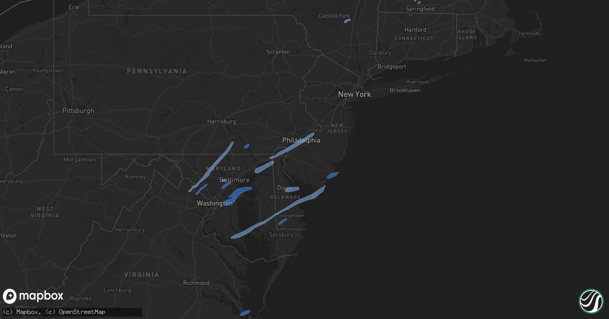
Hail Map on February 7, 2020
Get this storm
February 7 map
$229
one time, instant access
Download today. No call, no setup
Keep the $229
Bought the map and want the full workflow? Apply the entire $229 to a subscription within 7 days. None of it is wasted.
Every map, not just this one
This buys you this map. Subscription and you get every map we run, in the markets you choose from a few cities to whole states to nationwide. Plus real-time alerts the moment a storm fires.
Contact data
Name, contact info, occupancy, even credit band for addresses in the footprint. You go from where it hit to who to call.
Become the source they trust
Unlimited branding weather history reports on demand. You already have the documented answer ready for the property owner, and you are the one who showed up with it.
Property data and RoofTrace estimates
Pull up any address you have got, its value and the exact code rules for that jurisdiction, straight from One Click Code. Then RoofTrace estimates the squares, pitch, and roof value, priced the way you price.
States Impacted by Hail Map on February 7, 2020
Storm reports
Florida
| Date | Description |
|---|---|
| 02/07/20206:54 AM CST | At 1253 AM EST, strong to severe thunderstorms were located along a line extending from Edgewater to Christmas and Lake Kissimmee, moving east at 40 mph. HAZARD...60 mph wind gusts. SOURCE...Radar indicated. IMPACT...Expect damage to roofs, siding, and trees. Locations impacted include... Palm Bay, Melbourne, Titusville, Rockledge and Cocoa. |
| 02/07/20206:07 AM CST | At 1206 AM EST, severe thunderstorms were located along a line extending from 10 miles east of Daytona Beach Shores to near Lone Cabbage Fish Camp, moving east at 50 mph. HAZARD...60 mph wind gusts. SOURCE...Radar indicated. IMPACT...Expect damage to roofs, siding, and trees. Locations impacted include... Orlando, Deltona, Daytona Beach, Kissimmee and Port Orange. |
| 02/06/20207:45 PM CST | At 145 AM EST, a severe thunderstorm was located over West Melbourne, or over Melbourne, moving east at 45 mph. HAZARD...60 mph wind gusts. SOURCE...Radar indicated. IMPACT...Expect damage to roofs, siding, and trees. Locations impacted include... Palm Bay, Melbourne, Satellite Beach, Malabar and Indialantic. |
Delaware
| Date | Description |
|---|---|
| 02/07/20209:42 AM CST | Several reports of power lines down in newark. |
| 02/07/20209:26 AM CST | Weatherflow site xlew. |
| 02/07/20209:20 AM CST | Tree down on structure... Time estimated from radar. |
| 02/07/20209:20 AM CST | A local report indicates 59 MPH wind near 4 S INDIAN BEACH |
| 02/07/20209:15 AM CST | Poles down on main street... Time estimated from radar. |
| 02/07/20209:15 AM CST | A local report indicates 63 MPH wind near 3 ENE SELBYVILLE |
| 02/07/20209:15 AM CST | Tree fell on structure... Time estimated from radar. |
| 02/07/20209:12 AM CST | Damage to billboards... Power lines... And traffic signals from strong winds in the georgetown area. Time estimated from radar. |
| 02/07/20209:10 AM CST | Tree into a house. Time estimated from radar. |
| 02/07/20209:10 AM CST | Tree on roof in river road. Time estimated from radar. |
| 02/07/20209:10 AM CST | Trailer split in half by fallen tree. Time estimated from radar. |
| 02/07/20209:09 AM CST | 2 large trees down at a residence. Report via social media. Time estimated from radar. |
| 02/07/20209:06 AM CST | Downed trees and wires in the area. Time estimated from radar. |
| 02/07/20209:05 AM CST | A local report indicates 64 MPH wind near 2 SSE GREENWOOD |
| 02/07/20209:04 AM CST | Downed trees and wires in the area. Time estimated from radar. |
| 02/07/20209:02 AM CST | Downed tree blocking interstate 495 near the pennsylvania state line. Time estimated from radar. |
| 02/07/20209:02 AM CST | Several reports of downed trees in the area. Time estimated from radar. |
| 02/07/20209:00 AM CST | A local report indicates 59 MPH wind near 3 E HIGHLAND ACRES |
| 02/07/20209:00 AM CST | A local report indicates 59 MPH wind near SHELLBURNE |
| 02/07/20208:56 AM CST | Downed tree and power pole. Time estimated from radar. |
| 02/07/20208:55 AM CST | A local report indicates 66 MPH wind near 1 NE MAGNOLIA |
| 02/07/20208:54 AM CST | Several reports of downed trees and wires. Time estimated from radar. |
| 02/07/20208:54 AM CST | Downed power lines on centerville road. |
| 02/07/20208:52 AM CST | Roof blown off a trailer. Time estimated from radar. |
| 02/07/20208:52 AM CST | A local report indicates 61 MPH wind near 3 WSW MOUNT PLEASANT |
| 02/07/20208:52 AM CST | Tree into a house on redwood avenue. Time estimated from radar. |
| 02/07/20208:52 AM CST | Downed power lines from strong winds. Time estimated from radar. |
| 02/07/20208:51 AM CST | Downed tree and wires. Time estimated from radar. |
| 02/07/20208:50 AM CST | Several reports of trees and wires down near telegraph road... Including a tree into a house. Time estimated from radar. |
| 02/07/20208:50 AM CST | Downed trees on car and residences in murray manor. Time estimated from radar. |
| 02/07/20208:48 AM CST | Downed power lines from strong winds. Time estimated from radar. |
| 02/07/20208:46 AM CST | Power pole snapped from strong wind. Time estimated from radar. |
| 02/07/20208:46 AM CST | Downed tree into a house on brewster drive. Time estimated from radar. |
| 02/07/20208:45 AM CST | Loss of stockade fencing. Time estimated from radar. |
| 02/07/20208:45 AM CST | Multiple trees down on telegraph rd. Time estimated from radar. |
| 02/07/20208:45 AM CST | Downed tree on wires. |
| 02/07/20208:45 AM CST | Photo of a tree down onto a deck... Destroying part of a fence. Time estimated from radar. |
| 02/07/20208:40 AM CST | A local report indicates 58 MPH wind near CLAYTON |
| 02/07/20208:35 AM CST | Halltown rd closed at brittany ln due to wires down in the roadway. Time estimated from radar. |
North Carolina
| Date | Description |
|---|---|
| 02/07/20207:10 AM CST | Public reported large tree limbs/branches down |
| 02/07/20206:59 AM CST | At 1259 AM EST, a severe thunderstorm was located near Barefoot Landing Area Of North Myrtle Beach, or near Myrtle Beach, moving northeast at 85 mph. HAZARD...60 mph wind gusts. SOURCE...Radar indicated. IMPACT...Expect wind damage to trees and power lines. Locations impacted include... Myrtle Beach, North Myrtle Beach, Shallotte, Sunset Beach, Little River, North Myrtle Beach Airport, Iredell, Carolina Shores, Calabash, Bethel, Freeland, Nakina, Bughill, Longwood, Seaside, Barefoot Landing Area Of North Myrtle Beach, Wampee, Ash, Grissettown and Mollie. |
| 02/07/20206:21 AM CST | At 1221 AM EST, a severe thunderstorm was located over Kure Beach, moving northeast at 65 mph. HAZARD...60 mph wind gusts. SOURCE...Radar indicated. IMPACT...Expect wind damage to trees and power lines. Locations impacted include... Wilmington, Oak Island, Carolina Beach, Wrightsville Beach, Kure Beach, Caswell Beach, Bald Head Island, South Masonboro Island, Johnny Mercer Pier, Snows Cut, Figure Eight Island, Yaupon Beach, North Masonboro Island, Boiling Spring Lakes, St. James, Southport, Myrtle Grove, Masonboro, Ogden and Mayfaire. |
| 02/07/20203:07 AM CST | At 906 AM EST, showers with severe winds were located along a line extending from near Lee Hall to near Churchland to near Corapeake, moving northeast at 60 mph. HAZARD...60 mph wind gusts. SOURCE...Radar indicated. IMPACT...Expect damage to trees and powerlines. Severe storms will be near, Virginia Institute For Marine Sciences, Old Dominion University, Seaford, Downtown Norfolk, Gloucester Point, Norfolk State University, Downtown Portsmouth, Hampton University, Patrick Henry Field and Portsmouth around 910 AM EST. Ocean View, Virginia Wesleyan University, Norfolk, Achilles, Norfolk International, Fort Monroe and Buckroe Beach around 915 AM EST. Deep Creek and Mobjack around 920 AM EST. Great Bridge and Bavon around 925 AM EST. Regent University and Fentress around 930 AM EST. Kempsville, Princess Anne and Back Bay around 935 AM EST. Cheriton around 940 AM EST. Virginia Beach around 945 AM EST.Other locations impacted by these severe thunderstorms include SouthNorfolk, Rudee Heights, Portlock, Lackey, Laban, Eastville, Naxera,Franktown, Pungo and Bayside. |
Pennsylvania
| Date | Description |
|---|---|
| 02/07/20209:40 AM CST | A few reports of power lines down from strong winds in the croydon area. Time estimated from radar. |
| 02/07/20209:32 AM CST | Downed trees from strong winds. Time estimated from radar. |
| 02/07/20209:32 AM CST | Several reports of power lines down near somerton... Bustleton... And huntingdon valley. Time estimated from radar. |
| 02/07/20209:30 AM CST | Tree down in newtown. Time estimated from radar. |
| 02/07/20209:28 AM CST | Downed tree blocking the road near the intersection of huntingdon road and edmund road. |
| 02/07/20209:26 AM CST | Several reports of power outages in buckingham... Pineville... And lahaska areas. Time estimated from radar. |
| 02/07/20209:26 AM CST | Downed power lines from strong winds near whitaker avenue. Time estimated from radar. |
| 02/07/20209:18 AM CST | Downed power lines from strong winds near province island. Time estimated from radar. |
| 02/07/20209:18 AM CST | Downed tree near the intersection of cedar hill road and stongs lane. Time estimated from radar. |
| 02/07/20209:16 AM CST | Downed trees on vehicles near poplar street and woodland terrace. Time estimated from radar. |
| 02/07/20209:16 AM CST | Downed tree near academy park high school. Time estimated from radar. |
| 02/07/20209:12 AM CST | Downed tree on wires. Time estimated from radar. |
| 02/07/20209:10 AM CST | Downed telephone pole from strong winds. Time estimated from radar. |
| 02/07/20209:10 AM CST | Reports over social media with photos of multiple trees down. Time estimated from radar. |
| 02/07/20209:08 AM CST | Downed trees and wires near incinerator road. Time estimated from radar. |
| 02/07/20209:08 AM CST | Trees and power lines down in lansdale. Time estimated from radar. |
| 02/07/20209:07 AM CST | Several large trees snapped or uprooted near the border of upper gwynedd and towamencin twps. Multiple properties damaged due to downed trees and limbs. Time estimated |
| 02/07/20209:07 AM CST | Downed utility on pa-320. Time estimated from radar. |
| 02/07/20209:06 AM CST | Roof blown off a building. Time estimated from radar. |
| 02/07/20209:06 AM CST | Downed tree and wires near forwood street. Time estimated from radar. |
| 02/07/20209:06 AM CST | Downed trees and wires blocking ward street. Time estimated from radar. |
| 02/07/20209:06 AM CST | Downed trees closed pennell road between mount alverson and glendale. Time estimated from radar. |
| 02/07/20209:04 AM CST | Several reports of power lines down near evansburg state park. Time estimated from radar. |
| 02/07/20209:02 AM CST | Tree down on i-95. Time estimated from radar. |
| 02/07/20208:54 AM CST | Downed power lines from strong winds near bridlewood boulevard. Time estimated from radar. |
| 02/07/20208:51 AM CST | Downed wires near copeland school road and kenmara drive. |
| 02/07/20208:50 AM CST | Several reports of trees and power lines down near pughtown... Royersford... Phoenixville... And st. Peters. Time estimated from radar. |
| 02/07/20208:48 AM CST | Downed tree on wires. Time estimated from radar. |
| 02/07/20208:46 AM CST | Downed power lines from strong winds near canterbury drive. Time estimated from radar. |
| 02/07/20208:32 AM CST | Downed tree blocking the road near the intersection of lorane road and ahrens road. Time estimated from radar. |
| 02/07/20208:30 AM CST | Several trees and power lines down. |
| 02/07/20208:30 AM CST | Downed tree and wires near the intersection of five points road and glenrose road. Time estimated from radar. |
| 02/07/20208:28 AM CST | Downed power lines from strong winds near elkdale road. Time estimated from radar. |
| 02/07/20208:26 AM CST | Video and photos show gusty winds with a portion of a warehouse exterior wall pushed inward. |
| 02/07/20208:26 AM CST | Downed tree on wires. Time estimated from radar. |
| 02/07/20208:22 AM CST | Several power lines down near manor road and horseshoe pike. Strong winds well in advance of precipitation. |
| 02/07/20208:12 AM CST | Downed tree near the intersection of kaolin road and round hill road. Strong winds well in advance of precipitation. |
| 02/07/20208:06 AM CST | Downed tree on wires near the intersection of wollaston road and street road. Strong gusts well in advance of precipitation. |
| 02/07/20208:02 AM CST | A local report indicates 58 MPH wind near LANCASTER AIRPORT |
| 02/07/20207:55 AM CST | Many large trees down along landisville road between spooky nook rd and graystone rd. |
| 02/07/20207:50 AM CST | Trees and wires down in martic twp. |
| 02/07/20207:35 AM CST | Trees and wires down in york twp. Time estimated from radar. |
| 02/07/20207:25 AM CST | Trees and wires down in west manheim twp. Time estimated from radar. |
| 02/07/20207:20 AM CST | Damage to several farm bldgs at brodbeck rd and fiscal rd. Roof off barn with partial bldg collapse. Roof off silo landed several hundred yards away. Numerous trees dow |
| 02/07/20207:15 AM CST | Trees and wires down in west manheim twp. Time estimated from radar. |
| 02/07/20207:15 AM CST | Tree down on home in heidelberg twp. Time estimated from radar. |
| 02/07/20204:14 AM CST | At 1013 AM EST, severe thunderstorms were located along a line extending from near Ambler to Darby Township to near Quinton, moving northeast at 55 mph. HAZARD...70 mph wind gusts and penny size hail. SOURCE...Radar indicated. IMPACT...Expect considerable tree damage. Damage is likely to mobile homes, roofs, and outbuildings. Locations impacted include... Philadelphia, Trenton, Camden, New Brunswick, Perth Amboy, Gloucester City, Somerset, Edison, Cherry Hill, Old Bridge, Bensalem, Jackson, East Brunswick, Evesham, South Brunswick, Sayreville, Mount Laurel, North Brunswick, Marlboro and Manalapan.This includes the following highways... Atlantic City Expressway between mile markers 30 and 44. Garden State Parkway between mile markers 116 and 134. Interstate 195 in New Jersey between mile markers 0 and 27. Interstate 287 in New Jersey between mile markers 0 and 12. Interstate 295 in New Jersey between mile markers 9 and 76. Interstate 95 in Pennsylvania between mile markers 13 and 40. New Jersey Turnpike between exits 1 and 13. Interstate 476 in Pennsylvania between mile markers 18 and 19. Pennsylvania Turnpike between exits 333 and 353. Northeast Extension near exit A20. Interstate 676 in New Jersey between mile markers 0 and 4. Interstate 676 in Pennsylvania between mile markers 0 and 1. Interstate 76 in New Jersey between mile markers 0 and 3. Interstate 76 in Pennsylvania between mile markers 332 and 351. |
| 02/07/20203:43 AM CST | At 942 AM EST, severe thunderstorms were located along a line extending from near Bally to near Lionville-Marchwood, moving northeast at 45 mph. HAZARD...70 mph wind gusts and penny size hail. SOURCE...Radar indicated. IMPACT...Expect considerable tree damage. Damage is likely to mobile homes, roofs, and outbuildings. Locations impacted include... Allentown, Easton, Bethlehem, Pottstown, Phoenixville, Lansdale, West Norriton, Forks, East Norriton, Emmaus, Northampton, Quakertown, Perkasie, Doylestown, Byram, Wilson, Downingtown, Souderton, Bedminster and Washington.This includes the following highways... Interstate 78 in New Jersey between mile markers 0 and 17. Interstate 80 in New Jersey between mile markers 2 and 4. Interstate 78 in Pennsylvania between mile markers 41 and 76. Pennsylvania Turnpike between exits 312 and 320. Northeast Extension between exits A31 and A56. |
New Jersey
| Date | Description |
|---|---|
| 02/07/202010:36 AM CST | A local report indicates 66 MPH wind near SANDY HOOK |
| 02/07/202010:30 AM CST | Hads sensor. |
| 02/07/202010:26 AM CST | Downed trees and power lines from strong winds. Time estimated from radar. |
| 02/07/202010:10 AM CST | Downed tree and wires on nj 34 northbound south of cr 520. All lanes closed. Time estimated from radar. |
| 02/07/202010:06 AM CST | Downed tree on state highway 28 westbound west of mountain avenue. Lane restrictions in place. Time estimated from radar. |
| 02/07/202010:06 AM CST | Downed trees and power poles. Mping report. Time estimated from radar. |
| 02/07/202010:02 AM CST | Downed tree on wires from strong winds. Time estimated from radar. |
| 02/07/202010:02 AM CST | Weatherflow site xtuk. |
| 02/07/202010:02 AM CST | Downed tree and wires near the intersection of dukes parkway and dickerson road. Time estimated from radar. |
| 02/07/202010:01 AM CST | Mping report of 3 inch tree limbs or power poles snapped. |
| 02/07/202010:00 AM CST | Hads sensor. |
| 02/07/20209:57 AM CST | Downed tree on i-78 eastbound east of exit 29. Time estimated from radar. |
| 02/07/20209:56 AM CST | Downed trees and wires near windrow drive. Time estimated from radar. |
| 02/07/20209:54 AM CST | Great road closed between stuart road and princeton day school from a pole and wires down. Time estimated from radar. |
| 02/07/20209:50 AM CST | Tree down across the road on goshen rd. |
| 02/07/20209:48 AM CST | Downed tree limbs from strong winds. Mping report. Time estimated from radar. |
| 02/07/20209:46 AM CST | Downed tree limbs and power lines. Mping report. Time estimated from radar. |
| 02/07/20209:44 AM CST | Downed tree on nj-31 northbound north of cr 623. Time estimated from radar. |
| 02/07/20209:43 AM CST | Downed tree on nj 31 both directions north of cr-612. All lanes closed and detoured. Time estimated from radar. |
| 02/07/20209:42 AM CST | Kttn asos. |
| 02/07/20209:42 AM CST | Downed tree on i-295 southbound north of exit 52. Time estimated from radar. |
| 02/07/20209:40 AM CST | Downed tree on nj-68 southbound. All lanes closed and detoured. Time estimated from radar. |
| 02/07/20209:40 AM CST | Downed traffic signal from strong winds. Time estimated from radar. |
| 02/07/20209:40 AM CST | Njwxnet sensor. |
| 02/07/20209:38 AM CST | Downed tree and wires near lincoln avenue and studdiford street. Time estimated from radar. |
| 02/07/20209:38 AM CST | Report from mping: 1-inch tree limbs broken; shingles blown off. |
| 02/07/20209:36 AM CST | Downed trees and wires near the intersection of sandy ridge road and rittenhouse road. Time estimated from radar. |
| 02/07/20209:35 AM CST | Traffic signal down on nj-38 westbound east of fellowship rd. Time estimated from radar. |
| 02/07/20209:34 AM CST | Downed tree on wires near knoll top lane. Time estimated from radar. |
| 02/07/20209:33 AM CST | Report of a tree down across route 9 and traffic lights down on cars in upper twp. Time estimated from radar. |
| 02/07/20209:32 AM CST | Wires down on lafayette st. |
| 02/07/20209:30 AM CST | Antenna mast downed on west ocean ave due to high winds. |
| 02/07/20209:30 AM CST | Large tree down onto power lines across central ave. Report via social media with a photo. Time estimated from radar. |
| 02/07/20209:30 AM CST | Report via social media with photos. Damage to a carport and fencing. |
| 02/07/20209:30 AM CST | Tree down on a house on pacific ave. |
| 02/07/20209:28 AM CST | Downed tree and wires on nj-50 southbound north of honest john rd. All lanes closed. Time estimated from radar. |
| 02/07/20209:28 AM CST | Downed trees and power lines from strong winds. Time estimated from radar. |
| 02/07/20209:20 AM CST | Uprooted tree on the new jersey turnpike. Time estimated from radar. |
| 02/07/20209:18 AM CST | Downed trees and wires near crow pond road. Time estimated from radar. |
| 02/07/20209:15 AM CST | A local report indicates 60 MPH wind near FORTESCUE |
| 02/07/20209:13 AM CST | Trees down and fences blown over near millville. Time estimated from radar. |
| 02/07/20209:12 AM CST | Mping report. |
| 02/07/20204:10 AM CST | At 1010 AM EST, severe thunderstorms were located along a line extending from Olivet to near Fortesque to 7 miles northwest of Lewes, moving northeast at 65 mph. HAZARD...70 mph wind gusts and penny size hail. SOURCE...Radar indicated. IMPACT...Expect considerable tree damage. Damage is likely to mobile homes, roofs, and outbuildings. Locations impacted include... Toms River, Vineland, Atlantic City, Millville, Bridgeton, Ocean City, Cape May, Cumberland, Lakewood, Jackson, Barnegat, Pleasantville, Glassboro, Hammonton, Beachwood, Somers Point, Ventnor City, Brigantine, Northfield and Absecon.This includes the following highways... Atlantic City Expressway between mile markers 0 and 40. Garden State Parkway between mile markers 0 and 94. Interstate 195 in New Jersey between mile markers 17 and 26. |
Virginia
| Date | Description |
|---|---|
| 02/07/20208:53 AM CST | Tree knocked down near the intersection of mason rd and shoreman dr. Near bloxom. Time estimated from radar. |
| 02/07/20208:50 AM CST | Numerous trees knocked down across the county. Time estimated from radar. |
| 02/07/20208:18 AM CST | Buoy station lwtv2 lewisetta... Va. |
| 02/07/20208:18 AM CST | Tree knocked down. Report via social media. |
| 02/07/20208:11 AM CST | Awos station klfi langley afb hamp. |
| 02/07/20207:55 AM CST | Numerous pines trees were uprooted as a line of showers with high wind moved across the area. |
| 02/07/20207:35 AM CST | Road closure due to downed tree near hooes rd and lackawanna dr |
| 02/07/20207:30 AM CST | Road closure due to downed tree near clifton rd and main st |
| 02/07/20207:20 AM CST | Multiple downed trees near governor's drive and country club drive |
| 02/07/20207:17 AM CST | Tree down onto wires near intersection of telegraph rd and s. Kings hwy |
| 02/07/20207:15 AM CST | Tree down onto wires near rt 7 and carlin springs rd |
| 02/07/20207:14 AM CST | Two large oak trees uprooted |
| 02/07/20207:12 AM CST | Tree down onto wires near intersection of rolling rd and pohick rd |
| 02/07/20207:11 AM CST | Two trees knocked down... One into a house and another on a car. Report via social media. Time estimated from radar. |
| 02/07/20206:57 AM CST | Tree down near intersection of warrenton rd and richards ferry rd |
| 02/07/20206:26 AM CST | 3-ft diameter trees fell on two homes in leesburg. Homes suffered structural damage. |
| 02/07/20206:25 AM CST | Several trees down and roof damage in around the neighborhood of greenway farm in leesburg. |
| 02/07/20206:24 AM CST | Multiple trees and wires down near intersection of leesburg bypass and battlefield parkway. |
| 02/07/20206:23 AM CST | Chimneys toppled at apartments off clark court ne. |
| 02/07/20206:22 AM CST | Multiple downed and snapped trees on barksdale drive |
| 02/07/20206:21 AM CST | Trees down on house on monroe street se |
| 02/07/20206:20 AM CST | Trees down on house in 1000 block of white place sw. |
| 02/07/20206:20 AM CST | Considerable tree damage across the town of leesburg. Damage to townhomes and an apartment complex in ne leesburg as well. Path length 3.3 miles. Maximum path width 250 |
| 02/07/20203:45 AM CST | At 944 AM EST, severe thunderstorms were located along a line extending from 6 miles northwest of Virginia Beach to Back Bay to near Indiantown, moving east at 45 mph. HAZARD...60 mph wind gusts. SOURCE...Radar indicated. IMPACT...Expect damage to trees and powerlines. Severe thunderstorms will be near, Virginia Beach around 950 AM EST. Grandy around 955 AM EST. Corolla around 1000 AM EST.Other locations impacted by these severe thunderstorms include RudeeHeights, Poplar Branch, Princess Anne Plaza, Sigma, Pungo, Barco,Bayside, Dam Neck, Maple and Snowden. |
| 02/07/20203:38 AM CST | At 937 AM EST, showers with embedded severe thunderstorms were located along a line extending from Agner to near Vienna to 10 miles west of Deal Island, moving east to northeast at 50 mph. HAZARD...60 mph wind gusts. SOURCE...Radar indicated. IMPACT...Expect damage to trees and powerlines. Severe thunderstorms will be near, Hurlock and Vienna around 945 AM EST. Sharptown around 950 AM EST. Princess Anne, University Of Maryland Eastern Shore and Westover around 1005 AM EST. Salisbury, Fruitland and Salisbury University around 1015 AM EST. Parsonsburg around 1025 AM EST. Newark around 1030 AM EST. Berlin and Ocean Pines around 1040 AM EST. Cape Isle Of Wight around 1045 AM EST.Other locations impacted by these severe thunderstorms includeBrookview, Ocean City Municipality, Trinity, Cokesbury, Eden,Longridge, Mount Vernon, Chesapeake Heights, Pittsville andPowellville. |
| 02/07/20202:09 AM CST | At 809 AM EST, a severe thunderstorm was located near Bowling Green, moving northeast at 40 mph. HAZARD...60 mph wind gusts and quarter size hail. SOURCE...Radar indicated. IMPACT...Minor damage to vehicles is possible. Expect wind damage to trees and powerlines. This severe thunderstorm will be near, Loretto around 825 AM EST.Other locations impacted by this severe thunderstorm include Supply,Sparta, Hustle and Chance. |
Maryland
| Date | Description |
|---|---|
| 02/07/202010:35 AM CST | Tree branch onto power lines near ritchie highway and baltimore annapolis blvd |
| 02/07/20208:43 AM CST | Power pole knocked down. Time estimated from radar. Report via social media. |
| 02/07/20208:40 AM CST | Several reports of downed trees. Time estimated from radar. |
| 02/07/20208:39 AM CST | An ef-1 tornado briefly touched down near the elk mills quarry in cecil county... Maryland. The tornado uprooted and snapped numerous softwood trees just east and north |
| 02/07/20208:35 AM CST | A local report indicates 58 MPH wind near 8 E SMITH ISLAND |
| 02/07/20208:35 AM CST | Straight line winds collapsed a block barn on howard road north of federalsburg. A swath of damage to multiple other nearby structures consistent with winds of 70-80 mp |
| 02/07/20208:30 AM CST | Downed utility on state highway 480 at sunset boulevard. Time estimated from radar. |
| 02/07/20208:30 AM CST | Significant structural damage to a barn. Time estimated from radar. |
| 02/07/20208:27 AM CST | Large tree limb knocked down. Report via social media. |
| 02/07/20208:24 AM CST | Reports of downed trees in the area of rock hall road. Time estimated from radar. |
| 02/07/20208:23 AM CST | Wind blown debris in the road on i-95 north of exit 93. Time estimated from radar. |
| 02/07/20208:21 AM CST | Tree knocked down. Time estimated from radar. Report via social media. |
| 02/07/20208:18 AM CST | A local report indicates 64 MPH wind near 7 SSE SAINT GEORGE ISLA |
| 02/07/20208:17 AM CST | A local report indicates 67 MPH wind near PATUXENT RIVER NAS |
| 02/07/20208:16 AM CST | A local report indicates 62 MPH wind near PATUXENT RIVER NAS |
| 02/07/20208:12 AM CST | Large tree splintered down the middle. |
| 02/07/20208:12 AM CST | A marina structure collapsed impacting 20 boats |
| 02/07/20208:12 AM CST | A local report indicates 63 MPH wind near SOLOMONS |
| 02/07/20208:02 AM CST | Tree down near intersection of eaglehill rd and n shore rd |
| 02/07/20208:02 AM CST | Tree down near intersection of shore acres rd and stonington dr. |
| 02/07/20208:02 AM CST | 12 reports of trees down in the area around solomons and lusby. Approximately half of the reports involved trees falling onto homes. |
| 02/07/20208:00 AM CST | A local report indicates 65 MPH wind near 1 SSE SOTTERLEY |
| 02/07/20207:56 AM CST | Tree down onto rt 4 southbound lane near lower pindell rd |
| 02/07/20207:55 AM CST | Tree down blocking road near intersection of fishers station rd and w. Bayfront rd |
| 02/07/20207:52 AM CST | Tree branch down onto road at 188 mountain rd |
| 02/07/20207:51 AM CST | *** 1 inj *** roof removed from small building of business. One occupant injured. |
| 02/07/20207:51 AM CST | Tree down blocking roadway near intersection of governors bridge rd and davidsonville rd |
| 02/07/20207:50 AM CST | 29 reports of trees down across roadways and/or powerlines...mainly across central/northern parts of the county |
| 02/07/20207:42 AM CST | Unoccupied barn destroyed |
| 02/07/20207:42 AM CST | Large tree branch down onto power lines near intersection of largo rd and hancock dr |
| 02/07/20207:29 AM CST | Tree down near intersection of race rd and church ave |
| 02/07/20207:20 AM CST | Tree down at 8432 high ridge rd |
| 02/07/20207:20 AM CST | Tree down near intersection of vollmerhausen rd and dragonclaw |
| 02/07/20207:20 AM CST | Tree down near intersection of rogers ave and brightwell dr |
| 02/07/20207:19 AM CST | Tree down near intersection of oakland mills rd and dobbin rd |
| 02/07/20207:19 AM CST | Tree down near intersection of gilford rd and oakland mills rd |
| 02/07/20207:19 AM CST | Tree down near intersection of red branch rd and old annapolis rd |
| 02/07/20207:18 AM CST | Tree down to the south of the i-70 and us 29 ramp |
| 02/07/20207:17 AM CST | Tree down at 5870 thunder hill rd |
| 02/07/20207:15 AM CST | A local report indicates 67 MPH wind near MILLERS |
| 02/07/20207:15 AM CST | Tree down near intersection of cedar ln and lightfoot path |
| 02/07/20207:13 AM CST | Tree down near intersection of dobbin rd and mcgaw ct |
| 02/07/20207:12 AM CST | Tree fell into a house. |
| 02/07/20207:10 AM CST | Tree down near intersection of marriottsville rd and baltimore national pike |
| 02/07/20207:10 AM CST | Tree down near intersection of driver rd and marriottsville rd |
| 02/07/20207:08 AM CST | Multiple trees down with some damage to structures |
| 02/07/20207:07 AM CST | Metal roof blown off of pnc bank near englar rd and rt 140 |
| 02/07/20207:04 AM CST | Roof blown from property on west main st |
| 02/07/20207:03 AM CST | Multiple downed and snapped trees at and near long valley road |
| 02/07/20207:03 AM CST | Tree down at 6885 haviland mill rd |
| 02/07/20207:03 AM CST | Intermittent tree damage... Roof and siding damage in central carroll county. Path length 10.3 miles. Maximum path width 100 yards. Estimated maximum wind speed 90 mph. |
| 02/07/20207:00 AM CST | Tree fell on a house. |
| 02/07/20206:56 AM CST | Tree down at 715 lisbon center dr |
| 02/07/20206:56 AM CST | Tree down on a vehicle. Several trees down in the area. |
| 02/07/20206:55 AM CST | Multiple uproted trees in property near the 150200 block of oak orchard rd |
| 02/07/20206:51 AM CST | Trees and wires down blocking rt 28 east before martinsburg rd. |
| 02/07/20206:49 AM CST | Trees and wires down on whites ferry rd at sugarland road |
| 02/07/20206:48 AM CST | Many trees uprooted and snapped from old annapolis rd to jesse smith rd. |
| 02/07/20206:48 AM CST | Trees down blocking knoll rd in mt. Airy/new market area |
| 02/07/20206:47 AM CST | Multiple large trees down on knoll road. |
| 02/07/20206:47 AM CST | Wires down across the road between whites ferry rd and sugarland rd. |
| 02/07/20206:46 AM CST | Trees and wires down on white ground rd at darnestown rd |
| 02/07/20206:46 AM CST | Multiple downed trees near lynn burke rd and mid county dr |
| 02/07/20206:45 AM CST | Snapped trees on knoll rd |
| 02/07/20206:44 AM CST | Tornado confirmed in monrovia. Significant tree damage with nearly complete deforestation along sections of the path. Siloh and machine shop destroyed. Path length 6.0 |
| 02/07/20206:41 AM CST | Wires down on darnestown rd at beallsville rd in dawsonville. |
| 02/07/20206:38 AM CST | Pole barn destroyed and damage to cars in 1400 block of shaeffer road. |
| 02/07/20206:36 AM CST | Downed tree and branches on rt 109 between i-270 and rt 355 |
| 02/07/20206:35 AM CST | Multiple utility poles down. Four large trees downed and partially uprooted. |
| 02/07/20206:31 AM CST | Trees and wires down blocking darnestown rd. |
| 02/07/20206:28 AM CST | Trees down. Outbuildings damaged. Debris impaled trailer on schaeffer road. Path length 2.3 miles. Maximum path width 75 yards. Estimated maximum wind speed 80 mph. Max |
| 02/07/20206:28 AM CST | Numerous trees uprooted and snapped. Several barns damaged or destroyed. Shingle damage to farm house. Path length 1.0 mile. Maximum path width 150 yards. Estimated max |
| 02/07/20206:26 AM CST | Sheds collapsed... Roof blown from barn... Wind mill destroyed at farm near md 107 and martinsburg rd |
| 02/07/20206:25 AM CST | Multiple trees down in chesapeake and ohio canal near intersection of whites ferry road and river road. |
| 02/07/20203:36 AM CST | At 936 AM EST, severe thunderstorms were located along a line extending from Marshallton to Elkton to Kennedyville, moving northeast at 50 mph. HAZARD...70 mph wind gusts and penny size hail. SOURCE...Radar indicated. IMPACT...Expect considerable tree damage. Damage is likely to mobile homes, roofs, and outbuildings. Locations impacted include... Philadelphia, Camden, Wilmington, Newark, Middletown, West Chester, Elkton, Norristown, Chester, West Deptford, West Norriton, East Norriton, Pennsville, Yeadon, Westtown, Woodbury, Carneys Point, Downingtown, Conshohocken and Hatboro.This includes the following highways... Interstate 295 in New Jersey between mile markers 0 and 23. Interstate 95 in Pennsylvania between mile markers 0 and 23. New Jersey Turnpike between exits 1 and 2. Interstate 95 in Delaware between mile markers 0 and 23. Interstate 476 in Pennsylvania between mile markers 0 and 19. Pennsylvania Turnpike between exits 320 and 343. Northeast Extension near exit A20. Interstate 676 in Pennsylvania between mile markers 0 and 1. Interstate 76 in Pennsylvania between mile markers 327 and 351. |
| 02/07/20203:27 AM CST | At 927 AM EST, severe thunderstorms were located along a line extending from 13 miles northwest of Exmore to 10 miles north of Virginia Beach, moving northeast at 50 mph. HAZARD...60 mph wind gusts. SOURCE...Radar indicated. IMPACT...Expect damage to trees and powerlines. Severe thunderstorms will be near, Onancock around 945 AM EST. Onley around 950 AM EST. Parksley around 955 AM EST.Other locations impacted by these severe thunderstorms includeHorntown, Capeville, Kiptopeke State Park, Harborton, Melfa,Mappsville, Greenbackville, Eastville, Saxis and Franktown. |
| 02/07/20203:24 AM CST | At 924 AM EST, severe thunderstorms were located along a line extending from near Goldsboro to near Tanyard to 6 miles south of Cambridge, moving northeast at 70 mph. HAZARD...60 mph wind gusts and penny size hail. SOURCE...Radar indicated. IMPACT...Damage to roofs, siding, trees, and power lines is possible. Locations impacted include... Dover, Georgetown, Smyrna, Milford, Seaford, Millsboro, Laurel, Harrington, Camden, Clayton, Lewes, Milton, Selbyville, Bridgeville, Delmar, Cheswold, Dagsboro, Millville, Ellendale and Bowers. |
| 02/07/20203:16 AM CST | At 916 AM EST, a severe thunderstorm was located over Lexington Park, moving east at 50 mph. HAZARD...60 mph wind gusts. SOURCE...Radar indicated. IMPACT...Damaging winds will cause some trees and large branches to fall. This could injure those outdoors, as well as damage homes and vehicles. Roadways may become blocked by downed trees. Localized power outages are possible. Unsecured light objects may become projectiles. Locations impacted include... Lexington Park, Chesapeake Ranch Estates, Piney Point, Tall Timbers, Saint Inigoes Creek, Cuckold Creek, Saint Marys City, Saint George Island, Town Creek, Saint Marys River, California, Lusby, Patuxent River Naval Air Station, Drum Point, Valley Lee, Scotland, Great Mills, Drayden, Saint Inigoes and Park Hall. |
| 02/07/20202:59 AM CST | At 859 AM EST, severe thunderstorms were located along a line extending from near Lake Shore to Rhode River, moving northeast at 65 mph. HAZARD...60 mph wind gusts. SOURCE...Radar indicated. IMPACT...Damaging winds will cause some trees and large branches to fall. This could injure those outdoors, as well as damage homes and vehicles. Roadways may become blocked by downed trees. Localized power outages are possible. Unsecured light objects may become projectiles. Locations impacted include... Annapolis, Riviera Beach, Mayo, Shady Side, Naval Academy, Magothy River, Dobbins Island, Severn River, South River, Fort Smallwood State Park, Pinehurst, Gibson Island, Bodkin Point, Sillery Bay, Rhode River, Glen Burnie, Severna Park, Pasadena, Arnold and Lake Shore. |
| 02/07/20202:57 AM CST | At 857 AM EST, severe thunderstorms were located along a line extending from near St. Michaels to 6 miles southwest of Oxford to near Calvert Cliffs, moving northeast at 50 mph. HAZARD...60 mph wind gusts and penny size hail. SOURCE...Radar indicated. IMPACT...Expect damage to trees and powerlines. Severe thunderstorms will be near, University Of Maryland Center For Environmental Studies around 920 AM EST. Cambridge around 925 AM EST. Secretary around 935 AM EST. Hurlock around 940 AM EST.Other locations impacted by these severe thunderstorms includeGalestown, Madison, Brookview, Eldorado, Hudson, Honga, Church Creek,Lloyds, Taylors Island and Woolford. |
| 02/07/20202:52 AM CST | At 851 AM EST, severe thunderstorms were located along a line extending from Mountville to Delta to Essex, moving northeast at 60 mph. This storm has a history of producing wind damage across portions of Maryland. HAZARD...70 mph wind gusts and penny size hail. SOURCE...Radar indicated. IMPACT...Expect considerable tree damage. Damage is likely to mobile homes, roofs, and outbuildings. Locations impacted include... Reading, Wilmington, Newark, Middletown, West Chester, Elkton, Calvert, Pottstown, Phoenixville, Coatesville, Westtown, Wyomissing, Downingtown, Elsmere, Kennett Square, Birdsboro, Collegeville, Oxford, Kutztown and Royersford.This includes the following highways... Interstate 78 in Pennsylvania between mile markers 43 and 44. Interstate 95 in Maryland between mile markers 91 and 109. Interstate 95 in Delaware between mile markers 0 and 11. Pennsylvania Turnpike between exits 298 and 320. Interstate 176 in Pennsylvania between mile markers 1 and 11. |
| 02/07/20202:49 AM CST | At 848 AM EST, severe thunderstorms were located along a line extending from Odenton to near Upper Marlboro to near Waldorf, moving northeast at 50 mph. This line of storms has a history of producing wind damage. HAZARD...70 mph wind gusts and penny size hail. SOURCE...Radar indicated. IMPACT...Expect considerable tree damage. Damage is likely to mobile homes, roofs, and outbuildings. Locations impacted include... Easton, Centerville, Talbot, Chestertown, Denton, Centreville, Romancoke, Federalsburg, Greensboro, Oakland, Ridgely, Rock Hall, Trappe, St. Michaels, Church Hill, Preston, Oxford, Millington, Sudlersville and Goldsboro. |
| 02/07/20202:48 AM CST | At 848 AM EST, a severe thunderstorm was located near Leonardtown, moving northeast at 60 mph. HAZARD...60 mph wind gusts. SOURCE...Radar indicated. IMPACT...Damaging winds will cause some trees and large branches to fall. This could injure those outdoors, as well as damage homes and vehicles. Roadways may become blocked by downed trees. Localized power outages are possible. Unsecured light objects may become projectiles. Locations impacted include... Lexington Park, Chesapeake Ranch Estates, Leonardtown, Cuckold Creek, Sheridan Point, Calvert Cliffs, Greenwell State Park, Saint Leonard Creek, Saint Clements Bay, Town Creek, Flag Harbor, White Point Beach, California, Lusby, Patuxent River Naval Air Station, Saint Leonard, Hollywood, Drum Point, Long Beach and Mechanicsville. |
| 02/07/20202:42 AM CST | At 841 AM EST, severe thunderstorms were located along a line extending from Bainbridge to near Brogue to 6 miles north of Jarrettsville, moving northeast at 50 mph. HAZARD...60 mph wind gusts. SOURCE...Radar indicated. IMPACT...Expect damage to trees, roofs, and siding. Locations impacted include... Lancaster, Ephrata, Columbia, Lititz, Millersville, Willow Street, Mount Joy, New Holland, East Petersburg, Akron, Leola, Paradise, Salunga-Landisville, Denver, Maytown, Reamstown, Rothsville, Strasburg, Mountville and Hallam.This includes The Pennsylvania Turnpike from mile markers 283 to 295. |
| 02/07/20202:30 AM CST | At 830 AM EST, severe thunderstorms were located along a line extending from Oxon Hill to near Fort Washington, moving northeast at 50 mph. HAZARD...60 mph wind gusts. SOURCE...Radar indicated. IMPACT...Damaging winds will cause some trees and large branches to fall. This could injure those outdoors, as well as damage homes and vehicles. Roadways may become blocked by downed trees. Localized power outages are possible. Unsecured light objects may become projectiles. Locations impacted include... Bowie, Clinton, Fort Washington, Forestville, Largo, Upper Marlboro, Andrews Air Force Base, Camp Springs, Oxon Hill, Kettering, Rosaryville, Friendly, Marlton, Temple Hills, Marlow Heights, Woodmore, Accokeek, Brandywine, District Heights and Baden. |
| 02/07/20202:17 AM CST | At 817 AM EST, a severe thunderstorm was located near Manchester, moving northeast at 65 mph. HAZARD...60 mph wind gusts. SOURCE...Radar indicated. IMPACT...Expect damage to trees, roofs, and siding. Locations impacted include... York, Hanover, Weigelstown, Parkville, Red Lion, Spry, Dallastown, Shiloh, East York, Stonybrook-Wilshire, West York, Shrewsbury, Codorus, Grantley, Tyler Run-Queens Gate, Hallam, Emigsville, Wrightsville, Spring Grove and Stewartstown.This includes Interstate 83 from mile markers 0 to 23. |
| 02/07/20202:00 AM CST | At 800 AM EST, a severe thunderstorm was located near Montclair, or near Dale City, moving northeast at 55 mph. HAZARD...60 mph wind gusts. SOURCE...Radar indicated. IMPACT...Damaging winds will cause some trees and large branches to fall. This could injure those outdoors, as well as damage homes and vehicles. Roadways may become blocked by downed trees. Localized power outages are possible. Unsecured light objects may become projectiles. Locations impacted include... Alexandria, Dale City, Annandale, Springfield, Fort Washington, Fort Hunt, Groveton, Huntington, Fort Belvoir, Woodbridge, Lake Ridge, Burke, Lincolnia, Montclair, Lorton, Franconia, Hybla Valley, Newington, Lake Barcroft and Triangle. |
| 02/07/20201:56 AM CST | At 756 AM EST, a severe thunderstorm was located near Damascus, moving east at 50 mph. HAZARD...60 mph wind gusts. SOURCE...Radar indicated. IMPACT...Damaging winds will cause some trees and large branches to fall. This could injure those outdoors, as well as damage homes and vehicles. Roadways may become blocked by downed trees. Localized power outages are possible. Unsecured light objects may become projectiles. Locations impacted include... Columbia, Olney, Pikesville, Historic Ellicott City, Ellicott City, Catonsville, Woodlawn, Randallstown, Owings Mills, Eldersburg, Milford Mill, Reisterstown, Lochearn, Arbutus, Redland, Sykesville, Oakland, Ilchester, Garrison and Highland. |
| 02/07/20201:26 AM CST | At 725 AM EST, a severe thunderstorm was located over Leesburg, moving rapidly northeast at 55 mph. HAZARD...60 mph wind gusts. SOURCE...Radar indicated. IMPACT...Damaging winds will cause some trees and large branches to fall. This could injure those outdoors, as well as damage homes and vehicles. Roadways may become blocked by downed trees. Localized power outages are possible. Unsecured light objects may become projectiles. Locations impacted include... Germantown, Leesburg, Damascus, Poolesville, Green Valley, Boyds, Clarksburg, Monrovia, Barnesville, Dickerson and Beallsville. |
Alabama
| Date | Description |
|---|---|
| 02/07/202010:26 AM CST | Multiple roads impassible due to fallen trees & tree debris. Time estimated. |
South Carolina
| Date | Description |
|---|---|
| 02/07/202012:10 PM CST | Myrtle beach em reported several palm trees down at myrtle beach fire station #2. |
New York
| Date | Description |
|---|---|
| 02/07/20205:01 AM CST | At 1100 AM EST, severe thunderstorms were located along a line extending from near Jamesburg to Holiday City-Berkeley, moving northeast at 65 mph. HAZARD...70 mph wind gusts. SOURCE...Radar indicated. IMPACT...Expect considerable tree damage. Damage is likely to mobile homes, roofs, and outbuildings. Locations impacted include... Toms River, New Brunswick, Perth Amboy, Long Branch, Asbury Park, Sandy Hook, Somerset, Edison, Lakewood, Middletown, Old Bridge, Jackson, Howell, East Brunswick, Sayreville, Marlboro, Carteret, Tinton Falls, Holmdel and Red Bank.This includes the following highways... Garden State Parkway between mile markers 81 and 134. Interstate 195 in New Jersey between mile markers 22 and 34. Interstate 287 in New Jersey between mile markers 0 and 9. New Jersey Turnpike between exits 10 and 13. |
| 02/07/20204:43 AM CST | At 1043 AM EST, severe thunderstorms were located along a line extending from near Washington to Sand Brook, moving northeast at 55 mph. HAZARD...60 mph wind gusts. SOURCE...Radar indicated. IMPACT...Damage to roofs, siding, trees, and power lines is possible. Locations impacted include... Morristown, Somerville, Newton, Bridgewater, Dover, Madison, Hopatcong, Middlesex, Florham Park, East Hanover, Lincoln Park, Bound Brook, Manville, Kinnelon, Hackettstown, Chatham, Boonton, Butler, Wharton and Washington.This includes the following highways... Interstate 287 in New Jersey between mile markers 11 and 54. Interstate 78 in New Jersey between mile markers 13 and 42. Interstate 80 in New Jersey between mile markers 17 and 47. |
Cities Impacted by Hail Map on February 7, 2020
- Easthampton, MA
- Southampton, MA
- Holyoke, MA
- Chicopee, MA
- South Hadley, MA
- Accord, NY
- Stone Ridge, NY
- Kingston, NY
- Hurley, NY
- West Hurley, NY
- Olivebridge, NY
- Leesburg, VA
- Glen Rock, PA
- Seven Valleys, PA
- Dallastown, PA
- Westminster, MD
- Red Lion, PA
- New Windsor, MD
- Monrovia, MD
- Mount Airy, MD
- Dickerson, MD
- Barnesville, MD
- Clarksburg, MD
- Manchester, MD
- Damascus, MD
- Hampstead, MD
- York, PA
- Beallsville, MD
- Ijamsville, MD
- Airville, PA
- Holtwood, PA
- Pequea, PA
- Rio Grande, NJ
- Avalon, NJ
- Bridgeville, DE
- Ocean View, NJ
- Lincoln, DE
- Cape May, NJ
- East New Market, MD
- Wildwood, NJ
- Greenwood, DE
- Lusby, MD
- Hollywood, MD
- Cambridge, MD
- Villas, NJ
- Leonardtown, MD
- Ellendale, DE
- Taylors Island, MD
- Hurlock, MD
- Sea Isle City, NJ
- Solomons, MD
- Church Creek, MD
- Milford, DE
- Madison, MD
- Federalsburg, MD
- California, MD
- Woolford, MD
- Dowell, MD
- Stone Harbor, NJ
- Cape May Court House, NJ
- Seaford, DE
- Dover, DE
- Camden Wyoming, DE
- Magnolia, DE
- Dover Afb, DE
- Severna Park, MD
- Millersville, MD
- Odenton, MD
- Arnold, MD
- Upper Marlboro, MD
- Bowie, MD
- Riva, MD
- Annapolis, MD
- Gibson Island, MD
- Davidsonville, MD
- Rock Hall, MD
- Gambrills, MD
- Pasadena, MD
- Crownsville, MD
- Harwood, MD
- Crofton, MD
- Aberdeen Proving Ground, MD
- North East, MD
- Newark, DE
- Bear, DE
- Elkton, MD
- Chesapeake City, MD
- Earleville, MD
- Ridley Park, PA
- Lansdowne, PA
- Prospect Park, PA
- Beverly, NJ
- Wilmington, DE
- Aston, PA
- Gibbstown, NJ
- Riverton, NJ
- Marcus Hook, PA
- Darby, PA
- Maple Shade, NJ
- Brookhaven, PA
- Merchantville, NJ
- Palmyra, NJ
- Camden, NJ
- Chester, PA
- Pedricktown, NJ
- Swedesboro, NJ
- Burlington, NJ
- Elk Mills, MD
- Folcroft, PA
- Pennsauken, NJ
- Glenolden, PA
- Willingboro, NJ
- Essington, PA
- Folsom, PA
- Norwood, PA
- Woodlyn, PA
- Riverside, NJ
- Sharon Hill, PA
- Claymont, DE
- Bridgeport, NJ
- Moorestown, NJ
- Philadelphia, PA
- Crum Lynne, PA
- Somers Point, NJ
- Atlantic City, NJ
- Margate City, NJ
- Brigantine, NJ
- Pleasantville, NJ
- Ventnor City, NJ
- Linwood, NJ
- Northfield, NJ
- Longport, NJ
- Absecon, NJ
- Bethel, DE
- Laurel, DE
- Fort Monroe, VA
- Hampton, VA
- Newport News, VA
- Ellicott City, MD
- Halethorpe, MD
- Columbia, MD
- Jessup, MD
- Catonsville, MD
- Baltimore, MD
- Laurel, MD
- Elkridge, MD
- Germantown, MD
- Boyds, MD
- Poolesville, MD
- Sterling, VA
- Ashburn, VA
- Gaithersburg, MD