Hail Map in Virginia on February 7, 2020
Get this storm
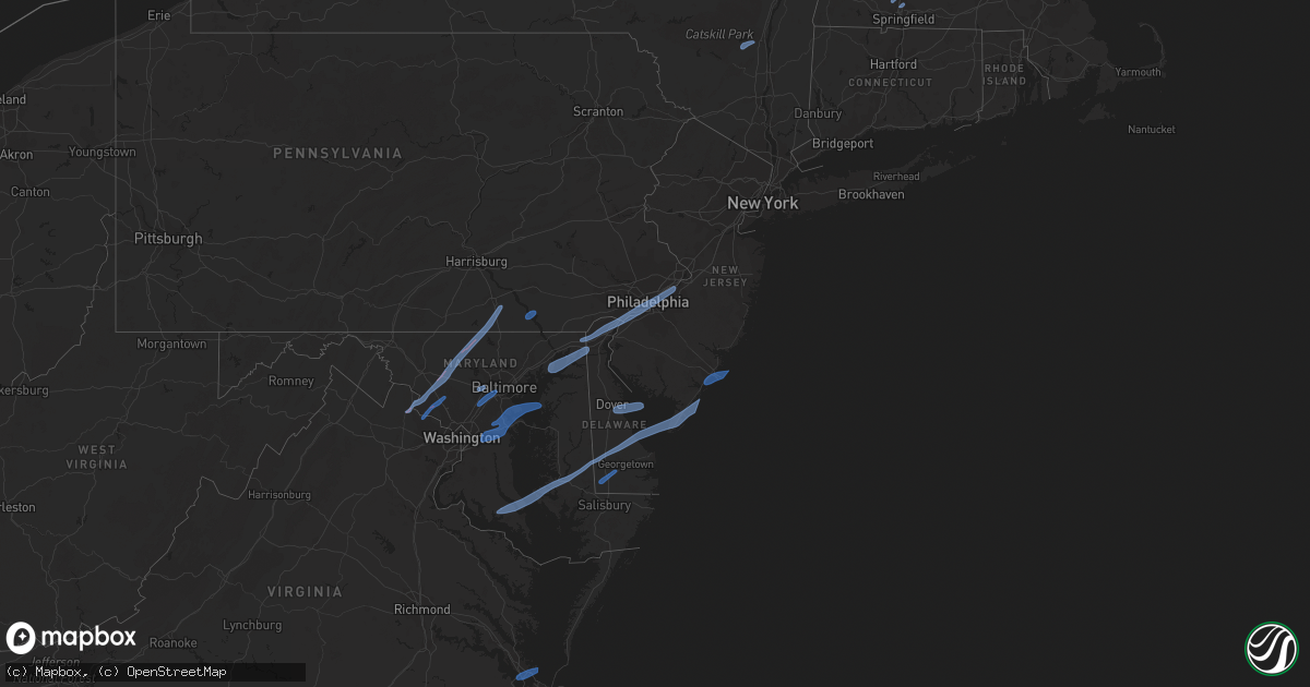
February 7 map
$229
one time, instant access
Download today. No call, no setup
Keep the $229
Bought the map and want the full workflow? Apply the entire $229 to a subscription within 7 days. None of it is wasted.
Every map, not just this one
This buys you this map. Subscription and you get every map we run, in the markets you choose from a few cities to whole states to nationwide. Plus real-time alerts the moment a storm fires.
Contact data
Name, contact info, occupancy, even credit band for addresses in the footprint. You go from where it hit to who to call.
Become the source they trust
Unlimited branding weather history reports on demand. You already have the documented answer ready for the property owner, and you are the one who showed up with it.
Property data and RoofTrace estimates
Pull up any address you have got, its value and the exact code rules for that jurisdiction, straight from One Click Code. Then RoofTrace estimates the squares, pitch, and roof value, priced the way you price.
Storm reports in Virginia
Virginia
| Date | Description |
|---|---|
| 02/07/20208:53 AM CST | Tree knocked down near the intersection of mason rd and shoreman dr. Near bloxom. Time estimated from radar. |
| 02/07/20208:50 AM CST | Numerous trees knocked down across the county. Time estimated from radar. |
| 02/07/20208:18 AM CST | Buoy station lwtv2 lewisetta... Va. |
| 02/07/20208:18 AM CST | Tree knocked down. Report via social media. |
| 02/07/20208:11 AM CST | Awos station klfi langley afb hamp. |
| 02/07/20207:55 AM CST | Numerous pines trees were uprooted as a line of showers with high wind moved across the area. |
| 02/07/20207:35 AM CST | Road closure due to downed tree near hooes rd and lackawanna dr |
| 02/07/20207:30 AM CST | Road closure due to downed tree near clifton rd and main st |
| 02/07/20207:20 AM CST | Multiple downed trees near governor's drive and country club drive |
| 02/07/20207:17 AM CST | Tree down onto wires near intersection of telegraph rd and s. Kings hwy |
| 02/07/20207:15 AM CST | Tree down onto wires near rt 7 and carlin springs rd |
| 02/07/20207:14 AM CST | Two large oak trees uprooted |
| 02/07/20207:12 AM CST | Tree down onto wires near intersection of rolling rd and pohick rd |
| 02/07/20207:11 AM CST | Two trees knocked down... One into a house and another on a car. Report via social media. Time estimated from radar. |
| 02/07/20206:57 AM CST | Tree down near intersection of warrenton rd and richards ferry rd |
| 02/07/20206:26 AM CST | 3-ft diameter trees fell on two homes in leesburg. Homes suffered structural damage. |
| 02/07/20206:25 AM CST | Several trees down and roof damage in around the neighborhood of greenway farm in leesburg. |
| 02/07/20206:24 AM CST | Multiple trees and wires down near intersection of leesburg bypass and battlefield parkway. |
| 02/07/20206:23 AM CST | Chimneys toppled at apartments off clark court ne. |
| 02/07/20206:22 AM CST | Multiple downed and snapped trees on barksdale drive |
| 02/07/20206:21 AM CST | Trees down on house on monroe street se |
| 02/07/20206:20 AM CST | Trees down on house in 1000 block of white place sw. |
| 02/07/20206:20 AM CST | Considerable tree damage across the town of leesburg. Damage to townhomes and an apartment complex in ne leesburg as well. Path length 3.3 miles. Maximum path width 250 |
| 02/07/20203:45 AM CST | At 944 AM EST, severe thunderstorms were located along a line extending from 6 miles northwest of Virginia Beach to Back Bay to near Indiantown, moving east at 45 mph. HAZARD...60 mph wind gusts. SOURCE...Radar indicated. IMPACT...Expect damage to trees and powerlines. Severe thunderstorms will be near, Virginia Beach around 950 AM EST. Grandy around 955 AM EST. Corolla around 1000 AM EST.Other locations impacted by these severe thunderstorms include RudeeHeights, Poplar Branch, Princess Anne Plaza, Sigma, Pungo, Barco,Bayside, Dam Neck, Maple and Snowden. |
| 02/07/20203:38 AM CST | At 937 AM EST, showers with embedded severe thunderstorms were located along a line extending from Agner to near Vienna to 10 miles west of Deal Island, moving east to northeast at 50 mph. HAZARD...60 mph wind gusts. SOURCE...Radar indicated. IMPACT...Expect damage to trees and powerlines. Severe thunderstorms will be near, Hurlock and Vienna around 945 AM EST. Sharptown around 950 AM EST. Princess Anne, University Of Maryland Eastern Shore and Westover around 1005 AM EST. Salisbury, Fruitland and Salisbury University around 1015 AM EST. Parsonsburg around 1025 AM EST. Newark around 1030 AM EST. Berlin and Ocean Pines around 1040 AM EST. Cape Isle Of Wight around 1045 AM EST.Other locations impacted by these severe thunderstorms includeBrookview, Ocean City Municipality, Trinity, Cokesbury, Eden,Longridge, Mount Vernon, Chesapeake Heights, Pittsville andPowellville. |
| 02/07/20202:09 AM CST | At 809 AM EST, a severe thunderstorm was located near Bowling Green, moving northeast at 40 mph. HAZARD...60 mph wind gusts and quarter size hail. SOURCE...Radar indicated. IMPACT...Minor damage to vehicles is possible. Expect wind damage to trees and powerlines. This severe thunderstorm will be near, Loretto around 825 AM EST.Other locations impacted by this severe thunderstorm include Supply,Sparta, Hustle and Chance. |
All States Impacted by Hail Map on February 7, 2020
Cities Impacted by Hail Map on February 7, 2020
- Easthampton, MA
- Southampton, MA
- Holyoke, MA
- Chicopee, MA
- South Hadley, MA
- Accord, NY
- Stone Ridge, NY
- Kingston, NY
- Hurley, NY
- West Hurley, NY
- Olivebridge, NY
- Leesburg, VA
- Glen Rock, PA
- Seven Valleys, PA
- Dallastown, PA
- Westminster, MD
- Red Lion, PA
- New Windsor, MD
- Monrovia, MD
- Mount Airy, MD
- Dickerson, MD
- Barnesville, MD
- Clarksburg, MD
- Manchester, MD
- Damascus, MD
- Hampstead, MD
- York, PA
- Beallsville, MD
- Ijamsville, MD
- Airville, PA
- Holtwood, PA
- Pequea, PA
- Rio Grande, NJ
- Avalon, NJ
- Bridgeville, DE
- Ocean View, NJ
- Lincoln, DE
- Cape May, NJ
- East New Market, MD
- Wildwood, NJ
- Greenwood, DE
- Lusby, MD
- Hollywood, MD
- Cambridge, MD
- Villas, NJ
- Leonardtown, MD
- Ellendale, DE
- Taylors Island, MD
- Hurlock, MD
- Sea Isle City, NJ
- Solomons, MD
- Church Creek, MD
- Milford, DE
- Madison, MD
- Federalsburg, MD
- California, MD
- Woolford, MD
- Dowell, MD
- Stone Harbor, NJ
- Cape May Court House, NJ
- Seaford, DE
- Dover, DE
- Camden Wyoming, DE
- Magnolia, DE
- Dover Afb, DE
- Severna Park, MD
- Millersville, MD
- Odenton, MD
- Arnold, MD
- Upper Marlboro, MD
- Bowie, MD
- Riva, MD
- Annapolis, MD
- Gibson Island, MD
- Davidsonville, MD
- Rock Hall, MD
- Gambrills, MD
- Pasadena, MD
- Crownsville, MD
- Harwood, MD
- Crofton, MD
- Aberdeen Proving Ground, MD
- North East, MD
- Newark, DE
- Bear, DE
- Elkton, MD
- Chesapeake City, MD
- Earleville, MD
- Ridley Park, PA
- Lansdowne, PA
- Prospect Park, PA
- Beverly, NJ
- Wilmington, DE
- Aston, PA
- Gibbstown, NJ
- Riverton, NJ
- Marcus Hook, PA
- Darby, PA
- Maple Shade, NJ
- Brookhaven, PA
- Merchantville, NJ
- Palmyra, NJ
- Camden, NJ
- Chester, PA
- Pedricktown, NJ
- Swedesboro, NJ
- Burlington, NJ
- Elk Mills, MD
- Folcroft, PA
- Pennsauken, NJ
- Glenolden, PA
- Willingboro, NJ
- Essington, PA
- Folsom, PA
- Norwood, PA
- Woodlyn, PA
- Riverside, NJ
- Sharon Hill, PA
- Claymont, DE
- Bridgeport, NJ
- Moorestown, NJ
- Philadelphia, PA
- Crum Lynne, PA
- Somers Point, NJ
- Atlantic City, NJ
- Margate City, NJ
- Brigantine, NJ
- Pleasantville, NJ
- Ventnor City, NJ
- Linwood, NJ
- Northfield, NJ
- Longport, NJ
- Absecon, NJ
- Bethel, DE
- Laurel, DE
- Fort Monroe, VA
- Hampton, VA
- Newport News, VA
- Ellicott City, MD
- Halethorpe, MD
- Columbia, MD
- Jessup, MD
- Catonsville, MD
- Baltimore, MD
- Laurel, MD
- Elkridge, MD
- Germantown, MD
- Boyds, MD
- Poolesville, MD
- Sterling, VA
- Ashburn, VA
- Gaithersburg, MD


