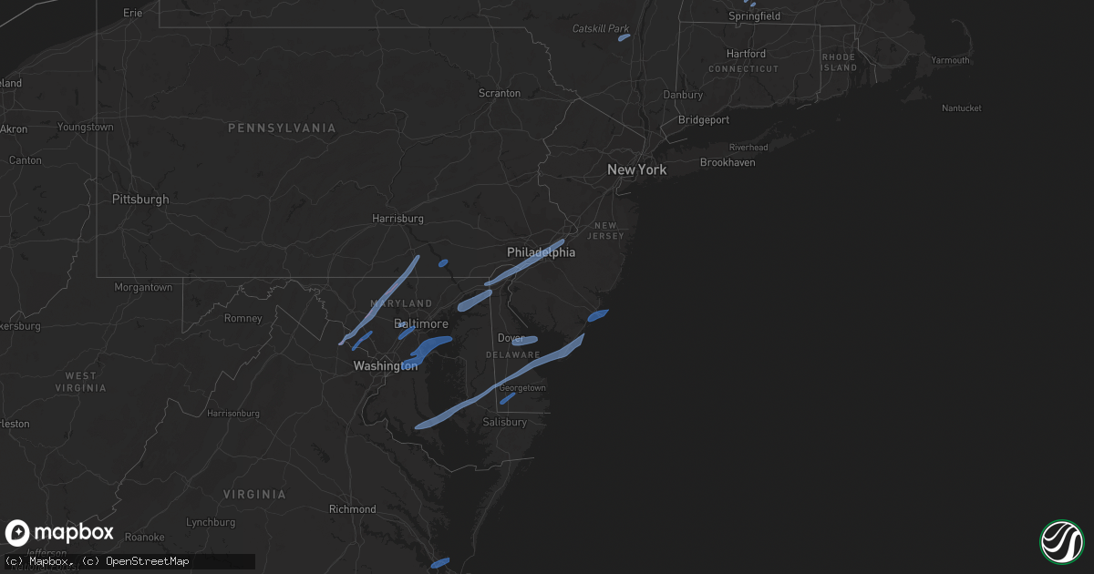
Hail Map in New Jersey on February 7, 2020
Get this storm
February 7 map
$229
one time, instant access
Download today. No call, no setup
Keep the $229
Bought the map and want the full workflow? Apply the entire $229 to a subscription within 7 days. None of it is wasted.
Every map, not just this one
This buys you this map. Subscription and you get every map we run, in the markets you choose from a few cities to whole states to nationwide. Plus real-time alerts the moment a storm fires.
Contact data
Name, contact info, occupancy, even credit band for addresses in the footprint. You go from where it hit to who to call.
Become the source they trust
Unlimited branding weather history reports on demand. You already have the documented answer ready for the property owner, and you are the one who showed up with it.
Property data and RoofTrace estimates
Pull up any address you have got, its value and the exact code rules for that jurisdiction, straight from One Click Code. Then RoofTrace estimates the squares, pitch, and roof value, priced the way you price.
Storm reports in New Jersey
New Jersey
| Date | Description |
|---|---|
| 02/07/202010:36 AM CST | A local report indicates 66 MPH wind near SANDY HOOK |
| 02/07/202010:30 AM CST | Hads sensor. |
| 02/07/202010:26 AM CST | Downed trees and power lines from strong winds. Time estimated from radar. |
| 02/07/202010:10 AM CST | Downed tree and wires on nj 34 northbound south of cr 520. All lanes closed. Time estimated from radar. |
| 02/07/202010:06 AM CST | Downed tree on state highway 28 westbound west of mountain avenue. Lane restrictions in place. Time estimated from radar. |
| 02/07/202010:06 AM CST | Downed trees and power poles. Mping report. Time estimated from radar. |
| 02/07/202010:02 AM CST | Weatherflow site xtuk. |
| 02/07/202010:02 AM CST | Downed tree on wires from strong winds. Time estimated from radar. |
| 02/07/202010:02 AM CST | Downed tree and wires near the intersection of dukes parkway and dickerson road. Time estimated from radar. |
| 02/07/202010:01 AM CST | Mping report of 3 inch tree limbs or power poles snapped. |
| 02/07/202010:00 AM CST | Hads sensor. |
| 02/07/20209:57 AM CST | Downed tree on i-78 eastbound east of exit 29. Time estimated from radar. |
| 02/07/20209:56 AM CST | Downed trees and wires near windrow drive. Time estimated from radar. |
| 02/07/20209:54 AM CST | Great road closed between stuart road and princeton day school from a pole and wires down. Time estimated from radar. |
| 02/07/20209:50 AM CST | Tree down across the road on goshen rd. |
| 02/07/20209:48 AM CST | Downed tree limbs from strong winds. Mping report. Time estimated from radar. |
| 02/07/20209:46 AM CST | Downed tree limbs and power lines. Mping report. Time estimated from radar. |
| 02/07/20209:44 AM CST | Downed tree on nj-31 northbound north of cr 623. Time estimated from radar. |
| 02/07/20209:43 AM CST | Downed tree on nj 31 both directions north of cr-612. All lanes closed and detoured. Time estimated from radar. |
| 02/07/20209:42 AM CST | Kttn asos. |
| 02/07/20209:42 AM CST | Downed tree on i-295 southbound north of exit 52. Time estimated from radar. |
| 02/07/20209:40 AM CST | Downed tree on nj-68 southbound. All lanes closed and detoured. Time estimated from radar. |
| 02/07/20209:40 AM CST | Njwxnet sensor. |
| 02/07/20209:40 AM CST | Downed traffic signal from strong winds. Time estimated from radar. |
| 02/07/20209:38 AM CST | Report from mping: 1-inch tree limbs broken; shingles blown off. |
| 02/07/20209:38 AM CST | Downed tree and wires near lincoln avenue and studdiford street. Time estimated from radar. |
| 02/07/20209:36 AM CST | Downed trees and wires near the intersection of sandy ridge road and rittenhouse road. Time estimated from radar. |
| 02/07/20209:35 AM CST | Traffic signal down on nj-38 westbound east of fellowship rd. Time estimated from radar. |
| 02/07/20209:34 AM CST | Downed tree on wires near knoll top lane. Time estimated from radar. |
| 02/07/20209:33 AM CST | Report of a tree down across route 9 and traffic lights down on cars in upper twp. Time estimated from radar. |
| 02/07/20209:32 AM CST | Wires down on lafayette st. |
| 02/07/20209:30 AM CST | Report via social media with photos. Damage to a carport and fencing. |
| 02/07/20209:30 AM CST | Large tree down onto power lines across central ave. Report via social media with a photo. Time estimated from radar. |
| 02/07/20209:30 AM CST | Tree down on a house on pacific ave. |
| 02/07/20209:30 AM CST | Antenna mast downed on west ocean ave due to high winds. |
| 02/07/20209:28 AM CST | Downed tree and wires on nj-50 southbound north of honest john rd. All lanes closed. Time estimated from radar. |
| 02/07/20209:28 AM CST | Downed trees and power lines from strong winds. Time estimated from radar. |
| 02/07/20209:20 AM CST | Uprooted tree on the new jersey turnpike. Time estimated from radar. |
| 02/07/20209:18 AM CST | Downed trees and wires near crow pond road. Time estimated from radar. |
| 02/07/20209:15 AM CST | A local report indicates 60 MPH wind near FORTESCUE |
| 02/07/20209:13 AM CST | Trees down and fences blown over near millville. Time estimated from radar. |
| 02/07/20209:12 AM CST | Mping report. |
| 02/07/20204:10 AM CST | At 1010 AM EST, severe thunderstorms were located along a line extending from Olivet to near Fortesque to 7 miles northwest of Lewes, moving northeast at 65 mph. HAZARD...70 mph wind gusts and penny size hail. SOURCE...Radar indicated. IMPACT...Expect considerable tree damage. Damage is likely to mobile homes, roofs, and outbuildings. Locations impacted include... Toms River, Vineland, Atlantic City, Millville, Bridgeton, Ocean City, Cape May, Cumberland, Lakewood, Jackson, Barnegat, Pleasantville, Glassboro, Hammonton, Beachwood, Somers Point, Ventnor City, Brigantine, Northfield and Absecon.This includes the following highways... Atlantic City Expressway between mile markers 0 and 40. Garden State Parkway between mile markers 0 and 94. Interstate 195 in New Jersey between mile markers 17 and 26. |
All States Impacted by Hail Map on February 7, 2020
Cities Impacted by Hail Map on February 7, 2020
- Easthampton, MA
- Southampton, MA
- Holyoke, MA
- Chicopee, MA
- South Hadley, MA
- Accord, NY
- Stone Ridge, NY
- Kingston, NY
- Hurley, NY
- West Hurley, NY
- Olivebridge, NY
- Leesburg, VA
- Glen Rock, PA
- Seven Valleys, PA
- Dallastown, PA
- Westminster, MD
- Red Lion, PA
- New Windsor, MD
- Monrovia, MD
- Mount Airy, MD
- Dickerson, MD
- Barnesville, MD
- Clarksburg, MD
- Manchester, MD
- Damascus, MD
- Hampstead, MD
- York, PA
- Beallsville, MD
- Ijamsville, MD
- Airville, PA
- Holtwood, PA
- Pequea, PA
- Rio Grande, NJ
- Avalon, NJ
- Bridgeville, DE
- Ocean View, NJ
- Lincoln, DE
- Cape May, NJ
- East New Market, MD
- Wildwood, NJ
- Greenwood, DE
- Lusby, MD
- Hollywood, MD
- Cambridge, MD
- Villas, NJ
- Leonardtown, MD
- Ellendale, DE
- Taylors Island, MD
- Hurlock, MD
- Sea Isle City, NJ
- Solomons, MD
- Church Creek, MD
- Milford, DE
- Madison, MD
- Federalsburg, MD
- California, MD
- Woolford, MD
- Dowell, MD
- Stone Harbor, NJ
- Cape May Court House, NJ
- Seaford, DE
- Dover, DE
- Camden Wyoming, DE
- Magnolia, DE
- Dover Afb, DE
- Severna Park, MD
- Millersville, MD
- Odenton, MD
- Arnold, MD
- Upper Marlboro, MD
- Bowie, MD
- Riva, MD
- Annapolis, MD
- Gibson Island, MD
- Davidsonville, MD
- Rock Hall, MD
- Gambrills, MD
- Pasadena, MD
- Crownsville, MD
- Harwood, MD
- Crofton, MD
- Aberdeen Proving Ground, MD
- North East, MD
- Newark, DE
- Bear, DE
- Elkton, MD
- Chesapeake City, MD
- Earleville, MD
- Ridley Park, PA
- Lansdowne, PA
- Prospect Park, PA
- Beverly, NJ
- Wilmington, DE
- Aston, PA
- Gibbstown, NJ
- Riverton, NJ
- Marcus Hook, PA
- Darby, PA
- Maple Shade, NJ
- Brookhaven, PA
- Merchantville, NJ
- Palmyra, NJ
- Camden, NJ
- Chester, PA
- Pedricktown, NJ
- Swedesboro, NJ
- Burlington, NJ
- Elk Mills, MD
- Folcroft, PA
- Pennsauken, NJ
- Glenolden, PA
- Willingboro, NJ
- Essington, PA
- Folsom, PA
- Norwood, PA
- Woodlyn, PA
- Riverside, NJ
- Sharon Hill, PA
- Claymont, DE
- Bridgeport, NJ
- Moorestown, NJ
- Philadelphia, PA
- Crum Lynne, PA
- Somers Point, NJ
- Atlantic City, NJ
- Margate City, NJ
- Brigantine, NJ
- Pleasantville, NJ
- Ventnor City, NJ
- Linwood, NJ
- Northfield, NJ
- Longport, NJ
- Absecon, NJ
- Bethel, DE
- Laurel, DE
- Fort Monroe, VA
- Hampton, VA
- Newport News, VA
- Ellicott City, MD
- Halethorpe, MD
- Columbia, MD
- Jessup, MD
- Catonsville, MD
- Baltimore, MD
- Laurel, MD
- Elkridge, MD
- Germantown, MD
- Boyds, MD
- Poolesville, MD
- Sterling, VA
- Ashburn, VA
- Gaithersburg, MD


