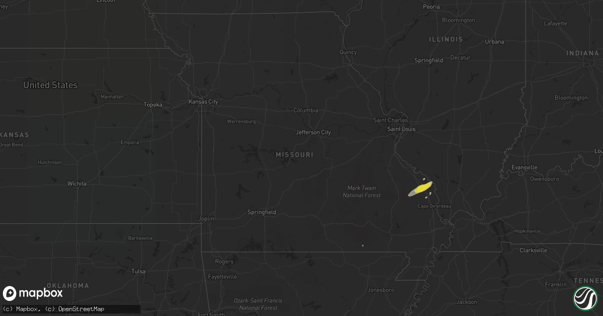
Hail Map in Missouri on February 7, 2019
Get this storm
February 7 map
$229
one time, instant access
Download today. No call, no setup
Keep the $229
Bought the map and want the full workflow? Apply the entire $229 to a subscription within 7 days. None of it is wasted.
Every map, not just this one
This buys you this map. Subscription and you get every map we run, in the markets you choose from a few cities to whole states to nationwide. Plus real-time alerts the moment a storm fires.
Contact data
Name, contact info, occupancy, even credit band for addresses in the footprint. You go from where it hit to who to call.
Become the source they trust
Unlimited branding weather history reports on demand. You already have the documented answer ready for the property owner, and you are the one who showed up with it.
Property data and RoofTrace estimates
Pull up any address you have got, its value and the exact code rules for that jurisdiction, straight from One Click Code. Then RoofTrace estimates the squares, pitch, and roof value, priced the way you price.
Storm reports in Missouri
Missouri
| Date | Description |
|---|---|
| 02/07/201910:13 AM CST | Two barns destroyed and downed power lines reported along county road 208. |
| 02/07/20199:30 AM CST | 60 kt wind gust reported with tree limbs down in the area. |
| 02/07/20199:20 AM CST | A local report indicates 59 MPH wind near 2 W SCOTT CITY |
| 02/07/20199:14 AM CST | Roof and tree damage reported. |
| 02/07/20199:05 AM CST | Tree snapped at the base and fell on a house. |
| 02/07/20199:01 AM CST | A train was derailed due to thunderstorm winds. |
| 02/07/20199:00 AM CST | An nws storm survey found straight-line wind damage in dexter... Mo. Estimated peak winds were 90 mph. The damage started on the southwest side of dexter and ended on t |
| 02/07/20199:00 AM CST | An nws damage survey found sporadic straight-line wind damage in the southern part of cape girardeau county... Beginning two miles south of whitewater... Mo... And endi |
| 02/07/20198:08 AM CST | Several boats and trailers were flipped over at a marine shop. Glass doors were blown out of the shop building. Several trees were down in the doniphan area as well as |
| 02/07/20198:08 AM CST | An nws damage survey found scattered damage caused by straight-line thunderstorm winds. Estimated peak winds were 75 mph. The event began at 8:08 am cst paralleling mis |
| 02/07/20196:39 AM CST | At 1239 AM CST, severe thunderstorms were located along a line extending from 14 miles north of Hartville to near Norwood, moving east at 55 mph. HAZARD...60 mph wind gusts and quarter size hail. SOURCE...Radar indicated. IMPACT...Hail damage to vehicles is expected. Expect wind damage to roofs, siding, and trees. Locations impacted include... Southwestern Fort Leonard Wood... Mountain Grove... Licking... Cabool... Houston... Dawson... Norwood... Hartville... Summersville... Raymondville... Huggins... Plato... Competition... Manes... Lynchburg... Success... Eunice... Yukon... Roby... Clear Springs... |
| 02/07/20196:15 AM CST | At 1215 AM CST, severe thunderstorms were located along a line extending from Marshfield to near Fordland, moving east at 45 mph. HAZARD...60 mph wind gusts and quarter size hail. SOURCE...Radar indicated. IMPACT...Hail damage to vehicles is expected. Expect wind damage to roofs, siding, and trees. Locations impacted include... Marshfield... Mountain Grove... Seymour... Mansfield... Fordland... Dawson... Norwood... Hartville... Niangua... Duncan... Diggins... Manes... Graff... Grovespring... Northview... Odin...This includes Interstate 44 between mile markers 96 and 101. |
| 02/07/20196:10 AM CST | At 1210 AM CST, a severe thunderstorm was located 7 miles south of Sparta, or 12 miles southeast of Ozark, moving east at 60 mph. HAZARD...Golf ball size hail and 60 mph wind gusts. SOURCE...Radar indicated. IMPACT...People and animals outdoors will be injured. Expect hail damage to roofs, siding, windows, and vehicles. Expect wind damage to roofs, siding, and trees. Locations impacted include... Ava... Rome... Vanzant... Squires... Brushyknob... Goodhope... Drury... Dogwood... Gentryville... |
| 02/07/20192:54 AM CST | At 853 AM CST, a severe thunderstorm was located near Grand Tower, or 11 miles west of Murphysboro, moving northeast at 65 mph. HAZARD...60 mph wind gusts and nickel size hail. SOURCE...Radar indicated. IMPACT...Expect damage to roofs, siding, and trees. Locations impacted include... Carbondale, Murphysboro, Du Quoin, De Soto, Royalton, Elkville, Hurst, Grand Tower, Altenburg, Dowell, Vergennes, Bush, Gorham and Colp. |
| 02/07/20192:04 AM CST | At 804 AM CST, a severe thunderstorm was located near Doniphan, moving east at 50 mph. HAZARD...60 mph wind gusts and quarter size hail. SOURCE...Radar indicated. IMPACT...Hail damage to vehicles is expected. Expect wind damage to roofs, siding, and trees. Locations impacted include... Doniphan, Naylor, Neelyville, Qulin, Harviell, Oxly, Fairdealing and Briar. |
| 02/06/201911:37 PM CST | At 537 AM CST, severe thunderstorms were located along a line extending from near Eminence to near Winona to near Alton, moving northeast at 85 mph. HAZARD...60 mph wind gusts. SOURCE...Radar indicated. IMPACT...Expect damage to roofs, siding, and trees. Locations impacted include... Current River State Park... Winona... Alton... Eminence... Alley Spring... Midridge... Round Spring... West Eminence... Greer... |
| 02/06/201911:13 PM CST | At 512 AM CST, a severe thunderstorm was located 8 miles southeast of West Plains, moving northeast at 70 mph. HAZARD...60 mph wind gusts. SOURCE...Radar indicated. IMPACT...Expect damage to roofs, siding, and trees. Locations impacted include... West Plains... Grand Gulf State Park... Thayer... Koshkonong... Brandsville... Thomasville... Peace Valley... Lanton... Rover... White Church... Moody... |
| 02/06/20199:58 PM CST | At 357 AM CST, a severe thunderstorm was located near Pruitt, or 5 miles northeast of Jasper, moving northeast at 55 mph. HAZARD...60 mph wind gusts and quarter size hail. SOURCE...Radar indicated. IMPACT...Hail damage to vehicles is expected. Expect wind damage to roofs, siding, and trees. Locations impacted include... Mountain Home... Bull Shoals... Yellville... Jasper... Gassville... Flippin... Lakeview in Baxter County... Norfork... Salesville... Western Grove... Briarcliff... Pyatt... Valley Springs... Arkawana... Dugger... Olvey... Carver... Erbie... Lakeway... Bull Shoals State Park... |
| 02/06/20199:13 PM CST | At 312 AM CST, severe thunderstorms were located along a line extending from 4 miles west of Beaver to 3 miles north of Cass to 3 miles east of Mulberry, moving east at 60 mph. HAZARD...60 mph wind gusts. SOURCE...Radar indicated. IMPACT...Expect damage to roofs, siding, and trees. Locations in or near the path include... Berryville... Ozark... Huntsville... Eureka Springs... Green Forest... Mulberry... Altus... St. Paul... Beaver... Hindsville... Wiederkehr Village... Carrollton... Rudd... Saint Paul... Forum... Aurora... Hobbs State Park... Clifty... Boston... Withrow Springs State Park...This includes Interstate 40 in Arkansas between mile markers 25 and42. |
Cities Impacted by Hail Map on February 7, 2019
- Lonsdale, AR
- Hot Springs National Park, AR
- Hot Springs Village, AR
- Benton, AR
- Jackson, MO
- Frohna, MO
- Friedheim, MO
- Oak Ridge, MO
- Perryville, MO
- Uniontown, MO
- Alexander, AR
- Marquand, MO
- Altenburg, MO
- Old Appleton, MO
- Jacob, IL
- Sedgewickville, MO
- Marble Hill, MO
- Patton, MO
- Cutler, IL
- Coulterville, IL
- Sparta, IL
- Little Rock, AR
- Gatewood, MO


